
Mori Atlas logo
Protected landscapeOcala National Forest

Mapping the sand pine scrub ecosystems, natural springs, and hydric hammocks of North Central Florida

Ocala National Forest: An Essential Protected Landscape and Geographic Atlas of Florida

Ocala National Forest stands as a critical protected area in North Central Florida, spanning expansive tracts between the Ocklawaha and St. Johns rivers. This landscape functions as a vital recharge zone for the Floridan Aquifer, defined by its unique sand pine scrub, rolling sandhills, and a dense network of over 600 natural lakes. Its geography reflects a complex interplay between fire-maintained scrub habitats and lush spring-fed corridors that characterize this significant regional landmark.

national forestFloridasand pine scrublongleaf pineBig Scrubsprings
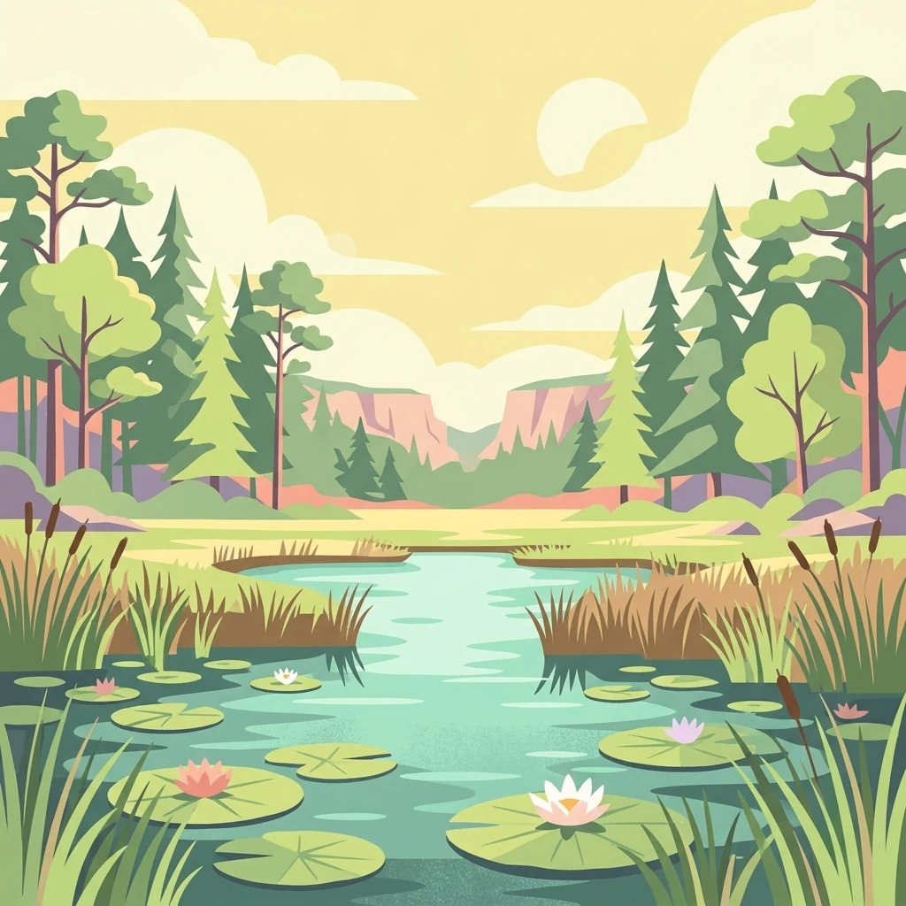
A flat-style digital illustration of a peaceful pond with lily pads, cattails, and pine trees under a warm, soft-toned sky.

Ocala National Forest

Protected landscape

Park overview

Structured park overview, official facts, and landscape profile for Ocala National Forest

Ocala National Forest park facts, protected area profile, and essential visitor context

Review the core facts for Ocala National Forest, including designation, size, terrain, visitor scale, habitats, and operating context in one park-focused overview.

About Ocala National Forest

Ocala National Forest occupies a unique place in the geography of the southeastern United States. It sits in North Central Florida between the Ocklawaha and St. Johns rivers, covering parts of Marion, Lake, and Putnam counties, with the city of Ocala lying just to the west and Gainesville a short distance to the northwest. The forest encompasses roughly 430,000 acres of land that was once part of an ancient seafloor; the limestone bedrock beneath the forest was formed by the calcium-rich remains of prehistoric marine life, while higher ridges in the limestone made this region one of the first parts of the Florida peninsula to emerge from the sea.

The landscape of Ocala is defined by five major physical elements: central highlands, coastal lowlands, swamps, springs, and hundreds of lakes and ponds. Sandy soils and porous terrain allow rainfall to soak rapidly into the ground, making the forest a critical recharge area for the Floridan Aquifer, one of the most productive aquifer systems in the country. Blackwater rivers wind through the forest, lined with baldcypress and bordered by spring-fed hydric hammocks of evergreen and hardwood trees. Wet prairies, nonriverine basin swamps, and oak domes round out a remarkable mosaic of habitats.

Ecologically, the forest lies within the southeastern conifer forests and the Florida scrub ecoregions. Two ecosystems dominate the uplands: longleaf pine sandhills, sometimes called high pine, and Florida scrub, a fire-maintained community of sand pine and shrubby vegetation. Where fire has been excluded, southern coastal plain oak domes and hammocks can develop as small, dense, evergreen thickets. Frequent fire is essential to all of these systems, and the U.S. Forest Service actively conducts controlled burns to preserve their ecological character.

Ocala is more than a wilderness, however. It hosts the Pinecastle Bombing Range, the only location on the U.S. East Coast where the Navy conducts live impact training, with thousands of bombs delivered annually to a small section of the forest under a long-standing special use permit. It contains the ghost town of Kerr City, the historic Carr Family Cabin, and the Sweetwater Cabin, a 1930s Civilian Conservation Corps structure. Cultural history extends even further back: Paleo-Indians inhabited the region as long as 12,000 years ago, and archaeological sites uncovered in the 1950s and 1960s provide evidence of continuous human presence across millennia.

Quick facts and research context for Ocala National Forest

Ocala National Forest is a federally managed national forest in North Central Florida, administered by the U.S. Forest Service and headquartered in Tallahassee along with Florida's other national forests. Established in 1908, it holds two notable distinctions: it is the oldest national forest east of the Mississippi River and the southernmost national forest in the continental United States. The forest covers roughly 607 square miles, lying between the Ocklawaha and St. Johns rivers.

The area is characterized by an exceptional density of freshwater features, with more than 600 natural lakes and ponds scattered across the landscape, along with spring-fed rivers, wet prairies, and forested swamps. It also contains the Big Scrub, roughly 200,000 acres of sand pine scrub, which is the largest such ecosystem of its kind. The forest is the most-visited national forest in Florida and serves as a key recharge zone for the Floridan Aquifer.

Protection and recognition

Documented terrestrial protection scope and conservation designation records

Ocala National Forest Protection Status and International Recognition Data

Terrestrial protection status records for Ocala National Forest outline the documented conservation scope for this protected area. Official designation data details management frameworks without external recognition sources.

Protection details

Protection scope
Terrestrial
Transboundary protection
No
Park context

Deeper park guide and search-rich context for Ocala National Forest

Ocala National Forest history, landscape, wildlife, and travel context

Explore Ocala National Forest through its history, landscape character, ecosystems, wildlife, conservation priorities, cultural context, and seasonal travel timing in a structured park guide built for atlas discovery and search intent.

Why Ocala National Forest stands out

Ocala National Forest is best known for the Big Scrub, an enormous and globally unique sand pine scrub ecosystem that dominates the southern portion of the forest. This scrub landscape, sometimes described as a sea of scrub with islands of high pine, contains the largest concentration of sand pine in the world and is sustained by periodic, intense fires that shape its character. The forest also holds some of the most important remaining stands of longleaf pine in northern Florida. Equally distinctive is the forest's hydrological richness. More than 600 natural lakes and ponds dot the landscape, supported by spring-fed rivers like Juniper Creek and Alexander Springs. Clearwater Lake, Wildcat Lake, Lake Kerr, and Lake George are among the prominent water bodies that anchor recreation and ecological diversity. The combination of scrub, sandhill, hammock, swamp, and spring ecosystems gives Ocala a level of ecological complexity that few southeastern forests can match.
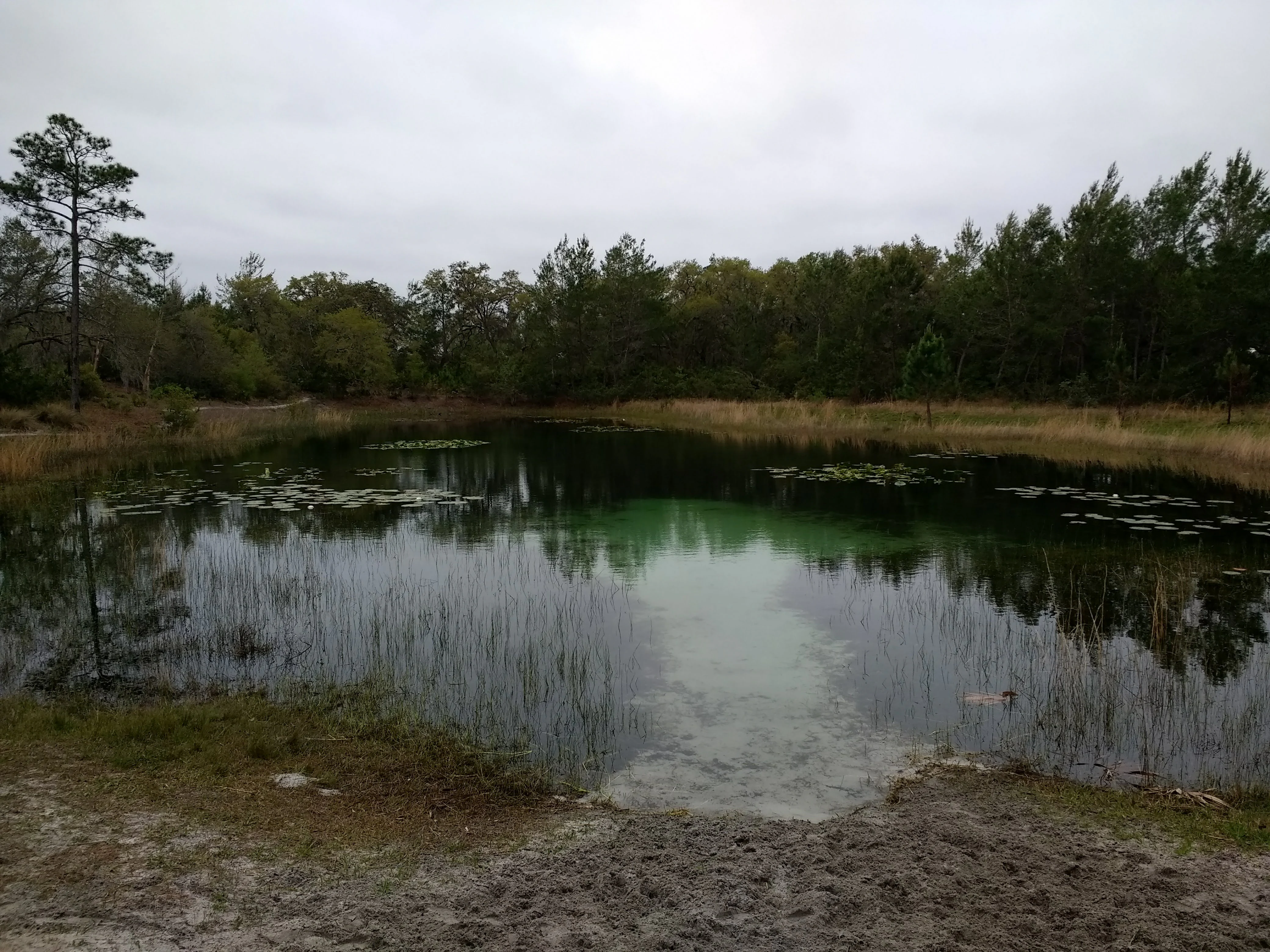
A small, clear pond surrounded by forest and tall grasses under an overcast sky.
A view of Hidden Pond in the Juniper Prairie Wilderness of Ocala National Forest.

Ocala National Forest history and protected-area timeline

The geological history of the Ocala region began long before any humans arrived. During prehistoric times, the area now occupied by the forest lay beneath shallow seas, where the calcium from decomposing fish bones and shells contributed to the formation of the underlying limestone. As sea levels fluctuated, higher ridges in the limestone emerged early in Florida's geologic history, creating one of the first dry land habitats in the peninsula and providing refuge for semi-aquatic animals transitioning out of marine environments.

Human presence in what is now Ocala National Forest dates back at least 12,000 years. The earliest known inhabitants were Paleo-Indians, and archaeological work conducted during the 1950s and 1960s uncovered three sites within the forest containing burial evidence and artifacts. These finds illustrate that the region has supported human communities throughout nearly all of Florida's post-glacial prehistory.

The modern history of the forest began in 1908, when it was established as a national forest, making it both the oldest national forest east of the Mississippi River and the southernmost national forest in the continental United States. Its name comes from a Timucuan term, often translated as fair land or big hammock, reflecting the indigenous peoples who shaped the landscape long before European settlement.

The forest's identity has been strongly shaped by the literary work of Marjorie Kinnan Rawlings, who lived in nearby Cross Creek during much of her adult life. Drawing on the lives of settlers in the Big Scrub, Rawlings wrote South Moon Under and her Pulitzer Prize-winning novel The Yearling, the latter of which was filmed on the Yearling Trail near Juniper Springs. She described the Big Scrub as unique in the world, a vast wall keeping out the timid and the alien. The forest's cultural footprint is reinforced by structures like the historic Carr Family Cabin and the 1930s Sweetwater Cabin, a Civilian Conservation Corps building still in use today.

Ocala National Forest landscape and geographic character

Ocala National Forest presents a landscape of striking contrasts. The central portion features gently rolling sandhills and high pine ridges, while the lowlands host swamps, marshes, and the blackwater rivers that give the forest much of its hydrology. Sandy soils dominate the surface, producing both the porous terrain that feeds the Floridan Aquifer and the deep drifts of sand that support scrub vegetation.

The most visually distinctive landscape feature is the Big Scrub, an enormous block of sand pine scrub spanning roughly 40 miles in length and 15 to 20 miles in width. Marjory Kinnan Rawlings famously described it as a sea of scrub with islands of high pine. Fires are a fundamental part of this landscape; a 1935 lightning-caused fire burned through 35,000 acres in just four hours, becoming the fastest-spreading wildfire in U.S. Forest Service history. The modern Forest Service uses controlled burns to mimic that natural process.

Water shapes the forest as much as fire does. More than 600 natural lakes and ponds punctuate the terrain, including large water bodies such as Lake George, Lake Kerr, Lake Weir, and Wildcat Lake. Slow-moving blackwater rivers, including tributaries of the Ocklawaha and St. Johns, wind through the forest, lined with baldcypress and forming a network of floodplains and hydric hammocks. Springs like Juniper Springs and Alexander Springs feed clear, palm-lined runs that are among the most popular features in the forest. The Rodman Reservoir forms much of the northern and northwestern border, completing a landscape that blends sandy uplands, lush river corridors, and countless freshwater basins.
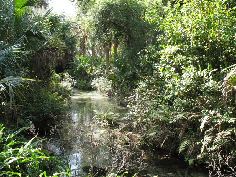
A narrow, clear stream flowing through a dense, lush green forest with palmetto plants and ferns along the banks.
A view of the clear waters at Juniper Springs within Ocala National Forest.

Ocala National Forest ecosystems, habitats, and plant life

The forest lies at the intersection of two major ecoregions: the southeastern conifer forests and the Florida scrub. Its upland ecosystems are dominated by two fire-maintained plant communities, Florida longleaf pine sandhills, also called high pine, and Florida scrub. The longleaf pine sandhills are open woodlands with a scattered overstory of longleaf pine and a diverse ground layer of wiregrass and herbaceous species. Florida scrub consists of dense shrubby vegetation with a canopy of sand pine, a species uniquely adapted to the region's sandy soils and fire cycles. Together with smaller communities like oak domes, hammocks, and cypress swamps, these habitats create one of the most ecologically diverse forests in the southeastern United States.

Wetland and aquatic systems contribute substantially to this diversity. Blackwater rivers support baldcypress forests along their banks, while spring-fed streams create southern coastal plain hydric hammocks, evergreen hardwood forests that thrive in the moist soils near floodplains. The forest's wet prairies function as Floridian highlands freshwater marshes, providing crucial habitat for amphibians, wading birds, and the invertebrates they depend on. Seasonally flooded nonriverine basin swamps, dominated by baldcypress and swamp tupelo, form deep, dark pools that fill and empty with rainfall cycles.

The forest also represents one of the most important holdings of inland scrub habitat in the southeastern United States. Concentrations of scrub-dependent species, including the globally declining sand pine and associated plants, are unusually high here, giving Ocala disproportionate conservation value on a regional and continental scale.
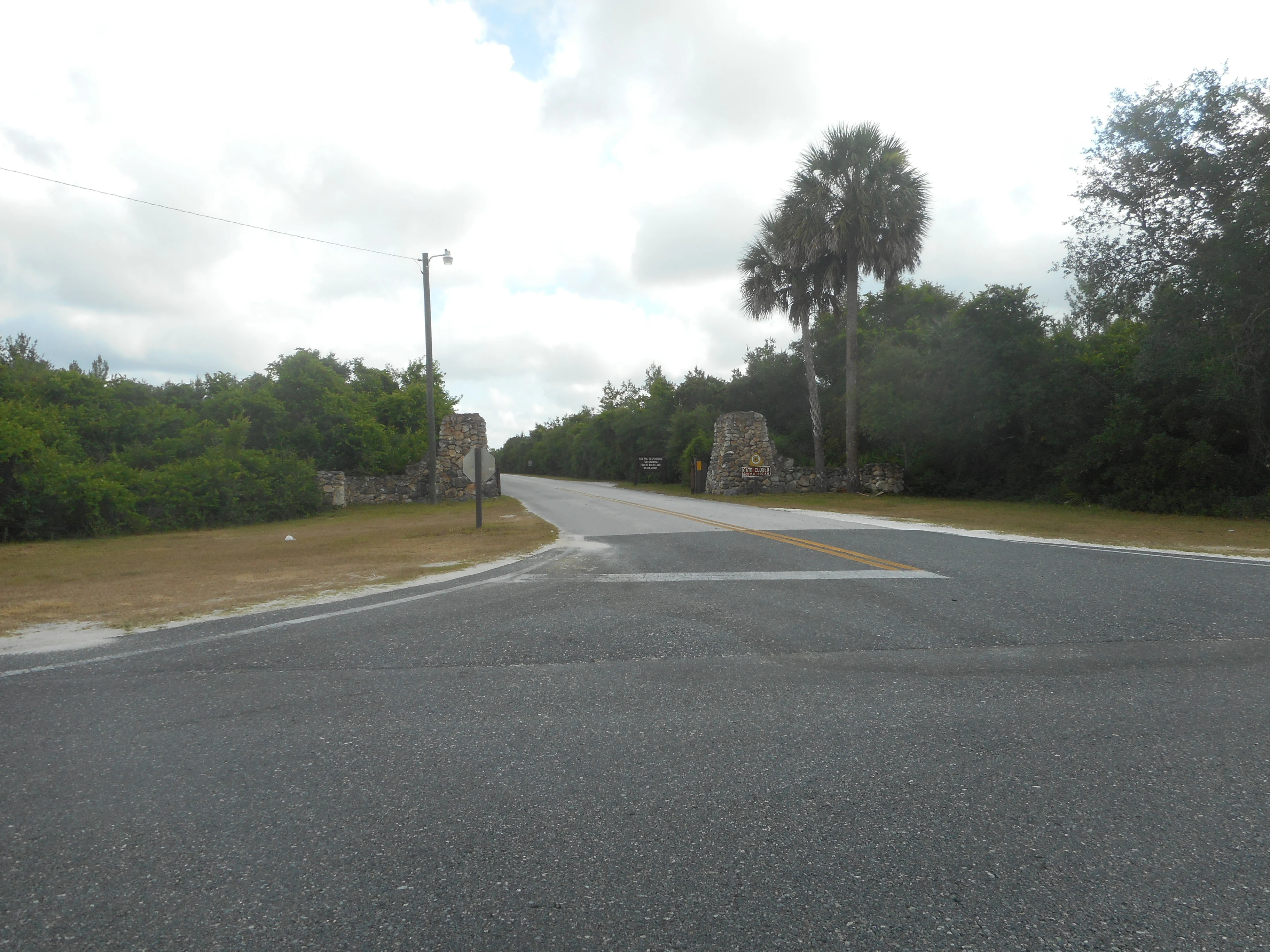
A paved road leading through a stone pillar gateway into a wooded recreation area, with lush Florida vegetation and palm trees in the background.
The historic stone entrance gateway to the Juniper Springs Recreation Area in Ocala National Forest.

Ocala National Forest wildlife and species highlights

Wildlife in Ocala National Forest is shaped by the interplay between fire-maintained uplands and the wetland systems that thread through the landscape. The forest supports the highest concentration of Florida black bears anywhere in the state, a population of particular importance given the species' broader struggles in the region. West Indian manatees frequent the forest's inland waterways, especially the spring-fed rivers that maintain warm temperatures year-round.

Mammals common to the forest include white-tailed deer, bobcats, coyotes, gray and red foxes, raccoons, river otters, Virginia opossums, nine-banded armadillos, eastern gray squirrels, striped skunks, and southeastern pocket gophers. Wild boar, descended from domestic stock, are also present and can affect native vegetation through their rooting behavior. The forest's bat fauna adds another layer of diversity, with multiple species foraging over lakes, prairies, and wooded corridors.

Reptile and amphibian life is exceptionally rich. The sandy soils support the endangered gopher frog and gopher tortoise, whose burrows create shelter for dozens of other species, from snakes and lizards to small mammals. Snakes such as the eastern diamondback rattlesnake, pygmy rattlesnake, Florida cottonmouth, eastern coral snake, pine snake, corn snake, yellow rat snake, and coachwhip share the forest with turtles like the common snapping turtle, Florida softshell turtle, peninsula cooter, and pond slider. Frogs and toads thrive in the wet prairies and hammocks, including species such as the pine woods tree frog, squirrel treefrog, oak toad, southern toad, and American bullfrog. The forest is also one of the few places in Florida where an introduced population of Rhesus macaques, originally released at Silver Springs, has occasionally been observed.
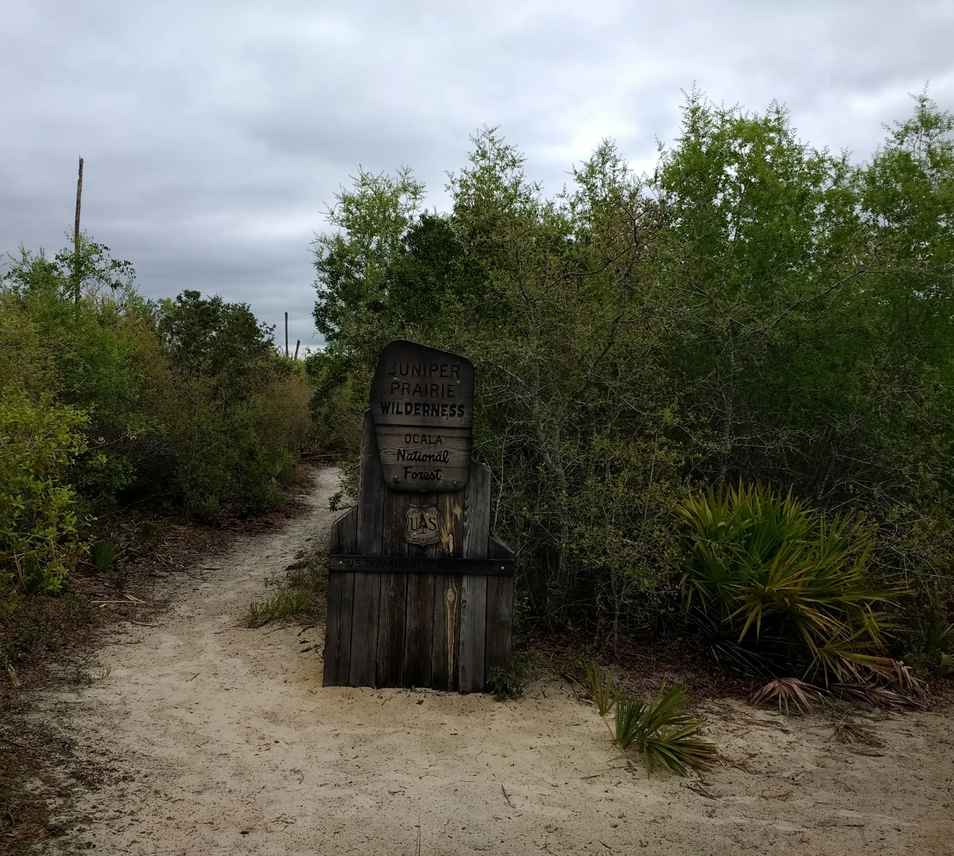
A rustic wooden signpost marks the entrance to a sandy trail in a dense, green forest.
A wooden trailhead sign marking the entrance to the Juniper Prairie Wilderness in Ocala National Forest.

Ocala National Forest conservation status and protection priorities

Ocala National Forest is one of the most ecologically significant protected landscapes in the southeastern United States. It holds the largest block of inland Florida scrub habitat remaining on the planet, a globally rare ecosystem dependent on periodic fire for survival. Within that scrub, the forest contains the world's largest concentration of sand pine, a species so tightly tied to frequent burning that fire suppression quickly transforms its habitat. The forest also safeguards some of the most important remaining stands of longleaf pine in northern Florida, an ecosystem that has experienced catastrophic decline across its historic range.

Conservation of the forest's hydrology is equally important. Because the region's porous sands funnel rainfall directly into the ground, the forest functions as a major recharge zone for the Floridan Aquifer, the source of drinking water for much of Florida and a critical resource for the state's springs, rivers, and wetlands. Protecting the forest's undeveloped land cover is therefore essential to maintaining water quality and quantity far beyond the boundaries of the forest itself.

Management of the forest relies heavily on prescribed fire. The U.S. Forest Service conducts periodic burns, often after harvesting sand pines from an area, to maintain scrub and sandhill communities in their natural state. Hunting is regulated through a wildlife management area framework administered in coordination with the Florida Fish and Wildlife Conservation Commission. The forest also balances competing demands, including the Pinecastle Bombing Range, which has operated under a special use permit for decades. Despite this pressure, the forest remains an anchor of biodiversity conservation in a state where natural landscapes are increasingly fragmented.

Ocala National Forest cultural meaning and human context

The cultural landscape of Ocala National Forest is layered and ancient. The earliest known inhabitants were Paleo-Indians who arrived as the Pleistocene gave way to the Holocene, leaving behind burial sites that archaeologists have dated to roughly 12,000 years ago. Subsequent Indigenous presence in the region contributed the name Ocala itself, derived from a Timucuan term variously translated as fair land or big hammock, a reflection of how the original inhabitants perceived and named the landscape.

In the twentieth century, the region became intimately associated with the work of Marjorie Kinnan Rawlings, the Pulitzer Prize-winning author who lived in nearby Cross Creek. Her celebrated novel The Yearling was inspired by the settlers eking out a living among the Big Scrub's edges, and she later published South Moon Under with similar themes. Rawlings was a keen observer of the scrub, describing it as a place of profound human solitude and writing, There is no human habitation, there never has been and probably never will be, in the scrub itself.

Other cultural traces remain visible in the forest today. The ghost town of Kerr City sits quietly along County Road 316, a reminder of small Florida settlements that did not survive. Civilian Conservation Corps-era structures, particularly the Sweetwater Cabin from the 1930s, preserve a tangible link to New Deal-era conservation work. Historic features like the Carr Family Cabin add to the sense of the forest as a place where human stories and natural history are deeply interwoven.
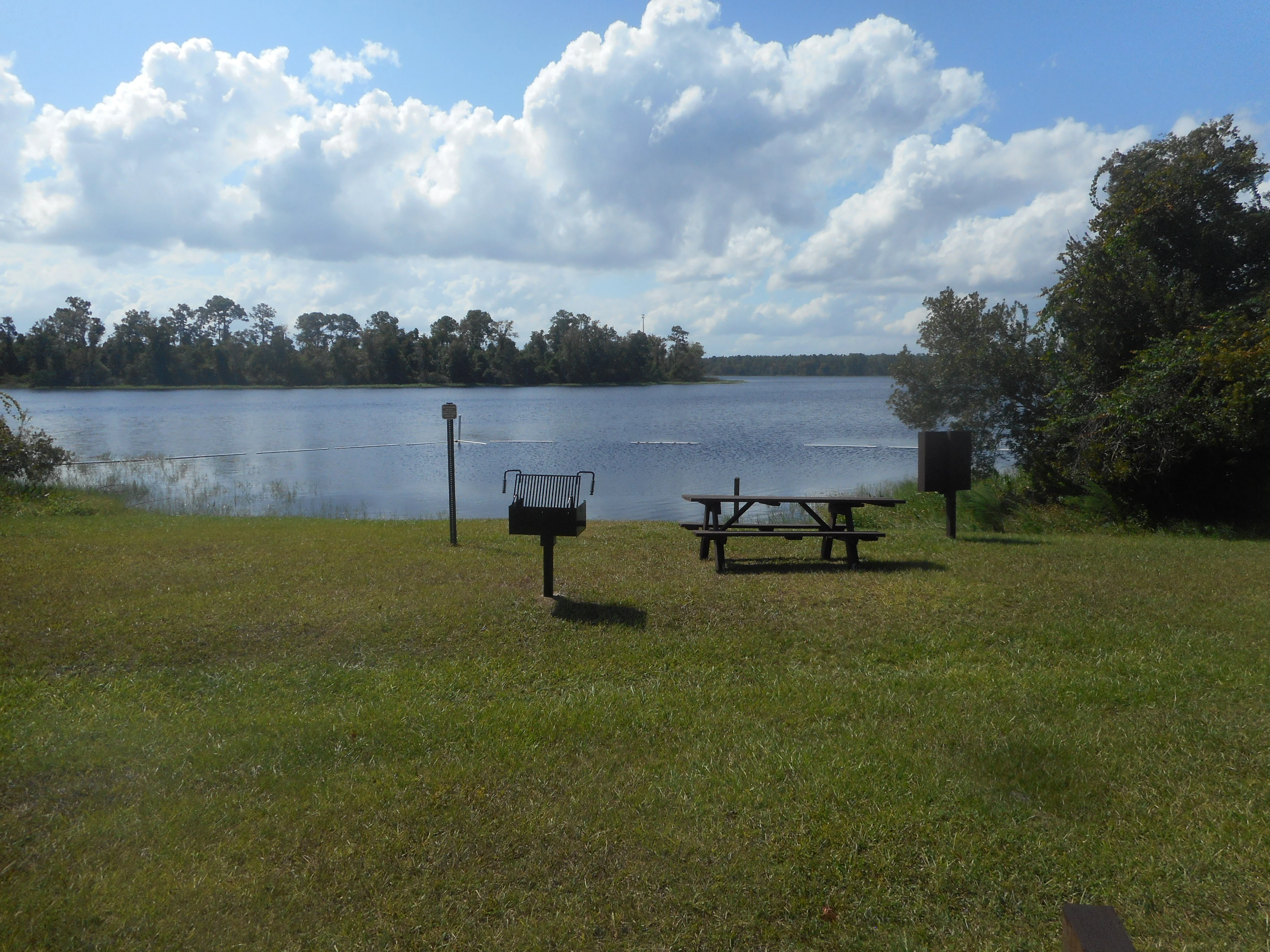
A green grassy lawn with a metal picnic table and a pedestal-mounted charcoal grill overlooking a still lake under a blue sky with white clouds.
A picnic table and charcoal grille at the Wildcat Lake recreational area within Ocala National Forest.

Top sights and standout views in Ocala National Forest

The Big Scrub is the signature feature of Ocala National Forest, a vast and unusual sea of sand pine scrub that contains extraordinary biodiversity and is found in few other places on Earth. Its scale, fire history, and ecological isolation make it one of the most distinctive protected ecosystems in the southeastern United States.

Equally compelling are the forest's waters. More than 600 lakes and ponds, together with spring-fed rivers and clear-water runs like Juniper Springs and Alexander Springs, anchor a freshwater network that supports manatees, alligators, diverse aquatic life, and some of the region's best recreational paddling. Combined with world-class OHV trails, designated wilderness areas, and a rich cultural heritage tied to Marjorie Kinnan Rawlings, Ocala offers a depth of experience that few southeastern forests can match.

Best time to visit Ocala National Forest

Ocala National Forest offers recreation throughout the year, but the experience shifts noticeably with the seasons. The cooler, drier months from late autumn through early spring bring mild temperatures, lower humidity, and comfortable conditions for hiking, camping, and exploring the scrub. Winter is a relaxed, family-friendly time to visit, with crisp mornings and warm afternoons.

Summer in the forest is warm, humid, and punctuated by short afternoon thunderstorms, but it is also when swimming, snorkeling, and paddling the spring-fed rivers are most rewarding. The clear, cool runs at places like Juniper Springs offer relief from the heat and attract visitors looking for an immersive water experience. Wildlife viewing tends to be productive year-round, though cooler months make early-morning and dusk sightings more comfortable for observers.
Monthly climate preview

Long-term representative monthly temperature and precipitation data for Ocala National Forest

Ocala National Forest Climate Normals and Annual Temperature Patterns

Representative coordinate records show measured monthly averages ranging from mild winter temperatures to high summer maximums alongside distinct precipitation shifts. Examining the complete twelve-month climatology profile reveals comprehensive variations in temperature and precipitation normals.
Annual mean22 °C
14 °C27 °C
Jan14°
Feb16°
Mar18°
Apr22°
May25°
Jun27°
Jul27°
Aug27°
Sep26°
Oct22°
Nov18°
Dec15°
Warmest month
July

27.4 °C

Coolest month
January

13.9 °C

Wettest month
June

6.2 mm/day

Driest month
November

1.6 mm/day

Park location guide

Geography guide, regional context, and park location map for Ocala National Forest

Ocala National Forest park geography, regions, and map view in United States of America

Understand where Ocala National Forest sits in United States of America through a broader geographic reading of the surrounding landscape, nearby location context, and its mapped position within the national park landscape.

How Ocala National Forest fits into United States of America

The United States of America is a federal presidential republic and one of the world's largest countries by area and population. It consists of 50 states across a vast territory spanning multiple time zones, with its capital in Washington, D.C. and largest city in New York City. The nation has a diverse economy, influential political system, and significant cultural and military presence globally.

Wider geography shaping Ocala National Forest in United States of America

The United States occupies a vast territory in North America, bordered by Canada to the north and Mexico to the south. The 48 contiguous states stretch from the Atlantic to the Pacific Ocean, while Alaska occupies the northwestern region and Hawaii is an archipelago in the Pacific. The country encompasses diverse terrain including the Rocky Mountains, Appalachian Mountains, Great Plains, and extensive river systems.

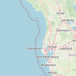
Map view of Ocala National Forest

Use this park location map to pinpoint Ocala National Forest in United States of America, understand its exact geographic position, and read its mapped placement within the surrounding landscape more clearly.

Pigeon | © OpenStreetMap contributors

Location context for Ocala National Forest

Florida

Visual reference for sand pine scrub, clear springs, and protected terrain

Ocala National Forest Photos and Landscape Scenery

Explore authentic visual documentation of Ocala National Forest, featuring the expansive Big Scrub ecosystem and crystal-clear spring runs. Photographic records reveal the unique sandy terrain, diverse habitats, and protected landscapes that define Florida's oldest national forest.

A small, clear pond surrounded by forest and tall grasses under an overcast sky.

A pool of water sits in the center of a grassy wetland under a cloudy sky, with pine trees in the background.

A narrow, clear stream flowing through a dense, lush green forest with palmetto plants and ferns along the banks.

A paved road leading through a stone pillar gateway into a wooded recreation area, with lush Florida vegetation and palm trees in the background.

A rustic wooden signpost marks the entrance to a sandy trail in a dense, green forest.

A wooden post holds a rectangular sign for The Yearling Trail, featuring an illustration of a deer; a utility pole stands behind the sign against a clear blue sky.

A green grassy lawn with a metal picnic table and a pedestal-mounted charcoal grill overlooking a still lake under a blue sky with white clouds.

Park atlas

Compare regional geography, surrounding ecosystems, and adjacent protected areas

Explore Parks Near Ocala National Forest and Connected Protected Landscapes

Browse other parks near Ocala National Forest to examine related sand pine scrub, freshwater springs, and regional forest ecosystems. Expanding the geographic comparison reveals broader ecological patterns and connected protected landscapes across the surrounding region.
A pale watercolor landscape painting featuring silhouetted dead trees against a soft, light-colored prairie background.
Wildlife reserveMarion County
Park boundaries overlap#1 closest

East

Juniper Prairie Wilderness: Wildlife Reserve Geography and Mapped Protected Landscapes

Central Florida ecological preserve in Marion County

Covering over 13,000 acres, Juniper Prairie Wilderness preserves a transition of ecosystems from dry pine scrub to wet sawgrass flats. This wildlife reserve in Marion County provides essential protection for the Juniper River drainage basin and its first-magnitude springs, offering a dense study of central Florida natural history and terrain.

Area
54 km²
Established
1984
IUCN
Ib
Relief
Lowland
A minimalist watercolor illustration showing green rolling hills and a shoreline against a pale background, representing the natural coastal landscape.
Protected landscapeFlorida
About 33 km away#2 closest

Southeast

Canaveral National Seashore Protected Landscape and Barrier Island Geography

Coastal ecosystems of the Florida Atlantic shore

Canaveral National Seashore stands as a significant protected landscape on the Florida coast, offering a cross section of barrier island geography. This protected area connects the dynamic Atlantic oceanfront with the calm, biodiverse waters of the Mosquito Lagoon, forming a vital refuge of dunes, maritime hammocks, and estuarine wetlands.

Area
233.35 km²
Established
1975
IUCN
V
Visitors
2.5M annual
A watercolor painting showing a soft, stylized landscape with rolling green hills, a small river or stream, and a hazy sky at sunrise or sunset.
Protected landscapeFlorida
39 km away#3 closest

North

Osceola National Forest: Mapping the Protected Landscapes and Geography of Northeast Florida

Pine flatwoods, cypress swamps, and historic wilderness terrain

Osceola National Forest serves as a protected landscape in northeast Florida, defined by its extensive pine flatwoods and cypress-hardwood swamp mosaics. The forest provides vital habitat for wildlife like the Florida black bear and red-cockaded woodpecker, while preserving significant historical narratives. Its geography, marked by low elevations and slow-moving water, creates an expansive natural environment for ecological observation and regional exploration.

Area
772.67 km²
Established
1931
Relief
Lowland
Climate
Subtropical
Nature reserveFlorida
About 66 km away#4 closest

Northeast

Guana Tolomato Matanzas National Estuarine Research Reserve: Florida Nature Reserve Atlas

Protected estuarine geography and coastal river convergence

Discover the geographic complexity of this research-driven protected area, where freshwater and saltwater environments converge along the Florida coastline. The reserve features an intricate network of tidal creeks, pine flatwoods, and coastal dunes, providing a unique look into the regional ecology of the Carolinian marine bioregion and its significant role in maritime conservation science.

Area
296.46 km²
Established
1999
IUCN
IV
Relief
Lowland
A soft watercolor painting of a coastal scene with sandy dunes, pine trees, and palmetto bushes against a pale, warm-toned sky.
Protected areaGeorgia
136 km away#5 closest

North

Cumberland Island National Seashore: Protected Barrier Island Geography and Mapping

A wild coastal landscape on the southeastern Georgia shoreline

Cumberland Island National Seashore stands as a significant protected area on the Atlantic coast, defined by its lack of paved roads and vehicle-free status. The geography spans a complex array of habitats, including maritime forests, tidal creeks, and salt marshes, anchored by historic estates. This protected landscape represents an essential case study in coastal barrier island ecology and preserved historic environments.

Area
147.368 km²
Established
1972
IUCN
II
Visitors
60.3K annual
Marine protected areaGeorgia
222 km away#6 closest

North

Gray's Reef National Marine Sanctuary: Continental Shelf Geography and Reef Mapping

Submerged sandstone ridges and Atlantic marine habitat

Gray's Reef National Marine Sanctuary protects one of the largest near-shore live-bottom reefs in the southeastern United States. This submerged landscape consists of sandstone ledges rising above the sandy seafloor, fostering a unique three-dimensional habitat that supports a diverse range of marine invertebrates and fish species across its 22-square-mile protected boundary.

Area
57 km²
Established
1981
IUCN
IV
Relief
Lowland
Watercolor painting of a meandering river flowing through a green marshland with rolling hills in the background under a pale sky.
Nature reserveFlorida
About 293 km away#7 closest

West

Apalachicola National Estuarine Research Reserve: Florida Protected Estuary and Coastal Geography

Exploring the tidal marshes and benthic habitats of Florida's Gulf Coast.

Apalachicola National Estuarine Research Reserve offers a deep look into the coastal geography of the Florida panhandle. As a protected area, it manages the complex intersection of estuarine food chains, commercial fishing zones, and vital wetland habitats, utilizing advanced GIS capabilities to map the bay's submerged reefs and tidal channels.

Relief
Lowland
Climate
Subtropical
Scope
Marine
Water
Water-dominated
Watercolor illustration depicting a panoramic view of a coastal estuary with green mangrove islands, tidal channels, and a soft pink sunset sky.
Marine protected areaFlorida
About 301 km away#8 closest

South

Rookery Bay National Estuarine Research Reserve: Coastal Geography and Protected Estuarine Waters

Subtropical mangrove landscapes within the Florida Gulf Coast region.

This marine protected area encompasses a vast sweep of sheltered coastal waters and tidal forests at the northern edge of the Ten Thousand Islands. The reserve stands as a prime example of an undisturbed subtropical estuary, characterized by continuous mangrove shorelines and intricate hydrologic networks that provide critical habitat for numerous estuarine dependent species.

Area
445.15 km²
Established
1980
Relief
Lowland
Climate
Subtropical

Common questions about visiting, size, designation, and location context for Ocala National Forest

Ocala National Forest FAQs for park facts, access, geography, and protected area context

Find quick answers about Ocala National Forest, including protected-area facts, park geography, trail and visitor context, and how the park fits into its surrounding country and regional landscape.
MoriAtlas Explorer

Continue Your Protected Areas Search Across the Global Atlas

Deepen your exploration by continuing the structured search for national parks and protected areas worldwide. Utilize the comprehensive filtering capabilities to compare different conservation landscapes and refine your understanding of global park geography. Discover more about the distribution and characteristics of protected natural areas.

Global natural geography