Mori Atlas logo
National parkOkomu National Park

Explore the mapped terrain and protected area boundaries of Okomu National Park.

Okomu National Park: Nigeria's Protected Landscape and National Park Geography in Edo State

Okomu National Park stands as a vital protected landscape in Edo State, Nigeria, offering a unique focus for geographic discovery and atlas exploration. This national park provides a key point for understanding the regional geography and the distribution of conservation lands. Engage with its mapped boundaries and terrain to appreciate its distinct environmental context within the broader Nigerian landscape.

rainforestnational parkWest AfricaGuinea-Congo forestendangered speciesforest elephants

Okomu National Park

National park

Park overview

Structured park overview, official facts, and landscape profile for Okomu National Park

Okomu National Park park facts, protected area profile, and essential visitor context

Review the core facts for Okomu National Park, including designation, size, terrain, visitor scale, habitats, and operating context in one park-focused overview.

About Okomu National Park

Okomu National Park occupies a small but ecologically significant portion of what was once a continuous belt of Nigerian lowland rainforest extending from the Niger River westward to the Dahomey Gap in Benin. This forest block, once 50 to 100 kilometers wide, has been reduced to fragmented remnants by centuries of human activity and agricultural expansion. Today, Okomu stands as the last substantial habitat for many endangered species in the region, though its boundaries continue to face pressure from surrounding communities and commercial plantation development. The park is accessible to tourists with well-maintained trails and guided forest walks that reveal the intricate ecology of the rainforest, from termite nests to medicinal plants. Visitors can observe wildlife from elevated tree houses or stay in chalets constructed on stilts amid fig trees frequented by Mona monkeys. The park's location within the larger Okomu Forest Reserve provides a buffer zone of ecological continuity, though the core protected area has shrunk dramatically from its original extent.

Quick facts and research context for Okomu National Park

Okomu National Park spans roughly 200 square kilometers in Edo State, Nigeria, making it the smallest of Nigeria's seven national parks. The protected area sits within the larger 1,082 square kilometer Okomu Forest Reserve, approximately 60 kilometers northwest of Benin City. The ecosystem is classified as Guinea-Congo lowland rainforest with vegetation types including swamp forest, high forest, secondary forest, and open scrub. Annual rainfall ranges between 1,524 and 2,540 millimeters. The park is managed by Nigeria's National Park Service and features visitor amenities including marked trails, tree house observation platforms, and chalet accommodations.

Protection and recognition

Documenting the terrestrial boundary framework and official conservation context within Nigeria

Exploring the Official Protection Status and Designation of Okomu National Park

Terrestrial conservation structures define Okomu National Park, establishing a legally recognized framework to protect crucial West African forest habitats. Verifying documented protection status and regional boundary configurations helps researchers trace the network of national parks across Nigeria.

Protection details

Protection scope
Terrestrial
Transboundary protection
No
Park context

Deeper park guide and search-rich context for Okomu National Park

Okomu National Park history, landscape, wildlife, and travel context

Explore Okomu National Park through its history, landscape character, ecosystems, wildlife, conservation priorities, cultural context, and seasonal travel timing in a structured park guide built for atlas discovery and search intent.

Why Okomu National Park stands out

Okomu National Park is best known as one of the last significant remnants of Nigeria'sGuinea-Congo lowland rainforest, representing a critical habitat for endangered species including the African forest elephant and white-throated guenon. The park contains what is considered the finest example of mature secondary forest in southwest Nigeria, with towering kapok trees, diverse canopy species, and exceptional butterfly diversity. Its tree house platforms, particularly a 140-foot-high observation post in a silk-cotton tree, offer visitors unique elevated views of the forest ecosystem and birdlife.

Okomu National Park history and protected-area timeline

The Okomu area contains evidence of human presence dating back 700 years, with archaeological findings of charcoal and pottery beneath the forest floor indicating past clearing and subsequent regeneration. By the start of the 20th century, the original continuous forest had been reduced to disconnected blocks under intense human pressure. The wildlife sanctuary was formally gazetted from the Okomu Forest Reserve in 1935, protecting a 200-square-kilometer rainforest ecosystem. A comprehensive survey of southwestern Nigeria's forests in 1982 prompted recommendations for strengthened conservation of the sanctuary, leading the state government to formally define the sanctuary boundaries in 1986 with an area of 66 square kilometers. The Nigerian Conservation Foundation assumed management in 1987 and expanded the protected area to 114 square kilometers by adding a buffer zone. However, the Foundation's efforts to assist migrant farmers in the surrounding areas inadvertently attracted immigrants from poorer regions, increasing pressure from illegal hunting and logging. By 1997, several NCF employees were found to be involved in illegal logging within the sanctuary. In May 1999, the sanctuary was transferred to the National Park Service for direct management. A Local Advisory Committee was established in 2010, bringing together park management and seven major surrounding communities to address conservation challenges.

Okomu National Park landscape and geographic character

The terrain of Okomu National Park is characterized by lowland rainforest terrain typical of the Guinea-Congo ecosystem, with the landscape shaped by the Osse River forming the eastern boundary and the Okomu River defining the western edge. The topography consists of gentle rolling terrain typical of Nigeria's southern forest zone rather than dramatic mountainous features. The soils are acidic, nutrient-poor sandy loam conditions that support the characteristic dense forest vegetation. Within the park, visitors encounter diverse forest stages including mature high forest canopies, areas of secondary growth following past disturbance, swamp-forest zones in lower-lying areas, and patches of more open scrub vegetation. The landscape is visually dominated by tall trees including the conspicuous kapok with its massive trunk and buttressed roots, along with other large canopy species that create the layered forest structure typical of equatorial rainforest.

Okomu National Park ecosystems, habitats, and plant life

The vegetation classification places Okomu within the Guinea-Congo lowland rain forest biome, representing one of the most species-diverse forest types in Africa. The park contains multiple habitat subtypes including swamp-forest communities in riparian zones, high forest with emergent canopy trees, secondary forest at various stages of regeneration, and more open scrub vegetation. Common tree species include the kapok, also known as the silk-cotton tree, along with Celtis zenkeri, Triplochiton scleroxylon, Antiaris africana, Pycnanthus angolensis, and Alstonia congensis. The Okomu Forest Reserve supports approximately 90 native plant species across 45 families, with Euphorbiaceae and legumes showing the greatest species diversity. Botanical surveys have documented 60 distinct medicinal plant species used in traditional healthcare by local communities, including 50 leafy plant species and 10 types of mushrooms. The park is considered the best example of mature secondary forest remaining in southwest Nigeria.

Okomu National Park wildlife and species highlights

Okomu National Park supports a diverse mammalian fauna with 33 species documented, including the endangered African forest elephant and African buffalo. The vulnerable white-throated guenon, a primate species, maintains a population within the park, while chimpanzees were reported in the broader reserve area in 2009 with an estimated 25 to 50 individuals possibly using the national park at times. Other notable mammals include dwarf crocodile, red river hog, sitatunga, warthog, African wildcat, Maxwell's duiker, greater cane rat, Mona monkey, Thomas's bushbaby, tree pangolin, and red-capped mangabey. The bird fauna comprises approximately 150 species including the Angolan pitta, grey parrot, African fish eagle, various hornbill species, egrets, and spinetails. Perhaps most remarkable is the butterfly diversity with over 700 species recorded, making the park particularly significant for lepidopteran conservation. A survey of terrestrial molluscs identified 46 species in 11 families, representing lower diversity than comparable forests in Cameroon and Sabah.

Okomu National Park conservation status and protection priorities

Okomu National Park represents a critical conservation priority as one of the last remaining fragments of Nigeria's Guinea-Congo lowland rainforest, an ecosystem that has been extensively cleared for agriculture and timber. The park serves as a stronghold for multiple endangered species including the African forest elephant and provides habitat for vulnerable primates and numerous endemic forest species. However, the protected area faces severe challenges from illegal logging, agricultural encroachment from expanding rubber and oil-palm plantations, and pressure from a growing human population engaged in farming and hunting. Management strategies emphasize community engagement through the Local Advisory Committee established in 2010, which provides a platform for park management and local communities to collaborate on conservation issues. The National Park Service works in partnership with organizations including the Nigerian Conservation Foundation, World Wide Fund for Nature, and Wildlife Conservation Society to strengthen protection and sustainable management. Conservation techniques focus on addressing habitat loss through improved park management, community engagement, law enforcement, and sustainable resource practices.

Okomu National Park cultural meaning and human context

The Okomu Forest region has supported human communities for centuries, as evidenced by archaeological findings of charcoal and pottery beneath the forest floor dating back 700 years. The local communities in the Ovia South-West area have historically utilized forest resources and maintain traditional practices that interact with the landscape. While the park itself operates as a strict protected area, surrounding communities engage in activities including beekeeping and palm oil production as sustainable economic alternatives that can reduce pressure on forest resources. The establishment of the Local Advisory Committee in 2010 formally recognizes the role of seven major communities bordering the park in conservation outcomes. The conservation approach acknowledges the need to balance protection objectives with the essential livelihoods and economic concerns of neighboring populations.

Top sights and standout views in Okomu National Park

The park offers several distinctive visitor experiences centered on its intact rainforest ecosystem. The tree house observation platform rising 140 feet in a silk-cotton tree provides panoramic views across the forest canopy and excellent birdwatching opportunities. Guided forest walks led by knowledgeable guides reveal the park's ecological secrets, from active termite colonies to the diverse medicinal plants used in local traditional medicine. The chalet accommodations built on stilts amid fig trees create an immersive experience with frequent Mona monkey sightings. With over 700 butterfly species, the park supports exceptional insect diversity that attracts lepidopterists and nature enthusiasts. The combination of large mammal species including forest elephants and primates, the bird checklist of approximately 150 species, and the botanical richness of the Guinea-Congo forest makes Okomu a compact but valuable destination for understanding West African rainforest ecology.

Best time to visit Okomu National Park

The optimal period for visiting Okomu National Park falls within the dry season months from November to March, when rainfall is reduced and trail conditions are more favorable for forest exploration. During this period, wildlife becomes somewhat more accessible as animals concentrate around remaining water sources, though forest elephant sightings remain rare due to the species' secretive nature and population decline. The wet season from April to October brings heavier rainfall, which can limit some activities but also creates lush green conditions and optimal butterfly viewing when many species are active. The park's high annual rainfall of 1,500 to 2,500 millimeters means visitors should be prepared for humid conditions year-round regardless of season. Birdwatching is productive throughout the year, though migration patterns may bring different species during specific periods.

Monthly climate preview

Analyzing long term temperature trends and precipitation cycles in Edo State

Okomu National Park Climate Normals and Monthly Weather Patterns

Measured data shows consistent warm temperatures throughout the year alongside a pronounced wet cycle that peaks with average precipitation over nine millimeters per day. Exploring the complete monthly climate profiles reveals detailed daily temperature ranges and seasonal precipitation variations recorded at the representative park coordinate.
Annual mean25 °C
24 °C27 °C
Jan25°
Feb26°
Mar27°
Apr26°
May26°
Jun25°
Jul24°
Aug24°
Sep25°
Oct25°
Nov26°
Dec25°
Warmest month
March

26.6 °C

Coolest month
August

24.3 °C

Wettest month
September

9.2 mm/day

Driest month
January

0.6 mm/day

Park location guide

Geography guide, regional context, and park location map for Okomu National Park

Okomu National Park park geography, regions, and map view in Nigeria

Understand where Okomu National Park sits in Nigeria through a broader geographic reading of the surrounding landscape, nearby location context, and its mapped position within the national park landscape.

How Okomu National Park fits into Nigeria

Nigeria is a West African federal republic spanning 923,769 km² between the Sahel and the Gulf of Guinea. It is Africa's most populous nation with over 236 million residents, composed of diverse ethnic groups including Hausa, Yoruba, Igbo, and numerous others. The country operates as a federal presidential republic with 36 states and the Federal Capital Territory, using English as its official language and possessing significant linguistic diversity with over 525 indigenous languages.

Wider geography shaping Okomu National Park in Nigeria

Nigeria occupies West Africa between the Sahel region to the north and the Gulf of Guinea in the Atlantic Ocean to the south. It shares borders with Niger to the north, Chad to the northeast, Cameroon to the east, and Benin to the west. The country covers an area of 923,769 square kilometres.

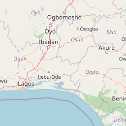
Map view of Okomu National Park

Use this park location map to pinpoint Okomu National Park in Nigeria, understand its exact geographic position, and read its mapped placement within the surrounding landscape more clearly.

Pigeon | © OpenStreetMap contributors

Location context for Okomu National Park

Edo State
Park atlas

Compare Okomu National Park's unique ecosystem with adjacent protected areas and regional conservation landscapes.

Continue Your Park Discovery: Explore Nearby Protected Areas Beyond Okomu National Park

Discover a curated list of national parks and protected areas geographically relevant to Okomu National Park, exploring a wider spread of Nigeria's lowland rainforest and adjacent ecosystems. Comparing these protected areas provides deeper insight into regional conservation efforts, revealing the diverse ecological terrain and spread of protected landscapes.
Wildlife reserveNigeria
About 270 km away#1 closest

North

Lower Kaduna-Middle Niger Floodplain: Protected Wildlife Reserve and Wetland Atlas

An expansive floodplain corridor in the heart of Nigeria

Spanning the confluence of the Niger and Kaduna rivers, this wildlife reserve preserves a critical mosaic of swamps, sandbanks, and flooded grasslands. The area is defined by its seasonal inundation cycles and vital role as a refuge for bird populations within the Guinea savanna. Explore the mapped boundaries and natural terrain of this unique aquatic environment.

Area
2,290.54 km²
Established
2008
Relief
Lowland
Climate
Tropical
Protected areaOuémé
About 277 km away#2 closest

West

Basse vallée de l'Ouémé, lagune de Porto-Novo, lac Nokoué: Benin Wetland and Protected Area

Geographic analysis of a major West African riverine and lagoon system

Spanning the lower reaches of the Ouémé River, this protected wetland area in southern Benin integrates complex fluvial and coastal landscapes. The territory includes Lake Nokoué and the Porto-Novo lagoon, creating a vital hydrological basin that supports seasonal floodplains, mangrove fringes, and significant ecological connectivity. Examine the mapped boundaries and natural terrain of this unique West African environmental corridor.

Area
916 km²
Relief
Lowland
Climate
Tropical
Access
Access unknown
National parkOyo State
About 280 km away#3 closest

Northwest

Old Oyo National Park: Mapped Savanna Terrain and Historical Significance in Nigeria

Explore its geographic setting and protected landscape features.

Old Oyo National Park is a prominent national park situated in Nigeria's Oyo State, covering a substantial area of lowland savanna. The park's terrain features include scattered granite outcrops, ridges, and important archaeological sites, remnants of the ancient Oyo Empire. Its mapped geography reveals a dynamic landscape shaped by river systems and elevated formations, offering a unique blend of natural and cultural heritage for dedicated atlas exploration.

Area
2,512 km²
IUCN
II
Relief
Lowland
Climate
Tropical
Biosphere reserveBenin
About 314 km away#4 closest

West

Réserve de biosphère de la Basse vallée de l’Ouémé: Geographic Overview and Protected Area Map

Coastal lagoon and river delta ecosystems in Benin

The Réserve de biosphère de la Basse vallée de l’Ouémé represents a significant protected landscape in southern Benin where riverine and marine influences converge. This biosphere reserve map highlights a dense network of mangroves, seasonally flooded grasslands, and freshwater lakes. Gain insights into the regional geography and hydrologic patterns of this important wetland complex.

Area
3,143.4 km²
Established
2020
Relief
Lowland
Climate
Tropical
Nature reserveAtlantique
About 324 km away#5 closest

West

Vallée du Sitatunga: Nature Reserve Geography and Wetland Protected Area Context

Community-managed marshland ecosystems in southern Benin

Vallée du Sitatunga encompasses over 67,000 hectares of diverse terrain in southern Benin, ranging from humid forest to expansive floodplains. As a community-led nature reserve, it preserves a vital network of waterways and swamp habitats that sustain rare species such as the sitatunga. This landscape focus offers clear insight into the protected basin geography of the Atlantique region.

Area
700 km²
Established
2009
IUCN
VI
Relief
Lowland
Protected areaZou Department
About 343 km away#6 closest

West

Forêt marécageuse de Lokoli: Protected Alluvial Forest and Wetland Geography in Zou Department

A rare flooded ecosystem in southern Benin

Spanning approximately 500 hectares, Forêt marécageuse de Lokoli serves as a crucial refuge for primate species and native swamp-forest vegetation. The area illustrates a distinct alluvial geography, characterized by seasonal flooding from the Hlan stream that transforms the forest floor into a mosaic of shallow pools and dense, stilt-rooted woodland environments.

Area
5 km²
Relief
Lowland
Water
Major water bodies
Nature reserveBenin
About 349 km away#7 closest

West

Forêt classée de la Lama: Nature Reserve Geography and Protected Area Landscape

A dense forest refuge located within the Dahomey Gap

The Forêt classée de la Lama is a significant nature reserve in Benin, characterized by its unique position in the Lama depression. This area preserves a crucial core of dense semi-deciduous forest surrounded by managed buffer zones. Examine the mapped terrain, hydrological features, and the distinct ecological role this reserve plays in West African forest conservation.

Area
162.5 km²
Established
1946
Relief
Lowland
Climate
Subtropical
Nature reserveAtlantique
About 349 km away#8 closest

West

Forêt relique de Niaouli Nature Reserve: Geography and Protected Landscape Boundaries

A scientific forest refuge in the Atlantique region of southern Benin

The Forêt relique de Niaouli nature reserve covers 220 hectares of protected land, serving as a rare survivor of the semi-deciduous forest that once characterized this part of coastal Benin. This site provides researchers and geography enthusiasts with a deep look into riparian and plateau forest ecosystems. Its ongoing value stems from its long-term ecological data and unique position within the broader West African forest block.

Area
2.2 km²
Established
1997
Relief
Lowland
Climate
Tropical

Common questions about visiting, size, designation, and location context for Okomu National Park

Okomu National Park FAQs for park facts, access, geography, and protected area context

Find quick answers about Okomu National Park, including protected-area facts, park geography, trail and visitor context, and how the park fits into its surrounding country and regional landscape.
MoriAtlas Explorer

Continue Your Protected Areas Search Across the Global Atlas

Deepen your exploration by continuing the structured search for national parks and protected areas worldwide. Utilize the comprehensive filtering capabilities to compare different conservation landscapes and refine your understanding of global park geography. Discover more about the distribution and characteristics of protected natural areas.

Global natural geography