
Mori Atlas logo
Marine protected areaOlympic Coast National Marine Sanctuary

A detailed look at the submarine canyons, continental shelf habitats, and shared tribal-stewardship coastal geography.

Olympic Coast National Marine Sanctuary: Mapping the Temperate Pacific Marine Wilderness of Washington

Olympic Coast National Marine Sanctuary preserves a vast and productive marine corridor along the outer coast of the Olympic Peninsula in Washington. This protected area connects rugged shoreline landscapes with deep offshore submarine canyons and nutrient-rich continental shelf ecosystems. Through collaborative governance with tribal nations and federal agencies, the sanctuary maintains a unique temperate Pacific environment that integrates mountain, coastal, and oceanic terrain into a single protected wilderness.

marine sanctuaryPacific Oceancontinental shelfsubmarine canyonskelp forestsseabirds
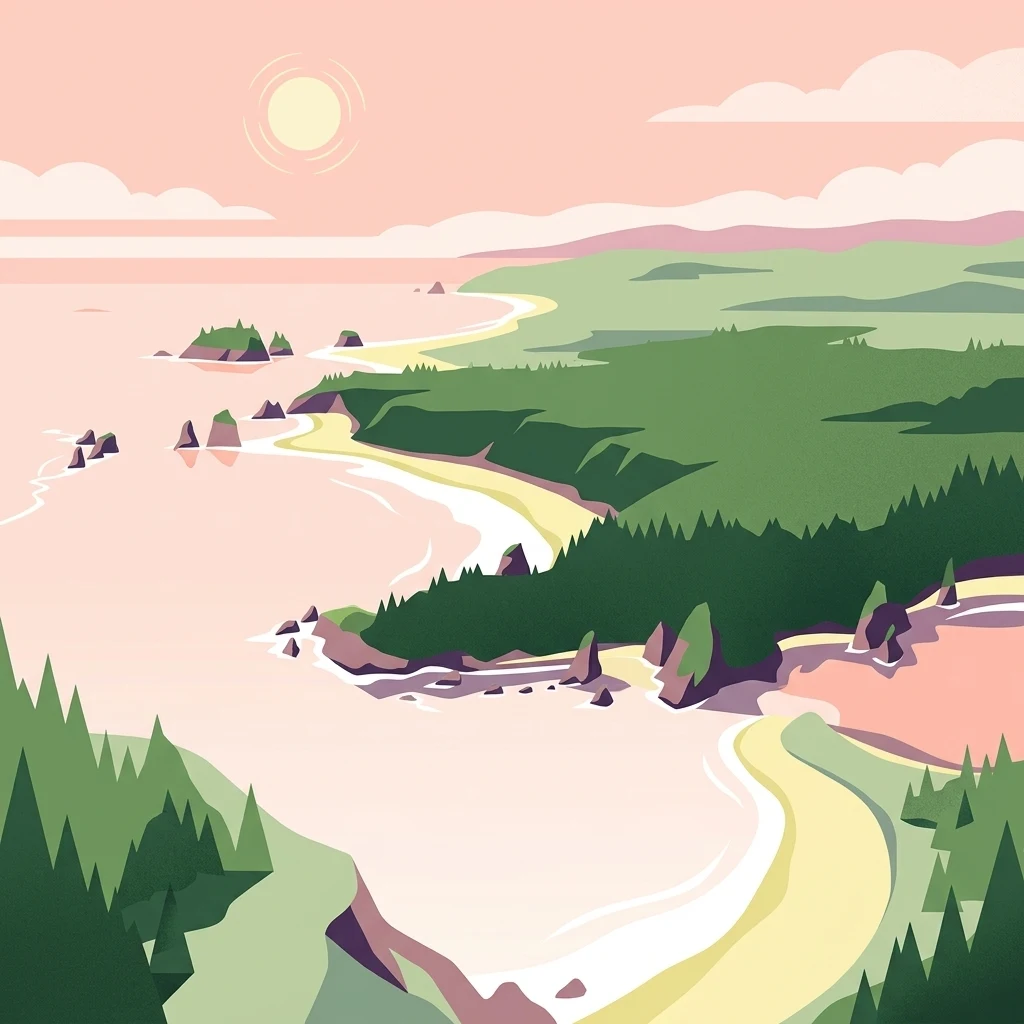
A flat-style digital illustration of a Pacific coastline with sandy beaches, rocky sea stacks, and dense evergreen forests under a pale sunrise.

Olympic Coast National Marine Sanctuary

Marine protected area

Park overview

Structured park overview, official facts, and landscape profile for Olympic Coast National Marine Sanctuary

Olympic Coast National Marine Sanctuary park facts, protected area profile, and essential visitor context

Review the core facts for Olympic Coast National Marine Sanctuary, including designation, size, terrain, visitor scale, habitats, and operating context in one park-focused overview.

About Olympic Coast National Marine Sanctuary

Olympic Coast National Marine Sanctuary protects a major segment of the Pacific Ocean off the northwestern corner of Washington state, along the outer coast of the Olympic Peninsula. Running from Cape Flattery in the north to the Copalis River in the south, the sanctuary stretches along roughly 162 miles of coastline and reaches 25 to 40 miles offshore into the open Pacific. Its total area of approximately 3,189 square miles encompasses most of the local continental shelf and large portions of three important submarine canyon systems: Nitinat Canyon, Quinault Canyon, and Juan de Fuca Canyon.

The oceanic environment here is shaped by the cold, nutrient-rich waters of the California Current extension, which produces strong seasonal upwelling along the coast. These conditions support dense plankton blooms, which in turn fuel kelp forests, rich invertebrate communities, fish populations, marine mammals, and large seabird colonies. The sanctuary's waters also abut a famously rugged shoreline characterized by sea stacks, tide pools, headlands, and remote islands such as James Island, near Teahwhit Head. Much of the adjacent land is protected within Olympic National Park, creating an unusually continuous transition from forested mountains to tide line to deep ocean.

As one of fifteen National Marine Sanctuaries in the United States, the area was designated on May 11, 1994, under the National Oceanic and Atmospheric Administration. Federal protection recognizes both the ecological importance of the offshore environment and the cultural importance of the coastline to indigenous peoples. The sanctuary overlays three national wildlife refuges that protect seabird nesting rocks and haul-out sites: Flattery Rocks, Quillayute Needles, and Copalis Rock. These refuges, separately managed by the U.S. Fish and Wildlife Service, focus on breeding seabirds and marine mammals, while the sanctuary addresses broader marine habitat protection.

What distinguishes Olympic Coast National Marine Sanctuary most is its cooperative structure. Federal stewardship, through NOAA, is shared with Olympic National Park along a 64-mile stretch of the coast, and the sanctuary also maintains formal partnerships with the Hoh, Quileute, Makah, and Quinault tribal nations. These tribes have inhabited and used the coastal and marine environment for thousands of years, and their traditional ecological knowledge plays a meaningful role in sanctuary management decisions, research, and education programs. The sanctuary's visitor center in Port Angeles, dedicated in 2004, supports this broad public and educational mission.

Quick facts and research context for Olympic Coast National Marine Sanctuary

Olympic Coast National Marine Sanctuary lies along the western edge of Washington state, fronting the Olympic Peninsula and stretching from Cape Flattery in the north to the Copalis River mouth in the south. It is one of fifteen U.S. National Marine Sanctuaries and the only one located in the Pacific Northwest's outer coastal waters. The sanctuary was designated on May 11, 1994, reflecting recognition of the area's ecological, geological, and cultural importance.

Managed by the National Oceanic and Atmospheric Administration, the sanctuary covers roughly 3,189 square miles of ocean, encompassing most of the continental shelf off the Olympic Peninsula and reaching well into the open Pacific. Its waters overlie three notable submarine canyons: Nitinat, Quinault, and Juan de Fuca. The sanctuary also overlaps the Flattery Rocks, Quillayute Needles, and Copalis Rock National Wildlife Refuges, and shares sixty-four miles of coastline with Olympic National Park. Co-stewardship agreements with the Hoh, Quileute, Makah, and Quinault tribal nations make this one of the most distinctive cooperative marine management arrangements in the United States.

Protection and recognition

Marine conservation scope and designation timeline for Olympic Coast National Marine Sanctuary

Olympic Coast National Marine Sanctuary Protection Status and Designated History

Marine protection status for Olympic Coast National Marine Sanctuary anchors the documented 1994 designation year and management scope. Official records outline designated area parameters and international recognition sources to support structured marine park analysis.

Protection details

Protection scope
Marine
Designated year
1994
Transboundary protection
No
Park context

Deeper park guide and search-rich context for Olympic Coast National Marine Sanctuary

Olympic Coast National Marine Sanctuary history, landscape, wildlife, and travel context

Explore Olympic Coast National Marine Sanctuary through its history, landscape character, ecosystems, wildlife, conservation priorities, cultural context, and seasonal travel timing in a structured park guide built for atlas discovery and search intent.

Why Olympic Coast National Marine Sanctuary stands out

Olympic Coast National Marine Sanctuary is best known for protecting a long, productive stretch of the Pacific Ocean along one of the wildest and least-developed coastlines in the contiguous United States. The sanctuary's combination of cold-water upwelling systems, deep submarine canyons, rich kelp and seafloor habitats, and abundant seabird colonies gives the area its strong identity as a temperate Pacific marine environment. Equally defining is the sanctuary's co-management framework. Few marine protected areas in the United States pair such intensive federal protection with such a significant tribal-governance role, particularly for the Makah, Quileute, Hoh, and Quinault peoples, whose cultural and subsistence relationships with the sea stretch back centuries. The sanctuary is also recognized for its proximity to Olympic National Park, allowing terrestrial and marine wilderness to meet along a single, continuous coastal corridor.
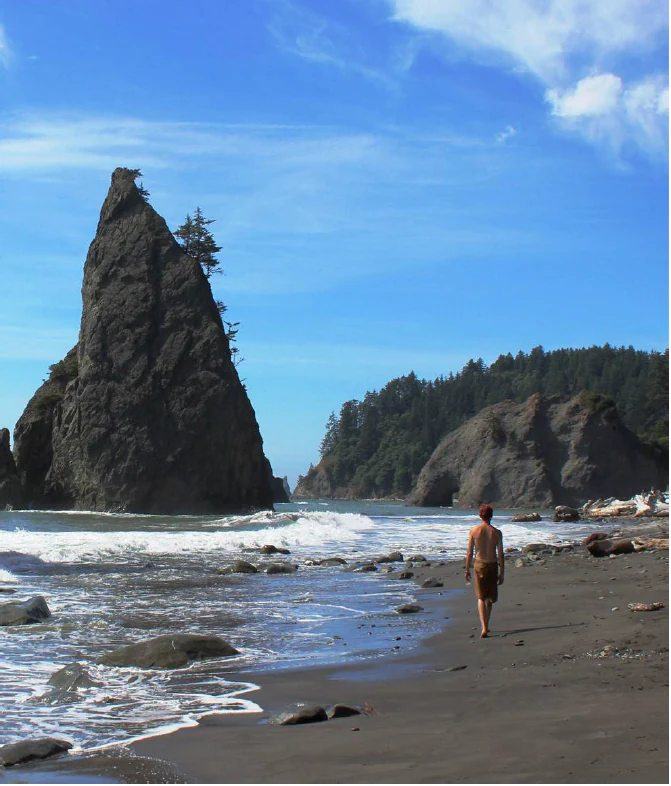
A person walks on a dark sand beach with large sea stacks and forested cliffs in the background under a blue sky.
A person walks along the dark, rugged sands of Rialto Beach within the Olympic Coast National Marine Sanctuary.

Olympic Coast National Marine Sanctuary history and protected-area timeline

Olympic Coast National Marine Sanctuary was formally designated on May 11, 1994, following years of mounting concern over the health of Pacific marine ecosystems off Washington state. The designation placed the offshore waters of the Olympic Peninsula under the protection framework of the National Oceanic and Atmospheric Administration, marking them as one of the most significant marine protected areas in the continental United States. Federal recognition reflected both the area's ecological value and the unique convergence of tribal cultures, national park lands, and national wildlife refuges along the outer coast.

The sanctuary's early years focused on establishing research, monitoring, and education programs, as well as developing a working relationship with the National Park Service along the shared coastal corridor. A major milestone came in 2004, when a dedicated visitor center and offices were formally established in Port Angeles, Washington, in an event featuring U.S. Representative Norm Dicks. This facility served to centralize public engagement, outreach, and tribal collaboration efforts.

In the years following its designation, the sanctuary expanded its partnership with regional tribal nations. The Hoh, Quileute, Makah, and Quinault peoples were recognized not only as historically tied to the marine environment but also as active stewards in present-day sanctuary management. Educational programs such as the Quileute Tribal School's remotely operated vehicle project, developed in partnership with the University of Washington's School of Oceanography, illustrate how the sanctuary has evolved into a hub for community-led marine science as well as conservation.

Olympic Coast National Marine Sanctuary landscape and geographic character

The marine landscape of Olympic Coast National Marine Sanctuary is defined by the dramatic transition from steep, forested coastline into the open Pacific. Along the shore, the sanctuary faces one of the most rugged sections of the outer Pacific coast of the contiguous United States, marked by sea stacks, headlands, offshore rocks, and tide-pool-rich beaches such as Rialto Beach. Teahwhit Head and James Island, captured in iconic aerial images, represent the kind of exposed, wave-sculpted coastal landforms typical of the region.

Beneath the surface, the defining landscape features are the sanctuary's three major submarine canyons: Nitinat Canyon, Quinault Canyon, and Juan de Fuca Canyon. These deep incisions into the continental shelf funnel nutrients and sediments, creating zones of biological productivity and structural complexity that are quite different from the surrounding shelf. The continental shelf itself slopes gradually outward for many miles before dropping into these canyon systems, giving the sanctuary unusually diverse seafloor topography within a relatively compact area.

At the water's surface, kelp forests, tidal currents, and seasonal upwelling shape a dynamic seascape. Cold, nutrient-rich waters driven by offshore winds and currents rise along the coast, particularly during spring and summer, fueling the productivity that defines this temperate Pacific ecosystem. The result is a landscape where the visible coastline and the submerged topography are equally important, combining into a single continuous transition from mountain ridge to continental shelf to deep Pacific seafloor.
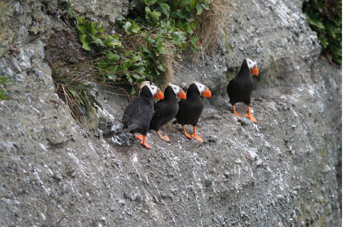
Four tufted puffins with black bodies, white face patches, and bright orange beaks standing on a rough gray rock ledge with sparse green vegetation.
A group of tufted puffins perched on a rocky coastal cliffside.

Olympic Coast National Marine Sanctuary ecosystems, habitats, and plant life

The ecological character of Olympic Coast National Marine Sanctuary is shaped by the meeting of cold, nutrient-rich Pacific waters with a uniquely varied seafloor and shoreline. Seasonal upwelling along the Olympic Peninsula brings deep, cool water toward the surface, loading the nearshore environment with nutrients that support dense marine food webs. This productivity underlies the entire ecological identity of the sanctuary and gives the area its place among the most biologically rich temperate marine environments in North America.

Important habitats include expansive kelp forests, dense invertebrate communities on rocky reefs, open continental shelf soft-sediment environments, and the deep, steep walls of submarine canyons. Tidal flats, tide pools, and intertidal zones along the adjacent coast support sea stars, anemones, mussels, and countless other invertebrate species. The combination of these habitats means that organisms ranging from microscopic plankton to large marine mammals can find critical habitat within the sanctuary's boundaries.

The sanctuary's protected waters also host breeding colonies of seabirds on offshore rocks that overlap with national wildlife refuges, and they serve as essential feeding grounds for migratory species. The continuity between the marine sanctuary and the adjoining terrestrial wilderness of Olympic National Park is not just geographic: it sustains ecological linkages between watersheds, nearshore life, and offshore food webs in a way that few other marine protected areas in the United States can claim.
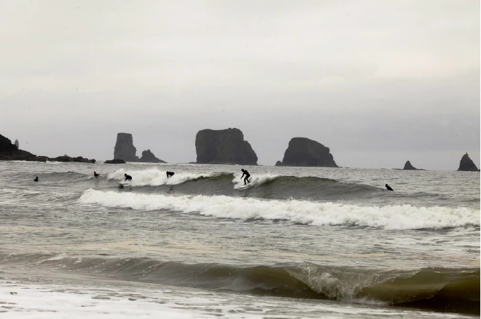
Several surfers on surfboards riding small waves in the ocean with large sea stacks visible on the horizon under an overcast sky.
Surfers ride waves along the coast of the Olympic Coast National Marine Sanctuary.

Olympic Coast National Marine Sanctuary wildlife and species highlights

Wildlife is one of the most prominent features of Olympic Coast National Marine Sanctuary. The sanctuary is well known for its seabird populations, including tufted puffins, which nest on the offshore rocks and islands of the adjacent national wildlife refuges. These rocky outcrops, protected within the Flattery Rocks, Quillayute Needles, and Copalis Rock refuges, also support murres, cormorants, gulls, and other seabirds that depend on the productive surrounding waters for food.

Marine mammals are another defining feature of the sanctuary. The cold, fish-rich waters off the Olympic Peninsula attract species such as gray whales during migration, humpback whales, harbor seals, and California sea lions. White shark sightings have been documented in the region in recent years, adding to the sanctuary's growing recognition as habitat for large pelagic species. Seals and sea lions frequently haul out on offshore rocks and coastal features, taking advantage of the same foraging grounds that draw larger predators.

Below the surface, the sanctuary supports dense communities of fish and invertebrates, including salmonids that pass through nearshore waters on their way to and from inland rivers. Crustaceans, echinoderms, mollusks, and other invertebrates flourish both in intertidal zones and on the deeper rocky reefs and canyon walls. Together, these groups form interconnected food webs in which nutrient cycles driven by upwelling ultimately support everything from seabirds nesting on remote rocks to whales passing through on long migrations.
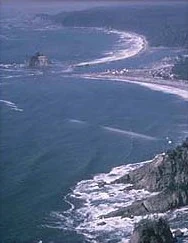
An aerial view of the Pacific Ocean meeting a rocky, forested coastline with waves crashing against shore cliffs.
An aerial view of the rugged coastline within the Olympic Coast National Marine Sanctuary.

Olympic Coast National Marine Sanctuary conservation status and protection priorities

Conservation is central to the identity and purpose of Olympic Coast National Marine Sanctuary. The 1994 designation recognized that this stretch of Pacific Ocean, with its combination of cold-water upwelling, productive continental shelf habitat, and deep submarine canyons, warranted permanent federal protection. By placing roughly 3,189 square miles of these waters under the National Marine Sanctuary system, NOAA aimed to safeguard an irreplaceable temperate marine environment from growing pressures such as offshore development, shipping impacts, and resource extraction.

Layered protection is one of the sanctuary's defining conservation strengths. The marine sanctuary itself, the seabird-focused national wildlife refuges overlaid on its offshore rocks, and the adjacent terrestrial wilderness of Olympic National Park together create a continuous protected corridor stretching from the Olympic Mountains to deep Pacific waters. This stacking of jurisdictions is rare and gives the area one of the strongest conservation frameworks of any marine region in the contiguous United States.

Equally important is the sanctuary's role in marine research and education. Long-term monitoring programs document changes in ocean conditions, marine mammal populations, and seabird colonies, while partnerships with the University of Washington and local tribal schools develop new generations of ocean scientists. The combined influence of federal agencies, tribal nations, academic institutions, and conservation partners gives the sanctuary not only legal protection but a deep, active scientific and community foundation for ongoing stewardship.

Olympic Coast National Marine Sanctuary cultural meaning and human context

The outer coast of the Olympic Peninsula has been home to indigenous peoples for thousands of years, and Olympic Coast National Marine Sanctuary formally recognizes this long cultural relationship. The Hoh, Quileute, Makah, and Quinault tribal nations all maintain traditional connections to the marine environment that surrounds the Olympic Peninsula. For each of these communities, the ocean is not just an ecosystem but a source of cultural identity, subsistence, ceremony, and historical memory.

The Makah, in particular, are renowned for their maritime heritage. Their reservation at Neah Bay lies near Cape Flattery, the northern boundary of the sanctuary, and the tribe has long been recognized for its expertise in whaling, sealing, fishing, and seafaring. The Quileute people, whose territory includes the area around La Push, maintain deep cultural ties to the coastal and river systems of the western Olympics. The Hoh and Quinault nations similarly link river, forest, and ocean worlds in their traditional lifeways.

Sanctuary management formally incorporates tribal governance through co-stewardship agreements. These agreements recognize tribal sovereignty, traditional ecological knowledge, and the right of tribal communities to continue practicing their cultural and subsistence activities. Programs such as tribal-school marine science initiatives and shared research efforts demonstrate how the sanctuary operates not only as a place of ecological protection but also as a place of living cultural continuity along Washington's outer coast.

Top sights and standout views in Olympic Coast National Marine Sanctuary

Olympic Coast National Marine Sanctuary stands out for the rare alignment of ecological, geological, and cultural values within a single marine protected area. Its waters cover one of the most productive stretches of temperate Pacific Ocean in North America, anchored by the upwelling-driven food webs of the continental shelf and the dramatic structure of three major submarine canyons. The sanctuary's proximity to Olympic National Park means that visitors can move from alpine wilderness to rugged outer-coast beaches within a single day's journey, a transition few marine sanctuaries offer so seamlessly.

Equally distinctive is the cooperative governance framework that links NOAA, the National Park Service, the U.S. Fish and Wildlife Service, and four sovereign tribal nations. This shared stewardship model has shaped how the sanctuary conducts research, education, and outreach, including the development of community-driven marine science programs and the establishment of a visitor center in Port Angeles dedicated to public engagement. The result is a marine protected area defined as much by the relationships among its stewards as by the species and habitats it protects.

Best time to visit Olympic Coast National Marine Sanctuary

The character of a visit to Olympic Coast National Marine Sanctuary shifts meaningfully with the seasons, both in terms of weather and biological activity. Summer and early fall, the typical visitor season for the Olympic Peninsula, generally offer the most reliable conditions along the outer coast, with calmer seas, longer daylight hours, and greater accessibility to beaches such as Rialto Beach within adjacent Olympic National Park. These months also coincide with peak upwelling, when cool, nutrient-rich Pacific waters support concentrated marine life near the surface.

Spring and fall migrations bring peak whale-watching opportunities, as gray whales move along the Pacific coast and other marine mammals feed in productive waters near the shelf break. Winter brings rougher seas, dramatic storms, and quieter conditions on the outer coast, but also some of the most powerful displays of Pacific weather and the return of certain seabird and pinniped activity. Calm, clear days throughout the year often offer the best views of offshore rocks, seabird colonies, and the stunning interplay between forested shoreline and open ocean.

Monthly climate preview

Long-term representative temperature and precipitation averages for Washington protected waters

Olympic Coast National Marine Sanctuary Climate Normals and Weather by Month

Representative coordinates record measured monthly temperature ranges alongside daily precipitation averages across twelve distinct periods. Examining complete monthly climate normals reveals detailed seasonal shifts in marine weather patterns.
Annual mean11 °C
8 °C14 °C
Jan
Feb
Mar
Apr
May11°
Jun13°
Jul14°
Aug14°
Sep14°
Oct12°
Nov10°
Dec
Warmest month
August

14.3 °C

Coolest month
February

7.8 °C

Wettest month
November

10.3 mm/day

Driest month
July

1.4 mm/day

Park location guide

Geography guide, regional context, and park location map for Olympic Coast National Marine Sanctuary

Olympic Coast National Marine Sanctuary park geography, regions, and map view in United States of America

Understand where Olympic Coast National Marine Sanctuary sits in United States of America through a broader geographic reading of the surrounding landscape, nearby location context, and its mapped position within the national park landscape.

How Olympic Coast National Marine Sanctuary fits into United States of America

The United States of America is a federal presidential republic and one of the world's largest countries by area and population. It consists of 50 states across a vast territory spanning multiple time zones, with its capital in Washington, D.C. and largest city in New York City. The nation has a diverse economy, influential political system, and significant cultural and military presence globally.

Wider geography shaping Olympic Coast National Marine Sanctuary in United States of America

The United States occupies a vast territory in North America, bordered by Canada to the north and Mexico to the south. The 48 contiguous states stretch from the Atlantic to the Pacific Ocean, while Alaska occupies the northwestern region and Hawaii is an archipelago in the Pacific. The country encompasses diverse terrain including the Rocky Mountains, Appalachian Mountains, Great Plains, and extensive river systems.

Map view of Olympic Coast National Marine Sanctuary

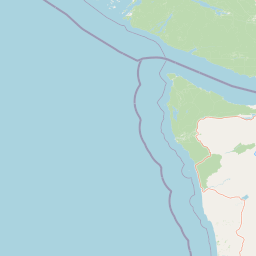
Use this park location map to pinpoint Olympic Coast National Marine Sanctuary in United States of America, understand its exact geographic position, and read its mapped placement within the surrounding landscape more clearly.

Pigeon | © OpenStreetMap contributors

Location context for Olympic Coast National Marine Sanctuary

Washington
Natural feature types

Trace the Geographic Features of Olympic Coast National Marine Sanctuary

Follow this collection to view the diverse natural features found throughout the Olympic Coast National Marine Sanctuary. MoriAtlas provides a structured look at the marine and coastal terrain, allowing for a deeper understanding of the environmental elements that characterize this significant federal sanctuary.
Recorded earthquake history

Explore Recorded Earthquake History for Olympic Coast National Marine Sanctuary

Examine the historical catalogue of recorded seismic activity associated with the Olympic Coast National Marine Sanctuary. This MoriAtlas collection offers researchers and geography enthusiasts an organized view of event data, magnitudes, and epicentre locations without implication of hazard or predictive trends.

Olympic Coast National Marine Sanctuary Earthquake History

Catalogued events

36 events

Strongest magnitude

Magnitude 4.5

Most recent event

Sep 15, 2026

This history includes earthquakes recorded inside the park or within 50 km of its borders

Visual exploration of rugged marine landscapes, coastal habitats, and protected Pacific ecosystems.

Olympic Coast National Marine Sanctuary Photos and Wild Scenery

Visual records reveal the diverse terrain of Olympic Coast National Marine Sanctuary, spanning wave-sculpted sea stacks, tidal zones, and deep submarine canyons. Examining these protected area views helps observers understand the environmental complexity and stark beauty of this temperate marine habitat.

A person walks on a dark sand beach with large sea stacks and forested cliffs in the background under a blue sky.

An aerial shot of a forested Pacific coastline meeting the ocean, with sea stacks visible in the water near a rocky headland.

Four tufted puffins with black bodies, white face patches, and bright orange beaks standing on a rough gray rock ledge with sparse green vegetation.

Several surfers on surfboards riding small waves in the ocean with large sea stacks visible on the horizon under an overcast sky.

An aerial view of the Pacific Ocean meeting a rocky, forested coastline with waves crashing against shore cliffs.

Park atlas

Compare adjacent coastal marine reserves and connected regional protected landscapes

Parks Near Olympic Coast National Marine Sanctuary And Surrounding Protected Areas

Browse nearby national parks and protected areas sharing the rugged marine geography of Olympic Coast National Marine Sanctuary. Expanding the geographic comparison reveals connected coastal habitats and adjacent wilderness corridors across the Pacific Northwest.
National parkWashington
Park boundaries overlap#1 closest

East

Olympic National Park National Park: Geographic Atlas and Protected Landscape Discovery

Explore its unique Washington landscape and mapped protected areas.

Olympic National Park serves as a key protected area within Washington, offering rich opportunities for geographic exploration. This detail page provides essential context on its designation as a national park, its mapped boundaries, and its contribution to the regional geography. Understand the park's specific landscape character and its role within the atlas of protected lands, facilitating a structured approach to discovering its natural terrain and geographic significance.

Area
3,733.8 km²
Established
1938
IUCN
II
Visitors
3.7M annual
National parkBritish Columbia
9.6 km away#2 closest

North

Pacific Rim National Park Reserve: National Park Protected Landscape & Map Atlas

Mapped boundaries and regional geographic context in British Columbia.

Pacific Rim National Park Reserve stands as a distinct protected natural landscape, serving as a critical component of Canada's national park inventory. This page facilitates an atlas-style exploration of its mapped boundaries and its position within the broader geography of British Columbia. Understanding the park's protected status and its integration with the surrounding natural terrain offers valuable insight into conservation landscapes.

Area
511 km²
Established
1970
IUCN
VI
Visitors
1.2M annual
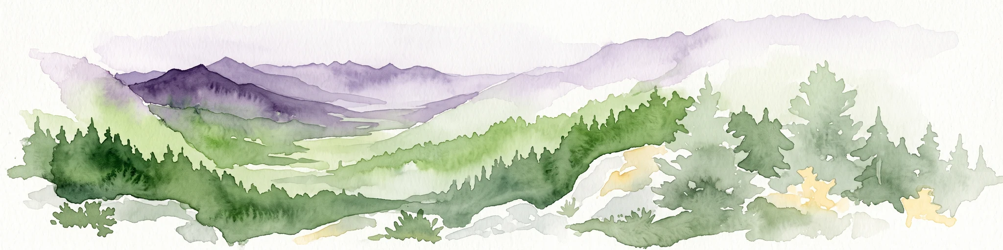
A watercolor painting showing a panoramic view of rolling mountain ranges and dense evergreen forests with a soft, misty aesthetic.
Protected landscapeWashington
11 km away#3 closest

East

Olympic National Forest: Atlas and Geographic Overview of Washington Protected Lands

Temperate rainforests, alpine ridges, and fjord shorelines

Olympic National Forest defines the outer reaches of the Olympic Mountains, featuring a massive expanse of old-growth conifers and high-precipitation temperate rainforests. This protected area connects diverse ecosystems ranging from the brackish waters of Hood Canal to rugged, snow-dusted subalpine ridges. Our detailed geographic mapping highlights the forest's role as a vital buffer and wilderness corridor within the broader Pacific Northwest landscape.

Area
2,541.89 km²
Established
1897
Relief
Mountain
Climate
Temperate
Wildlife reserveWashington
75 km away#4 closest

Southeast

Mount Skokomish Wilderness: Ridge Systems and Alpine Geography in Washington State

Exploration of a protected Olympic Peninsula mountain landscape.

Mount Skokomish Wilderness protects a dramatic stretch of the eastern Olympic Mountains defined by steep ridges and glacial basins. The area serves as a critical headwaters region and offers a dense display of peaks and old-growth forest transitions across its varied elevation profile, providing essential landscape context for the region.

Area
53.79 km²
Established
1984
IUCN
Ib
Relief
Mountain
Nature reserveBritish Columbia
About 83 km away#5 closest

East

Race Rocks Ecological Reserve: Protected Marine Landscape and Island Geography

Nature reserve in the Strait of Juan de Fuca, British Columbia

Race Rocks Ecological Reserve is a geographically distinct protected area consisting of low-lying rocky islets and surrounding high-current marine waters. Located in the Strait of Juan de Fuca, the reserve is recognized for its intense tidal mixing, which supports productive food webs and diverse marine mammals. This site provides a vital window into the ecological dynamics of the Pacific coast through its role as a dedicated research and conservation zone.

Area
2.27 km²
Established
1980
IUCN
Ia
Relief
Lowland
A soft watercolor illustration depicting a winding river flowing through a lush green valley with coniferous forests on the hillsides and mountains in the background.
State or regional parkBritish Columbia
88 km away#6 closest

North

Little Qualicum Falls Provincial Park: Regional Protected Landscape and Atlas Geography

River canyon and mountain lake habitat in British Columbia

Explore the structured geography of Little Qualicum Falls Provincial Park, a protected area characterized by its sequence of dramatic river cascades and old-growth Douglas Fir stands. This entry maps the park's key natural features, including the Cameron Lake shoreline and the rugged canyon terrain of the Little Qualicum River.

Area
4.4 km²
Established
1940
IUCN
II
Relief
Mountain
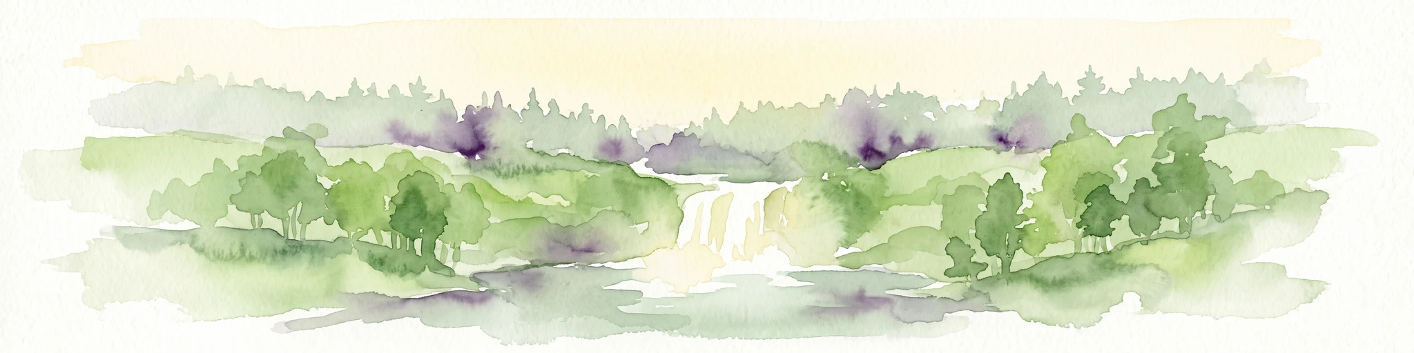
Watercolor painting of a waterfall surrounded by lush green trees and forest.
State or regional parkBritish Columbia
88 km away#7 closest

North

Englishman River Falls Provincial Park: Regional Geography and Protected Area Overview

Vancouver Island river canyon and coastal forest terrain

Englishman River Falls Provincial Park protects a concentrated area of canyon scenery and old-growth forest on the eastern side of Vancouver Island. The landscape is characterized by the dramatic steps of the Englishman River, deep plunge pools, and mature cedar and hemlock stands. This geography provides an essential look at the coastal rainforest ecosystems and river-fed topography that define the recreational corridors of British Columbia.

Area
0.97 km²
IUCN
II
Relief
Upland
Access
Easy access
A horizontal watercolor illustration featuring a wooden boardwalk winding through a calm, light-filled landscape with soft green trees, grassy foreground, and rolling hills in the distance.
State or regional parkBritish Columbia
About 88 km away#8 closest

North

MacMillan Provincial Park: Mapped Geography and Protected Forest Landscapes

Vancouver Island, British Columbia

Examine the mapped footprint of MacMillan Provincial Park, home to iconic old-growth Douglas fir trees and the Cameron River delta. This protected area serves as a biogeoclimatic transition zone, showcasing the rich, moisture-retentive coastal forest environment that defines this specific section of Vancouver Island.

Area
3.01 km²
Established
1947
IUCN
III
Visitors
543.7K annual

Common questions about visiting, size, designation, and location context for Olympic Coast National Marine Sanctuary

Olympic Coast National Marine Sanctuary FAQs for park facts, access, geography, and protected area context

Find quick answers about Olympic Coast National Marine Sanctuary, including protected-area facts, park geography, trail and visitor context, and how the park fits into its surrounding country and regional landscape.
MoriAtlas Explorer

Continue Your Protected Areas Search Across the Global Atlas

Deepen your exploration by continuing the structured search for national parks and protected areas worldwide. Utilize the comprehensive filtering capabilities to compare different conservation landscapes and refine your understanding of global park geography. Discover more about the distribution and characteristics of protected natural areas.

Global natural geography