
Mori Atlas logo
Nature reserveOorlogskloof Nature Reserve

Explore the terrain, river gorges, and biome diversity of this unique South African protected wilderness area.

Oorlogskloof Nature Reserve; Mapped Protected Landscapes and Geographic Features in the Northern Cape

Oorlogskloof Nature Reserve spans 4,776 hectares of mountainous terrain in South Africa, defined by the Oorlogskloof River and its deeply dissected gorge systems. This protected area creates a critical transition between the arid Karoo and the botanically rich fynbos biome. Visitors can trace a landscape of natural rock pools, seasonal streams, and plateau-edge cliffs that provide habitat for endemic freshwater fish and raptor species. The geography also preserves ancient rock art sites that document a complex cultural history within this isolated mountainous corridor.

river gorgefynbos biomeKaroo biomerock poolswaterfallsmountain terrain
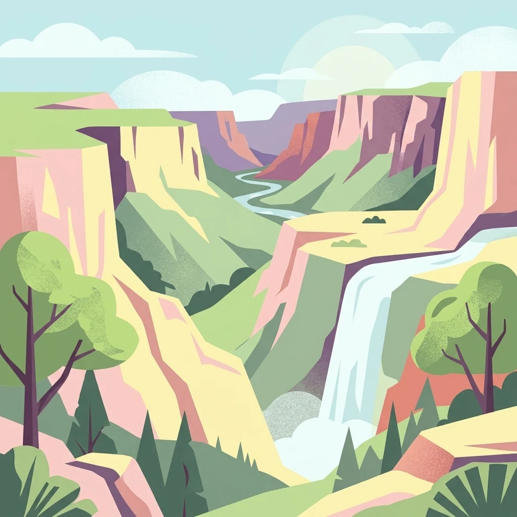
A stylized digital illustration of a deep gorge with steep rocky cliffs, a flowing river, a waterfall, and trees in the foreground.

Oorlogskloof Nature Reserve

Nature reserve

Park overview

Structured park overview, official facts, and landscape profile for Oorlogskloof Nature Reserve

Oorlogskloof Nature Reserve park facts, protected area profile, and essential visitor context

Review the core facts for Oorlogskloof Nature Reserve, including designation, size, terrain, visitor scale, habitats, and operating context in one park-focused overview.

About Oorlogskloof Nature Reserve

Oorlogskloof Nature Reserve sits in the Northern Cape of South Africa, in a transition zone between the arid interior and the biologically rich Cape floral kingdom. The reserve's 4,776 hectares are anchored by the Oorlogskloof River gorge along its eastern boundary, while the western side borders the Knersvlakte, a flat, quartz-strewn semi-desert plain that creates a striking contrast with the reserve's steep, dissected mountains. Numerous seasonal streams cut deep valleys into the terrain, producing the gorges, rock pools, and waterfalls that give the area its visual character.

Ecologically, the reserve lies at the overlap of two major South African biomes: the Karoo, with its hardy succulents and drought-adapted shrubs, and the fynbos, the unique shrubland biome of the Western Cape region that supports extraordinary plant diversity. The presence of fynbos-related species, together with the seasonal Namaqualand flower displays, makes the area significant for botanists and casual wildflower visitors alike. The mix of habitats also supports a varied bird community, including raptors and waterbirds that use the pools and cliffs, while the river system shelters several endemic fish species of conservation concern.

The reserve's open plateaus and cave sites contain rock-art evidence of earlier human presence and interaction with the landscape. In modern management terms, the reserve was formally protected in 1971 and has since been developed for low-impact tourism, with a network of day and multi-day hiking trails, log-cabin accommodation, and active programs to remove invasive alien plants such as black wattle, Port Jackson, eucalyptus, and Prosopis. Together, these features make Oorlogskloof a notable destination for travelers interested in combining arid-zone scenery, Cape fynbotany, freshwater biodiversity, and South Africa's broader natural heritage.

Protection and recognition

Documented terrestrial protection scope and international recognition records

Oorlogskloof Nature Reserve Protection Status and Governance

Oorlogskloof Nature Reserve maintains a documented terrestrial protection scope without imported international recognition sources or transboundary listings. Official records detail the baseline conservation framework and management designation governing the natural terrain.

Protection details

Protection scope
Terrestrial
Transboundary protection
No
Park context

Deeper park guide and search-rich context for Oorlogskloof Nature Reserve

Oorlogskloof Nature Reserve history, landscape, wildlife, and travel context

Explore Oorlogskloof Nature Reserve through its history, landscape character, ecosystems, wildlife, conservation priorities, cultural context, and seasonal travel timing in a structured park guide built for atlas discovery and search intent.

Why Oorlogskloof Nature Reserve stands out

Oorlogskloof Nature Reserve is best known for its deeply gouged river canyon landscape on the edge of the Knersvlakte, where the Oorlogskloof River has carved a network of gorges, natural pools, and waterfalls through the mountainous terrain. It is also distinguished by the rare meeting of two major biomes, the arid Karoo and the botanically rich fynbos, which supports Namaqualand wildflowers such as the wagon tree (Protea nitida) and creates habitat for raptors like Verreaux's eagles and black storks. The presence of endemic freshwater fish, including Clanwilliam yellowfish and Clanwilliam sandfish, adds to its natural significance.
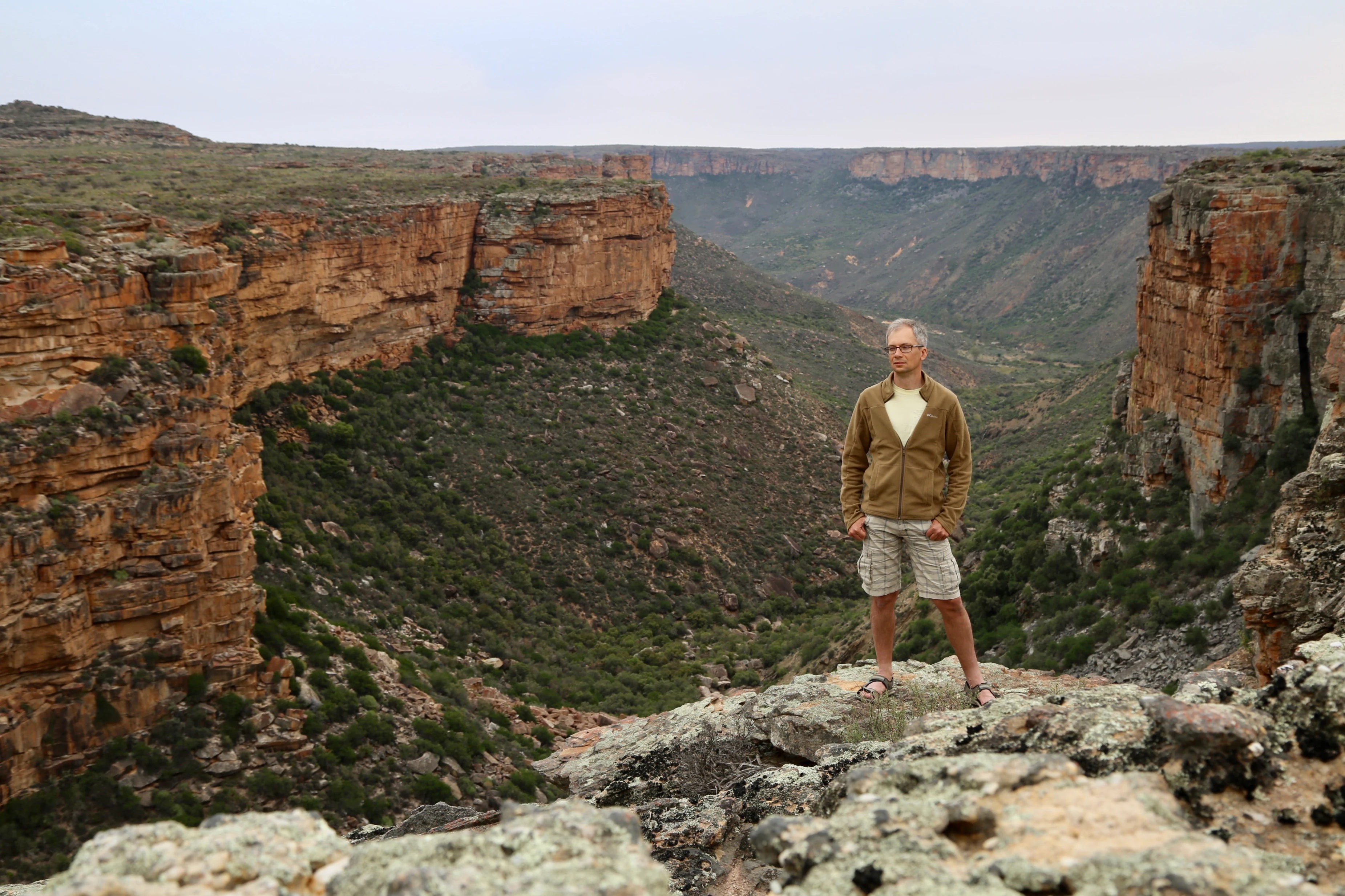
A man standing on a rocky cliff overlooking a deep canyon with rugged walls and sparse vegetation.
A hiker looking out over the expansive Oorlogskloof river canyon.

Oorlogskloof Nature Reserve history and protected-area timeline

The name "Oorlogskloof" translates from Afrikaans as "war gorge" and refers to a conflict that took place in 1739 between indigenous Khoi people and local frontier farmers. This early colonial-era event left a lasting imprint on local memory and provided the gorge with the name by which the entire surrounding landscape is now known.

The area was formally declared a nature reserve in 1971, establishing formal protection for its gorges, pools, and ecological value. A more visible phase of development came in 2012, when the South African Department of Environmental Affairs funded the construction of ten log cabins accommodating around 15 people each, along with solar panels, septic tanks, pedestrian bridges, stream crossings, and boreholes. The same period saw the servicing of hiking trails and access roads, and targeted removal of invasive species such as black wattle, Port Jackson, eucalyptus, and Prosopis, marking a shift toward active habitat restoration alongside the expansion of visitor infrastructure.

Oorlogskloof Nature Reserve landscape and geographic character

The landscape of Oorlogskloof Nature Reserve is defined by a dramatic contrast between plateau, gorge, and semi-desert plain. Along its eastern edge, the Oorlogskloof River has cut a deep gorge through the mountainous terrain, while the western part of the reserve meets the Knersvlakte, a flat, quartz-flecked semi-desert that lies at a noticeably lower elevation. Between these two bookends, the topography is broken by numerous seasonal streams that dissect the mountains into finger-like ridges, side valleys, rock shelves, and cliff sections.

This drainage network has produced scattered waterfalls along the various tributary courses, and around 36 natural pools that collect in basins within the gorges. The resulting scenery is one of layered cliffs, narrow canyon passages, and cool, vegetated pockets set against bare rock and open plateau. Cave formations beside several of the plateaus have in places preserved panels of rock art, adding a visible human dimension to what is otherwise a largely natural geological setting. From higher vantage points, views extend toward the broader Northern Cape landscape, including elevated features such as the Maskam, the Koebee Mountains ridge, the Gifberg, and the peaks of the Matzikama Mountains visible on the horizon.

Oorlogskloof Nature Reserve ecosystems, habitats, and plant life

Oorlogskloof Nature Reserve occupies a rare ecological transition where two of South Africa's most distinct biomes meet. On the drier, more arid side, the landscape carries the character of the Karoo, with drought-tolerant shrubs and succulents shaped by low and unpredictable rainfall. On the wetter, more botanically diverse side, the reserve transitions into fynbos, the finely leafed, fire-adapted shrubland that is unique to the southwestern corner of the continent and globally recognized for its extraordinary plant diversity.

This biomic overlap is most visible in the reserve's flora. The wagon tree, Protea nitida, is one of the more striking fynbos species found in the area, and the reserve is also part of the broader Namaqualand wildflower system. In favorable seasons, annual and bulbous plants associated with Namaqualand fill the open ground with seasonal color, blurring the boundary between the more permanent fynbos shrubland and the ephemeral flower fields that give the wider region its fame. Freshwater habitats in the pools and along the streams further diversify the ecological profile, supporting endemic fish and bivalves and providing essential resources for waterbirds and other fauna.

Oorlogskloof Nature Reserve wildlife and species highlights

The varied terrain and habitat mosaic of Oorlogskloof Nature Reserve supports a rich bird community. Raptors are visible in and around the gorges, with Verreaux's eagles and booted eagles recorded in the area, alongside the distinctive African harrier-hawk. Black storks have also been documented in the reserve, often associated with the pools and rock-strewn sections of the gorge system where they forage in shallow water.

The Oorlogskloof River and its tributaries are particularly important for freshwater wildlife. Endemic fish species include the Clanwilliam yellowfish and the Clanwilliam sandfish, both of which are significant for regional conservation, along with the chubbyhead barb and the sawfin. These native species are under pressure from local banded tilapia as well as introduced alien species such as bass and bluegill sunfish, which are considered a major ongoing threat within the reserve. Freshwater mussels also inhabit some of the pools, rounding out a freshwater community that is both ecologically distinctive and vulnerable to invasion.

Oorlogskloof Nature Reserve conservation status and protection priorities

Oorlogskloof Nature Reserve holds conservation significance primarily because it protects one of the relatively narrow transition zones between the Karoo and the fynbos biome, along with the river system that runs through it. The reserve safeguards a section of the Oorlogskloof River gorge and a network of natural pools and waterfalls, supporting endemic freshwater fish species of recognized conservation value. Its habitat mosaic also underpins populations of raptors such as Verreaux's eagles, as well as black storks and other water-associated birds.

Active management has been a defining feature of the reserve in recent years. Following its declaration in 1971, the area was the focus of a 2012 program funded by the Department of Environmental Affairs, which combined infrastructure upgrades with ecological restoration. This included targeted removal of invasive alien plants such as black wattle, Port Jackson, eucalyptus, and Prosopis from key locations. These interventions reflect a conservation approach that pairs habitat protection with restoration, recognizing that the long-term integrity of both the Karoo-fynbos transition and the endemic freshwater fauna depends on active management of invasive species and visitor pressure.

Oorlogskloof Nature Reserve cultural meaning and human context

The cultural identity of Oorlogskloof Nature Reserve is tied to both early colonial-era conflict and long-standing human presence in the landscape. The gorge itself takes its name from a 1739 encounter between indigenous Khoi people and frontier farmers, an event that became part of the regional heritage of the Northern Cape and was preserved in the Afrikaans place name. Rock-art sites found in caves beside several of the reserve's plateaus speak to human presence and expression in this terrain prior to the colonial period and remain a meaningful cultural layer in the protected area today.

Top sights and standout views in Oorlogskloof Nature Reserve

Oorlogskloof Nature Reserve is a compact, deeply varied Northern Cape reserve that combines gorge scenery, semi-desert plateaus, and Cape fynbotany within a single protected block. Its network of gorges, rock pools, and waterfalls, anchored by the Oorlogskloof River, gives the area some of its most memorable vistas, while the transition between Karoo and fynbos creates habitat for both Namaqualand wildflowers and iconic fynbos species like the wagon tree. Raptor-rich cliffs, endemic freshwater fish, and rock-art sites in plateau-edge caves add further layers of interest, making the reserve equally appealing for natural-history visitors, hikers, and those drawn to South Africa's arid-zone landscapes.

Best time to visit Oorlogskloof Nature Reserve

The character of Oorlogskloof Nature Reserve is strongly seasonal, with conditions shaped by the wider Northern Cape climate. The cooler, drier months are typically the most comfortable for hiking the reserve's day and multi-day trails, when daytime temperatures are more moderate and the natural pools and gorges are easier to explore. Winter and early spring bring cooler nights but also coincide with the broader Namaqualand wildflower season, when rainfall in preceding months can transform open areas into seasonal displays of annual and bulbous flowers, enhancing the visual contrast between the arid Karoo landscapes and the fynbos-influenced slopes. Visitors interested in birdlife or in seeing the reserve's waterfalls at their most active may find late winter and spring particularly rewarding, while summer months tend to be hotter and drier, requiring more preparation for arid conditions.
Monthly climate preview

Track long-term representative temperature ranges and monthly precipitation patterns.

Oorlogskloof Nature Reserve Climate Normals and Annual Temperature Rhythm

Representative coordinate measurements reveal distinct annual temperature swings and monthly precipitation variations across Oorlogskloof Nature Reserve. Accessing the complete twelve-month profile provides detailed meteorological data for ongoing geographic and ecological analysis.
Annual mean19 °C
12 °C24 °C
Jan24°
Feb24°
Mar23°
Apr20°
May16°
Jun13°
Jul12°
Aug13°
Sep16°
Oct19°
Nov21°
Dec23°
Warmest month
February

24.4 °C

Coolest month
July

12.3 °C

Wettest month
June

1.6 mm/day

Driest month
January

0.2 mm/day

Park location guide

Geography guide, regional context, and park location map for Oorlogskloof Nature Reserve

Oorlogskloof Nature Reserve park geography, regions, and map view in South Africa

Understand where Oorlogskloof Nature Reserve sits in South Africa through a broader geographic reading of the surrounding landscape, nearby location context, and its mapped position within the national park landscape.

How Oorlogskloof Nature Reserve fits into South Africa

South Africa is the southernmost country in Africa, spanning 1.22 million km² with a population of over 63 million. The country operates with three capital cities, Pretoria (executive), Cape Town (legislative), and Bloemfontein (judicial), and is renowned for its biodiversity, national parks, and multicultural society.

Wider geography shaping Oorlogskloof Nature Reserve in South Africa

South Africa occupies the southernmost region of Africa, with coastline along both the Atlantic Ocean to the west and the Indian Ocean to the east. The interior features elevated plateaus including the Highveld, with the Drakensberg escarpment marking the eastern highlands. The country shares borders with Namibia, Botswana, Zimbabwe, Mozambique, Eswatini, and Lesotho.

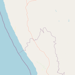
Map view of Oorlogskloof Nature Reserve

Use this park location map to pinpoint Oorlogskloof Nature Reserve in South Africa, understand its exact geographic position, and read its mapped placement within the surrounding landscape more clearly.

Pigeon | © OpenStreetMap contributors

Location context for Oorlogskloof Nature Reserve

Northern Cape

Visual reference for rugged gorges, biomes, and protected terrain

Oorlogskloof Nature Reserve Photos and Landscape Scenery

Photographic records capture the rugged canyon landscape, dramatic cliff faces, and striking biome transitions of Oorlogskloof Nature Reserve. Visual documentation reveals the intricate topography of river gorges, rock pools, and plateau edges that define this protected Northern Cape environment.

A man standing on a rocky cliff overlooking a deep canyon with rugged walls and sparse vegetation.

Park atlas

Compare regional mountain terrain, river gorges, and connected conservation landscapes.

Explore Parks Near Oorlogskloof Nature Reserve and Surrounding Protected Areas

Browse other protected areas sharing the distinctive terrain and ecological transitions of Oorlogskloof Nature Reserve. Comparing adjacent regional reserves provides broader perspective on Northern Cape geography and native biomes.
A watercolor illustration of a scenic wilderness landscape with rolling hills, a winding stream, foreground grasses, and a distinct rock arch formation in the background.
Wildlife reserveWestern Cape
About 93 km away#1 closest

South

Cederberg Wilderness Area: Geographic Overview of Western Cape Protected Landscapes

Mapped sandstone peaks and diverse fynbos wilderness.

The Cederberg Wilderness Area represents a rugged mountain range defined by its resistant Peninsula Formation sandstone and complex geological history. Encompassing dramatic rock formations, ancient caves, and unique botanical endemics, the area offers a study in the intersection of mountainous terrain and the Cape Floral Region. Understand the regional context and physical geography that shape this protected sanctuary.

Area
710 km²
Established
1973
Relief
Mountain
Climate
Mediterranean
Nature reserveWestern Cape
About 97 km away#2 closest

Southwest

Bird Island Nature Reserve: Mapped Coastal Protected Areas and Seabird Habitats

Geography and protected island landscapes in Western Cape, South Africa

Bird Island Nature Reserve represents a key protected coastal landform off the West Coast of South Africa. This three hectare reserve functions as a critical nesting ground, characterized by flat rocky shelves and sun-bleached outcrops. Browse the mapped boundaries and geographic features of this marine sanctuary, which plays a major role in regional seabird conservation and coastal ecological study.

Area
0.03 km²
Established
1988
Relief
Lowland
Climate
Mediterranean
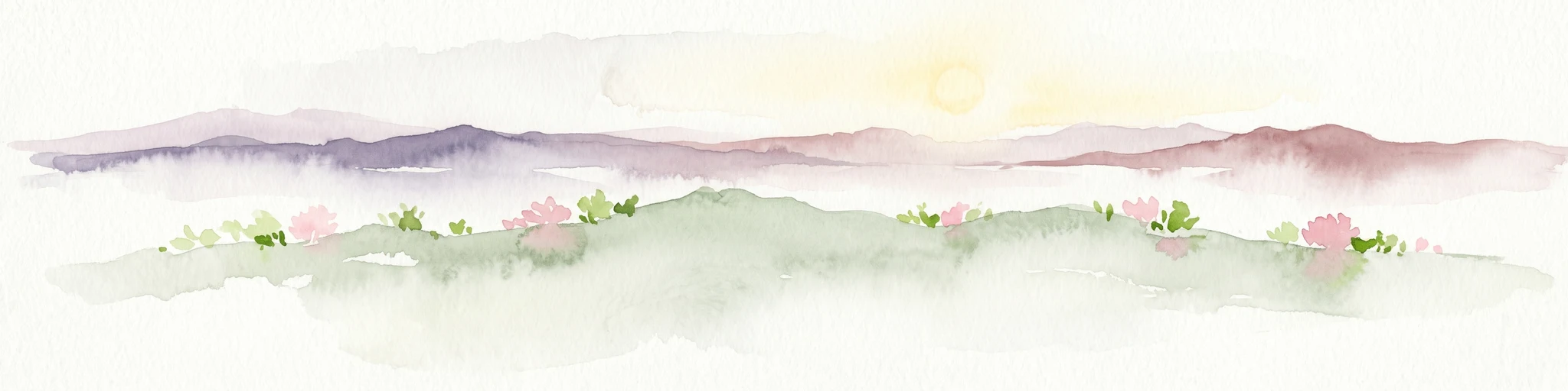
Watercolor illustration showing a mountain range with green hills and pink flowers
National parkNorthern Cape
About 98 km away#3 closest

Southeast

Tankwa Karoo National Park National Park: Mapped Protected Landscape in Northern Cape

Explore regional geography and protected area boundaries.

Tankwa Karoo National Park is a key protected area situated in the vast Northern Cape region of South Africa. This entry provides a detailed atlas perspective, focusing on the park's mapped geography and its significance as a national park. Understand the park's landscape context and its position within the broader regional geography for informed exploration and geographic discovery.

Area
1,436 km²
Established
1986
Relief
Upland
Climate
Arid
Nature reserveWestern Cape
About 118 km away#4 closest

South

Matjiesrivier Nature Reserve: Botanical Diversity and San Rock Art in Western Cape

A protected landscape bridging fynbos and karoo ecosystems

Matjiesrivier Nature Reserve represents a critical conservation landscape in South Africa, known for the transition between mountain terrain and semi-arid basins. The reserve protects unique slate-based soil habitats that sustain a blend of Cape Floral Kingdom vegetation and hardy karoo species. Visitors and researchers recognize this area for its high density of San rock art sites, offering a deep cultural look into the Late Stone Age history of the Western Cape.

Area
128 km²
Established
1995
Water
Minor water
Nature reserveWestern Cape
About 143 km away#5 closest

Southwest

Rocherpan Nature Reserve: Mapping Coastal Wetlands and Strandveld Landscapes in the Western Cape

Protected coastal reserve on the South African West Coast.

Located along the Atlantic shore between Velddrif and Elands Bay, Rocherpan Nature Reserve encompasses a rare, seasonal wetland system. The reserve protects a complex of dune cordons, sandy beaches, and low-lying coastal veld that transforms dramatically with the winter rains. This map-focused entry highlights the ecological layering and geographic significance of this South African protected area.

Area
18 km²
Established
1976
Relief
Lowland
Climate
Mediterranean
National parkNorthern Cape
About 157 km away#6 closest

Northwest

Namaqua National Park: Protected Landscape and Geographic Atlas Details

Explore Northern Cape's National Park mapped context.

Gain insight into Namaqua National Park, a protected national park situated in the expansive Northern Cape region of South Africa. This resource provides detailed geographic context, focusing on its mapped protected landscape and unique regional features. Understand its role as a distinct natural area for atlas-based exploration and geographic discovery within South Africa's diverse terrain.

Area
1,368.18 km²
Established
2001
Climate
Arid
Access
Moderate access
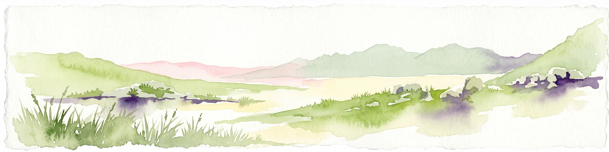
A horizontal watercolor painting showing a soft, stylized mountain landscape with green hills, purple shadows, and grassy foreground.
Wildlife reserveWestern Cape
About 171 km away#7 closest

South

Groot Winterhoek Wilderness Area: Protected Mountain Reserve in the Western Cape

Mapping sandstone ridges, fynbos plateaus, and mountain river systems

Spanning 30,000 hectares, Groot Winterhoek Wilderness Area represents a core mountain wilderness in South Africa. Its dissected landscape of Table Mountain sandstone features high peaks, sheltered kloofs, and seasonal rockpools, forming a critical ecological corridor and water catchment within the Cape Fold Belt mountain system.

Area
306.08 km²
Relief
Mountain
Climate
Mediterranean
Access
Moderate access
National parkWestern Cape
About 189 km away#8 closest

Southwest

West Coast National Park: A National Park's Mapped Boundaries and Geographic Identity

Explore its protected landscape within the Western Cape region.

West Coast National Park is a protected national park situated in the Western Cape province of South Africa. This dedicated page provides a structured view of its geographic scope, emphasizing its mapped boundaries and its significance as a protected landscape within the region's broader atlas context. Gain insight into the park's distinct natural terrain and regional geography.

Area
362.59 km²
Established
1985
Climate
Mediterranean
Access
Easy access

Common questions about visiting, size, designation, and location context for Oorlogskloof Nature Reserve

Oorlogskloof Nature Reserve FAQs for park facts, access, geography, and protected area context

Find quick answers about Oorlogskloof Nature Reserve, including protected-area facts, park geography, trail and visitor context, and how the park fits into its surrounding country and regional landscape.
MoriAtlas Explorer

Continue Your Protected Areas Search Across the Global Atlas

Deepen your exploration by continuing the structured search for national parks and protected areas worldwide. Utilize the comprehensive filtering capabilities to compare different conservation landscapes and refine your understanding of global park geography. Discover more about the distribution and characteristics of protected natural areas.

Global natural geography