
Mori Atlas logo
Protected landscapeOregon Dunes National Recreation Area

A vast coastal dune system bridging interdunal lakes and temperate forest ecosystems in Oregon

Mapping the Geographic Boundaries of the Oregon Dunes National Recreation Area Protected Landscape

The Oregon Dunes National Recreation Area represents the largest expanse of coastal sand dunes in North America, stretching across the central Pacific coastline of Oregon. This protected landscape encompasses a complex mosaic of shifting wind-swept sand, marshy sloughs, freshwater barrage lakes, and coastal forest. Through detailed mapping and atlas analysis, explore the interplay between the massive dune crests and the diverse interdunal wetlands that define this unusual geological terrain.

coastal dunessand dunestemperate dune systemPacific CoastOregon Coastnational recreation area
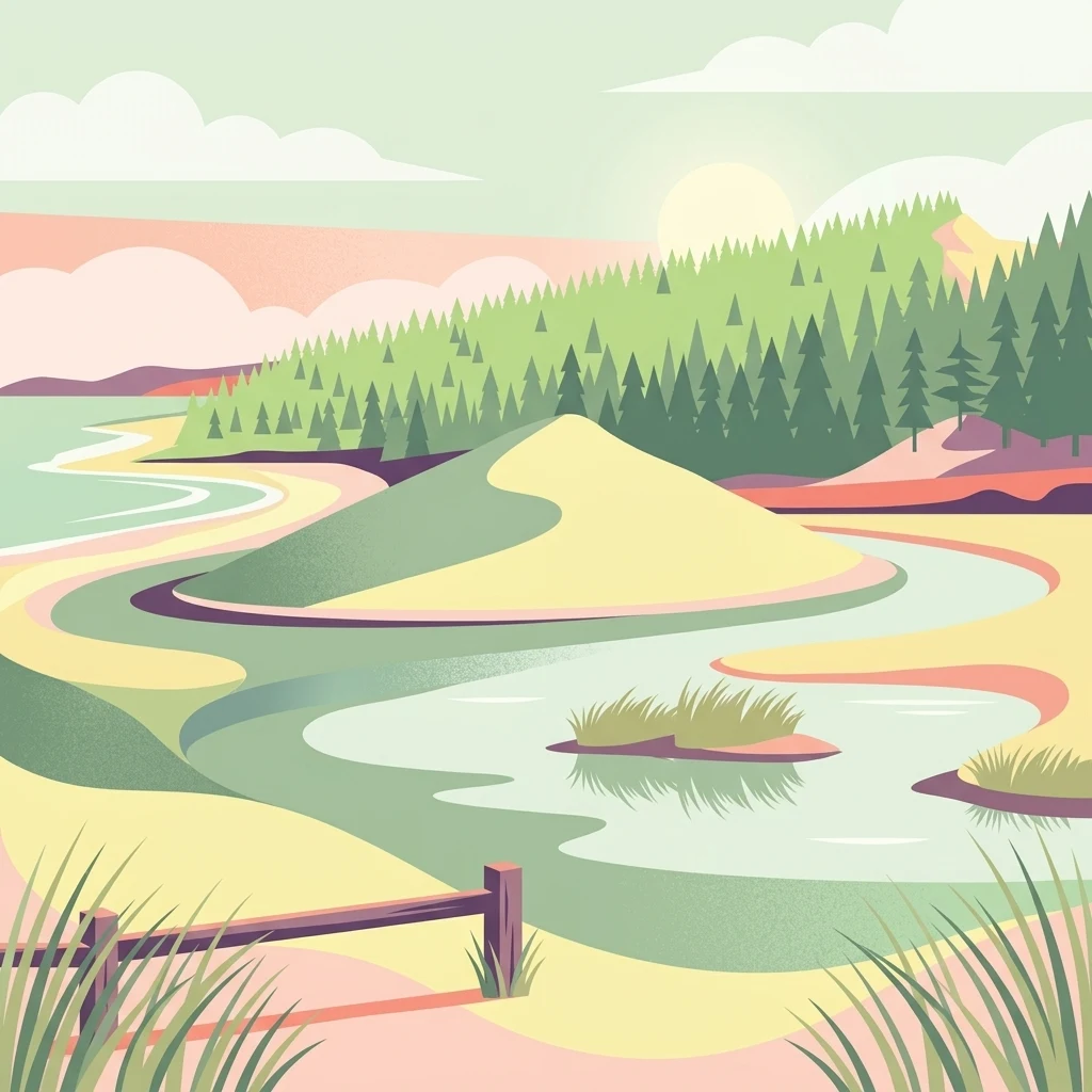
An illustration of a coastal landscape with large sand dunes, a forest in the background, a winding river or lagoon, and a wooden fence in the foreground under a bright sky.

Oregon Dunes National Recreation Area

Protected landscape

Park overview

Structured park overview, official facts, and landscape profile for Oregon Dunes National Recreation Area

Oregon Dunes National Recreation Area park facts, protected area profile, and essential visitor context

Review the core facts for Oregon Dunes National Recreation Area, including designation, size, terrain, visitor scale, habitats, and operating context in one park-focused overview.

About Oregon Dunes National Recreation Area

The Oregon Dunes National Recreation Area occupies a roughly forty-mile segment of the central Oregon Coast between the Coos River near North Bend and the Siuslaw River near Florence, contiguous with Honeyman State Park on its landward side. Although it is a unit that emphasizes recreation rather than wilderness preservation, it carries a scientific and scenic importance that places it among the most distinctive coastal protected landscapes in the United States. As part of Siuslaw National Forest, it falls under the management of the U.S. Forest Service rather than the National Park Service, which has shaped both its management approach and its strong emphasis on multi-use recreation.

What makes the area stand out is the unusual juxtaposition of environments within a relatively narrow coastal strip. Massive active sand dunes rise directly from forested and wetland terrain, while freshwater lakes, marshes, streams, and ocean beach all occur within a short distance of one another. This combination produces one of the most ecologically varied dune systems in the temperate world, supporting plant communities adapted to shifting sand alongside plants adapted to saturated, boggy ground. Visitors experience a landscape that can feel at turns arid and tropical, desolate and densely vegetated, all within the same walk.

Beyond its physical character, the recreation area plays a significant role in regional tourism and outdoor recreation on the Oregon Coast. Off-highway vehicle riding, hiking, camping, horseback riding, canoeing, and fishing all take place within its boundaries, making it one of the most heavily visited U.S. Forest Service sites in the country. The area also carries cultural weight through its connection to Frank Herbert's Dune universe, and conservation significance through its role as nesting habitat for the threatened western snowy plover. Together, these layers make the Oregon Dunes not simply a sand-dune landscape but a complex coastal environment where geology, ecology, recreation, and cultural imagination converge.

Quick facts and research context for Oregon Dunes National Recreation Area

The Oregon Dunes National Recreation Area lies on the Oregon Coast between the Coos River in the north and the Siuslaw River in the south, adjoining Honeyman State Park near Florence. It is part of Siuslaw National Forest and managed by the U.S. Forest Service, having been formally protected by federal legislation in 1972.

The dunes themselves are the largest coastal sand-dune system in North America and among the largest temperate coastal dune systems in the world. About a fifth of the recreation area is open shifting sand, while the remainder mixes interdunal lakes, marshes, forest, and shoreline habitats. It is one of the most popular U.S. Forest Service sites for off-highway vehicle recreation, in addition to serving as nesting habitat for the threatened western snowy plover.

Protection and recognition

Documented terrestrial protection scope, management designation framework, and international recognition records

Oregon Dunes National Recreation Area Protection Status and Formal Recognition Data

Oregon Dunes National Recreation Area maintains a documented terrestrial protection scope within the national park database. Official records assemble available designation history, administrative parameters, and international recognition sources for detailed analysis.

Protection details

Protection scope
Terrestrial
Transboundary protection
No
Park context

Deeper park guide and search-rich context for Oregon Dunes National Recreation Area

Oregon Dunes National Recreation Area history, landscape, wildlife, and travel context

Explore Oregon Dunes National Recreation Area through its history, landscape character, ecosystems, wildlife, conservation priorities, cultural context, and seasonal travel timing in a structured park guide built for atlas discovery and search intent.

Why Oregon Dunes National Recreation Area stands out

The Oregon Dunes National Recreation Area is best known for the sheer scale and visual drama of its coastal dune system. The open dunes, shaped by persistent ocean winds and supplied with sand carried down from the Coast Range by rivers, form an unusually large temperate dune landscape and rise in places several hundred feet above sea level, creating an almost desert-like terrain immediately adjacent to the Pacific Ocean. Equally distinctive is the way these dunes intermingle with wet habitats. Open sand gives way to quiet interdunal lakes, marshy sloughs, and forested deflations, producing a landscape that is remarkable for both its desert-like dunes and its lush, water-filled pockets. The area also has unexpected cultural resonance: science-fiction author Frank Herbert drew on the Oregon Dunes while researching his novel Dune, cementing the place as one of the most recognizable real-world landscapes in its genre.
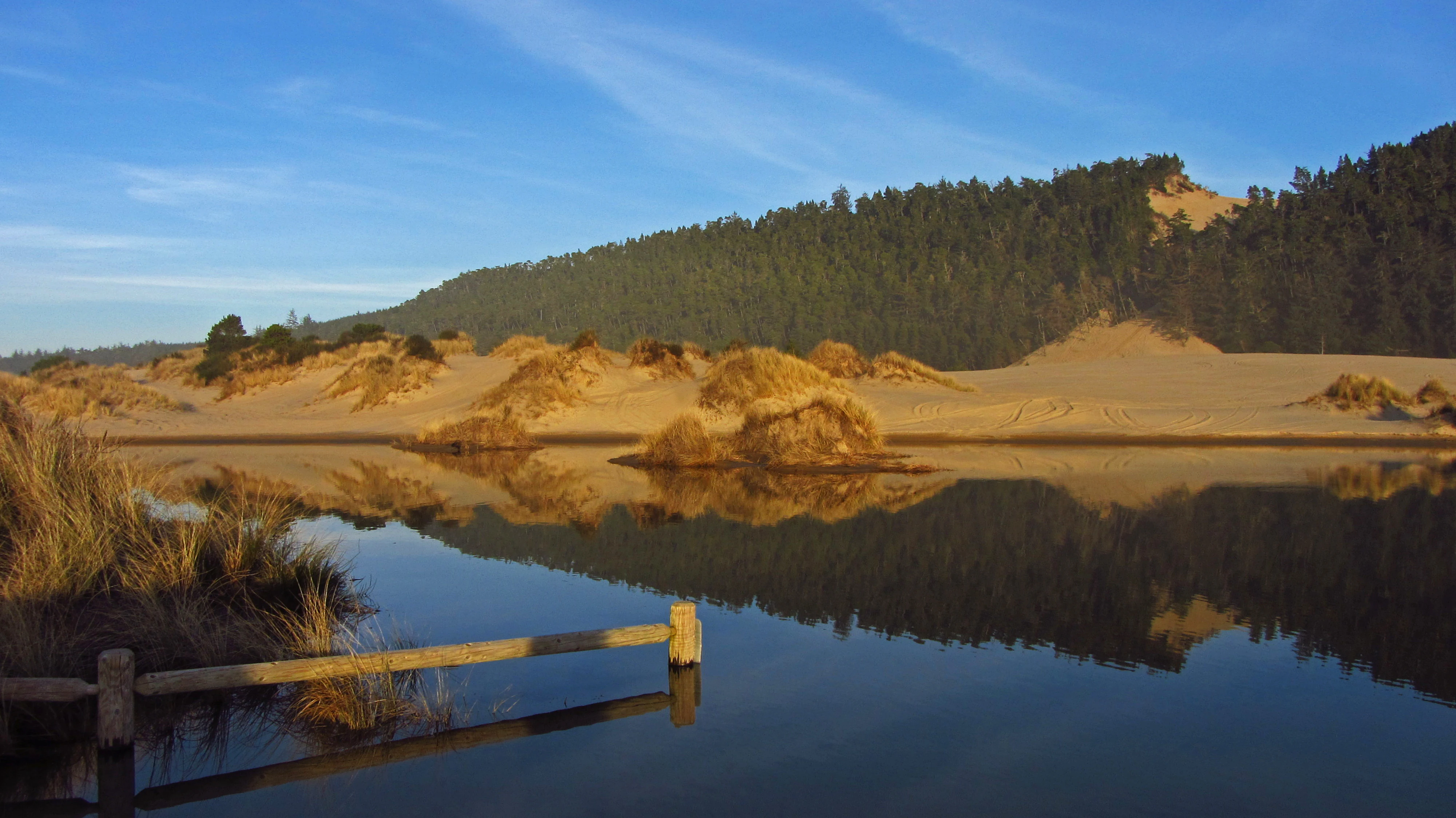
A wide view of a large sandy dune rising behind a calm, reflective pond on the Oregon coast, with a wooden fence railing in the foreground.
Banshee Hill, the highest dune in the Oregon Dunes National Recreation Area, reflected in a coastal pond.

Oregon Dunes National Recreation Area history and protected-area timeline

The Oregon Dunes are an ancient landscape, with some of the older dune formations dating back more than a hundred thousand years, while the youngest dunes closest to the ocean began forming roughly seven thousand years ago. Studies of individual sand grains trace the origins of the sand to erosion in the Oregon Coast Range, with rivers such as the Umpqua and Siuslaw carrying material down to the coast where wind and waves reworked it into dunes.

Federal recognition of the area's significance took shape across more than a decade of competing proposals. In 1959, Senator Richard L. Neuberger introduced legislation to establish a national seashore at the Oregon Dunes, a proposal opposed by Governor Mark Hatfield and several local groups. A 1963 bill reintroduced by Congressman Robert B. Duncan passed the Senate Interior Committee unanimously but stalled due to opposition from Senator Wayne Morse and reluctance within the Forest Service to transfer the land to the National Park Service. The compromise that ultimately succeeded was a 1972 act sponsored by Congressman John R. Dellenback, which set aside roughly thirty-two thousand acres as the Oregon Dunes National Recreation Area and kept management within the Forest Service.

The recreation area was formally dedicated on July 15, 1972 at Eel Creek Campground, an event attended by Forest Service Chief John McQuire, Governor Tom McCall, Senator Hatfield, and Congressman Dellenback; the trail beginning at that site now bears Dellenback's name. Subsequent decades brought evolving management, including the first recreation use plan in 1979 and a more restrictive revision in 1994 that substantially reduced the share open to off-highway vehicle use. By the early twenty-first century, restoration efforts led to the formation of the Oregon Dunes Restoration Collaborative in 2014, focused on reversing ecological changes caused by decades of non-native dune-stabilization plantings.

Oregon Dunes National Recreation Area landscape and geographic character

The defining feature of the Oregon Dunes National Recreation Area is its dramatic system of temperate coastal dunes, the largest of its kind in North America. The dunes owe their scale and form to a long interplay of wind, waves, and rivers. Sand carried down from the Coast Range by rivers such as the Umpqua and Siuslaw is continually dredged from the ocean floor by waves and tide and deposited along the beach, where prevailing winds sweep it inland to build dunes of extraordinary size. Some of these dunes rise to around five hundred feet above sea level, dominating the surrounding forest and shoreline scenery.

The wind regime that shapes the dunes is highly seasonal. In summer, winds from the north and northwest push sand inland at moderate speeds, while winter winds, often more southerly and frequently storm-driven, can reach extreme velocities and reshape the dune structures on a much larger scale. Coastal mountains near the shoreline deflect these currents, exaggerating turbulence and contributing to the varied dune shapes seen across the area. The resulting terrain shifts constantly in detail, even where its broader pattern remains familiar from year to year.

Within the dune field itself, the landscape is not uniformly dry. Interdunal areas and former stream channels hold standing water in places several feet deep, sometimes producing quicksand where water-saturated sand grains lose contact and behave almost like a fluid. The largest lakes in the recreation area are barrage lakes, formed when west-flowing streams from the Coast Range foothills were dammed by the growing dunes. This alternation of dry dune crests and quiet forested lakes, sometimes only a short walk apart, produces the unusual visual character that defines the Oregon Dunes landscape.
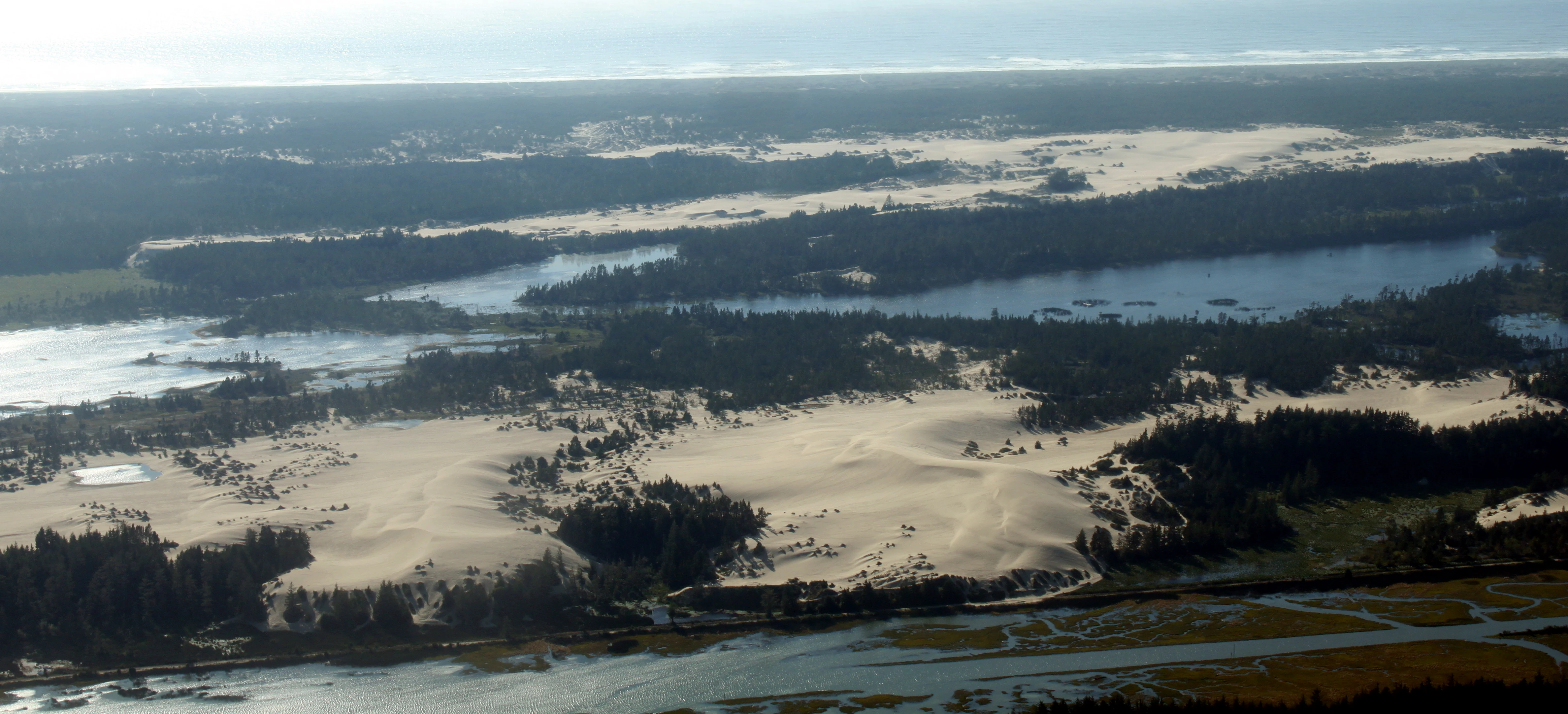
Aerial view looking over a large landscape featuring vast patches of light-colored sand dunes separated by dark green forests and coastal waterways.
An aerial view of the expansive sand dunes and interspersed forest areas within the Oregon Dunes National Recreation Area.

Oregon Dunes National Recreation Area ecosystems, habitats, and plant life

The ecosystems of the Oregon Dunes National Recreation Area reflect the unusual meeting of dry coastal sand and persistent freshwater within a relatively confined area. Despite visually resembling a desert in places, the system as a whole is ecologically rich and depends heavily on stable native plant communities that anchor the dunes and define habitat structure. Important native species across the dune and interdunal habitats include red fescue, seashore bluegrass, shore pine, Sitka spruce, evergreen huckleberry, hairy manzanita, bog blueberry, bearberry, tufted hairgrass, slough sedge, Port Orford cedar, and skunk cabbage, each playing a role in stabilizing sand, shading wetlands, or providing cover for wildlife.

The dune vegetation has been profoundly altered by historical land management. Between 1910 and 1979, extensive plantings of European beachgrass, Scotch broom, and shore pine were carried out to stabilize the sand, which succeeded in slowing dune migration but drastically reduced populations of many original native plants. Today these same non-native grasses have become invasive, crowding out native flora and changing the way dunes are shaped by wind. Active management and restoration efforts now focus on reestablishing conditions under which the original dune ecosystem can be maintained.

Wetland phases of the system, including marshes, lakes, sloughs, and saturated deflation areas, host their own distinct vegetation communities. Boggy pockets with sedges, blueberry species, and skunk cabbage line the edges of interdunal lakes, while forested fringes of shore pine and Sitka spruce occupy the transitional zones between dunes and stable ground. The Oregon Dunes are thus best understood as a landscape of interwoven environments rather than a single dune habitat, with ecological character that shifts drastically over very short distances.
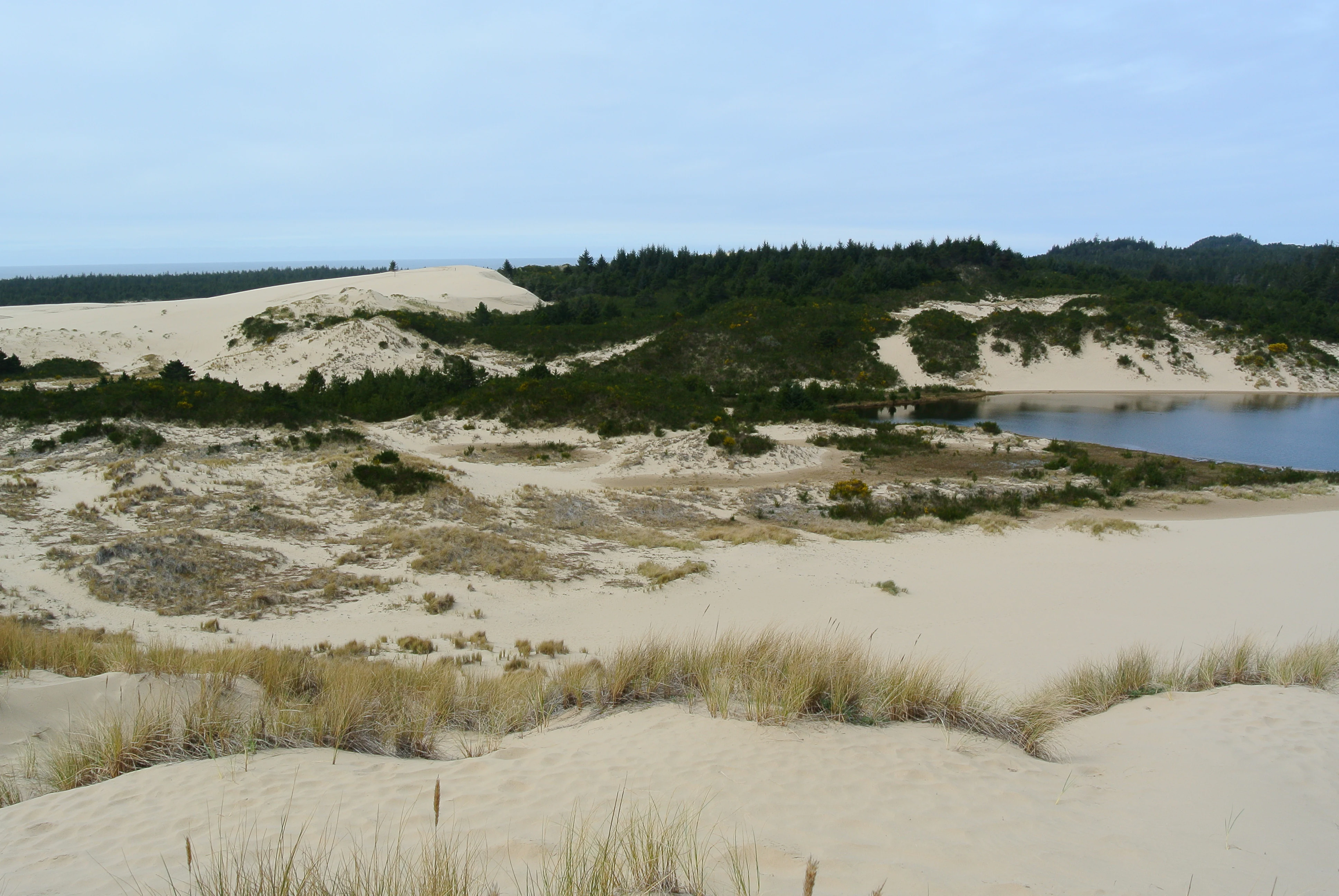
A wide shot of expansive sand dunes with patches of green vegetation and a small lake nestled among the dunes under a cloudy sky.
Sand dunes and Cleawox Lake within the Oregon Dunes National Recreation Area.

Oregon Dunes National Recreation Area wildlife and species highlights

Wildlife in the Oregon Dunes National Recreation Area is distributed across an unusually broad range of habitats in a relatively small area, supporting a richer mix of species than the open sand alone would suggest. The South Jetty area combines beach, marsh, and coastal wetland habitat and hosts tundra swans, marsh wrens, Canada geese, yellow-rumped warblers, red-tailed hawks, sanderlings, long-billed curlews, dunlins, and least sandpipers. The Siticoos area around the Waxmyrtle Trail, with lakes and forested banks, supports great blue herons, American bitterns, green herons, Virginia rails, cinnamon teal, common yellowthroats, common mergansers, belted kingfishers, snowy plovers, bald eagles, and ospreys.

Forested and transitional areas have their own character. The pine-dominated Eel Creek area shelters pine siskins, chestnut-backed chickadees, Swainson's thrushes, wrentits, northern flickers, red crossbills, olive-sided flycatchers, and Anna's hummingbirds, while the Horsefalls area has produced sightings of white-tailed kites, northern harriers, violet-green swallows, downy woodpeckers, orange-crowned warblers, yellow warblers, black-throated gray warblers, Townsend's warblers, hermit warblers, great horned owls, and great egrets.

The most prominent single focus of conservation attention is the western snowy plover, which nests on the open sand and in adjacent beach habitat. Listed as threatened under the Endangered Species Act in 1993, when fewer than seventy adults remained in Oregon, the species has been the subject of a multi-agency recovery effort combining habitat restoration, invasive-grass removal, predator control, public education, and seasonal beach protections. By 2012, the breeding population had risen substantially, reflecting both the recovery program and the unique suitability of the Oregon Dunes landscape for this species.
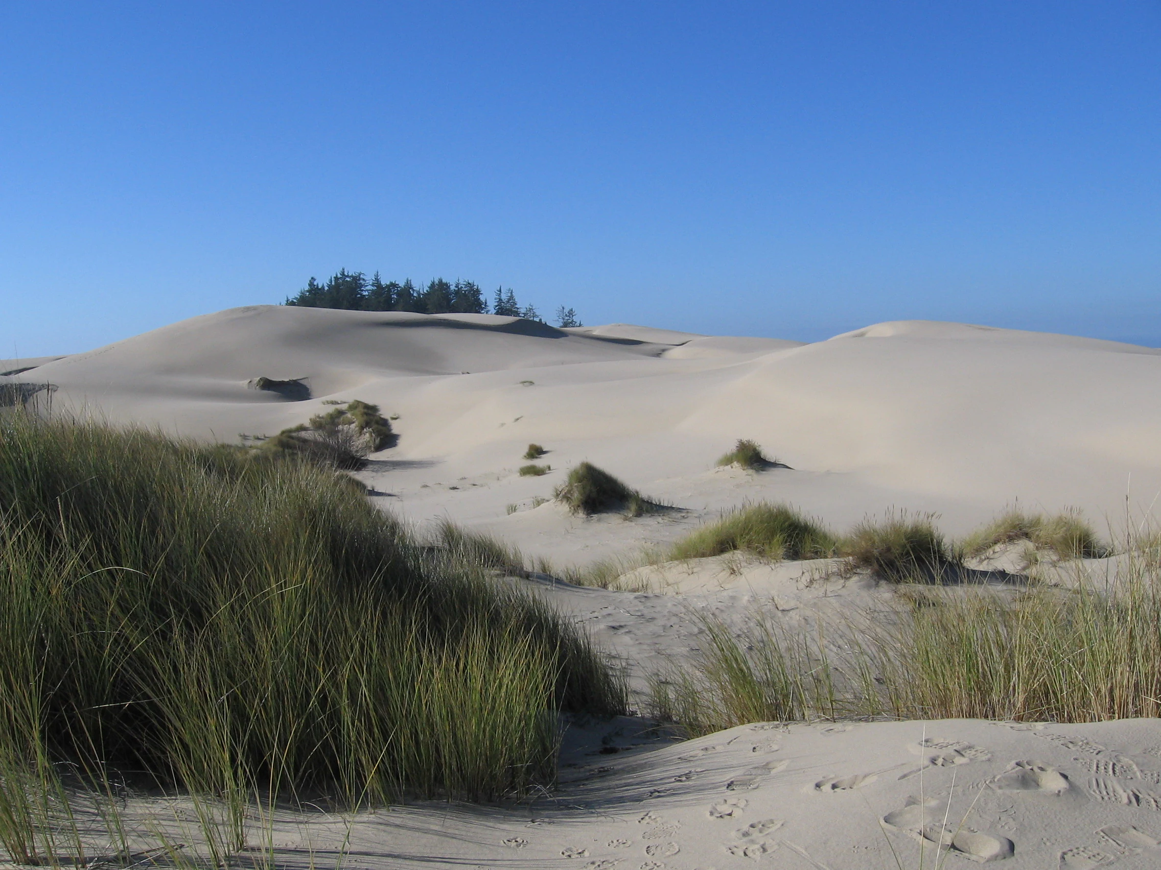
A wide view of light-colored sand dunes with scattered patches of beach grass under a clear blue sky, featuring a small forested area on a ridge in the background.
Expansive coastal sand dunes at the Oregon Dunes National Recreation Area.

Oregon Dunes National Recreation Area conservation status and protection priorities

The conservation significance of the Oregon Dunes National Recreation Area lies in the protection of a globally unusual temperate coastal dune system and the mosaic of habitats embedded within it. Federal protection in 1972 set aside roughly thirty-two thousand acres and created a framework for managing recreation, ecological restoration, and wildlife recovery within the Siuslaw National Forest. Because the dunes include large concentrations of open sand, interdunal wetlands, forested deflations, and shoreline habitats in close proximity, the area preserves ecological interactions that rarely occur together in such a compact coastal setting.

A central conservation focus has been restoring dunes that were historically altered by non-native dune-stabilization plantings. The Oregon Dunes Restoration Collaborative, formed in 2014 in partnership with the U.S. Forest Service and other entities, develops prioritization plans, secures funding, and coordinates volunteer efforts to combat the spread of invasive grasses. Techniques include removal of European beachgrass and similar non-native species, restoration of native dune flora, and public outreach about sustainable recreation practices, all of which are intended to allow wind-driven dune processes to resume.

Equally significant has been the recovery effort for the western snowy plover, which depends on open dune and beach habitat for nesting. After being listed as threatened in Oregon in 1993, the species has benefited from a coordinated program of habitat restoration, nest-site protection, predator management, and seasonal beach restrictions. The measurable recovery of the local plover population has made the Oregon Dunes an important case study in dune-dependent species conservation, alongside its broader role in preserving a major temperate dune landscape in its natural state.

Oregon Dunes National Recreation Area cultural meaning and human context

Beyond its ecological and recreational identity, the Oregon Dunes National Recreation Area carries a distinctive cultural resonance through its connection to one of the most influential science-fiction works of the twentieth century. Author Frank Herbert's research on and fascination with the Oregon Dunes contributed substantially to the environmental imagery of his novel Dune, making the recreation area an unexpectedly important real-world reference point for a fictional universe of planetary deserts. This cultural association has helped raise the international profile of the area well beyond its regional audience.

Locally, the dunes are embedded in the coastal identity of central Oregon, framing the relationship between communities such as North Bend, Reedsport, and Florence and the natural landscape at their doorstep. The area's management history, including years of debate between advocates of national seashore, national recreation area, and continued national forest designation, reflects the long-running negotiation between economic interests, recreation traditions, and environmental values along the Oregon Coast. Today the recreation area supports not only habitat and wildlife but also a regional sense of place tied to the dunes, the forest, and the ocean that meet within its boundaries.

Top sights and standout views in Oregon Dunes National Recreation Area

Among the standout features of the Oregon Dunes National Recreation Area are its sheer scale as the largest coastal dune system in North America, with dunes reaching some of the tallest elevations of any temperate coastal dunes in the world. Equally distinctive are the interdunal barrage lakes, marshy sloughs, and forested deflation areas that interrupt the open sand and produce an unusual mix of desert-like and wetland landscapes within walking distance of one another. The area also stands out as one of the most heavily used U.S. Forest Service sites for off-highway vehicle recreation, alongside more traditional activities such as hiking, horseback riding, canoeing, fishing, and camping.

The recreation area is also notable for its ecological significance, particularly as nesting habitat for the threatened western snowy plover, and for its cultural profile as a landscape that influenced Frank Herbert's Dune. Together, these features, geological grandeur, ecological complexity, strong recreation tradition, and literary resonance, make the Oregon Dunes one of the most recognizable and individual protected coastal landscapes in the Pacific Northwest.

Best time to visit Oregon Dunes National Recreation Area

The Oregon Coast and the dunes have distinct seasonal characters shaped largely by wind, weather, and wildlife patterns. Summer brings the most consistent access and milder conditions, with prevailing north and northwest winds driving the seasonal reshaping of dunes at moderate speeds; this period also coincides with the heart of beach recreation and the latter part of the snowy plover nesting season, when some areas may be subject to seasonal restrictions.

Winter is the more dynamic and unpredictable season for the dunes themselves, when storm-driven winds from the south and southwest can reach very high speeds and significantly reshape dune structures over short periods. Temperatures generally remain mild along the coast, but rain, wind, and changing sand conditions make for more demanding outdoor experiences. Spring and fall offer useful compromises, with quieter conditions than mid-summer and shifting patterns of bird presence and dune form. For visitors focused on dune scenery and recreation, summer tends to be the most accessible season, while winter appeals to those interested in watching the dunes in their most active, weather-driven state.
Monthly climate preview

Track monthly temperature ranges and precipitation totals across the representative coordinate

Oregon Dunes National Recreation Area Climate Normals and Annual Weather Patterns

Representative baseline coordinates record average temperatures ranging from 8.37 °C to 15.63 °C alongside measurable shifts in monthly precipitation totals from 0.33 mm to 8.21 mm per day. Examining the complete twelve-month temperature profile provides deeper geographic context regarding long-term atmospheric patterns across the protected landscape.
Annual mean12 °C
8 °C16 °C
Jan
Feb
Mar
Apr10°
May12°
Jun14°
Jul15°
Aug16°
Sep15°
Oct13°
Nov10°
Dec
Warmest month
August

15.6 °C

Coolest month
December

8.4 °C

Wettest month
December

8.2 mm/day

Driest month
July

0.3 mm/day

Park location guide

Geography guide, regional context, and park location map for Oregon Dunes National Recreation Area

Oregon Dunes National Recreation Area park geography, regions, and map view in United States of America

Understand where Oregon Dunes National Recreation Area sits in United States of America through a broader geographic reading of the surrounding landscape, nearby location context, and its mapped position within the national park landscape.

How Oregon Dunes National Recreation Area fits into United States of America

The United States of America is a federal presidential republic and one of the world's largest countries by area and population. It consists of 50 states across a vast territory spanning multiple time zones, with its capital in Washington, D.C. and largest city in New York City. The nation has a diverse economy, influential political system, and significant cultural and military presence globally.

Wider geography shaping Oregon Dunes National Recreation Area in United States of America

The United States occupies a vast territory in North America, bordered by Canada to the north and Mexico to the south. The 48 contiguous states stretch from the Atlantic to the Pacific Ocean, while Alaska occupies the northwestern region and Hawaii is an archipelago in the Pacific. The country encompasses diverse terrain including the Rocky Mountains, Appalachian Mountains, Great Plains, and extensive river systems.

Map view of Oregon Dunes National Recreation Area

Use this park location map to pinpoint Oregon Dunes National Recreation Area in United States of America, understand its exact geographic position, and read its mapped placement within the surrounding landscape more clearly.

Pigeon | © OpenStreetMap contributors

Location context for Oregon Dunes National Recreation Area

Oregon
Recorded earthquake history

Explore the Historical Earthquake Catalogue for Oregon Dunes National Recreation Area

Examine the record of past seismic events associated with the surrounding geography of Oregon Dunes National Recreation Area. This catalogue, curated by MoriAtlas, provides essential data on historical activity to enhance understanding of the coastal landscape's geological context.

Oregon Dunes Earthquake History

Catalogued events

6 events

Strongest magnitude

Magnitude 4.9

Most recent event

Dec 5, 2016

This history includes earthquakes recorded inside the park or within 50 km of its borders

Visual reference guide to temperate coastal sand dunes, wetlands, and shorelines

Oregon Dunes National Recreation Area Photos, Scenery, and Landscapes

Visual documentation of Oregon Dunes National Recreation Area reveals towering temperate sand formations, interdunal wetlands, and coastal forest environments. Examining these protected landscapes provides a clear understanding of the unique geology and diverse habitats defining the Pacific shoreline.

A wide view of a large sandy dune rising behind a calm, reflective pond on the Oregon coast, with a wooden fence railing in the foreground.

Two small, fluffy Western snowy plover chicks sitting in a nest on dark, coarse sand beside a speckled, light-colored bird egg.

Aerial view looking over a large landscape featuring vast patches of light-colored sand dunes separated by dark green forests and coastal waterways.

A wide shot of expansive sand dunes with patches of green vegetation and a small lake nestled among the dunes under a cloudy sky.

A wide view of light-colored sand dunes with scattered patches of beach grass under a clear blue sky, featuring a small forested area on a ridge in the background.

Park atlas

Compare adjacent coastal terrain, regional forest reserves, and connected Pacific shorelines.

Explore Parks Near Oregon Dunes National Recreation Area and Surrounding Protected Landscapes

Continue browsing other parks near Oregon Dunes National Recreation Area to evaluate similar coastal dune formations, wetland habitats, and temperate forest ecosystems across the region. Extending the geographic comparison reveals how surrounding protected landscapes share comparable terrain features and environmental conservation patterns.
Watercolor painting of a coastal landscape with sandy dunes, beach grasses in the foreground, and a dense treeline in the background.
Protected landscapeOregon
Park boundaries overlap#1 closest

North

Siuslaw National Forest: Oregon Coast Range and Protected Landscape Geography

Coastal dunes, temperate rainforests, and river networks

Explore the mapped boundaries and natural geography of Siuslaw National Forest. This protected landscape highlights the ecological transition from Pacific shorelines to the high-elevation forests of the Oregon Coast Range, encompassing sand dune systems, salmon-supporting streams, and significant wilderness refuges.

Area
2,566.54 km²
Established
1908
Visitors
1M annual
Climate
Temperate
Wildlife reserveOregon
About 19 km away#2 closest

North

Rock Creek Wilderness: Coastal Forest Geography and Protected Terrain

Oregon wilderness with undisturbed temperate rainforest watersheds

Discover the geographic identity of Rock Creek Wilderness, a congressionally designated area on the Oregon Coast. This protected block of temperate rainforest is characterized by its trail-free, road-free interior and its role as a sanctuary for old growth Douglas-fir and rare butterfly habitat. The watershed terrain, centered around Rock and Big Creeks, preserves a continuous ecological gradient stretching from inland ridges to the Pacific maritime climate.

Area
30.29 km²
Established
1984
IUCN
Ib
Relief
Upland
Wildlife reserveOregon
About 52 km away#3 closest

North

Drift Creek Wilderness: Protected Wildlife Reserve and Old Growth Geography in Oregon

Mapping the old growth forests and stream corridors of the Coast Range.

Deep within Oregon's Coast Range, Drift Creek Wilderness stands as a significant protected landscape known for its intact old growth Sitka spruce and western hemlock stands. The terrain is characterized by steep, dissected slopes and narrow valleys that form a complex, moss-heavy temperate rainforest ecosystem. This area provides essential habitat for Roosevelt elk, northern spotted owls, and wild salmon populations, offering a compact yet dense look at the region's unique coastal wilderness geography.

Area
23.46 km²
Established
1984
IUCN
Ib
Relief
Upland
An artistic watercolor illustration showing a line of green evergreen trees in the foreground with hazy, distant mountains in the background against a light, neutral sky.
Protected landscapeOregon
67 km away#4 closest

South

Rogue River, Siskiyou National Forest: Mapped Geography and Protected Area Overview

Tracing volcanic peaks and river-carved mountain terrain in Oregon

Spanning nearly 7,300 square kilometers, the Rogue River, Siskiyou National Forest acts as a crucial ecological anchor in the Pacific Northwest. This overview details its unique mountain geography, the extensive wilderness tracts within its boundaries, and the river systems that define its mountainous character.

Area
6,973.46 km²
Established
2004
Visitors
915K annual
Relief
Mountain
Protected landscapeOregon
109 km away#5 closest

East

Willamette National Forest: Geography and Protected Landscapes of the Central Oregon Cascades

Mapped terrain, old-growth forests, and protected wilderness boundaries.

Explore the expansive territory of Willamette National Forest, a primary protected area extending over 100 miles along Oregon's Cascade Range. This region features volcanic peaks exceeding 10,000 feet, extensive old-growth Douglas-fir stands, and a dense network of Wild and Scenic rivers, providing a detailed look at the geographic character and ecological heritage of the Pacific Northwest.

Area
6,790.75 km²
Established
1933
Visitors
1.7M annual
Relief
Mountain
Wildlife reserveOregon
111 km away#6 closest

South

Kalmiopsis Wilderness: Mapping the Protected Landscapes and Geology of Southwestern Oregon

Botanical richness and dramatic canyon terrain in the Klamath Mountains

Kalmiopsis Wilderness preserves a dramatic landscape of steep ridges and river-cut valleys across 180,000 acres in southwestern Oregon. Known for its distinct serpentine soils and high botanical diversity, the wilderness area offers a look at complex mountain ecology and significant Wild and Scenic River headwaters within the Rogue River-Siskiyou National Forest.

Area
727.44 km²
Established
1964
IUCN
Ib
Relief
Mountain
Wildlife reserveOregon
144 km away#7 closest

Southeast

Rogue-Umpqua Divide Wilderness: Protected Ridge Landscape and Watershed Geography

High-country wilderness area in southwestern Oregon

Rogue-Umpqua Divide Wilderness preserves a dense, high-elevation ridge environment that separates the Rogue and Umpqua river drainages. Featuring a complex mix of volcanic and sedimentary rock outcrops within a continuous conifer canopy, the area offers a unique look at forest ecology in the Klamath Mountains. The geography provides extensive views across both watersheds and stands as a primary example of protected montane forest terrain within the Oregon landscape.

Area
134 km²
Established
1984
IUCN
Ib
Water
Minor water
Watercolor painting of a rolling mountain landscape with coniferous trees in the foreground and a hazy range of hills in the background.
Wildlife reserveOregon
About 153 km away#8 closest

Northeast

Menagerie Wilderness Wildlife Reserve: Oregon Cascade Range Geography and Rock Pinnacles

Protected Cascade mountain terrain and unique crag clusters

Situated in the central Cascade Range of Oregon, Menagerie Wilderness provides a compact, highly defined landscape of rising rock pinnacles and lush coniferous forest. This resource traces the unique topography and protected boundaries of this specialized wilderness area, offering insight into the geological features and forest ecosystems that distinguish it from surrounding mountainous terrain.

Area
20.37 km²
Established
1984
IUCN
Ib
Relief
Mountain

Common questions about visiting, size, designation, and location context for Oregon Dunes National Recreation Area

Oregon Dunes National Recreation Area FAQs for park facts, access, geography, and protected area context

Find quick answers about Oregon Dunes National Recreation Area, including protected-area facts, park geography, trail and visitor context, and how the park fits into its surrounding country and regional landscape.
MoriAtlas Explorer

Continue Your Protected Areas Search Across the Global Atlas

Deepen your exploration by continuing the structured search for national parks and protected areas worldwide. Utilize the comprehensive filtering capabilities to compare different conservation landscapes and refine your understanding of global park geography. Discover more about the distribution and characteristics of protected natural areas.

Global natural geography