
Mori Atlas logo
Protected landscapeOttawa National Forest

Mapping the boreal forests, waterfall corridors, and glacial watersheds of the western Upper Peninsula

Ottawa National Forest: A Comprehensive Geographical Profile of the Michigan Protected Landscape

Ottawa National Forest occupies nearly a million acres of the western Upper Peninsula of Michigan, serving as a critical anchor for the regional Great Lakes boreal ecosystem. This protected landscape encompasses a complex hydrological network where rivers like the Black and Presque Isle descend through deep gorges toward Lake Superior. Beyond the cascading waterfalls and dense forest cover, the area preserves rare old-growth pine stands and glacial soils that define this significant Midwest wilderness corridor.

national forestUpper PeninsulaLake Superior watershedboreal forestold-growth pinewaterfalls
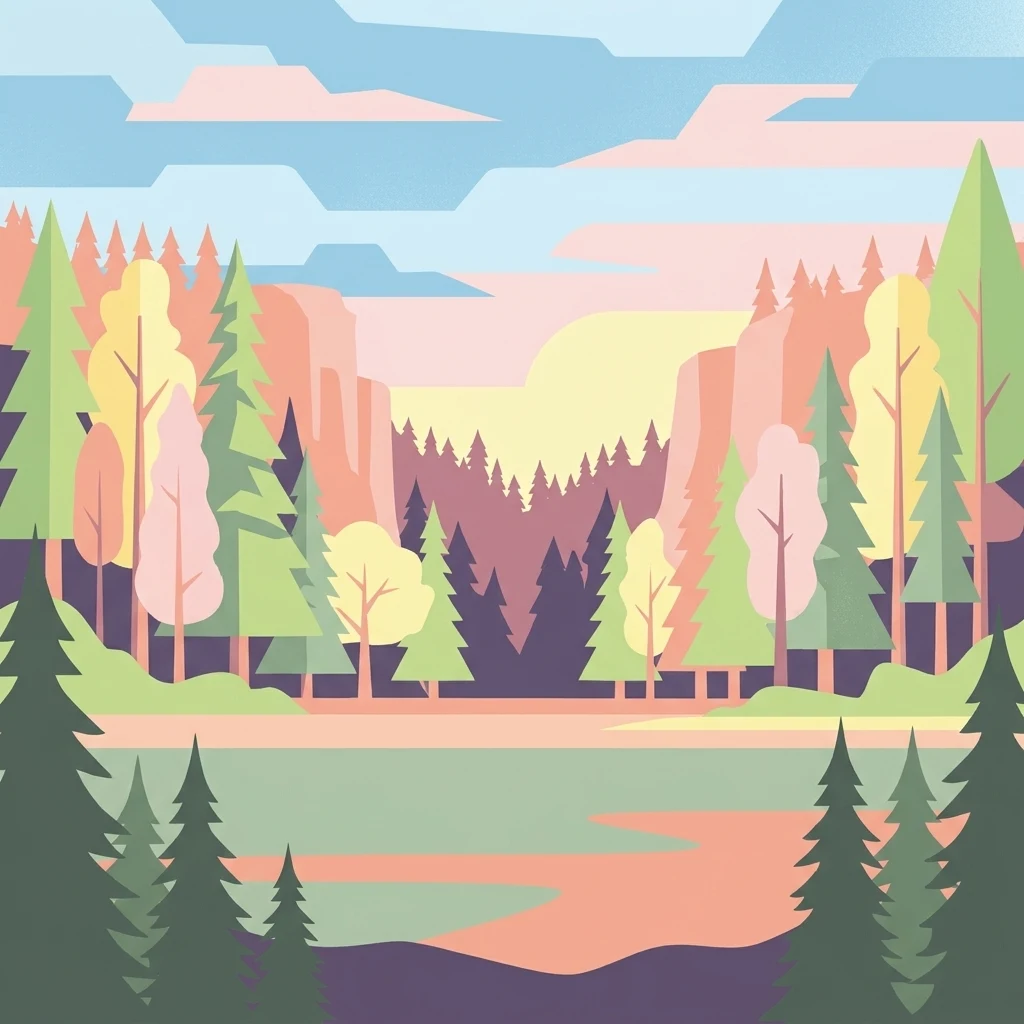
A flat vector illustration of a forested landscape featuring layers of coniferous and deciduous trees around a calm body of water under a soft colored sky.

Ottawa National Forest

Protected landscape

Park overview

Structured park overview, official facts, and landscape profile for Ottawa National Forest

Ottawa National Forest park facts, protected area profile, and essential visitor context

Review the core facts for Ottawa National Forest, including designation, size, terrain, visitor scale, habitats, and operating context in one park-focused overview.

About Ottawa National Forest

Ottawa National Forest is one of the cornerstones of conservation and outdoor recreation in Michigan's Upper Peninsula, occupying almost a million acres of heavily forested terrain between Lake Superior and the Wisconsin border. Across its vast extent, the forest weaves together a remarkable set of natural features: long stretches of Lake Superior shoreline, deep interior forests of aspen, birch, maple, hemlock, and pine, dozens of inland lakes, broad wetland complexes, and some of the most dramatic river gorges in the Midwest.

The forest's identity is shaped by its water. The Black River and Presque Isle River systems fall rapidly from upland ridges down to Lake Superior, producing sequences of named waterfalls that have become signature features of the region. Several of these rivers carry National Wild and Scenic River designation, underscoring both their scenic quality and their ecological importance. Inland, the forest holds many smaller rivers and streams, along with lakes such as Lac Vieux Desert, Henry Lake, and Katherine Lake, which support fishing, paddling, and quiet shoreline recreation.

Ottawa National Forest is also a refuge for old-growth forest in a region that was otherwise intensively logged. The Sylvania Wilderness in particular preserves mature white and red pine stands around its central lakes, while the McCormick Wilderness and Sturgeon River Gorge Wilderness add further protected backcountry surrounding the Kenton area. These wilderness areas, combined with the North Country Trail, make the forest a significant destination for long-distance hiking, backpacking, and wilderness paddling.

Culturally, the forest is layered and complex. It has been home to clans of the Ojibwa people for generations, with communities such as the Lac Vieux Desert Band of Lake Superior Chippewa maintaining a continuous presence tied to the fur trade era and the 1854 Treaty of La Pointe. Later, industrial-scale logging reshaped much of the landscape after the arrival of the Duluth, South Shore and Atlantic Railway in the 1890s, a chapter whose impacts still define the forest's patchwork of regrowth and centuries-old remnants. The 1931 establishment of the national forest, followed by major federal land purchases in the 1930s, marked a pivotal recovery phase that converted an exploited timber landscape into a managed public forest now valued for both ecology and recreation.

Quick facts and research context for Ottawa National Forest

Ottawa National Forest lies in the western Upper Peninsula of Michigan, with its headquarters in Ironwood and its main visitor center in Watersmeet. It is administered by the U.S. Forest Service as part of the Eastern Region's national forest system and spans a broad swath of the Lake Superior watershed.

The forest sits on terrain heavily shaped by glaciation, which stripped much of the region down to sand or bare rock and produced the well-drained, rocky soils that support a classic boreal forest ecosystem. Its interior hills are crossed by rivers that rise in the uplands and descend steeply toward Lake Superior, while its northern boundary is defined by a long stretch of Lake Superior shoreline marked by wooded slopes and dramatic waterfall corridors. The forest's waters also contribute to the broader Great Lakes and, via the Wisconsin River, to the Gulf of Mexico watershed.

Protection and recognition

Documented terrestrial protection scope, designation history, and management metrics

Ottawa National Forest Protection Status and International Recognition Data

Ottawa National Forest maintains a documented terrestrial protection scope defining its formal conservation boundaries. Official records organize international recognition data, management designations, and administrative parameters for structured analysis.

Protection details

Protection scope
Terrestrial
Transboundary protection
No
Park context

Deeper park guide and search-rich context for Ottawa National Forest

Ottawa National Forest history, landscape, wildlife, and travel context

Explore Ottawa National Forest through its history, landscape character, ecosystems, wildlife, conservation priorities, cultural context, and seasonal travel timing in a structured park guide built for atlas discovery and search intent.

Why Ottawa National Forest stands out

Ottawa National Forest is best known for its concentration of wild Lake Superior rivers and waterfalls, especially the Black River and Presque Isle corridors, which drop from interior highlands past series after series of named cascades toward the largest freshwater lake in the world by surface area. These rivers have earned National Wild and Scenic protection and remain among the most photogenic waterfall systems in the Upper Peninsula. The forest is equally famous for protecting rare old-growth pine stands, particularly in the Sylvania Wilderness, which preserves a network of old-growth white and red pine around Katherine Lake and other interior lakes. Together, the rivers, the old-growth tracts, and the surrounding boreal forest give Ottawa National Forest a landscape identity closely associated with the pristine, lake-dotted interior of the western Upper Peninsula.
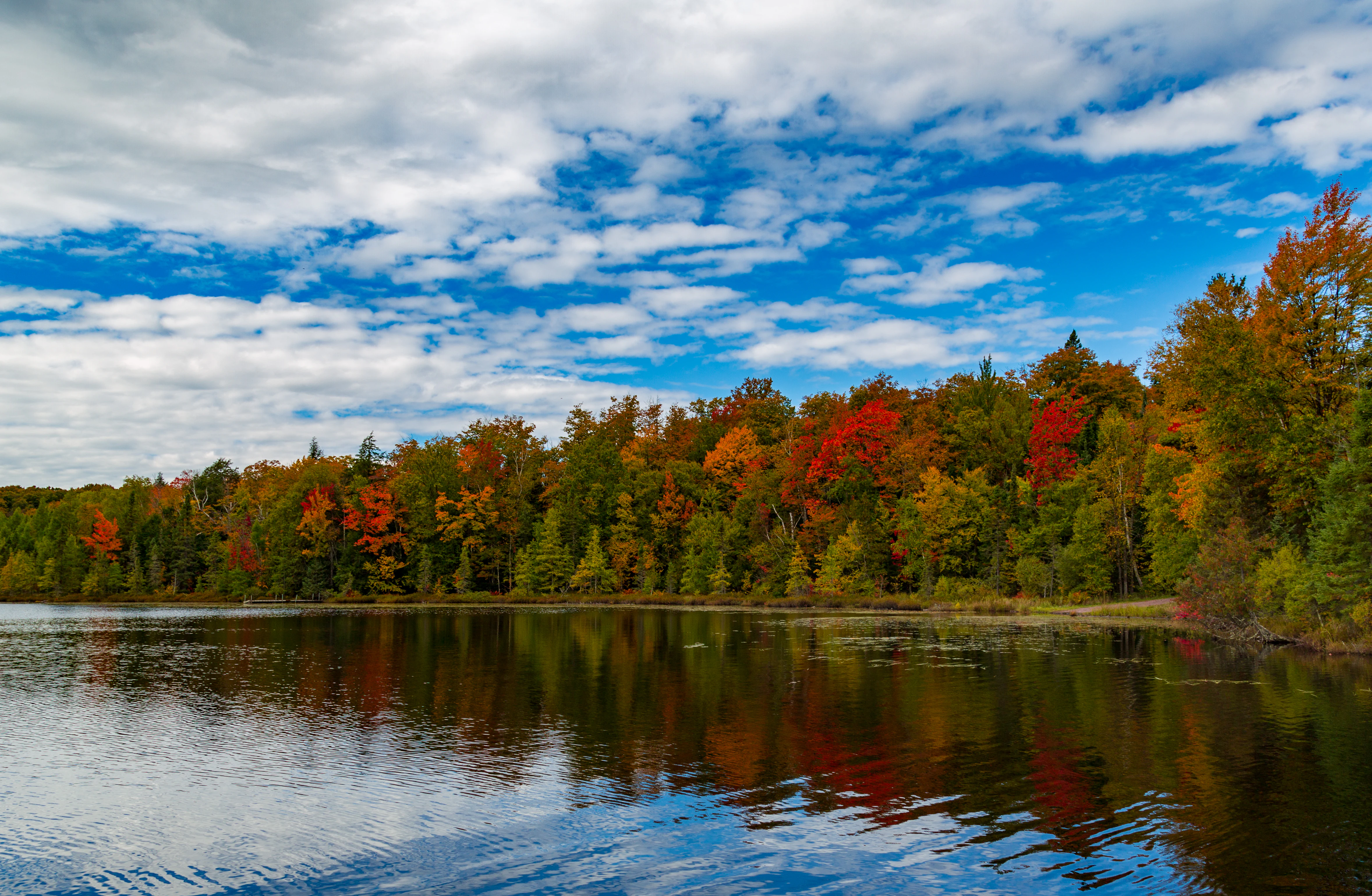
A peaceful lake in autumn with vibrant red, orange, and yellow fall foliage on the forested shoreline reflecting in the calm water under a partly cloudy blue sky.
Autumn foliage reflecting in the calm waters of Henry Lake in Ottawa National Forest.

Ottawa National Forest history and protected-area timeline

The human history of what is now Ottawa National Forest stretches back far beyond the arrival of European-American settlers. Long before the timber era, the landscape was inhabited and used by clans of the Ojibwa people, who coexisted with the forest's numerous rocky wetlands and harvested local mammals, particularly beaver, for the regional fur trade. Traders connected the area to markets in Canada and the eastern United States, including operations of the American Fur Company.

As the fur trade declined, much of the region was ceded through the 1854 Treaty of La Pointe. Part of the proceeds from that earlier fur economy was used by one community of Ojibwa people to purchase lands around Lac Vieux Desert, where their descendants remain today as the Lac Vieux Desert Band of Lake Superior Chippewa. This treaty-era transition set the stage for a new wave of pressure on the forest landscape.

The arrival of the Duluth, South Shore and Atlantic Railway between 1892 and 1894 opened the forest to industrial logging, which for several decades dominated the regional economy and dramatically altered the composition of the woodlands. While most of the original pine was cut, a few parcels of old-growth white pine and red pine survived, particularly in places such as the Sylvania area. The exploited tracts were partly abandoned in the early 20th century, leading the U.S. federal government to establish Ottawa National Forest on January 27, 1931. The forest did not reach its full size until two large land purchases in 1933 and 1935 brought it to a peak of over a million acres; later privatizations reduced it to its current extent.

The post-World War II rise in automobile tourism transformed how Americans experienced the region, making the forest accessible to a much wider audience. In 1971, the Ottawa Visitor Center opened to provide interpretive programs and exhibits about the natural history and resources of the forest, formalizing an ongoing educational mission that has continued to shape public engagement with this landscape.

Ottawa National Forest landscape and geographic character

Ottawa National Forest sits within a landscape sculpted by glaciers and shaped by water. Successive Ice Ages, including the most recent Wisconsonian glaciation, scraped much of the region down to bare rock or sand, leaving behind the thin, rocky soils and well-drained till plains that today support a distinctive boreal forest mosaic. The forest's terrain is not extreme in elevation, but its relief is dramatic in places: Underwood Hill, rising 1,867 feet above sea level, stands more than 1,200 feet above nearby Lake Superior and anchors the Presque Isle River drainage area.

The highest point in the forest is an unnamed 1,900-foot hill in southeastern Gogebic County, north of Lac Vieux Desert, sitting on a watershed divide of regional significance. Rain or snow on the north side of this ridge flows through the Ontonagon River toward Lake Superior, while precipitation on the south side ultimately reaches the Gulf of Mexico via the Wisconsin River. This subtle hydrological feature means the forest feeds into two of North America's great drainage systems.

The forest's most striking landscape elements are its Lake Superior tributaries, particularly the Black River and the Presque Isle River with its major tributary, Copper Creek. As these rivers descend from interior hills toward the lake, they tumble over a remarkable succession of waterfalls: the Black River alone drops past seven named cascades, while the Presque Isle system includes eleven waterfalls (several of which lie just outside the national forest in the adjacent Porcupine Mountains Wilderness State Park). The result is a shoreline corridor of wooded slopes, gorges, and cascades that forms one of the most distinctive waterfall landscapes in the Upper Peninsula.

Ottawa National Forest ecosystems, habitats, and plant life

The ecological identity of Ottawa National Forest is closely tied to its position along the Lake Superior basin, where Cold lake-modified air masses, abundant precipitation, and thin post-glacial soils interact to produce a classic boreal forest system. The forest receives substantial moisture in both winter and summer: heavy snowfall is generated as water vapor rises off the largely unfrozen surface of Lake Superior, while warm, moist air from the Gulf of Mexico regularly reaches saturation as it moves into the cooler lake basin.

Because glaciation stripped most of the region down to rock or sand, topsoil is thin, which limits certain kinds of vegetation and helps give the forest its characteristic mix of hardy conifers, birches, aspens, and associated understory species. Mixed stands of hardwoods and conifers occupy much of the uplands, while wet depressions, river corridors, and lakeward slopes support dense coniferous cover. The mosaic of rock outcrops, sandy flats, lakes, and wetlands adds structural diversity that supports a wide range of plant communities across the forest's almost-million-acre footprint.

This ecological variability is what allows the forest to host everything from old-growth pine stands near Katherine Lake in the Sylvania Wilderness to riverine forest along Wild and Scenic stretches of the Black River. The combination of boreal character, abundant surface water, and a long Lake Superior shoreline makes Ottawa National Forest a key node in the broader northern Great Lakes forest ecosystem.

Ottawa National Forest wildlife and species highlights

The combination of boreal forest cover, abundant water, wetlands, and old-growth remnants gives Ottawa National Forest a rich and varied wildlife profile. Its mix of mature coniferous stands, regenerating hardwoods, riparian corridors, and rocky wetlands supports mammals ranging from beaver, white-tailed deer, and black bear to smaller species adapted to northern forest edges. Beaver, in particular, have deep historical significance here, having been central to the fur trade economy that shaped the region prior to American settlement.

The forest's many lakes, rivers, and wetlands also attract breeding and migratory waterfowl, while its extensive coniferous cover provides valuable habitat for northern bird species associated with the boreal forest zone. Raptors and a wide range of songbirds make use of the varied edge habitats created by logging history, regrowth, and the long transition zones between upland forest and Lake Superior shoreline. Cold-water streams that tumble down through the Black River and Presque Isle corridors support trout populations and add to the diversity of aquatic life.

The old-growth tracts, especially in the Sylvania Wilderness, play an outsized role in supporting cavity-nesting birds, small mammals, and specialist forest-interior species. Across the forest, the recurring pattern of wild rivers, lakes, wetlands, and dense forest creates a connected habitat network that anchors wildlife populations in the western Upper Peninsula.

Ottawa National Forest conservation status and protection priorities

Ottawa National Forest is a conservation anchor for the Lake Superior watershed and the broader northern Great Lakes region. Its size and ecological continuity preserve landscape-scale processes that would otherwise be lost in a region long dominated by industrial forestry, agriculture, and shoreline development. By protecting almost a million acres of mostly contiguous forest, the U.S. Forest Service sustains habitat for northern forest wildlife, maintains watershed functions that influence water quality in Lake Superior, and buffers communities against the cumulative ecological pressures of an actively managed region.

Within this broader reserve, several areas carry elevated conservation status. The Black River is recognized as a National Wild and Scenic River, while the Presque Isle River system includes additional Wild and Scenic components, reflecting the exceptional scenic and ecological values of these corridors. Three designated wilderness areas, Sylvania, McCormick, and Sturgeon River Gorge, set aside core tracts of primitive backcountry where old-growth forest and undisturbed hydrology are preserved at the highest level of protection available within the National Forest System.

The survival of fragments of old-growth white pine and red pine, particularly within the Sylvania Wilderness, adds another conservation dimension: these stands are genetic and ecological heirlooms of the pre-logging forest and serve as reference points for understanding the composition and function of original Upper Peninsula forests. Their protection gives the forest a distinctive role in ecological research, restoration science, and conservation education in the Great Lakes region.

Ottawa National Forest cultural meaning and human context

The cultural landscape of Ottawa National Forest is built on layers of Indigenous presence, treaty-era transitions, and early 20th-century conservation policy. For generations before European-American arrival, clans of the Ojibwa people inhabited and shaped this landscape, harvesting wildlife, particularly beaver, for the fur trade economy that connected the Great Lakes region to markets in Canada and the eastern United States. Their descendants, including the Lac Vieux Desert Band of Lake Superior Chippewa, maintain a continuous community in the forest region to this day, with lands at Lac Vieux Desert that were purchased in part using proceeds of the earlier trapping economy.

The 1854 Treaty of La Pointe marked a turning point, transferring vast tracts of forest out of Indigenous control and opening the region to American settlement and industry. The arrival of the Duluth, South Shore and Atlantic Railway in the 1890s triggered an intensive logging era that saw most of the old-growth pine harvested. The abandonment of heavily exploited tracts in the early 20th century, and the subsequent federal acquisition and establishment of the national forest in 1931, embedded the region into a new cultural framework of conservation, public access, and outdoor recreation.

In the modern era, the forest has become an integral part of Upper Peninsula identity, offering residents and visitors a shared landscape for hiking, paddling, fishing, snowmobiling, and cross-country skiing. The interpretive mission of the Ottawa Visitor Center, opened in 1971, formalizes the forest's role in communicating its natural and cultural history to a broad public audience.

Top sights and standout views in Ottawa National Forest

Ottawa National Forest's strongest points of distinction lie in the overlap between landscape drama and ecological rarity. Its Black River and Presque Isle corridors deliver some of the most concentrated waterfall scenery in the Great Lakes region, while its interior wilderness tracts, particularly the Sylvania Wilderness, preserve rare old-growth white and red pine stands that have otherwise been lost across the Midwest. The presence of three designated wilderness areas and segments of the long-distance North Country Trail makes it a major backcountry destination in the Upper Peninsula.

Equally notable is the forest's hydrological character: it straddles a divide between waters that flow into Lake Superior and waters that ultimately reach the Gulf of Mexico, and its lakes, wetlands, and rivers support an unusually rich boreal ecosystem. Layered with a deep Ojibwa heritage, a 19th-century fur-trade legacy, and a 20th-century conservation story, the forest offers both ecological and cultural depth rare in a single national forest unit.

Best time to visit Ottawa National Forest

Visit timing in Ottawa National Forest is shaped strongly by the seasons. Summer brings warm conditions ideal for canoeing, lake kayaking, and exploring the river and waterfall corridors, with long daylight hours that make it easier to hike segments of the North Country Trail or paddle interior lakes. Mosquitoes and other insects can be significant along waterways, particularly near wetlands and beaver-influenced stretches of the rivers.

Fall is widely considered one of the most rewarding seasons to visit, with hardwood stands turning bright color across hillsides and around lakes such as Henry Lake, and crisp temperatures favorable for hiking and backcountry camping. Winter transforms the forest into a snow-driven landscape, with several areas receiving very heavy snowfall each year, drawing cross-country skiers and snowmobilers to groomed trail networks and remote forest roads.

Spring can be a quieter and more transitional time, with high water in the rivers, lingering snow, and the gradual greening of the forest. Visitors interested in wildlife, waterfalls, or fall foliage will find the most distinctive seasonal character in summer and autumn, while winter visitors come primarily for snow-based recreation in one of the snowier parts of the Great Lakes region.

Monthly climate preview

Long-term monthly temperature and precipitation data recorded at representative coordinates

Ottawa National Forest Climate Normals and Measured Annual Temperature Profiles

Historical measurements for Ottawa National Forest track a wide annual temperature swing alongside measured monthly precipitation rates. Reviewing the complete twelve-month climatology dataset reveals detailed long-term averages for each recorded period.
Annual mean4 °C
-11 °C19 °C
Jan-11°
Feb-10°
Mar-4°
Apr
May11°
Jun16°
Jul19°
Aug18°
Sep14°
Oct
Nov-1°
Dec-8°
Warmest month
July

18.8 °C

Coolest month
January

-11.4 °C

Wettest month
June

3.6 mm/day

Driest month
February

1.1 mm/day

Park location guide

Geography guide, regional context, and park location map for Ottawa National Forest

Ottawa National Forest park geography, regions, and map view in United States of America

Understand where Ottawa National Forest sits in United States of America through a broader geographic reading of the surrounding landscape, nearby location context, and its mapped position within the national park landscape.

How Ottawa National Forest fits into United States of America

The United States of America is a federal presidential republic and one of the world's largest countries by area and population. It consists of 50 states across a vast territory spanning multiple time zones, with its capital in Washington, D.C. and largest city in New York City. The nation has a diverse economy, influential political system, and significant cultural and military presence globally.

Wider geography shaping Ottawa National Forest in United States of America

The United States occupies a vast territory in North America, bordered by Canada to the north and Mexico to the south. The 48 contiguous states stretch from the Atlantic to the Pacific Ocean, while Alaska occupies the northwestern region and Hawaii is an archipelago in the Pacific. The country encompasses diverse terrain including the Rocky Mountains, Appalachian Mountains, Great Plains, and extensive river systems.

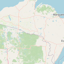
Map view of Ottawa National Forest

Use this park location map to pinpoint Ottawa National Forest in United States of America, understand its exact geographic position, and read its mapped placement within the surrounding landscape more clearly.

Pigeon | © OpenStreetMap contributors

Location context for Ottawa National Forest

Michigan

Visual exploration of protected river gorges, waterfalls, and old growth boreal forest habitats

Ottawa National Forest Photos and Landscape Scenery

Browse detailed photographs showcasing the rugged river corridors, cascading waterfalls, and dense pine woodlands of Ottawa National Forest. Visual documentation reveals the terrain and protected habitats defining this prominent Upper Peninsula wilderness.

A peaceful lake in autumn with vibrant red, orange, and yellow fall foliage on the forested shoreline reflecting in the calm water under a partly cloudy blue sky.

A line of tall evergreen trees stands along the edge of a calm lake in autumn with golden foliage visible in the undergrowth.

Park atlas

Compare adjacent forest landscapes, regional waterways, and nearby wilderness areas

Parks Near Ottawa National Forest and Surrounding Protected Areas

Explore other protected areas and national forests sharing the surrounding Upper Peninsula geography. Compare adjacent boreal terrain, river corridors, and glacial landscapes to expand regional park discovery.
Wildlife reserveMichigan
About 83 km away#1 closest

Northeast

McCormick Wilderness: Protected Forest and Hydrology in Michigan's Upper Peninsula

A federally protected wildlife reserve and river headwaters landscape

Centrally located within the western Upper Peninsula of Michigan, McCormick Wilderness preserves 17,000 acres of dense, regrown northern forest. The area is defined by its unusual density of river headwaters, providing significant ecological value as a quiet, roadless tract within the Ottawa National Forest network.

Area
69 km²
Established
1987
IUCN
Ib
Relief
Upland
A watercolor painting of a rolling, soft-toned landscape with a foreground of green forest and layers of hills receding into the distance.
Protected landscapeUpper Peninsula of Michigan
About 134 km away#2 closest

East

Hiawatha National Forest: Geographic Overview and Protected Area Map of the Upper Peninsula

Coastal forest landscape and wilderness river corridors.

Hiawatha National Forest spans significant portions of the Upper Peninsula of Michigan, bridging the gap between northern hardwood forests and the boreal environments of the Great Lakes. This protected landscape encompasses extensive shorelines along Lake Superior, Lake Michigan, and Lake Huron, alongside six wilderness areas and five designated wild and scenic rivers.

Area
3,621.27 km²
Established
1931
IUCN
VI
Relief
Lowland
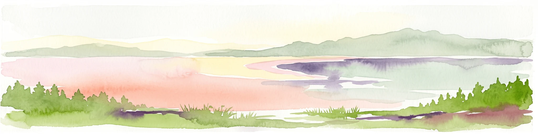
Watercolor illustration showing a calm lake with pink and purple reflections, green forested shoreline in the foreground with rocks, and distant hills under a pale sky
Protected landscapeWisconsin
About 137 km away#3 closest

Northwest

Apostle Islands National Lakeshore: Wisconsin Protected Archipelago and Landscape Map

Geographic overview of sandstone sea caves and wilderness islands.

Apostle Islands National Lakeshore represents a significant protected area within the Great Lakes region of Wisconsin. Composed of twenty-one islands and a mainland shoreline, the landscape is defined by its dramatic red sandstone geology, historic maritime sites, and vast wilderness tracts. This dataset provides a clear view of the lakeshore's boundaries, surrounding water environments, and the interplay between its unique forest ecosystems and Lake Superior.

Area
281.4 km²
Established
1970
IUCN
V
Visitors
253.7K annual
Wildlife reserveAlger County
About 152 km away#4 closest

East

Rock River Canyon Wilderness: Geographic Atlas and Protected Landscape Overview

Sandstone canyons and unmanaged forest terrain in Alger County

Covering 4,640 acres of the Upper Peninsula, Rock River Canyon Wilderness offers a rare look at natural forest processes. This protected area is defined by two 150-foot deep sandstone canyons, the flow of the Rock River, and the scenic Rock River Falls, serving as an ecological buffer within the broader Hiawatha National Forest landscape.

Area
18.8 km²
Established
1987
IUCN
Ib
Relief
Upland
Wildlife reserveBayfield County
About 165 km away#5 closest

West

Porcupine Lake Wilderness: Mapping the Protected Forest and Glacial Basins of Bayfield County

A federally designated wildlife reserve and forest landscape

Examine the geographic composition of Porcupine Lake Wilderness. This protected area features a dense network of glacial lakes, including the namesake Porcupine Lake and Eighteen Mile Spring Pond, surrounded by a rolling landscape of northern hardwoods and white pine. The mapped boundaries highlight a roadless wilderness that serves as a core forest habitat in northern Wisconsin.

Area
17.99 km²
Established
1984
IUCN
Ib
Relief
Upland
National parkKeweenaw County
About 178 km away#6 closest

North

Isle Royale National Park: Protected Landscape Atlas and Geographic Context

Explore mapped boundaries and natural terrain of this national park.

Isle Royale National Park offers a distinct opportunity for understanding protected landscapes through detailed map exploration. As a national park within Keweenaw County, its geographic identity and mapped boundaries provide valuable context for regional geography and atlas-based discovery. Investigate the natural terrain and protected land features that define this unique area, contributing to a richer comprehension of the surrounding protected areas.

Area
2,314 km²
Established
1940
IUCN
Ib
Visitors
29K annual
Wildlife reserveBayfield County
About 179 km away#7 closest

West

Rainbow Lake Wilderness: Protected Forest and Lake Mosaic in Bayfield County

Exploration of a designated wildlife reserve in northern Wisconsin

Rainbow Lake Wilderness presents a deeply forested landscape in northern Wisconsin, marked by a high density of sixteen named lakes and numerous ponds. Managed to maintain its natural character, this protected area in Bayfield County provides an essential look at the intersection of glacial geography, old-growth hardwood stands, and quiet aquatic habitats within a larger federal forest context.

Area
28.9 km²
Established
1975
IUCN
Ib
Relief
Upland
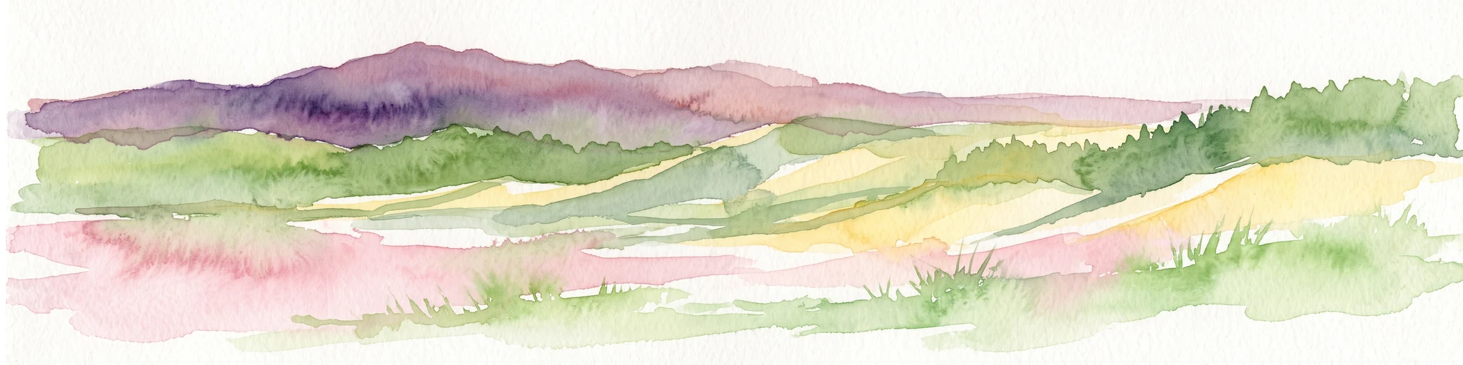
A watercolor painting showing a rolling landscape with green fields, sandy dunes, and a purple mountain range in the distance.
Natural monumentAlger County
About 206 km away#8 closest

East

Pictured Rocks National Lakeshore: Geographic Atlas of Cliffs and Shoreline Terrain

Protected landscape geography in Alger County, Michigan

Pictured Rocks National Lakeshore offers a deep look into the Great Lakes coastal geography. Explore the intersection of Cambrian-era sandstone cliffs, perched dune systems, and inland forested wilderness. This area provides a clear record of glacial and lake-driven erosion, featuring unique formations like Miners Castle and Chapel Rock across its extensive Lake Superior boundary.

Area
296.38 km²
Established
1966
IUCN
III
Visitors
953.1K annual

Common questions about visiting, size, designation, and location context for Ottawa National Forest

Ottawa National Forest FAQs for park facts, access, geography, and protected area context

Find quick answers about Ottawa National Forest, including protected-area facts, park geography, trail and visitor context, and how the park fits into its surrounding country and regional landscape.
MoriAtlas Explorer

Continue Your Protected Areas Search Across the Global Atlas

Deepen your exploration by continuing the structured search for national parks and protected areas worldwide. Utilize the comprehensive filtering capabilities to compare different conservation landscapes and refine your understanding of global park geography. Discover more about the distribution and characteristics of protected natural areas.

Global natural geography