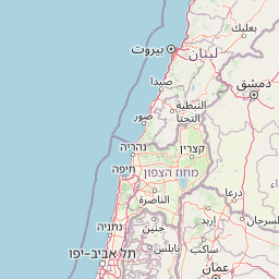
Why Ouadi Qadisha stands out
Ouadi Qadisha is best known as the 'Holy Valley,' one of the oldest and most significant centers of Christian monasticism in the Middle East. The valley is famous for its network of cave monasteries, cliff-side chapels, and terraced agricultural fields created by hermits over centuries. It is particularly renowned for the Qannubin Monastery, which served as the seat of the Maronite Patriarch for 500 years beginning in the 15th century, and the Monastery of Qozhaya, which housed the first printing press in the Middle East in 1610. The valley's association with the nearby ancient Cedars of God forest adds to its exceptional historical and religious significance.
Ouadi Qadisha history and protected-area timeline
The history of Ouadi Qadisha stretches back to the Palaeolithic period, when the valley's natural caves served as shelters and burial sites. Archaeological evidence from the Aassi Hauqqa cave near Hawqa indicates continuous use through Palaeolithic, Roman, and medieval periods. From the early days of Christianity, the valley attracted those seeking solitude and spiritual retreat, with Maronite monks establishing their center at Qannubin in the heart of the valley. The monastic communities faced significant challenges, including Mameluk campaigns in 1268 and 1283 led by Baibars and Qalaoun against the fortress-caves and monasteries. Despite these attacks, Qannubin became the seat of the Maronite Patriarch in the 15th century and retained this role for 500 years. The 17th century saw increased European interest in the valley, facilitated by the Maronite school's reputation and the 1584 founding of a Maronite college in Rome. The first printing press in the Middle East was established in 1585 at the Monastery of Qozhaya, producing its first book, the Book of Psalms in Syriac, in 1610. In 1998, the valley was inscribed as a UNESCO World Heritage Site in recognition of its extraordinary monastic heritage.
Ouadi Qadisha landscape and geographic character
Ouadi Qadisha is a dramatic limestone gorge carved by the Kadisha River, also known as Nahr Abu Ali downstream. The valley extends approximately 35 kilometers from its source in a cave below the Forest of the Cedars of God to its confluence near Tripoli. The valley sides consist of steep, often vertical cliffs containing numerous caves at elevations exceeding 1,000 meters, many extremely difficult to access. The most scenically impressive section spans roughly 20 kilometers between the town of Bsharri and Tourza, characterized by dramatic cliff faces, cascading streams, and lush vegetation in the valley floor. The surrounding landscape includes the ancient Cedars of God forest on the mountain above the valley, preserving living specimens of the legendary Cedrus libani. The terrain creates numerous microclimates and ecological niches, with the river providing water for terraced agriculture throughout the valley. The overall impression is of a deep, dramatic fissure in the mountainside, with human settlement and monastic structures nestled against the cliff walls and on ledges throughout the gorge.
Ouadi Qadisha ecosystems, habitats, and plant life
The ecological character of Ouadi Qadisha encompasses a transition from montane cedar forest at higher elevations through mixed deciduous woodland to the cultivated valley floor. The valley's limestone geology creates numerous caves and karst features that support specialized ecosystems. The Kadisha River and its tributaries provide aquatic habitats and water for agriculture throughout the valley. The nearby Forest of the Cedars of God, while a separate protected area, forms an integral part of the broader landscape context, preserving ancient Cedrus libani specimens including trees claimed to be over 3,000 years old. The valley's steep slopes and varied aspect create diverse microhabitats supporting Mediterranean vegetation communities, while the canyon walls provide nesting sites for birds of prey. The combination of protected forest above and the gorge's unique microclimate contributes to biodiversity in this mountainous region of Lebanon.
Ouadi Qadisha wildlife and species highlights
While detailed wildlife documentation is limited in the source material, Ouadi Qadisha's diverse habitats support various bird species associated with cliff faces and forested slopes. The valley's limestone walls provide nesting sites for raptors, while the river corridor and surrounding vegetation support other birdlife. The broader northern Lebanon mountains region is known for migratory bird routes and species diversity. The cave systems throughout the valley may contain specialized troglobitic species adapted to underground environments. The presence of the nearby Cedars of God forest indicates a broader ecological zone supporting species associated with old-growth forest and montane ecosystems.
Ouadi Qadisha conservation status and protection priorities
Ouadi Qadisha was inscribed as a UNESCO World Heritage Site in 1998 under cultural criteria (iii) and (iv), recognizing its importance as the site of some of the earliest Christian monastic settlements and its continued example of living Christian faith. However, the valley faces significant conservation challenges including encroachment from human settlement, illegal building construction, and inconsistent conservation activity. While not currently on UNESCO's endangered list, warnings have been issued that continued violations may lead to this status. The protection framework addresses both the remarkable archaeological and architectural heritage of the monasteries and cave dwellings, as well as the broader cultural landscape that includes traditional agricultural terraces and villages. Conservation efforts must balance the needs of living monastic communities and local residents with the preservation of historic structures and natural landscape values.
Ouadi Qadisha cultural meaning and human context
Ouadi Qadisha represents an exceptional example of the relationship between landscape and religious practice in the Middle East. The valley has been a continuous center of Christian monasticism since the early centuries of the faith, with the Maronite tradition particularly associated with the region. The caves and cliff faces were not merely shelters but were actively adapted into monastic architecture, with cells, chapels, and churches carved from rock or built against cliff walls. The valley supported both communal monastic life and individual hermit traditions, creating a distinctive religious culture. The presence of the first Middle Eastern printing press at Qozhaya in the early 17th century demonstrates the valley's historical role as a center of learning and cultural production. The valley remains home to active monastic communities, making it a living cultural landscape rather than a purely archaeological site. The traditional villages and agricultural terraces throughout the valley reflect centuries of human interaction with this challenging landscape.
Top sights and standout views in Ouadi Qadisha
The network of ancient cave monasteries representing one of Christianity's oldest monastic traditions; the Qannubin Monastery, seat of the Maronite Patriarch for 500 years; the Monastery of Qozhaya housing the first printing press in the Middle East; steep cliffs containing caves at elevations exceeding 1,000 meters; proximity to the Forest of the Cedars of God with trees claimed to be over 3,000 years old; the dramatic 20-kilometer scenic section between Bsharri and Tourza; UNESCO World Heritage status since 1998; the discovery of well-preserved Maronite mummies dating to around 1283 AD in the valley's caves.
Best time to visit Ouadi Qadisha
The valley can be visited throughout the year, though spring and early summer offer pleasant temperatures for hiking between monasteries and exploring the gorge. The winter months may bring snow in higher elevations and cooler conditions in the valley, while summer can be hot in the lower valley floor. The valley's monastic communities remain active year-round, so visitors interested in experiencing the living religious culture should be respectful of prayer times and monastic schedules. The dramatic landscape is particularly impressive after rainfall when streams cascade down the cliff faces, though some trails may be more challenging. Visitors interested in the historical and religious sites should allow sufficient time to explore the various monasteries and caves, many of which require moderate hiking to access.