Mori Atlas logo
National parkParc national d'Azagny

Understanding the coastal geography and estuarine landscape of this protected West African wetland

Parc national d'Azagny: A Mapped Protected Area of Mangroves, Wetlands, and Savanna

Parc national d'Azagny stands as a significant protected coastal wetland situated at the confluence of the Bandama River and the Ebrié Lagoon system. This lowland landscape is defined by its complex network of tidal channels, mangrove forests, and inland savanna clearings. Users can examine the park's distinct estuarine boundaries and terrain, which provide essential habitat for chimpanzees, forest elephants, and diverse migratory bird populations within the Lagunes region of Côte d'Ivoire.

mangroveswetlandscoastal savannaestuarine ecosystemnational parkRamsar site

Parc national d'Azagny

National park

Park overview

Structured park overview, official facts, and landscape profile for Azagny National Park

Azagny National Park park facts, protected area profile, and essential visitor context

Review the core facts for Azagny National Park, including designation, size, terrain, visitor scale, habitats, and operating context in one park-focused overview.

About Azagny National Park

Azagny National Park lies within the southern stretch of Côte d'Ivoire's coastline, anchored by the nearby town of Grand-Lahou and the broader Lagunes region. Although it is only a short distance from Abidjan, it feels far removed from urban life, because access is primarily by water through a network of channels, tidal flats, and mangrove forests. The park occupies a flat coastal platform, generally only a few meters above sea level, that gradually rises inland toward the savanna plateaus near its northern boundary. This low-lying geography defines everything about the park's character: soils remain saturated for most of the year, and drainage flows gently east toward the Ebrié Lagoon and west toward the Bandama River.

The Bandama, one of Côte d'Ivoire's major rivers, forms much of the park's western edge as it approaches the sea, while the Azagny Canal was specially cut to link the river to the lagoon system. Together, these waterways form a productive estuarine environment where freshwater, brackish water, and tidal influences interact. The result is an ecological mosaic dominated by mangroves, particularly Rhizophora racemosa and Avicennia africana, with pockets of Raphia palm swamp, scattered coastal savannas, especially the Ségui clearing, and small surviving patches of humid forest.

Ecologically, Azagny sits within the heart of the Guinea-Congolian forest biome but its identity is shaped as much by water as by forest. The park is technically a forested protected area on maps, yet much of its actual surface is wetland. This duality is central to its appeal: visitors experience dense mangrove tunnels by pirogue, then emerge into open savanna clearings where large mammals can be observed. The Azagny chimpanzee community on islands within the park has long drawn scientific interest, and the surrounding waters support diverse fish populations that use the depressions and channels as spawning habitat.

Quick facts and research context for Azagny National Park

Azagny National Park is a national park and Ramsar wetland site in the Lagunes District of southern Côte d'Ivoire, near Grand-Lahou and at the mouth of the Bandama River. It covers approximately 19,400 hectares of low-lying coastal terrain dominated by mangroves, marshes, coastal savanna, and limited humid forest. The park was created on 2 April 1981 and became the first Ivorian site to be designated under the Ramsar Convention on 27 February 1996. It holds IUCN Category II protected-area status and is managed by the Office Ivoirien des Parcs et des Réserves. Notable features include at least 162 recorded bird species, a community of chimpanzees on islands in the park, and the mangrove-lined Ebrié Lagoon shoreline on its eastern edge.

Protection and recognition

Documented terrestrial protection history and conservation framework

Parc national d'Azagny Protection Status and Designated Area Record

Parc national d'Azagny maintains documented terrestrial protection status established in nineteen ninety-six within the global database. Official records outline the formal designation history and management scope without external recognition sources.

Protection details

Protection scope
Terrestrial
Designated year
1996
Transboundary protection
No
WDPA ID
7522
Park context

Deeper park guide and search-rich context for Azagny National Park

Azagny National Park history, landscape, wildlife, and travel context

Explore Azagny National Park through its history, landscape character, ecosystems, wildlife, conservation priorities, cultural context, and seasonal travel timing in a structured park guide built for atlas discovery and search intent.

Why Azagny National Park stands out

Azagny is best known for its extensive mangrove-dominated coastal wetlands and its estuarine setting at the confluence of the Bandama River, the Ebrié Lagoon, and the Azagny Canal. This unusual convergence of tidal and freshwater influences has shaped a landscape of swamps, channels, and palm-fringed savanna clearings that support elephants, dwarf crocodiles, turtles, and primates, including an island-based chimpanzee population that is itself a symbol of the park. Ornithologically, Azagny is also notable for hosting at least 162 recorded bird species, including migratory waterbirds and coastal-restricted species such as the orange weaver and specialized sunbirds that depend on mangroves and shoreline vegetation.

Azagny National Park history and protected-area timeline

The landscape that is now Azagny was recognized for its natural value well before formal protection. Beginning in 1979, German-supported initiatives helped develop the first visitor and research facilities, including a Campement Hôtel constructed in 1984.

The park was officially created as a national park on 2 April 1981, as part of Côte d'Ivoire's broader push to protect representative ecosystems of its southern coast. A management plan for the park was drawn up in 1983, although its practical implementation only began decades later. In 1996, Azagny earned international recognition when it became Côte d'Ivoire's first site designated under the Ramsar Convention, highlighting its importance as a wetland of global significance.

In 2004, the Office Ivoirien des Parcs et des Réserves was established as the national body responsible for managing the country's protected areas, taking over stewardship of Azagny. From the late 1990s into the early 2000s, much of the park's early infrastructure fell into ruin. Beginning in 2017, rehabilitation efforts included new ranger bases, boat ramps, viewing platforms, and the reopening of a small campement with bungalows, restoring a basis for both conservation work and modest tourism.

Azagny National Park landscape and geographic character

Azagny is fundamentally a flat, water-shaped landscape. Its terrain consists of a low coastal plateau that rises only one to six meters above sea level, intersected by streams, depressions, and tidal channels. The interior includes inundated forest and marshland for much of the year, while the periphery rises gently toward coastal savanna and farmland.

The park's boundaries are defined almost entirely by water and infrastructure rather than by dramatic relief. To the east lies the Ebrié Lagoon, to the west the Bandama River, and to the south the Azagny Canal, a purpose-cut channel linking the lagoon and the river system. Inland, open clearings known locally as 'petites savanes', including the Ségui savanna, break the closed canopy of mangrove and swamp forest and offer elevated vantage points across the wetlands and panoramic views from miradors constructed along the park's edge.

Azagny National Park ecosystems, habitats, and plant life

Azagny's ecological identity is dominated by mangroves, which cover roughly two-thirds of the park. The most abundant species are Rhizophora racemosa and Avicennia africana, both adapted to the tidal conditions along the Bandama and the lagoon. These mangroves are accompanied by extensive stands of Raphia palm in waterlogged areas, while slightly higher ground supports coastal savannas dotted with Borassus aethiopum palms. Remnant patches of humid forest and denser thickets survive mainly along the margins where drainage is slightly better.

The habitat mix is unusually rich for such a small area. Mangroves, swamp forest, muddy depressions, open savanna, freshwater channels, and brackish lagoons all occur in close proximity. This diversity supports different ecological communities within short distances and helps sustain breeding populations of fish, waterbirds, and small mammals. The transition zones between mangrove and savanna are particularly important, hosting specialized species unlikely to thrive in either habitat alone.

Azagny National Park wildlife and species highlights

Azagny is home to a notable cross-section of West African forest and wetland fauna. Mammals include the forest elephant, the dwarf crocodile, bushpig, and buffalo, alongside several primate species, most famously a community of chimpanzees that occupies islands within the park and is typically observed by boat. Four turtle species are also present in the wetlands, and the swampy depressions support abundant fish populations that use the mangrove channels and seasonal pools as spawning habitat.

Bird diversity is one of Azagny's standout features. At least 162 bird species have been recorded, a number believed to grow as further surveys are completed, and the park is recognized as a potentially important site for the rare rufous fishing owl, Scotopelia ussheri. Mangrove specialists include the orange weaver (Ploceus aurantius) and sunbird species such as Nectarinia fuliginosa and Nectarinia reichenbachii, while the wider mosaic attracts numerous migratory waterbirds and various herons.

Azagny National Park conservation status and protection priorities

Azagny protects one of the most extensive mangrove and estuarine wetlands remaining along Côte d'Ivoire's southern coast, making it critical for regional biodiversity, fisheries, and coastal stability. Its Ramsar designation in 1996 reflects its recognized international importance as a wetland, while its IUCN Category II status confirms its role as a strictly protected national park.

Conservation challenges persist. Agricultural encroachment has been a long-standing pressure along the northern edge of the park, while poaching, illegal fishing, and wood cutting for fuel have affected interior areas. In 2014, four elephants were relocated to Azagny from Daloa, but the animals eventually moved back toward their original range, illustrating how movement corridors and broader landscape connectivity remain important management issues.

Conservation management has gradually strengthened since 2004 under the Office Ivoirien des Parcs et des Réserves, supported by international partners and community engagement programs designed to reduce poaching. Recent infrastructure investments, including ranger outposts, a boat ramp, and a restored campement, have improved on-the-ground capacity. Engagement activities with surrounding villages also aim to reduce conflict by demonstrating how protecting the park can be compatible with local livelihoods, particularly through sustainable fisheries and small-scale tourism.

Azagny National Park cultural meaning and human context

Azagny is deeply tied to the cultural and economic life of communities around Grand-Lahou and along the Bandama River corridor. The lagoon and river systems that define the park have long supported fishing-based livelihoods, and traditional interactions with the landscape include spiritual practices and resource use that predate modern protection.

Because the park is bordered by rural villages, conservation efforts have increasingly focused on cultural ties and local involvement. Community training programs, awareness initiatives, and partnerships with local authorities aim to align protection goals with the realities of fishing, agriculture, and small-scale tourism. The chimpanzee community on the park's islands has also become a focus of educational and cultural interest, reinforcing Azagny's role as a place where local identity, traditional knowledge, and biodiversity conservation intersect.

Top sights and standout views in Azagny National Park

Azagny's main highlights are its exceptional mangrove-dominated coastal wetlands, its estuarine position between the Bandama River and the Ebrié Lagoon, and the small 'petites savanes' clearings, especially the Ségui savanna, which offer open vantage points in an otherwise dense landscape. The park's island chimpanzee population, at least 162 recorded bird species, and rare residents such as the forest elephant and dwarf crocodile make it a focal site for both visitors and researchers.

The combination of mangrove tunnels navigable by pirogue, savanna clearings reachable on foot, and an active management program brings together wildlife viewing, wetland conservation, and cultural engagement in a single compact reserve. As Côte d'Ivoire's first Ramsar site and a flagship of the country's coastal park network, Azagny offers a distinctive and accessible window into West African estuarine ecosystems.

Best time to visit Azagny National Park

Azagny lies in an equatorial climate zone with consistently warm temperatures and high humidity. The best window for visiting is generally during the drier months between December and March, when rainfall is lower and access by lagoon, river, or the unpaved coastal road is most reliable. Wildlife viewing is often easier as animals concentrate around water sources.

The rainy season transforms the park into a deeply flooded wetland, which can make some areas difficult to access yet also brings lush conditions for birdwatching, as migratory waterbirds and wetland specialists are most active. Visitors interested primarily in bird observation may therefore find the wet season rewarding, while those prioritizing general exploration may prefer the drier months. Whatever the season, the atmosphere remains hot and humid, with daytime temperatures often reaching the low thirties Celsius, so early mornings are generally the most comfortable times for excursions.
Monthly climate preview

Long-term monthly temperature averages and precipitation measurements for Lagunes

Parc national d'Azagny Climate Normals and Annual Weather Rhythm

Historical data records mean monthly temperatures spanning from 24.31 degrees Celsius to 27.5 degrees Celsius alongside shifting daily precipitation rates across the representative coordinate. Examining the complete twelve-month record clarifies multi-year climate norms and long-term environmental patterns for the protected area.
Annual mean26 °C
24 °C28 °C
Jan27°
Feb27°
Mar28°
Apr27°
May27°
Jun26°
Jul25°
Aug24°
Sep25°
Oct26°
Nov27°
Dec27°
Warmest month
March

27.5 °C

Coolest month
August

24.3 °C

Wettest month
June

9.4 mm/day

Driest month
January

1.1 mm/day

Park location guide

Geography guide, regional context, and park location map for Azagny National Park

Azagny National Park park geography, regions, and map view in Ivory Coast

Understand where Azagny National Park sits in Ivory Coast through a broader geographic reading of the surrounding landscape, nearby location context, and its mapped position within the national park landscape.

How Azagny National Park fits into Ivory Coast

Ivory Coast, officially the Republic of Côte d'Ivoire, is a West African country with a coastline on the Gulf of Guinea. It gained independence from France in 1960 and is now a presidential republic. The country is a major producer of cocoa and coffee, with Abidjan serving as its largest city and economic hub, while Yamoussoukro is the official capital.

Wider geography shaping Azagny National Park in Ivory Coast

Ivory Coast is situated on the southern coast of West Africa along the Gulf of Guinea. It borders Guinea to the northwest, Liberia to the west, Mali to the northwest, Burkina Faso to the northeast, Ghana to the east, and the Atlantic Ocean to the south. The terrain includes coastal plains, interior highlands, and forested regions.

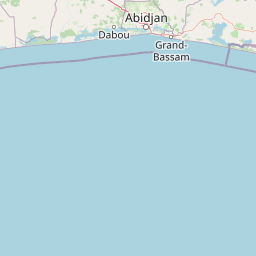
Map view of Azagny National Park

Use this park location map to pinpoint Azagny National Park in Ivory Coast, understand its exact geographic position, and read its mapped placement within the surrounding landscape more clearly.

Pigeon | © OpenStreetMap contributors

Location context for Azagny National Park

Lagunes
Park atlas

Compare adjacent coastal wetlands and regional conservation landscapes

Explore Protected Areas and Parks Near Parc national d'Azagny

Continue browsing related national parks and protected areas surrounding Parc national d'Azagny. Compare adjacent estuarine terrain and regional wetland reserves within the broader geographic network.
National parkIvory Coast
Mapped location lies within the park boundary#1 closest

East

Assagny National Park: Ivory Coast's Protected Natural Landscape and Park Boundaries

Explore the mapped terrain and regional geography.

Assagny National Park is a significant protected area in Ivory Coast, functioning as a national park. This entry provides detailed information on its geographic setting, mapping its protected boundaries and surrounding natural landscapes. It serves as a resource for understanding the park's specific landscape character and its contribution to the regional geography of West Africa, offering an atlas-style exploration of its conservation significance.

Area
170 km²
Established
1981
IUCN
II
Nature reserveLôh-Djiboua
About 85 km away#2 closest

Northwest

Réserve botanique de Divo: Protected Forest Landscapes and Regional Geography in Lôh-Djiboua

Nature reserve featuring extensive forest restoration projects.

Discover the complex landscape of Réserve botanique de Divo, one of the oldest nature reserves in Côte d'Ivoire. Located in the Lôh-Djiboua region, this protected area represents a transition between remaining secondary forest fragments and agricultural land, serving as a primary site for international tropical forestry restoration efforts.

Area
68.02 km²
Established
1935
Relief
Lowland
Climate
Tropical
Protected areaIvory Coast
About 90 km away#3 closest

Northwest

Forêt classée de Divo: Protected Area and Forest Geography of Southwestern Ivory Coast

A study of humid Guinean forest remnants and regional land use

Discover the mapped landscape and protected status of the Forêt classée de Divo. Situated in the Divo department, this reserve highlights the interaction between Guinean-type humid forests and agricultural expansion, providing a critical look at state-managed forest conservation in southwestern Ivory Coast.

Area
20 km²
Established
1928
Relief
Lowland
Climate
Tropical
National parkAbidjan
About 91 km away#4 closest

East

Banco National Park National Park: Primary Forest Landscape and Abidjan Geography

Explore mapped boundaries and urban conservation.

Banco National Park is a globally significant protected area, uniquely preserving dense primary tropical forest within the urban sprawl of Abidjan, Ivory Coast. This national park offers critical insights into urban conservation, featuring rare tree species and providing essential ecosystem services like water supply and carbon sequestration for the surrounding region. Its landscape, characterized by the Gbangbo River and rare mahogany and avodire trees, forms a vital geographic element within the metropolitan atlas.

Area
30 km²
Established
1953
IUCN
II
Relief
Lowland
A horizontal watercolor painting showing a green landscape with trees, a winding stream, and rolling hills in the background against a soft, light-filled sky.
National parkAbidjan
About 91 km away#5 closest

East

Parc national du Banco: Protected Tropical Rainforest and Urban Water Reserve in Abidjan

A dense primary forest island within a major urban landscape

Parc national du Banco preserves a significant block of primary tropical vegetation in the center of Abidjan. Functioning as both a vital municipal water reservoir and a complex wildlife refuge, this protected area offers a unique intersection of tropical forest ecology and dense urban development. Its central core of rare hardwood species and distinct river corridors illustrate a rare conservation landscape surrounded by the growth of a major West African metropolis.

Area
34.4 km²
Established
1953
IUCN
II
Relief
Lowland
A soft watercolor painting of a pastoral landscape with a meandering river in the foreground, clumps of green trees, and layered rolling hills in the background.
Nature reserveIvory Coast
About 113 km away#6 closest

North

Station d'écologie de Lamto: Nature Reserve and Protected Landscape in Ivory Coast

Examining the forest and savanna transition zone along the Bandama River

Station d'écologie de Lamto is a significant nature reserve situated at a unique ecological contact point in central Ivory Coast. This 2,500 hectare protected area encompasses Borassus palm savanna and gallery forest, serving as a landmark site for West African ecological research and the study of forest and savanna mosaic landscapes.

Area
25 km²
Established
1962
IUCN
Ia
Relief
Lowland
Nature reserveIvory Coast
About 149 km away#7 closest

West

Forêt classée de Niégré: Mapping the Protected Forest Landscape of Southwestern Ivory Coast

A regional study of forest fragments and Guinean moist forest ecology

Forêt classée de Niégré serves as a focal point for understanding the interplay between protected-area boundaries and agrarian expansion in southwestern Ivory Coast. This geographic profile examines the massif as a remnant of Guinean moist evergreen forest, mapping its transformation from a closed canopy system into a fragmented mosaic that reflects broader regional shifts in land-use and environmental management policy.

Area
925 km²
Established
1937
Relief
Lowland
Climate
Subtropical
National parkIvory Coast
About 183 km away#8 closest

East

Îles Ehotilé National Park: A Protected Island Ecosystem within Ivory Coast's National Park Network

Explore its island terrain and mapped coastal geography.

Îles Ehotilé National Park stands as a protected island ecosystem within the national park system of Ivory Coast. This area is distinguished by its island landscapes, coastal zones, and the surrounding marine environments characteristic of the Gulf of Guinea. As a designated national park, it plays a crucial role in preserving unique West African island biodiversity and providing a mapped protected area for ecological study and appreciation. The park's conservation focus highlights the importance of safeguarding coastal habitats within the region.

Area
105 km²
Established
1974
IUCN
II
Relief
Lowland

Common questions about visiting, size, designation, and location context for Azagny National Park

Azagny National Park FAQs for park facts, access, geography, and protected area context

Find quick answers about Azagny National Park, including protected-area facts, park geography, trail and visitor context, and how the park fits into its surrounding country and regional landscape.
MoriAtlas Explorer

Continue Your Protected Areas Search Across the Global Atlas

Deepen your exploration by continuing the structured search for national parks and protected areas worldwide. Utilize the comprehensive filtering capabilities to compare different conservation landscapes and refine your understanding of global park geography. Discover more about the distribution and characteristics of protected natural areas.

Global natural geography