

Mori Atlas logo
National parkParc national de Ma Mbed Mbed

Tracing the landscape mosaic and transboundary ecological corridors of this critical savanna conservation zone.

Parc national de Ma Mbed Mbed: An Essential Protected Area in the Extrême-Nord Region of Cameroon

Parc national de Ma Mbed Mbed serves as a vital ecological bridge within the Extrême-Nord region of Cameroon, acting as a protected corridor between larger northern and southern wildlife habitats. The landscape is defined by a distinct mosaic of dry wooded savanna, open acacia plains, and seasonal hydrological networks that link the Mayo Kébi to the broader Benue and Niger basins. This small, high-value protected area plays a crucial role in maintaining regional biodiversity and elephant movement between Cameroon and Chad.

sahelian-savannawooded-savannaacacia-savannatransboundary-conservationelephant-conservationMayo-Kani
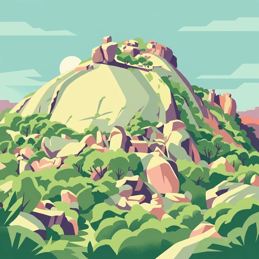
A digital illustration of a large, rounded granite hill covered in sparse green vegetation and scattered boulders under a pale sky.

Parc national de Ma Mbed Mbed

National park

Park overview

Structured park overview, official facts, and landscape profile for Ma Mbed Mbed National Park

Ma Mbed Mbed National Park park facts, protected area profile, and essential visitor context

Review the core facts for Ma Mbed Mbed National Park, including designation, size, terrain, visitor scale, habitats, and operating context in one park-focused overview.

About Ma Mbed Mbed National Park

Ma Mbed Mbed National Park occupies a modest but strategically placed corner of northern Cameroon, in the Far North Region's Mayo-Kani department, where the country meets the Chadian border. Despite a small territorial footprint of roughly 181 square kilometers, the park fills a meaningful gap in Cameroon's protected-area network: it is the only national park within a north-south corridor of about 300 kilometers that stretches between Waza National Park in the far north and Boubandjida National Park much further south. In regional conservation terms, this intermediate position makes Ma Mbed Mbed a crucial link in maintaining ecological connectivity across landscapes that otherwise span very different climatic zones.

The park covers parts of the Guidiguis, Kaélé, and Taibong arrondissements, including enclaves such as Gourney and Torok. Its administrative headquarters are located in Kaélé, the largest nearby town, which also provides an airport and basic public services. The terrain itself belongs to the Sahelian transitional zone identified locally as the 'bec de canard' (duck's beak), so the climate is semi-arid, though the proximity of more humid wooded country a few kilometers to the south softens conditions slightly compared with the harsher Sahelian environments further north.

Ma Mbed Mbed functions as more than just a wildlife refuge. It was conceived as a tool for strengthening transboundary cooperation with Chad in the conservation of elephants and other wide-ranging species, and it is intended to indirectly reduce conflict between local communities and elephants crossing the border. At the same time, the park's small catchments feed several local watercourses, including tributaries that eventually join the Mayo Kébi and Benue system, so its protection is tied to local water regulation as well. In February 2021, the site was proposed for designation as a Ramsar wetland of international importance, reflecting the recognition of its hydrological and ecological significance beyond its modest size.

Quick facts and research context for Ma Mbed Mbed National Park

Ma Mbed Mbed National Park is a small, relatively new Cameroonian national park in the Far North Region, covering about 181 square kilometers across parts of the Guidiguis, Kaélé, and Taibong arrondissements of the Mayo-Kani department. Created in 2009 and given formal legal status by decree on 7 January 2020, it sits along the Chadian border and is the only protected area of national park status in a long corridor linking Waza National Park to Boubandjida National Park. The landscape is semi-arid savanna typical of the Sahelian transition zone, and the park is recognized primarily for transboundary elephant conservation, hydrological function, and its proposed designation as a Ramsar wetland of international importance (proposed in February 2021).

Protection and recognition

Documented terrestrial protection scope, designation year, and transboundary status

Parc national de Ma Mbed Mbed Protection Status and Designation History

Official records outline the established terrestrial protection scope and designation year for Parc national de Ma Mbed Mbed. Documented conservation history provides clear reference data regarding its transboundary status and administrative framework.

Protection details

Protection scope
Terrestrial
Designated year
2020
Transboundary protection
Yes
WDPA ID
555548872
Park context

Deeper park guide and search-rich context for Ma Mbed Mbed National Park

Ma Mbed Mbed National Park history, landscape, wildlife, and travel context

Explore Ma Mbed Mbed National Park through its history, landscape character, ecosystems, wildlife, conservation priorities, cultural context, and seasonal travel timing in a structured park guide built for atlas discovery and search intent.

Why Ma Mbed Mbed National Park stands out

Ma Mbed Mbed is best known as a transboundary conservation buffer between Cameroon and Chad, specifically created to protect elephants and other wildlife moving between the two countries and to reduce human-elephant conflict in surrounding communities. It is also distinguished by its position at the ecological interface between Sahelian semi-arid conditions and more humid wooded savannas to the south, which gives the park a unique transitional character within Cameroon's national park system.
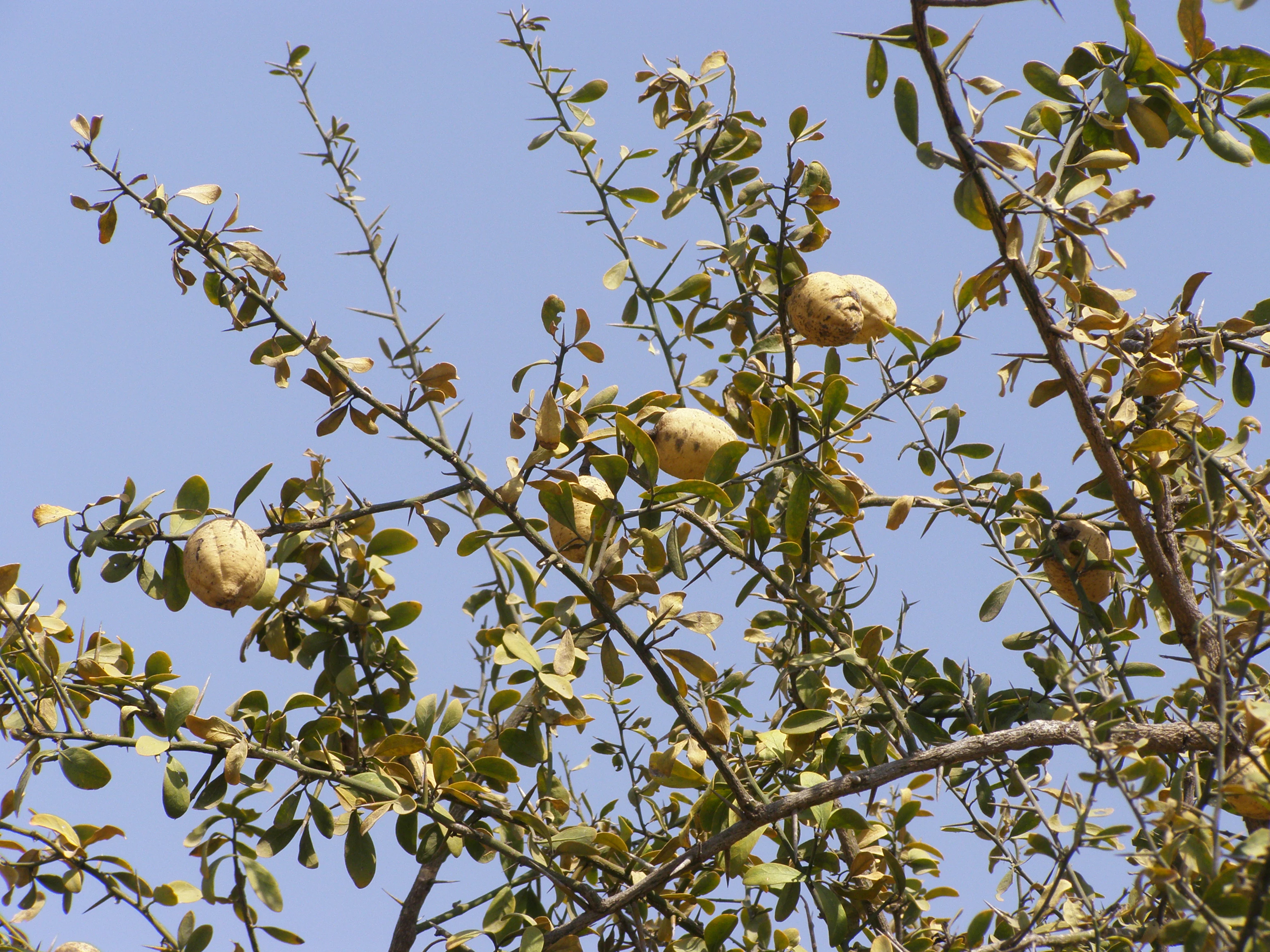
A close-up shot of a thorny Balanites aegyptiaca tree with small green leaves and round yellowish fruits against a clear blue sky.
Fruits and foliage of a desert date tree, Balanites aegyptiaca.

Ma Mbed Mbed National Park history and protected-area timeline

The creation of Ma Mbed Mbed National Park was closely tied to changes in land use along the Chadian border during the late twentieth century. Beginning in the 1990s, agricultural repopulation of the Mayo-Kani region brought new cultivation into areas that had previously served as fallow land or movement corridors. Some of these expansion zones overlapped with traditional routes used by protected elephant herds crossing back and forth between Cameroon and Chad, generating recurring human-elephant conflict.

In response to these pressures and the broader need for transboundary wildlife management, a proposal for a protected area in this region was advanced from 2004 onward and was formally adopted between 2007 and 2009. The park was officially created on 7 January 2020 by a decree signed by Prime Minister Joseph Dion Ngute, which defined the park's location in the Far North Region, Mayo-Kani department, across the arrondissements of Guidiguis, Kaélé, and Taibong, and set its area at 12,708 hectares. With this decree, Ma Mbed Mbed became one of the youngest entries in Cameroon's national park system.

Immediately after its formal legal recognition, additional steps were taken to extend the park's conservation recognition beyond national boundaries. In February 2021, the site was proposed for inclusion on the Ramsar list of wetlands of international importance, and a roadmap was drawn up to complete the technical documentation required for full designation. The park's recent creation also coincides with a more challenging security environment in the wider Far North, linked to regional instability in neighboring countries, which has complicated on-the-ground management of protected areas across the region.

Ma Mbed Mbed National Park landscape and geographic character

The physical landscape of Ma Mbed Mbed reflects its location at the southern edge of the Sahelian climatic zone, giving it a predominantly dry, open character. The park is dominated by a mosaic of dense wooded savanna, open acacia savanna, and grass plains, with vegetation patterns shaped by rainfall variability typical of the Far North Region. The terrain is gently undulating rather than mountainous, but it includes subtle geomorphological features such as the so-called 'Toupouri depression,' a slight basin in which sediments have accumulated over time to produce naturally fertile vertisol soils.

Water defines much of the park's spatial structure. Although the climate is semi-arid, several small seasonal watercourses rise within or near the protected area, making the presence of surface water effectively continuous for only about three months of the year. These intermittent streams flow southward into the Mayo Kébi, which in turn belongs to the broader Benue and ultimately Niger river system, linking Ma Mbed Mbed to a major transregional watershed. Vegetation strongly associated with watercourses, such as the African birch (Anogeissus leiocarpa) and the doum palm Hyphaene thebaica, tend to follow these hydrological corridors, while the surrounding uplands support more drought-resistant species.

Ma Mbed Mbed National Park ecosystems, habitats, and plant life

Ecologically, Ma Mbed Mbed is shaped by its position between two major biomes: the Sahelian arid environments to the north and the humid wooded savannas and equatorial forests further south. This intermediate setting has encouraged a notable level of local endemism in both flora and fauna, comparable in some respects to the Yaéré plains slightly further north, but with its own distinct character shaped by rainfall patterns, soil types, and proximity to the Chadian border.

The park's vegetation falls broadly into three overlapping environments: dense wooded savanna, acacia-dominated savanna, and expansive grass plains dominated by andropogonaceous grasses and other graminoids, with sedges (Cyperaceae) appearing in seasonally wetter pockets. Iconic or characteristic woody species include the desert date (Balanites aegyptiaca), several Acacia and Faidherbia species, Prosopis africana (known locally as the 'iron tree' for its termite- and fire-resistant wood), Mitragyna species with medicinal value, and Combretum species adapted to dry savanna conditions. These plant communities together form the structural backbone of the park's habitats and the foundation for its wildlife.

Ma Mbed Mbed National Park wildlife and species highlights

Wildlife at Ma Mbed Mbed is shaped by the wet-dry seasonal cycle and by the park's role as a transboundary refuge. The most prominent large-mammal concern that motivated the park's creation is the elephant population that moves between Cameroon and Chad, which historically caused conflicts with local farmers but is now central to the park's conservation mission.

Beyond elephants, the park supports an insect fauna typical of Sahelian and Sudano-Sahelian environments, including grasshoppers and locusts such as Oedaleus senegalensis, Anacridium melanorhodon, and various Acrotylus species, some of which periodically become agricultural pests across the broader region. Praying mantises, shield bugs, and a range of other insects also feature in local ecological dynamics. The source material for this park does not yet provide a comprehensive inventory of larger mammals or bird species, but the combination of wooded savanna, acacia stands, seasonal wetlands, and proximity to a major wetland complex makes the park ecologically significant for regional and international wildlife movements.

Ma Mbed Mbed National Park conservation status and protection priorities

Ma Mbed Mbed National Park occupies a special place in Cameroon's conservation strategy because of its role as a transboundary refuge and a hydrological stabilizer. Its establishment was explicitly designed to strengthen the conservation of elephants and other wildlife moving across the Cameroon-Chad border, and to reduce the resulting tensions between those animals and the rural communities living in the surrounding villages. In this way, the park's conservation importance reaches well beyond its own boundaries, linking ecological, social, and cross-border policy objectives.

The park's recognition as a proposed Ramsar site in February 2021 underscores its value from a wetland-conservation perspective, since the Mayo Kébi basin and the park's seasonal watercourses are considered ecologically important even though surface water is present continuously for only a few months each year. At the same time, conservation in this park faces practical and security-related challenges. Poaching remains a threat to endemic and locally unique species, as it does across many Cameroonian protected areas, and wider instability in parts of the Sahel and adjacent regions has weakened management capacity in nearby parks such as Waza and Kalamaloué. These conditions have shaped the way Ma Mbed Mbed is governed and have made external partnerships particularly important.

Ma Mbed Mbed National Park cultural meaning and human context

The territory of Ma Mbed Mbed overlaps with the ancestral lands of the Guiziga people, a sub-branch of the broader Kirdi cultural group. The Guiziga are traditionally agricultural, farming sorghum and cotton, including counter-season crops grown on the fertile vertisols that benefit from seasonal flooding and small-scale irrigation. They have inhabited this border region for centuries and have historically not recognized formal administrative boundaries, whether national frontiers, regional borders, or protected-area limits, in their land-use practices.

Alongside the Guiziga, Fulani (Peul) pastoralists are also present in the wider area. Their villages and hamlets are traditionally organized into lamidats, which are long-standing chieftaincies with strong historical identities. Tensions between Guiziga and Fulani communities have sometimes influenced local agricultural patterns, particularly during periods of migration such as the 1970s and 1980s, when Guiziga groups moved toward the Benue valley, and again from the 1990s onward, when migrants from the Logone valley and returning populations from the Benue valley began settling in Guiziga territory, contributing to the land-use changes that eventually prompted the park's creation.

Top sights and standout views in Ma Mbed Mbed National Park

Ma Mbed Mbed stands out as a small park with an outsized role in transboundary conservation between Cameroon and Chad, particularly for elephants. It is the only national park along a roughly 300-kilometer corridor connecting Waza and Boubandjida, giving it a unique bridging position between Sahelian and Sudano-Sahelian landscapes. Its mosaic of dense wooded savanna, acacia stands, and grass plains supports locally adapted flora and a climate at the southern edge of the Sahel. The park is also notable for its hydrological contribution to the Mayo Kébi, Benue, and Niger basins, and for its 2021 proposal as a Ramsar wetland of international importance, a recognition that highlights the ecological value packed into its modest 181-square-kilometer footprint.

Best time to visit Ma Mbed Mbed National Park

Given Ma Mbed Mbed's semi-arid Sahelian climate, the character of a visit is strongly influenced by the seasonal cycle. Surface water and the lushness of savanna vegetation are concentrated during the short wet season, when intermittent streams flow and the surrounding plains take on a greener, more dynamic appearance. The dry season, while harsher, can also be a productive time for wildlife observation because animals tend to concentrate near remaining water sources and visibility is higher in the more open vegetation. General travel planning in this part of the Far North Region is also shaped by security considerations linked to wider instability in neighboring countries, which can affect the practical feasibility of visiting at any time of year.
Monthly climate preview

Long-term representative point measurements for temperature and precipitation

Parc national de Ma Mbed Mbed Climate Normals and Annual Weather Rhythm

Historical averages for Parc national de Ma Mbed Mbed record sustained mean monthly temperatures alongside a distinct annual precipitation cycle across the sampled coordinate. Reviewing the complete twelve-month profile provides deeper context for long-term climatological variations across the protected landscape.
Annual mean28 °C
25 °C33 °C
Jan26°
Feb29°
Mar32°
Apr33°
May31°
Jun28°
Jul26°
Aug25°
Sep26°
Oct27°
Nov27°
Dec26°
Warmest month
April

32.6 °C

Coolest month
August

25 °C

Wettest month
August

7.4 mm/day

Driest month
January

0 mm/day

Park location guide

Geography guide, regional context, and park location map for Ma Mbed Mbed National Park

Ma Mbed Mbed National Park park geography, regions, and map view in Cameroon

Understand where Ma Mbed Mbed National Park sits in Cameroon through a broader geographic reading of the surrounding landscape, nearby location context, and its mapped position within the national park landscape.

How Ma Mbed Mbed National Park fits into Cameroon

Cameroon is a Central African country spanning coastal, highland, and forest regions. It has a population of nearly 31 million people who speak 250 native languages alongside English and French as official languages. The country gained independence from France in 1960 and unified with British Southern Cameroons in 1961.

Wider geography shaping Ma Mbed Mbed National Park in Cameroon

Cameroon is located in Central Africa, bordering Nigeria and Chad to the west and north, the Central African Republic to the east, and Equatorial Guinea, Gabon, and the Republic of the Congo to the south. The country has a coastline on the Bight of Biafra, part of the Gulf of Guinea. Terrain includes coastal plains, mountainous highlands (including Mount Cameroon), plateaus, and dense rainforest regions.

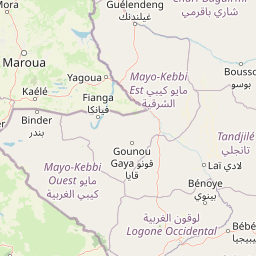
Map view of Ma Mbed Mbed National Park

Use this park location map to pinpoint Ma Mbed Mbed National Park in Cameroon, understand its exact geographic position, and read its mapped placement within the surrounding landscape more clearly.

Pigeon | © OpenStreetMap contributors

Location context for Ma Mbed Mbed National Park

Extrême-Nord

Visualizing the dry savanna habitats and transitional terrain of northern Cameroon

Parc national de Ma Mbed Mbed Landscapes and Protected Area Scenery

Photographs reveal the characteristic acacia woodlands, grass plains, and seasonal watercourses defining the protected terrain of Parc national de Ma Mbed Mbed. Examining these visual records helps researchers and travelers understand the ecological transition between Sahelian zones and wooded southern savannas.

A close-up shot of a thorny Balanites aegyptiaca tree with small green leaves and round yellowish fruits against a clear blue sky.

A large, rounded granite dome peak known as Mount Boboyo rising above surrounding dry shrubland and scattered green trees.

Park atlas

Explore surrounding regional landscapes and connected transboundary conservation zones

Parks Near Parc national de Ma Mbed Mbed And Related Protected Areas

Compare Parc national de Ma Mbed Mbed with other protected areas across the surrounding regional corridor and Sahelian transition zone. Examining adjacent parks reveals broader ecological patterns, wildlife migration routes, and regional watershed connections.
National parkCameroon
About 119 km away#1 closest

South

Bouba Njida National Park: A Protected Landscape within Cameroon's National Park Atlas

Discover its mapped geography and regional context.

Bouba Njida National Park represents a key component of Cameroon's protected lands, contributing essential context to any atlas of Central African geography. As a designated national park, it offers a distinct focus for understanding mapped landscape features and the distribution of protected areas within the country. This park serves as a vital point of reference for exploring the nation's natural terrain and its significance within the broader context of regional conservation efforts.

Area
2,200 km²
Established
1980
IUCN
II
Relief
Upland
National parkFar North Region
About 139 km away#2 closest

North

Waza National Park: A Designated Protected Landscape in the Far North Region

Mapped Boundaries and Regional Geographic Context

Waza National Park stands as a vital protected natural landscape in Cameroon's Far North Region. This entry provides a deep dive into its mapped protected-area boundaries and its significance within the broader regional geography. Explore the specific landscape identity of this national park through an atlas-focused lens, understanding its terrain and context without travel logistics or visitor advice.

Area
1,700 km²
Established
1934
IUCN
II
Relief
Lowland
National parkCameroon
About 161 km away#3 closest

South

Bouba Ndjida National Park: A Protected Savanna Landscape in Northern Cameroon's Geography

Explore its mapped boundaries and diverse terrain.

Bouba Ndjida National Park, situated in northern Cameroon, serves as a critical protected savanna and woodland ecosystem. This park, one of Cameroon's oldest national parks, is recognized for its expansive grasslands, scattered woodlands, and gallery forests that sustain diverse wildlife, particularly large mammals. Its location within an ecological transition zone provides a rich geographic context, making it an important area for understanding protected landscape dynamics and regional conservation within the broader atlas.

IUCN
II
Watercolor illustration of a landscape with rolling hills, a winding river, and varied terrain in soft colors
National parkBénoué Department
About 177 km away#4 closest

Southwest

Bénoué National Park: Protected Landscape Atlas in Bénoué Department, Cameroon

Explore savanna woodland, riparian ecosystems, and geographic context.

Bénoué National Park is a vast protected landscape in Cameroon, defined by its Sudanian savanna woodland and significant frontage along the Bénoué River. Recognized as a UNESCO Biosphere Reserve, it offers critical insights into regional geography, habitat diversity, and the broader atlas of conservation lands in West Africa. Users can explore its varied terrain, from riverine zones to higher massifs, gaining a detailed understanding of this important protected area.

Area
1,800 km²
Established
1968
IUCN
II
Relief
Mixed relief
National parkNigeria
About 189 km away#5 closest

North

Chad Basin National Park: Exploring Nigeria's Protected Natural Landscape

Mapped protected area and regional geography context.

Chad Basin National Park is a key protected landscape within Nigeria, designated as a national park. This page serves as a gateway to understanding its specific geographic identity, mapped boundaries, and its role within the country's natural terrain. Users can explore detailed information, focusing on the park's atlas-relevant features and its contribution to Nigeria's protected areas, offering a distinct view of the nation's geography.

Area
2,258 km²
Established
1991
IUCN
II
Relief
Lowland
National parkExtrême-Nord
About 229 km away#6 closest

North

Parc national de Kalamaloué: A Deep Geographic Analysis of Cameroon's Yaéré Floodplain

Mapped protected landscapes along the Logone and Chari rivers.

Parc national de Kalamaloué serves as a prime case study for sudano-sahelian geography, defined by its flat terrain and the seasonal inundation of the Logone basin. The park provides an essential look at how river hydrology influences small-scale protected habitats, ranging from dense mangrove fringes to dry acacia-dominated woodlands.

Area
45 km²
Established
1972
IUCN
II
Relief
Lowland
National parkCameroon
About 270 km away#7 closest

Southwest

Faro National Park: Central Africa's Largest Hippo Population within Sudano-Sahelian Protected Landscape

Explore mapped boundaries and regional geography of this vital national park.

Faro National Park stands as a critical protected area within Cameroon, celebrated for its immense hippopotamus population and its role in conserving large mammals across the Sudano-Sahelian zone. The park's landscape comprises undulating savanna plains, river valleys, and elevated hilltops, offering a diverse geographic context for conservation. Its inclusion in a transboundary protected network highlights its importance for regional landscape mapping and ecological continuity. Understanding Faro National Park involves appreciating its unique habitat mosaic and its contribution to the protected areas atlas.

Area
3,418 km²
Established
1989
IUCN
II
Relief
Upland
Wildlife reserveBorno
About 343 km away#8 closest

North

Lake Chad Game Reserve: A Regional Geography and Wetland Protected Area Profile

Examining the floodplain terrain and hydrological network of Borno, Nigeria.

Lake Chad Game Reserve serves as a primary example of Sahelian wetland ecology, covering vast plains in Borno, Nigeria. The area is characterized by seasonal inundation and a diverse mosaic of swamps, marshes, and river corridors. This profile details the geographic boundaries and distinctive terrain that make the reserve a vital protected landscape within the West African environmental system.

Area
6,073.54 km²
IUCN
IV
Relief
Lowland
Climate
Tropical

Common questions about visiting, size, designation, and location context for Ma Mbed Mbed National Park

Ma Mbed Mbed National Park FAQs for park facts, access, geography, and protected area context

Find quick answers about Ma Mbed Mbed National Park, including protected-area facts, park geography, trail and visitor context, and how the park fits into its surrounding country and regional landscape.
MoriAtlas Explorer

Continue Your Protected Areas Search Across the Global Atlas

Deepen your exploration by continuing the structured search for national parks and protected areas worldwide. Utilize the comprehensive filtering capabilities to compare different conservation landscapes and refine your understanding of global park geography. Discover more about the distribution and characteristics of protected natural areas.

Global natural geography
