
Mori Atlas logo
National parkParc national du Banco

Explore the geographic boundaries and critical hydrological role of this unique urban protected forest landscape.

Parc national du Banco: A Dense Primary Tropical Rainforest Reserve Within Urban Abidjan

Parc national du Banco stands as a rare example of a primary tropical rainforest located within the heart of a major African city. Spanning approximately 3,400 hectares, this protected area serves as a critical water reservoir and ecological lung for Abidjan, maintaining a dense canopy of rare West African hardwoods and providing a refuge for chimpanzees and forest antelopes. The park features undulating terrain and distinct river systems that define its local hydrology and habitat mosaic.

urban national parktropical rainforestprimary forestprotected forest reservewater reservoirAbidjan
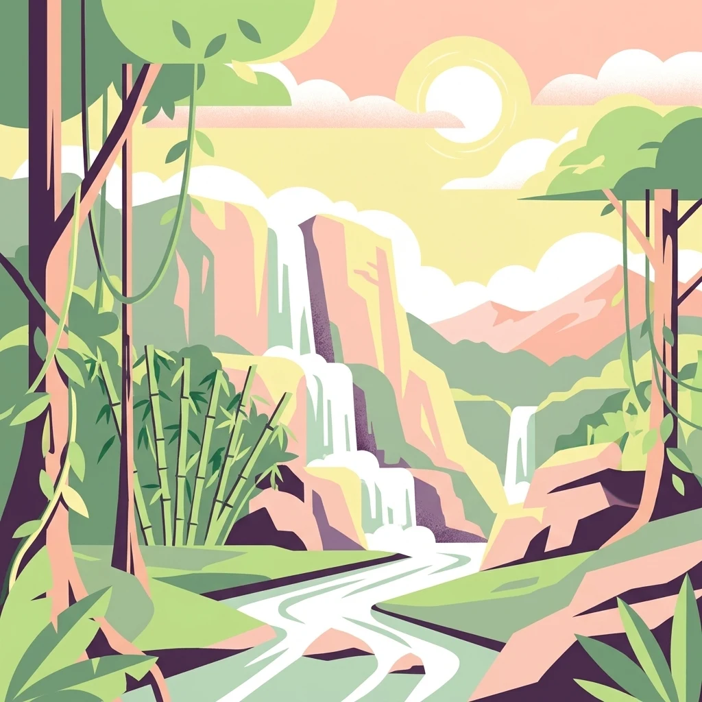
An illustration of a tropical rainforest with a waterfall cascading down rocky cliffs into a winding river; bamboo and jungle vines frame the scene under a sunrise.

Parc national du Banco

National park

Park overview

Structured park overview, official facts, and landscape profile for Banco National Park

Banco National Park park facts, protected area profile, and essential visitor context

Review the core facts for Banco National Park, including designation, size, terrain, visitor scale, habitats, and operating context in one park-focused overview.

About Banco National Park

Banco National Park is a national park of Côte d'Ivoire situated in the geographic center of Abidjan, Africa's largest Francophone city and the country's economic capital. The reserve sits at the meeting point of four communes: Abobo, Yopougon, Adjamé, and Attécoubé, and occupies a roughly square block of about 7.8 kilometers on each side, with a perimeter of about 25.5 kilometers. Its roughly 3,438 hectares of protected land form part of the historical customary territories of the Attié villages of Andokoi and the Ebrié villages of Anonkoua-Kouté and Agba.

The defining feature of Banco National Park is its primary tropical rainforest, which remains unusually intact given its urban surroundings. A central core of about 600 hectares of old-growth forest contains hardwood species that have become rare elsewhere in West Africa, including mahogany and avodiré. Surrounding this core are areas of secondary forest, planted stands, and regenerating vegetation, traversed by the Gbangbo River, whose name in the Ebrié language also evokes a refreshing water source.

The park's position inside one of West Africa's most populous urban regions gives it extraordinary ecological and social importance. Beyond its biodiversity value, Banco functions as a primary hydrological reservoir for Abidjan, with around 29 municipal boreholes drawing from its aquifer and supplying a major share of the city's drinking water. It is also considered the city's "green lung," contributing to air quality and carbon sequestration. Recreational infrastructure, including hiking trails and an extensive network of cycling paths, has been developed carefully within the bounds of strict protection.

Quick facts and research context for Banco National Park

Banco National Park lies at the junction of four communes of Abidjan: Abobo, Yopougon, Adjamé, and Attécoubé. Its name derives from the Ebrié word Gbancô, meaning "source of refreshing water," which reflects the park's central role as a hydrological reserve for the city.

The park covers about 3,438 hectares, with a perimeter of roughly 25.5 kilometers, and encloses a core primary forest of around 600 hectares. It is classified as a national park under IUCN Category II and is governed by Côte d'Ivoire's 2002 framework law on national parks and natural reserves, which prohibits hunting, logging, and plant collection within its boundaries.

Protection and recognition

Documented terrestrial protection scope and baseline administrative records

Parc National Du Banco Protection Status And International Recognition Records

Terrestrial protection status for Parc national du Banco brings together verified conservation records and administrative source data for comprehensive evaluation. Baseline preservation metrics provide clear documentation of international frameworks without assuming unverified management outcomes.

Protection details

Protection scope
Terrestrial
Transboundary protection
No
WDPA ID
725
Park context

Deeper park guide and search-rich context for Banco National Park

Banco National Park history, landscape, wildlife, and travel context

Explore Banco National Park through its history, landscape character, ecosystems, wildlife, conservation priorities, cultural context, and seasonal travel timing in a structured park guide built for atlas discovery and search intent.

Why Banco National Park stands out

Banco National Park is best known for being one of the only dense primary tropical rainforests located entirely inside a major African city, a characteristic it shares with very few sites worldwide, most notably Rio de Janeiro's Tijuca National Park. It is also recognized for its role as an urban water reservoir and ecological lung for Abidjan, supplying a substantial portion of the city's drinking water through its aquifer while absorbing atmospheric carbon. The forest's central primary core, containing rare West African hardwoods, and its surviving populations of forest antelope and a small group of chimpanzees give the park a distinctive conservation profile that blends urban ecology with classic tropical rainforest preservation.
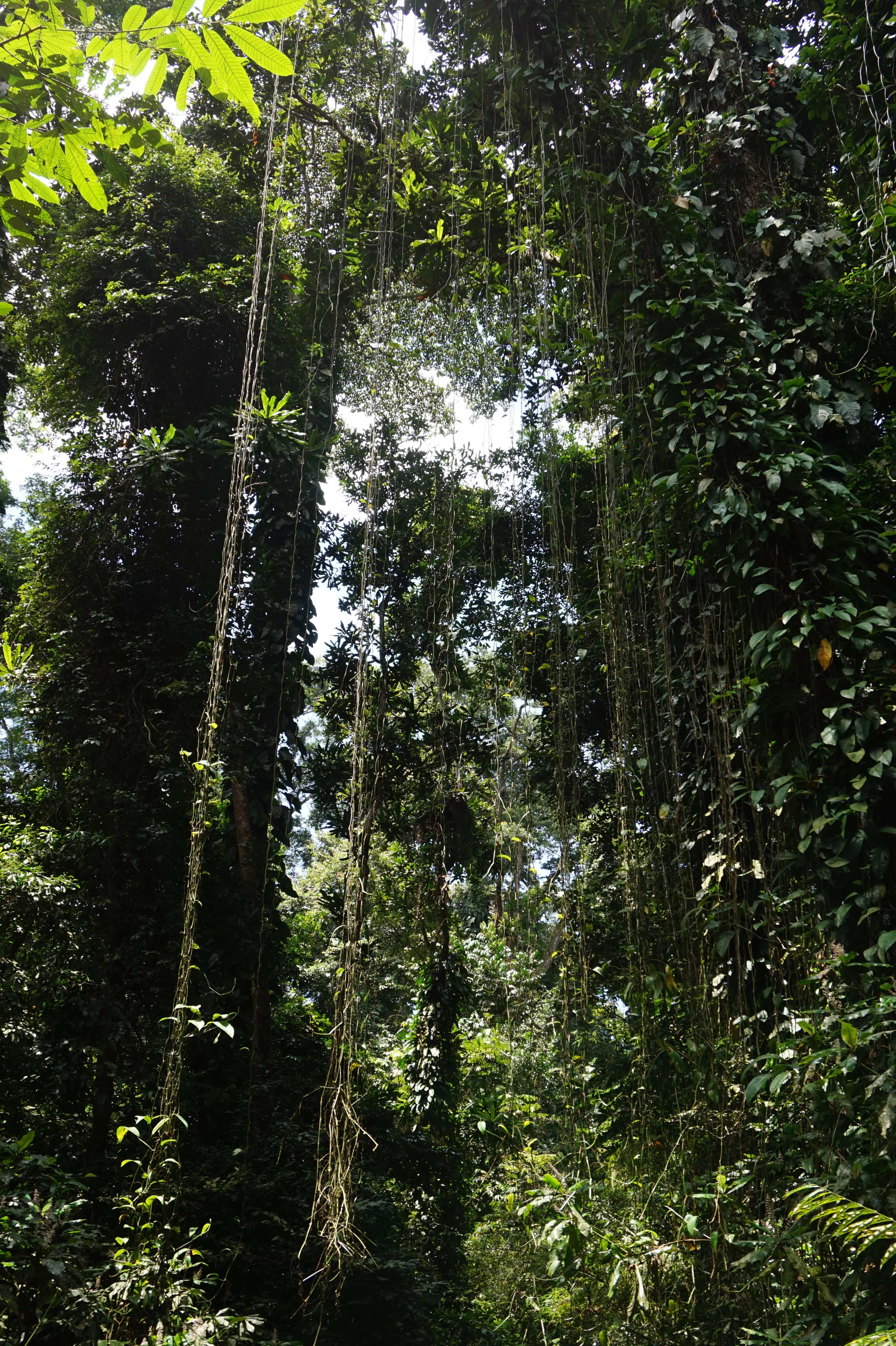
A low angle view of a dense tropical rainforest canopy featuring tall trees draped with long hanging lianas and vines.
Dense primary rainforest canopy with hanging lianas in Parc national du Banco.

Banco National Park history and protected-area timeline

The history of Banco National Park is closely tied to the broader effort in Côte d'Ivoire to preserve natural forest resources. In 1926, the Banco forest was first given formal status as a forest station, recognizing its ecological value at a time when much of the surrounding region was being opened for agriculture and timber extraction. Decades later, in 1953, the Banco forest station was elevated to the status of a national park, becoming one of the foundational protected areas of post-colonial Côte d'Ivoire.

In 1966, the park's legal status was further reinforced when it was designated a permanent state forest domain under Law 66-433, along with a decree regulating the classification procedure for integral nature reserves and national parks. This legal foundation gave Banco long-term recognition as a protected area, even as the city of Abidjan expanded rapidly around it.

The park's history also includes moments of compromise with urban infrastructure. In 1978, a corridor was opened in the northeast of the park to accommodate high-voltage power lines serving Abidjan, creating a 1.7-kilometer-long, 0.15-kilometer-wide notch that gave the park a horn-like shape, later known as the Triangle de Sagbé because of its proximity to the Abobo-Sagbé neighborhood. In 2002, Côte d'Ivoire adopted Law 2002-102, which established the modern legal framework for the creation, management, and financing of national parks and natural reserves, defining Banco's legal status and the penalties for violations of its protection rules.

Banco National Park landscape and geographic character

The physical landscape of Banco National Park is defined by a compact block of tropical rainforest surrounded on all sides by intense urban development. Although small in absolute terms, the protected area forms a striking natural patch within Abidjan's built environment, with lowland rainforest vegetation extending across gently undulating terrain in the heart of the city.

The forest is structured around a central zone of primary vegetation, where mature trees form a dense and relatively unbroken canopy. Surrounding this core are secondary forest areas, regenerating growth, and planted stands, all contributing to a varied mosaic of habitats. The Gbangbo River flows through the park and, together with the forest's groundwater system, defines much of the local hydrology. Together, the forested blocks, watercourses, and clearings create a landscape that alternates between shadowy closed canopy and more open, light-filtered understory.
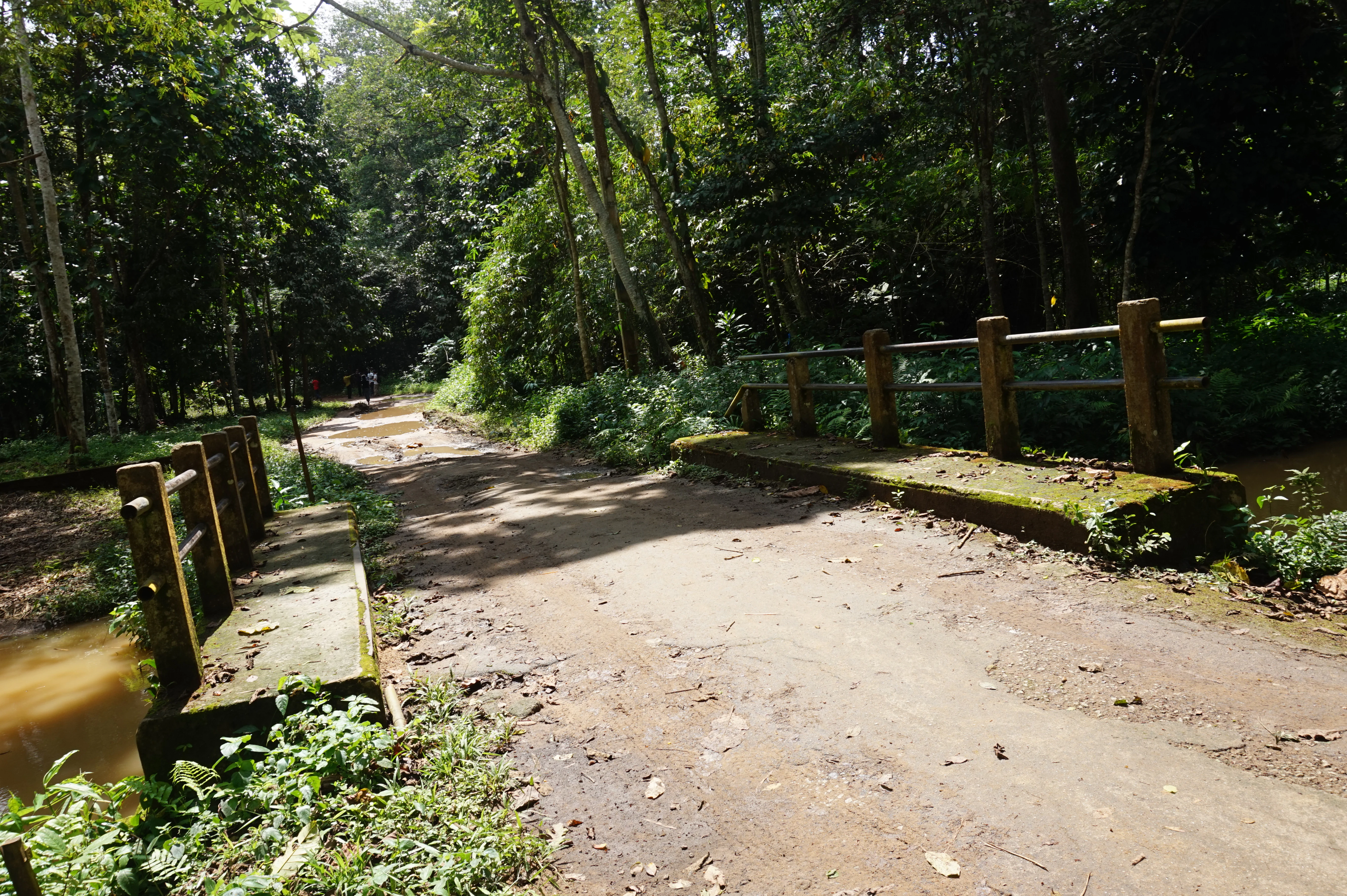
A dirt path crosses over a small concrete bridge within a dense tropical forest, with mud and green foliage visible on the sides.
A small bridge crossing a stream along a forest trail in Parc national du Banco.

Banco National Park ecosystems, habitats, and plant life

Banco National Park represents a rare example of preserved lowland Guinean rainforest habitat embedded directly within a major West African city. Its vegetation is layered and diverse, with mature hardwoods, mid-story trees, and an understory typical of the regional tropical forest zone.

A core area of about 600 hectares retains characteristics of primary forest, supporting tree species such as mahogany and avodiré that have become increasingly scarce elsewhere in West Africa due to logging and land conversion. Beyond this core, mosaic habitats include secondary regrowth and managed forest, supporting a broad range of plant communities and contributing to the resilience of the broader forest block.

The hydrology of the park reinforces its ecological character. Soils and underground aquifers sustain a complex network of streams and a permanent flow of freshwater, supporting both forest vegetation and the surrounding city. This combination of mature forest, regenerating vegetation, and reliable freshwater makes Banco an unusually complete small-scale tropical ecosystem by global standards.
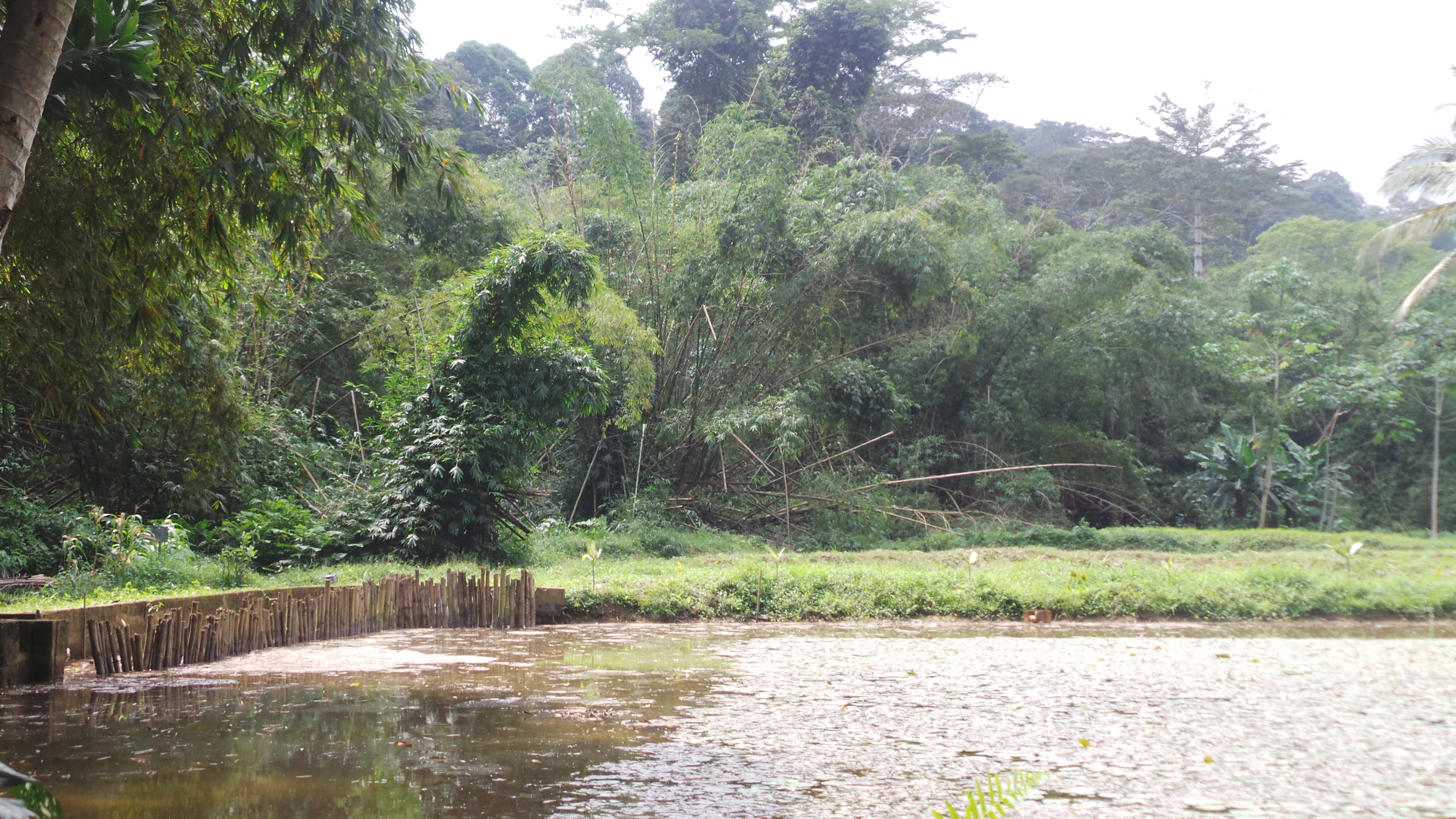
A small pond with a wooden fence border in the foreground, with thick, lush green tropical rainforest rising in the background.
A view of the dense primary rainforest within Parc national du Banco, seen from the edge of a pond.

Banco National Park wildlife and species highlights

Banco National Park historically supported a rich West African forest fauna, but as the surrounding city has expanded, much of its larger wildlife has been reduced or eliminated. Today, the park's surviving mammal populations include the bushbuck, a distinctive forest antelope once considered emblematic of the reserve, along with smaller duiker species, several monkey species, and a small but significant community of about a dozen chimpanzees identified through research by the Wild Chimpanzee Foundation in 2004 and 2005.

Birdlife is one of the park's current strong points, with a rich variety of forest and edge species, some of which are considered at risk regionally. Smaller mammals, reptiles, and insects typical of Guinean rainforest habitats also persist in the protected area.

Hunting, logging, and the collection of plants are formally prohibited under the park's 2002 legal framework, although illegal hunting, trapping, and logging pressure continue to affect wildlife populations and require ongoing management attention.
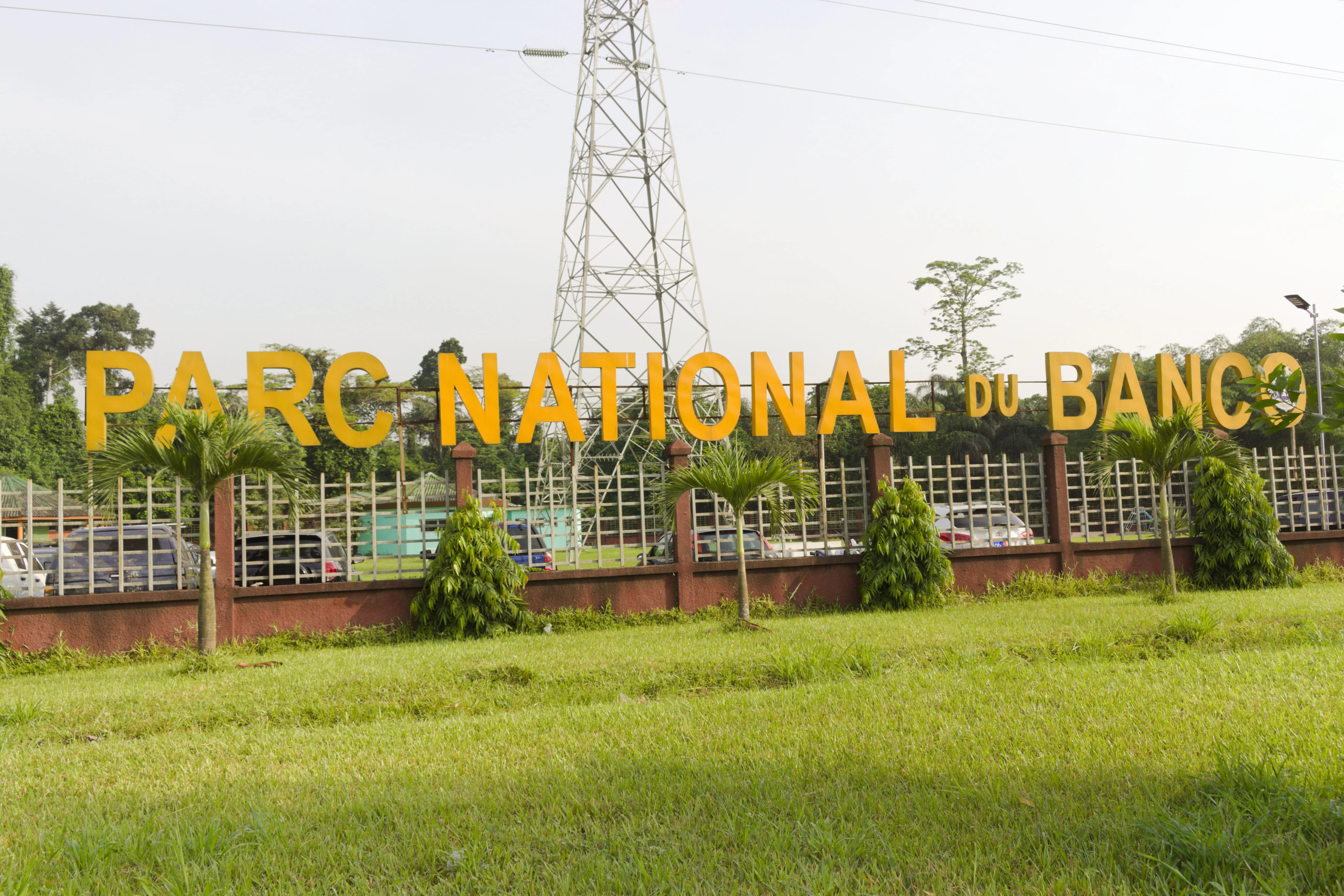
A large yellow sign reading PARC NATIONAL DU BANCO mounted on a gated metal fence, with green trees and a tall electrical transmission tower in the background.
The main entrance sign of Parc National du Banco in Ivory Coast.

Banco National Park conservation status and protection priorities

Banco National Park is a conservation priority at multiple scales: locally, because it supplies water and clean air to millions of urban residents, and nationally and globally, because it preserves primary tropical forest in an otherwise heavily urbanized setting. Its formal status as an IUCN Category II national park, combined with the legal protections established by Law 2002-102, places it within the strongest tier of national protected-area safeguarding in Côte d'Ivoire.

The park faces persistent conservation pressures, including illegal logging, poaching, uncontrolled waste dumping from surrounding neighborhoods, and the steady encroachment of urban development on its edges. In response, in 2022, authorities began constructing a roughly 10-kilometer brick wall around sections of the park, designed to act as a physical barrier against urban expansion and to clearly delineate the protected boundary.

Beyond law enforcement and infrastructure, the park is the focus of partnerships with local communities, who are involved in discussions about its protection, and with conservation organizations such as the Wild Chimpanzee Foundation. Together, these efforts aim to preserve the park's primary forest core, its hydrological function, and its remaining wildlife populations in the face of intense urban pressure.

Banco National Park cultural meaning and human context

Banco National Park has deep local cultural roots, having grown up on the traditional lands of Attié and Ebrié communities, including the villages of Andokoi, Anonkoua-Kouté, and Agba. Its name itself preserves this heritage, derived from the Ebrié word Gbancô, meaning "source of refreshing water," which mirrors the meaning carried by the Gbangbo River that runs through the forest.

For the modern city of Abidjan, the park is a cultural landmark as well as an ecological one, functioning as a communal green space, an educational site, and a symbol of urban nature. The paths, bridges, and recreational areas that have been developed within the forest are widely used by city residents, and the park features prominently in the identity of surrounding neighborhoods.

Top sights and standout views in Banco National Park

Banco National Park's strongest distinguishing features include its status as one of the world's few large primary rainforests located entirely within a major city, its central 600-hectare primary forest core containing rare West African hardwoods, and its role as a hydrological reserve supplying a significant share of Abidjan's drinking water.

Equally important is its surviving wildlife population, particularly the small resident community of chimpanzees and a rich variety of forest birds, as well as the park's role as a green lung and recreational space for one of West Africa's largest urban populations.

Best time to visit Banco National Park

As a tropical lowland rainforest located near the equator, Banco National Park experiences limited seasonal variation in temperature, but rainfall patterns shape the character of visits throughout the year. The dry season, generally running from roughly November through March, tends to offer more comfortable hiking conditions, with firmer trails and greater visibility for birdwatching, while the wetter months bring lusher vegetation, higher water levels in the park's streams, and louder insect and amphibian activity.

Because the park lies in a densely populated urban area, early morning visits also tend to be quieter and cooler, improving both wildlife observation and general comfort regardless of season.
Monthly climate preview

Long-term representative monthly temperature and precipitation patterns across the coordinate profile

Parc National du Banco Climate Normals and Annual Temperature Rhythm

Representative coordinates record measured monthly temperature and precipitation variations across the park terrain from historical climatology data. Examining the complete twelve-month normals reveals long-term shifts in thermal and rainfall rhythms for detailed environmental analysis.
Annual mean26 °C
24 °C28 °C
Jan27°
Feb28°
Mar28°
Apr27°
May27°
Jun26°
Jul24°
Aug24°
Sep25°
Oct26°
Nov27°
Dec27°
Warmest month
February

27.9 °C

Coolest month
August

24.3 °C

Wettest month
June

8.6 mm/day

Driest month
January

0.8 mm/day

Park location guide

Geography guide, regional context, and park location map for Banco National Park

Banco National Park park geography, regions, and map view in Ivory Coast

Understand where Banco National Park sits in Ivory Coast through a broader geographic reading of the surrounding landscape, nearby location context, and its mapped position within the national park landscape.

How Banco National Park fits into Ivory Coast

Ivory Coast, officially the Republic of Côte d'Ivoire, is a West African country with a coastline on the Gulf of Guinea. It gained independence from France in 1960 and is now a presidential republic. The country is a major producer of cocoa and coffee, with Abidjan serving as its largest city and economic hub, while Yamoussoukro is the official capital.

Wider geography shaping Banco National Park in Ivory Coast

Ivory Coast is situated on the southern coast of West Africa along the Gulf of Guinea. It borders Guinea to the northwest, Liberia to the west, Mali to the northwest, Burkina Faso to the northeast, Ghana to the east, and the Atlantic Ocean to the south. The terrain includes coastal plains, interior highlands, and forested regions.

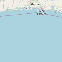
Map view of Banco National Park

Use this park location map to pinpoint Banco National Park in Ivory Coast, understand its exact geographic position, and read its mapped placement within the surrounding landscape more clearly.

Pigeon | © OpenStreetMap contributors

Location context for Banco National Park

Abidjan

Explore national park photography capturing dense primary forest canopies, rare hardwoods, and unique urban habitats.

Parc national du Banco Photos and Landscapes: Visualizing an Urban Rainforest

Visual documentation of Parc national du Banco reveals the dense tropical rainforest canopies and undulating terrain preserved within a major urban center. Examining these protected area views and habitat photographs helps researchers understand the striking contrast between old growth vegetation and surrounding metropolitan development.

A low angle view of a dense tropical rainforest canopy featuring tall trees draped with long hanging lianas and vines.

A close-up view of a large, deeply twisted, rope-like vine coiling vertically around a tropical rainforest tree trunk.

A dirt path crosses over a small concrete bridge within a dense tropical forest, with mud and green foliage visible on the sides.

A small pond with a wooden fence border in the foreground, with thick, lush green tropical rainforest rising in the background.

A large yellow sign reading PARC NATIONAL DU BANCO mounted on a gated metal fence, with green trees and a tall electrical transmission tower in the background.

A small green house with a light-colored roof tucked among tall bamboo stalks and dense tropical forest.

Park atlas

Compare regional park geography and connected protected landscapes

Explore Other Parks Near Parc National Du Banco And Related Protected Areas

Browsing other parks near Parc national du Banco reveals broader regional protected landscapes and diverse tropical environments. Continuing from this urban rainforest reserve allows comparison with connected forest ecosystems across the surrounding region.
National parkAbidjan
Park boundaries overlap#1 closest

South

Banco National Park National Park: Primary Forest Landscape and Abidjan Geography

Explore mapped boundaries and urban conservation.

Banco National Park is a globally significant protected area, uniquely preserving dense primary tropical forest within the urban sprawl of Abidjan, Ivory Coast. This national park offers critical insights into urban conservation, featuring rare tree species and providing essential ecosystem services like water supply and carbon sequestration for the surrounding region. Its landscape, characterized by the Gbangbo River and rare mahogany and avodire trees, forms a vital geographic element within the metropolitan atlas.

Area
30 km²
Established
1953
IUCN
II
Relief
Lowland
National parkIvory Coast
80 km away#2 closest

West

Assagny National Park: Ivory Coast's Protected Natural Landscape and Park Boundaries

Explore the mapped terrain and regional geography.

Assagny National Park is a significant protected area in Ivory Coast, functioning as a national park. This entry provides detailed information on its geographic setting, mapping its protected boundaries and surrounding natural landscapes. It serves as a resource for understanding the park's specific landscape character and its contribution to the regional geography of West Africa, offering an atlas-style exploration of its conservation significance.

Area
170 km²
Established
1981
IUCN
II
National parkIvory Coast
About 91 km away#3 closest

East

Îles Ehotilé National Park: A Protected Island Ecosystem within Ivory Coast's National Park Network

Explore its island terrain and mapped coastal geography.

Îles Ehotilé National Park stands as a protected island ecosystem within the national park system of Ivory Coast. This area is distinguished by its island landscapes, coastal zones, and the surrounding marine environments characteristic of the Gulf of Guinea. As a designated national park, it plays a crucial role in preserving unique West African island biodiversity and providing a mapped protected area for ecological study and appreciation. The park's conservation focus highlights the importance of safeguarding coastal habitats within the region.

Area
105 km²
Established
1974
IUCN
II
Relief
Lowland
Watercolor illustration of a tropical lagoon scene with palm trees on the banks, calm water, and a distant, hazy shoreline.
National parkComoé District
About 91 km away#4 closest

East

Parc national des îles Ehotilé: Geography and Protected Landscapes of the Aby Lagoon Archipelago

Coastal national park featuring unique estuarine terrain and mangrove ecosystems.

Parc national des îles Ehotilé preserves a rare six-island archipelago within the Aby lagoon. The area showcases diverse aquatic environments, including salt-tolerant mangrove forests and dense woodland habitats that support large fruit bat colonies and West African manatee populations. This protected landscape represents a critical estuarine intersection in southeastern Cote d'Ivoire, offering deep insight into the region's complex hydrological and botanical geography.

Area
105 km²
Established
1974
IUCN
II
National parkLagunes
About 91 km away#5 closest

West

Parc national d'Azagny: Protected Coastal Wetlands and Estuarine Terrain in Lagunes

Coastal wetland geography and savanna ecosystems in Côte d'Ivoire

Explore the unique estuarine geography of Parc national d'Azagny, a Ramsar site encompassing a dense mosaic of mangrove swamps, coastal savanna clearings, and tidal waterways. This protected area plays a crucial role in maintaining the ecological stability of the Lagunes region and supports a variety of species within its specialized low-lying habitats.

Area
194 km²
Established
1981
IUCN
II
Relief
Lowland
National parkWestern North Region
About 126 km away#6 closest

Northeast

Bia National Park: Ghana's Vital Protected Forest Landscape with West Africa's Tallest Trees

Explore the unique mapped geography and biodiversity of this key conservation area.

Bia National Park serves as a crucial protected landscape in Ghana's Western North Region, celebrated for harboring some of West Africa's tallest trees and a rich diversity of wildlife. This detailed entry provides context on its mapped boundaries and ecological significance as one of the last relatively untouched forest remnants in the region. Understand the park's place within Ghana's geography and its value for conservation research, showcasing its unique transitional forest ecosystem and the documented species it protects.

Area
563 km²
Established
1974
IUCN
II
Climate
Tropical
A soft watercolor painting of a pastoral landscape with a meandering river in the foreground, clumps of green trees, and layered rolling hills in the background.
Nature reserveIvory Coast
About 136 km away#7 closest

Northwest

Station d'écologie de Lamto: Nature Reserve and Protected Landscape in Ivory Coast

Examining the forest and savanna transition zone along the Bandama River

Station d'écologie de Lamto is a significant nature reserve situated at a unique ecological contact point in central Ivory Coast. This 2,500 hectare protected area encompasses Borassus palm savanna and gallery forest, serving as a landmark site for West African ecological research and the study of forest and savanna mosaic landscapes.

Area
25 km²
Established
1962
IUCN
Ia
Relief
Lowland
Nature reserveLôh-Djiboua
About 136 km away#8 closest

Northwest

Réserve botanique de Divo: Protected Forest Landscapes and Regional Geography in Lôh-Djiboua

Nature reserve featuring extensive forest restoration projects.

Discover the complex landscape of Réserve botanique de Divo, one of the oldest nature reserves in Côte d'Ivoire. Located in the Lôh-Djiboua region, this protected area represents a transition between remaining secondary forest fragments and agricultural land, serving as a primary site for international tropical forestry restoration efforts.

Area
68.02 km²
Established
1935
Relief
Lowland
Climate
Tropical

Common questions about visiting, size, designation, and location context for Banco National Park

Banco National Park FAQs for park facts, access, geography, and protected area context

Find quick answers about Banco National Park, including protected-area facts, park geography, trail and visitor context, and how the park fits into its surrounding country and regional landscape.
MoriAtlas Explorer

Continue Your Protected Areas Search Across the Global Atlas

Deepen your exploration by continuing the structured search for national parks and protected areas worldwide. Utilize the comprehensive filtering capabilities to compare different conservation landscapes and refine your understanding of global park geography. Discover more about the distribution and characteristics of protected natural areas.

Global natural geography