Mori Atlas logo
National parkParc national du Mont Péko

A critical protected massif within the Montagnes region, featuring diverse mountain flora and riverine corridors.

Parc national du Mont Péko: Mapping the Granite Inselbergs and Primary Mountain Rainforests

Parc national du Mont Péko stands as a significant protected area within the western highlands of Côte d'Ivoire. This mountain forest ecosystem preserves critical primary rainforest habitats, dramatic granite inselbergs, and cascading waterfalls that define the rugged terrain of the Montagnes District. It serves as an ecological anchor within the broader Sassandra River watershed, supporting distinct vegetation zones and varied wildlife populations across its compact, elevated landscape.

rainforestprimary forestmountain forestinselberggranite domeswaterfalls

Parc national du Mont Péko

National park

Park overview

Structured park overview, official facts, and landscape profile for Mont Péko National Park

Mont Péko National Park park facts, protected area profile, and essential visitor context

Review the core facts for Mont Péko National Park, including designation, size, terrain, visitor scale, habitats, and operating context in one park-focused overview.

About Mont Péko National Park

Mont Péko National Park is one of the most ecologically distinctive of Côte d'Ivoire's eight national parks, defined by the unique pairing of tall primary rainforest with exposed granite domes that rise sharply above the green canopy. Located between Bangolo and Duékoué in the Montagnes District of western Côte d'Ivoire, the reserve preserves roughly 34,000 hectares of terrain that includes the summit of Mont Péko and the neighboring peak of Mont Kahoué, the highest point in the massif at 967 meters.

The park's identity is shaped by its climate. The area falls within the equatorial zone of West Africa, with consistent warmth and humidity throughout the year, producing dense, multilayered forest that is regularly broken by bare granite outcrops. These inselbergs, with their smooth domed surfaces and sheer flanks, give the park a memorable visual signature and serve as ecological islands within the forest matrix. The southern and western portions of the park drain into the Sasandra River basin, while the broader middle Sasandra landscape, particularly the left bank upstream of Buyo, remains one of the most exceptional stretches of continuous forest in the country.

Ecologically, Mont Péko still functions as a meaningful sanctuary for large mammals. Although the park is relatively small and encircled by active village lands, the continued presence of elephants, leopards, buffaloes, duikers, and several primate species reflects the role that traditional local management and limited, culturally regulated hunting have played in keeping these populations viable. The forest itself is botanically diverse, with quantitative studies showing a clear structure of vegetation layers and dominance by families such as Fabaceae, Rubiaceae, Malvaceae, and Moraceae.

The park is also notable for its conservation challenges. It lies in a region historically dominated by cocoa cultivation, and over the decades large parts of its buffer have been converted to smallholder farms. Its protected designation since 1968, its inclusion in the national park system, and its representation in international databases such as the UNEP-WCMC World Database on Protected Areas underscore its continuing role as a refuge and research site for the rainforest heritage of western Côte d'Ivoire.

Quick facts and research context for Mont Péko National Park

Mont Péko National Park is located in western Côte d'Ivoire, within the Montagnes District, between the prefectures of Bangolo and Duékoué, with Bangolo serving as the nearest accessible town. The park covers about 34,000 hectares of primary rainforest and granite uplands, administered as a Category II protected area under the IUCN framework, and was legally established by decree on 9 February 1968.

The park takes its name from Mont Péko, which rises to about 833 meters, while a higher neighboring summit, Mont Kahoué, reaches 967 meters. The terrain belongs to the middle Sassandra River watershed, so the broader landscape blends rainforest, river valleys, and isolated granite domes, including a particularly striking inselberg that defines the park's skyline.

Protection and recognition

Examine the documented protection status and official recognition data for Parc national du Mont Péko.

Parc National Du Mont Péko Protection Status And Designated Area Facts

Examine the recorded protection status and administrative framework established for Parc national du Mont Péko. Review the official designation data and international records associated with this protected natural area.

Protection details

WDPA ID
724
Park context

Deeper park guide and search-rich context for Mont Péko National Park

Mont Péko National Park history, landscape, wildlife, and travel context

Explore Mont Péko National Park through its history, landscape character, ecosystems, wildlife, conservation priorities, cultural context, and seasonal travel timing in a structured park guide built for atlas discovery and search intent.

Why Mont Péko National Park stands out

Mont Péko is best known for its combination of primary rainforest and dramatic granite inselbergs rising abruptly from the canopy, giving the park a distinctive mountain forest character unusual in West Africa. The massif is also recognized for its waterfalls, dense mountain flora dominated by Fabaceae, Rubiaceae, Malvaceae, and Moraceae families, and for still sheltering large mammals such as forest elephants and leopards despite its compact size.

Mont Péko National Park history and protected-area timeline

Mont Péko owes its protected status to the broader Ivorian conservation effort that began in the mid-twentieth century to preserve the country's rapidly dwindling natural forests. Côte d'Ivoire established its national parks and natural reserves specifically to maintain representative forest ecosystems in their natural state, both for biodiversity and for scientific and educational purposes.

The Mont Péko massif was formally designated as a national park by Decree 68-69, issued on 9 February 1968. The decree aimed to protect the summit areas of Mont Kahoué, which reaches 967 meters, and Mont Péko itself, along with the surrounding forests, wildlife, and watersheds. The reserve was conceived as a long-term site for scientific study and environmental education, recognizing that the combination of mountain topography and primary forest created a particularly valuable natural laboratory.

Since its creation, the park has remained one of eight national parks in Côte d'Ivoire and has been catalogued in international protected-area databases, including the UNEP-WCMC World Database on Protected Areas under site identifier 724. Over time, however, the park's surrounding landscape has been transformed by the expansion of cocoa cultivation, putting increasing pressure on the reserve and making the historical role of the 1968 decree even more significant as a legal anchor for ongoing protection.

Mont Péko National Park landscape and geographic character

The landscape of Mont Péko is defined by the contrast between steep granite highlands and dense lowland rainforest. The massif rises abruptly from the surrounding plains, with the principal summits being Mont Péko at roughly 833 meters and Mont Kahoué at 967 meters, the latter forming the park's highest point. These elevations create a mountain rainforest setting that is uncommon elsewhere in Côte d'Ivoire.

The most striking landscape features are the inselbergs. These isolated granite domes emerge sharply from the forest canopy, exposing bare rock faces that contrast vividly with the surrounding greenery. Their smooth, weathered profiles and vertical walls define the park's skyline and provide one of its most recognizable visual signatures. Combined with natural waterfalls that cascade from the higher terrain, these granite formations give the park a uniquely scenic character.

Hydrologically, the park belongs to the Sasandra River watershed. Its streams feed the middle course of the Sasandra, which flows along the broader western Ivorian landscape, passing near the town of Buyo and continuing through exceptionally well-forested sections of its left bank, including the protected Haut-Sasandra classified forest. This riverine context links the park to one of the largest surviving contiguous forest corridors in the country, reinforcing its role as a key component of the regional landscape.

Mont Péko National Park ecosystems, habitats, and plant life

Mont Péko preserves a representative slice of the primary rainforest that once covered much of the western Côte d'Ivoire highlands. The park's vegetation is structured into clearly identifiable layers, from the dense understory up through the main canopy and emergent trees, shaped by the equatorial climate of consistent warmth and high humidity throughout the year.

Botanical surveys of the park have shown a hierarchical distribution of plant families. Fabaceae are the most dominant family in the reserve, followed by Rubiaceae, Malvaceae, and Moraceae, which together shape much of the park's forest composition. These families include many of the familiar large trees and lianas of West African rainforest, contributing to the closed, multilayered character of the canopy.

The combination of humid lowland forest and elevated terrain produces a mosaic of microhabitats around the granite outcrops. Forest cover extends up the slopes where soils permit, while rocky outcrops remain bare or carry specialized vegetation. The result is a heterogeneous ecological setting that supports both generalist rainforest species and more localized mountain forest flora, making the park an important reference site for studying primary tropical forest dynamics in West Africa.

Mont Péko National Park wildlife and species highlights

Despite covering a relatively modest area, Mont Péko supports an unusually rich mammal community for a park of its size. Forest elephants remain the most emblematic of the park's large mammals, moving through the primary forest between the granite domes. Leopards are also recorded within the reserve, alongside forest buffaloes, various duiker species (céphalophes), and several primates, including monkeys that thrive in the multilayered canopy.

This continued presence of large mammals is significant because the park is encircled by village lands and active agricultural fronts. The persistence of such fauna has been attributed to traditional local hunting practices that remain 'controlled' and oriented toward local consumption, rather than to commercial poaching pressures. In effect, cultural taboos and customary regulation appear to have acted as a partial buffer against the wildlife declines seen in many other parts of West Africa.

The park's smaller fauna, birds, reptiles, and insects are less documented in the available sources, but the integrity of the primary forest suggests that the reserve continues to support a wide range of forest-dependent species. The combination of intact habitat structure, large mammal presence, and limited but culturally regulated hunting makes Mont Péko a particularly notable refuge for wildlife survival in a heavily human-modified landscape.

Mont Péko National Park conservation status and protection priorities

Mont Péko holds an important place in Côte d'Ivoire's national conservation system. Established by decree in 1968 as one of the country's original national parks, it falls within IUCN Category II, signifying its recognition as a protected area managed primarily for ecosystem protection and recreation. Its inclusion in the UNEP-WCMC World Database on Protected Areas, under site number 724, reflects its continuing international profile.

The park was created expressly to conserve the forests, watersheds, and wildlife of the Mont Péko massif in their natural state, with stated scientific and educational objectives. That mission remains especially relevant given the historical expansion of cocoa cultivation across the surrounding landscape. While the park itself has remained officially protected, much of its broader buffer has been converted to smallholder agriculture, making the remaining primary forest inside the reserve an increasingly critical refuge.

The conservation significance of Mont Péko therefore lies both in what it preserves and in how that preservation has been achieved. The continued coexistence of large mammals with nearby human populations suggests that a model of culturally regulated, locally negotiated protection has played a meaningful role in maintaining biodiversity. At the same time, the park's vulnerability to agricultural encroachment underscores the ongoing importance of its protected status as a foundation for future restoration and landscape connectivity efforts in western Côte d'Ivoire.

Mont Péko National Park cultural meaning and human context

The territory of Mont Péko National Park is closely intertwined with the lives of the local communities in the Bangolo and Duékoué areas of western Côte d'Ivoire. The park is bordered by village lands (terroirs villageois) that have shaped long-standing relationships between local populations and the forest, including customary practices that regulate hunting and natural resource use.

These traditional governance practices appear to have influenced how wildlife has been managed inside the park, with hunting described as remaining 'controlled' and oriented toward local consumption rather than commercial exploitation. While the available sources do not provide detailed ethnographic narratives, this cultural dimension is meaningful: it suggests that the persistence of large mammals such as elephants, leopards, and primates inside the reserve is tied in part to relationships between people and forest that predate and overlap with formal conservation policy.

Top sights and standout views in Mont Péko National Park

Mont Péko's most distinctive highlights are its granite inselbergs rising sharply from unbroken primary rainforest, the multi-layered mountain flora dominated by Fabaceae and Rubiaceae families, and the natural waterfalls that descend from the higher slopes. The park is also notable for still harboring forest elephants, leopards, and duikers within a relatively compact area, and for being one of only eight national parks in Côte d'Ivoire, anchored in the watershed of the Sasandra River.

Best time to visit Mont Péko National Park

Mont Péko lies in an equatorial climate zone characterized by warmth and high humidity throughout the year, so seasonal variation is relatively muted compared to higher-latitude parks. The dry season months generally offer more comfortable conditions for hiking, exploring the inselbergs, and accessing the park's tracks, while the wetter periods intensify the lushness of the forest and the flow of its waterfalls.

Forest wildlife viewing can be productive year-round thanks to the dense canopy, though drier months tend to make animal signs along tracks and water edges easier to observe. Visitors planning to combine forest exploration with viewing the peaks and waterfalls may find that the early dry period offers a good balance between accessibility and landscape vibrancy.
Monthly climate preview

Monthly precipitation data and long term weather patterns recorded at representative park elevations

Parc national du Mont Péko climate normals and temperature rhythms

Representative coordinate records show average monthly temperatures ranging from 23.77 to 26.73 degrees Celsius alongside variable daily precipitation rates across the annual cycle. Reviewing the complete twelve month profile provides deeper insight into measured long term climate normals for this protected area.
Annual mean25 °C
24 °C27 °C
Jan25°
Feb26°
Mar27°
Apr27°
May26°
Jun25°
Jul24°
Aug24°
Sep24°
Oct25°
Nov25°
Dec25°
Warmest month
March

26.7 °C

Coolest month
August

23.8 °C

Wettest month
September

7.7 mm/day

Driest month
January

0.5 mm/day

Park location guide

Geography guide, regional context, and park location map for Mont Péko National Park

Mont Péko National Park park geography, regions, and map view in Ivory Coast

Understand where Mont Péko National Park sits in Ivory Coast through a broader geographic reading of the surrounding landscape, nearby location context, and its mapped position within the national park landscape.

How Mont Péko National Park fits into Ivory Coast

Ivory Coast, officially the Republic of Côte d'Ivoire, is a West African country with a coastline on the Gulf of Guinea. It gained independence from France in 1960 and is now a presidential republic. The country is a major producer of cocoa and coffee, with Abidjan serving as its largest city and economic hub, while Yamoussoukro is the official capital.

Wider geography shaping Mont Péko National Park in Ivory Coast

Ivory Coast is situated on the southern coast of West Africa along the Gulf of Guinea. It borders Guinea to the northwest, Liberia to the west, Mali to the northwest, Burkina Faso to the northeast, Ghana to the east, and the Atlantic Ocean to the south. The terrain includes coastal plains, interior highlands, and forested regions.

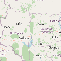
Map view of Mont Péko National Park

Use this park location map to pinpoint Mont Péko National Park in Ivory Coast, understand its exact geographic position, and read its mapped placement within the surrounding landscape more clearly.

Pigeon | © OpenStreetMap contributors

Location context for Mont Péko National Park

Montagnes
Park atlas

Compare regional mountain rainforests and surrounding West African conservation landscapes

Explore Protected Areas and Parks Near Parc national du Mont Péko

Continue exploring regional park geography by comparing protected areas adjacent to Parc national du Mont Péko. Examining these neighboring ecosystems provides a broader perspective on the forested highlands and river basins of western Côte d'Ivoire.
National parkIvory Coast
About 2.9 km away#1 closest

Northeast

Mont Péko National Park: Ivory Coast National Park with Mapped Boundaries

Explore its protected landscape and regional geography.

Delve into Mont Péko National Park, a designated national park within Ivory Coast, to understand its unique protected landscape. This entry facilitates detailed atlas exploration, focusing on its geographic placement, mapped boundaries, and contribution to the regional natural terrain. Discover the essence of this protected area through its mapped geography and landscape identity.

Area
340 km²
Established
1968
IUCN
II
Relief
Mountain
A watercolor painting depicting a soft-focus landscape with rolling green hills in the distance and a band of trees in the middle ground.
National parkDistrict des Montagnes
About 97 km away#2 closest

South

Parc national de Taï: Primary Rainforest and Protected Terrain in District des Montagnes

Mapping intact forest corridors and major drainage systems

Parc national de Taï encompasses a vast, primary evergreen rainforest landscape that anchors the Upper Guinea forest block. This protected area features a complex topography of hills, plateaus, and permanent rivers, providing a vital habitat and a major site for scientific research in Côte d'Ivoire.

Area
4,540 km²
Established
1973
IUCN
II
Relief
Lowland
National parkIvory Coast
About 97 km away#3 closest

South

Taï National Park: A Primary Rainforest Protected Area in Ivory Coast

Explore mapped boundaries and critical primate habitats in West Africa.

Taï National Park in Ivory Coast stands as a monumental protected landscape, comprising the largest contiguous area of primary rainforest remaining in West Africa. Its designation as a national park highlights its critical role in preserving biodiversity and unique geographic features. Users exploring this destination can delve into its mapped terrain, understand its regional landscape context within Ivory Coast, and appreciate its significance as a vital habitat for endangered species and an integral part of the Upper Guinean forest ecosystem.

Area
3,300 km²
Established
1972
IUCN
II
Relief
Upland
National parkIvory Coast
About 108 km away#4 closest

North

Mont Sângbé National Park National Park: Ivory Coast Protected Area Geography and Map Exploration

Explore the mapped natural landscape of Mont Sângbé National Park.

Mont Sângbé National Park is a protected national park offering a unique geographic perspective within Ivory Coast. This entry facilitates exploration of its mapped boundaries and regional landscape context, contributing to a broader understanding of protected areas in West Africa through structured atlas data. Discover the essential geographic elements that define this conservation landscape.

Area
950 km²
Established
1976
IUCN
II
Relief
Mountain
National parkMontagnes
About 108 km away#5 closest

North

Parc national du Mont Sangbé: A Rugged Highland Protected Area in the Montagnes District

Mountain forest landscape and highland topographic discovery.

Parc national du Mont Sangbé defines a major mountainous landscape within Côte d'Ivoire, characterized by an elevation profile that hosts fourteen summits above 1,000 meters. This protected area serves as an essential habitat for forest wildlife and supports a continuous tree canopy that shapes the ecology of the Montagnes region. Its unique highland topography makes it a primary subject for mapping the diverse physical geography and conservation zones of West Africa.

Area
950 km²
Established
1975
IUCN
II
Relief
Mountain
A minimalist watercolor painting depicting a soft green savanna landscape with scattered trees, rolling hills, and a central waterway, isolated on a white background.
National parkSassandra-Marahoué
About 136 km away#6 closest

East

Parc national de la Marahoué: Sassandra-Marahoué Protected Landscape and River Atlas

Analyzing the savanna and forest mosaic of Côte d'Ivoire

Parc national de la Marahoué represents a critical ecological junction in Côte d'Ivoire, spanning over 100,000 hectares along the Marahoué River. This protected area offers an analytical look at the intersection of Sudano-Guinean savanna and humid forest biomes, providing a unique case study in West African conservation landscapes and biodiversity patterns within the Sassandra-Marahoué region.

Area
1,010 km²
Established
1968
IUCN
II
Scope
Terrestrial
National parkSassandra-Marahoué District
About 136 km away#7 closest

East

Marahoué National Park: Geographic and Protected Landscape Analysis in Central Ivory Coast

Examining the ecological terrain within the Sassandra-Marahoué District

Marahoué National Park occupies a transitional zone where forest remnants meet savanna grasslands in the heart of Ivory Coast. This analysis explores the park's geographic boundaries along the Marahoué River and the shifting habitats that continue to sustain a notable variety of bird species within this protected district.

Area
1,000 km²
Established
1968
IUCN
II
Relief
Upland
Protected areaNimba County
About 148 km away#8 closest

West

Nimba National Forest: Protected Mountain Landscape & Bird Area in Nimba County

Explore mapped boundaries and regional geographic context.

Nimba National Forest, a protected area of approximately 187 square kilometers, is defined by its mountainous terrain in Nimba County, Liberia. Situated at the tri-border region with Guinea and Ivory Coast, this forest is recognized for its importance as a habitat for diverse bird species and its role in regional conservation efforts. Discover its mapped landscape, its position within the Nimba Range, and its ecological significance within West Africa's protected natural areas.

Area
187 km²
IUCN
VI
Access
Access unknown
Scope
Terrestrial

Common questions about visiting, size, designation, and location context for Mont Péko National Park

Mont Péko National Park FAQs for park facts, access, geography, and protected area context

Find quick answers about Mont Péko National Park, including protected-area facts, park geography, trail and visitor context, and how the park fits into its surrounding country and regional landscape.
MoriAtlas Explorer

Continue Your Protected Areas Search Across the Global Atlas

Deepen your exploration by continuing the structured search for national parks and protected areas worldwide. Utilize the comprehensive filtering capabilities to compare different conservation landscapes and refine your understanding of global park geography. Discover more about the distribution and characteristics of protected natural areas.

Global natural geography