Mori Atlas logo
Nearby park discovery

Geographic analysis of neighboring protected lands and regional environmental connectivity

Protected Areas and Natural Landscapes near Parc naturel des Deux Ourthes in the Belgian Ardennes

Examine the geographic distribution of protected areas located in the vicinity of Parc naturel des Deux Ourthes. This regional analysis provides spatial context for surrounding forested valleys, high plateaus, and river-carved landscapes within the Belgian Ardennes, allowing for a structured comparison of protected land boundaries and terrain characteristics throughout the province of Luxembourg.

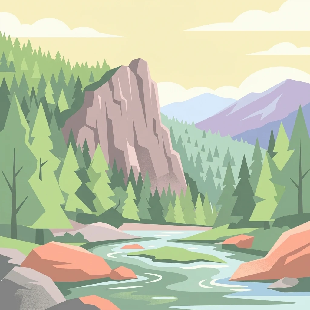
A flat vector illustration showing a winding river flowing through a forested valley with a large craggy cliff face in the foreground and rolling mountains in the distance.

An Ardennes nature park in Wallonia, shaped by the twin branches of the Ourthe and its forested high plateaus.

Parc naturel des Deux Ourthes

The Parc naturel des Deux Ourthes is a large protected natural area in the Belgian Ardennes, located in the northeastern part of the province of Luxembourg in Wallonia. The park takes its name from the two branches of the Ourthe river, the Eastern Ourthe and the Western Ourthe, both of which rise within the protected territory before joining to form a single meandering river that flows on toward La Roche-en-Ardenne. Spread across six communes, the park protects a varied Ardennes landscape of forested valleys, high plateaus covered with heath and peatlands, meandering river gorges, and extensive mixed woodlands. It includes some of the most characteristic sites of the Belgian Ardennes, from the dramatic cliffs of the Rocher du Hérou to the open peat plateaus of Mochamps and the Hautes Fagnes-style environments of the Plateau des Tailles. Beyond its natural interest, the park supports a rich network of marked hiking trails, including major long-distance routes, and has been recognized for its importance to bird conservation. It is a defining element of the Ardennes experience in Wallonia, combining ecological value, scenic appeal, and outdoor recreation within a single coherent natural territory.

Location
Belgium
Park type
Protected landscape
Established
2001
Area
760 km²
Highest point
651 m
Parc naturel des Deux Ourthes Landscape Atlas
Regional park map

See the ranked park cluster in its geographic setting

Nearby parks around Parc naturel des Deux Ourthes

This regional map shows the same 20 nearby parks ranked below around Parc naturel des Deux Ourthes. Select a ranked marker to highlight that park’s boundary where boundary data is available.
Reference park: Parc naturel des Deux OurthesRanked nearby parkSelected boundary: Parc naturel des Deux Ourthes20 nearby parks shown
20 nearby parks

Explore surrounding protected landscape patterns and regional park geography by measured distance

Ranked Parks and Protected Areas Geographically Near Parc naturel des Deux Ourthes

Examine the ranked collection of protected areas located geographically near Parc naturel des Deux Ourthes using direct boundary measurements and directional separation. Compare surrounding regional environments and conservation contexts to analyze broader habitat patterns across the broader territory.
Nature reserveRhineland-Palatinate
About 13 km away#1 closest

East

Mittleres Ourtal zwischen Dreiländereck und Rellesmühle Protected Area and River Valley

Eifel region river geography and cross-border nature reserve

The Mittleres Ourtal zwischen Dreiländereck und Rellesmühle nature reserve serves as a critical ecological spine within the Eifelkreis district of Rhineland-Palatinate. It protects an undisturbed stretch of the Our river, integrating aquatic channels, riparian wetlands, and forest slopes into a single, cohesive landscape that supports diverse plant and animal populations across an international boundary.

Area
4.9 km²
Established
1989
A soft watercolor illustration of a gentle winding river flowing through a green, rolling landscape with scattered trees and distant, hazy hills.
Regional parkProvince de Luxembourg
About 20 km away#2 closest

South

Parc naturel Haute-Sûre Forêt d'Anlier: Regional Park and Protected Forest Landscapes

Geography and mapped river basins of the Belgian Ardennes

Covering over 800 square kilometers, this regional park protects the significant deciduous woodlands of the Anlier massif and the Sûre river valleys. Analyze the geographic scope of this Natura 2000 protected area, tracing its upland terrain and dense riparian networks across the municipalities of the Belgian Ardennes.

Area
833 km²
Established
2001
Water
Major water bodies
Watercolor illustration of a landscape with rolling hills, a river, and green vegetation
Protected areaProvince of Luxembourg
21 km away#3 closest

Southwest

Gaume Natural Park: A Protected Area Defining the Landscape of Province of Luxembourg

Explore its mapped natural landscape and geographic context.

Gaume Natural Park is a protected area offering a unique perspective on the natural landscapes found within Belgium's Province of Luxembourg. As a key geographic entity, it provides a vital component for atlas exploration, showcasing distinct mapped boundaries and regional terrain. Understand its significance as a protected natural space contributing to the Ardennes region's extensive geography, making it an essential point for structured discovery of protected lands.

Area
581.04 km²
Established
2014
IUCN
V
Relief
Lowland
Protected landscapeProvince de Luxembourg
About 27 km away#4 closest

South

Parc naturel de la Vallée de l'Attert: Geography and Protected Landscape Analysis

Mapping the rural bocage and river corridors of southeastern Belgium

Understand the landscape composition of Parc naturel de la Vallée de l'Attert, a protected area bridging the Ardennes and Lorraine regions. This analysis covers the park's semi-bocage structure, alluvial river corridors, and the ecological transition defined by its unique regional geography.

Area
70.95 km²
Established
1994
Relief
Mixed relief
Climate
Temperate
A soft watercolor painting of a rolling countryside landscape featuring green trees, pink flowering bushes, and a meadow under a bright, light-filled sky.
Nature reserveRhineland-Palatinate
30 km away#5 closest

East

Schönecker Schweiz Protected Area: An Atlas of the Eifel Limestone Basin Geography

Mapping the karst terrain, dolomite ridges, and submontane habitats of Rhineland-Palatinate.

Schönecker Schweiz stands as a defining example of the Prüm Kalkmulde, showcasing a dense network of steep slopes, plateau uplands, and narrow gorge valleys. This nature reserve serves as an essential refuge for rare calcareous flora and fauna, anchored by a geologically significant dolomite bedrock. The area is marked by striking landforms, including exposed rock faces, swallow holes, and stream meadows, which collectively provide a primary reference site for submontane limestone geography in western Germany.

Area
8.65 km²
Established
1991
Relief
Upland
Scope
Terrestrial
Watercolor illustration showing a soft-focus landscape with rolling green hills, a winding stream, and hints of red floral color against a light background.
Nature reserveNordrhein-Westfalen
31 km away#6 closest

Northeast

Naturschutzgebiet Perlenbach-Fuhrtsbachtal: Geographic Atlas and Protected Area Context

Mapped brook valleys and rare Eifel wetland habitats

The Naturschutzgebiet Perlenbach-Fuhrtsbachtal protects a distinctive valley system near the Eifel plateau. This area is recognized for its cold, humid microclimate and diverse habitats, ranging from spring-fed fens to ancient meadow systems. Beyond its rare floral displays, the reserve serves as a critical refuge for freshwater pearl mussels and ice-age butterfly relict species, illustrating the intersection of regional geography and conservation.

Area
3.4 km²
Established
1976
IUCN
IV
Relief
Upland
Nature reserveRhineland-Palatinate
About 32 km away#7 closest

East

Niesenberg bei Weinsheim Nature Reserve: Geography and Protected Area Overview

Dolomite hill and calcareous grassland in Rhineland-Palatinate

Niesenberg bei Weinsheim is a protected nature reserve located in the Eifel region of Germany, centered on a distinct dolomite hill. The reserve protects a fine-grained mosaic of semi-natural dry grasslands and pine stands that contrast sharply with the surrounding slate uplands. Its unique soil chemistry supports a specialized array of flora, making it an essential point of study for understanding the biodiversity of the Prüm Limestone Basin.

Area
0.085 km²
Established
1985
Relief
Upland
Climate
Temperate
Watercolor illustration of rolling green hills and meadows with patches of pink and yellow flowers
National parkNorth Rhine-Westphalia
33 km away#8 closest

Northeast

Eifel National Park: North Rhine-Westphalia Protected Area Atlas

Explore mapped boundaries and regional geography.

Gain a structured understanding of Eifel National Park, a key protected area within Germany's North Rhine-Westphalia region. This page focuses on its geographic identity, detailing mapped boundaries and offering context within the state's broader natural landscapes. MoriAtlas enhances your exploration by presenting Eifel National Park as a distinct entity within a larger geographic framework, ideal for atlas-based research and understanding protected land distribution.

Area
107 km²
Established
2004
IUCN
II
Relief
Upland
A soft watercolor painting of a rolling landscape with gentle hills, distant mountain ridges, and a foreground of trees and meadows.
Nature reserveNorth Rhine-Westphalia
About 34 km away#9 closest

Northeast

Lewertbach mit Nebenbächen Nature Reserve: A Detailed Geographic and Landscape Atlas Profile

Examining the Nordeifel stream system and protected pastoral habitats

Located in the Euskirchen district, Lewertbach mit Nebenbächen protects a diverse mosaic of naturally flowing brooks and hedgerow-structured pastures. The reserve functions as a key component of the regional FFH habitat network, showcasing the delicate balance between aquatic drainage lines and traditional lowland meadow landscapes across three distinct parcels.

Area
0.713 km²
Established
2001
IUCN
IV
Protected landscapeBelgium
About 36 km away#10 closest

Northeast

Hohes Venn, Eifel Nature Park: A Protected Landscape in Belgium for Geographic Atlas Exploration

Explore mapped natural terrain and protected area details.

The Hohes Venn, Eifel Nature Park in Belgium represents a key protected landscape for atlas and geographic discovery. This entry focuses on the park's specific identity, its geographic setting within Belgium, and the value it holds for users interested in mapped terrain and protected area exploration. Understand the landscape context and the detailed geographic information available for this significant natural area, supporting structured learning about Belgium's conservation efforts.

IUCN
V
A soft watercolor illustration of a rolling green landscape with flowering trees and distant forested hills, isolated on a white background.
Nature reserveNordrhein-Westfalen
About 37 km away#11 closest

Northeast

Kluckbachtal Nature Reserve: Geographic Atlas and Protected Stream Valley Overview

Mapped riparian forest and orchard meadow habitats in Nordrhein-Westfalen

Kluckbachtal protects a distinctive valley segment between Rohren and Höfen, featuring a complex of stream beds, wet grasslands, and old oak and alder woodland. This nature reserve is recognized for its significant role in preserving Red List species and traditional cultural landscapes, offering a detailed look at the ecology of the northern Eifel region through its varied habitats.

Area
1.13 km²
Established
1997
IUCN
IV
Relief
Upland
A watercolor painting depicting a soft, panoramic landscape of a meandering stream valley with rolling hills, meadows, and scattered patches of trees.
Nature reserveNordrhein-Westfalen
About 37 km away#12 closest

Northeast

Kleines Laufenbachtal Nature Reserve: Geographic Atlas of an Eifel Stream Valley

Protected brook habitats and natural rock landscapes in North Rhine-Westphalia

Investigate the topographical features and habitat diversity of Kleines Laufenbachtal, an established nature reserve in the Eifel. This protected area showcases a dense assembly of wet grasslands, reed banks, and rocky slopes that anchor local ecological corridors within the Monschau landscape.

Area
0.13 km²
Established
1997
IUCN
IV
A soft watercolor illustration featuring distinctive sandstone rock formations in the foreground with rolling hills and a forested landscape in the distance.
Nature reserveNoumer
About 37 km away#13 closest

Southeast

Eechelbuer-Lock: Protected Sandstone Plateau and Archaeological Landmark in Central Luxembourg

A unique nature reserve in the Noumer region with rare geological formations.

Eechelbuer-Lock serves as a vital protected landscape that blends geological oddity with archaeological depth. Located in Noumer, this sandstone plateau hosts the iconic Champignon rock and provides essential habitats for dry heath and juniper thickets. The site offers a clear view into central Luxembourg's protected geography, featuring a trapezoidal expanse where ancient stone carvings and prehistoric occupation sites remain preserved within the modern nature reserve boundaries.

Established
1972
Relief
Upland
Climate
Temperate
Scope
Terrestrial
A pale, minimalist watercolor painting showing a soft-focus landscape with green trees in the foreground, rolling hills in the background, and hints of pink in the foreground foliage.
Protected areaGermany
About 38 km away#14 closest

Northeast

Holderbachtal, Dürholderbachtal: Protected Area Geography and Landscape Mapping in Germany

Integrated stream valley and wetland habitat analysis

Holderbachtal, Dürholderbachtal covers 187 hectares of diverse terrain in Germany, blending alder swamp forests with species-rich grasslands. This protected area offers deep insight into the valley-bound ecology and hydrological characteristics that define the Eifel region. Explore the connection between the primary stream systems, spring mires, and the surrounding woodland mosaic in this structured geographic overview.

Nature reserveNorth Rhine-Westphalia
About 38 km away#15 closest

Northeast

Simmeler Bach Nature Reserve: Geographic Atlas and Protected Landscape Overview

Riparian stream valleys and forest habitats in North Rhine-Westphalia

Simmeler Bach serves as a vital nature reserve and restored stream corridor in the Eifel district of Euskirchen. The protected area features a diverse landscape including open wet meadows, alder-lined brook banks, and rare mat-grass sward, all integrated into a wider regional network of conserved riparian habitats across western Germany.

Area
1.086 km²
Established
2001
Relief
Upland
Climate
Temperate
A horizontal watercolor painting showing a soft, stylized landscape with rolling green hills, distant purplish ridges, and grassy foreground elements on a white background.
Nature reserveNordrhein-Westfalen
About 39 km away#16 closest

Northeast

Mittleres Rurtal mit den Felsbildungen der Perdsley und Wiselsley Protected Nature Reserve Map

Exploring the Rur valley river dynamics and cliff geology

Investigate the topographical features of the Mittleres Rurtal mit den Felsbildungen der Perdsley und Wiselsley, a critical nature reserve characterized by free flowing river segments and steep ravine forests. This overview outlines the ecological distribution of rock formations and riparian habitats across the Monschau region landscape.

Area
1.33 km²
Established
2003
IUCN
IV
Nature reserveNordrhein-Westfalen
About 39 km away#17 closest

Northeast

Wüstebachtal Nature Reserve: Protected Eifel Valley and Wetland Landscapes

Hydrological geography and upland meadow ecosystems in Nordrhein-Westfalen

Wüstebachtal represents a quintessential Eifel nature reserve where the convergence of flowing stream corridors and species-rich meadows creates a unique habitat for threatened flora. This protected area focuses on the conservation of the Wüstebach valley, maintaining vital connections between alpine-style meadow communities and forest-fringed wetlands within the North Rhine-Westphalia region.

Area
0.834 km²
Established
1997
IUCN
IV
Watercolor illustration showing a winding river flowing through a lush green valley with distant hills under a soft pink and yellow sky.
Nature reserveGrand Est
About 41 km away#18 closest

West

Réserve naturelle nationale de la pointe de Givet: Protected Nature Reserve and Geological Atlas

Limestone cliffs, Meuse valley geography, and botanical enclaves in Grand Est

Covering 354 hectares of fragmented terrain, this nature reserve protects a vital corridor of limestone pavements, rocky scree, and dry grasslands. It hosts the internationally recognized Givétian geological stage and provides critical habitat for protected southern plant species. The area offers a distinct geographic profile where medieval fortifications and Vauban military history intersect with specialized forest and cave ecosystems along the Meuse river.

Area
3.54 km²
Established
1999
IUCN
III
Relief
Upland
Watercolor painting of a soft, hazy landscape featuring rolling hills and marshy wetlands in muted green and yellow tones.
Nature reserveNorth Rhine-Westphalia
About 42 km away#19 closest

Northeast

Kalltal Nature Reserve: Protected Stream Valley and Eifel Landscape in North Rhine-Westphalia

Ecological corridor with rare bog habitats and wet meadows.

Kalltal protects a stretch of the Kall stream, creating a haven for moisture-dependent plant species and wildlife within the Monschau municipality. Its terrain is defined by soft wet grasslands, peat-rich depressions, and small forest patches that form an intact ecological refuge within the broader German landscape.

Area
0.545 km²
Established
1998
IUCN
IV
A soft watercolor illustration showing a hazy, green landscape with a winding stream, distant hills, and low-lying vegetation on a white background.
Nature reserveNordrhein-Westfalen
About 43 km away#20 closest

Northeast

Kranzbach und Kranzbruchvenn: Protected Nature Reserve and Bog Landscape in Nordrhein-Westfalen

Wetland stream valleys and historic military relic landscapes

Investigate the specialized wetland ecosystems of Kranzbach und Kranzbruchvenn, a nature reserve in Nordrhein-Westfalen known for its bog and fen habitats. The site offers a detailed case study of small-stream hydrology and the transformation of former Westwall dragon teeth structures into unique marsh environments.

Area
0.328 km²
Established
2002
IUCN
IV
Distance methodology

Geographic measurements, not driving distances

How nearby park distances are calculated

Distances use park boundaries whenever the available geometry allows it. When one or both boundaries are missing, the mapped park locations provide a clearly labelled estimate. Every value represents straight-line geographic separation and does not use roads or routing.

Boundary distance

Calculated between the nearest points of both park boundaries.

Location-to-boundary estimate

Estimated from one mapped park location to the nearest boundary of the other park.

Mapped-location estimate

Estimated between the mapped locations of both parks.

MoriAtlas Explorer

Analyze the Protected Landscape and Geography of Parc naturel des Deux Ourthes

Continue your study of Belgian protected areas by exploring the detailed geographic layout and territorial boundaries of Parc naturel des Deux Ourthes. MoriAtlas provides a clear map-based context for the Ardennes, detailing the interplay between river-carved valleys and elevated heathland plateaus across this unique conservation region.