
Mori Atlas logo
Regional parkParc naturel des Vallées de la Burdinale et de la Mehaigne

Examining the confluence of river valley ecosystems and traditional agricultural land in Belgium

Parc naturel des Vallées de la Burdinale et de la Mehaigne: Regional Protected Landscape Atlas

Parc naturel des Vallées de la Burdinale et de la Mehaigne serves as a regional natural park that protects the gentle topography and working rural terrain of the Hesbaye heartland. This atlas resource maps the intersection of the Mehaigne and Burdinale river valleys with expansive plateau agriculture, illustrating the ecological integration of Natura 2000 sites across the Province de Liège. The landscape is characterized by its authentic Walloon villages, historic water-driven infrastructure, and a finely textured mosaic of meadows, woodlands, and arable fields.

regional natural parkWalloniaHesbayeriver valleyagricultural landscaperural villages
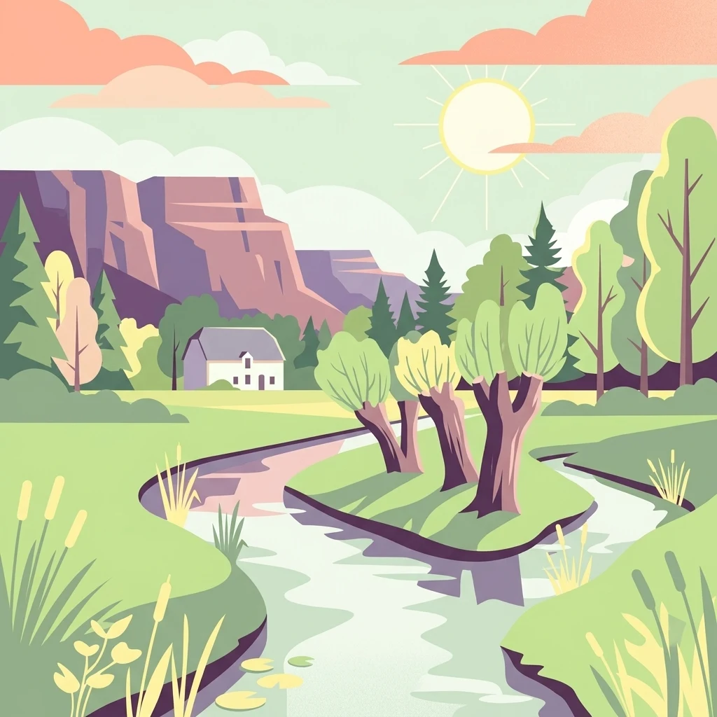
A flat-design, colorful illustration of a winding river flowing through a lush green valley with trees, a small house, and cliffs in the background under a warm sun.

Parc naturel des Vallées de la Burdinale et de la Mehaigne

Regional park

Park overview

Structured park overview, official facts, and landscape profile for Parc naturel des Vallées de la Burdinale et de la Mehaigne

Parc naturel des Vallées de la Burdinale et de la Mehaigne park facts, protected area profile, and essential visitor context

Review the core facts for Parc naturel des Vallées de la Burdinale et de la Mehaigne, including designation, size, terrain, visitor scale, habitats, and operating context in one park-focused overview.

About Parc naturel des Vallées de la Burdinale et de la Mehaigne

The Parc naturel des Vallées de la Burdinale et de la Mehaigne is one of the recognized natural parks of Wallonia, the French-speaking southern region of Belgium. Located in the northern part of the province of Liège, it occupies a broad swathe of the Hesbaye plateau, a traditional agricultural region known for its fertile soils and its characteristic mosaic of fields, hedgerows, small woodlands, and scattered villages.

The park's identity is closely tied to its hydrography. The Mehaigne, a small river typical of the Hesbaye region, and its tributary the Burdinale cut shallow valleys through the surrounding plateau, creating gentle relief, varied soil conditions, and ecologically richer habitats along the watercourses. These valleys, rather than dramatic peaks or wild coastline, define the landscape character of the protected area and give the park its name. The territory stretches across roughly 11,000 hectares and reaches into twenty-two villages and hamlets, distributed among the municipalities of Braives, Burdinne, Héron, and Wanze.

Culturally, the park is notable for the density of authentic rural settlements it encompasses. These villages reflect long-standing Walloon rural building traditions, including stone farmhouses, small churches, chapels, and other heritage features that contribute to the region's distinctive character. The natural park framework explicitly seeks to maintain harmony between conservation and the continuation of agricultural activity, recognizing that the landscape has been shaped over centuries by farming practices and remains a working countryside rather than a purely wild space. Specific sites within the park, notably stretches of the Burdinale and Mehaigne valleys, have been integrated into the European Natura 2000 network, lending the area broader conservation significance as habitats of community interest.

Overall, the park serves as both a protected landscape and a regional identity marker for this part of Hesbaye. It combines ecological functions, cultural heritage preservation, and support for rural life, offering a model of conservation that is firmly rooted in the everyday landscape of the Walloon countryside.

Quick facts and research context for Parc naturel des Vallées de la Burdinale et de la Mehaigne

The Parc naturel des Vallées de la Burdinale et de la Mehaigne covers approximately 11,000 hectares in the Hesbaye region of the province of Liège, Belgium. It is one of the regional natural parks of Wallonia and was formally classified as a natural park in 1991. Its territory spans parts of the municipalities of Braives, Burdinne, Héron, and Wanze, and includes twenty-two villages and hamlets within the triangle formed by Huy, Andenne, and Hannut. The park's two namesake rivers, the Mehaigne and its tributary the Burdinale, run through the protected area, and selected zones are included in the European Natura 2000 network of protected sites of community interest.

Protection and recognition

Documented terrestrial protection scope and official recognition data

Parc naturel des Vallées de la Burdinale et de la Mehaigne Protection Status

Parc naturel des Vallées de la Burdinale et de la Mehaigne holds a documented terrestrial protection scope within its regional conservation boundaries. Official records organize the administrative protection status and management data for structural atlas evaluation.

Protection details

Protection scope
Terrestrial
Transboundary protection
No
Park context

Deeper park guide and search-rich context for Parc naturel des Vallées de la Burdinale et de la Mehaigne

Parc naturel des Vallées de la Burdinale et de la Mehaigne history, landscape, wildlife, and travel context

Explore Parc naturel des Vallées de la Burdinale et de la Mehaigne through its history, landscape character, ecosystems, wildlife, conservation priorities, cultural context, and seasonal travel timing in a structured park guide built for atlas discovery and search intent.

Why Parc naturel des Vallées de la Burdinale et de la Mehaigne stands out

The park is best known for its two namesake river valleys, the Mehaigne and the Burdinale, which carve a gently rolling agricultural landscape in the Hesbaye heartland of Wallonia. It is recognized as a regional natural park where ecological protection and traditional rural land use are explicitly balanced, with several valley areas recognized under the European Natura 2000 framework. The territory is also valued for its concentration of authentic Walloon villages and a significant architectural and cultural heritage that sits within an actively working countryside.
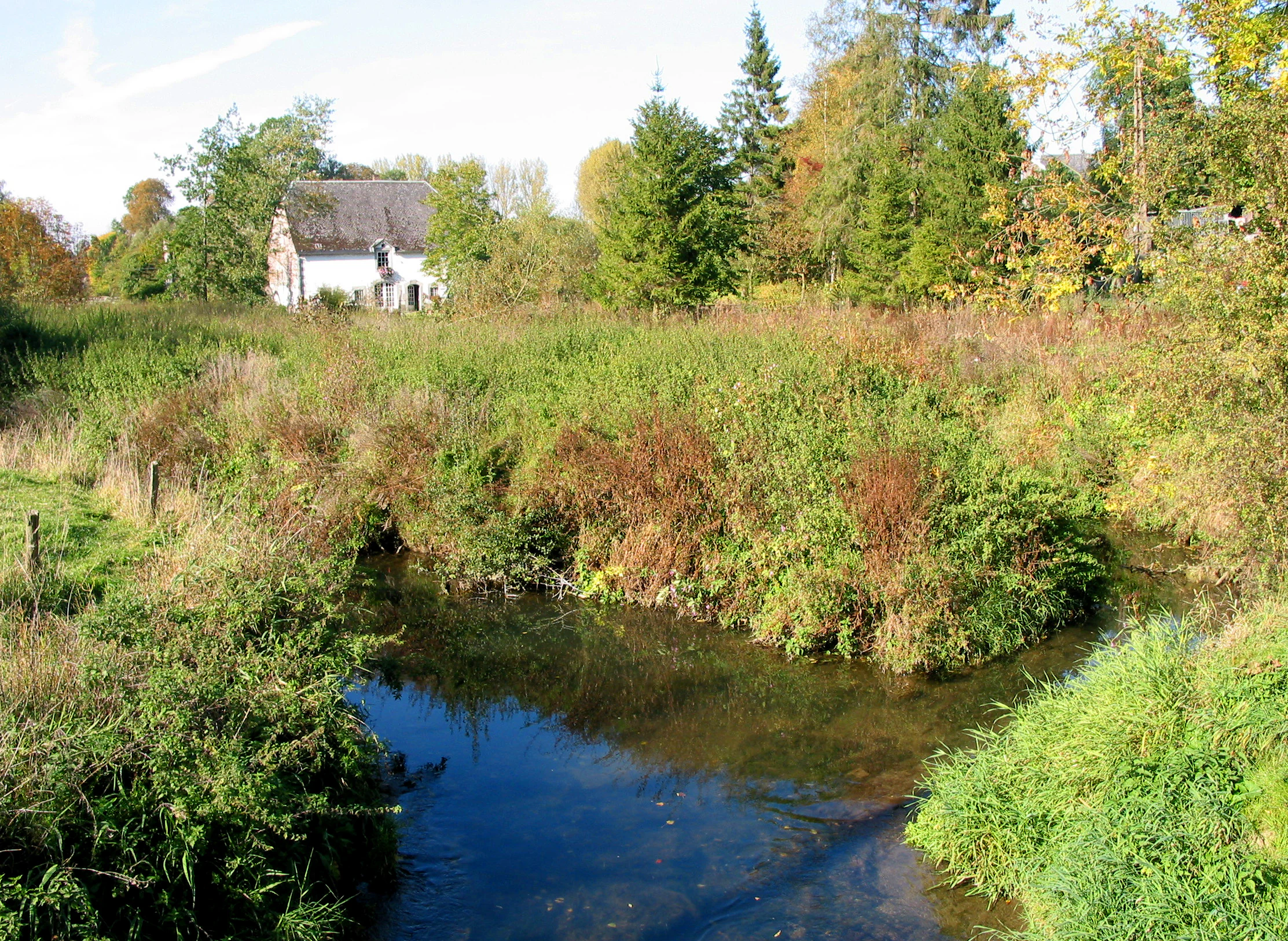
A peaceful stream winds through lush green vegetation and trees, with a stone house visible in the background.
The Mehaigne river flowing past a historic building in Braives.

Parc naturel des Vallées de la Burdinale et de la Mehaigne history and protected-area timeline

The period leading up to the formal designation of the park saw the gradual recognition of the Burdinale and Mehaigne valleys as a coherent territory of natural and cultural importance, shaped by centuries of agricultural use and characterized by a network of traditional villages.

In 1991, the area was officially classified as a natural park under the Walloon system of regional natural parks, establishing a formal framework for coordinating conservation, landscape management, and rural heritage protection across the territory. This designation reflected the desire to protect the area's hydrological, ecological, and cultural assets while supporting the continuation of agricultural activity that defines the region.

A subsequent milestone came with the integration of selected zones of the park into the European Natura 2000 network. This step extended the significance of the territory beyond the regional scale, recognizing particular stretches of the Burdinale and Mehaigne valleys as sites of community interest within the broader European network of protected natural areas. Since then, the park has continued to function as a working protected landscape where environmental, agricultural, and heritage goals are pursued in parallel.

Parc naturel des Vallées de la Burdinale et de la Mehaigne landscape and geographic character

The landscape of the park is defined by the gentle topography of the Hesbaye region, where broad stretches of cultivated plateau are interrupted by the shallow valleys cut by the Mehaigne river and its tributary the Burdinale. These valleys introduce the most distinctive relief of the area, with sloping meadows, riparian vegetation, and small watercourses running through a predominantly agricultural plateau.

Rather than offering dramatic landforms, the park presents a finely textured rural scene composed of arable fields, pasture, hedgerows, small woodlands, farmsteads, and clustered villages. The combination of open farmland with wooded valley edges and linear water features shapes a calm, varied countryside that responds subtly to seasonal change, with different tonalities of green dominating in spring and summer, and warmer earth tones appearing in autumn after the harvest.

The Burdinale and Mehaigne valleys function as the organizing threads of the landscape. They collect water from the surrounding plateau, support the densest vegetation within the park, and historically provided locations for mills, small settlements, and routes through the otherwise uniform agricultural plain. Their presence breaks the visual monotony of the open fields and creates the conditions for richer habitats along the river corridors.

Parc naturel des Vallées de la Burdinale et de la Mehaigne ecosystems, habitats, and plant life

Ecologically, the park reflects the character of the Hesbaye plateau, which has long been dominated by arable farming but retains significant natural value along its river valleys and in its less intensively managed corners. The Mehaigne and Burdinale corridors are the ecological backbone of the protected territory, hosting riparian vegetation, wet meadows, and habitats associated with small lowland rivers in a region otherwise largely given over to cultivation.

The mosaic of farmland, hedgerows, woodland patches, and valley habitats provides conditions for a variety of plant communities typical of western European cultivated lowlands. Linear features such as hedgerows, field margins, and roadside vegetation serve as ecological corridors through the agricultural matrix and contribute to habitat connectivity across the park.

Selected sites within the park form part of the European Natura 2000 network, distincly recognizing areas of community-level biodiversity importance. These designations are particularly associated with the valley habitats of the Burdinale and the Mehaigne, where conditions support more specialized flora and fauna than the surrounding plateau. The ecological identity of the park is therefore closely tied to watercourses and the habitats they create in an otherwise predominantly agricultural setting.

Parc naturel des Vallées de la Burdinale et de la Mehaigne wildlife and species highlights

Wildlife in the park reflects the broader pattern of a lowland, cultivated region where most animal diversity concentrates along valleys, woodlands, hedgerows, and other semi-natural features rather than in the open fields themselves. The Mehaigne and Burdinale river corridors are particularly important for wildlife, offering sheltered habitats, varied vegetation, and access to water for a range of species.

The mix of farmland and habitat patches supports typical western European lowland bird communities, small mammals adapted to agricultural landscapes, and invertebrates associated with hedgerows, meadows, and riparian vegetation. While the park is not characterized by large or charismatic species, its ecological value lies in the continuity of habitat features that allow common regional wildlife to persist within a working agricultural landscape.

The Natura 2000 designation of portions of the park underlines the conservation relevance of these wildlife communities. The recognition of these zones at European level reflects the importance of even modest river valley habitats in maintaining biodiversity across the intensively farmed landscapes of the wider region.

Parc naturel des Vallées de la Burdinale et de la Mehaigne conservation status and protection priorities

The park is formally recognized as a regional natural park of Wallonia, established in 1991, and forms part of the broader network of Walloon natural parks that combine ecological protection with support for rural land use. This framework commits the territory to coordinated management of its landscapes, habitats, and heritage, rather than strict nature reserve status, and reflects an approach that integrates conservation with the working agricultural character of the area.

A key dimension of the park's conservation significance is the inclusion of selected zones within the European Natura 2000 network. Portions of the Burdinale valley and the Mehaigne valley have been designated as Sites of Community Importance under this program, recognizing their ecological value within the European Union's network of protected natural areas. This status is particularly relevant given the heavily agricultural character of the surrounding Hesbaye plateau, where such valley habitats represent relatively scarce semi-natural environments.

Beyond ecological protection, the park's conservation approach encompasses the preservation of the rural and architectural heritage of its villages, recognizing that the cultural landscape is itself a value to be maintained. By coordinating natural habitat protection, heritage safeguarding, and agricultural continuity, the Burdinale-Mehaigne park embodies a conservation model oriented toward the long-term viability of a functioning rural landscape.

Parc naturel des Vallées de la Burdinale et de la Mehaigne cultural meaning and human context

The cultural character of the park is rooted in the rural heritage of Hesbaye, a traditional agricultural region of Wallonia shaped by centuries of farming. The twenty-two villages and hamlets within the park reflect this heritage through their built environment, including traditional stone farmhouses, churches, chapels, and other structures that illustrate the region's architectural traditions.

Agricultural activity, particularly crop farming, has long defined both the landscape and the local economy of the area. Rather than being set apart from the natural environment, the cultural identity of the park is intertwined with this farming tradition, and the natural park framework explicitly seeks to support the continuation of these land uses as part of the protected area's identity.

The villages within the park also carry broader cultural-historical significance through their settlement patterns, public spaces, and heritage buildings. Their inclusion within the protected territory reflects a regional understanding that the maintenance of authentic rural communities is itself part of preserving the landscape's character and meaning.

Top sights and standout views in Parc naturel des Vallées de la Burdinale et de la Mehaigne

The park's strongest point of distinction is its identity as a working agricultural landscape where valley habitats, traditional villages, and conservation efforts coexist within a single regional framework. The Mehaigne and Burdinale valleys provide the landscape and ecological backbone of the territory, while the inclusion of selected zones within the European Natura 2000 network adds a layer of broader European conservation significance.

Equally important is the density and authenticity of the twenty-two villages and hamlets found within the park. These settlements, along with their associated built heritage, make the park not only an ecological asset but also a cultural landscape of regional value, where the character of rural Wallonia is preserved alongside the protection of natural features.

Best time to visit Parc naturel des Vallées de la Burdinale et de la Mehaigne

The park's character shifts subtly with the seasons in ways that shape the experience of visiting. Late spring and early summer bring lush green vegetation along the valley corridors, active agricultural fields across the plateau, and the most vivid contrast between cultivated land and greener river habitats.

Autumn is also a rewarding period, as the surrounding farmland shifts toward warmer tones after the harvest and the landscape takes on a softer, more muted palette. Winters tend to be calm and quiet, with open views across the plateau and unobstructed sightlines along the valley edges, while early spring marks the gradual return of activity as fields are prepared and vegetation comes back to life. The park's gentle topography means that trails and viewpoints are generally usable across much of the year, weather permitting.

Monthly climate preview

Long-term temperature and precipitation averages across twelve representative months

Parc naturel des Vallées de la Burdinale et de la Mehaigne Climate and Weather Normals

Representative coordinate records show measured monthly averages ranging from freezing winter lows to warm summer maximums alongside steady daily precipitation rates. Analyzing complete monthly climate data helps trace thermal rhythms and seasonal moisture patterns across the protected landscape.
Annual mean10 °C
2 °C18 °C
Jan
Feb
Mar
Apr
May13°
Jun16°
Jul18°
Aug18°
Sep14°
Oct10°
Nov
Dec
Warmest month
July

18 °C

Coolest month
January

1.6 °C

Wettest month
December

2.8 mm/day

Driest month
April

1.6 mm/day

Park location guide

Geography guide, regional context, and park location map for Parc naturel des Vallées de la Burdinale et de la Mehaigne

Parc naturel des Vallées de la Burdinale et de la Mehaigne park geography, regions, and map view in Belgium

Understand where Parc naturel des Vallées de la Burdinale et de la Mehaigne sits in Belgium through a broader geographic reading of the surrounding landscape, nearby location context, and its mapped position within the national park landscape.

How Parc naturel des Vallées de la Burdinale et de la Mehaigne fits into Belgium

Belgium is a parliamentary constitutional monarchy and federal state in Northwestern Europe. Located in the Low Countries, it borders the Netherlands, Germany, Luxembourg, France, and the North Sea. The country has three autonomous regions and three official languages, with Brussels as both the capital and largest city. Belgium is a founding member of the European Union and hosts its de facto capital in Brussels.

Wider geography shaping Parc naturel des Vallées de la Burdinale et de la Mehaigne in Belgium

Belgium occupies a coastal lowland region in Northwestern Europe known as the Low Countries. It is bordered by the Netherlands to the north, Germany to the east, Luxembourg to the southeast, France to the south, and the North Sea to the west. The country also shares a maritime boundary with the United Kingdom to the northwest.

Map view of Parc naturel des Vallées de la Burdinale et de la Mehaigne

Use this park location map to pinpoint Parc naturel des Vallées de la Burdinale et de la Mehaigne in Belgium, understand its exact geographic position, and read its mapped placement within the surrounding landscape more clearly.

Pigeon | © OpenStreetMap contributors

Location context for Parc naturel des Vallées de la Burdinale et de la Mehaigne

Province de Liège

Visual reference of river valleys, agricultural plateaus, and protected rural habitats

Parc naturel des Vallées de la Burdinale et de la Mehaigne Landscapes and Scenery Photography

Visual records capture the rolling topography and river corridors that define the protected territory of Parc naturel des Vallées de la Burdinale et de la Mehaigne. Photographic documentation reveals the interplay between valley ecosystems, cultivated plateaus, and historic Walloon settlements across the region.

A peaceful stream winds through lush green vegetation and trees, with a stone house visible in the background.

A narrow, calm river flowing through a lush green meadow, flanked on both sides by rows of pollarded willow trees with thick, pruned trunks.

Park atlas

Explore other protected landscapes and regional valley reserves across Wallonia

Parks Near Parc naturel des Vallées de la Burdinale et de la Mehaigne

Compare adjacent river valleys and surrounding agricultural protected areas after viewing Parc naturel des Vallées de la Burdinale et de la Mehaigne. Continued geographic browsing reveals connected conservation lands and regional park networks throughout the Belgian countryside.
Protected areaBelgium
About 1.3 km away#1 closest

South

Burdinale Protected Area: Explore its Mapped Landscape and Geographic Context in Belgium

Mapped protected area discovery within Belgium's geography.

Burdinale Protected Area serves as a key point for understanding Belgium's protected lands from an atlas perspective. This page details the park's specific geographic setting and mapped natural landscape, providing essential context for regional geography exploration. Discover the protected boundaries and terrain features that define Burdinale, contributing to a structured overview of conservation areas.

IUCN
V
Scope
Mixed
Water
Major water bodies
Watercolor painting showing hills, a body of water, grasses, and a large rock in a landscape scene
National parkLimburg
About 43 km away#2 closest

Northeast

Hoge Kempen National Park: National Park Protected Landscape and Limburg Geographic Context

Explore mapped boundaries within the Limburg region.

Gain a comprehensive understanding of Hoge Kempen National Park as a distinct protected national park. This resource provides critical insights into its geographic setting within the Limburg region, detailing its mapped boundaries and overall landscape context. It serves as an essential point for atlas exploration, allowing users to appreciate the park's role as a protected natural area and its place within the regional geography of Belgium.

Area
127 km²
Established
2006
IUCN
II
Visitors
1M annual
A soft watercolor illustration showing a calm river flowing through a lush, green landscape with forested hills in the distance.
Protected landscapeProvince de Luxembourg
About 50 km away#3 closest

Southeast

Parc naturel des Deux Ourthes: Protected Landscape and Ardennes River Geography

Exploring the forested plateaus and meandering valleys of the Belgian Ardennes

Parc naturel des Deux Ourthes presents a complex geography defined by the convergence of the Ourthe river branches and the expansive Forêt de Freyr. This protected landscape contains rare upland peat bogs and dramatic rock formations, offering a dense, multi-layered terrain that defines the ecological character of the Province de Luxembourg. Its boundaries reflect a significant commitment to forest preservation and habitat conservation within the broader Wallonian natural context.

Area
760 km²
Established
2001
IUCN
V
Relief
Mountain
A horizontal watercolor illustration depicting rolling green hills, scattered evergreen trees, and distant ridgelines in a soft, light-filled style.
Protected landscapeNamur
About 52 km away#4 closest

Southwest

Parc naturel Viroin-Hermeton: Protected Landscape and Geographic Atlas for Namur, Belgium

Karst geology, limestone tienne hills, and river valley terrain

Parc naturel Viroin-Hermeton covers a vast area in Namur province, defined by its geological contrast and biodiversity. The landscape features deep karst fissures known as fondrys, sunny limestone tienne hills, and dramatic river valleys where the Eau Noire and Eau Blanche meet. This atlas entry provides a structured look at the terrain, mapping the transition from agricultural plateau to forest ecosystems within this significant protected area.

Area
480 km²
Established
1998
IUCN
V
Relief
Mixed relief
Watercolor illustration showing a winding river flowing through a lush green valley with distant hills under a soft pink and yellow sky.
Nature reserveGrand Est
About 58 km away#5 closest

Southwest

Réserve naturelle nationale de la pointe de Givet: Protected Nature Reserve and Geological Atlas

Limestone cliffs, Meuse valley geography, and botanical enclaves in Grand Est

Covering 354 hectares of fragmented terrain, this nature reserve protects a vital corridor of limestone pavements, rocky scree, and dry grasslands. It hosts the internationally recognized Givétian geological stage and provides critical habitat for protected southern plant species. The area offers a distinct geographic profile where medieval fortifications and Vauban military history intersect with specialized forest and cave ecosystems along the Meuse river.

Area
3.54 km²
Established
1999
IUCN
III
Relief
Upland
Nature reserveGermany
About 68 km away#6 closest

East

Wurmtal Nature Reserve: Mapping the Protected River Valley and Floodplain Geography

Protected riparian habitat in North Rhine-Westphalia

Wurmtal protects a diverse river corridor characterized by free-meandering stretches, soft-wood floodplain forests, and distinct industrial-heritage landmarks. This atlas entry provides insight into the valley's structural geography, including its steep erosion cliffs, gravel-bed river dynamics, and role as a significant ecological migration route within the regional landscape.

Established
1989
Relief
Lowland
Scope
Terrestrial
Water
Water-dominated
A soft watercolor illustration showing a winding river flowing through a forested valley with gentle rolling hills in the background.
Nature reserveGermany
About 72 km away#7 closest

East

Naturschutzgebiet Oberlauf der Inde im Münsterwald: Germany Protected Nature Reserve Atlas

Headwater streams and rare wetland habitats in the Aachen region.

Situated in the Münsterwald near Aachen, this nature reserve protects the intact headwaters of the Inde and Fobisbach streams. The area is characterized by a complex, compact landscape of alder carr, spring-fed bogs, and Molinia grasslands, offering a rare window into the natural hydrology and wetland vegetation of the region.

Area
0.299 km²
Established
1988
Relief
Upland
Climate
Temperate
A horizontal watercolor illustration depicting rolling, soft-toned hills and a line of stylized trees in greens and pinks against a white background.
Nature reserveNordrhein-Westfalen
About 72 km away#8 closest

East

Naturschutzgebiet Schmithof: A Geological and Ecological Protected Area in Nordrhein-Westfalen

Mapped limestone quarries and traditional coppice forest landscapes

Located within the Städteregion Aachen, Naturschutzgebiet Schmithof protects a significant conjunction of geological and biological values. The site features an abandoned limestone quarry set against a backdrop of historic oak-hornbeam forest. This reserve provides a clear window into the local terrain, where calcareous grassland soils support rare flora and reflect ongoing habitat succession within a protected landscape context.

Area
0.048 km²
Established
1988
IUCN
IV
Relief
Lowland

Common questions about visiting, size, designation, and location context for Parc naturel des Vallées de la Burdinale et de la Mehaigne

Parc naturel des Vallées de la Burdinale et de la Mehaigne FAQs for park facts, access, geography, and protected area context

Find quick answers about Parc naturel des Vallées de la Burdinale et de la Mehaigne, including protected-area facts, park geography, trail and visitor context, and how the park fits into its surrounding country and regional landscape.
MoriAtlas Explorer

Continue Your Protected Areas Search Across the Global Atlas

Deepen your exploration by continuing the structured search for national parks and protected areas worldwide. Utilize the comprehensive filtering capabilities to compare different conservation landscapes and refine your understanding of global park geography. Discover more about the distribution and characteristics of protected natural areas.

Global natural geography