
Mori Atlas logo
Regional parkParc naturel régional des Monts d'Ardèche

Mapping the volcanic peaks, incised river valleys, and rural heritage of this Auvergne-Rhône-Alpes regional park

Parc naturel régional des Monts d'Ardèche: Geographic Atlas of a Protected Volcanic Landscape

Parc naturel régional des Monts d'Ardèche encompasses a vast highland territory in the southern Massif Central of France, where dramatic volcanic sucs and deep river valleys define the regional geography. This protected area connects ancient basalt peaks, traditional chestnut groves, and terraced agricultural landscapes that form a unique, interconnected rural ecosystem. The territory acts as a comprehensive natural laboratory for studying the interplay between geological heritage and human settlement patterns across the Auvergne-Rhône-Alpes region.

regional natural parkUNESCO Global Geoparkvolcanic landscapesucs and basalt peaksMassif CentralCévennes
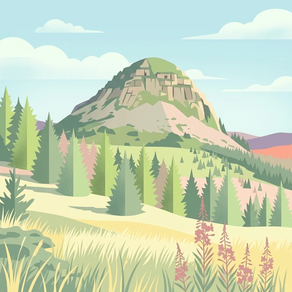
A flat-style digital illustration depicting a rocky, volcanic mountain peak surrounded by pine forests and rolling grasslands with wildflowers in the foreground.

Parc naturel régional des Monts d'Ardèche

Regional park

Park overview

Structured park overview, official facts, and landscape profile for Parc naturel régional des Monts d'Ardèche

Parc naturel régional des Monts d'Ardèche park facts, protected area profile, and essential visitor context

Review the core facts for Parc naturel régional des Monts d'Ardèche, including designation, size, terrain, visitor scale, habitats, and operating context in one park-focused overview.

About Parc naturel régional des Monts d'Ardèche

The Parc naturel régional des Monts d'Ardèche is a protected rural territory in the southern portion of the Massif Central, in the Auvergne-Rhône-Alpes region of France. It stretches across the western Ardèche and into adjacent communes of Haute-Loire, forming a wide crescent of highland landscape shaped by geology, water and centuries of farming. Within its perimeter lie some of the most emblematic landscapes of the Ardèche: the basaltic 'sucs' of Mézenc, the chestnut-covered slopes of the Cévennes, the crystalline plateau of Vernoux and the deeply cut valleys of the Eyrieux and other Cévenol rivers.

Rather than enclosing a single continuous wilderness, the park functions as a regional framework, gathering together 152 communes and about 83,000 residents around a shared project of land stewardship. Its charter focuses on preserving landscapes, supporting rural know-how, maintaining biodiversity and promoting a sustainable local economy tied to chestnuts, blueberries, small-scale agriculture and tourism. Two gateway towns extend the park's influence into neighbouring urban areas and serve as entry points for visitors.

The park's identity is inseparable from its human history. Terraced fields, stone walls, religious heritage sites, traditional mills and silk moulinages all form part of the cultural fabric that the charter seeks to protect. At the same time, the region's volcanic past, its river systems and its mosaic of woodlands, meadows and rocky outcrops give it a strong natural heritage value. The 2015 UNESCO Global Geopark designation reinforced this dual ecological and geological importance on an international scale.

Quick facts and research context for Parc naturel régional des Monts d'Ardèche

Located in the Auvergne-Rhône-Alpes region of France, the Parc naturel régional des Monts d'Ardèche covers the western part of the Ardèche department and extends into parts of Haute-Loire. It was officially created by decree on 9 April 2001 following a candidate project launched in 1992 by local chestnut growers, and its perimeter was revised in 2013 to 2014 to broaden its scope.

The park is classified as a 'Parc naturel régional' and also carries the UNESCO Global Geopark label granted in 2015. Its IUCN category is V (protected landscape or seascape). Administratively, it is managed by a public syndicat mixte and brings together around 152 communes and two gateway towns, with a population of roughly 83,000 people spread across more than 248,000 hectares.

Protection and recognition

Examine official registry records, designation history, and administrative scope for this regional protected landscape.

Parc naturel régional des Monts d'Ardèche Protection Status and Protected Area Documentation

Registry records for Parc naturel régional des Monts d'Ardèche compile verified conservation assignments and administrative frameworks. Documented protection details outline the governance standards and international database entries associated with this regional terrain.

Protection details

WDPA ID
178272
Park context

Deeper park guide and search-rich context for Parc naturel régional des Monts d'Ardèche

Parc naturel régional des Monts d'Ardèche history, landscape, wildlife, and travel context

Explore Parc naturel régional des Monts d'Ardèche through its history, landscape character, ecosystems, wildlife, conservation priorities, cultural context, and seasonal travel timing in a structured park guide built for atlas discovery and search intent.

Why Parc naturel régional des Monts d'Ardèche stands out

The park is best known for the volcanic sucs and highland scenery of the Massif du Mézenc, with Mont Gerbier-de-Jonc as one of the most recognisable landmarks. Its territory also features the chestnut groves, terraced landscapes and Cévenol river valleys that have shaped local rural life for centuries. Equally distinctive is the park's double identity as both a regional natural park and a UNESCO Global Geopark, making it a place where pastoral heritage, traditional food crops and geological heritage converge. The combination of volcanic landforms, chestnut culture, blueberry harvests and mountain rivers gives the Monts d'Ardèche a sharply defined regional character within the Massif Central.
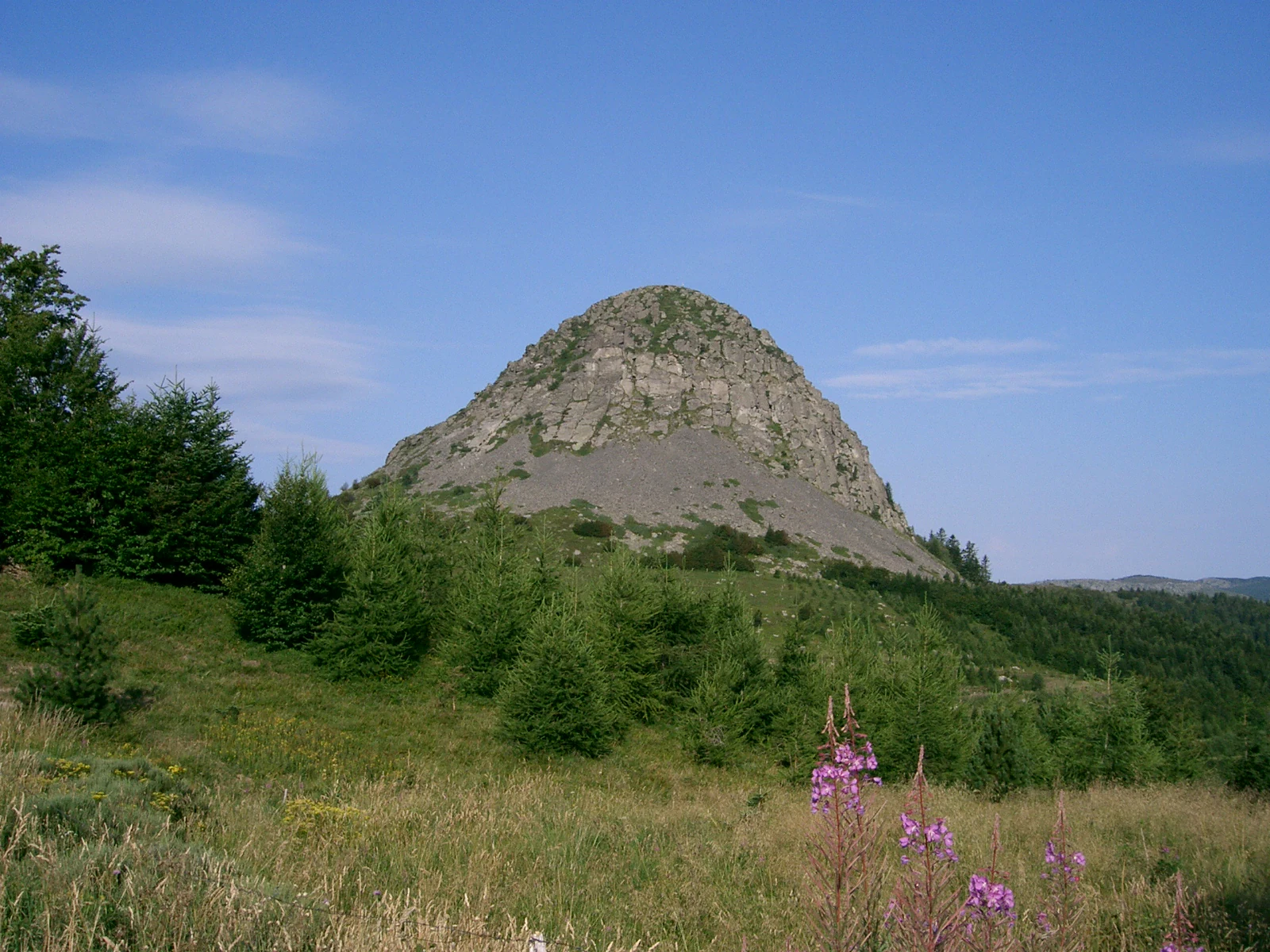
A wide angle view of the cone-shaped, rocky Mont Gerbier de Jonc mountain peak rising above a green, grassy, and forested landscape under a clear blue sky.
The distinctive profile of Mont Gerbier de Jonc, a prominent peak in the Parc naturel régional des Monts d'Ardèche.

Parc naturel régional des Monts d'Ardèche history and protected-area timeline

The idea for the Monts d'Ardèche regional natural park emerged in 1992, initiated by local chestnut growers, or castanéiculteurs, who wanted a formal tool to protect chestnut landscapes and the rural heritage tied to them. After a long candidacy process involving the western Ardèche communes, the French Prime Minister signed the official decree on 9 April 2001, formally creating the Parc naturel régional des Monts d'Ardèche.

The park then operated under an initial ten-year charter covering 132 communes and around 61,700 inhabitants. As the charter neared its renewal, the territory was revised in 2013 and 2014, extending the perimeter to include additional communes in Haute-Loire. The renewed charter took effect on 14 March 2014, expanding the park's footprint and renewing the institutional commitment of local communities.

In 2015, the Monts d'Ardèche was awarded UNESCO Global Geopark status, recognising the area's exceptional geological heritage, particularly its volcanic landscapes and the presence of Mont Gerbier-de-Jonc, one of the most iconic volcanic peaks in the Massif Central. The park has been led over the years by successive presidents from the communes of Privas, Payzac, Saint-Étienne-de-Boulogne, Saint-Mélany and, most recently, Lachamp-Raphaël, reflecting the breadth of municipal involvement in its governance.

Parc naturel régional des Monts d'Ardèche landscape and geographic character

The Monts d'Ardèche scene takes shape around dramatic volcanic geology, with the sucs of the Mézenc massif rising as conical basalt peaks above the surrounding plateau. Mont Gerbier-de-Jonc, perhaps the most celebrated of these summits, anchors the highland identity of the park and marks a landmark visible from across the territory. Between these peaks lie broad stretches of high plateau, moorland and pasture, broken by crags and rocky outcrops that reveal the deep volcanic history of the Massif Central.

Below the highland core, the landscape opens into deeply incised river valleys. The Boutières area, drained by the Eyrieux and its tributaries, forms a transitional zone between the volcanic highlands and the Cévennes. Further south, the high Cévennes, the Cévenol Piedmont near Aubenas and Les Vans, and the southern Cévennes add forested slopes, chestnut groves, terraced fields and steep limestone valleys to the overall mix. The eastern plateau of Vernoux-en-Vivarais offers a flatter, wooded counterpoint to the more vertical terrain of the volcanic and Cévenol zones.

Water is a defining element throughout the territory. Clear Cévenol streams, waterfalls and gorges shape the valley bottoms, while mountain springs feed both natural habitats and traditional water mills. The interplay between volcanic uplands, Cévenol slopes, river-cut valleys, terraced agriculture and forest cover gives the Monts d'Ardèche a markedly varied topography within a single, interrelated rural landscape.

Parc naturel régional des Monts d'Ardèche ecosystems, habitats, and plant life

Ecologically, the Monts d'Ardèche sits at a meeting point between Mediterranean, Cévenol and Massif Central influences. The varied altitude, exposure and geology create a mosaic of habitats, from high-altitude moorlands and volcanic grasslands on the Mézenc plateau to chestnut forests, beech woodlands, terraced meadows and riparian corridors along the river valleys.

These habitat gradients support a rich and varied biodiversity. River systems host species such as the European otter, whose presence has been used as an indicator of healthy waterways in regional conservation work. Upland moors and grasslands sustain specialised flora adapted to volcanic soils, while chestnut groves and mixed deciduous forests provide habitat for a wide range of woodland birds, insects and small mammals. The geographic position of the park, bridging Cévennes and Massif Central, gives it particular importance for species that depend on transitional landscapes.

The park's protection framework places strong emphasis on maintaining these habitat mosaics through traditional land use. Grazing, chestnut cultivation, blueberry harvesting and extensive small-scale farming are all viewed as part of the ecological balance, alongside the conservation of geological features, river corridors and highland open spaces. This integration of farming and biodiversity preservation is one of the defining elements of the park's environmental approach.

Parc naturel régional des Monts d'Ardèche wildlife and species highlights

Wildlife in the Monts d'Ardèche is shaped by the diversity of habitats stretching from volcanic highland moors down through chestnut forests and Cévenol river valleys. The clean, well-vegetated rivers are particularly important for aquatic and semi-aquatic fauna, with the European otter serving as a flagship species for the park's river conservation programmes and a symbol of the ecological recovery of its waterways.

Forest environments support typical Massif Central and Cévenne fauna, including deer, wild boar, foxes and a wide variety of woodland birds. Open upland areas around the sucs and the Mézenc plateau host raptors and species adapted to mosaic landscapes of grassland, heath and rock. The transition between Mediterranean and mountain influences also enriches the invertebrate and reptile fauna, particularly in the southern parts of the park, where drier, sun-exposed slopes contrast with the wetter Cévenol valleys.

Fruit-bearing habitats, particularly chestnut groves and bilberry-rich moorlands, play a seasonal role in supporting feeding and migration patterns. The presence of diverse microhabitats, from rocky volcanic outcrops to riparian corridors and old terraced fields, allows the park to host a broad range of species across a relatively compact territory.

Parc naturel régional des Monts d'Ardèche conservation status and protection priorities

The park's conservation significance lies in its scale and its integration of rural land use with habitat protection. By covering more than 248,000 hectares and linking 152 communes under a single charter, it provides a framework for maintaining the traditional agro-pastoral systems that have shaped the Monts d'Ardèche for centuries, while also protecting the underlying natural heritage.

Recognition of the territory as a UNESCO Global Geopark in 2015 elevated the profile of its conservation work, particularly around volcanic landforms and geological heritage. The park's IUCN Category V designation as a protected landscape underlines the importance of maintaining not only individual species or sites but the broader landscape mosaic, including chestnut groves, terraced fields, riverbanks, upland moors and historic villages.

Local conservation initiatives address river health, with otter-friendly river management, the preservation of dry-stone terraces, and programmes that support chestnut cultivation and traditional orchards as living cultural and ecological landscapes. By linking geological heritage, biodiversity and rural culture, the Monts d'Ardèche functions as a large-scale laboratory for integrated rural conservation in the Massif Central.

Parc naturel régional des Monts d'Ardèche cultural meaning and human context

The cultural fabric of the Monts d'Ardèche is closely tied to the land. Chestnut cultivation has long been central to local identity, both as an everyday food source and as a defining element of the landscape, and the original impetus for the park's creation came from the castanéiculteurs of the region. Religious heritage, stone-built villages, terraced fields and a long tradition of small hydraulic mills and silk moulinages together give the territory a strong sense of place.

Seasonal rural practices, including blueberry harvests in the uplands, chestnut gathering in autumn and transhumance of livestock through mountain pastures, continue to structure local life. These traditions are not presented as relics, but as living heritage supported by the park's charter, which encourages farm diversification, local food products and the maintenance of rural skills. Religious and pilgrimage heritage, along with architectural traditions in stone and timber, further reinforce the region's distinct cultural character within the broader Ardèche and Massif Central area.

Top sights and standout views in Parc naturel régional des Monts d'Ardèche

The Monts d'Ardèche offers a rare combination of volcanic highlands, Cévenol chestnut country and incised river valleys within a single protected territory. Mont Gerbier-de-Jonc, the Mézenc sucs and the UNESCO Global Geopark designation give the park a strong geological identity, while chestnut groves, terraced fields, historic mills and traditional food crops provide a vivid rural and cultural dimension.

For travellers, researchers and residents alike, the park stands out as an example of how a large rural territory can organise itself around shared landscape, biodiversity and heritage goals. The breadth of the territory, the diversity of its communes and the involvement of more than 80,000 inhabitants make it one of the most distinctive regional natural parks in the southern Massif Central.

Best time to visit Parc naturel régional des Monts d'Ardèche

The Monts d'Ardèche has a distinctly seasonal character shaped by its elevation and rural traditions. Late spring and early summer bring fresh green slopes, full rivers and active wildlife along the Cévenol valleys, while highland moors around the Mézenc plateau begin to bloom.

Autumn is one of the most characteristic seasons, when chestnut harvests, blueberry gathering and the rich colours of the forests give the territory its strongest sense of rural tradition. Winter, with snow often dusting the sucs and upland areas, offers a quieter, more atmospheric experience focused on highland scenery and traditional villages. Summer remains attractive for hiking and river-based activities, though warmer temperatures are felt most strongly in the lower Cévenol and Piémont zones.
Monthly climate preview

Long term temperature and precipitation measurements sampled at representative park coordinates

Parc naturel régional des Monts d'Ardèche Climate Normals and Weather by Month

Historical climate data for Parc naturel régional des Monts d'Ardèche records steady thermal shifts and measured monthly precipitation values across a representative elevation. Examining the complete twelve month profile provides granular baseline patterns for this protected landscape.
Annual mean11 °C
3 °C22 °C
Jan
Feb
Mar
Apr10°
May14°
Jun19°
Jul22°
Aug22°
Sep17°
Oct12°
Nov
Dec
Warmest month
July

22 °C

Coolest month
January

2.6 °C

Wettest month
November

3.7 mm/day

Driest month
July

1.5 mm/day

Park location guide

Geography guide, regional context, and park location map for Parc naturel régional des Monts d'Ardèche

Parc naturel régional des Monts d'Ardèche park geography, regions, and map view in France

Understand where Parc naturel régional des Monts d'Ardèche sits in France through a broader geographic reading of the surrounding landscape, nearby location context, and its mapped position within the national park landscape.

How Parc naturel régional des Monts d'Ardèche fits into France

France is a unitary semi-presidential republic and one of the world's largest economies. It borders Belgium, Luxembourg, Germany, Switzerland, Italy, Monaco, Andorra, and Spain, with a maritime border to the United Kingdom. The country is known for its cultural influence, art, cuisine, and political history spanning centuries.

Wider geography shaping Parc naturel régional des Monts d'Ardèche in France

France is located in Western Europe. Metropolitan France extends from the Rhine to the Atlantic Ocean and from the Mediterranean Sea to the English Channel and North Sea. The country borders Belgium, Luxembourg, Germany, Switzerland, Italy, Monaco, Andorra, Spain, and has a maritime border with the United Kingdom.

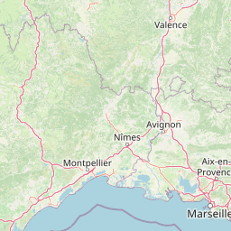
Map view of Parc naturel régional des Monts d'Ardèche

Use this park location map to pinpoint Parc naturel régional des Monts d'Ardèche in France, understand its exact geographic position, and read its mapped placement within the surrounding landscape more clearly.

Pigeon | © OpenStreetMap contributors

Location context for Parc naturel régional des Monts d'Ardèche

Auvergne-Rhône-Alpes
Recorded earthquake history

Explore Historical Earthquake Records for Parc naturel régional des Monts d'Ardèche

Access a detailed catalogue of recorded seismic activity associated with the geography of Parc naturel régional des Monts d'Ardèche. MoriAtlas provides transparent access to historical event data, including magnitude and depth, for those exploring the geological context of this protected mountain region.

Parc naturel régional des Monts d'Ardèche Earthquake History

Catalogued events

14 events

Strongest magnitude

Magnitude 4.8

Most recent event

Nov 11, 2019

This history includes earthquakes recorded inside the park or within 50 km of its borders

Visual reference of volcanic sucs, basalt peaks, and deep river valleys

Parc naturel régional des Monts d'Ardèche Photos and Volcanic Landscapes

Visual records reveal the dramatic volcanic geology and terraced river valleys that define this protected highland territory. Photographic documentation captures the conical basalt peaks, chestnut groves, and upland pastures shaping the regional landscape character.

A wide angle view of the cone-shaped, rocky Mont Gerbier de Jonc mountain peak rising above a green, grassy, and forested landscape under a clear blue sky.

A multi-story historic chateau building with light-colored walls and blue shutters, featuring a stone tower section and an external stone staircase.

Park atlas

Compare adjacent volcanic highlands and surrounding regional protected areas

Parks Near Parc naturel régional des Monts d'Ardèche and Protected Landscapes

Browsing nearby protected areas helps connect the volcanic geology of Parc naturel régional des Monts d'Ardèche to wider regional terrain. Comparing adjacent reserves reveals broader ecological patterns across the surrounding highlands and river valleys.
A soft watercolor painting showing a wide, panoramic view of rolling green hills, distant ridges, and gentle scrub vegetation against a white background.
Regional parkAuvergne-Rhône-Alpes
About 0.5 km away#1 closest

South

Réserve naturelle régionale des Grads de Naves: Regional Park and Limestone Plateau Geography

Mediterranean habitat in the southern Ardèche region of France

Situated near Les Vans, the Réserve naturelle régionale des Grads de Naves is a small but biologically significant limestone plateau. This protected area demonstrates the natural reclamation of former cultivated farmland, now featuring a dense community of Mediterranean flora, breeding birds, and butterfly species within an iconic garrigue and oak-scrub landscape.

Area
0.12 km²
Established
1981
IUCN
IV
Relief
Upland
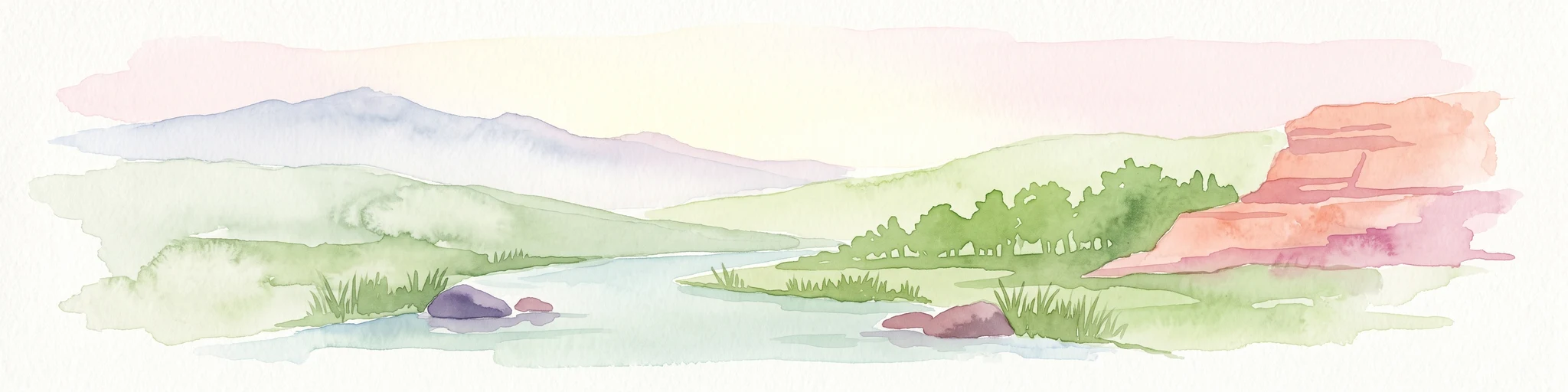
A wide watercolor illustration showing a river flowing through a green valley with distant purple mountains and a large reddish rock formation on the right bank.
Protected areaFrance
About 5 km away#2 closest

Southeast

Ripisylve et lit majeur de l'Ardèche: Protected Area and Alluvial River Geography

A vital riparian corridor in the French Ardèche valley.

This protected area centers on the active Ardèche river channel and its adjacent floodplain. The site features a rich diversity of humid habitats, ranging from quiet pools and side channels to sediment rich gravel deposits. It serves as an ecologically significant corridor for riparian woodland, providing a habitat structure that is central to the environmental health of the region.

Area
2.87 km²
Established
1999
Relief
Lowland
Climate
Temperate
Watercolor illustration of green fields, a river, and mountains under a soft pink and yellow sky
National parkOccitanie
6.3 km away#3 closest

Southwest

Cévennes National Park: Explore its Mapped Terrain and Protected Landscape in Occitanie

Discover the unique geographic context and park boundaries.

Cévennes National Park, situated in Occitanie, France, offers a rich exploration of mid-mountain Mediterranean geography. As a protected landscape, its mapped terrain features dramatic limestone plateaus, deep river gorges, and distinct granite massifs. This entry provides essential geographic context for Cévennes National Park, highlighting its unique natural features and its significance as a protected area within the broader regional atlas.

Area
937 km²
Established
1970
IUCN
V
Visitors
800K annual
Nature reserveAuvergne-Rhône-Alpes
About 32 km away#4 closest

East

Réserve naturelle régionale du réseau de grottes à chauves-souris en Drôme et en Ardèche: Protected Area Overview

Subterranean habitat protection within the Auvergne-Rhône-Alpes regional geography.

This regional nature reserve secures vital karst cavities serving as essential refuges for multiple bat species. By bridging administrative boundaries in southeastern France, the protected area demonstrates a precise focus on underground ecology and the preservation of irreplaceable subterranean environments across the departments of Drôme and Ardèche.

Area
0.49 km²
Established
2019
IUCN
IV
Relief
Mixed relief
Nature reserveAuvergne-Rhône-Alpes
37 km away#5 closest

Northwest

Réserve naturelle régionale du lac de Malaguet: Regional Nature Reserve and Wetland Atlas

Mapped protected landscapes in Haute-Loire, Auvergne-Rhône-Alpes

This protected area centers on a 14th-century artificial lake that now functions as a rich ecological sanctuary. Explore the confluence of medieval water infrastructure, riparian forests, and meadow zones that support diverse upland fauna. The site offers a clear example of long-term landscape transformation from industrial utility to a protected biodiversity refuge within the eastern Massif Central.

Area
0.542 km²
Established
2014
IUCN
IV
Relief
Upland
A horizontal watercolor painting showing a soft, stylized river winding through green hills and forests.
Regional parkAuvergne-Rhône-Alpes
42 km away#6 closest

North

Réserve naturelle régionale des gorges de la Loire: Landscape and Protected Area Geography

Regional nature reserve in the Auvergne-Rhône-Alpes landscape.

The Réserve naturelle régionale des gorges de la Loire protects a rugged stretch of the Loire River valley in the eastern Massif Central. Discover the geographic mosaic of rocky outcrops, shrubby heaths, and woodland slopes that define this protected area, and see how the terrain shapes its distinct biodiversity and river corridor boundaries.

Area
3.55 km²
Established
1988
IUCN
IV
Relief
Upland
A watercolor painting of a soft, rolling landscape with green hills, light forest cover, and wild grasses in the foreground, rendered in a light, atmospheric style.
Nature reserveAuvergne-Rhône-Alpes
About 47 km away#7 closest

East

Réserve naturelle régionale de la grotte des Sadoux: Protected Cave and Forested Hills

Regional Nature Reserve in the Drôme department of France

The Réserve naturelle régionale de la grotte des Sadoux encompasses a 30-hectare forested coteau above the Courance valley. This site is defined by its subterranean karstic gallery and surrounding woodland edge, creating a focused conservation landscape for threatened bat species within the Auvergne-Rhône-Alpes region.

Area
0.3 km²
Established
2010
IUCN
IV
Relief
Upland
A soft watercolor painting of a winding river flowing through a gentle, rolling green valley with hills in the background.
Nature reserveOccitanie
About 50 km away#8 closest

South

Réserve naturelle régionale des gorges du Gardon: Geography and Protected Area Overview

Mediterranean river valley and raptor conservation corridor

Examine the distinct topography of the Réserve naturelle régionale des gorges du Gardon. The protected area features steep limestone cliffs and a river corridor that sustains dense Mediterranean oak forests. This site remains a critical node for raptor conservation, specifically supporting nesting Egyptian vultures and Bonelli eagles within its structured valley geography.

Area
4.913 km²
Established
2007
IUCN
IV

Common questions about visiting, size, designation, and location context for Parc naturel régional des Monts d'Ardèche

Parc naturel régional des Monts d'Ardèche FAQs for park facts, access, geography, and protected area context

Find quick answers about Parc naturel régional des Monts d'Ardèche, including protected-area facts, park geography, trail and visitor context, and how the park fits into its surrounding country and regional landscape.
MoriAtlas Explorer

Continue Your Protected Areas Search Across the Global Atlas

Deepen your exploration by continuing the structured search for national parks and protected areas worldwide. Utilize the comprehensive filtering capabilities to compare different conservation landscapes and refine your understanding of global park geography. Discover more about the distribution and characteristics of protected natural areas.

Global natural geography