
Mori Atlas logo
Protected landscapeParque rural del Nublo

A vast mountain territory shaped by ancient volcanic activity, deep erosional ravines, and historic troglodyte settlements.

Parque rural del Nublo: Mapping the Volcanic Highlands and Protected Landscapes of Gran Canaria

The Parque rural del Nublo serves as the largest protected natural area on Gran Canaria, spanning the central and western highlands of the island. This complex volcanic landscape features iconic monoliths, dissected plateaus, and extensive barrancos that harbor diverse ecosystems ranging from coastal scrub to high-mountain pine forests. Beyond its natural terrain, the area integrates a profound cultural heritage, including significant archaeological sites and traditional agrosilvopastoral land use that defines its unique protected status.

volcanic landscaperural parkGran CanariaCanary Islands Spainmountain highlandsbarrancos
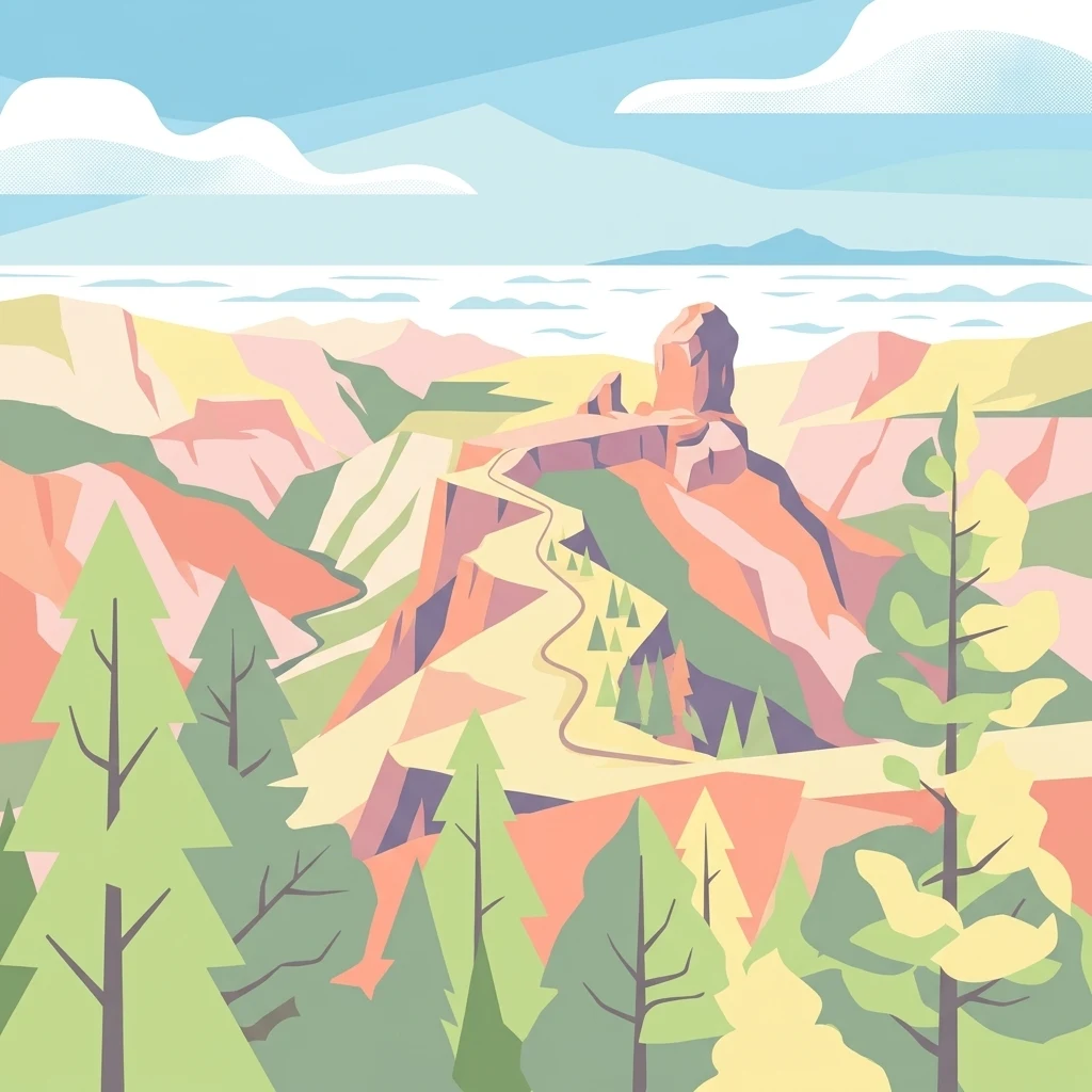
A digital illustration of a mountainous park landscape showing deep canyons and a prominent rock formation in the distance, framed by stylized coniferous trees in the foreground.

Parque rural del Nublo

Protected landscape

Park overview

Structured park overview, official facts, and landscape profile for Parque Rural del Nublo

Parque Rural del Nublo park facts, protected area profile, and essential visitor context

Review the core facts for Parque Rural del Nublo, including designation, size, terrain, visitor scale, habitats, and operating context in one park-focused overview.

About Parque Rural del Nublo

The Parque Rural del Nublo lies at the core of Gran Canaria, a volcanic island in the Atlantic Ocean belonging to Spain's Canary Islands archipelago. Created as an Espacio Natural in 1987 and reclassified as a rural park on 19 December 1994, it is the largest protected natural area on the island and one of the largest in the entire archipelago. It spans roughly 26,764 hectares across the municipalities of Tejeda, La Aldea de San Nicolás, Mogán, San Bartolomé de Tirajana, Artenara, Vega de San Mateo, Valleseco, and Moya, and contains close to thirty settled population nuclei within its boundaries.

A defining feature of the park is the contrast between its volcanic origins and its long erosional history. Roughly fourteen million years of eruptive construction followed by continuous erosion have produced a landscape of dismantled volcanic structures, steep escarpments, jagged ridges, and deep barrancos. The geography includes the Cumbre Central, crowned by Pico de las Nieves at 1,948 meters, the broad arc of the Caldera de Tejeda, the distinctive agglomeratic plateau of Toscón-Juncal, the upper basin of the Barranco de Arguineguín, the Rampa de Tabaibales, and the network of barrancos and cuchillos that drain toward the southwestern coast.

At the heart of this scenery stands the Roque Nublo monolith, recognized separately as a natural monument and forming one of the most recognizable landmarks in the Canary Islands, often photographed with Mount Teide on neighboring Tenerife in the background. Volcanic interest extends beyond the Roque Nublo itself: the Caldera de Tejeda, the Ayacata area, and parts of the western slope of the Arguineguín barranco have been identified by Spain's former Instituto Tecnológico GeoMinero as geological points of interest, with international significance attached to ignimbrite deposits south of Veneguera associated with the ancient Roque Nublo stratovolcano.

The park's ecological value reflects its wide altitudinal range. Inland pine forests of the Canary Island pine (Pinus canariensis) dominate the highest elevations, especially around the Inagua massif, while mid-altitude slopes preserve fragmented woodlands of wild olive (Olea cerasiformis), mastic (Pistacia atlantica), Canary palm (Phoenix canariensis), dragon trees (Dracaena draco), and Canary juniper (Juniperus turbinata subsp. canariensis). Along the coastal fringe, relict stands of cardonal-tabaibal scrub survive between the shoreline and roughly four hundred meters of elevation. Reservoirs such as the Parralillo and Caidero de la Niña embalsments, combined with pine stands and coastal cliffs, make the park one of the most important areas for birdlife on the island and have earned it the designation of Special Protection Area for Birds (ZEPA) under the European Union's Natura 2000 framework.

Cultural heritage is deeply woven into the protected area. The mountains within and around the park hold the most significant aboriginal troglodyte heritage of Gran Canaria, including the cave complexes of Bentayga, Risco Caído, and Acusa, all of which were inscribed on the UNESCO World Heritage List in 2019 as part of the cultural landscape known as Risco Caído and the Sacred Mountains of Gran Canaria. Traditional agrosilvopastoral activity, terraced hillsides, scattered hamlets, and introduced almond groves continue to give the park a lived-in rural character that complements its protected status.

Quick facts and research context for Parque Rural del Nublo

The Parque Rural del Nublo is a rural park: a category of protected natural area in the Canary Islands that allows for the continuation of traditional human activities within a predominantly natural setting. It is the largest protected space on Gran Canaria at roughly 26,764 hectares, and is divided across eight municipalities, making it one of the most populated protected areas in the Canary Islands.

The park lies at the heart of Gran Canaria, stretching from the high central summit area where Pico de las Nieves, the island's second highest peak, stands at 1,948 meters, down toward the western coastline between La Aldea and Tasarte. It is classified as a Special Protection Area for Birds and incorporates Special Conservation Zones under the European Natura 2000 framework.

Within or alongside the park sit other notable protected zones, including the Inagua integral natural reserve, the Roque Nublo natural monument, the Las Cumbres protected landscape, and the Tamadaba natural park. Much of the park overlaps with the UNESCO World Heritage Site known as the cultural landscape of Risco Caído and the Sacred Mountains of Gran Canaria.

Protection and recognition

Terrestrial protected area established in 1994 with documented management records.

Parque rural del Nublo Protection Status and Designated History Overview

Parque rural del Nublo maintains a documented terrestrial protection status established in the year 1994. Structured conservation data outlines the official designation timeline and management scope for this protected landscape.

Protection details

Protection scope
Terrestrial
Designated year
1994
Transboundary protection
No
Park context

Deeper park guide and search-rich context for Parque Rural del Nublo

Parque Rural del Nublo history, landscape, wildlife, and travel context

Explore Parque Rural del Nublo through its history, landscape character, ecosystems, wildlife, conservation priorities, cultural context, and seasonal travel timing in a structured park guide built for atlas discovery and search intent.

Why Parque Rural del Nublo stands out

The park is above all known for its monumental volcanic scenery, especially the Roque Nublo monolith, one of the most recognizable geological landmarks in the Canary Islands, and the surrounding dissected volcanic highlands shaped by millions of years of eruptive activity and erosion. The Cumbre Central, the Caldera de Tejeda, the agglomeratic plateau of Toscón-Juncal, and the deep barrancos cutting southwest toward the coast all contribute to a landscape of dramatic cliffs, ridges, and pinnacles. Equally distinctive is the park's ecological richness across an unusually broad altitude range. Within its boundaries, ecosystems shift from coastal cardonal-tabaibal scrub, through mid-elevation relic woodlands of wild olive, mastic, Canary palm, and juniper, up to high-mountain Canary pine forests in massifs such as Inagua. This gradient supports numerous endemic plant and animal species, including the Gran Canaria giant lizard and endemic invertebrates, and underpins the area's status as a Special Protection Area for Birds. The park is also recognized for its cultural heritage. The troglodyte sites of Bentayga, Risco Caído, and Acusa, along with the broader Sacred Mountains of Gran Canaria that were inscribed as a UNESCO World Heritage Site in 2019, give the park a strong archaeological and aboriginal dimension that complements its natural significance.
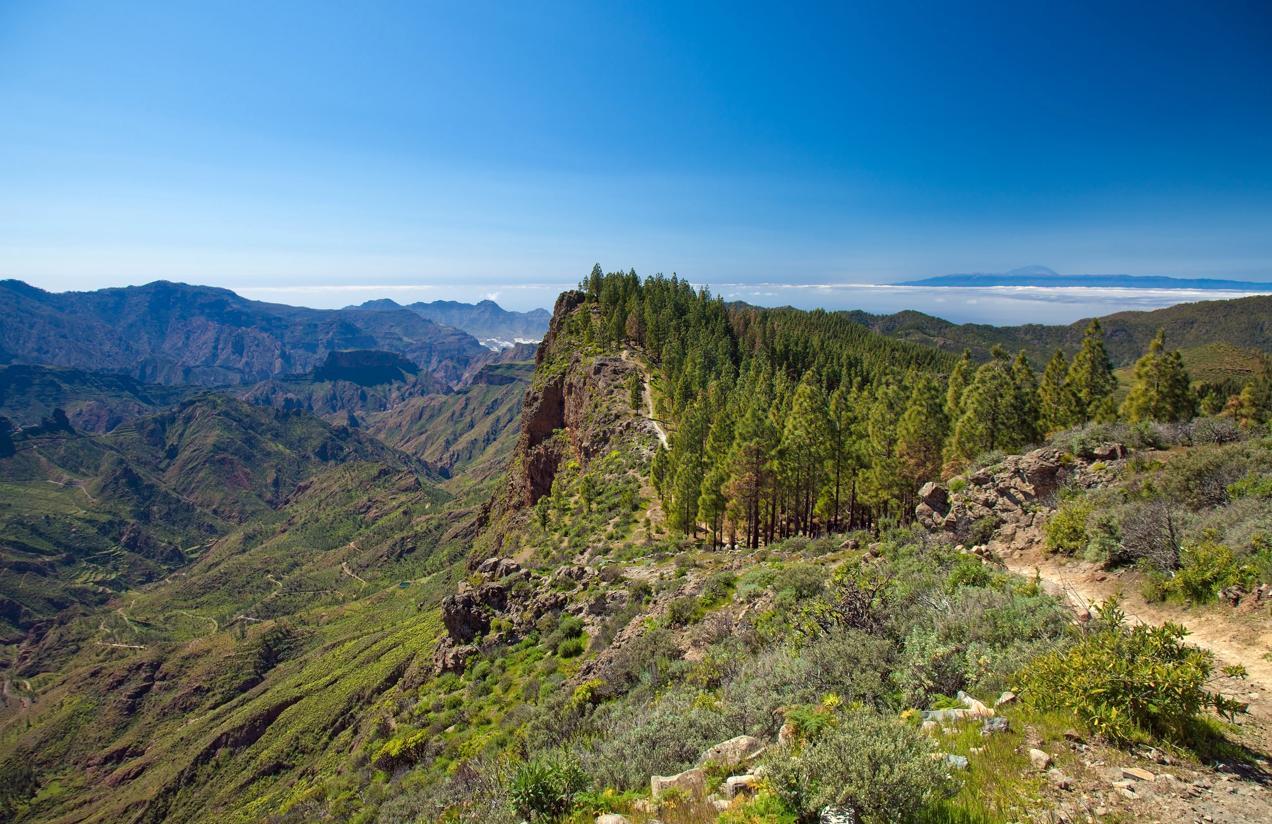
A dirt hiking trail curves along a mountainous ridge populated by tall pine trees, overlooking a deep ravine and distant valley in Gran Canaria.
A scenic hiking trail winds along a ridge covered with pine forest in the Caldera de Tejeda.

Parque Rural del Nublo history and protected-area timeline

The area now protected as the Parque Rural del Nublo received its first formal recognition as a natural space (Espacio Natural) on 19 June 1987, under the framework of the Canary Islands' emerging network of protected areas. On 19 December 1994 it was reclassified as a Parque Rural, a designation that aligns natural protection with the continued presence of rural communities, traditional land use, and human settlement within its boundaries. This designation brought the territory into the official list of natural spaces of the Canary Islands.

Within the park, the Inagua integral natural reserve occupies a special status: the sector of the rural park that abuts the reserve is given additional consideration as an area of ecological sensitivity, providing an extra layer of conservation protection around one of the most significant Canary pine forest remnants on Gran Canaria. The Roque Nublo monolith itself is separately protected as a natural monument within the same park territory.

A turning point for the park's broader profile came on 7 July 2019, when UNESCO inscribed the cultural landscape of Risco Caído and the Sacred Mountains of Gran Canaria on the World Heritage List. Much of this cultural landscape lies within the boundaries of the Parque Rural del Nublo, linking the park's natural heritage with the deep prehistoric and aboriginal legacy of Gran Canaria. The park is also part of the Canary Network of Protected Natural Spaces, and within the European Natura 2000 framework it has been designated as a Special Protection Area for Birds (ZEPA) and as Special Conservation Zones (ZEC) under the names El Nublo and El Nublo II.

Parque Rural del Nublo landscape and geographic character

The physical landscape of the Parque Rural del Nublo is dominated by the interplay of volcanic construction and erosional dissection that has shaped Gran Canaria's interior over millions of years. From the central summits down to the sea, the terrain shifts from high-altitude plateaus and volcanic cones, through deeply cut calderas and barrancos, to rugged coastal cliffs in the southwest. The Cumbre Central forms the eastern backbone of the park and contains Pico de las Nieves at 1,948 meters, the second highest point on Gran Canaria.

West and south of the central summits, the landscape opens into the Caldera de Tejeda, a broad, partially eroded volcanic depression that gives the municipality of Tejeda its amphitheater-like setting. Further west rise the Pajonales highlands, and below them stretches the agglomeratic plateau of Toscón-Juncal, a striking tabular surface built from Roque Nublo-type volcanic breccias. The southern margin of the park drops into the upper basin of the Barranco de Arguineguín and the Rampa de Tabaibales, where long slopes descend toward the southwestern barrancos of the island.

The drainage network is unusually elaborate. Numerous barrancos and cuchillos have carved the southwestern slopes into a sequence of ridges and ravines, while two major reservoirs, the Parralillo and the Caidero de la Niña, interrupt the upper drainage of the Tejeda basin. Three areas have been catalogued as points of geological interest: the Caldera de Tejeda, the Ayacata sector, and a portion of the western slope of the Arguineguín barranco. The latter preserves avalanche blocks associated with the ancient Roque Nublo stratovolcano and international-significance ignimbrite deposits south of Veneguera.

Parque Rural del Nublo ecosystems, habitats, and plant life

The Parque Rural del Nublo stands out ecologically because of the unusually wide altitudinal range it encompasses, which produces a layered mosaic of habitats across roughly two thousand meters of vertical difference. This gradient, combined with diverse substrates and varying degrees of human influence, underpins both its botanical richness and its importance for endemic fauna.

Along the coastal fringe, between sea level and about four hundred meters in elevation, the park shelters relict stands of cardonal-tabaibal, the characteristic xerophytic shrubland of the Canarian coastal zone. Degraded sectors of Euphorbia and tabaiba amarga (Euphorbia regis-jubae), together with aulaga (Launaea arborescens), leña buena (Neochamaelea pulverulenta), balo (Plocama pendula), and various grasses, dominate much of this strip. Closer to four hundred meters, more anthropized landscapes preserve small groups of almacigo (Pistacia atlantica), acebuches (Olea cerasiformis), Canary palms (Phoenix canariensis), and isolated Canary junipers (Juniperus turbinata subsp. canariensis).

Above this mid-level zone, the park climbs into the pine forests that define its high country. Above roughly 1,500 meters, Canary Island pine (Pinus canariensis) becomes the dominant tree, particularly in the Inagua massif, where natural pine communities survive in good condition. Elsewhere, high-elevation pine stands are reforestation plantings that include introduced species such as Monterey pine (Pinus radiata), stone pine (Pinus pinea), and Aleppo pine (Pinus halepensis). Understory plants in these pine areas include species such as Erysimum bicolor, Sideritis dasygnaphala, Teline microphylla, Chamaecytisus proliferus subsp. meridionalis, and Adenocarpus foliolosus. On degraded ground, matorrales of tabaiba amarga, jarales, Micromeria thymes, and Lavandula minutolii take over.

The cliffs, riscos, and rupicolous habitats scattered through the park host a suite of specialized endemic plants including Sonchus brachylobus var. canariensis, Camptoloma canariense, Allagopappus viscosissimus, Aeonium virgineum, and Cheirolophus arbutifolius. Botanists have catalogued 168 native taxa in the park, of which 53 are exclusive to Gran Canaria, 64 are exclusive to the Canary Islands, and 21 are Macaronesian. The vegetation pattern is strongly shaped by both physical conditions and centuries of human activity, ranging from introduced almond groves in the Cuenca de Tejeda to dense scrub and pine forest in less accessible terrain.

Parque Rural del Nublo wildlife and species highlights

Wildlife within the Parque Rural del Nublo is closely tied to the park's altitudinal range and habitat diversity. Reptiles are represented by the Gran Canaria giant lizard (Gallotia stehlini), the Gran Canaria striped skink (Chalcides sexlineatus sexlineatus), the variable Gran Canaria skink (Chalcides sexlineatus bistriatus), and Boettger's wall gecko (Tarentola boettgeri). Amphibians are limited to two introduced species, the Iberian green frog (Pelophylax perezi) and the Mediterranean tree frog (Hyla meridionalis), which appear where permanent water is available. Fish communities are also essentially introduced, with tilapia, perch, and carp inhabiting the park's reservoirs.

Birds are the most prominent vertebrate group and the reason the park has been designated a Special Protection Area for Birds. Regularly recorded species include the Canary Islands chiffchaff (Phylloscopus canariensis), Berthelot's pipit (Anthus berthelotii), the Canary Islands common kestrel (Falco tinnunculus canariensis), the Canary Islands buzzard (Buteo buto insularum), the Canary Islands raven (Corvus corax canariensis), Cory's shearwater (Calonectris diomedea borealis), the Canary Islands long-eared owl (Asio otus canariensis), the endangered Gran Canaria blue chaffinch (Fringilla polatzeki), the Gran Canaria subspecies of the great spotted woodpecker (Dendrocopos major thanneri), and the Canary Islands southern grey shrike (Lanius meridionalis koenigi). The park also holds historical importance for the Canarian Egyptian vulture or guirre (Neophron percnopterus majorensis), whose last documented habitat on Gran Canaria was in the Llanos de Ojeda area of the park.

Invertebrate life is exceptionally rich in the Parque Rural del Nublo, with around 170 endemic species and subspecies recorded on the island because of the variety of ecosystems from coastal scrub up to the high pine zone. Endemic gastropods make up ten species exclusive to the park, arachnids contribute twenty-two, and isopod crustaceans include Venezillo fillolae, Porcellio babilonus, Porcellio ovalis, and Porcellio strinatii. Myriapods such as Dolichoiulus alauaudi, D. architheca, and D. martini (millipedes) and Lithobius canariensis (centipede) also live in the park. Insects are the largest group, with roughly 145 unique Gran Canarian species and subspecies, including ninety-three endemic beetles such as the chispita de Acusa (Attalus acusae), the Thorictus ants' nest beetles from Acusa, Tamadaba, and Tejeda, and the pine jewel beetle (Buprestis berthelotii). Introduced mammals, particularly feral cats, rabbits, and wild goats, remain an important pressure on endemic flora and fauna in the park.

Parque Rural del Nublo conservation status and protection priorities

The conservation significance of the Parque Rural del Nublo rests on the combination of a very large protected surface area, a wide altitudinal range, and unusually high proportions of habitat types that are rare elsewhere in the Canary Islands. Its roughly 26,764 hectares make it the most extensive protected natural area on Gran Canaria and among the largest in the archipelago, encompassing coastal, mid-elevation, and high-mountain ecosystems within a single administrative unit.

The park belongs simultaneously to several conservation frameworks. It is part of the Canary Network of Protected Natural Spaces, recognized as a Special Protection Area for Birds (ZEPA) under the European Union's Birds Directive, and has two Special Conservation Zones (ZEC) within Natura 2000, named El Nublo and El Nublo II. Its inclusion in Natura 2000 reflects the presence of natural habitats of community interest, including thermomediterranean riparian galleries, Phoenix palm groves, Mediterranean juniper woodlands, and lava fields and natural excavations, as well as priority plant species such as Limonium sventenii, Isoplexis isabelliana, and Gonospermum ptarmiciflorum.

Ecologically, the park plays a key role as a refuge for threatened endemics, including the Gran Canarian blue chaffinch and the Gran Canarian giant lizard, as well as numerous endemic plants and invertebrates that are otherwise restricted to small areas. Its forested areas also contribute to aquifer recharge and to the conservation of soils on the steep slopes of central and southwestern Gran Canaria. The integrative management approach of the rural park category, which combines active protection with continued traditional land use, is itself an important conservation strategy in the Canary Islands, maintaining the cultural landscape that has shaped the area for centuries while safeguarding its natural values.

Parque Rural del Nublo cultural meaning and human context

The Parque Rural del Nublo carries a particularly rich cultural layer because much of its territory overlaps with the UNESCO World Heritage cultural landscape of Risco Caído and the Sacred Mountains of Gran Canaria, inscribed in July 2019. This cultural landscape celebrates the aboriginal Canarian civilization that inhabited Gran Canaria before the European conquest, with cave dwellings, ceremonial sites, astronomical alignments, and an enduring sacred relationship with the island's central mountains. Within the rural park, archaeological complexes such as Bentayga, Risco Caído, and Acusa stand as some of the most important troglodyte sites in the archipelago.

The cultural identity of the park is also shaped by centuries of agro-silvo-pastoral activity. Terraced hillsides, scattered hamlets, traditional caseríos, and cultivated plots, including almond groves concentrated in the Cuenca de Tejeda, reflect a long continuity of rural life. The Casandra pine, or pino Bonito, a centuries-old Canary pine near the Cueva de las Niñas reservoir in Tejeda, embodies this blend of landscape and folklore: its hollow trunk has been shaped by historical extraction of pine resin for torches, and local legend links it to the tragic story of Casandra, a young mother condemned at the tree. These natural, archaeological, and ethnographic strands together give the park one of the deepest cultural contexts of any protected area in the Canary Islands.

Top sights and standout views in Parque Rural del Nublo

The Parque Rural del Nublo concentrates an unusual combination of natural, geological, and cultural highlights within a single protected territory. The Roque Nublo monolith, separately protected as a natural monument, dominates the central scenery, while nearby the Caldera de Tejeda, the agglomeratic plateau of Toscón-Juncal, and the barranco network of the southwestern coast offer some of the most visually striking volcanic topography in the Canary Islands.

Ecologically, the park's altitudinal mosaic supports relict coastal cardonal-tabaibal, mid-elevation woodlands of wild olive, mastic, palm, and juniper, and high-elevation pine forests of the Inagua massif, each layer harboring its own package of endemic species. The integration of this natural richness with the UNESCO-listed Sacred Mountains of Gran Canaria, and with the troglodyte sites of Bentayga, Risco Caído, and Acusa, raises the park's profile beyond a purely natural setting into a place where landscape, biodiversity, and aboriginal heritage are tightly intertwined.

Best time to visit Parque Rural del Nublo

The climate of Gran Canaria's interior around the Parque Rural del Nublo is generally milder than the coast, with cooler temperatures and clearer seasonal contrasts at higher elevations. Spring is often favorable for visiting because the milder weather supports hiking across the barranco network and through the pine forests, when wildflowers and endemic plants are most easily observed in bloom. Summers in the interior are warmer and drier, and while still accessible, they favor early starts and visits to higher elevations rather than the lower barrancos.

Autumn and winter tend to bring cooler temperatures and occasional rainfall, which can transform the barrancos into greener, more dynamic landscapes and benefit birdwatching around the reservoirs and lower valleys. Pine-forest areas and the higher parts of the Cumbre Central can be noticeably cooler than the lowland sections of the park in this season, so visitors aiming for peaks such as Pico de las Nieves or routes through the Inagua area should plan for cooler mountain conditions.
Monthly climate preview

Long term monthly averages for temperature and precipitation records

Parque rural del Nublo Climate Normals and Measured Temperature Rhythm

Representative point measurements for Parque rural del Nublo record a sustained annual temperature range alongside distinct monthly precipitation variations across the coordinate baseline. Examining the complete twelve month climatology profile provides deeper analytical insight into multi year meteorological patterns.
Annual mean20 °C
17 °C23 °C
Jan18°
Feb17°
Mar18°
Apr18°
May19°
Jun21°
Jul22°
Aug23°
Sep23°
Oct22°
Nov21°
Dec19°
Warmest month
September

22.8 °C

Coolest month
February

17.5 °C

Wettest month
December

0.9 mm/day

Driest month
July

0.1 mm/day

Park location guide

Geography guide, regional context, and park location map for Parque Rural del Nublo

Parque Rural del Nublo park geography, regions, and map view in Spain

Understand where Parque Rural del Nublo sits in Spain through a broader geographic reading of the surrounding landscape, nearby location context, and its mapped position within the national park landscape.

How Parque Rural del Nublo fits into Spain

Spain, officially the Kingdom of Spain, is a unitary parliamentary constitutional monarchy located in Southern and Western Europe. The country occupies most of the Iberian Peninsula and includes territories in the Mediterranean and Atlantic. With a population of approximately 49.6 million and an area of 506,030 km², Spain is a major European economy and cultural force. Its capital is Madrid, and the country is known for its diverse landscapes ranging from mountainous regions to coastal areas.

Wider geography shaping Parque Rural del Nublo in Spain

Spain occupies the Iberian Peninsula in Southern and Western Europe. Peninsular Spain is bordered to the north by France, Andorra, and the Bay of Biscay; to the east and south by the Mediterranean Sea and Gibraltar; and to the west by Portugal and the Atlantic Ocean. The territory includes the Canary Islands in the Atlantic Ocean, the Balearic Islands in the Mediterranean Sea, and the autonomous cities of Ceuta and Melilla in mainland Africa. Spain features diverse terrain including the Pyrenees in the northeast, the Sierra Nevada in the south, and the Meseta Central plateau.

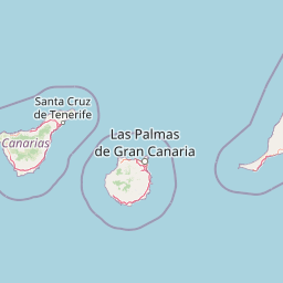
Map view of Parque Rural del Nublo

Use this park location map to pinpoint Parque Rural del Nublo in Spain, understand its exact geographic position, and read its mapped placement within the surrounding landscape more clearly.

Pigeon | © OpenStreetMap contributors

Location context for Parque Rural del Nublo

Canary Islands

Visual reference for rugged terrain, towering monoliths, and protected highland habitats

Parque Rural del Nublo Landscape Photography and Volcanic Scenery

Visual records illustrate the monumental volcanic terrain, deep barrancos, and ecological zones defining Parque Rural del Nublo. Photographic documentation reveals the distinct geomorphology, native pine forests, and dramatic escarpments shaping the surrounding protected region.

A dirt hiking trail curves along a mountainous ridge populated by tall pine trees, overlooking a deep ravine and distant valley in Gran Canaria.

A distant view of the Roque Nublo monolith standing on a rocky ridge, framed by foreground pine trees with a faint mountain peak in the distance.

Park atlas

Compare adjacent highland terrain, volcanic landscapes, and regional conservation zones.

Exploring Other Protected Areas and Parks Near Parque Rural del Nublo

Browse nearby protected natural areas and regional reserves to compare the volcanic topography and highland ecosystems surrounding Parque rural del Nublo. Extending your geographic comparison across adjacent terrain reveals the wider ecological patterns and protected landscapes spanning the archipelago.
A soft watercolor painting showing a rolling landscape with green hills, a small tree in the foreground, and pale blue mountains in the background.
Protected landscapeCanarias
About 11 km away#1 closest

North

Parque rural de Doramas Protected Landscape: Gran Canaria Geographic and Terrain Atlas

Exploring laurel forest strongholds and rugged ravine geography.

Parque rural de Doramas encompasses over 3,500 hectares of diverse northern Gran Canaria terrain, where steep-sided barrancos support rare laurisilva and monteverde vegetation. This protected landscape serves as a living remnant of the island's once-vast indigenous forests, offering a unique opportunity to study the relationship between human-influenced agricultural slopes and wild, humid forest refuges found deep within the island's northern flanks.

Area
35.86 km²
Relief
Upland
Climate
Mediterranean
Scope
Terrestrial
Watercolor painting of soft, layered mountain ridges in shades of green, purple, and pale yellow, set against a white background.
Protected landscapeCanarias
About 80 km away#2 closest

Northwest

Parque rural de Anaga: Mapping the Volcanic Relief and Laurisilva Forests of Canarias

A detailed geographic overview of the Anaga massif protected landscape.

Parque rural de Anaga preserves a dramatic landscape of volcanic plugs, deeply incised valleys, and endemic-rich cloud forests in the Canary Islands. Understand the complex terrain and protected area boundaries that define this historic massif, from its coastal cliffs to its high mountain ridges.

Area
144.187 km²
Established
1994
Relief
Mountain
Climate
Subtropical
Watercolor illustration of a mountainous landscape with green and purple hues, featuring rolling hills, distant mountains, and a light sky.
National parkTenerife
About 94 km away#3 closest

West

Teide National Park: Spain's Highest Peak and Distinctive Volcanic Landscape

Explore protected volcanic terrain and mapped geography on Tenerife.

Teide National Park protects the highest point in Spain, Mount Teide, within a spectacular caldera and surrounding volcanic terrain on Tenerife. This national park offers a unique landscape for geographic discovery, showcasing dramatic lava flows, volcanic cones, and endemic flora. Its protected boundaries define a significant area of natural interest, making it a key landmark for atlas exploration of island geography and protected lands.

Area
189.9 km²
Established
1954
IUCN
II
Visitors
4.5M annual
A soft watercolor painting depicting green rolling hills and layered mountain ridges against a white background.
Protected landscapeTenerife
About 121 km away#4 closest

West

Parque rural de Teno: Volcanic Massif and Protected Landscape Geography in Tenerife

Coastal cliffs, volcanic barrancos, and laurel forest ecosystems.

Parque rural de Teno serves as a primary geographic anchor for northwest Tenerife, encompassing a triangular volcanic block defined by vertical sea cliffs and steep, eroded ravines. This protected landscape preserves unique biodiversity and traditional cultural architecture, offering a comprehensive look at the island's geological and ecological variety from the shoreline to the mist-prone summits.

Area
80.636 km²
Established
1987
Relief
Mountain
Climate
Mediterranean
National parkSpain
About 156 km away#5 closest

West

Garajonay National Park: Ancient Laurisilva Forest and Volcanic Landscapes

Explore Spain's unique protected area with rich geographic context.

Garajonay National Park, a treasure of La Gomera, preserves one of the last stands of Europe's ancient laurisilva forest atop dramatic volcanic terrain. This national park offers a rare opportunity to explore a landscape shaped by persistent cloud cover and unique island evolution. Examine the park's mapped boundaries and distinctive natural features through its detailed geographic profile.

Area
40 km²
Established
1981
IUCN
II
Visitors
450K annual
A soft watercolor illustration of a landscape with muted green and purple hills against a white background.
Protected landscapeCanarias
About 159 km away#6 closest

East

Parque rural de Betancuria: Protected Landscape, Fuerteventura, Canarias

A rugged volcanic and geological interior landscape

Investigate the topographical intensity of Parque rural de Betancuria, home to the Betancuria Massif and unique Basal Complex exposures. This protected landscape documents a long history of geological transformation and traditional human adaptation to the arid Fuerteventura environment.

Area
165.443 km²
Established
1987
Relief
Mountain
Climate
Arid
Watercolor painting of a landscape with grassy areas, a winding river, and mountains under a light sky
National parkCanary Islands
About 208 km away#7 closest

Northeast

Timanfaya National Park: Dramatic Volcanic Landscape in the Canary Islands

Explore Spain's unique geological national park.

Timanfaya National Park offers an extraordinary exploration of volcanic terrain, a protected area that defines geological conservation in the Canary Islands. Its landscape, shaped by powerful eruptions, features vast lava fields, striking volcanic cones, and visible geothermal activity. As Spain's only purely geological national park, Timanfaya provides a unique context for understanding volcanic processes and appreciating the raw beauty of its protected natural environment, serving as a key landmark within the archipelago's geography.

Area
51.07 km²
Established
1974
IUCN
II
Relief
Mountain
Watercolor illustration showing a mountainous landscape with green forests, a winding river, and distant hills
National parkSpain
About 232 km away#8 closest

West

Caldera de Taburiente National Park: National Park & Geological Heritage Site

Explore its volcanic caldera, mapped ravines, and pine forests.

Caldera de Taburiente National Park is a protected natural area on the island of La Palma, Spain. It encompasses a vast, approximately 10-kilometer-wide volcanic caldera, characterized by immense cliffs, deep ravines, and extensive Canary Island Pine forests. This national park is recognized for its significant geological features and unique landscape, making it a key destination for understanding protected area geography and regional natural heritage.

Area
46.9 km²
Established
1954
IUCN
II
Visitors
389K annual

Common questions about visiting, size, designation, and location context for Parque Rural del Nublo

Parque Rural del Nublo FAQs for park facts, access, geography, and protected area context

Find quick answers about Parque Rural del Nublo, including protected-area facts, park geography, trail and visitor context, and how the park fits into its surrounding country and regional landscape.
MoriAtlas Explorer

Continue Your Protected Areas Search Across the Global Atlas

Deepen your exploration by continuing the structured search for national parks and protected areas worldwide. Utilize the comprehensive filtering capabilities to compare different conservation landscapes and refine your understanding of global park geography. Discover more about the distribution and characteristics of protected natural areas.

Global natural geography