
Mori Atlas logo
Protected landscapePawnee National Grassland

Mapping the shortgrass prairie, dramatic butte escarpments, and semiarid ecosystems.

Pawnee National Grassland: A Protected Landscape Map of Northeastern Colorado Great Plains

Pawnee National Grassland encompasses expansive semiarid plains in northeastern Colorado, forming a crucial protected landscape within the South Platte River basin. This atlas entry focuses on the geologic significance of the Pawnee Buttes and the surrounding mosaic of shortgrass prairie, clay barrens, and scarp woodlands. Users can examine the park boundaries and regional terrain that define this distinctive Great Plains conservation area.

shortgrass prairieGreat Plainsgrassland preservationprairie ecosystemPawnee Buttesbuttes and escarpments
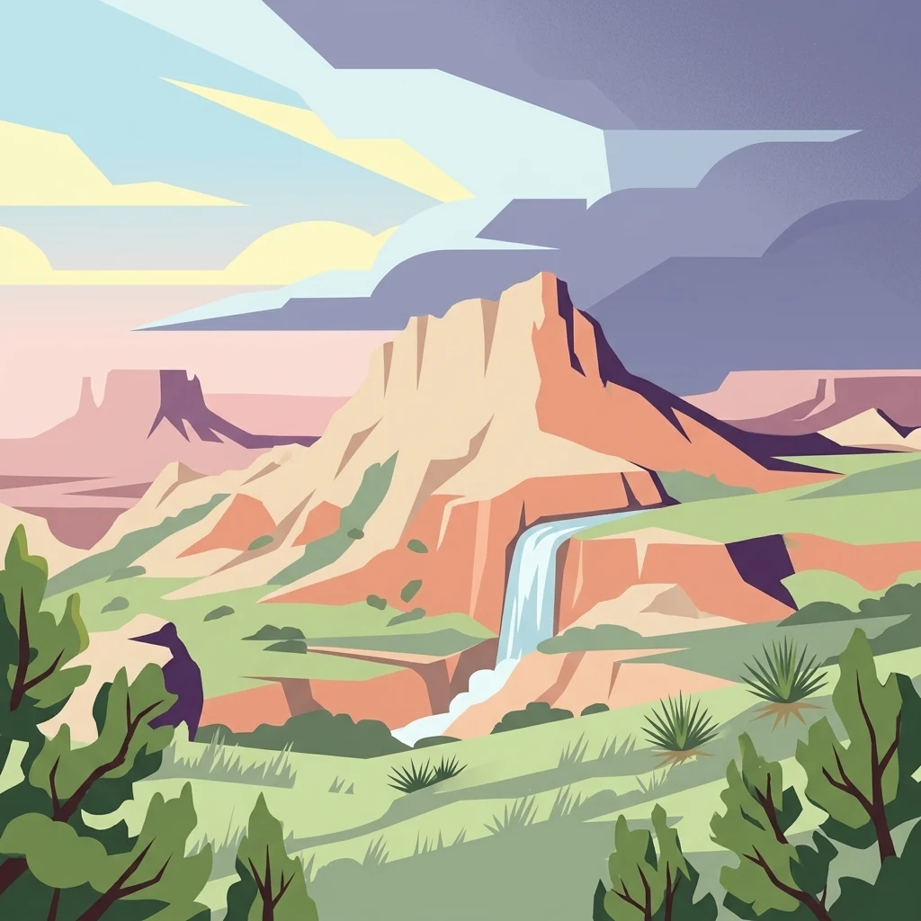
An illustration of arid grasslands with prominent mesas, a waterfall, and desert shrubs under a stormy sky.

Pawnee National Grassland

Protected landscape

Park overview

Structured park overview, official facts, and landscape profile for Pawnee National Grassland

Pawnee National Grassland park facts, protected area profile, and essential visitor context

Review the core facts for Pawnee National Grassland, including designation, size, terrain, visitor scale, habitats, and operating context in one park-focused overview.

About Pawnee National Grassland

Pawnee National Grassland is one of the largest blocks of protected shortgrass prairie in Colorado and an important representation of North America's Great Plains ecosystems. Located in the South Platte River basin of northeastern Colorado, the grassland occupies remote Weld County lands between the agricultural communities of Greeley and Sterling. Although it lies in one of the more depopulated regions of the Colorado Eastern Plains, it is easily reachable from the Front Range population centers and forms a key component of the federally administered Arapaho and Roosevelt National Forests and Pawnee National Grassland.

The landscape is defined by vast, flat to gently rolling terrain that opens up to dramatic geological anomalies. The most iconic of these are the Pawnee Buttes, ancient remnants of erosion-resistant caprock that stand as rugged sentinels above the surrounding steppe. These formations are not only visually striking but also ecologically critical: their north-facing cliffs and sheltered canyons retain moisture and support vegetation types such as scarp woodlands that differ sharply from the open prairie elsewhere in the grassland.

The area was used for limited cultivation in the early twentieth century but was abandoned to farming after the catastrophic Dust Bowl era, which left much of the soil vulnerable to wind erosion. The U.S. Forest Service began acquiring the land, and the grassland was formally established in 1960 to restore native vegetation, protect soil, and preserve the shortgrass prairie ecosystem. Today, it functions both as a working landscape, with active grazing leases, and as a recreational and conservation area.

Beyond its ecological importance, the grassland offers visitors a sense of uninterrupted prairie that is increasingly rare in the modern Great Plains. The terrain, wildlife, weather, and wide horizons combine to give visitors a feel for what much of the American West looked like before large-scale agricultural conversion.

Quick facts and research context for Pawnee National Grassland

Pawnee National Grassland covers roughly 193,060 acres of federally protected shortgrass prairie in Weld County, northeastern Colorado. It is administered by the U.S. Forest Service together with the Arapaho and Roosevelt National Forests, with a district office in Greeley and overall administration based in Fort Collins.

The grassland lies within the South Platte River basin and is divided into a western parcel drained largely by Crow Creek and an eastern parcel drained by Pawnee Creek. Established in 1960 from lands withdrawn after the Dust Bowl, it preserves one of the best examples of the shortgrass plains ecosystem, especially around the geologically prominent Pawnee Buttes.

Protection and recognition

Examine the documented terrestrial scope and official preservation metrics for this protected landscape

Pawnee National Grassland Protection Status and Terrestrial Designation

Pawnee National Grassland maintains a documented terrestrial protection scope within the national conservation framework. Review the recorded management context, designation details, and international recognition criteria assigned to this protected area.

Protection details

Protection scope
Terrestrial
Transboundary protection
No
Park context

Deeper park guide and search-rich context for Pawnee National Grassland

Pawnee National Grassland history, landscape, wildlife, and travel context

Explore Pawnee National Grassland through its history, landscape character, ecosystems, wildlife, conservation priorities, cultural context, and seasonal travel timing in a structured park guide built for atlas discovery and search intent.

Why Pawnee National Grassland stands out

The grassland is best known for the Pawnee Buttes, two prominent butte formations that rise sharply from the surrounding plains and host the most intact examples of shortgrass prairie in the region. The buttes also support unusual scarp woodlands featuring limber pine and small ponderosa pines, which are relicts of colder ice-age forests. Equally significant is the grassland's role in conserving the semiarid shortgrass steppe itself, an ecosystem dominated by buffalo grass and blue grama. The area combines open prairie expanses, eroded clay escarpments, arroyos, shrub steppe, and alkaline flats, creating a remarkably varied Great Plains landscape in a relatively compact region.
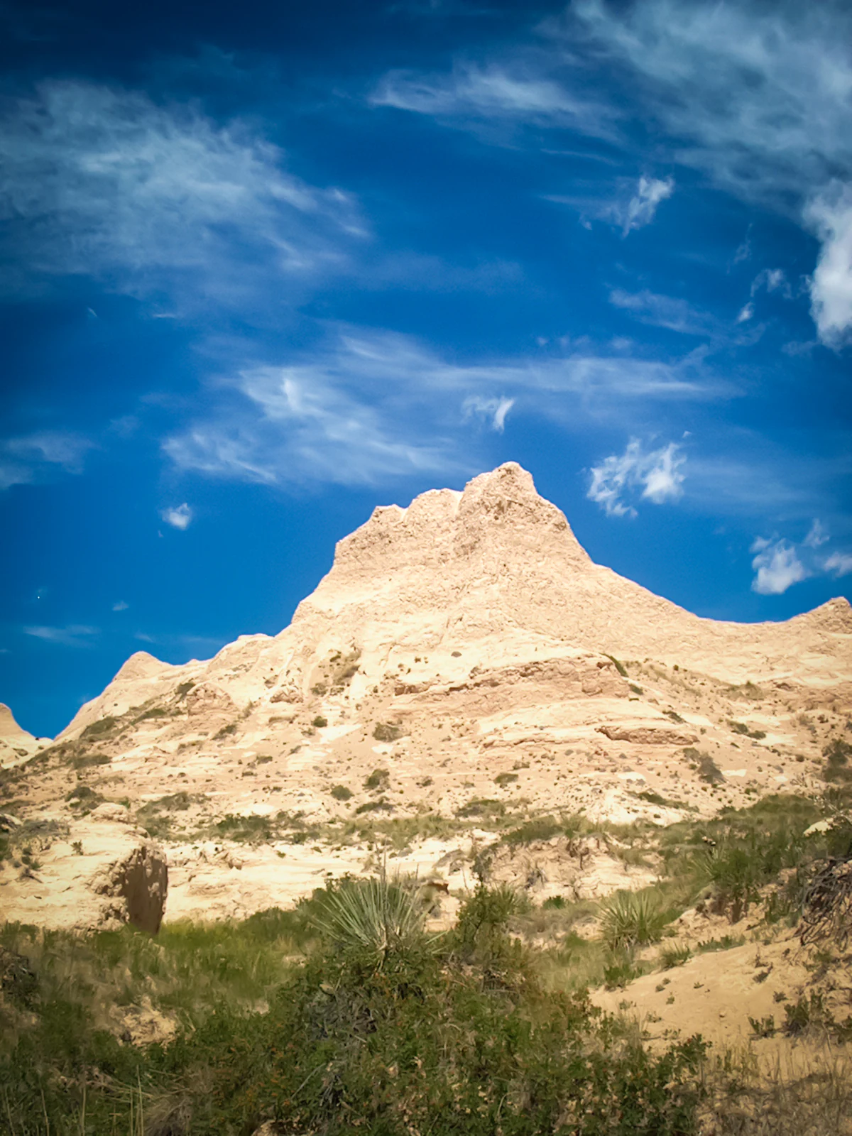
A steep, light-colored sedimentary butte stands against a vibrant blue sky with scattered clouds, surrounded by sparse prairie vegetation.
A distinctive sandstone butte rises above the shortgrass prairie landscape of Pawnee National Grassland.

Pawnee National Grassland history and protected-area timeline

The history of Pawnee National Grassland is closely tied to the agricultural and environmental upheaval of the early twentieth century on the Great Plains. During the homesteading era, parts of what is now the grassland were plowed for wheat and other dryland crops. The region's semiarid climate, with only fifteen to twenty inches of annual rainfall, proved poorly suited to intensive cultivation.

The Dust Bowl of the 1930s devastated these dryland farms. Severe wind erosion stripped topsoil from large areas, rendering the land economically ruined and ecologically fragile. In response to the ecological disaster, the federal government began acquiring parcels of abandoned and damaged land in northeastern Colorado under programs designed to restore the soil and native vegetation.

In 1960, the accumulated lands were formally established as Pawnee National Grassland under the administration of the U.S. Forest Service. The grassland was designated to protect the shortgrass prairie ecosystem, stabilize soils, and serve as a working landscape where grazing and conservation could coexist. Today it is administered jointly with the Arapaho and Roosevelt National Forests. Despite a long period of ecological recovery, the grassland has more recently faced new pressures from energy development, including extensive oil and gas drilling across the property.

Pawnee National Grassland landscape and geographic character

Pawnee National Grassland is a landscape of expansive, semiarid shortgrass plains, interrupted predominantly by the dramatic outcrops of the Pawnee Buttes in the eastern parcel. The terrain is shaped by the eastward-flowing South Platte River basin, with the western unit mostly drained by Crow Creek and the eastern unit by Pawnee Creek. Across most of the grassland, the land is flat to gently rolling, producing uninterrupted horizons that characterize the Great Plains.

Soils shift gradually from west to east, transitioning from darker prairie soils to chestnut and brown chernozems in the central and western portions, with brown soils near the buttes. Annual rainfall is typically fifteen to twenty inches, classifying the region as semiarid and supporting the hardy grass and shrub communities for which the plains are famous.

The Pawnee Buttes themselves are the most striking geological feature. They are erosional remnants of ancient sedimentary layers, likely including Brule Formation clays, cut by deep gullies, arroyos, and canyons. These formations rise abruptly from the plain, exposing colorful clay barrens, vertical cliff faces, and broken rocky slopes. Around and beneath the buttes, the terrain becomes much more varied, with sinkholes, escarpments, swales, and sandy or gravelly rises creating a mosaic of microhabitats in a relatively small area.
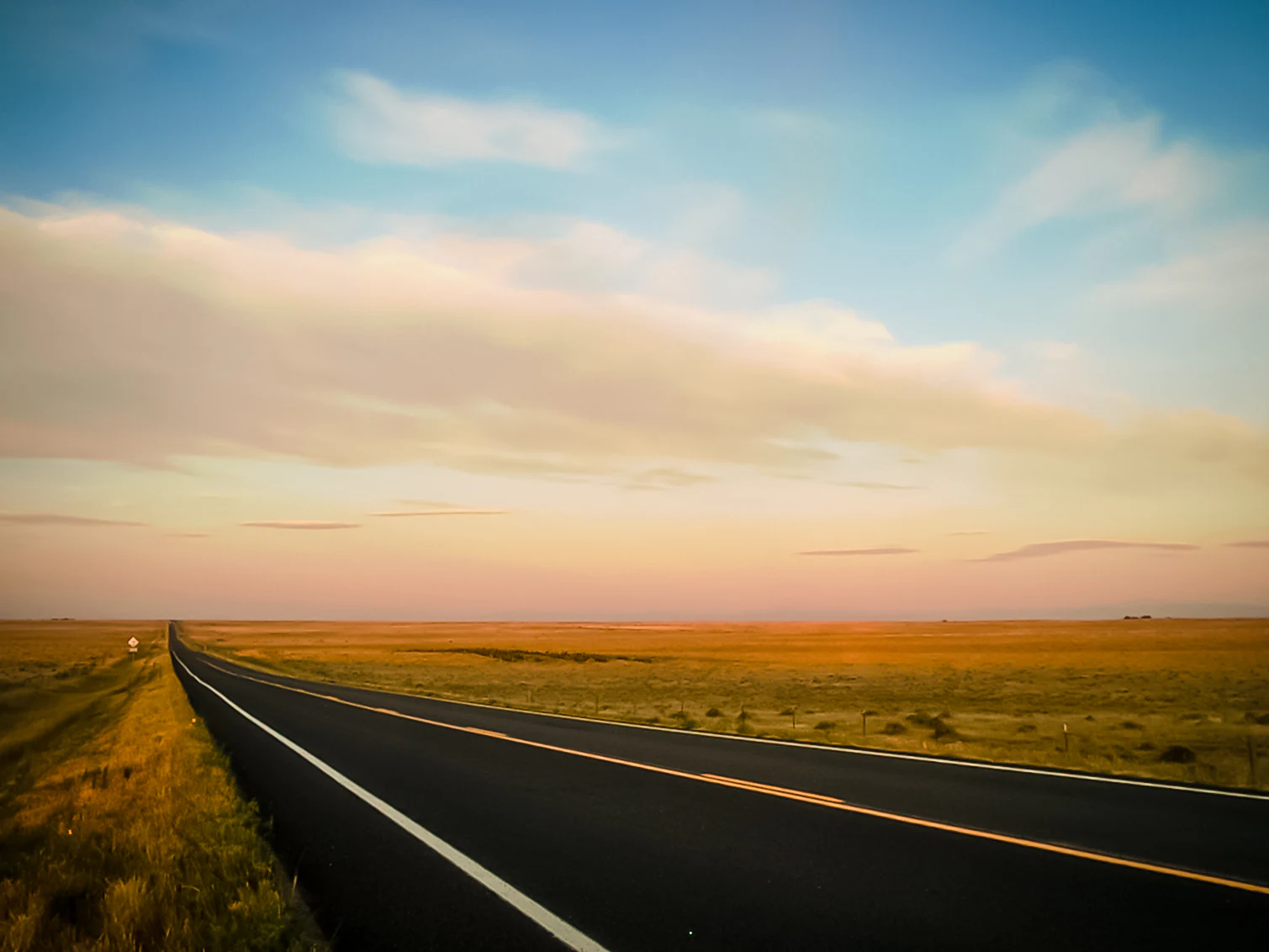
A long, straight paved road cuts through a vast, flat grassland under a soft sunrise sky with pink and blue hues.
A straight road stretches through the open shortgrass prairie of Pawnee National Grassland during sunrise.

Pawnee National Grassland ecosystems, habitats, and plant life

The natural character of Pawnee National Grassland is defined by its place within the shortgrass plains, one of the major ecosystem types of North America. The core of the grassland is dominated by two grass species, blue grama and buffalo grass, which form the dense, low-growing carpet typical of the western Great Plains. These species are well adapted to the semiarid climate and produce the characteristic rolling, tawny texture of the prairie.

The vegetation of the grassland is organized into eleven distinct zones, reflecting the interaction of soils, slope, exposure, and moisture. These include short grass prairie, mixed prairie, little bluestem patches in swales, shrub steppe on alkaline soils, deep arroyo woodlands, clay barrens on eroding Brule Formation clays, broken-rock break shrub communities, and the rare scarp woodlands of the north-facing butte slopes.

Scarp woodlands are particularly notable, as they host limber pine, small ponderosa pines, and Rocky Mountain juniper, trees that descend into the plains here from much cooler, higher elevations. Their presence is interpreted as a relict of ice-age forests that once extended much farther down into the Great Plains during glacial periods. The combination of plains, shrublands, and scattered woodlands gives the grassland an unusually rich natural profile for a semiarid prairie preserve.
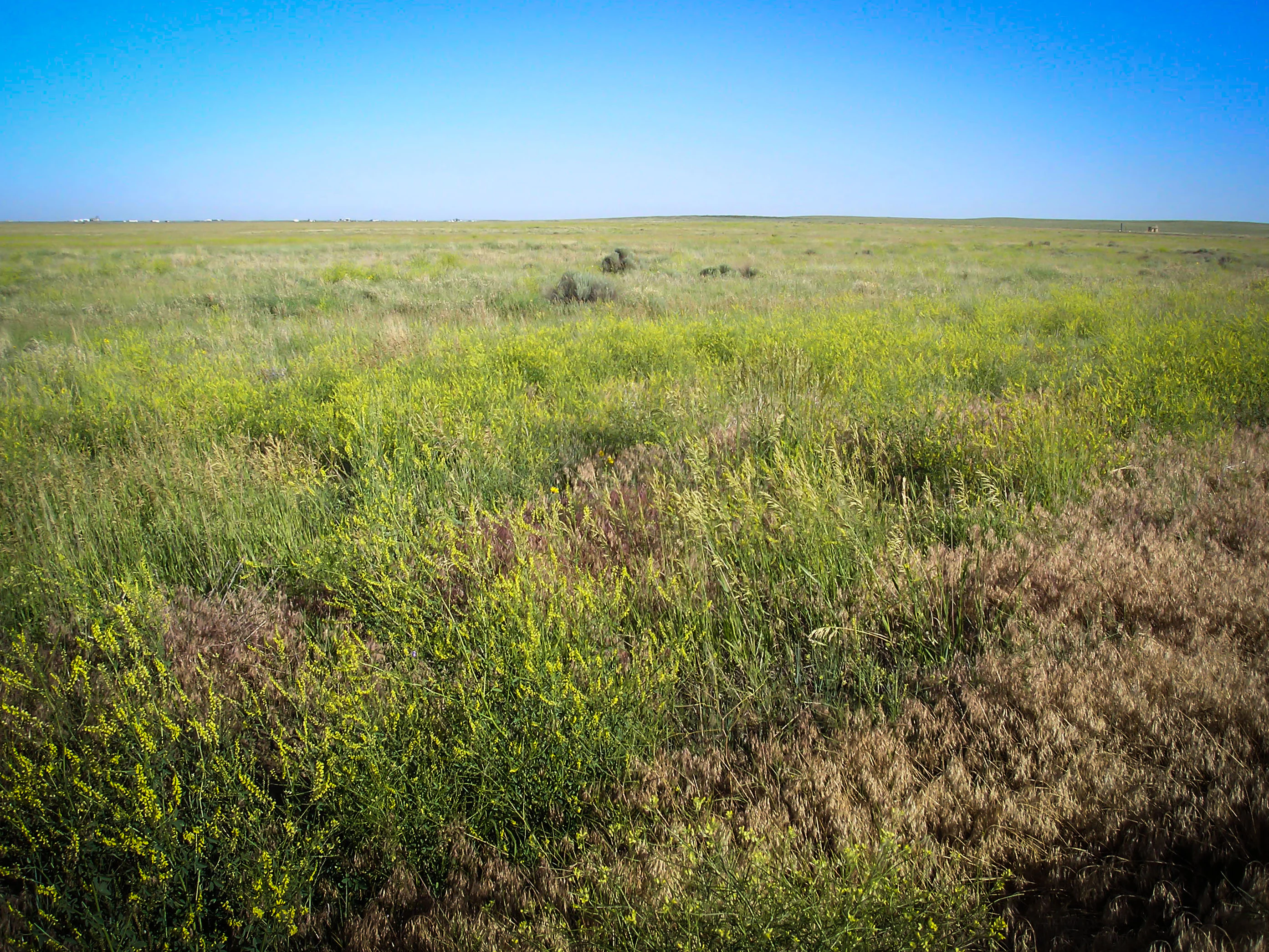
An expansive, flat prairie landscape under a clear blue sky, featuring a mix of green grasses and patches of dried brown vegetation.
A wide, open view of the shortgrass prairie landscape within the Pawnee National Grassland.

Pawnee National Grassland wildlife and species highlights

Wildlife is most concentrated around the Pawnee Buttes, where intact vegetation and varied terrain provide cover and forage for a wide range of Great Plains species. The most visible large mammals are pronghorn, with mule deer, bison, and coyotes also present. Black-tailed jackrabbits and numerous rodent species are abundant, and prairie dog colonies contribute to the prairie ecosystem by creating disturbed patches used by other plants and animals.

The grassland supports an important raptor community. Golden eagles and prairie falcons nest on the cliffs and bluffs of the buttes, and the Chalk Bluffs area is recognized as a notable raptor nesting site. A wide variety of songbirds, ground-nesting birds, and other raptors occur throughout the prairie, making birdwatching one of the most popular recreational pursuits in the grassland.

Wet features such as the Willow Spring area and scattered potholes support small concentrations of moisture-loving plants and attract amphibians, insects, and additional birdlife. The varied habitats within a relatively compact area mean that even casual visitors may see species that are difficult to find elsewhere on the open plains.
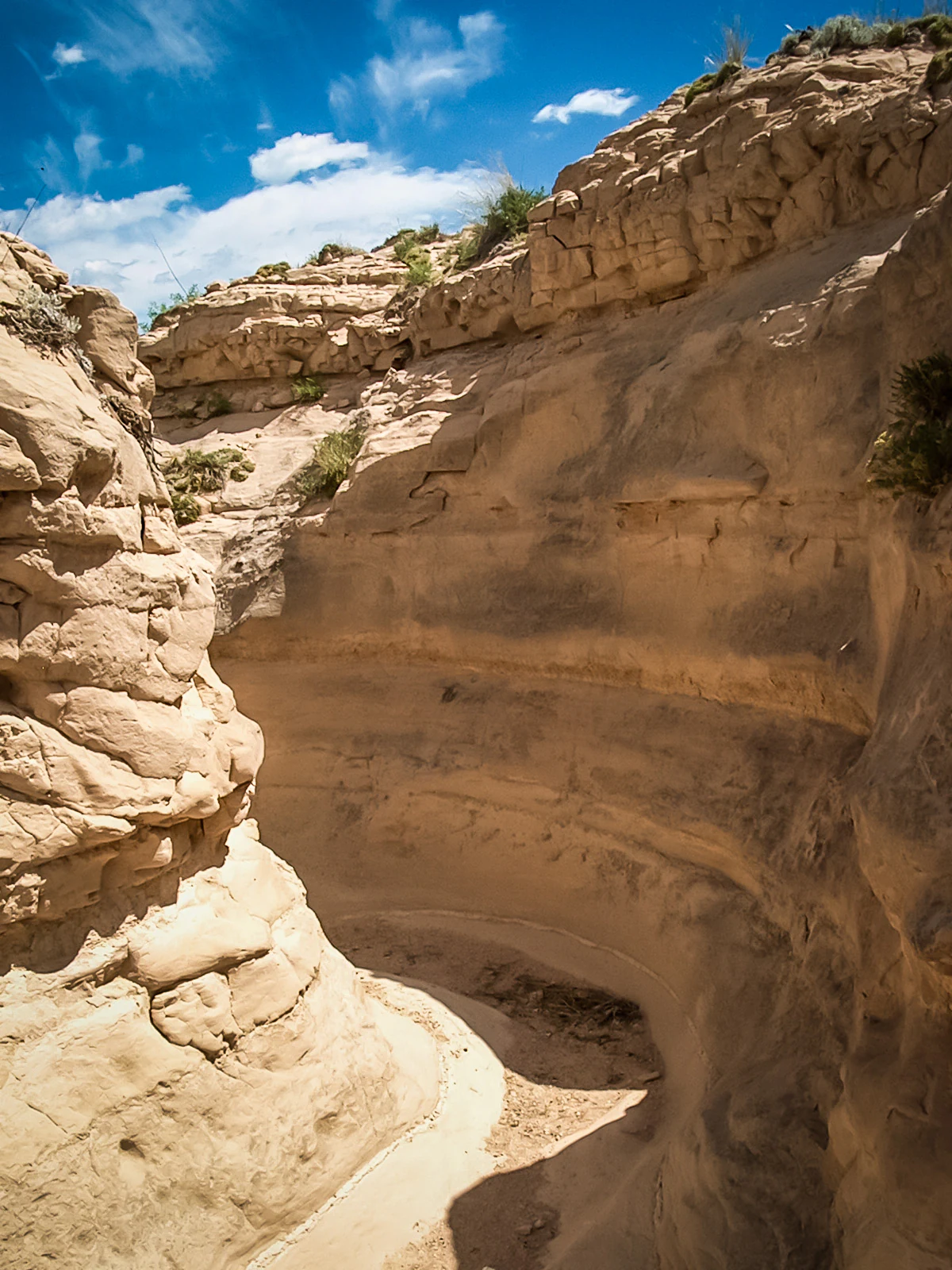
A narrow, winding gully carved into light-colored sedimentary rock under a bright blue sky.
A narrow gully winding through sedimentary rock formations in the Pawnee National Grassland.

Pawnee National Grassland conservation status and protection priorities

Pawnee National Grassland represents one of the more important efforts to restore and conserve the shortgrass prairie ecosystem following the ecological disaster of the Dust Bowl. Established in 1960 on lands damaged by failed dryland farming, the grassland serves as a model for recovering native vegetation in a semiarid landscape and demonstrates how federal ownership can stabilize soils and vegetation across broad landscapes.

The area around the Pawnee Buttes is considered the best-preserved example of the shortgrass plains ecosystem, and the eleven recognized vegetation zones highlight its ecological diversity. The rare scarp woodlands of the buttes, with their limber and ponderosa pines, are a particular focus of conservation interest as relicts of ice-age forests.

However, the grassland's conservation mission faces ongoing challenges. Energy development, particularly oil and gas drilling, has expanded significantly within the protected area. According to the U.S. Forest Service, dozens of active wells are present on the property, and only a small fraction of the total acreage is shielded from drilling. This tension between conservation, working-landscape grazing, and energy production shapes the modern management of the grassland.

Pawnee National Grassland cultural meaning and human context

The cultural identity of the region surrounding Pawnee National Grassland is shaped by the frontier and Dust Bowl eras. Small communities such as Keota, Purcell, Grover, and Briggsdale still occupy the grasslands and surrounding plains, some surviving as remnants of the homesteading boom that briefly placed farms in this semiarid region. Their existence reflects the broader settlement and abandonment pattern of the Great Plains in the twentieth century.

The name of the grassland itself references the Pawnee people, whose historical territory included parts of the central Plains. While the protected area is a modern federal designation and not a tribal land base, the name situates the landscape within a longer Indigenous history of the region.
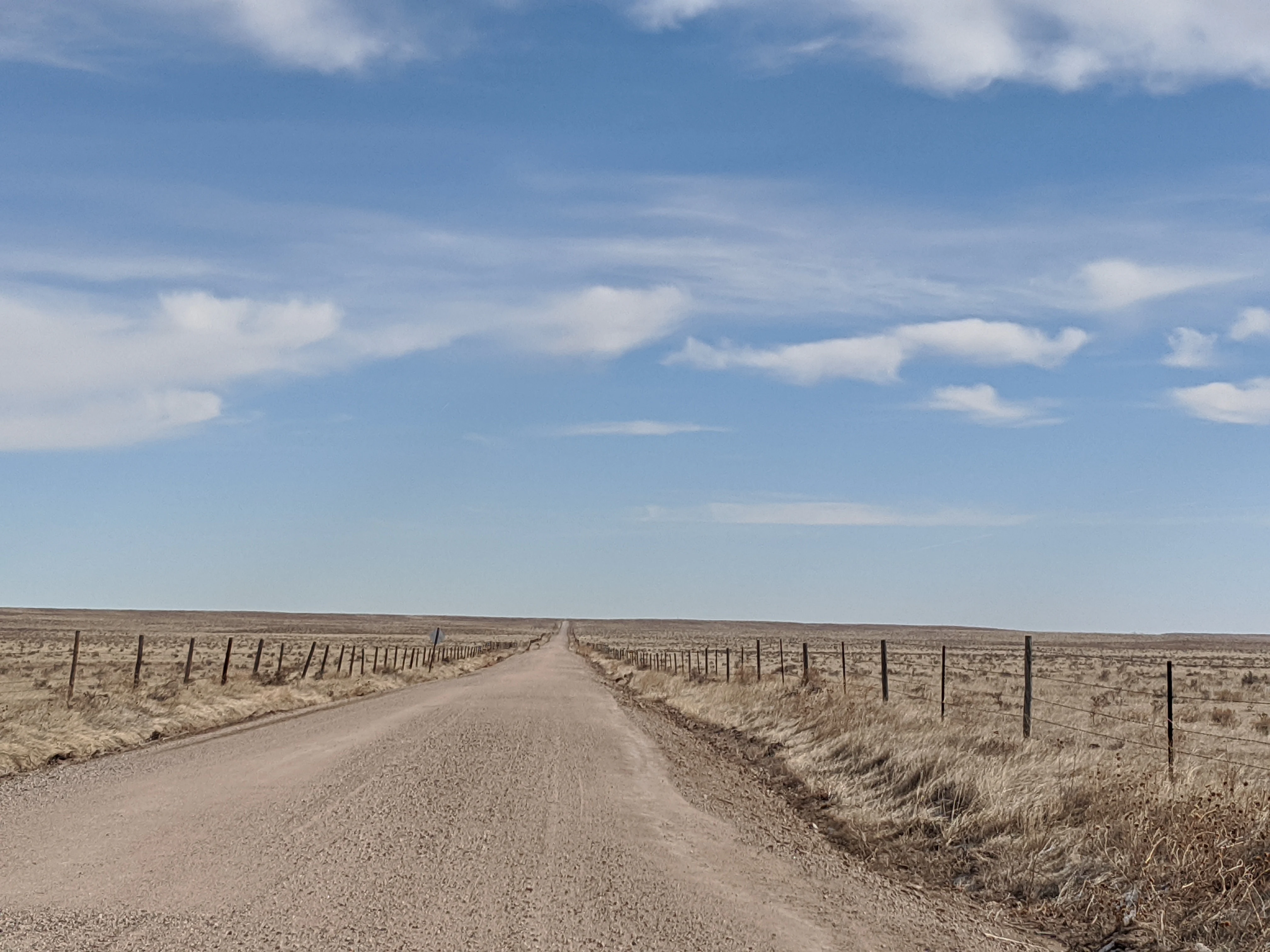
A wide, unpaved gravel road leads into the distance through a vast, flat, dry grassland bordered by wire fences under a clear blue sky with light clouds.
A dirt road stretching across the open, shortgrass prairie landscape of Pawnee National Grassland.

Top sights and standout views in Pawnee National Grassland

The standout features of Pawnee National Grassland are concentrated around the Pawnee Buttes and their surrounding ecological mosaic. These formations combine dramatic visual scenery with the grassland's most intact native vegetation, making them the principal destination for most visitors. The buttes' north-facing cliffs support rare scarp woodlands, one of the most distinctive ecological elements in the entire shortgrass plains.

Wider highlights include the sweeping unbroken vistas of shortgrass prairie, the abundance of raptors and nesting birds especially at Chalk Bluffs, the recreational opportunities around Crow Valley Recreation Area, and the unusual combination of clay barrens, arroyos, shrub steppe, and alkaline flats. Together these attributes make the grassland one of the richer shortgrass preserves in the American West.

Best time to visit Pawnee National Grassland

Seasonal timing has a strong influence on the look and feel of Pawnee National Grassland. Spring and early summer are generally the most rewarding periods for wildflowers, which bloom from April through September, and for seeing the broadest range of plant species in the mixed prairie and along roadsides. The vegetation is greener and more varied in these months, and wildflowers are most visible near rocky outcrops and wet potholes around the Pawnee Buttes.

Late summer into early fall tends to bring drier, more golden prairie conditions, with clearer skies but warmer temperatures. Winters are typically cold and can bring snow, giving the prairie a quieter, more austere character and occasional dramatic storm skies over the open plains. Birdwatching for nesting raptors is generally best in spring, while pronghorn and other mammals can be observed across much of the year.

Monthly climate preview

Long term temperature and precipitation patterns across representative coordinates

Pawnee National Grassland Climate Normals and Annual Weather by Month

Representative coordinates for Pawnee National Grassland track a measured annual temperature rhythm alongside consistent monthly precipitation records from 1991 through 2020. Reviewing the complete twelve month profile provides deeper insight into long term averages for temperature extremes and precipitation distribution.
Annual mean10 °C
-1 °C24 °C
Jan-1°
Feb
Mar
Apr
May14°
Jun20°
Jul24°
Aug23°
Sep17°
Oct
Nov
Dec-1°
Warmest month
July

24.2 °C

Coolest month
December

-1.5 °C

Wettest month
May

2.3 mm/day

Driest month
January

0.2 mm/day

Park location guide

Geography guide, regional context, and park location map for Pawnee National Grassland

Pawnee National Grassland park geography, regions, and map view in United States of America

Understand where Pawnee National Grassland sits in United States of America through a broader geographic reading of the surrounding landscape, nearby location context, and its mapped position within the national park landscape.

How Pawnee National Grassland fits into United States of America

The United States of America is a federal presidential republic and one of the world's largest countries by area and population. It consists of 50 states across a vast territory spanning multiple time zones, with its capital in Washington, D.C. and largest city in New York City. The nation has a diverse economy, influential political system, and significant cultural and military presence globally.

Wider geography shaping Pawnee National Grassland in United States of America

The United States occupies a vast territory in North America, bordered by Canada to the north and Mexico to the south. The 48 contiguous states stretch from the Atlantic to the Pacific Ocean, while Alaska occupies the northwestern region and Hawaii is an archipelago in the Pacific. The country encompasses diverse terrain including the Rocky Mountains, Appalachian Mountains, Great Plains, and extensive river systems.

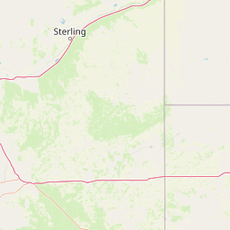
Map view of Pawnee National Grassland

Use this park location map to pinpoint Pawnee National Grassland in United States of America, understand its exact geographic position, and read its mapped placement within the surrounding landscape more clearly.

Pigeon | © OpenStreetMap contributors

Location context for Pawnee National Grassland

Colorado
Recorded earthquake history

Review the Historical Earthquake Catalogue for Pawnee National Grassland

Examine documented seismic records associated with the surrounding region of Pawnee National Grassland. This database provides a searchable collection of historical earthquakes including magnitude and location details to support geographic discovery within the MoriAtlas framework.

Pawnee National Grassland Earthquake History

Catalogued events

2 events

Strongest magnitude

Magnitude 3.2

Most recent event

Nov 6, 2016

This history includes earthquakes recorded inside the park or within 50 km of its borders

Visualizing shortgrass prairie terrain, eroding buttes, and semiarid plains

Pawnee National Grassland Photos and Landscapes

Visual documentation captures the vast shortgrass plains, dramatic clay escarpments, and rugged buttes defining the protected landscape. Examining field photography reveals the distinct ecological character and diverse microhabitats preserved across the eastern Colorado prairie.

A steep, light-colored sedimentary butte stands against a vibrant blue sky with scattered clouds, surrounded by sparse prairie vegetation.

A large dark storm cloud looms over a flat, grassy plain with a simple wire fence in the foreground.

A long, straight paved road cuts through a vast, flat grassland under a soft sunrise sky with pink and blue hues.

An expansive, flat prairie landscape under a clear blue sky, featuring a mix of green grasses and patches of dried brown vegetation.

A narrow, winding gully carved into light-colored sedimentary rock under a bright blue sky.

A wide view of the Pawnee Buttes, which are two prominent, light-colored geological rock formations rising from a flat, grassy landscape under a clear blue sky.

A wide, unpaved gravel road leads into the distance through a vast, flat, dry grassland bordered by wire fences under a clear blue sky with light clouds.

Park atlas

Compare regional geography, grassland ecosystems, and adjacent protected landscapes

Explore Other Parks Near Pawnee National Grassland and Surrounding Protected Areas

Browse nearby national parks and protected areas sharing similar shortgrass prairie geography across the surrounding region. Comparing adjacent conservation lands reveals broader ecological patterns across the Great Plains and regional river basins.
A horizontal watercolor painting showing a range of purple and reddish-toned mountains in the distance, behind rolling green fields and a pale pinkish waterway in the foreground.
Protected landscapeColorado
35 km away#1 closest

West

Roosevelt National Forest: Mapping Wilderness and Protected Landscapes in Northern Colorado

Regional geography, river corridors, and alpine mountain terrain

Roosevelt National Forest encompasses a significant protected landscape across Larimer, Boulder, Gilpin, and Jefferson counties. The forest features a complex terrain of deep canyons, forested plateaus, and protected wilderness areas that form a scenic buffer along the eastern side of the Continental Divide and Rocky Mountain National Park.

Area
3,293.33 km²
Established
1902
Relief
Mountain
Climate
Subpolar
National parkColorado
70 km away#2 closest

West

Rocky Mountain National Park: National Park Protected Landscape in Colorado

Explore its mapped boundaries and regional geographic context.

Rocky Mountain National Park is a designated National Park within Colorado, crucial for understanding the distribution and geographic context of protected areas in the United States. This detail page provides an atlas-oriented perspective, emphasizing the park's mapped boundaries and its place within the natural landscape of the region. It is designed to facilitate a clear understanding of the park's protected status and its contribution to the atlas of natural landscapes, offering factual insights for geographic discovery.

Area
1,074.28 km²
Established
1915
IUCN
II
Visitors
4.2M annual
A watercolor painting of a mountain landscape featuring a small lake, grassy slopes, and conifer trees with a prominent rocky peak in the distance.
Wildlife reserveColorado
93 km away#3 closest

Southwest

Indian Peaks Wilderness: Alpine Geography and Front Range Protected Landscapes

Mapping high country summits and glacial basins in Colorado

Indian Peaks Wilderness stands as a signature wildlife reserve along the Colorado Continental Divide. This atlas entry focuses on its complex system of thirteen-thousand-foot peaks, relict glaciers, and interconnected alpine lakes that define the Front Range. Gain insight into the protected boundaries and glacial geomorphology that characterize this high-country landscape near the Denver metropolitan region.

Area
310.44 km²
Established
1978
IUCN
Ib
Relief
Mountain
A horizontal watercolor painting showing a soft mountain range in the distance, a midground forest, and a foreground area suggesting marshy ground or a meadow.
Wildlife reserveColorado
101 km away#4 closest

West

Never Summer Wilderness: Protected Mountain Geography and Alpine Terrain in Colorado

High-altitude wilderness along the Continental Divide

Spanning over 21,000 acres, the Never Summer Wilderness defines a critical segment of the Colorado Rockies. This protected area features a jagged skyline of 12,000-foot summits, extensive alpine tundra, and the remarkable old-growth spruce and fir forests of Bowen Gulch. Use these maps to understand its role as a vital headwater landscape and its position as a sanctuary for alpine wildlife and ecosystems.

Area
85.3 km²
Established
1980
IUCN
Ib
Relief
Mountain
Protected landscapeGrand County
107 km away#5 closest

Southwest

Arapaho National Recreation Area: Geographic Profile and Protected Landscape Context

High-country mountain reservoirs and forested mountain terrain

The Arapaho National Recreation Area defines a unique intersection of montane forest and water-based geography in Grand County, Colorado. As the home to the Great Lakes of Colorado, this protected landscape provides a critical connection point between the Colorado River headwaters and the Continental Divide. Examine the park's terrain, reservoir distribution, and its role as a forested gateway to the neighboring mountain regions.

Area
124.2 km²
Established
1978
Relief
Mountain
Climate
Alpine
A watercolor painting showing a panoramic view of mountain peaks in the background behind a forest landscape, set against a white background.
Wildlife reserveColorado
About 127 km away#6 closest

Southwest

James Peak Wilderness: Geographic Profile and Protected Landscape Mapping

High elevation terrain in the Colorado Rockies

James Peak Wilderness provides a critical protected landscape featuring dramatic alpine summits, U-shaped glacial valleys, and subalpine meadows. Its geographic structure forms an essential ecological link along the Colorado Front Range, characterized by high-elevation peaks, dense coniferous forests, and diverse tundra ecosystems situated immediately east of the Continental Divide.

Area
68.86 km²
Established
2002
IUCN
Ib
A horizontal watercolor painting depicting a winding river flowing through a green valley with purple-tinted mountain ranges in the background.
Wildlife reserveWyoming
132 km away#7 closest

West

Platte River Wilderness: Geography and Protected Landscape Atlas

Mapping wild river corridors and mountain forest terrain across Wyoming and Colorado.

Platte River Wilderness preserves a vital stretch of the North Platte River, carving through mountain ranges with steep canyon walls and rocky gorges. The terrain offers a distinct profile of conifer forests and shifting river landscapes. This protected area stands as a primary example of wilderness administration, managing complex river-based topography and regenerating mountain habitat for regional wildlife populations.

Area
95.07 km²
Established
1984
IUCN
Ib
Relief
Mountain
A watercolor painting showing purple and white mountain peaks rising above green rolling hills and meadows in a wide panoramic format
Protected areaColorado
133 km away#8 closest

Southwest

Mount Evans Wilderness: Alpine Landscapes and Protected Geography in Colorado

Glacial cirques and high-altitude wilderness ecosystems.

Mount Evans Wilderness offers a premier look at the Colorado Front Range, defined by its dramatic relief, sheer cliff lines, and extensive glacial history. This entry examines the wilderness as a protected zone that transitions from montane forests to tundra, providing a reference for high-elevation mountainous geography within the United States.

Area
301.09 km²
Established
1980
IUCN
Ib
Relief
Mountain

Common questions about visiting, size, designation, and location context for Pawnee National Grassland

Pawnee National Grassland FAQs for park facts, access, geography, and protected area context

Find quick answers about Pawnee National Grassland, including protected-area facts, park geography, trail and visitor context, and how the park fits into its surrounding country and regional landscape.
MoriAtlas Explorer

Continue Your Protected Areas Search Across the Global Atlas

Deepen your exploration by continuing the structured search for national parks and protected areas worldwide. Utilize the comprehensive filtering capabilities to compare different conservation landscapes and refine your understanding of global park geography. Discover more about the distribution and characteristics of protected natural areas.

Global natural geography