
Mori Atlas logo
State or regional parkPeace Arch Park

Analyzing the mapped boundaries and geographic features of this cross border coastal green space

Peace Arch Park: An Integrated Binational Protected Landscape in British Columbia and Washington

Peace Arch Park serves as a distinct binational protected area at the western terminus of the Canada and United States land boundary. Straddling the coastline where Semiahmoo Bay meets the Pacific, this site features a complex, shared landscape that bridges provincial and state jurisdictions. Through its unique geography and open movement, the area provides a rare look at how protected land functions as a singular site of international connection in the Pacific Northwest.

international parkbinational parkborder landmarkhistorical monumentpeace monumentPacific coast
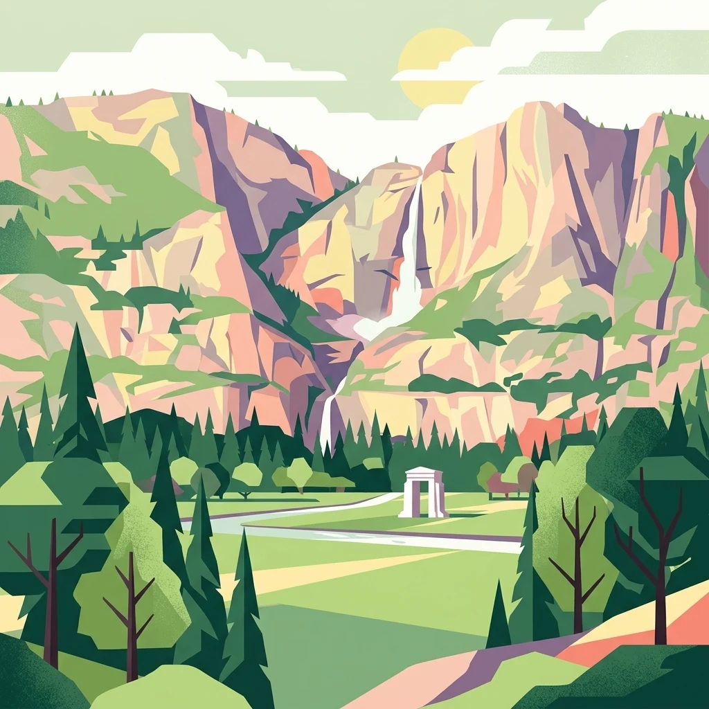
A graphic illustration of a sunny mountain valley with a waterfall in the background and a simple white stone arch in the foreground.

Peace Arch Park

State or regional park

Park overview

Structured park overview, official facts, and landscape profile for Peace Arch Park

Peace Arch Park park facts, protected area profile, and essential visitor context

Review the core facts for Peace Arch Park, including designation, size, terrain, visitor scale, habitats, and operating context in one park-focused overview.

About Peace Arch Park

Peace Arch Park is a transboundary park formed by two adjoining protected areas that meet at the Canada–United States line. Its northern half is Peace Arch Provincial Park in Surrey, British Columbia, administered under the BC Parks system, while its southern half is Peace Arch Historical State Park in Blaine, Washington, part of the Washington State Parks network. Although managed by two separate authorities, the two sides function as a single unified park landscape, with a grassed median and pedestrian areas that allow visitors to walk across the international boundary without crossing through customs controls.

The park occupies a strategic and symbolic location at the extreme western end of the contiguous Canada–United States land border, where that border meets Semiahmoo Bay on the Salish Sea, along the larger Pacific coast of the continent. To its east runs the Peace Arch Border Crossing, one of the busiest crossings between Canada and the United States, and the busiest west of Detroit. Highway 99 in British Columbia and Interstate 5 in Washington converge here, and the Peace Arch monument stands directly on the boundary line in a landscaped median between the northbound and southbound lanes.

Beyond its role as a borderland park, Peace Arch Park is significant as a place of memory and diplomacy. The Peace Arch itself was conceived in 1914 by Samuel Hill, a lawyer tied to the Great Northern Railway, and designed by architect Harvey Wiley Corbett. Rising 20.5 meters, it was dedicated on September 6, 1921, commemorating both the Treaty of Ghent and the Rush-Bagot agreement, which together ended the War of 1812 and established the principle of an unguarded U.S.–Canadian border. The structure is recognized as one of the earliest earthquake-resistant constructions in North America.

The park carries strong heritage recognition on both sides of the border. The Peace Arch was added to the Canadian Register of Historic Places in 1939, the same year the Canadian portion of the park was formally established as a provincial park on November 7, while the American portion dates to 1931 as a state park. The monument was later added to the U.S. National Register of Historic Places in 1996. Today, the park is supported in its cultural mission by the International Peace Arch Association, a nonprofit group that organizes events including an annual International Sculpture Exhibition featuring American and Canadian artists.

Quick facts and research context for Peace Arch Park

Peace Arch Park is a binational protected area made up of two adjoining parks, one on each side of the Canada–United States border. The Canadian portion, Peace Arch Provincial Park, covers roughly 22 acres in Surrey, British Columbia, and is managed by BC Parks. The American portion, Peace Arch Historical State Park, covers about 20 acres in Blaine, Washington, and is managed by Washington State Parks.

The site sits at the western end of the main contiguous land border between the two countries, where that border reaches Semiahmoo Bay on the Salish Sea. The park's central landmark, the Peace Arch, was dedicated in 1921 and was designed by American architect Harvey Wiley Corbett through an effort led by lawyer and Great Northern Railway figure Samuel Hill.

Protection and recognition

Examine documented terrestrial protection scope and international recognition facts.

Peace Arch Park Protection Status and Transboundary Recognition

Peace Arch Park features a documented terrestrial protection scope and transboundary status within the global conservation network. Review structured records detailing management parameters and official designation history for this protected landscape.

Protection details

Protection scope
Terrestrial
Transboundary protection
Yes
Park context

Deeper park guide and search-rich context for Peace Arch Park

Peace Arch Park history, landscape, wildlife, and travel context

Explore Peace Arch Park through its history, landscape character, ecosystems, wildlife, conservation priorities, cultural context, and seasonal travel timing in a structured park guide built for atlas discovery and search intent.

Why Peace Arch Park stands out

Peace Arch Park is best known as the home of the Peace Arch monument, a large 1921 concrete structure that spans the Canada, United States boundary in the median of a major highway crossing. The monument, with its shared flags and bilingual inscriptions, has become one of the most photographed symbols of the peaceful relationship between the two countries. The park is also known for the unusual experience it offers of being able to walk freely between two national jurisdictions inside a single connected green space. This binational openness has given the park a unique cultural identity, making it a frequent setting for cross-border gatherings, ceremonies, and symbolic events tied to peace between Canada and the United States.
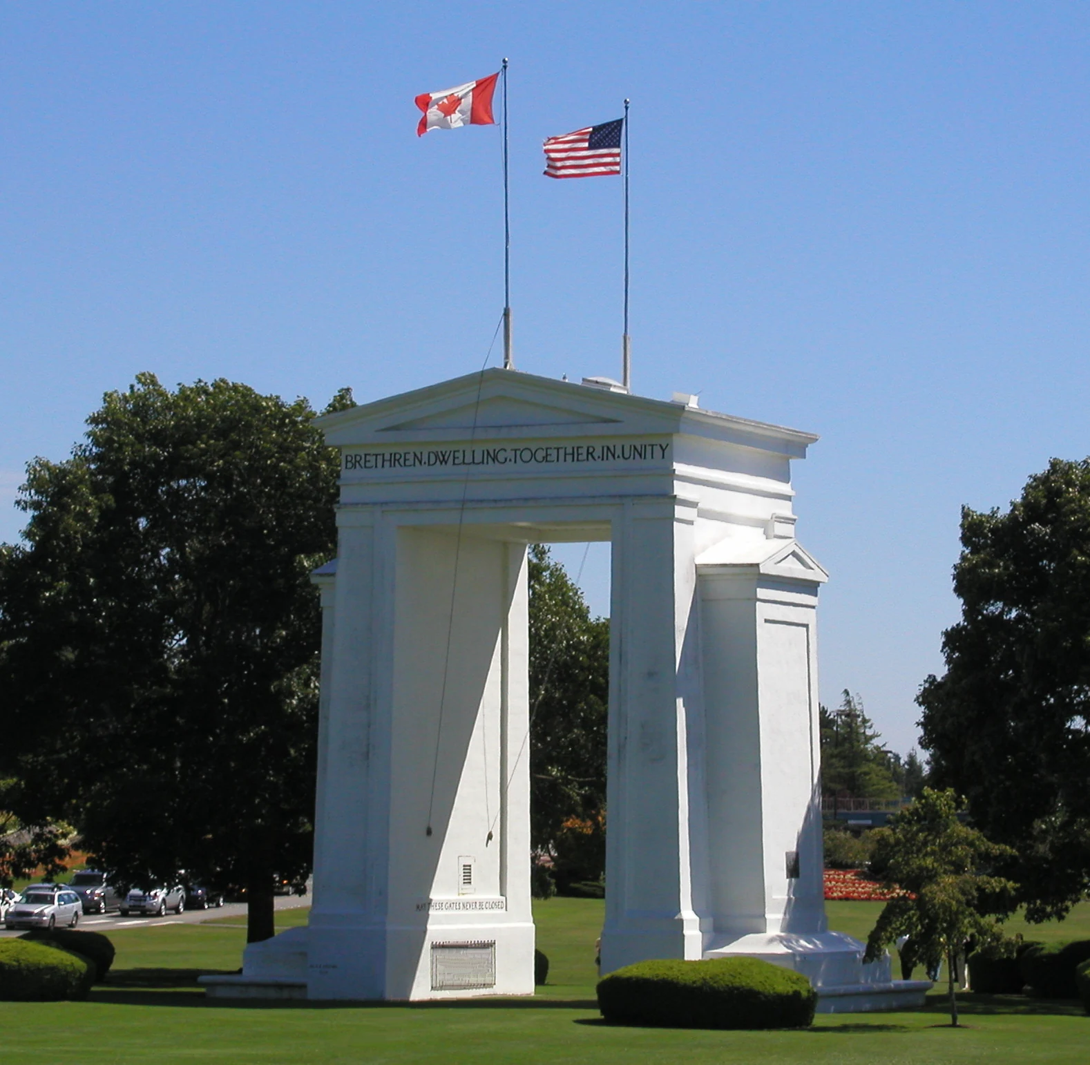
A white neoclassical monument titled Peace Arch stands in a grassy park, with the flags of Canada and the United States flying above it against a clear blue sky.
The Peace Arch monument, symbolizing the border between the United States and Canada, stands prominently in Peace Arch Park.

Peace Arch Park history and protected-area timeline

Peace Arch Park has a layered history that blends early cross-border infrastructure, a monument-building campaign rooted in the railway era, and a long evolution of formal protection on both sides of the border. Border inspection activity at what is now the Peace Arch Border Crossing long predates the construction of the Peace Arch itself, with the crossing already functioning as a significant point of entry between Washington and British Columbia.

In 1914, Samuel Hill, a lawyer for the Great Northern Railway, organized an international fundraising campaign to build a peace monument on the boundary line. Architect Harvey Wiley Corbett contributed the design, and construction began in 1920, largely through international volunteer efforts. The monument was dedicated on September 6, 1921, commemorating the 1814 Treaty of Ghent and the Rush-Bagot agreement that together ended the War of 1812 and laid the groundwork for the modern unguarded Canada–United States border.

The park's formal creation followed over the next two decades. The American portion of the park was established as a state park in 1931, while the Canadian portion was established as a provincial park on November 7, 1939. The Peace Arch was recognized on the Canadian Register of Historic Places in 1939 and, much later, was placed on the U.S. National Register of Historic Places in 1996.

The park has also served as a stage for major public moments. In 1952, singer and activist Paul Robeson, effectively barred from international travel during the Red Scares, performed at the site for Canadian audiences from the American side. The monument was vandalized during Vietnam War protests on May 9, 1970, over the Cambodian campaign. More recently, the park was a symbolic stop on the 2010 Vancouver Olympic Torch Relay and became an unexpected venue for cross-border family meetings and weddings during the COVID-19 pandemic era, including an unusually high concentration of weddings in 2020 and 2021.

Peace Arch Park landscape and geographic character

The landscape of Peace Arch Park is shaped as much by its geopolitical position as by its natural setting. The park sits at the coast where the Canada–United States land border reaches Semiahmoo Bay on the Salish Sea, part of the larger Pacific coastal environment shared by southwestern British Columbia and northwestern Washington. This places the park within the mild, marine-influenced climate zone of the region, framed by coastal waters on the west and the higher lands of the Cascade region farther inland.

The park's terrain itself is largely a series of manicured green spaces in and around a major border-crossing corridor. The Peace Arch monument sits on the exact boundary line, set into a grassy median between the northbound and southbound lanes of Highway 99 on the Canadian side and Interstate 5 on the American side. Walkways, lawns, picnic areas, and small landscaped features connect the monument to the rest of the park, with an open and accessible feel that contrasts sharply with the heavier infrastructure of the crossing itself.
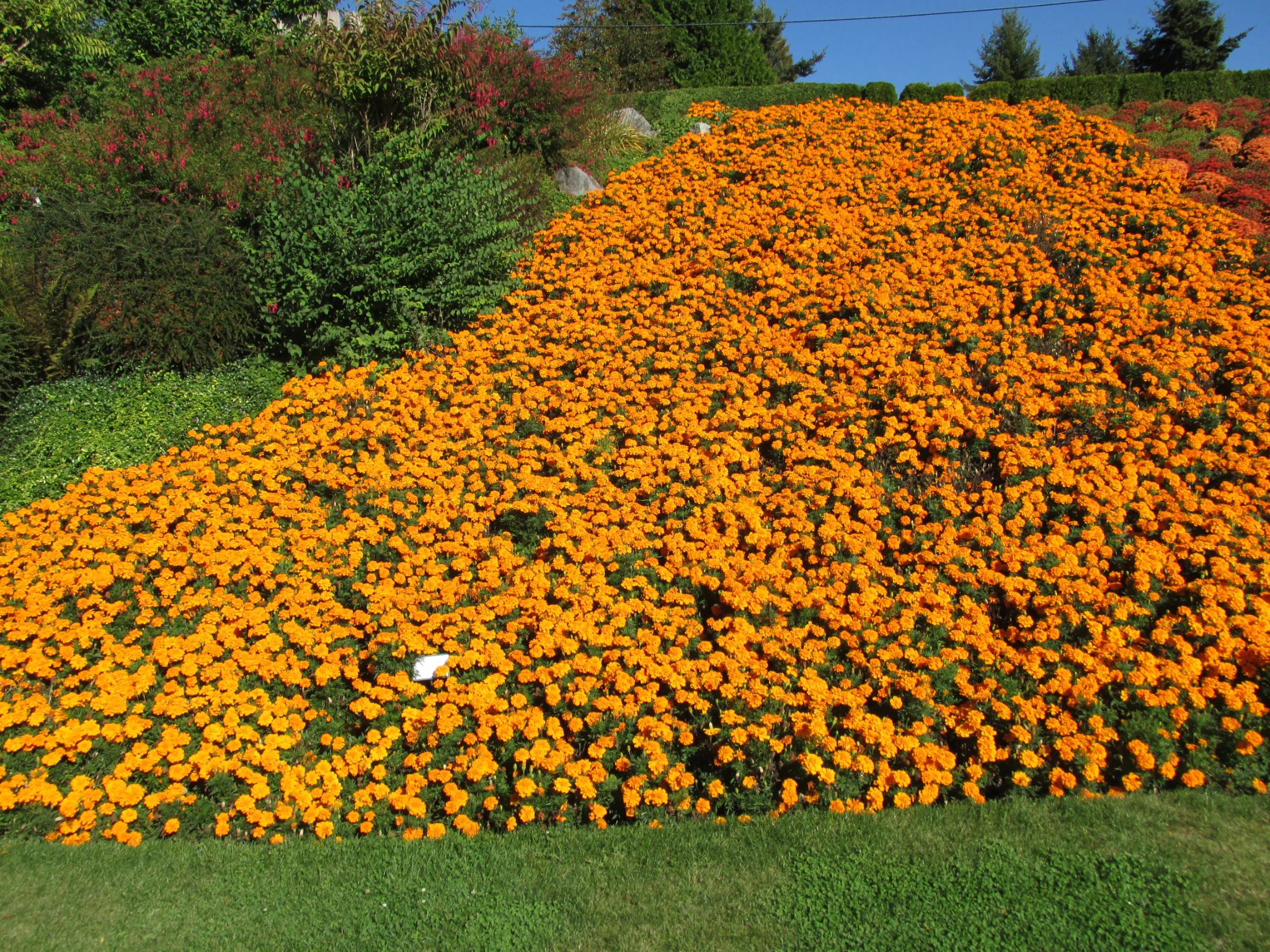
A large, dense bed of vibrant orange marigolds planted on a slight slope, with green bushes and a clear blue sky in the background.
A dense patch of orange marigolds in bloom at Peace Arch Park.

Peace Arch Park conservation status and protection priorities

Although Peace Arch Park is primarily a heritage and commemorative park rather than a wilderness preserve, it carries meaningful recognition on both sides of the border. On the Canadian side, the park is administered by BC Parks as a provincial park, while on the American side it is managed by the Washington State Parks and Recreation Commission as a state park. Together, these designations protect an open, publicly accessible green space in one of the most heavily trafficked border corridors in North America.

The park's conservation significance also lies in the protection of the Peace Arch monument and its surrounding landscape. The monument itself has been placed on the Canadian Register of Historic Places and the U.S. National Register of Historic Places, giving the park an official role in preserving one of the earliest earthquake-resistant structures in North America and an internationally recognized symbol of bilateral peace. By holding the grounds around the monument in protected status, the park ensures the long-term integrity of a site where two national jurisdictions meet in a single shared landscape.

Peace Arch Park cultural meaning and human context

Peace Arch Park reflects the cultural identity of the Canada–United States border more clearly than almost any other site in the region. It is a place where visitors and residents from both countries can meet without crossing customs, and that quality has shaped its function as a venue for shared ceremonies, music, political protest, and family reunions. The arch's bilingual inscriptions, including the U.S. phrase "Children of a common mother" and the Canadian phrase "Brethren dwelling together in unity," anchor the park's symbolic meaning as a site of shared heritage and longstanding peaceful relations.

The park also has an active nonprofit cultural partner, the International Peace Arch Association, which hosts events and exhibitions including an annual International Sculpture Exhibition that highlights work by American and Canadian artists. The park's recent history reinforces its role as a meeting place across national lines. During the COVID-19 pandemic, when the wider border was closed to non-essential travel, the park became one of the most-reported locations for border weddings, with both partners able to meet in the same space rather than across a barrier, a reflection of how the park's openness has been used, in difficult times, to maintain personal and familial connections across the border.

Top sights and standout views in Peace Arch Park

Peace Arch Park's standout qualities begin with the Peace Arch itself, a 20.5-meter monument straddling the boundary line and serving as one of the most enduring symbols of U.S.–Canadian peace. The monument's dedication in 1921 and its later listing on both the Canadian and U.S. historic registers give the park a layered heritage profile that few border parks can match.

Equally distinctive is the park's function as a single continuous green space shared by two countries. Visitors can walk across the international boundary within the park without passing through customs, allowing the grounds to host cross-border gatherings, weddings, and ceremonies that rely on the site as a shared meeting ground. The combination of symbolic architecture, transboundary management, and active cultural programming makes the park a notable model of how a protected landscape can also function as a living place of international connection.

Best time to visit Peace Arch Park

As a year-round urban-edge park in the mild coastal climate of the Pacific Northwest, Peace Arch Park is open across the seasons, with usable green space through much of the year. Late spring through early fall tends to bring the most comfortable conditions for outdoor picnics, walking the grounds, and viewing floral displays in the landscaped beds around the monument, when warmer weather and longer daylight encourage visitors to linger.

Winter and shoulder seasons still allow for quieter visits and a more reflective atmosphere around the monument. Visitors interested in seeing the arch during major symbolic moments may want to align travel with commemorative events, while those seeking a calm, low-density experience may prefer the cooler months when visitor numbers tend to ease. In all cases, the park's compact size and pedestrian-friendly layout make short visits feasible regardless of season.
Monthly climate preview

Long-term monthly averages for temperature and precipitation patterns

Peace Arch Park Climate Normals and Annual Temperature Rhythm

Representative coordinates record measured monthly temperature ranges and precipitation rates across a multi-year climatology period for Peace Arch Park. Detailed monthly breakdowns provide complete baseline data for evaluating long-term environmental conditions.
Annual mean10 °C
2 °C18 °C
Jan
Feb
Mar
Apr
May12°
Jun15°
Jul18°
Aug18°
Sep15°
Oct10°
Nov
Dec
Warmest month
August

17.8 °C

Coolest month
December

1.9 °C

Wettest month
November

7.3 mm/day

Driest month
July

1.2 mm/day

Park location guide

Geography guide, regional context, and park location map for Peace Arch Park

Peace Arch Park park geography, regions, and map view in Canada

Understand where Peace Arch Park sits in Canada through a broader geographic reading of the surrounding landscape, nearby location context, and its mapped position within the national park landscape.

How Peace Arch Park fits into Canada

Canada is a federal parliamentary constitutional monarchy spanning North America from the Atlantic to the Pacific and Arctic Oceans. With a population of over 41 million, it is officially bilingual in English and French at the federal level. The country gained independence from the United Kingdom through a gradual process culminating in 1982.

Wider geography shaping Peace Arch Park in Canada

Canada occupies the northern portion of North America, sharing its longest international border with the United States. The country extends from the Atlantic Ocean to the Pacific Ocean and northward into the Arctic Ocean, giving it the longest coastline of any nation.

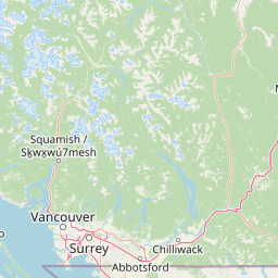
Map view of Peace Arch Park

Use this park location map to pinpoint Peace Arch Park in Canada, understand its exact geographic position, and read its mapped placement within the surrounding landscape more clearly.

Pigeon | © OpenStreetMap contributors

Location context for Peace Arch Park

British ColumbiaWashington
Recorded earthquake history

Examine the Historical Catalogue of Recorded Earthquakes near Peace Arch Park

Explore the documented seismic history associated with the binational landscape of Peace Arch Park. This archive provides accessible, data-driven records of past events to help users understand the regional seismic profile through a clear, mapped geographic lens.

Peace Arch Park Earthquake History

Catalogued events

48 events

Strongest magnitude

Magnitude 5.1

Most recent event

Mar 3, 2025

This history includes earthquakes recorded inside the park or within 50 km of its borders

Explore protected area views, coastal terrain, and the iconic border monument architecture.

Peace Arch Park Photos and Scenery: Visualizing the Binational Protected Landscape

Visual documentation captures the unique coastal terrain, manicured lawns, and historical monuments that define the binational protected space. Examining these protected area views allows researchers and visitors to understand the distinctive border geography and open landscape character more clearly.

A white neoclassical monument titled Peace Arch stands in a grassy park, with the flags of Canada and the United States flying above it against a clear blue sky.

A white stone arch monument stands in a manicured green lawn near a calm bay, with cars visible on a nearby road.

A large, dense bed of vibrant orange marigolds planted on a slight slope, with green bushes and a clear blue sky in the background.

A bronze historical plaque set into a concrete base at Peace Arch Park, featuring embossed text and figures representing the peaceful relationship between Canada and the United States.

Park atlas

Discover related regional conservation areas and border sanctuaries for broader natural comparison.

Exploring Parks Near Peace Arch Park and Surrounding Coastal Protected Landscapes

Compare Peace Arch Park with other protected areas across the surrounding coastal region to examine shared Pacific habitats and regional geography. Continuing your exploration reveals connected green spaces and neighboring natural reserves that enrich your spatial understanding.
A watercolor painting showing a soft-focus landscape with rolling green hills, distant mountains, and a central river or water feature.
State or regional parkBritish Columbia
30 km away#1 closest

Northeast

Golden Ears Provincial Park: Geographic Atlas and Protected Landscape Overview

Coast Mountains terrain and protected wilderness boundaries

Golden Ears Provincial Park is a major protected wilderness in British Columbia, defined by the twin peaks of the Golden Ears massif and vast glacial lake systems like Alouette and Pitt. This site serves as a vital ecological corridor where lowland forests meet high subalpine ridges. Explore the park through its mapped boundaries and diverse ecological zones within the Pacific Northwest mountain landscape.

Area
609 km²
Established
1967
IUCN
II
Visitors
956.5K annual
National parkBritish Columbia
31 km away#2 closest

West

Gulf Islands National Park Reserve: British Columbia National Park Protected Area

Mapped boundaries and regional geographic context.

Delve into the protected landscape of Gulf Islands National Park Reserve, a significant national park located in British Columbia. This entry provides detailed insights into its mapped boundaries, regional geographic setting, and its identity as a protected area. Understand the park's place within the natural terrain and atlas of Canada, offering a clear geographic overview for focused discovery and landscape context.

Area
36 km²
Established
2003
IUCN
VI
Visitors
28.4K annual
A watercolor illustration of a mountain landscape featuring soft rolling hills, evergreen trees, and low-lying vegetation on a white background.
State or regional parkBritish Columbia
33 km away#3 closest

North

Pinecone Burke Provincial Park: Coast Mountain Wilderness and Protected Terrain Geography

Mapping a vast ecological corridor in British Columbia

Spanning over 38,000 hectares, Pinecone Burke Provincial Park represents a dramatic transition from the urban proximity of Coquitlam to the remote interiors of the southern Coast Mountains. The landscape is defined by its rugged relief, featuring subalpine meadows, deep freshwater systems, and historically significant forested slopes. This park provides a critical look at the complex topography of the Pacific Northwest, serving as a sanctuary for wildlife and a foundational piece of regional conservation.

Area
380 km²
Established
1995
IUCN
II
Relief
Mountain
A soft watercolor painting of a landscape featuring a lake, low rolling hills in the background, and grassy vegetation along the foreground shoreline under a warm, pale yellow sky.
State or regional parkFraser Valley Regional District
About 38 km away#4 closest

Northeast

Rolley Lake Provincial Park: An Atlas of Protected Landscapes and Regional Geography

Lakeshore forest terrain and protected park geography

Delve into the geographic identity of Rolley Lake Provincial Park, a state-protected landscape in the Fraser Valley Regional District. This documentation traces the park's internal map, including its central freshwater lake, loop trail connectivity, and surrounding second-growth forest topography, providing essential context for understanding this localized wilderness zone.

Area
1.15 km²
Established
1961
IUCN
II
A watercolor painting showing a soft, hazy landscape of a lake with green forest along the shore and distant purple mountains under a pale sky.
State or regional parkBritish Columbia
About 50 km away#5 closest

Northeast

Davis Lake Provincial Park: Protected Forest and Lake Geography in British Columbia

Regional protected area with old-growth forest and waterfalls

Davis Lake Provincial Park represents a significant protected area in the Fraser Valley, characterized by its undisturbed Western Hemlock forest and the scenic descent of Murdo Creek into McDonald Falls. The park provides an essential look at the regional geography of southwestern British Columbia, balancing dense coniferous canopy with accessible lake-based terrain in a quiet, natural setting.

Area
0.75 km²
Established
1963
IUCN
II
Relief
Upland
A horizontal watercolor painting depicting a calm coastal inlet, surrounded by green hills, coniferous trees, and distant soft mountain silhouettes.
Marine protected areaUnited States of America
About 56 km away#6 closest

South

Padilla Bay National Estuarine Research Reserve: Coastal Protected Area Geography

A significant tidal estuary and marine protected landscape in Washington

This marine protected area encompasses large, shallow tidal mudflats and salt marshes within the Salish Sea. It serves as a essential hub for ecological research and conservation, framing a hybrid environment where historical diked farmlands meet protected coastal terrain. The reserve offers deep insight into the regional geography of Washington, detailing how tidal processes and human history have shaped this productive Pacific Northwest estuarine landscape.

Area
32 km²
Established
1980
Relief
Lowland
Access
Easy access
A watercolor painting showing a panoramic view of mountain peaks in the distance above green foothills and plains.
Protected landscapeWashington
58 km away#7 closest

Southeast

Mount Baker, Snoqualmie National Forest: Mapped Geography and Protected Landscape Analysis

Exploratory atlas of Washington's primary Cascade Range wilderness

Delve into the structural geography of Mount Baker, Snoqualmie National Forest. This protected area corridor serves as a major ecological transition zone between the Puget Sound lowlands and the interior Cascades, characterized by extensive glaciers, wild river systems, and iconic stratovolcanoes that define the regional landscape of Washington state.

Area
6,978 km²
Established
1974
Relief
Mountain
Climate
Alpine
State or regional parkBritish Columbia
About 63 km away#8 closest

Northeast

Kilby Provincial Park: Protected Riverfront Geography and Historic Sites in BC

A unique riparian landscape along the Harrison River

Kilby Provincial Park offers an intimate look at the flood plain geography of the Harrison River. The site features an elevated, boardwalk-linked heritage environment integrated with sandy riverfronts and seasonal wildlife corridors. This protected area stands out for its combination of historical pioneer preservation and river-based ecosystem monitoring within the Upper Fraser Valley region of British Columbia.

Area
0.03 km²
Established
1973
IUCN
II
Relief
Lowland

Common questions about visiting, size, designation, and location context for Peace Arch Park

Peace Arch Park FAQs for park facts, access, geography, and protected area context

Find quick answers about Peace Arch Park, including protected-area facts, park geography, trail and visitor context, and how the park fits into its surrounding country and regional landscape.
MoriAtlas Explorer

Continue Your Protected Areas Search Across the Global Atlas

Deepen your exploration by continuing the structured search for national parks and protected areas worldwide. Utilize the comprehensive filtering capabilities to compare different conservation landscapes and refine your understanding of global park geography. Discover more about the distribution and characteristics of protected natural areas.

Global natural geography