
Mori Atlas logo
Nature reserveRéserve naturelle nationale de la pointe de Givet

Mapping the Devonian stratotype, limestone cliff corridors, and southern botanical enclaves within the Ardennes region

Réserve naturelle nationale de la pointe de Givet: Protected Landscapes and Geological Geography of the Meuse Valley

The Réserve naturelle nationale de la pointe de Givet safeguards a dramatic section of the Meuse valley in northeastern France. This protected area spans eleven discrete units across five communes, featuring steep limestone cliffs, rocky slopes, and dry grasslands that support a unique botanical enclave and diverse fauna. By integrating the internationally significant Givétian Devonian stratotype with varied forest and shrubland habitats, the reserve serves as a vital geographic laboratory within the Grand Est region.

national nature reservecalcareous cliffsMeuse valleytemperate forestdry grasslandlimestone habitats
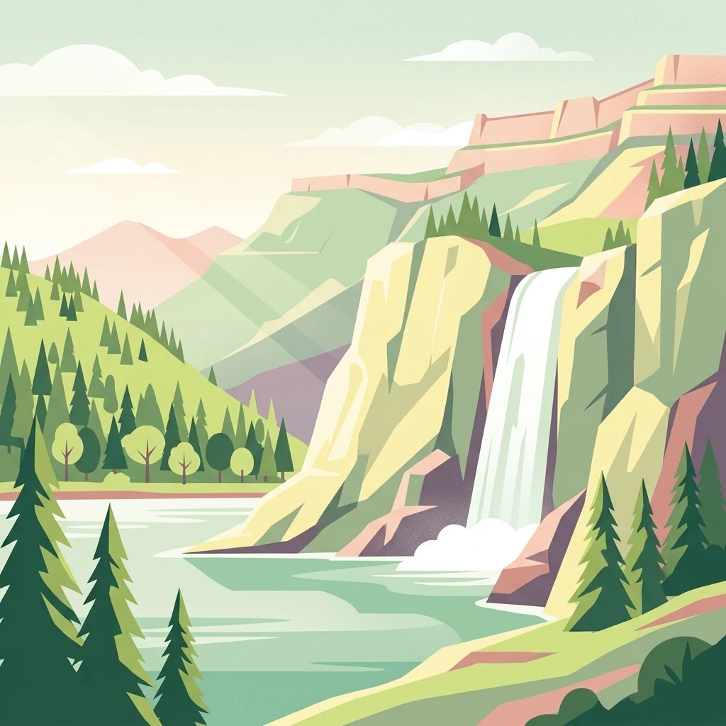
A stylized vector illustration of a waterfall cascading down rocky cliffs into a lake, surrounded by pine trees and distant mountains.

Réserve naturelle nationale de la pointe de Givet

Nature reserve

Park overview

Structured park overview, official facts, and landscape profile for Pointe de Givet National Nature Reserve

Pointe de Givet National Nature Reserve park facts, protected area profile, and essential visitor context

Review the core facts for Pointe de Givet National Nature Reserve, including designation, size, terrain, visitor scale, habitats, and operating context in one park-focused overview.

About Pointe de Givet National Nature Reserve

The Pointe de Givet National Nature Reserve is one of the most compact and ecologically diverse protected areas of France's Meuse valley. Although it spans only 354 hectares, this surface is fragmented into eleven separate units that together climb from the riverbank up across the steep limestone spine of the pointe de Givet. The fragmented layout reflects the practical challenge of conserving a mosaic of natural habitats while working around centuries of human use, from medieval crossings and military fortifications to post-war training grounds that left lasting traces on the landscape.

What makes the reserve distinctive is the very tight juxtaposition of habitat types within a small radius. Visitors moving only a few hundred meters can pass through sun-drenched dry grasslands studded with juniper and orchid-rich fringes, transition into denser shrubby thickets, and then enter mature deciduous forest interrupted by limestone cliffs, scree slopes, and cave entrances. This mosaic supports a flora that, against expectations for this corner of northeastern France, includes species more typical of southern or sub-Mediterranean landscapes, taking advantage of locally warm microclimates on south-facing rocks.

The reserve is also an important center for environmental education and biodiversity study in the Ardennes. Interpretation panels, guided walks, lectures, and university and volunteer-based habitat restoration projects have been developed here since the early 2000s, making the site a working example of how a small but rich reserve can drive wider conservation and public engagement outcomes.

Quick facts and research context for Pointe de Givet National Nature Reserve

Pointe de Givet National Nature Reserve lies in the Grand Est region of France, in the far north of the Ardennes department, on the Meuse valley near the Belgian border. Established as a national nature reserve on 4 March 1999, it covers 354 hectares spread across eleven non-contiguous entities on the communes of Charnois, Chooz, Foisches, Fromelennes, Givet, and Rancennes. It is classified under France's national nature reserve system and assigned IUCN Category III.

The reserve is recognized for three complementary dimensions: a Devonian limestone type section of internationally significant geological value, a flora of more than 460 species with a marked southern affinity, and a rich community of cave-dwelling bats, breeding birds, and thermophilic insects. The site is jointly managed by the Conservatoire d'espaces naturels de Champagne-Ardenne and the ONF Ardennes, and it overlaps with several other protection designations, including ZNIEFF zones, ZICO, ZSC, and APPB.

Protection and recognition

Documented terrestrial protection scope, designation year, and official records

Réserve naturelle nationale de la pointe de Givet Protection Status and History

Terrestrial protection status for Réserve naturelle nationale de la pointe de Givet traces back to its official 1999 designation year. Structured records consolidate conservation parameters, management scopes, and international database identifiers for targeted analysis.

Protection details

Protection scope
Terrestrial
Designated year
1999
Transboundary protection
No
WDPA ID
178294
Park context

Deeper park guide and search-rich context for Pointe de Givet National Nature Reserve

Pointe de Givet National Nature Reserve history, landscape, wildlife, and travel context

Explore Pointe de Givet National Nature Reserve through its history, landscape character, ecosystems, wildlife, conservation priorities, cultural context, and seasonal travel timing in a structured park guide built for atlas discovery and search intent.

Why Pointe de Givet National Nature Reserve stands out

The reserve is most widely recognized for its Devonian stratotype. It contains the Givétian type section, defined in this very stretch of the Meuse valley and giving its name to a globally used geological stage of the Middle Devonian. This geological signature is deeply woven into the local identity of Givet and the surrounding cliffscape, where limestone pavements, schists, sandstones, ancient fluorite workings, and fossil-rich exposures coexist in a compact area. Equally distinct is the botanical character of the reserve. Its dry, sun-warmed limestone slopes support a remarkable southern-flora enclave at unusually high latitude, including protected and regionally rare species such as Artemisia alba, Cotoneaster integerrimus, Antennaria dioica, Orchis simia, and Geranium sanguineum. Combined with the area's importance for bats, raptors, and thermophilic butterflies, this dual geological and botanical profile is what gives the reserve its distinctive identity.
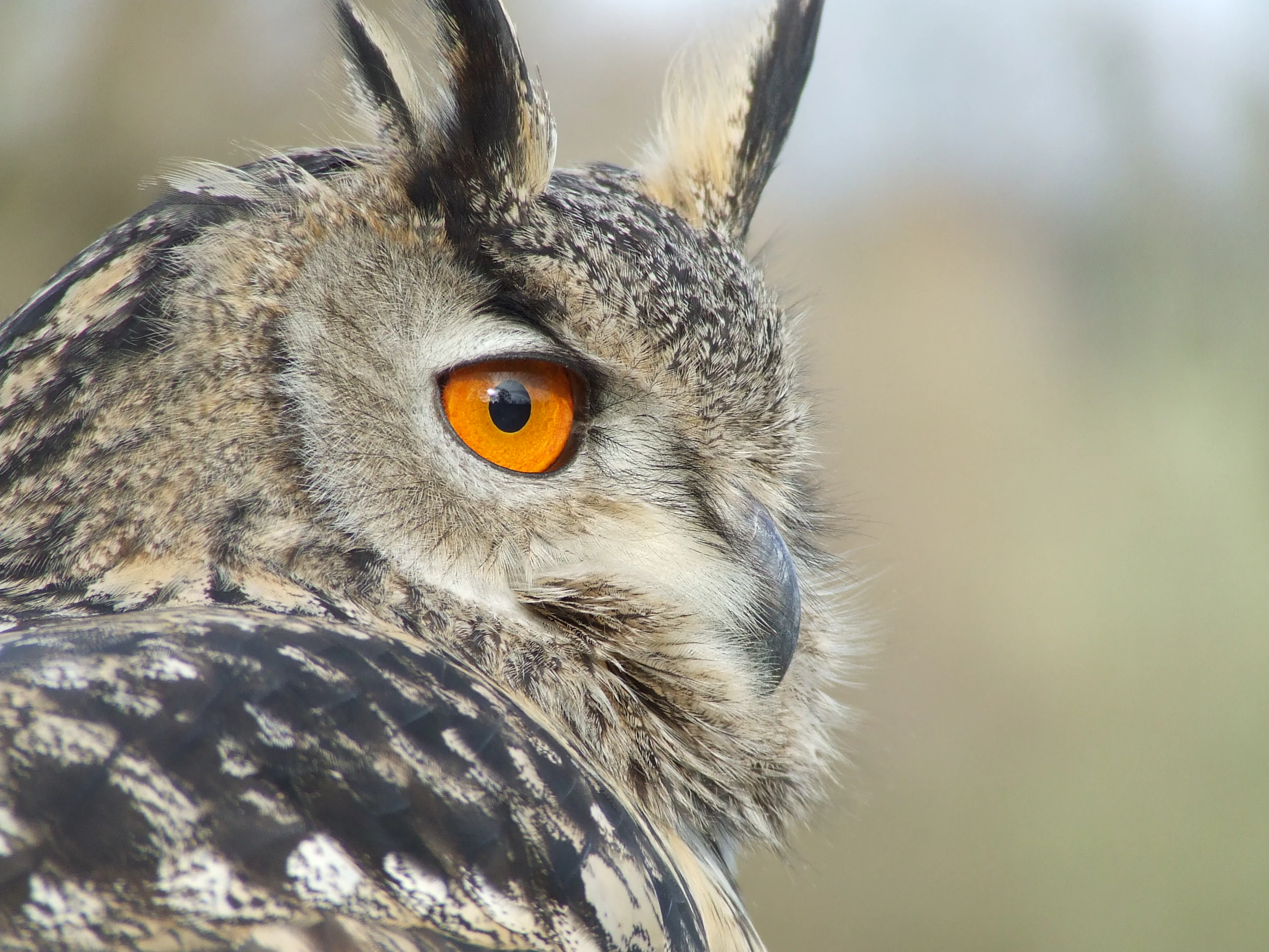
Close-up profile view of an Eurasian eagle-owl showing its distinctive orange eye, ear tufts, and patterned brown feathers.
A close-up portrait of an Eurasian eagle-owl, a species inhabiting the Réserve naturelle nationale de la pointe de Givet.

Pointe de Givet National Nature Reserve history and protected-area timeline

The natural richness of the pointe de Givet sector has been documented by naturalists since at least the nineteenth century, but it was not until the late twentieth century that formal protection was pursued. In 1990, the association La Valenne submitted a request to classify the most remarkable natural environments of the pointe de Givet as a national nature reserve, after observing progressive degradation of the area's geological and botanical heritage.

The classification process took nearly a decade to conclude. A decree of 4 March 1999, issued under France's 1976 nature reserve law, formally established the Pointe de Givet National Nature Reserve with the code RNN145. Site managers were designated the following year, with the Conservatoire d'espaces naturels de Champagne-Ardenne and the Office national des forêts Ardennes taking joint responsibility for day-to-day management, monitoring, and restoration work.

In subsequent years, the reserve developed steadily as both a conservation tool and a public amenity. A first management plan covered 2003 to 2007 and saw significant habitat restoration through scrub clearance and hay-cutting, often carried out by students, reintegration teams, and volunteer nature work camps. From 2005, extensive goat grazing was introduced in parts of the Aviette Maurière ravines as a low-intensity method of controlling shrub encroachment on dry grasslands. By the time a second management plan had been completed for 2008 to 2012, the site was firmly anchored in the regional environmental education network.

Pointe de Givet National Nature Reserve landscape and geographic character

The reserve occupies a particularly dramatic reach of the Meuse valley, where the river has cut a deep notch through a hard limestone bar. The dominant impression is one of vertical relief: abruptly rising limestone cliffs, sheer rocky ledges, and steep slopes flanking the river corridor. This topography is not uniform but rather fractured into headlands, ravines, and spurs that together form the geographic feature known locally as the pointe de Givet.

Below the cliffs, the valley floor carries a different texture, with meadows, alluvial edges, former allées, and patches reworked by human activity. Above, plateaus and forested ridges extend beyond the immediate cliffs. The reserve's eleven protected units capture a sample of every level of this landscape. Among the most eye-catching formations are bare rock outcrops, scree and boulder fields, cave entrances, and short cliffs that face south and southwest, gaining warmth that creates local microclimates far warmer than the surrounding region.

Culturally, the same slopes carry the imprint of several centuries of strategic geography. The medieval tower known as Tour Grégoire crowns one of the cliff edges above the river, while the town of Givet is framed by the famous Porte de France and the massive Fort de Charlemont. The unfinished Fort du Mont d'Haurs, designed by Vauban to support Charlemont, occupies another ridge within or adjacent to the reserve, embedding the natural landscape within one of France's most concentrated groups of historic fortifications.
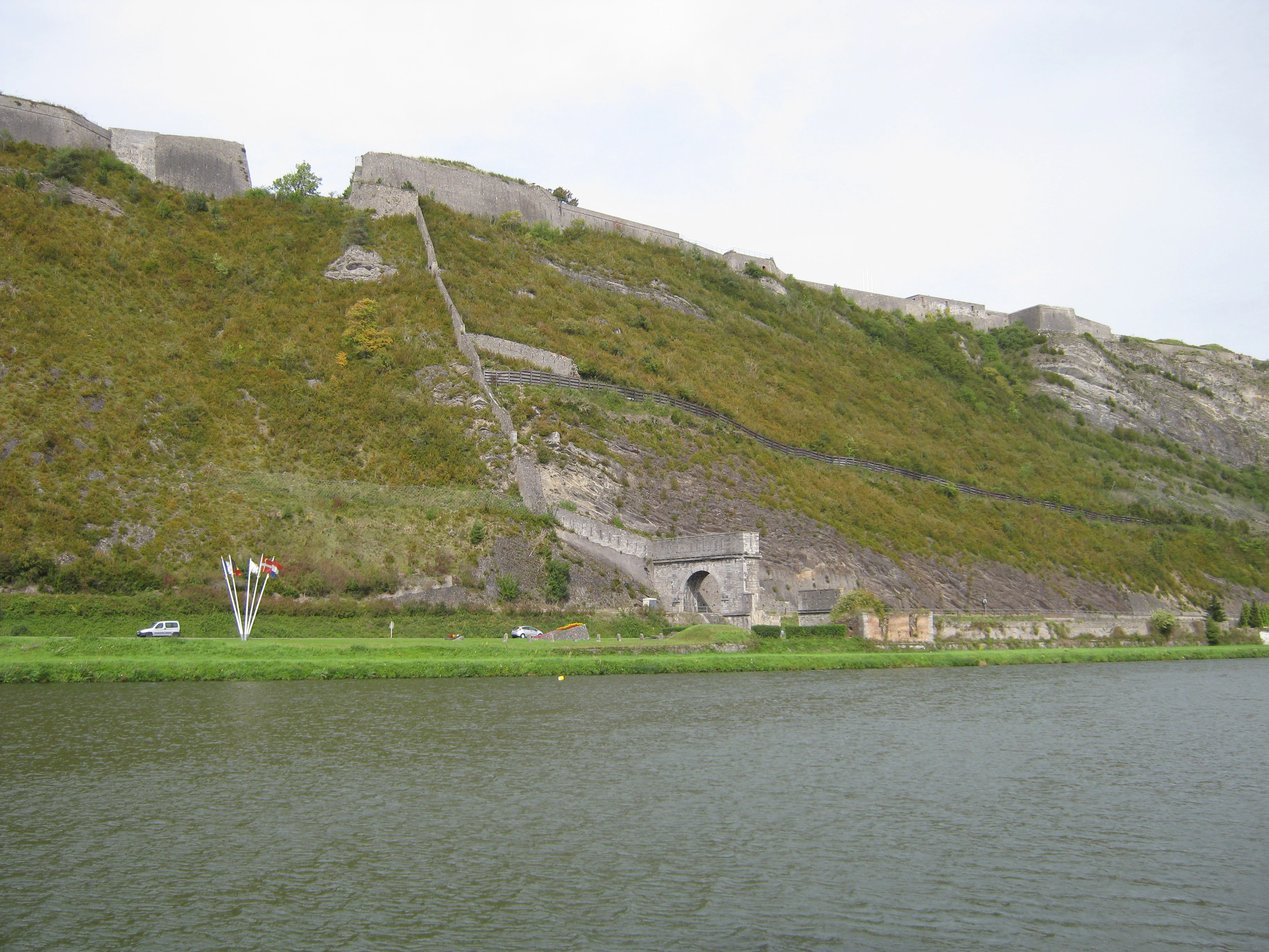
A green hillside rising from a riverbank, featuring a stone fortification wall and the Porte de France archway at its base.
View of the Fort de Charlemont and the Porte de France from the greenway near the Meuse River in Givet.

Pointe de Givet National Nature Reserve ecosystems, habitats, and plant life

Ecologically, the reserve is best understood as a mosaic of calcareous, xerophilic, and forest habitats concentrated on a relatively small but topographically complex stretch of valley. Five broad habitat groups dominate: mineral substrates including exposed rocks, cliffs, scree, and cave entrances; low herbaceous vegetation dominated by dry grasslands and heathlands; shrubby formations and thickets; woodlands and forest edges; and semi-natural habitats shaped by human activity, such as game-cover plots, hedges, and embankments. This variety allows species with sharply contrasting requirements to coexist within a short distance.

A particularly important pattern is the presence of warm microclimates generated by south-facing rock. These create conditions favorable for plant communities that are otherwise unexpected at this latitude and altitude, giving the reserve its southern botanical signature. Several protected and regionally red-listed plant species are concentrated in these dry, sunlit habitats, where open ground, low competition, and rocky substrate reinforce one another.

The inventory of the site's biological heritage remains incomplete, especially for fungi, soil-dwelling invertebrates, saproxylic organisms tied to dead wood, and certain semi-open habitat specialists. This unfinished picture is itself part of the reserve's character: it provides ongoing scientific opportunities and supports its role as a long-term monitoring site, while also underscoring the fragility of the less conspicuous diversity that depends on continuity of mature habitat and undisturbed micro-sites.

Pointe de Givet National Nature Reserve wildlife and species highlights

The fauna of the Pointe de Givet reserve mirrors the diversity of its habitats. More than 320 animal species have been recorded, with the strongest wildlife values concentrated among bats, birds, and insects. Twenty mammal species are known, but the most important group is the chiropterans: at least twelve bat species have been documented, supported by a combination of insect-rich open habitats and accessible cave systems. Several of these bats, including the lesser horseshoe bat, greater horseshoe bat, greater mouse-eared bat, and Geoffroy's bat, are species of European conservation concern.

The bird community is similarly varied, with over 70 species recorded and roughly one third of them appearing on the regional red list. Breeding and visitor species of particular interest include the Eurasian eagle-owl, the European nightjar, and the woodlark, all of which depend on the combination of rocky shelter, semi-open terrain, and extensive forest that the reserve maintains. Reptiles such as the adder and the smooth snake make use of rocky, sun-warmed areas.

Insect diversity is the most striking wildlife feature at the species level. More than 170 insect species have been identified, including about 78 butterfly species, with sun-loving species such as the Provence fritillary, the green hairstreak, the marsh fritillary, and the scarce heath butterfly among the most noteworthy. Roughly 30 orthopteran species have also been recorded, including the blue-winged grasshopper, the wart-biter, and the keeled groundhopper. Many of these insects depend on open, flower-rich grasslands and on warm rocky slopes, both of which require active management to prevent closure through shrub encroachment.

Pointe de Givet National Nature Reserve conservation status and protection priorities

The reserve is protected under France's strongest domestic nature reserve regime, layered on top of multiple other designations including ZNIEFF type I and II zones, Important Bird Areas (ZICO), Special Areas of Conservation (ZSC), sites classés and sites inscrits, and a prefectoral biotope protection order (APPB). This stack of statuses reinforces the site's role as a cornerstone of biodiversity protection in the northern Ardennes.

A central conservation challenge is fragmentation. Because the reserve is divided into eleven non-contiguous units, its ecological coherence depends heavily on the quality of the surrounding matrix. The managers have invested in restoration initiatives, including scrub clearance, low-intensity goat grazing, and volunteer-driven work camps, to maintain and reopen dry grasslands. Pressure from past military activity is also significant: wartime relics still dot the territory and continue to limit some uses while also providing microhabitats of their own.

Given the absence of large wild herbivores, the natural tendency of open habitats is to revert to scrub and woodland. Conservation management therefore focuses on maintaining a balance between closed forest, open rocky habitats, and the open dry grasslands on which much of the area's distinctive flora and fauna depend. The reserve's contribution to regional and national biodiversity networks is amplified by its role as a monitoring site, an outdoor laboratory for student and volunteer projects, and a focal point for environmental education in the Grand Est region.

Pointe de Givet National Nature Reserve cultural meaning and human context

The pointe de Givet has long been a strategic crossroads in the Meuse valley, and this human history is woven into the protected landscape. The medieval Tour Grégoire, hypothetically dating back to the eleventh century though repeatedly transformed, once watched over the road and river approaches and still crowns one of the steepest cliff edges within the reserve. The nearby Fort de Charlemont, the Porte de France, and the unfinished Fort du Mont d'Haurs, planned by Vauban to reinforce Charlemont, exemplify the area's centuries-long military role.

Modern military use left another mark: the Fort de Charlemont area, used as a training center by the 9th Zouaves commandos between 1962 and 2009, lies adjacent to the reserve and has shaped how visitors and managers experience the site. Equally significant is the geological heritage: the area gave its name to the Givétian stage of the Devonian through the stratotype defined here in 1879 by Jules Gosselet, and the local pierre bleue de Givet limestone has been a recognizable building stone for centuries. Together, these layers of strategic, military, and geological culture give the reserve a much richer human context than its small area might suggest.

Top sights and standout views in Pointe de Givet National Nature Reserve

The reserve's defining features cluster around three signatures. First, its geological identity: the cliff sections along the Meuse host the Givétian stratotype and a remarkable variety of exposed Devonian rocks, from fossil-rich limestones to ancient fluorite workings. Second, its botanical identity: more than 460 plant species, including 35 red-listed and 11 regionally protected taxa, occupy a southern-style enclave at this latitude. Third, its ecological identity: a functional mosaic of rock, grassland, shrub, and forest habitats sustaining twelve bat species, more than seventy bird species, numerous reptiles, and over 170 insect species.

Beyond these ecological signatures, the reserve also functions as an active conservation laboratory and an environmental education hub, where management plans combine scientific monitoring, volunteer work, low-intensity grazing, and restoration of dry grasslands. The integration of such a strong program of habitat management into a landscape layered with medieval and Vauban-era military heritage gives the site a unique profile among French national nature reserves.

Best time to visit Pointe de Givet National Nature Reserve

Spring and early summer tend to be the most rewarding periods for visiting the reserve, when the dry grasslands and rocky slopes come alive with rare orchids, southern-style forbs, and a high diversity of butterflies. Mild conditions also make the cliff paths and forest edges more comfortable for walking. Late spring is particularly favorable for observing nesting birds and hearing nocturnal species such as the Eurasian eagle-owl and the European nightjar as dusk falls over the cliffs.

Late summer and early autumn offer a more geological focus, with clearer visibility of the limestone stratotypes and exposures along the cliff paths. At any time of year, layered clothing and sturdy footwear are advisable because the topography is steep and the microclimate along the cliffs can differ sharply from the riverside and plateau areas.

Monthly climate preview

Long term monthly temperature and precipitation averages for representative protected terrain

Réserve naturelle nationale de la pointe de Givet Climate Normals and Temperature Rhythms

Measured coordinates reveal consistent shifts between winter lows and summer maximums alongside steady precipitation patterns across the protected landscape. Examining the complete twelve month dataset provides granular context on historical temperature variations and monthly precipitation norms.
Annual mean9 °C
1 °C18 °C
Jan
Feb
Mar
Apr
May12°
Jun15°
Jul18°
Aug18°
Sep14°
Oct
Nov
Dec
Warmest month
July

17.7 °C

Coolest month
January

0.8 °C

Wettest month
December

3.1 mm/day

Driest month
April

1.8 mm/day

Park location guide

Geography guide, regional context, and park location map for Pointe de Givet National Nature Reserve

Pointe de Givet National Nature Reserve park geography, regions, and map view in France

Understand where Pointe de Givet National Nature Reserve sits in France through a broader geographic reading of the surrounding landscape, nearby location context, and its mapped position within the national park landscape.

How Pointe de Givet National Nature Reserve fits into France

France is a unitary semi-presidential republic and one of the world's largest economies. It borders Belgium, Luxembourg, Germany, Switzerland, Italy, Monaco, Andorra, and Spain, with a maritime border to the United Kingdom. The country is known for its cultural influence, art, cuisine, and political history spanning centuries.

Wider geography shaping Pointe de Givet National Nature Reserve in France

France is located in Western Europe. Metropolitan France extends from the Rhine to the Atlantic Ocean and from the Mediterranean Sea to the English Channel and North Sea. The country borders Belgium, Luxembourg, Germany, Switzerland, Italy, Monaco, Andorra, Spain, and has a maritime border with the United Kingdom.

Map view of Pointe de Givet National Nature Reserve

Use this park location map to pinpoint Pointe de Givet National Nature Reserve in France, understand its exact geographic position, and read its mapped placement within the surrounding landscape more clearly.

Pigeon | © OpenStreetMap contributors

Location context for Pointe de Givet National Nature Reserve

Grand Est

Visualizing calcareous cliffs, Meuse valley terrain, and rare limestone habitats

Réserve naturelle nationale de la pointe de Givet Photos and Visual Landscape Scenery

Photographs capture the dramatic vertical relief, steep limestone cliffs, and sun-warmed rocky slopes defining the Meuse valley corridor. Visual records reveal the complex mosaic of dry grasslands, scrub formations, and forested ridges shaping the protected reserve environment.

Close-up profile view of an Eurasian eagle-owl showing its distinctive orange eye, ear tufts, and patterned brown feathers.

A historic stone watchtower built on a rocky cliffside with a small footbridge attached to one side and ivy growing on its walls.

A green hillside rising from a riverbank, featuring a stone fortification wall and the Porte de France archway at its base.

Park atlas

Compare surrounding regional geography, limestone terrain, and connected protected landscapes

Other Protected Areas and Parks Near Réserve naturelle nationale de la pointe de Givet

Browsing other protected areas near Réserve naturelle nationale de la pointe de Givet reveals the broader ecological patterns shaping the Meuse valley. Extending your geographic comparison across regional park terrain highlights connected limestone habitats and river corridor geology.
A horizontal watercolor illustration depicting rolling green hills, scattered evergreen trees, and distant ridgelines in a soft, light-filled style.
Protected landscapeNamur
About 6.6 km away#1 closest

Southwest

Parc naturel Viroin-Hermeton: Protected Landscape and Geographic Atlas for Namur, Belgium

Karst geology, limestone tienne hills, and river valley terrain

Parc naturel Viroin-Hermeton covers a vast area in Namur province, defined by its geological contrast and biodiversity. The landscape features deep karst fissures known as fondrys, sunny limestone tienne hills, and dramatic river valleys where the Eau Noire and Eau Blanche meet. This atlas entry provides a structured look at the terrain, mapping the transition from agricultural plateau to forest ecosystems within this significant protected area.

Area
480 km²
Established
1998
IUCN
V
Relief
Mixed relief
Nature reserveArdennes
About 39 km away#2 closest

South

Réserve naturelle régionale de la côte de Bois-en-Val: Ardennes Protected Nature Reserve

A study in post-industrial rewilding and mapped biodiversity.

Located in the Ardennes department, this 24-hectare reserve demonstrates how limestone quarry faces, calcicole woodlands, and marshy hollows support a high density of plant and wildlife species. It provides an accessible look at local geology and habitat recovery within a compact, protected geographic frame.

Area
0.24 km²
Established
2008
IUCN
IV
A soft watercolor illustration showing a calm river flowing through a lush, green landscape with forested hills in the distance.
Protected landscapeProvince de Luxembourg
About 41 km away#3 closest

East

Parc naturel des Deux Ourthes: Protected Landscape and Ardennes River Geography

Exploring the forested plateaus and meandering valleys of the Belgian Ardennes

Parc naturel des Deux Ourthes presents a complex geography defined by the convergence of the Ourthe river branches and the expansive Forêt de Freyr. This protected landscape contains rare upland peat bogs and dramatic rock formations, offering a dense, multi-layered terrain that defines the ecological character of the Province de Luxembourg. Its boundaries reflect a significant commitment to forest preservation and habitat conservation within the broader Wallonian natural context.

Area
760 km²
Established
2001
IUCN
V
Relief
Mountain
Nature reserveHauts-de-France
About 43 km away#4 closest

West

Réserve naturelle régionale des monts de Baives: Protected Limestone and Calcareous Landscapes

Ecological geography and regional conservation map context

Encompassing roughly 19 hectares, the Réserve naturelle régionale des monts de Baives protects a specialized ecosystem at the edge of the Ardennes foothills. The site is recognized for its south-facing limestone slopes, orchid-rich grasslands, and historical quarry habitats that support regional bat colonies and unique botanical species.

Area
0.188 km²
Established
1996
IUCN
IV
Relief
Upland
Watercolor illustration of a landscape with rolling hills, a river, and green vegetation
Protected areaProvince of Luxembourg
About 46 km away#5 closest

Southeast

Gaume Natural Park: A Protected Area Defining the Landscape of Province of Luxembourg

Explore its mapped natural landscape and geographic context.

Gaume Natural Park is a protected area offering a unique perspective on the natural landscapes found within Belgium's Province of Luxembourg. As a key geographic entity, it provides a vital component for atlas exploration, showcasing distinct mapped boundaries and regional terrain. Understand its significance as a protected natural space contributing to the Ardennes region's extensive geography, making it an essential point for structured discovery of protected lands.

Area
581.04 km²
Established
2014
IUCN
V
Relief
Lowland
Nature reserveHauts-de-France
About 47 km away#6 closest

Southwest

Réserve naturelle régionale des prairies humides de la ferme du Moulin Fontaine Protected Area

Wet meadow conservation in the Hauts-de-France region

Spanning 38 hectares in the Aisne department, this nature reserve focuses on the protection of humid grasslands. The site exemplifies regional efforts to maintain semi-natural habitats through a mosaic of hedgerows, moist meadows, and historic farm architecture in the Thiérache landscape.

Area
0.381 km²
Established
2014
IUCN
IV
Protected areaBelgium
About 57 km away#7 closest

Northeast

Burdinale Protected Area: Explore its Mapped Landscape and Geographic Context in Belgium

Mapped protected area discovery within Belgium's geography.

Burdinale Protected Area serves as a key point for understanding Belgium's protected lands from an atlas perspective. This page details the park's specific geographic setting and mapped natural landscape, providing essential context for regional geography exploration. Discover the protected boundaries and terrain features that define Burdinale, contributing to a structured overview of conservation areas.

IUCN
V
Scope
Mixed
Water
Major water bodies
A watercolor illustration depicting a soft, panoramic landscape of rolling hills and trees in light green, yellow, and pink hues against a white background.
Regional parkProvince de Liège
About 58 km away#8 closest

Northeast

Parc naturel des Vallées de la Burdinale et de la Mehaigne: Regional Park Geography

River valleys and agricultural heritage in Province de Liège

This regional park protects a distinct landscape defined by the confluence of the Mehaigne and Burdinale rivers within the Hesbaye region. The territory encompasses a mosaic of traditional rural settlements, valley habitats, and cultivated plateaus, providing a clear example of balanced land conservation and agricultural continuity in Belgium.

Area
110 km²
Established
1991
Relief
Lowland
Climate
Temperate

Common questions about visiting, size, designation, and location context for Pointe de Givet National Nature Reserve

Pointe de Givet National Nature Reserve FAQs for park facts, access, geography, and protected area context

Find quick answers about Pointe de Givet National Nature Reserve, including protected-area facts, park geography, trail and visitor context, and how the park fits into its surrounding country and regional landscape.
MoriAtlas Explorer

Continue Your Protected Areas Search Across the Global Atlas

Deepen your exploration by continuing the structured search for national parks and protected areas worldwide. Utilize the comprehensive filtering capabilities to compare different conservation landscapes and refine your understanding of global park geography. Discover more about the distribution and characteristics of protected natural areas.

Global natural geography