
Mori Atlas logo
Nature reservePöllwitzer Wald

Explore the historic forestry, moorland, and coniferous woodland boundaries of this protected area

Pöllwitzer Wald Nature Reserve: Mapped Protected Landscapes in the Thuringia Region of Germany

The Pöllwitzer Wald sits as a significant nature reserve within the Thuringia region of Germany, characterized by its rolling upland terrain and centuries of woodland management. This protected landscape combines managed spruce forests with remnant moorland basins, offering a clear geographic view of a habitat that has transitioned from medieval timber use to current environmental conservation. Explore the precise territorial extent and environmental profile of this historically layered forest landscape.

coniferous forestThuringiaVogtlandFFH habitat areaconservation forestmoorland
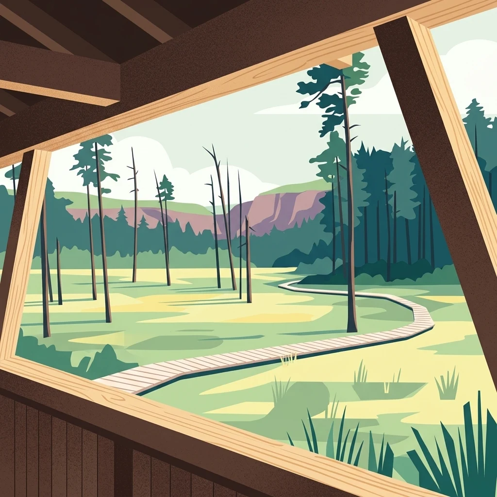
A flat-style digital illustration showing a view from inside a wooden shelter looking out onto a landscape with a winding boardwalk, scattered pine trees, and a forested horizon.

Pöllwitzer Wald

Nature reserve

Park overview

Structured park overview, official facts, and landscape profile for Pöllwitzer Wald

Pöllwitzer Wald park facts, protected area profile, and essential visitor context

Review the core facts for Pöllwitzer Wald, including designation, size, terrain, visitor scale, habitats, and operating context in one park-focused overview.

About Pöllwitzer Wald

The Pöllwitzer Wald is a forest district in the Landkreis Greiz in the German state of Thuringia, situated in the northern Vogtland between the town of Pöllwitz (a district of Zeulenroda-Triebes) and the state border with Saxony. With an average elevation of approximately 450 meters above sea level, it occupies a middle-elevation landscape typical of the eastern Thuringian uplands, where forested plateaus and gentle valleys shape a quiet, contiguous woodland landscape.

The forest is anchored by the village of Pöllwitz, the only settlement within its bounds, and is bordered by neighboring localities such as Niederböhmersdorf and Neuärgerniß to the north, Naitschau, Erbengrün, and Wellsdorf to the east, and the Zeulenroda district and the town of Märien to the west. Internal forest localities still carry names of abandoned settlements and former hunting and forestry houses, giving the area a layered place-name heritage that reflects both habitation decline and centuries of forestry use. The Wald is connected to the surrounding area by the L 2346 state road.

In ecological terms the Pöllwitzer Wald is part of the protected Pöllwitzer Wald FFH site (No. 150), a habitat protection area of about 962 hectares notified to the European Commission in the year 2000. The forest also includes a moorland experience area with a viewing tower and a raised walkway, allowing visitors to explore wetland habitat alongside the broader coniferous forest setting. In 2015, the forest and adjacent heath areas were transferred to the DBU Naturerbe GmbH, marking a new phase of conservation-oriented management.

Recreationally, the Pöllwitzer Wald functions as an important local recreation area, promoted within the framework of sanfter Tourismus (sustainable, low-impact tourism). Walking trails, educational nature trails, and the moorland experience area together form the core visitor infrastructure, while a 2008 tourism concept for the forest recognized the potential for stronger visitor engagement alongside remaining gaps in on-site accommodations.

Quick facts and research context for Pöllwitzer Wald

The Pöllwitzer Wald covers a forest area in the Landkreis Greiz of Thuringia, near the town of Zeulenroda-Triebes and the Thuringia-Saxony border. It sits at an average elevation of about 450 meters above sea level and is today dominated by spruce forest with mixed larch and pine stands.

A portion of the forest is designated as an FFH habitat protection area, covering roughly 962 hectares and notified to the European Commission in the year 2000, with part of the broader forest and adjoining heath areas transferred to the DBU Naturerbe GmbH in 2015.

Protection and recognition

Documented conservation history and official Natura 2000 recognition records

Pöllwitzer Wald Protection Status and International Recognition Details

Pöllwitzer Wald maintains a documented terrestrial protection status established in the year 2000. Official records track formal designation history alongside verified Natura 2000 recognition sources.
Park context

Deeper park guide and search-rich context for Pöllwitzer Wald

Pöllwitzer Wald history, landscape, wildlife, and travel context

Explore Pöllwitzer Wald through its history, landscape character, ecosystems, wildlife, conservation priorities, cultural context, and seasonal travel timing in a structured park guide built for atlas discovery and search intent.

Why Pöllwitzer Wald stands out

The Pöllwitzer Wald is best known as a historically layered coniferous forest landscape along the Thuringian-Saxon border, marked by the remnants of medieval and early modern log-floating infrastructure, an FFH-protected habitat area, and a moorland discovery area with an observation tower and circular walkway.
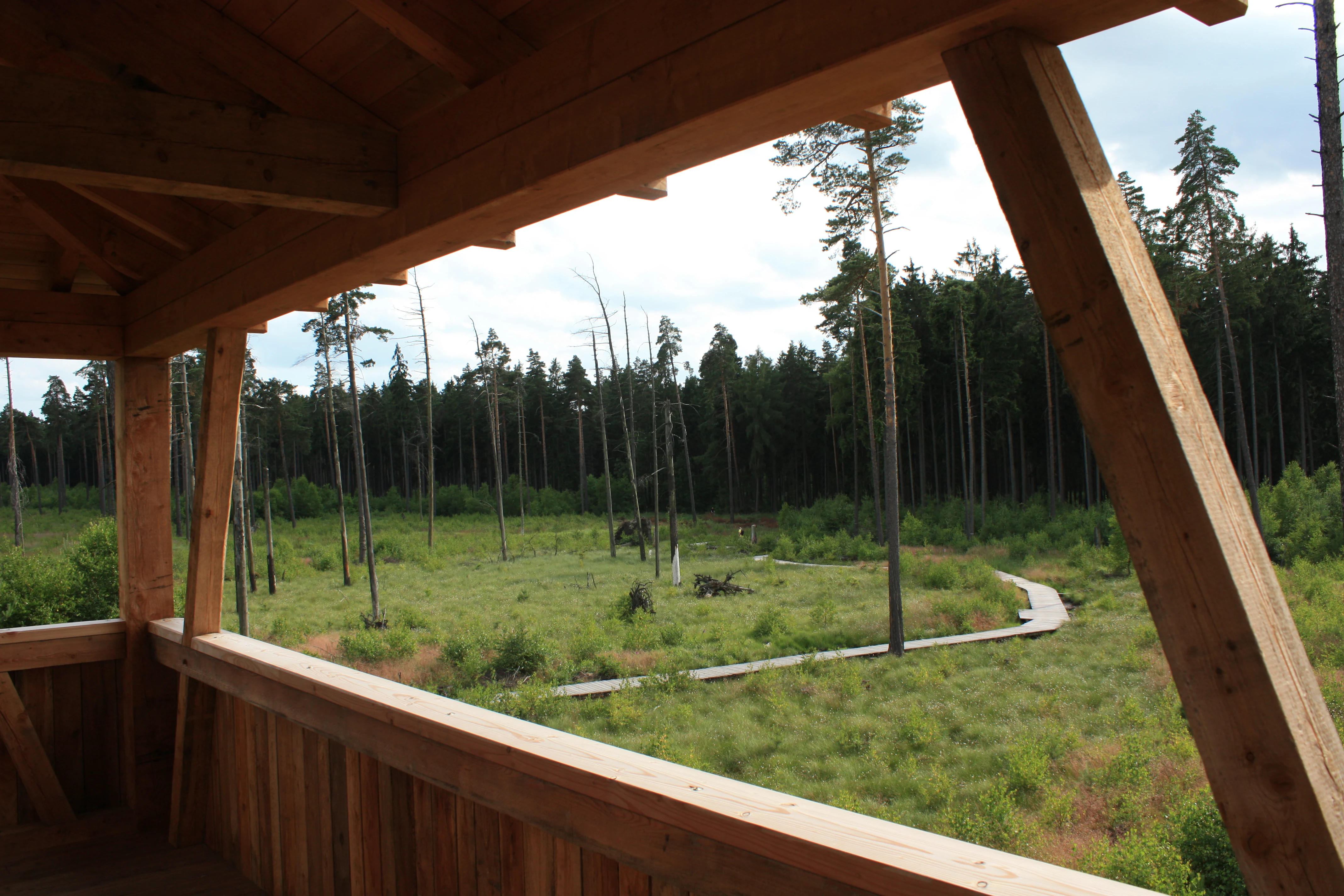
An elevated perspective looking out from a wooden observation structure onto a forest meadow with a narrow wooden boardwalk cutting through the grasses.
A view of the wooden boardwalk winding through the landscape, as seen from an elevated observation tower in Pöllwitzer Wald.

Pöllwitzer Wald history and protected-area timeline

The history of the Pöllwitzer Wald reaches back at least to 1359, when the forest was first documented under the name Gehörne. In the High Middle Ages it formed part of the territorial holdings of the Vögte von Weida, a regional aristocratic dynasty that shaped the political structure of the eastern Thuringian uplands. By the late sixteenth century the forest had become a focal point of regional competition between several branches of the Reuss lordship: in 1596 Heinrich the Elder of Obergreiz, Heinrich the Middle of Schleiz, and Heinrich Posthumus of Gera signed a division agreement that regulated forest use among the various Reuss territories.

The city of Gera, roughly 30 kilometers away, was particularly interested in securing timber supplies from the forest. In 1603 the Gera administration purchased the village of Pöllwitz from Greiz in order to control forest management directly on the ground, and soon negotiated a ten-year contract for the construction of a Flößgraben, a floating channel linking the forest to the Weiße Elster river system via the Triebes and Weida waterways. Through this infrastructure Gera was able to receive up to 1,500 Klafter of split firewood annually by water, a significant economic advantage over the more expensive overland transport routes. Beyond firewood, charcoal, pitch, and honey were also produced in the forest and delivered to Gera by floating.

The Flößholzgraben required continuous maintenance, and a sophisticated system of reservoirs, plank walkways, pack-animal tracks, and weirs was developed. The Gera council had to pay fees to neighboring lordships for transit rights; the expansion of the Pöllwitzer Teich alone was recorded as costing 514 Gulden. Toward the end of the Thirty Years' War the value of the forest rose sharply because many communities required construction timber, and disputes over payments escalated into the blockade of the floating channel by riparian villages, which was forcibly reopened by armed servants sent from Gera. After mediation by the territorial lord, the conflict was resolved and a second floating channel was constructed on an alternative route; between 1665 and 1700 up to 3,000 Klafter of firewood per year reached Gera. Floating on the Triebes was finally discontinued in 1825.

Forestry practices themselves shaped the structural character of the Pöllwitzer Wald over centuries. The original Hercynian mixed mountain forest contained large amounts of silver fir, spruce, and beech, but high demand for construction timber and fuel reduced the share of silver fir drastically, from an estimated 1,500 to 2,000 hectares in the 13th century to barely 100 hectares by about 1850. Dependence on natural regeneration, combined with the continued grazing rights of neighboring villages, transformed parts of the western forest into open heathland. Only around 1800 did systematic yield regulation begin, through a full survey and the division of the forest into equal rectangular compartments; at that time the area still measured about 6,036 Ackern (the regional unit of the Principality of Reuss).

From 1964 onward, a part of the forest was assigned to the NVA (National People's Army) of the GDR as a shooting range and restricted military zone. Several forestry and forestry worker houses had to be abandoned, and the area remained inaccessible to the public until after German reunification. Only after the decontamination of the former military grounds in 1990 did the broader population regain access, and the area was then developed with hiking trails and educational paths. The economic management of the state forest now lies with the Thüringer Landesforstverwaltung.

Pöllwitzer Wald landscape and geographic character

The Pöllwitzer Wald occupies a middle-elevation landscape at roughly 450 meters above sea level, set in the rolling uplands of the northern Vogtland along the border between Thuringia and Saxony. The terrain is shaped by gently undulating plateaus of coniferous forest, small valleys carved by local streams, and open or semi-open heathland transitions along the western edge, where centuries of grazing and exploitation produced open areas within the formerly closed woodland.

At the heart of the landscape the moorland experience area introduces a distinct wetland character: a moor basin crossed by a circular raised walkway and overlooked by an observation tower. This combination of dry coniferous forest, former heath transitions, and wetland moorland gives the Pöllwitzer Wald a varied visual profile in a relatively compact geographic setting, with forest tracks and educational paths threading through the different terrain types.
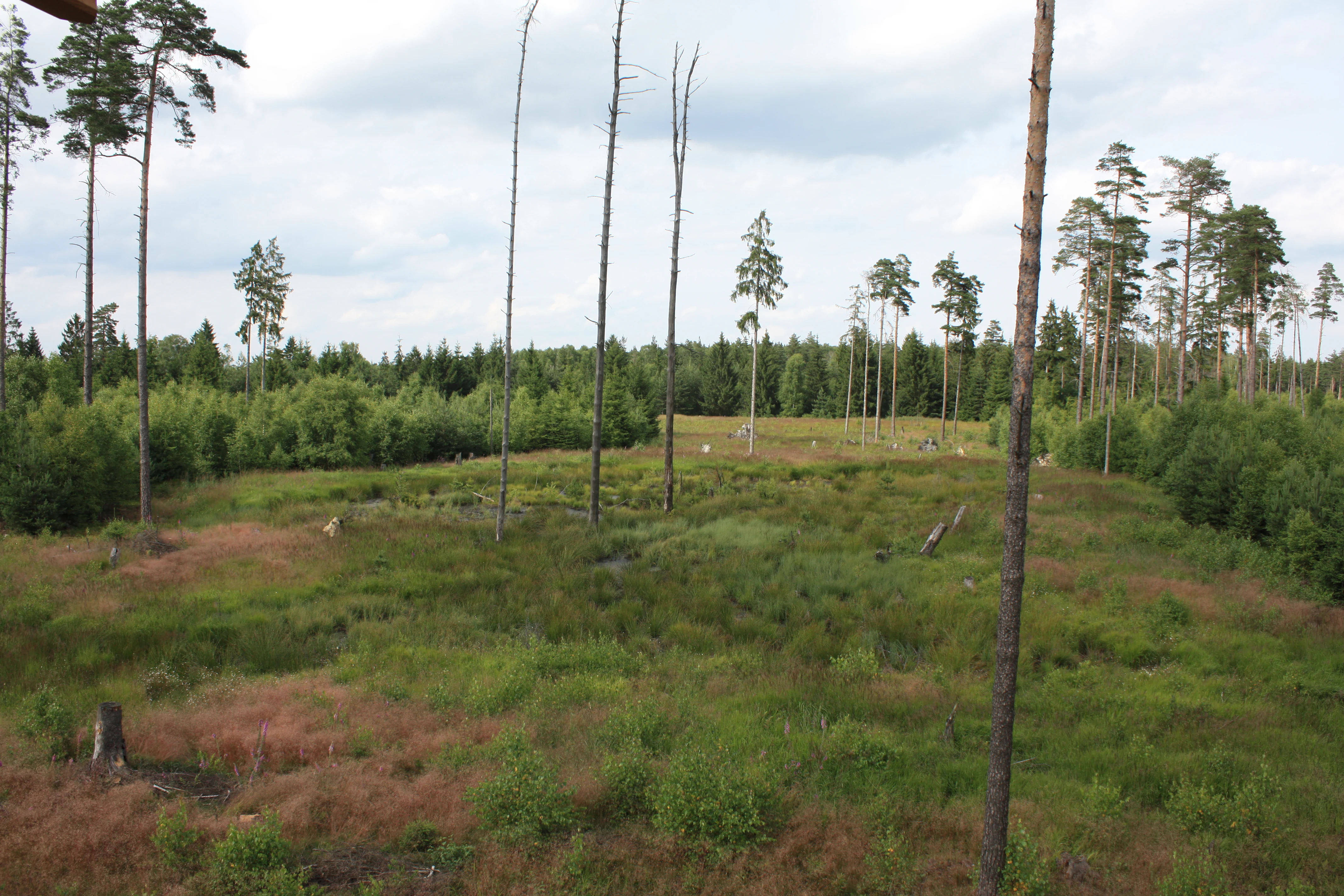
An elevated, wide view of a low-lying moorland landscape with patchy grass, scattered thin trees, and a dense forest line in the background.
A view overlooking the moorland landscape from an observation tower in Pöllwitzer Wald.

Pöllwitzer Wald ecosystems, habitats, and plant life

The ecological profile of the Pöllwitzer Wald reflects multiple phases of land-use history. The present-day forest is dominated by planted spruce stands, often mixed with larch and pine, while the original mixed mountain forest character of silver fir, spruce, and beech survives only in remnant form. Earlier planting experiments with oak failed because of the local soil conditions, leaving spruce as the structural backbone of the forest.

Parallel to the coniferous stands, the western sections of the forest retain an open heathland character derived from long historic grazing pressure. The protected FFH area of approximately 962 hectares also includes the forested wetland habitats around the Pöllwitzer Teich and the moorland experience area, adding peatland and wet woodland communities to the site. The combination of planted coniferous forest, surviving relict mixed forest elements, heath transitions, and wetland habitats forms a compact mosaic of habitat types within a relatively small area.

Pöllwitzer Wald wildlife and species highlights

Source coverage of the wildlife of the Pöllwitzer Wald is limited, reflecting its character as a working forest rather than a species-celebrity reserve. The forest is nonetheless mentioned in the context of a historically larger mammal fauna: a bear was sighted in the Pöllwitzer forest for the last time in 1662, an indication that larger mammals once belonged to the local fauna. The current wildlife emphasis of the area is embedded in the FFH designation and the DBU Naturerbe transfer, which focus on habitat-based rather than species-headline conservation.

Pöllwitzer Wald conservation status and protection priorities

Conservation in the Pöllwitzer Wald is organized primarily through the FFH habitat protection framework. The Pöllwitzer Wald FFH site (No. 150), covering about 962 hectares, was notified to the European Commission in the year 2000 and establishes site-defined usage restrictions grounded in scientific criteria. This designation governs both forestry practice and recreation in the protected core of the forest.

In 2015 the Pöllwitzer Wald and adjacent heath areas were transferred to the DBU Naturerbe GmbH, an organization dedicated to long-term conservation of ecologically valuable landscapes. Alongside the moorland experience area, with its observation tower and elevated walkway, this transfer marked a shift toward integrated habitat, visitor, and forest management under a strengthened conservation mandate.

Pöllwitzer Wald cultural meaning and human context

The Pöllwitzer Wald carries deep cultural significance as a forest whose internal place names still echo abandoned settlements and former hunting and forestry houses, while surviving forester infrastructure documents centuries of structured wood economy. The 1596 division agreement between the Reuss lords and the long-running Gera timber contracts shaped both the political geography and the everyday economy of the region.

The Flößgraben tradition is particularly prominent in local identity: the floating channel linked Pöllwitz to Gera via the Triebes and Weida rivers and gave rise to a complex system of reservoirs, plank walkways, packing trails, and weirs. Disputes over floating rights, the construction of a second Flößgraben, and the eventual end of floating in 1825 together mark an entire chapter of regional economic culture. The later NVA military use of part of the forest between 1964 and 1990, including the displacement of forest workers and the long-term closure of the area, adds a more recent layer to this cultural landscape.

Top sights and standout views in Pöllwitzer Wald

A defined FFH habitat protection area covering about 962 hectares, notified to the European Commission in 2000 and transferred to the DBU Naturerbe GmbH in 2015 alongside adjacent heath areas. A moorland experience area combining an observation tower, a circular raised walkway, and the broader Pöllwitzer Teich basin, offering an accessible point of contact with the wetland side of the forest. A historical forestry landscape marked by remnants of the great Gera log-floating infrastructure, including two successive Flößgraben routes and a sophisticated system of reservoirs and weirs. A survival landscape in which the original Hercynian mixed mountain forest character of silver fir, spruce, and beech still survives in remnant form, set against a now spruce-dominated working forest.

Best time to visit Pöllwitzer Wald

The Pöllwitzer Wald functions primarily as a quiet regional recreation area, and visits are most rewarding when conditions allow the forest and moorland experience area to be comfortably explored on foot. The moderate elevation of roughly 450 meters and the prominence of coniferous stands and heath transitions suggest that the warmer half of the year, when the trails are dry and the observation tower offers clear views across the moor, generally provides the most engaging conditions for both nature observation and broad landscape appreciation. Specific month-by-month weather or operational guidance is not supported by the source material.

Monthly climate preview

Long-term monthly temperature ranges and precipitation patterns across the representative coordinate

Pöllwitzer Wald Climate Normals: Measured Temperature and Precipitation Records

Representative coordinates record measured monthly temperature swings and daily precipitation averages spanning a thirty-year climatology period. Examining the complete twelve-month sequence reveals detailed regional climate normals and multi-season meteorological trends.
Annual mean8 °C
-2 °C18 °C
Jan-2°
Feb-1°
Mar
Apr
May12°
Jun16°
Jul18°
Aug18°
Sep13°
Oct
Nov
Dec-1°
Warmest month
July

17.8 °C

Coolest month
January

-2.4 °C

Wettest month
July

2.8 mm/day

Driest month
April

1.4 mm/day

Park location guide

Geography guide, regional context, and park location map for Pöllwitzer Wald

Pöllwitzer Wald park geography, regions, and map view in Germany

Understand where Pöllwitzer Wald sits in Germany through a broader geographic reading of the surrounding landscape, nearby location context, and its mapped position within the national park landscape.

How Pöllwitzer Wald fits into Germany

Germany is a federal republic in Western and Central Europe with a population of over 83 million across sixteen constituent states. It is Europe's largest economy by nominal GDP and a major global exporter and importer. The capital is Berlin, and the country borders Denmark, Poland, Czech Republic, Austria, Switzerland, France, Luxembourg, Belgium, and the Netherlands.

Wider geography shaping Pöllwitzer Wald in Germany

Germany is located in Western and Central Europe, spanning 357,022 km². It borders Denmark to the north, Poland and the Czech Republic to the east, Austria and Switzerland to the south, and France, Luxembourg, Belgium, and the Netherlands to the west. The country has coastlines on the Baltic Sea and North Sea to the north, with the Alps located in the southern region.

Map view of Pöllwitzer Wald

Use this park location map to pinpoint Pöllwitzer Wald in Germany, understand its exact geographic position, and read its mapped placement within the surrounding landscape more clearly.

Pigeon | © OpenStreetMap contributors

Location context for Pöllwitzer Wald

Thuringia
Recorded earthquake history

Browse the Pöllwitzer Wald Seismic History and Recorded Earthquake Catalogue

Investigate documented seismic activity associated with the Pöllwitzer Wald landscape through our structured data collection. MoriAtlas provides a clear, reliable path to review historical earthquake records and epicentre distances near this protected forest area for geographic context.

Pöllwitzer Wald Earthquake History

Catalogued events

43 events

Strongest magnitude

Magnitude 5.1

Most recent event

May 22, 2018

This history includes earthquakes recorded inside the park or within 50 km of its borders

Explore photographic records of forest terrain, wetland moor basins, and conservation zones.

Pöllwitzer Wald Photos and Landscape Scenery: Visualizing the Protected Forest

Photographic collections reveal the varied terrain, coniferous canopies, and wetland habitats defining Pöllwitzer Wald. Visual documentation helps researchers and visitors analyze the topography, moorland basins, and protected ecosystems across the region.

An elevated perspective looking out from a wooden observation structure onto a forest meadow with a narrow wooden boardwalk cutting through the grasses.

A wooden observation tower stands in the middle of a sparse forest landscape with tall pine trees and low-lying shrubs.

An elevated, wide view of a low-lying moorland landscape with patchy grass, scattered thin trees, and a dense forest line in the background.

Park atlas

Explore surrounding upland forests and connected conservation landscapes in the region

Other Protected Areas and Parks Near Pöllwitzer Wald for Regional Comparison

Browsing other parks near Pöllwitzer Wald reveals the varied forestry terrain and protected wetland habitats of the northern Vogtland uplands. Expanding the geographic view helps visitors compare adjacent conservation areas and understand the broader ecological network across the Thuringian border.
Protected areaThuringia
About 9 km away#1 closest

Northeast

Wälder um Greiz und Werdau: Protected Landscape and Regional Woodland Atlas for Thuringia

Continuous forest terrain on the Thuringia and Saxony border

The protected landscape of Wälder um Greiz und Werdau covers rolling hills and valleys between the Pleiße and Weiße Elster rivers. Use this atlas resource to understand the park's mapped boundaries, forest pond distribution, and its role as a green corridor between regional townscapes.

Area
62 km²
Established
1961
Relief
Upland
Climate
Temperate
A soft watercolor painting showing a pond landscape with rolling hills in the background, green trees in the midground, and tall grasses along the water edge.
Nature reserveSachsen
10 km away#2 closest

South

Großer Weidenteich Nature Reserve: Mapping the Biodiversity of the Saxon Vogtland

A vital protected landscape shaped by traditional grazing management

Großer Weidenteich acts as a crucial refuge for diverse species, including nearly 700 butterfly varieties and numerous breeding bird populations. The reserve's landscape is characterized by a mix of wetlands, meadows, and shrubby margins that rely on continuous sheep grazing for structural maintenance. This area provides a clear perspective on how small-scale water bodies and varied vegetation patches contribute to the health of the broader Saxon regional ecosystem.

Area
3.349 km²
Established
1994
IUCN
IV
A horizontal watercolor painting showing a soft, stylized landscape of rolling green hills, gentle slopes, and a calm body of water against a light pastel sky.
Nature reserveThuringia
13 km away#3 closest

West

Plothener Teiche Nature Reserve: Geographic Map and Protected Wetland Landscape Overview

Historic pond landscapes in the Saale-Orla-Kreis region of Thuringia

Plothener Teiche serves as a defining example of medieval-origin fishpond management in central Germany. This protected landscape combines open water basins, reed-lined margins, and woodland edges within the Thüringer Schiefergebirge and Obere Saale Nature Park. The area provides essential habitat for migratory bird populations and stands as a restored model of European wetland ecology.

Established
1967
IUCN
IV
Relief
Lowland
Climate
Temperate
Nature reserveSaxony
15 km away#4 closest

East

Waschteich Reuth Nature Reserve: Mapped Wetland Landscapes of the Saxony Vogtland

Protected pond habitats and regional woodland ecosystems

Waschteich Reuth serves as a compact yet ecologically rich nature reserve in the Vogtland. Its protected boundaries encompass a traditional pond with floating-leaf vegetation, damp meadows, and native oak-hornbeam forest. This site stands as a prime example of Saxony's wetland heritage, illustrating the importance of small-scale habitat preservation within the broader German river network.

Area
0.212 km²
Established
1995
Water
Major water bodies
A horizontal watercolor illustration showing soft green hills, forest patches, and distant pale pink mountains.
Nature reserveThuringia
About 22 km away#5 closest

Southwest

Kobersfelsen Nature Reserve: Silicate Cliff Geography and Protected Valley Landscapes

Geographic context for the Thuringian Slate Mountains protected area.

Kobersfelsen features a significant silicate rock outcrop rising above the Saale valley. As part of a larger Habitats Directive site, this nature reserve integrates cliffside forest with rare botanical communities. Users can examine the specific site boundaries and understand its role within the wider ecological network of the Thuringian region.

Area
0.06 km²
Established
1989
IUCN
IV
Relief
Upland
Protected landscapeThuringia
About 24 km away#6 closest

North

Zaufensgraben Protected Landscape: Geography and Natural Boundaries in Thuringia, Germany

A steep-sided stream valley and protected nature corridor near Gera

Zaufensgraben is a protected landscape corridor centered on a three-kilometer stream valley in Gera, Thuringia. Renowned for its steep gradient within the Weiße Elster system, this area preserves older willow stands and exposes complex Zechstein geology. Its mapped boundaries offer a look at how small-scale protected terrain maintains ecological character within an urbanized historical setting.

Area
0.11 km²
Relief
Upland
Scope
Terrestrial
Water
Minor water
Protected landscapeBavaria
27 km away#7 closest

Southwest

Naturpark Frankenwald: Geographic Profile of Bavaria's Forested Protected Landscape

A vast, interconnected upland spanning the Bavaria and Thuringia border

Naturpark Frankenwald functions as a large-scale managed nature preserve that integrates cultural heritage with ecological conservation. The terrain consists of gentle mountainous ridges, narrow river valleys, and extensive mixed forests that form a continuous landscape belt across northern Bavaria. This profile provides an overview of the regional geography, boundary extent, and the natural features that define this significant central German upland area.

Area
1,023 km²
Established
1973
Relief
Upland
Climate
Temperate
A soft watercolor painting of a rolling landscape with green hills, scattered trees, and pale, earthy foreground textures.
Nature reserveThuringia
About 33 km away#8 closest

West

Buchenberg bei Krölpa Nature Reserve: Mapped Geography and Protected Landscape Context

A restored limestone quarry habitat located in Thuringia, Germany.

Buchenberg bei Krölpa stands as a regionally significant nature reserve located east of Krölpa. Formerly a site of limestone extraction, the protected area now functions as a managed habitat, characterized by its broken, stepped terrain and slopes that host native orchid species and dry grassland vegetation within the broader Thuringian countryside.

Area
0.201 km²
Established
1996
IUCN
IV
Relief
Upland

Common questions about visiting, size, designation, and location context for Pöllwitzer Wald

Pöllwitzer Wald FAQs for park facts, access, geography, and protected area context

Find quick answers about Pöllwitzer Wald, including protected-area facts, park geography, trail and visitor context, and how the park fits into its surrounding country and regional landscape.
MoriAtlas Explorer

Continue Your Protected Areas Search Across the Global Atlas

Deepen your exploration by continuing the structured search for national parks and protected areas worldwide. Utilize the comprehensive filtering capabilities to compare different conservation landscapes and refine your understanding of global park geography. Discover more about the distribution and characteristics of protected natural areas.

Global natural geography