
Mori Atlas logo
Wildlife reservePowderhorn Wilderness

A vast, high-altitude protected landscape defined by ancient basalt flows, glacial cirques, and vital mountain headwaters.

Powderhorn Wilderness: Mapping the Volcanic Plateaus and Alpine Tundra of Colorado

Spanning over 62,000 acres in the San Juan Mountains, Powderhorn Wilderness represents a unique geographic convergence of volcanic geology and high-country ecology. This protected area features expansive, flat-topped basaltic plateaus from the Hinsdale Formation that rise above some of the largest continuous stretches of alpine tundra in the lower 48 states. Mapped terrain here reveals a rugged, water-shaped landscape where glacial basins and diverse headwater streams define the head of the Gunnison River system.

wilderness areaalpine tundravolcanic plateausan juan mountainsheadwatersGunnison River watershed
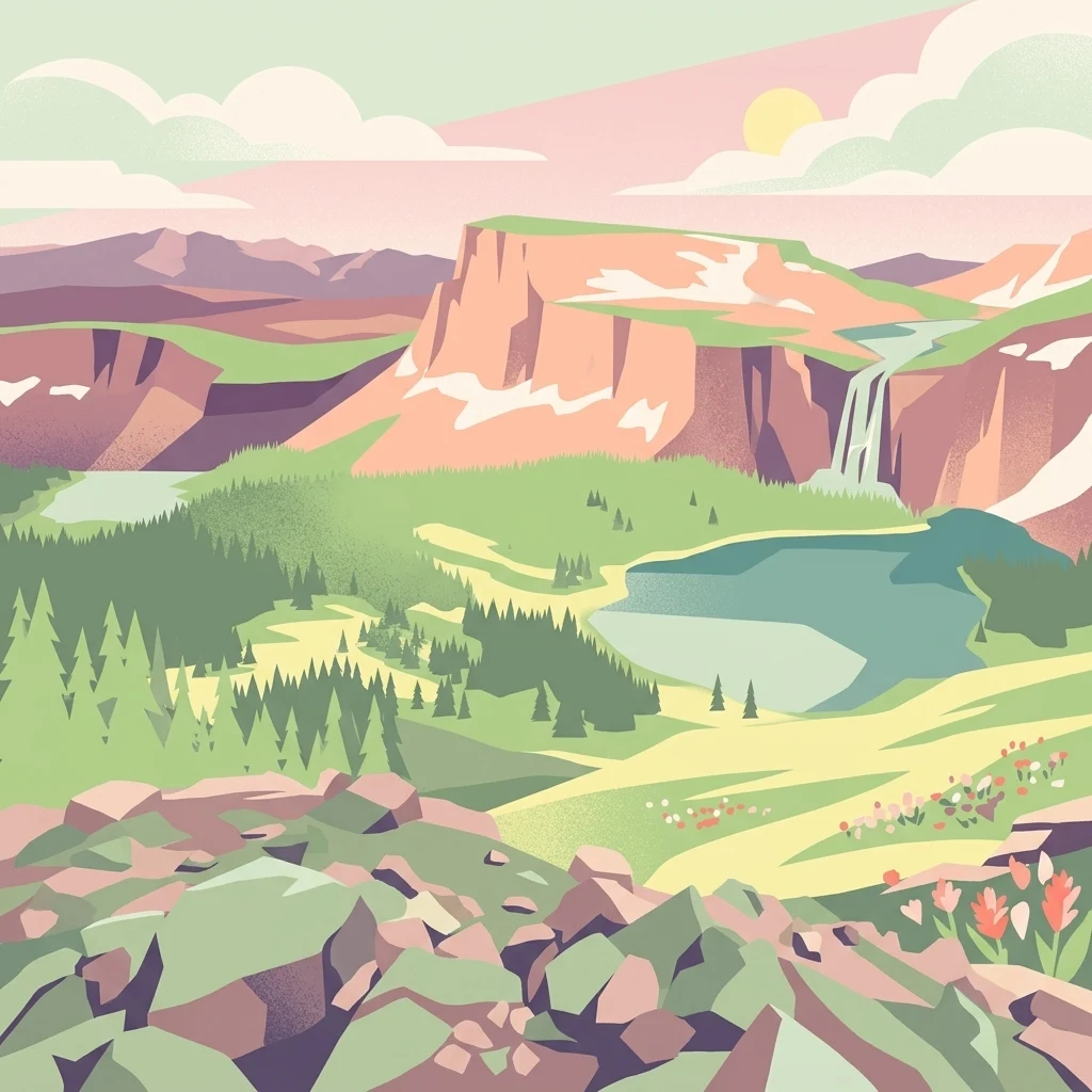
A digital illustration of a mountainous landscape with a prominent cliff, a waterfall flowing into a lake, alpine forest, and a foreground of rocky tundra and wildflowers.

Powderhorn Wilderness

Wildlife reserve

Park overview

Structured park overview, official facts, and landscape profile for Powderhorn Wilderness

Powderhorn Wilderness park facts, protected area profile, and essential visitor context

Review the core facts for Powderhorn Wilderness, including designation, size, terrain, visitor scale, habitats, and operating context in one park-focused overview.

About Powderhorn Wilderness

Powderhorn Wilderness is a federal wilderness area in southwestern Colorado that captures a remarkable range of mountain environments within a single protected boundary. Straddling Hinsdale and Gunnison counties near Lake City, it occupies a high and remote slice of the San Juan Mountains where volcanic history, glaciation, and alpine ecology come together. The roughly 62,000-acre landscape includes montane forests along its lower northern flanks, dense subalpine forest in its middle elevations, and an expansive alpine tundra covering about half the area. Because relatively few protected areas in the contiguous United States contain such a large unbroken tundra zone, Powderhorn carries an unusual ecological weight for its size.

The wilderness is jointly managed by the Bureau of Land Management, which oversees most of the northern portion within the Powderhorn–Black Canyon area, and the U.S. Forest Service, which manages the southern portion as part of Gunnison National Forest. This dual administration reflects the area's origins in adjacent federal land parcels. Wilderness designation, established on January 1, 1993, restricts travel to foot and horseback, limiting road building and mechanical use and keeping the area in a primitive condition. For visitors and researchers alike, this means an unusually intact mountain landscape with limited infrastructure, maintained through a network of about 45 miles of interconnecting trails.

From a landscape perspective, Powderhorn is shaped by two major geological chapters. The first is volcanic; the area lies within the San Juan volcanic field and preserves evidence of very large Oligocene eruptions whose ash sheets, including Cochetopa Park Tuff, Nelson Mountain Tuff, Carpenter Ridge Tuff, and Fish Canyon Tuff, underlie the higher terrain. After a long volcanic quiet period, basaltic lavas of the Hinsdale Formation erupted roughly 16 to 19 million years ago, capping the old ash surfaces and forming the broad plateaus that define the wilderness today. The second chapter is glacial; Pleistocene glaciers carved cirques, scoured basins, and left a string of lakes and ponds of which Powderhorn Lakes and Devils Lake are the most prominent. The resulting landscape feels simultaneously wide and high: broad, flat plateaus broken by abrupt cliffs of dark basalt, with deep glacial bowls tucked beneath them. Becaluse the volcanic rocks weather into rich soils in some areas and broken rubble in others, the terrain supports a more nuanced vegetation pattern than one might expect at such elevations, ranging from sagebrush flats through willow thickets and aspen stands to bare alpine ridges.

Ecosystems are layered tightly across elevation. Sagebrush steppe dominates the lowest, driest slopes, particularly in the northern extension. Ponderosa pine appears in scattered montane stands, giving way higher up to a subalpine zone of Engelmann spruce, subalpine fir, and quaking aspen. Above roughly 12,000 feet, vegetation thins into alpine tundra, where grasses, forbs, and willow thickets cover sweeping plateaus. Wildlife mirrors these layered habitats. Mule deer and elk move into the high country in summer, while year-round residents include mountain lions, black bears, bobcats, coyotes, and a characteristic alpine fauna of marmots and pikas. Beaver activity creates and maintains ponds along the forks of Powderhorn Creek, which form the heart of the wilderness's contribution to the Gunnison River watershed.

Human use of Powderhorn is intentionally light. With only six trailheads, including Devils Creek, Powderhorn Lake, Ten Mile Spring, Deer Lakes, Brush Creek, and Powderhorn Park, access is limited and many visitors come specifically for the Powderhorn Lakes basin, reached via a roughly 4.8-mile one-way hike from the Powderhorn Lake Trailhead. Yet the trail system is extensive enough to support longer loops and less-trafficked routes for those seeking solitude. The combination of unusual volcanic geology, large-scale tundra, intact watershed function, and relatively low visitation makes Powderhorn Wilderness a distinctive example of a high-elevation western wilderness.

Quick facts and research context for Powderhorn Wilderness

Powderhorn Wilderness sits in the San Juan volcanic field of southwest Colorado, about 5 miles northeast of Lake City, and straddles Hinsdale and Gunnison counties. Approximately 77 percent of the area is administered by the Bureau of Land Management, with the remaining 22 percent falling inside Gunnison National Forest, where the U.S. Forest Service has jurisdiction. Elevations range from around 8,500 feet along West Fork Powderhorn Creek to 12,661 feet at the summit of Calf Creek Plateau, the wilderness's highest point. The area forms a key headwaters portion of the Gunnison River basin and is recognized as one of the largest alpine tundra landscapes in the contiguous United States.

Protection and recognition

Documented terrestrial protection scope and designation records

Powderhorn Wilderness Protection Status and International Recognition

Powderhorn Wilderness maintains a defined terrestrial protection scope within the broader protected area network. Documented status records outline the management framework and associated recognition details for this wilderness landscape.

Protection details

Protection scope
Terrestrial
Transboundary protection
No
Park context

Deeper park guide and search-rich context for Powderhorn Wilderness

Powderhorn Wilderness history, landscape, wildlife, and travel context

Explore Powderhorn Wilderness through its history, landscape character, ecosystems, wildlife, conservation priorities, cultural context, and seasonal travel timing in a structured park guide built for atlas discovery and search intent.

Why Powderhorn Wilderness stands out

Powderhorn is best known for the unusual combination of volcanic highland geology and one of the largest contiguous alpine tundra areas in the lower 48 states. The Hinsdale Formation, a 16 to 19 million year old basaltic lava flow, caps the central plateaus and forms the two signature summits, Calf Creek Plateau and Cannibal Plateau. Glaciers later sculpted the landscape, leaving cirques such as the one cradling the popular Powderhorn Lakes. The wilderness is also recognized for its watershed significance. East, Middle, and West Forks of Powderhorn Creek rise within its boundaries, feeding Cebolla Creek and eventually the Gunnison River, while scattered beaver ponds, small lakes, and meadows shape a slow, water-rich alpine system. Equally important is its ecological role as summer range for mule deer and elk in a landscape where sagebrush steppe, aspen groves, subalpine conifer forest, and bare tundra all occur within a relatively compact area.
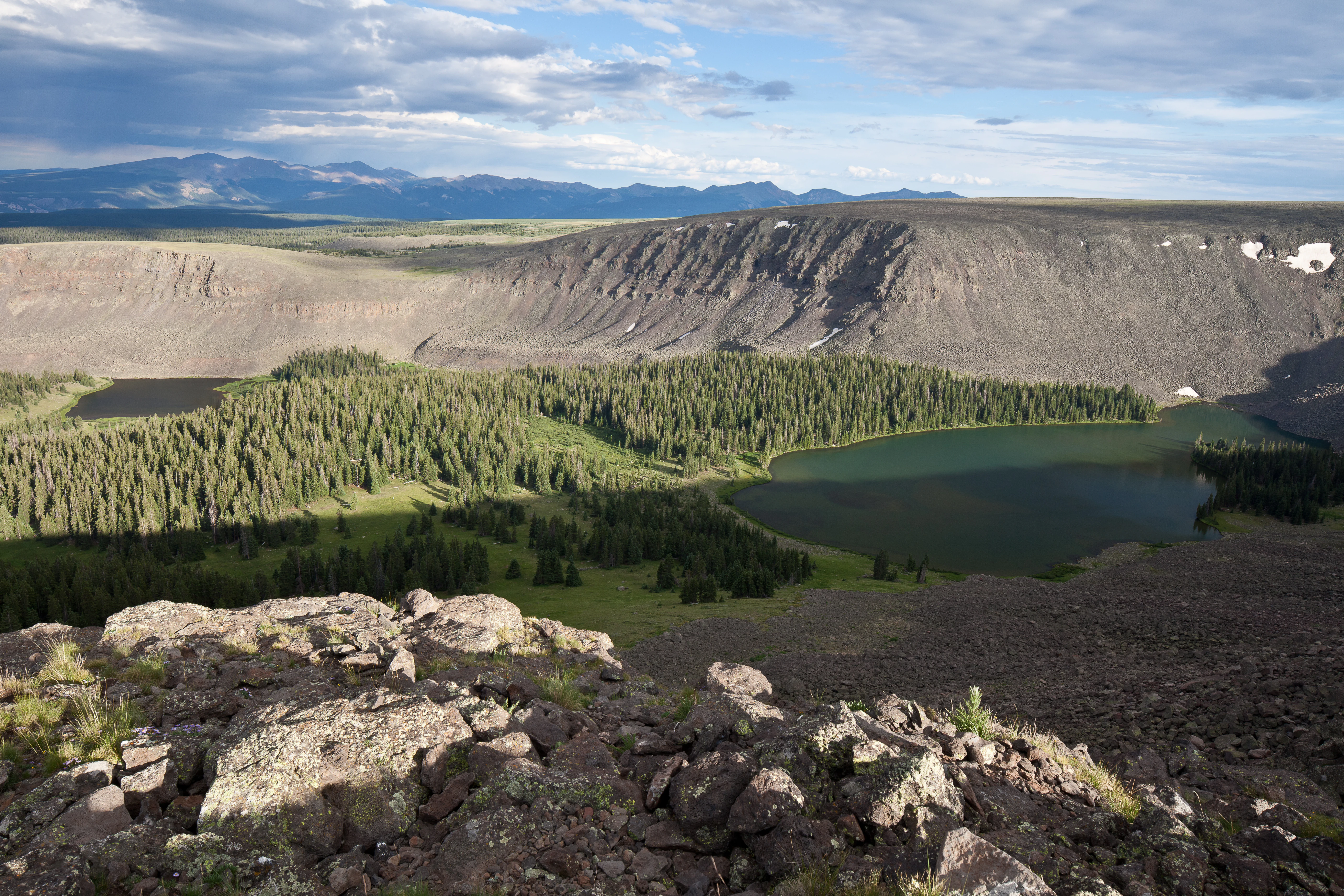
A high-angle view looking down into a valley containing a dark alpine lake surrounded by dense evergreen forests and steep volcanic cliffs.
A wide view of the volcanic landscape, evergreen forest, and alpine lakes in the Powderhorn Wilderness.

Powderhorn Wilderness history and protected-area timeline

Powderhorn Wilderness was formally designated as a federal wilderness area on January 1, 1993, after a process in which its underlying public lands were identified as appropriate candidates for enhanced protection. The area draws its administrative structure from two long-established federal land systems. The larger northern portion, comprising about three-quarters of the wilderness, was drawn from lands already administered by the Bureau of Land Management, while the southern portion came from within the Gunnison National Forest, long managed by the U.S. Forest Service. Both agencies continue to oversee their respective portions under a shared wilderness management framework.

Wilderness designation built on, rather than replaced, the area's earlier recognition as an important watershed for the Gunnison River and as a stronghold of volcanic and glacial geology in the San Juan Mountains. By placing the area in the National Wilderness Preservation System, Congress and the managing agencies restricted motor vehicle use, mechanical transport, new road construction, and other forms of development, locking in a primitive management condition. The change helped preserve the existing trail system rather than transforming land use, leaving Powderhorn essentially as it had been: a roadless, trail-based landscape used for foot and horse travel.

In later years, the area has continued to be valued primarily for its ecological and geological character rather than for settlement or infrastructure history, and its management has emphasized maintaining wilderness conditions, protecting sensitive alpine vegetation from overuse, and sustaining habitat for key wildlife such as mule deer and elk. There is no significant inholding, mining, or large-scale grazing administrative structure within the wilderness itself, and so Powderhorn's history has been shaped less by human development than by the slow geological and ecological processes that originally shaped the terrain and by the conservation decisions that preserved it.

Powderhorn Wilderness landscape and geographic character

Powderhorn Wilderness sits on the high, sloping ramparts of the San Juan volcanic field, where flat-topped basaltic plateaus give the wilderness a distinctly tabular profile. The central terrain is built from 16 to 19 million year old basaltic lava flows of the Hinsdale Formation, which form Calf Creek Plateau, the highest point at 12,661 feet, and Cannibal Plateau, the other dominant highland. Beneath these dark, ledge-forming basalts lie sheets of much older Oligocene ash, including the Cochetopa Park, Nelson Mountain, Carpenter Ridge, and Fish Canyon Tuffs, which record catastrophic eruptions from calderas such as Cochetopa, San Luis, Bachelor, and La Garita. The layered volcanic rocks produce a landscape of extensive flat highlands broken by abrupt cliffs, rocky benches, and rugged escarpments that transition into gentler lower slopes.

Glaciation has imprinted the volcanic template with sharp, contrasting forms. The most prominent cirques lie along the north side of the wilderness, where ice carved deep basins into the basalt and tuff, and these glacial bowls shelter lakes such as the paired Powderhorn Lakes, set at elevations above 11,800 feet. Elsewhere, smaller cirques, rock-rimmed tarns, and U-shaped valleys produce a varied topography where flat plateau tops coexist with steep-walled glacial alcoves. Elevation across the wilderness spans roughly 8,500 feet along West Fork Powderhorn Creek up to the 12,661-foot summit of Calf Creek Plateau, creating strong vertical compression of habitat zones.

Hydrology is a defining part of the landscape. East, Middle, and West Forks of Powderhorn Creek rise within the wilderness and converge into the broader Powderhorn Creek system, eventually joining Cebolla Creek and the Gunnison River. Calf Creek, originating on the southern National Forest portion, follows a similar path. Beaver activity along these creeks maintains numerous small ponds and wet meadows, while glacial features such as Devils Lake and the Powderhorn Lakes add standing water to the upper basins. The combined effect is a sparsely vegetated, water-shaped alpine landscape where open tundra, dark volcanic rock, beaver wetlands, and glacial lakes read as one continuous high-country scene.
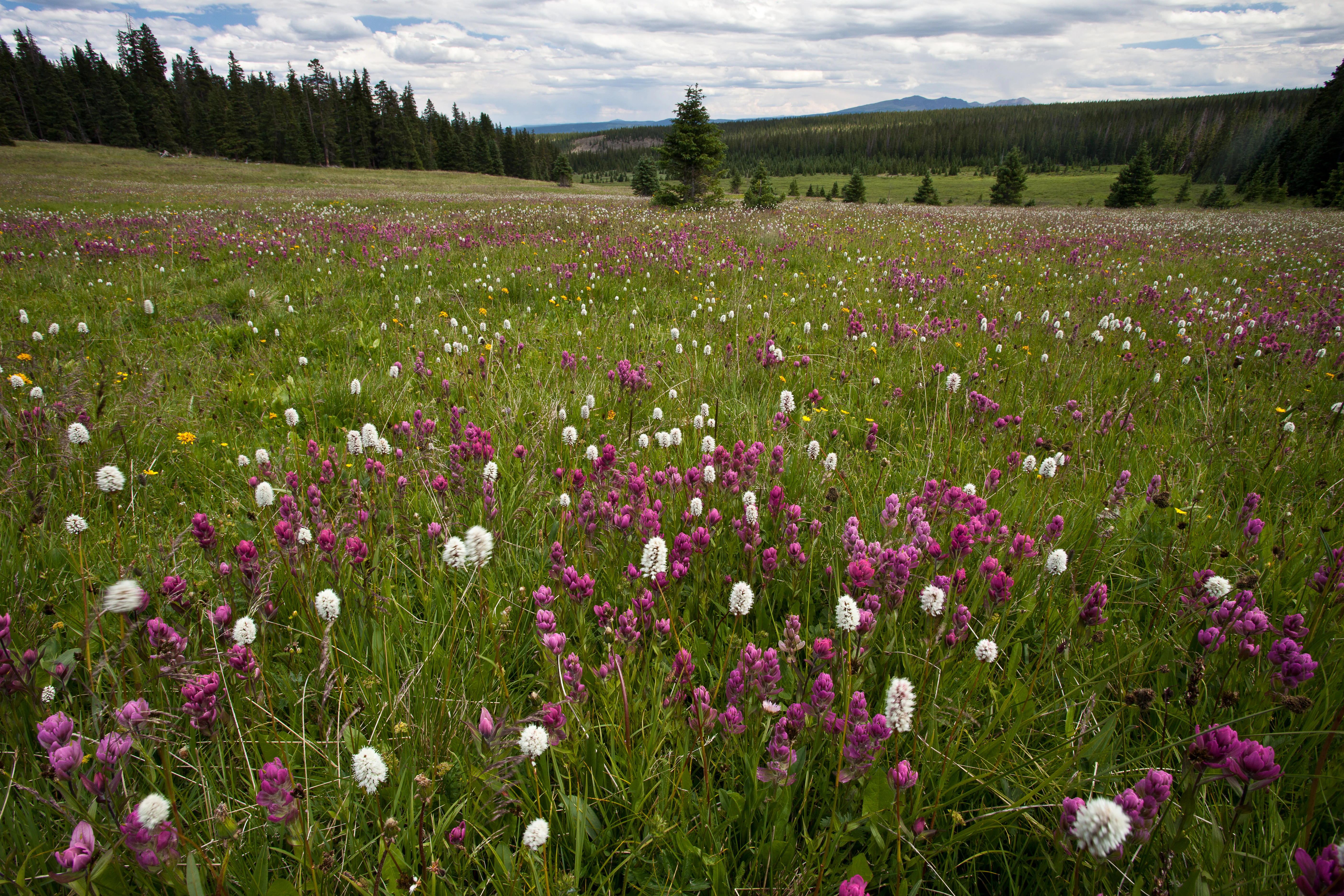
A vast alpine meadow covered in pink and white wildflowers with a coniferous forest and rolling hills in the background under a cloudy sky.
A vibrant meadow of wildflowers in the Powderhorn Wilderness.

Powderhorn Wilderness ecosystems, habitats, and plant life

Ecologically, Powderhorn Wilderness compresses several major Colorado mountain ecosystems into a relatively small area. The lower elevations in the northern extension support dry montane and woodland environments, where ponderosa pine becomes locally dominant on warmer, south-facing slopes and sagebrush steppe spreads across drier hillsides and open flats. These lower zones blend into a montane and subalpine forest belt of Engelmann spruce, subalpine fir, and aspen, broken by open meadows of grasses and wildflowers. Higher still, a subalpine to alpine transition includes willow thickets and tundra shrub communities before giving way to true alpine tundra.

Roughly half of the wilderness lies above tree line, producing one of the largest continuous alpine tundra areas in the contiguous United States, an unusual distinction that gives Powderhorn a meaningful role in regional ecological conservation. Tundra vegetation consists primarily of grasses, sedges, and forbs, with willow forming conspicuous thickets in moister draws and snow-accumulation zones. Because the volcanic substrate weathers unevenly, soils and plant communities vary sharply over short distances, supporting a mosaic of dry ridge tundra, meadow, and wetland habitats rather than the uniform tundra of colder, higher mountain ranges.

Wetland and riparian features add further ecological texture. Beaver ponds along the forks of Powderhorn Creek and around smaller lakes create slow-water environments that support aquatic invertebrates, amphibians, and a host of bird species. The combination of beaver wetlands, glacial lakes, subalpine meadows, and tundra plateaus produces a striking habitat mosaic, even though the treeless and sparsely vegetated upper zones dominate the visual impression of the area.
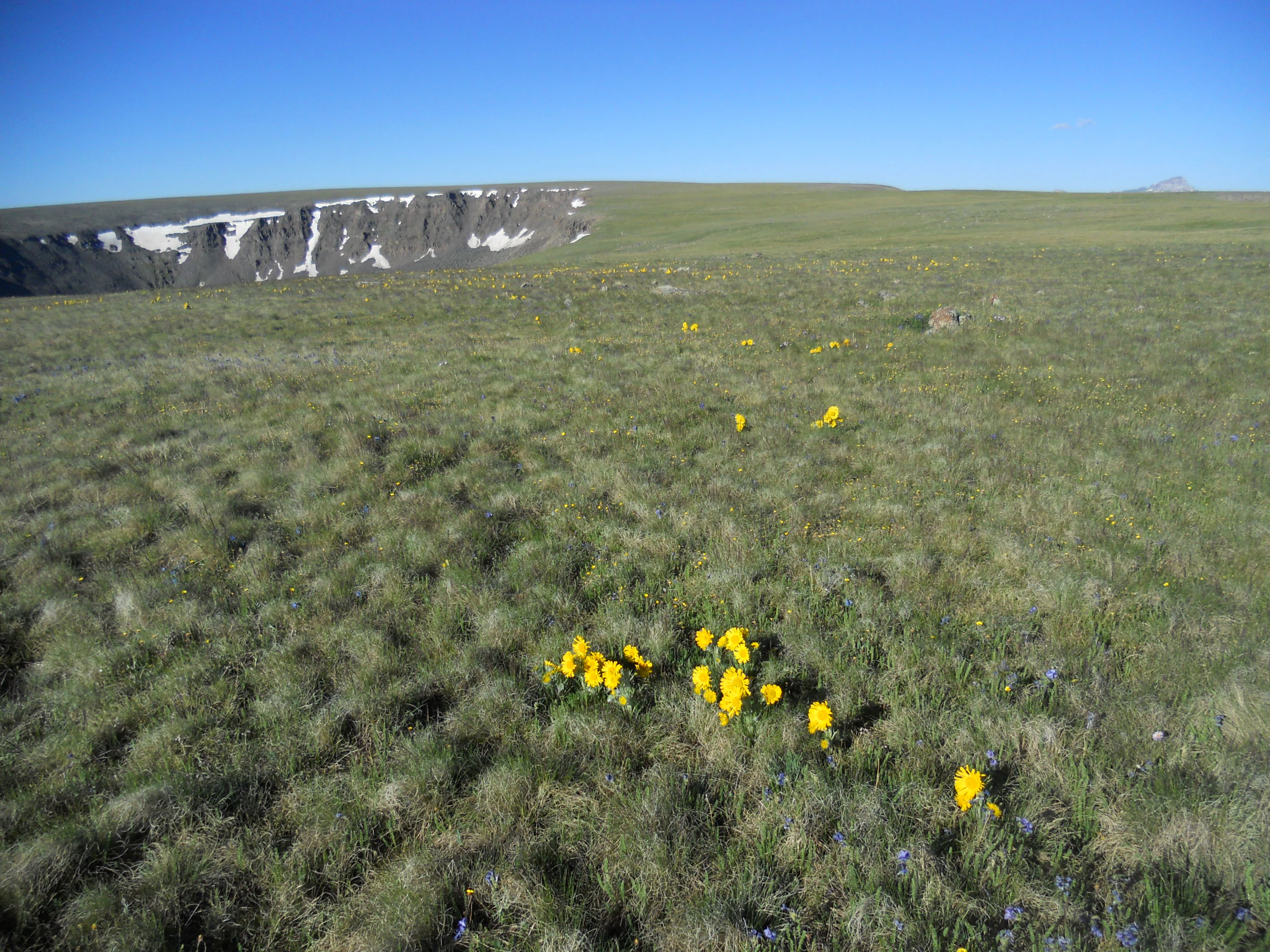
A wide, open alpine tundra landscape featuring grassy meadows, patches of yellow wildflowers in the foreground, and a rocky volcanic ridge with lingering snow in the distance under a clear blue sky.
Calf Creek Plateau in the Powderhorn Wilderness, featuring alpine tundra and volcanic terrain.

Powderhorn Wilderness wildlife and species highlights

Powderhorn Wilderness is most noted for its significance as summer range for two of the most visible large mammals of the southern Rockies: mule deer and elk. The wilderness's elevation span, with lush subalpine meadows in midsummer and snow-free tundra plateaus above 12,000 feet, supports predictable seasonal use by both species. Mule deer in particular take advantage of the open, edge-rich habitats, while elks use a mix of forest cover and meadow foraging areas.

Larger carnivores are present although rarely seen. Mountain lions range through the wilderness, using rock outcrops and forested cover for hunting and denning. Black bears forage across the meadows and berry-producing shrub zones during summer and fall, sometimes concentrated near berry-rich subalpine habitats. Bobcats and coyotes occupy similar but distinct niches, with coyotes often ranging more widely through open terrain and bobcats more often associated with rocky cover.

Smaller mammals and alpine specialists give the area much of its zoological character. Yellow-bellied marmots are common at rocky talus and meadow edges, and American pikas inhabit talus slides and boulder fields across the higher elevations. American martens move through denser subalpine conifer stands where large downed wood provides cover. Beaver are an important ecological presence in their own right, maintaining ponds and wet meadows along the forks of Powderhorn Creek. Avian life, while not detailed in source material, follows the typical pattern for Colorado's high elevations: raptors hunting the open ridges, corvids active across habitats, and a strong migratory and breeding presence in the beaver wetlands and subalpine meadows of the fork valleys.

Powderhorn Wilderness conservation status and protection priorities

The principal conservation value of Powderhorn Wilderness lies in the preservation of an unusually large and connected alpine tundra ecosystem in the lower 48 states. By protecting roughly half of its area in a tundra zone that has seen relatively little modification, Powderhorn contributes to regional climate refugia for alpine species such as pikas and marmots, which are sensitive to warming and to fragmentation of high-elevation habitat. The wilderness's compact elevation range and intact connectivity from sagebrush steppe up through tundra allow ecological processes to operate across the full altitudinal gradient that supports these species, a condition that is increasingly rare in the southern Rockies.

Watershed protection is equally central. As the headwaters of East, Middle, and West Forks of Powderhorn Creek, the wilderness delivers clean, cold, snowmelt-driven water to Cebolla Creek and the Gunnison River, a major tributary of the Colorado River system. The lightly developed nature of the area, combined with the lack of mining, motorized access, and permanent infrastructure, keeps erosion, runoff, and sedimentation low. Beaver-maintained wetlands and glacial lakes further act as natural water-storage features that moderate downstream flows, an increasingly valued function as climate variability affects western river systems. Federal wilderness status locks in this condition by prohibiting new roads, mechanical equipment, and most extractive uses.

The area's conservation profile is also shaped by the unusual dual management of the Bureau of Land Management and U.S. Forest Service, an arrangement that required coordinated planning and continues to influence management emphasis. The steep terrain, high elevations, and short growing season make the tundra ecosystem particularly vulnerable to trampling from concentrated foot traffic, a concern that influences trail alignment decisions and limits on informal campsite development around sensitive features such as Powderhorn Lakes. The combined effect is a working conservation model that emphasizes wilderness character, watershed integrity, and the protection of fragile alpine plant communities over more intensive forms of public use.

Powderhorn Wilderness cultural meaning and human context

Powderhorn Wilderness lies in a remote sliver of southwestern Colorado, an area long characterized by ranching, mining legacy, and small mountain communities such as Lake City in Hinsdale County and the broader Gunnison Basin across the county line. The wilderness itself does not contain significant built heritage or active inholdings, and its cultural context is shaped less by direct human occupation than by the regional identity of the San Juan Mountains as a landscape of mineral extraction, high-country grazing, and frontier-era settlement. Lake City, founded during the silver boom of the late nineteenth century, remains the closest small community and has functioned historically as a gateway for activity in the surrounding mountains.

Indigenous presence in the broader San Juan region, while not documented in detail within the wilderness itself, is part of the regional cultural landscape. Historically, mountain environments such as the Gunnison Basin and the headwaters of the Gunnison River were used by Indigenous peoples for hunting, travel, and seasonal resource gathering, and these patterns are reflected in regional ethnography rather than in specific sites within Powderhorn's boundaries. The absence of major cultural sites inside the wilderness itself, combined with strong federal protection, means that Powderhorn's cultural dimension is best understood as the regional backdrop of mountain settlement and indigenous land use rather than as in-park heritage features.

Top sights and standout views in Powderhorn Wilderness

Powderhorn Wilderness stands out for its unusual combination of volcanic geology, vast alpine tundra, and intact headwaters function. The Hinsdale Formation basalts, capping Calf Creek Plateau and Cannibal Plateau, are among the youngest volcanic rocks in the San Juan volcanic field and are unusually well preserved, giving the wilderness a distinctive dark, plateaulike character that contrasts with the sharper peaks of nearby ranges. Underlying ash tuffs connect the area to some of the largest known volcanic eruptions on the continent. Above these volcanic foundations lies one of the largest continuous tundra zones in the contiguous United States, a feature that gives Powderhorn disproportionate ecological importance relative to its size. Glacial cirques, particularly the basin cradling the popular Powderhorn Lakes, provide the wilderness's most recognizable scenic anchor. The network of trailheads and around 45 miles of interconnecting trails allows visitors to move between these distinct landscapes without motorized travel, preserving a quiet, primitive experience of one of the more unusual corners of the Colorado Rockies. The combination of large-scale, lightly visited tundra, classic glacial landforms, well-preserved volcanic stratigraphy, and an intact Gunnison River headwaters system makes Powderhorn a distinctive example of a southern Rockies wilderness defined more by plateaus and open space than by dramatic peaks.
Monthly climate preview

Long-term average temperature and precipitation measurements across twelve recorded intervals

Powderhorn Wilderness Climate Normals and Annual Weather by Month

Representative coordinates record sustained sub-zero winter temperatures alongside moderate summer maximums and steady daily precipitation rates. Examining the full twelve-month profile reveals detailed shifts in regional climate normals and monthly averages.
Annual mean1 °C
-11 °C14 °C
Jan-11°
Feb-10°
Mar-5°
Apr
May
Jun11°
Jul14°
Aug13°
Sep
Oct
Nov-5°
Dec-10°
Warmest month
July

14.2 °C

Coolest month
January

-11.1 °C

Wettest month
August

1.8 mm/day

Driest month
June

0.8 mm/day

Park location guide

Geography guide, regional context, and park location map for Powderhorn Wilderness

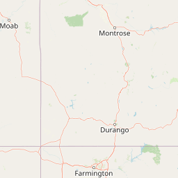
Powderhorn Wilderness park geography, regions, and map view in United States of America

Understand where Powderhorn Wilderness sits in United States of America through a broader geographic reading of the surrounding landscape, nearby location context, and its mapped position within the national park landscape.

How Powderhorn Wilderness fits into United States of America

The United States of America is a federal presidential republic and one of the world's largest countries by area and population. It consists of 50 states across a vast territory spanning multiple time zones, with its capital in Washington, D.C. and largest city in New York City. The nation has a diverse economy, influential political system, and significant cultural and military presence globally.

Wider geography shaping Powderhorn Wilderness in United States of America

The United States occupies a vast territory in North America, bordered by Canada to the north and Mexico to the south. The 48 contiguous states stretch from the Atlantic to the Pacific Ocean, while Alaska occupies the northwestern region and Hawaii is an archipelago in the Pacific. The country encompasses diverse terrain including the Rocky Mountains, Appalachian Mountains, Great Plains, and extensive river systems.

Map view of Powderhorn Wilderness

Use this park location map to pinpoint Powderhorn Wilderness in United States of America, understand its exact geographic position, and read its mapped placement within the surrounding landscape more clearly.

Pigeon | © OpenStreetMap contributors

Location context for Powderhorn Wilderness

Colorado
Recorded earthquake history

Examine the Recorded Earthquake History for Powderhorn Wilderness

Review the established record of seismic activity associated with the high plateaus and alpine terrain of the Powderhorn Wilderness. This MoriAtlas collection maps historical earthquake events by their epicentral distance to support deeper geographic inquiry.

Powderhorn Wilderness Earthquake History

Catalogued events

2 events

Strongest magnitude

Magnitude 3.4

Most recent event

Nov 19, 1989

This history includes earthquakes recorded inside the park or within 50 km of its borders

Visual reference collection showcasing protected highlands, glacial cirques, and high country habitats

Powderhorn Wilderness Photos, Volcanic Plateaus, and Alpine Tundra Scenery

Visual records capture the sweeping basalt plateaus, alpine tundra expanses, and glacial cirques defining the protected landscape. Examining high country imagery reveals the distinct geological character, diverse vegetation zones, and remote watershed environments preserved across the wilderness.

A high-angle view looking down into a valley containing a dark alpine lake surrounded by dense evergreen forests and steep volcanic cliffs.

A wide, high-angle landscape shot of a blue alpine lake nestled in a green valley, with a large, rocky, gray volcanic scree slope in the foreground.

A vast alpine meadow covered in pink and white wildflowers with a coniferous forest and rolling hills in the background under a cloudy sky.

A wide, open alpine tundra landscape featuring grassy meadows, patches of yellow wildflowers in the foreground, and a rocky volcanic ridge with lingering snow in the distance under a clear blue sky.

Park atlas

Compare surrounding San Juan mountain terrain and adjacent protected areas

Parks Near Powderhorn Wilderness and Related Colorado Protected Landscapes

Continue exploring regional conservation lands and high country protected areas surrounding Powderhorn Wilderness. Comparing nearby mountain terrain reveals broader geological patterns across the southwestern Colorado volcanic plateaus.
A pale watercolor painting showing a panoramic view of mountain ranges in the background, a coniferous forest on a small hill, and a meadow with wildflowers in the foreground.
Wildlife reserveColorado
0 km away#1 closest

Southeast

La Garita Wilderness: Exploring the High Alpine Geography of Southern Colorado

Volcanic terrain and protected mountain wilderness atlas

La Garita Wilderness serves as a primary example of protected high-alpine geography in southern Colorado. This atlas entry examines the undulating volcanic ridges, glacial cirques, and alpine basins that define the area, including the prominent peak of San Luis. It highlights the integration of significant trail systems within this protected landscape, offering a clear perspective on the physical geography and conservation value of the La Garita mountain range.

Area
524.58 km²
Established
1964
IUCN
Ib
Relief
Mountain
Watercolor painting of soft, layered mountain ranges behind green hills and patches of evergreen trees on a white background.
Protected landscapeColorado
9.1 km away#2 closest

Southeast

Rio Grande National Forest: Atlas and Geographic Profile of a Southern Colorado Landscape

Watershed geography and Continental Divide terrain analysis.

Rio Grande National Forest represents an immense protected landscape encompassing diverse terrain from high desert steppe to rugged alpine peaks. This profile details the forest's hydrological significance as the source of the Rio Grande and its role as a massive ecological transition zone in the Mountain West. Examine the boundaries and mountain geography that define this critical protected area.

Area
7,500 km²
Established
1908
Relief
Mountain
Climate
Boreal
A minimalist watercolor illustration showing soft green hills, purple mountains in the background, and a reflective water body in the foreground.
Protected areaColorado
About 29 km away#3 closest

North

Curecanti National Recreation Area: Mapped Geography and Protected Landscapes of Western Colorado

River-based recreation and volcanic canyon terrain

Curecanti National Recreation Area stretches across Gunnison and Montrose counties, serving as a primary water-based protected landscape in Colorado. The area preserves the geologic transitions from the broad expanse of Blue Mesa Reservoir to the granite-walled canyons of Morrow Point and Crystal, offering a deep look into the regional geography and historical infrastructure of the Gunnison basin.

Area
174.4 km²
Established
1965
Visitors
807.1K annual
Relief
Mountain
Protected landscapeColorado
38 km away#4 closest

Southwest

San Juan National Forest: Geographic Overview of a Major Southern Colorado Protected Landscape

Mapped terrain across the Southern San Juan Mountains

San Juan National Forest represents a massive protected landscape in western Colorado, defined by its rugged alpine peaks, dense conifer forests, and glacial valleys. This atlas entry details the forest boundary, its position along the Continental Divide, and the surrounding transition into the Colorado Plateau. It provides a structured look at the terrain that connects diverse ecosystems, from high-altitude tundra to expansive mesa country, within one of the largest national forests in the American West.

Area
7,603.42 km²
Established
1905
Relief
Mountain
Climate
Alpine
Protected landscapeColorado
About 47 km away#5 closest

West

Uncompahgre National Forest: Protected Landscapes and Geographic Features in Colorado

Mapping the arid plateau and high-country San Juan wilderness zones.

Uncompahgre National Forest represents a vast protected area in the American West, spanning iconic landscapes from the dry, pinyon-juniper covered Uncompahgre Plateau to the dramatic, jagged ridges of the northern San Juan Mountains. This atlas entry provides essential context on its alpine wilderness designations, high-country topography, and the unique geological transitions that define its status as a critical Colorado resource for regional landscape analysis.

Area
3,865.68 km²
Established
1905
Relief
Mountain
Climate
Alpine
Watercolor painting of a mountain landscape with light green rolling hills in the midground and pale, soft-toned mountain peaks in the background.
Protected areaColorado
47 km away#6 closest

West

Mount Sneffels Wilderness: Mapping the High Alpine Terrain of the San Juan Mountains

Protected mountain geography in southwestern Colorado

Mount Sneffels Wilderness protects a dramatic cluster of peaks in the San Juan range, characterized by glacial cirques, expansive talus fields, and sharp ridgelines. As a vital component of the Colorado backcountry, this area provides a window into high-altitude ecological transition zones, from dense conifer forests to exposed granite summits that define the character of the Uncompahgre National Forest.

Area
67.04 km²
Established
1980
IUCN
Ib
Relief
Mountain
National parkMontrose County
49 km away#7 closest

Northwest

Black Canyon of the Gunnison National Park: Protected Area Geography and Mapped Landscape

Explore the natural terrain and protected boundaries in Montrose County.

Black Canyon of the Gunnison National Park is a national park defined by its profound geological features and its status as a protected landscape. Located within Montrose County, it offers a distinct geographic profile for atlas-based exploration. Users can understand the park's mapped boundaries, its relation to the surrounding regional geography, and the unique natural terrain that defines this protected area, contributing to a structured discovery of its natural landscape identity.

Area
124.4 km²
Established
1999
IUCN
II
Visitors
357.1K annual
A horizontal watercolor illustration depicting soft layers of green rolling hills, a band of trees, and distant pinkish mountain peaks against a white background.
Protected landscapeColorado
About 52 km away#8 closest

North

Gunnison National Forest: Atlas and Geographic Overview of a Colorado Protected Landscape

Mapping deep wilderness areas and high mountain watersheds

Spanning over one million acres in western Colorado, this protected landscape features dramatic glaciated valleys, subalpine meadows, and iconic volcanic features. The forest anchors the Gunnison River headwaters and offers significant insights into the ecological structure of the Southern Rocky Mountains and its dense concentration of wilderness zones.

Area
6,766.89 km²
Established
1905
Relief
Mountain
Climate
Alpine

Common questions about visiting, size, designation, and location context for Powderhorn Wilderness

Powderhorn Wilderness FAQs for park facts, access, geography, and protected area context

Find quick answers about Powderhorn Wilderness, including protected-area facts, park geography, trail and visitor context, and how the park fits into its surrounding country and regional landscape.
MoriAtlas Explorer

Continue Your Protected Areas Search Across the Global Atlas

Deepen your exploration by continuing the structured search for national parks and protected areas worldwide. Utilize the comprehensive filtering capabilities to compare different conservation landscapes and refine your understanding of global park geography. Discover more about the distribution and characteristics of protected natural areas.

Global natural geography