

Mori Atlas logo
National parkPrince Albert National Park

Understanding the Protected Landscape Boundaries and Regional Natural Terrain

Prince Albert National Park: A Mapped National Park in Saskatchewan's Geography

Prince Albert National Park stands as a significant protected area within the Saskatchewan region, offering a distinct national park identity for geographic exploration. This canonical detail page provides an atlas-driven perspective, highlighting the park's mapped boundaries and its place within the natural terrain of Saskatchewan. It serves as a key entry point for understanding the protected landscape's geographic context and its role in broader regional mapping and conservation.

Boreal ForestNational ParkSaskatchewanBisonWildlife WatchingLakes

Prince Albert National Park

National park

Park overview

Structured park overview, official facts, and landscape profile for Prince Albert National Park

Prince Albert National Park park facts, protected area profile, and essential visitor context

Review the core facts for Prince Albert National Park, including designation, size, terrain, visitor scale, habitats, and operating context in one park-focused overview.

About Prince Albert National Park

Prince Albert National Park represents the southern boreal forest region of Canada, protecting a transition zone between the agricultural lands of southern Canada and the Canadian Shield to the north. The park's landscape was shaped by Pleistocene glaciers that deposited glacial till, sand, and other materials later colonized by trees and shrubs. The Waskesiu Upland dominates approximately 90% of the park's terrain, creating a rolling, forested landscape with numerous lakes and rivers. The park serves as a critical watershed, with several major rivers including the Spruce, Sturgeon, and Smoothstone rivers having their source within its boundaries. The community of Waskesiu Lake provides visitor facilities and services, while the park remains politically separate from surrounding rural municipalities, administered as part of the Northern Saskatchewan Administration District. The park's development as a recreation destination has influenced the broader region, with communities like Christopher Lake and Emma Lake becoming popular recreation areas adjacent to the park boundaries.

Quick facts and research context for Prince Albert National Park

Prince Albert National Park occupies 3,874 km² of central Saskatchewan boreal forest, making it a substantial protected wilderness area in Canada's prairie province. The park was established in 1927 and is administered by Parks Canada. The only community within the park is the hamlet of Waskesiu Lake, located on the southern shore of Waskesiu Lake. The park features diverse terrain including coniferous forests dominated by jack pine and white spruce, with aspen forest and rare fescue grasslands in the southern regions. The southwest corner hosts a herd of over 400 plains bison, the only free-ranging herd in Canada with natural predator populations. Water quality in the park's lakes remains high, supporting robust fish populations including northern pike, walleye, lake trout, and whitefish.

Protection and recognition

Mapping terrestrial boundary history and official conservation data since its 1927 designation.

Documented Protection Status and Designation of Prince Albert National Park

Researchers and conservation explorers can examine the official terrestrial protection records and historical designation parameters for Prince Albert National Park. Verifying the 1927 establishment timeline and regional boundary scope helps clarify how the park fits into the broader network of Canadian protected forest landscapes.

Protection details

Protection scope
Terrestrial
Designated year
1927
Transboundary protection
No
Park context

Deeper park guide and search-rich context for Prince Albert National Park

Prince Albert National Park history, landscape, wildlife, and travel context

Explore Prince Albert National Park through its history, landscape character, ecosystems, wildlife, conservation priorities, cultural context, and seasonal travel timing in a structured park guide built for atlas discovery and search intent.

Why Prince Albert National Park stands out

Prince Albert National Park is best known for its free-ranging plains bison herd in the southwest corner, the only herd in Canada existing within its original range alongside natural predators including timber wolves. The park also holds significance as the former home of Grey Owl (Archibald Belaney), a famous conservationist and author who lived at Ajawaan Lake in the 1930s and wrote influential books about wilderness protection including Pilgrims of the Wild. The park's boreal forest ecosystem, diverse wildlife including moose, elk, black bears, and wolves, and extensive lake systems make it a destination for wildlife observation. The presence of one of Canada's largest white pelican colonies at Lavallée Lake adds to the park's ornithological importance.

Prince Albert National Park history and protected-area timeline

Prince Albert National Park has human history spanning thousands of years, with archaeological evidence of pre-contact indigenous peoples dating from 11,000 years before present through to the historic period. A Hudson's Bay Company fur trading post operated at Waskesiu Lake between 1886 and 1893. In 1908-1909, the New Northwest expeditions led by Frank Crean were the first to scientifically document the region through photography and lake mapping, leading to Crean Lake being named in his honor. Early 20th century industries of fishing and logging operated in the boreal forest, though the large forest fire of 1919 eliminated the logging industry. The park was officially established on March 24, 1927, though Prime Minister William Lyon Mackenzie King did not perform the official opening ceremonies until August 10, 1928. Upon the park's creation, indigenous peoples who traditionally lived on the lands were forcibly removed by federal officials and the RCMP, with their possessions and cabins destroyed. The park became the subject of a 2011 National Parks Project film directed by Stéphane Lafleur. The park's most famous resident was Grey Owl, hired by the Dominion Parks Service as the first naturalist, who lived at Ajawaan Lake from 1932 until his death in 1938 and wrote influential conservation literature.

Prince Albert National Park landscape and geographic character

Prince Albert National Park features a rolling, predominantly forested landscape within the Waskesiu Hills, covering elevations from 488 metres in the western portions to 724 metres in the eastern areas. The terrain was shaped by Pleistocene glacial activity, which deposited glacial till, sand, and other materials that subsequently became colonized by vegetation. The park contains several significant lakes, with Waskesiu, Kingsmere, and Crean being the largest. The lake-studded landscape includes numerous smaller water bodies connected by rivers and streams that form the headwaters for several major river systems. The southern portion of the park contains rare fescue grasslands within an aspen forest matrix, representing an ecologically significant habitat type that has largely been lost outside the park boundaries due to agricultural conversion and urban development. The terrain provides diverse scenery from forested ridges to lake shores and wetland areas.

Prince Albert National Park ecosystems, habitats, and plant life

The park represents the southern boreal forest region of Canada, positioned south of the Canadian Shield in landscapes shaped by glacial processes. Most of the park is covered by coniferous forests, with jack pine and white spruce becoming more prevalent toward the north. The southern portions transition to predominantly aspen forest with understory shrubs including elderberry, honeysuckle, and rose, interspersed with meadows of fescue grassland. These fescue grasslands hold particular ecological importance due to their rarity, as most native fescue grassland outside the park has been lost to agriculture or development. The park's location on the drainage divide between the North Saskatchewan and Churchill Rivers creates diverse wetland and aquatic habitats. The numerous lakes support productive aquatic ecosystems with high water quality, though lake trout populations in Crean Lake have not recovered from commercial overfishing in the early 20th century.

Prince Albert National Park wildlife and species highlights

Prince Albert National Park supports diverse wildlife populations within its boreal forest ecosystem. Large mammals include elk, moose, white-tailed deer, black bears, coyotes, and timber wolves. The park is particularly notable for its free-ranging plains bison herd of over 400 individuals in the southwest corner, the only herd in Canada existing within its original range with a full complement of native predators. Boreal woodland caribou from a declining regional population occasionally range into the park, though their core habitat lies to the north. The park supports 21 documented fish species including northern pike, walleye, lake trout, yellow perch, cisco, and lake whitefish. Avian diversity includes waterfowl such as double-crested cormorants, red-necked grebes, and common loons, while raptors including bald eagles and osprey are common. One of Canada's largest white pelican colonies nests on Lavallée Lake in a closed area. River otters are reliably observable year-round, particularly around open water areas in winter.

Prince Albert National Park conservation status and protection priorities

Prince Albert National Park serves as a critical conservation area within Saskatchewan's boreal forest region, protecting representative ecosystems of the southern boreal forest. The park preserves rare fescue grassland habitats that have largely disappeared outside its boundaries due to agricultural conversion. The free-ranging bison herd represents a unique conservation success, maintaining the only plains bison population in Canada within its original geographic range with intact predator-prey relationships including timber wolves. The park's lakes and waterways support important fish populations, and the protection of watershed areas contributes to broader regional water quality. The white pelican colony at Lavallée Lake represents significant breeding habitat protection. Boreal woodland caribou conservation remains a challenge, as regional populations face habitat loss from forest logging outside the park. The park's protection extends to cultural heritage sites including Grey Owl's cabin at Ajawaan Lake.

Prince Albert National Park cultural meaning and human context

The lands now comprising Prince Albert National Park have been inhabited by indigenous peoples for thousands of years, with archaeological evidence spanning pre-contact periods from 11,000 years before present through to historic times. Upon the park's establishment in 1927, indigenous communities who traditionally lived on these lands were forcibly removed by federal officials and the RCMP, with their cabins and possessions destroyed. The park's name references the city of Prince Albert, though the park's main entrance lies 80 kilometres north of that city. The hamlet of Waskesiu Lake developed as the park's primary visitor service centre. The park holds cultural significance through its association with Grey Owl, the conservationist who lived at Ajawaan Lake and whose writings influenced public attitudes toward wilderness conservation in Canada.

Top sights and standout views in Prince Albert National Park

Prince Albert National Park offers exceptional boreal wilderness experiences with highlights including the free-ranging bison herd in the southwest, Grey Owl's historic cabin at Ajawaan Lake, excellent wildlife watching particularly for wolves, elk, and otters, and the extensive lake systems suitable for boating and fishing. The park provides over 400 kilometres of hiking trails including routes to scenic viewpoints and along river systems. The Waskesiu Golf Course, designed by Stanley Thompson in the 1930s, remains a notable recreational feature. The diverse habitats from coniferous forest to aspen parkland and fescue grassland support outstanding biodiversity. Winter visiting offers unique opportunities to observe wolves traveling on frozen lakes and reliable otter sightings around open water areas.

Best time to visit Prince Albert National Park

Prince Albert National Park is open year-round, with the most visited period from May to September when warm weather enables full access to hiking trails, swimming beaches, boating, and camping. Summer provides the most comprehensive park experience with all facilities and services operational. However, winter offers exceptional wildlife watching opportunities as wolves travel across frozen lakes and elk and deer become more visible in the town of Waskesiu. Otters are particularly reliable around open water at the Waskesiu Lake Narrows and where the Waskesiu River exits the lake during winter months. The shoulder seasons of spring and fall provide quieter visitation with different landscape character as the boreal forest transitions through seasonal changes.
Park guides

Targeted planning resources for the boreal forest and protected wilderness

Prince Albert National Park Published Guides and Focused Research

Published guides offer focused answers for travelers studying specific environmental conditions and seasonal patterns across the protected landscape. Resources examine timing considerations for warm weather lake recreation and winter wildlife observations within the regional ecosystem.
Monthly climate preview

Analyzing long term temperature averages and monthly precipitation patterns in Saskatchewan

Climate Normals and Weather by Month in Prince Albert National Park

Long term climatology data at a central park coordinate shows a wide annual temperature sweep, from sub zero winter averages to warm summer highs alongside moderate rainfall. Exploring the complete monthly climate normals reveals detailed insights into seasonal transitions and precipitation shifts across the year.
Annual mean1 °C
-18 °C18 °C
Jan-18°
Feb-15°
Mar-8°
Apr
May
Jun15°
Jul18°
Aug17°
Sep10°
Oct
Nov-8°
Dec-16°
Warmest month
July

17.9 °C

Coolest month
January

-18.2 °C

Wettest month
June

3.2 mm/day

Driest month
February

0.7 mm/day

Park location guide

Geography guide, regional context, and park location map for Prince Albert National Park

Prince Albert National Park park geography, regions, and map view in Canada

Understand where Prince Albert National Park sits in Canada through a broader geographic reading of the surrounding landscape, nearby location context, and its mapped position within the national park landscape.

How Prince Albert National Park fits into Canada

Canada is a federal parliamentary constitutional monarchy spanning North America from the Atlantic to the Pacific and Arctic Oceans. With a population of over 41 million, it is officially bilingual in English and French at the federal level. The country gained independence from the United Kingdom through a gradual process culminating in 1982.

Wider geography shaping Prince Albert National Park in Canada

Canada occupies the northern portion of North America, sharing its longest international border with the United States. The country extends from the Atlantic Ocean to the Pacific Ocean and northward into the Arctic Ocean, giving it the longest coastline of any nation.

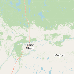
Map view of Prince Albert National Park

Use this park location map to pinpoint Prince Albert National Park in Canada, understand its exact geographic position, and read its mapped placement within the surrounding landscape more clearly.

Pigeon | © OpenStreetMap contributors

Location context for Prince Albert National Park

Saskatchewan
Natural feature types

Explore Geographic Features and Landscapes within Prince Albert National Park

Deepen your understanding of the terrain and aquatic systems by exploring the MoriAtlas collection of named features within Prince Albert National Park. Review the distribution of boreal habitats, glacial remnants, and hydrologic landmarks that form this significant Saskatchewan landscape.
Park atlas

Compare surrounding protected landscapes and explore regional park geography beyond central Saskatchewan.

Discover Other National Parks and Protected Areas Near Prince Albert National Park

Browse an expanded atlas of national parks and protected areas geographically connected to Prince Albert National Park's boreal forest and lake systems. Explore diverse Canadian conservation landscapes, understand regional ecological contexts, and trace the spread of protected terrain across Saskatchewan and neighboring regions for informed comparison.
Wildlife reserveSaskatchewan
About 86 km away#1 closest

Southwest

Thickwood Hills National Wildlife Area: Geography and Protected Landscape Analysis

A study of transitional Saskatchewan prairie and aspen ecosystems

Located northeast of Blaine Lake, this Canadian wildlife reserve encompasses a precise 299-hectare footprint. The site serves as a vital example of regional conservation, maintaining wetlands and native grasslands that define the transition between open prairie and northern boreal forest landscapes.

Area
2.99 km²
Established
2025
IUCN
IV
Relief
Lowland
Wildlife reserveSaskatchewan
124 km away#2 closest

Southwest

Scent Grass Lake Migratory Bird Sanctuary: Regional Geography and Wetland Protected Area Maps

Key waterfowl breeding and molting ground in Saskatchewan.

Examine the ecological significance of Scent Grass Lake Migratory Bird Sanctuary, a critical wildlife reserve within the Saskatchewan Aspen Parkland. This protected area offers essential open water and sedge marsh environments for migratory waterfowl, serving as a vital staging and breeding site that maintains regional habitat stability in the Canadian prairies.

Area
6.47 km²
Established
1948
IUCN
IV
Relief
Lowland
Wildlife reserveSaskatchewan
About 142 km away#3 closest

Southeast

Raven Island National Wildlife Area: Geographic Overview and Protected Island Landscape

Essential conservation geography within Saskatchewan

Located in the saline prairie basins of central Saskatchewan, Raven Island National Wildlife Area is a 112-hectare protected habitat. This site plays a strategic role in the Lenore Lake migratory bird complex, preserving crucial island breeding grounds within a gentle prairie landscape. Explore the physical boundaries and ecological context of this Canadian wildlife reserve.

Area
1.12 km²
Established
1982
IUCN
IV
Scope
Terrestrial
Wildlife reserveSaskatchewan
About 152 km away#4 closest

South

St. Denis National Wildlife Area: Geographic Profile and Protected Prairie Landscape

A research-focused wildlife reserve in central Saskatchewan.

St. Denis National Wildlife Area represents a critical nexus for prairie ecology, defined by its dense network of shallow ponds and native grassland communities. As a dual-designated National Wildlife and Research Area, this site offers a clear window into the delicate balance of wetland habitats, saline soil conditions, and agricultural landscape integration across Saskatchewan.

Area
3.6 km²
Established
1967
IUCN
IV
Protected areaSutherland
158 km away#5 closest

South

Zugvogelschutzgebiet Sutherland: Regional Geography and Protected Area Context

Historic migratory bird habitat in the Saskatchewan prairie landscape

The Zugvogelschutzgebiet Sutherland protected area serves as an important migratory refuge on the Canadian Prairies. While the site integrates diverse land uses including a zoo and research facilities, its remaining native grasslands continue to provide essential feeding and resting grounds for geese, swans, and ducks. This analysis maps the sanctuary within its broader regional context.

Area
1.3 km²
Established
1924
Relief
Lowland
Climate
Temperate
Wildlife reserveSaskatchewan
About 222 km away#6 closest

South

Harris Sandhills National Wildlife Area: Saskatchewan Protected Prairie Geography and Map

Mapped wildlife reserve within the Canadian prairie region.

This protected area in Saskatchewan showcases a distinct mosaic of stabilized dunes and native mixed-grass prairie. Understand its geographic significance as a sanctuary for migratory birds and rare prairie species within the expansive plains of Canada. The reserve offers a focused look at small-scale conservation landscapes through its defined physical boundaries and varied topographic features.

Area
3.7 km²
Established
2025
IUCN
IV
Relief
Lowland
Wildlife reserveSaskatchewan
233 km away#7 closest

Southeast

Neely Lake Migratory Bird Sanctuary: Boreal Wetland Geography and Protected Landscapes

Essential protected area data for the eastern Saskatchewan boreal fringe

Neely Lake Migratory Bird Sanctuary encompasses a shallow freshwater environment defined by marshy shorelines, wet meadows, and small islands. Situated within the Mid-Boreal Upland, this protected landscape provides crucial stopover habitat for waterfowl moving through the Prairie and Boreal flyways. Gain insight into the terrain, water-body structure, and ecological role of this significant Canadian wildlife reserve.

Area
5.02 km²
Established
1952
IUCN
IV
Protected areaEstonia
About 353 km away#8 closest

Southeast

Zugvogelschutzgebiet Upper Rousay Lake Protected Area: Regional Map and Geography

Examining the protected landscapes and territorial extent in Estonia.

This resource provides a comprehensive view of the Zugvogelschutzgebiet Upper Rousay Lake protected area in Estonia. Focus on the defined boundaries, mapped terrain, and regional geographic context that identify this site. We provide a structured overview for researchers and geography enthusiasts to understand the spatial distribution and protected land status of this specific wetland environment.

Area
5.73 km²
Established
1948
Relief
Lowland
Climate
Temperate

Common questions about visiting, size, designation, and location context for Prince Albert National Park

Prince Albert National Park FAQs for park facts, access, geography, and protected area context

Find quick answers about Prince Albert National Park, including protected-area facts, park geography, trail and visitor context, and how the park fits into its surrounding country and regional landscape.
MoriAtlas Explorer

Continue Your Protected Areas Search Across the Global Atlas

Deepen your exploration by continuing the structured search for national parks and protected areas worldwide. Utilize the comprehensive filtering capabilities to compare different conservation landscapes and refine your understanding of global park geography. Discover more about the distribution and characteristics of protected natural areas.

Global natural geography

