Mori Atlas logo
National parkWood Buffalo National Park

Discover the geographic boundaries and atlas context of Canada's Wood Buffalo National Park.

Wood Buffalo National Park: Mapped Protected Landscape and Regional Geography in Northwest Territories

Wood Buffalo National Park stands as a significant protected landscape within the vast geography of Northwest Territories, Canada. This national park offers a unique focal point for understanding regional natural terrains and mapped protected areas. Within MoriAtlas, users can explore its precise geographic scope and its place within the broader atlas, appreciating its role as a key protected natural feature.

Boreal ForestWorld Heritage SiteDark-Sky PreserveWetlandsDeltaBison

Wood Buffalo National Park

National park

Park overview

Structured park overview, official facts, and landscape profile for Wood Buffalo National Park

Wood Buffalo National Park park facts, protected area profile, and essential visitor context

Review the core facts for Wood Buffalo National Park, including designation, size, terrain, visitor scale, habitats, and operating context in one park-focused overview.

About Wood Buffalo National Park

Wood Buffalo National Park occupies a vast territory in northern Canada that encompasses some of the most ecologically significant landscapes in North America. The park was established in 1922 on Crown land acquired through Treaty 8 between Canada and local First Nations, with the primary mission of protecting the world's largest free-roaming wood bison herd. Today, the park stretches across a region larger than many countries, containing within its boundaries a remarkable range of habitats including boreal forest, grassland, wetlands, rivers, lakes, and the extensive Peace-Athabasca Delta. This delta, formed by the confluence of the Peace, Athabasca, and Birch rivers, represents one of the continent's most important wetland systems and was a key factor in the park's 1983 UNESCO World Heritage designation. The park completely surrounds several Indian reserves, including Peace Point and Hay Camp, reflecting the deep historical connection between Indigenous peoples and this landscape. Beyond its biological significance, Wood Buffalo holds cultural importance as a region inhabited by human cultures since the end of the last ice age, with the Dane-zaa, Chipewyan, South Slavey, and Woods Cree peoples historically calling this territory home.

Quick facts and research context for Wood Buffalo National Park

Wood Buffalo National Park covers 44,741 km² in northern Alberta and Northwest Territories, making it Canada's largest and the world's second-largest national park. The park protects the Peace-Athabasca Delta, one of the world's largest freshwater deltas, formed by the Peace, Athabasca, and Birch rivers. Elevation ranges from 183 meters at the Little Buffalo River to 945 meters in the Caribou Mountains. The park contains karst sinkholes in its northeastern section and Alberta's largest springs, Neon Lake Springs, with an estimated discharge rate of eight cubic meters per second. Park headquarters are located in Fort Smith, Northwest Territories, with a satellite office in Fort Chipewyan, Alberta.

Protection and recognition

Mapping the terrestrial conservation history and international UNESCO World Heritage designation.

Wood Buffalo National Park Protection Status and Global Recognition

A review of the terrestrial protection scope and established designation history reveals how Wood Buffalo National Park fits into broader geographic conservation networks. Documented records highlight its official 1983 designation alongside prestigious UNESCO World Heritage recognition to support accurate global database exploration.

International recognition

Protection details

Protection scope
Terrestrial
Designated year
1983
Transboundary protection
No
Park context

Deeper park guide and search-rich context for Wood Buffalo National Park

Wood Buffalo National Park history, landscape, wildlife, and travel context

Explore Wood Buffalo National Park through its history, landscape character, ecosystems, wildlife, conservation priorities, cultural context, and seasonal travel timing in a structured park guide built for atlas discovery and search intent.

Why Wood Buffalo National Park stands out

Wood Buffalo National Park is best known for protecting the world's largest free-roaming herd of wood bison, though the population has hybridized with plains bison introduced in the 1920s and now numbers approximately 3,000 individuals. The park is one of only two known nesting sites for the endangered whooping crane, a species brought back from near extinction. It contains the Peace-Athabasca Delta, one of the world's largest freshwater deltas and a Ramsar wetland site of international importance. The park is also notable for the world's largest known beaver dam, approximately 850 meters in length, discovered via satellite imagery in 2007. As a UNESCO World Heritage Site and Canada's newest dark-sky preserve, it represents an exceptional example of the Great Plains-Boreal grassland ecosystem of North America.

Wood Buffalo National Park history and protected-area timeline

The region that now constitutes Wood Buffalo National Park has been inhabited by Indigenous peoples for millennia, situated at the junction of three major rivers—the Athabasca, Peace, and Slave—that served as important canoe routes for trade and travel. The Dane-zaa, Chipewyan, South Slavey, and Woods Cree peoples inhabited the region, with a notable peace treaty between the Dene and Cree signed at Peace Point following a smallpox epidemic after 1781, giving the Peace River its name. European explorers Peter Pond and Alexander Mackenzie passed through the area in the late 18th century, followed by fur traders who established posts at Fort Chipewyan and Fort Vermilion in 1788. The park was established in 1922 to protect wood bison, but between 1925 and 1928, nearly 6,700 plains bison were relocated from Buffalo National Park, bringing diseases that hybridized with the local wood bison population and threatening their survival. Despite this ecological setback, a healthy herd of 200 relatively pure wood bison was discovered in 1957 near Nyarling River, and 23 of these were relocated to Elk Island National Park in 1965, where they have since grown to 300 individuals as the most genetically pure wood bison remaining. In 1983, the park was designated a UNESCO World Heritage Site, and in 2013, it became Canada's largest dark-sky preserve.

Wood Buffalo National Park landscape and geographic character

Wood Buffalo National Park spans a diverse landscape ranging from low river valleys to elevated uplands. The park's elevation varies from 183 meters at the Little Buffalo River to 945 meters in the Caribou Mountains, creating varied terrain across its vast extent. The Peace-Athabasca Delta, one of the world's largest freshwater deltas, dominates the southwestern portion of the park, formed by the confluence of the Peace, Athabasca, and Birch rivers and encompassing extensive wetlands, lakes, and channels. The northeastern section of the park contains notable karst geology with sinkholes, while Alberta's largest springs, Neon Lake Springs, discharge an estimated eight cubic meters per second in the Jackfish River drainage. The landscape supports a mosaic of boreal forest, grassland, wetlands, and riparian zones, with the park located directly north of the Athabasca Oil Sands. The Slave River runs through the park, offering dramatic rapids and providing important habitat for migratory birds and aquatic species.

Wood Buffalo National Park ecosystems, habitats, and plant life

The ecological significance of Wood Buffalo National Park stems from its position as the most ecologically complete and largest example of the Great Plains-Boreal grassland ecosystem in North America. The park protects a remarkable diversity of habitats, from the expansive Peace-Athabasca Delta wetlands to boreal forests and aspen parkland. The delta system, recognized as a Ramsar site of international importance, comprises a complex of contiguous water bodies including lakes, marshes, bogs, streams, and ponds that provide critical breeding and staging habitat for migratory birds. The park's position at the southern edge of the boreal forest creates an ecological transition zone where northern and southern species overlap. The Whooping Crane Summer Range within the park represents the only natural nesting habitat for this endangered species. The northernmost population of Red-sided Garter snakes in the world inhabits the park, forming communal dens in the karst terrain. This combination of wetland, forest, and grassland ecosystems supports exceptional biodiversity and earned the park its UNESCO World Heritage designation in 1983.

Wood Buffalo National Park wildlife and species highlights

Wood Buffalo National Park supports a remarkable diversity of wildlife species across its extensive territory. The park's most iconic species is the wood bison, originally protected when the park was established in 1922, though the current population of approximately 3,000 individuals has hybridized with plains bison introduced in the 1920s. The park is one of only two known nesting sites for the endangered whooping crane, a species whose recovery story is closely tied to this protected landscape. The wildlife inventory includes large mammals such as American black bears, Canada lynx, Northwestern wolves, Western moose, and wolverines. The park hosts significant bird populations including bald eagles, great grey owls, snowy owls, peregrine falcons, sandhill cranes, and American white pelicans. Smaller mammals include American martens, North American beavers, red foxes, ruffed grouses, marmots, and snowshoe hares. In 2007, the world's largest known beaver dam—approximately 850 meters in length—was discovered in the park via satellite imagery, located about 200 kilometers from Fort Chipewyan. Rare and notable species recorded in and around the park include grizzly bears, North American cougars, feral horses, and muskoxen.

Wood Buffalo National Park conservation status and protection priorities

Wood Buffalo National Park holds exceptional conservation significance as Canada's largest national park and a UNESCO World Heritage Site designated in 1983 for both the biological diversity of the Peace-Athabasca Delta and its wild bison population. The park represents the most ecologically complete and largest example of the Great Plains-Boreal grassland ecosystem in North America. However, the park faces ongoing conservation challenges, including the hybridization of wood bison with plains bison introduced in the 1920s and the spread of diseases such as bovine tuberculosis and brucellosis. In 2019, UNESCO expressed concerns about the park's ecological health and Indigenous usage, noting declines in water quality and warning of potential delisting from the World Heritage List. Canada committed $27.5 million to address these concerns. The establishment of adjacent Kitaskino Nuwenëné Wildland Provincial Park in 2019 provides additional protection for ecosystems bordering the park. The 2013 designation as a dark-sky preserve protects nocturnal ecology for species including bats, nighthawks, and owls while preserving opportunities for viewing the northern lights.

Wood Buffalo National Park cultural meaning and human context

Wood Buffalo National Park has been inhabited by human cultures since the end of the last ice age, with Indigenous peoples following subarctic lifeways based on hunting, fishing, and gathering. The region was historically home to the Dane-zaa, Chipewyan people, South Slavey (Dene Thaʼ), and Woods Cree, who competed for resources and trade at this strategic junction of the Athabasca, Peace, and Slave rivers. Following a devastating smallpox epidemic after 1781, the Dene and Cree made a peace treaty at Peace Point through a ceremonial pipe ceremony, giving the Peace River its enduring name and establishing a boundary between the Dane-zaa to the north and the Cree to the south. The park completely surrounds several Indian reserves including Peace Point and Hay Camp, reflecting the ongoing connection between Indigenous communities and this landscape. The Métis people also developed as a major ethnic group in the region, descending from European traders and Indigenous women. Traditional land use by Indigenous peoples continues within and around the park, and the creation of adjacent Kitaskino Nuwenëné Wildland Provincial Park resulted from negotiations with the Mikisew Cree First Nation, who first proposed protecting this land.

Top sights and standout views in Wood Buffalo National Park

Wood Buffalo National Park offers extraordinary natural wonders across its vast territory: the Peace-Athabasca Delta, one of the world's largest freshwater deltas and a UNESCO World Heritage site; the only natural nesting habitat for the endangered whooping crane; the world's largest known beaver dam at 850 meters in length; Alberta's largest springs at Neon Lake Springs; dramatic karst sinkhole terrain in the northeast; and pristine dark-sky viewing for northern lights. The park protects the largest free-roaming wood bison herd in the world, spanning landscapes from river valleys at 183 meters elevation to the 945-meter Caribou Mountains. Visitors can explore the Slave River with its impressive rapids, observe diverse wildlife including moose, wolves, bears, and eagles, and experience a landscape where Indigenous peoples have lived since the last ice age.

Best time to visit Wood Buffalo National Park

Wood Buffalo National Park experiences extreme seasonal variations that significantly shape the visitor experience. Summer brings very short but remarkably long days, with temperatures ranging from 10 to 30°C and warm, dry conditions typical, though some years may see cooler, wetter weather. The mean high in July reaches 22.5°C while mean lows hover around 9.5°C. Fall offers cool, windy, and dry conditions with the first snowfall typically arriving in October. Winter is severely cold, with temperatures capable of dropping below -40°C in January and February, the coldest months, when mean highs reach only -21.7°C and lows plunge to -31.8°C. Spring brings gradual warming as daylight increases. Year-round access to Fort Smith is available via the Mackenzie Highway connecting to Highway 5 near Hay River, while commercial flights serve both Fort Smith and Fort Chipewyan from Edmonton. Winter access via ice roads from Fort McMurray through Fort Chipewyan provides additional seasonal travel options.
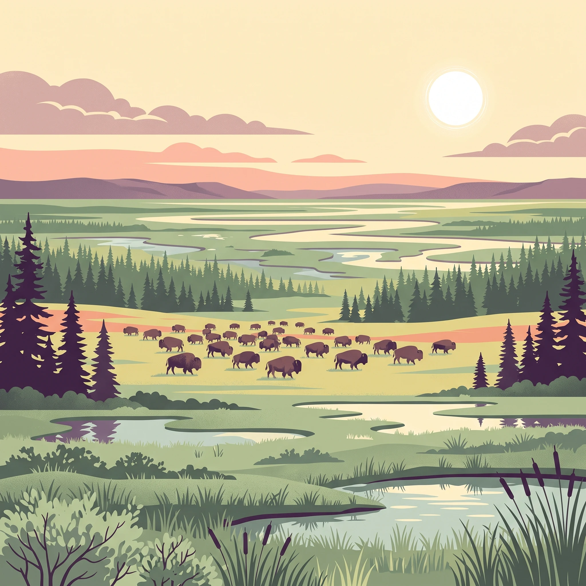
Monthly climate preview

Analyzing monthly temperature variations and precipitation trends across the subarctic wilderness

Wood Buffalo National Park Climate and Long-Term Weather Normals

Representative coordinates for Wood Buffalo National Park indicate sharp temperature transitions between severe winter lows averaging below -20 °C and warmer peak months reaching a mean of 17 °C. Accessing the complete climatology profile reveals month-by-month precipitation trends and long-term average statistics compiled from thirty years of data.
Annual mean-2 °C
-23 °C17 °C
Jan-23°
Feb-20°
Mar-13°
Apr-2°
May
Jun15°
Jul17°
Aug15°
Sep
Oct-1°
Nov-13°
Dec-21°
Warmest month
July

17.1 °C

Coolest month
January

-23.4 °C

Wettest month
July

2.3 mm/day

Driest month
February

0.6 mm/day

Park location guide

Geography guide, regional context, and park location map for Wood Buffalo National Park

Wood Buffalo National Park park geography, regions, and map view in Canada

Understand where Wood Buffalo National Park sits in Canada through a broader geographic reading of the surrounding landscape, nearby location context, and its mapped position within the national park landscape.

How Wood Buffalo National Park fits into Canada

Canada is a federal parliamentary constitutional monarchy spanning North America from the Atlantic to the Pacific and Arctic Oceans. With a population of over 41 million, it is officially bilingual in English and French at the federal level. The country gained independence from the United Kingdom through a gradual process culminating in 1982.

Wider geography shaping Wood Buffalo National Park in Canada

Canada occupies the northern portion of North America, sharing its longest international border with the United States. The country extends from the Atlantic Ocean to the Pacific Ocean and northward into the Arctic Ocean, giving it the longest coastline of any nation.

Map view of Wood Buffalo National Park

Use this park location map to pinpoint Wood Buffalo National Park in Canada, understand its exact geographic position, and read its mapped placement within the surrounding landscape more clearly.

Pigeon | © OpenStreetMap contributors

Location context for Wood Buffalo National Park

AlbertaNorthwest Territories
Natural feature types

Continue Exploring Natural Features in Wood Buffalo National Park

Deepen your understanding of Wood Buffalo National Park by browsing its mapped natural features and geographic landmarks. This MoriAtlas collection offers a focused view of the hydrological systems, karst formations, and forest terrain that characterize this significant Canadian protected area.
Park atlas

Browse surrounding protected landscapes and compare regional park geography across Northern Canada.

Discover National Parks and Protected Areas Near Wood Buffalo National Park, Canada

Continue your atlas exploration by discovering additional national parks and protected areas located geographically near Wood Buffalo National Park, tracing Canada's vast boreal forests and wetland systems. Compare their unique landscapes, conservation priorities, and regional contexts to understand the broader spread of protected territories across northern Canadian wilderness.
Wildlife reserveAlberta
8.1 km away#1 closest

Southeast

Richardson Lake Migratory Bird Sanctuary: Protected Boreal Geography in Alberta

Mapping a vital waterfowl refuge and wetland complex

Richardson Lake Migratory Bird Sanctuary protects a crucial boreal wetland node along the southern margin of the Peace-Athabasca Delta. The area features a shallow lake environment, sedge meadows, and floodplains that provide essential breeding and staging habitat for diverse migratory waterfowl populations, offering a unique record of northern conservation and river management history.

Area
107.98 km²
Established
1949
IUCN
Ib
National parkNorthwest Territories
About 332 km away#2 closest

Northeast

Thaidene Nëné National Park Reserve: Northwest Territories National Park Atlas Overview

Mapped geography and protected landscape context.

Investigate Thaidene Nëné National Park Reserve, a key national park within the Northwest Territories. This detailed entry focuses on its protected area status, mapped geographic boundaries, and regional landscape context, crucial for understanding its role in the broader atlas of conservation lands.

Area
14,070 km²
Established
2019
IUCN
II
Relief
Highland
State or regional parkBritish Columbia
About 430 km away#3 closest

West

Maxhamish Lake Provincial Park and Protected Area: Mapping Northern British Columbia Wilderness

Boreal lake ecosystems and protected indigenous heritage lands

Spanning over 27,500 hectares, Maxhamish Lake Provincial Park and Protected Area is a remote boreal refuge characterized by its central lake and extensive coniferous forests. This park provides a critical habitat for moose, deer, and cold-water fish species while maintaining deep ties to the Fort Nelson First Nation and Acho Dene Koe. Its geography reveals a distinct northern basin, offering insight into the ecological character and protected landscape features of northeastern British Columbia.

Area
275.16 km²
IUCN
II
Water
Major water bodies
Season
Seasonal
National parkNorthwest Territories
439 km away#4 closest

Northwest

Nahanni National Park Reserve National Park: Protected Landscape and Geographic Mapping

Explore the mapped terrain and protected area boundaries in Northwest Territories.

Navigate the protected landscape of Nahanni National Park Reserve, a designated national park within the Northwest Territories. This entry provides detailed insight into the park's mapped geographic boundaries and its role as a significant protected area. Understanding its place within the regional atlas allows for a deeper appreciation of its natural terrain and conservation significance, offering factual context for geographic exploration.

Area
30,050 km²
Established
1972
IUCN
II
Visitors
1.1K annual
State or regional parkBritish Columbia
About 443 km away#5 closest

West

Jackpine Remnant Provincial Park: Protected Boreal Landscape and Regional Map Context

Conservation and terrain data for the Fort Nelson region

Jackpine Remnant Provincial Park provides a critical study in northern conservation geography. Located in the Fort Nelson area of British Columbia, this 148-hectare site protects a rare stand of jack pine trees. Its mapped boundaries and boreal forest terrain offer a focused look at small-scale protected landscapes and their significance within the broader regional ecosystem of the Canadian north.

Area
1.48 km²
Established
2001
IUCN
II
Relief
Lowland
Wildlife reserveAlberta
444 km away#6 closest

Southwest

Saskatoon Lake Migratory Bird Sanctuary: Protected Wetland Landscape in Alberta

Geographic overview of sanctuary boundaries and habitat zones

Examine the territorial footprint and environmental setting of Saskatoon Lake Migratory Bird Sanctuary. This site highlights the intersection of shallow aquatic basins and boreal parkland vegetation, providing a deep look into protected areas within the Grande Prairie region of Alberta.

Area
11.5 km²
Established
1948
IUCN
III
State or regional parkBritish Columbia
About 463 km away#7 closest

Southwest

Kiskatinaw Provincial Park: A Protected Landscape Along the Historic Alaska Highway

Geography and heritage in the Peace River region of British Columbia

Kiskatinaw Provincial Park encompasses a distinctive horseshoe meander of the Kiskatinaw River, creating a deep gorge carved into the terrain of northeastern British Columbia. This protected area serves as a focal point for understanding both the river geomorphology of the Peace River Country and the engineering history of the original Alaska Highway, exemplified by the iconic 1942 wooden trestle bridge.

Area
0.58 km²
Established
1962
IUCN
II
Relief
Upland
National parkAlberta
486 km away#8 closest

South

Elk Island National Park: National Park Protected Landscape and Alberta Geography

Discover the mapped terrain and protected boundaries.

Elk Island National Park, a designated national park in Alberta, Canada, offers a distinct protected landscape for geographic exploration. This detail page focuses on its mapped boundaries, regional setting within Western Canada, and the specific natural terrain that constitutes its protected area. Users can gain a structured understanding of Elk Island National Park's role as a conserved natural entity, ideal for atlas-based discovery and geographic context.

Area
194 km²
Established
1913
IUCN
II
Visitors
401.9K annual

Common questions about visiting, size, designation, and location context for Wood Buffalo National Park

Wood Buffalo National Park FAQs for park facts, access, geography, and protected area context

Find quick answers about Wood Buffalo National Park, including protected-area facts, park geography, trail and visitor context, and how the park fits into its surrounding country and regional landscape.
MoriAtlas Explorer

Continue Your Protected Areas Search Across the Global Atlas

Deepen your exploration by continuing the structured search for national parks and protected areas worldwide. Utilize the comprehensive filtering capabilities to compare different conservation landscapes and refine your understanding of global park geography. Discover more about the distribution and characteristics of protected natural areas.

Global natural geography