Mori Atlas logo
National parkThaidene Nëné National Park Reserve

Discover the mapped geography and landscape context of this important protected area.

Thaidene Nëné National Park Reserve: A Protected National Park in Northwest Territories

Thaidene Nëné National Park Reserve stands as a significant protected national park located within the vast expanse of Canada's Northwest Territories. This page offers a focused exploration of its protected landscape identity and geographic setting. Understand its place within the regional geography through detailed mapping of its boundaries, providing essential context for atlas-based discovery of Canada's natural heritage.

Boreal ForestNorthern CanadaIndigenous-Led ConservationNational Park ReserveGreat Slave LakeWildlife Conservation

Thaidene Nëné National Park Reserve

National park

Park overview

Structured park overview, official facts, and landscape profile for Thaidene Nëné National Park Reserve

Thaidene Nëné National Park Reserve park facts, protected area profile, and essential visitor context
Review the core facts for Thaidene Nëné National Park Reserve, including designation, size, terrain, visitor scale, habitats, and operating context in one park-focused overview.

About Thaidene Nëné National Park Reserve

Thaidene Nëné National Park Reserve represents a landmark achievement in Canadian conservation, established through a unique partnership between the federal government, territorial authorities, and Indigenous Nations including the Łutselk'e Dene First Nation, Deninu K'ue First Nation, and Yellowknives Dene First Nation. The reserve protects a vast expanse of wilderness spanning approximately 14,070 square kilometers along the eastern arm of Great Slave Lake, Canada's deepest lake and the tenth largest freshwater lake in the world. The park's creation reflects a new paradigm in Canadian protected areas management, combining national park designation with Indigenous Protected Area status and territorial conservation designations to create a comprehensive conservation framework that spans over 26,000 square kilometers when all related protected zones are included. The landscape showcases the dramatic ecological transition from the southern boreal forest to northern tundra, with visitors encountering dense coniferous and mixed forests, exposed granite bedrock, expansive wetlands, and increasingly barren terrain as they travel northward through the reserve. This ecological diversity supports remarkable wildlife populations, from species characteristic of the boreal forest like moose, black bear, and Canada lynx to those more typical of the Arctic like barren-ground caribou, Arctic fox, and muskox. The park reserve also holds significant cultural value, as the Dene people have inhabited and maintained connections to this land for generations, with the name itself carrying profound meaning as "land of our ancestors."

Quick facts and research context for Thaidene Nëné National Park Reserve

Thaidene Nëné National Park Reserve occupies a strategic position in the North Slave Region of the Northwest Territories, approximately 150 kilometers northeast of Yellowknife. The reserve was formally established in August 2019 following decades of negotiation with Indigenous partners, particularly the Łutselk'e Dene First Nation. The protected landscape encompasses red granite cliffs, dramatic peninsulas, deep canyons, and cascading waterfalls where the boreal forest transitions into northern tundra. This transitional character supports an remarkable diversity of species, including both boreal and Arctic wildlife adapted to the park's unique ecological position at the southern edge of the tundra and northern limit of the boreal forest.

Park context

Deeper park guide and search-rich context for Thaidene Nëné National Park Reserve

Thaidene Nëné National Park Reserve history, landscape, wildlife, and travel context
Explore Thaidene Nëné National Park Reserve through its history, landscape character, ecosystems, wildlife, conservation priorities, cultural context, and seasonal travel timing in a structured park guide built for atlas discovery and search intent.

Why Thaidene Nëné National Park Reserve stands out

Thaidene Nëné is best known for its position at the ecological boundary between Canada's boreal forest and Arctic tundra, a transition zone of exceptional biodiversity and visual drama. The park reserve protects critical habitat for boreal woodland caribou, a species at risk, as well as significant populations of muskox, moose, wolves, and grizzly bears. The landscape is characterized by striking red granite cliffs rising from the boreal woodlands, giving way to an spectacular array of peninsulas, canyons, and waterfalls as the forests transition northward into tundra. This geological and ecological meeting point creates one of the most visually distinctive protected areas in Canada's north, with the added cultural significance of representing a successful model of Indigenous-guided conservation where First Nations played a central role in shaping the protected area's boundaries and management.

Thaidene Nëné National Park Reserve history and protected-area timeline

The establishment of Thaidene Nëné National Park Reserve represents a conservation journey spanning more than five decades. Initial consideration for a national park in the region emerged in the 1970s, but a proposed 7,340 square kilometer protected area was withdrawn under the Territorial Lands Act in 1970. The proposal lay dormant until 2001, when the Łutsël K'é Dene First Nation (then known as the Snowdrift band) reignited interest in protecting their traditional territory. From 2002 to 2004, formal consultations proceeded, eventually expanding to include the Métis Nation. In 2005, the Łutselk'e produced a Band Council Resolution supporting a national park as part of a broader protection initiative for their traditional lands. A pivotal 2006 memorandum of understanding between the Łutselk'e Dene First Nation and the federal Minister of Environment expanded the study area by an additional 26,350 square kilometers. By 2014, the Northwest Territories government assumed administrative control of the 33,690 square kilometer study area, proposing a scaled-down National Park Reserve of approximately 14,000 square kilometers combined with territorial designations protecting 75 percent of the total area. After public consultations and federal budget allocation in 2016, the Łutselk'e Dene First Nation voted to approve the park's creation on February 15, 2019. The formal agreement was signed on August 21, 2019, establishing the national park reserve alongside complementary territorial protected areas.

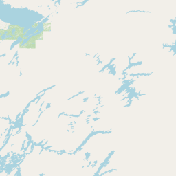
Thaidene Nëné National Park Reserve landscape and geographic character

The landscape of Thaidene Nëné National Park Reserve presents a dramatic north-south ecological and visual transition across approximately 14,070 square kilometers of northern Canadian wilderness. The southern portions of the reserve lie within the boreal forest, characterized by dense stands of coniferous trees including spruce, fir, and pine, interspersed with deciduous species like aspen and birch. As visitors travel northward through the park, the forest gradually thins and gives way to the open terrain of the northern tundra, creating a striking visual progression that defines the park's character. The geology is marked by spectacular red granite cliffs and exposed bedrock that create dramatic backdrops throughout the reserve. The landscape features an extraordinary array of peninsulas jutting into Great Slave Lake, deep canyons carved by ancient waterways, and numerous waterfalls where streams cascade over granite ledges. The eastern arm of Great Slave Lake itself forms a dominant feature of the park, its deep blue waters contrasting with the surrounding boreal woodlands and rocky shores. This combination of boreal forest, tundra, freshwater ecosystems, and rugged granite topography creates one of the most visually distinctive protected landscapes in Canada's north.

Thaidene Nëné National Park Reserve ecosystems, habitats, and plant life

Thaidene Nëné occupies a critical ecological position at the transition between Canada's boreal forest and Arctic tundra, creating a unique environment of exceptional biodiversity and ecological significance. The boreal forest that covers the southern portions of the reserve represents Canada's largest land ecosystem, while the northern reaches transition into tundra habitats characteristic of the subarctic. This ecological boundary zone supports species from both ecosystems, creating an unusual diversity of plant and animal life within a single protected area. The park protects significant freshwater ecosystems associated with Great Slave Lake and its tributaries, including numerous rivers, streams, and wetlands that provide critical habitat for aquatic species and migratory waterfowl. The combination of forest, tundra, and aquatic habitats creates a mosaic of ecological communities that supports the wide array of species documented within the reserve.

Thaidene Nëné National Park Reserve wildlife and species highlights

The wildlife of Thaidene Nëné reflects the park's unique position at the meeting point of boreal and Arctic ecosystems, with species from both environments found within its boundaries. The park provides crucial habitat for boreal woodland caribou, a species listed as threatened in Canada, whose conservation was a primary driver for the protected area's establishment. The reserve supports healthy populations of large mammals including moose, white-tailed deer, and both black bear and grizzly bear. The predator community includes wolves, Canada lynx, and wolverine, while smaller mammals like American marten, beaver, red fox, and Arctic fox are also present. Muskox inhabit the northern portions of the park, representing an Iconic Arctic species at the southern edge of its range. Barren-ground caribou, a separate ecotype from the woodland caribou, also utilize the reserve's tundra habitats during seasonal migrations. The area features significant birdlife, with various migratory duck species and songbirds staging and nesting in the wetlands and forests during the brief Arctic summer.

Thaidene Nëné National Park Reserve conservation status and protection priorities

Thaidene Nëné National Park Reserve represents a landmark achievement in Canadian conservation, embodying a new approach to protected area establishment that centers Indigenous leadership and collaborative governance. The reserve protects nationally significant boreal forest, tundra, and freshwater ecosystems that contain critical habitat for species at risk, particularly the boreal woodland caribou. The park's establishment followed extensive negotiations that resulted in a comprehensive conservation framework spanning over 26,000 square kilometers when combined with adjacent territorial protected areas and wildlife conservation zones. This layered approach to protection, which includes federal national park designation, territorial protected areas, and Indigenous Protected Area status, creates a robust conservation model that addresses both ecological and cultural values. The reserve contributes to Canada's international conservation commitments while protecting lands that have been central to Dene stewardship and traditional use for generations.

Thaidene Nëné National Park Reserve cultural meaning and human context

The name Thaidene Nëné derives from the Dene Chipewyan language and carries profound cultural meaning, translating to "land of our ancestors" and reflecting the deep connection between Indigenous peoples and this landscape. The Łutselk'e Dene First Nation played the central role in driving the establishment of the protected area, with their leadership and vision shaping both the boundaries and the management framework of the reserve. The creation process explicitly involved three First Nations—the Łutselk'e Dene First Nation, Deninu K'ue First Nation, and Yellowknives Dene First Nation—alongside the Métis Nation, representing a truly collaborative approach to northern conservation. The park forms part of the broader Thaıdene Nëné Indigenous Protected Area, a designation that recognizes the ongoing cultural connection between Indigenous communities and the land. This partnership model has become a reference point for how Indigenous peoples can lead conservation initiatives in Canada, demonstrating that protected areas can be established in ways that honor Indigenous rights, knowledge, and vision for their traditional territories.

Top sights and standout views in Thaidene Nëné National Park Reserve

Thaidene Nëné offers visitors access to one of Canada's most significant northern wilderness areas, with its dramatic transition from boreal forest to tundra creating a unique and visually striking landscape. The red granite cliffs and waterfalls of the east arm country represent some of the most impressive geological features in the Northwest Territories. Wildlife viewing opportunities are exceptional, with the chance to encounter muskox, moose, caribou, wolves, and grizzly bear in their natural boreal and Arctic habitats. The park represents a pioneering model of Indigenous-led conservation, where First Nations played a central role in shaping the protected area's establishment and continue to be partners in its management. The area's significance as a cultural landscape for the Dene people adds depth to the visitor experience, connecting natural beauty with Indigenous heritage and the meaning of "land of our ancestors."

Best time to visit Thaidene Nëné National Park Reserve

The optimal time to experience Thaidene Nëné National Park Reserve aligns with the brief northern summer, typically from mid-June through September, when temperatures are milder and the landscape is accessible. During this period, the boreal forest is green, waterfalls flow strongly, and wildlife is active throughout the extended daylight hours of the northern summer. The short but intense flowering season in late June and July brings the tundra to life with colorful wildflowers. Visitors interested in wildlife viewing may find the shoulder seasons of late spring and early fall particularly rewarding, as animals become more active during transitional periods. Winter visits offer the chance to experience the park's stark northern character, though access and services are extremely limited. The park's northern location means that summer visitors can experience the phenomenon of the midnight sun, while winter brings extended periods of darkness characteristic of the Arctic.

Park location guide

Geography guide, regional context, and park location map for Thaidene Nëné National Park Reserve

Thaidene Nëné National Park Reserve park geography, regions, and map view in Canada
Understand where Thaidene Nëné National Park Reserve sits in Canada through a broader geographic reading of the surrounding landscape, nearby location context, and its mapped position within the national park landscape.

How Thaidene Nëné National Park Reserve fits into Canada

Canada is a federal parliamentary constitutional monarchy spanning North America from the Atlantic to the Pacific and Arctic Oceans. With a population of over 41 million, it is officially bilingual in English and French at the federal level. The country gained independence from the United Kingdom through a gradual process culminating in 1982.

Wider geography shaping Thaidene Nëné National Park Reserve in Canada

Canada occupies the northern portion of North America, sharing its longest international border with the United States. The country extends from the Atlantic Ocean to the Pacific Ocean and northward into the Arctic Ocean, giving it the longest coastline of any nation.

Map view of Thaidene Nëné National Park Reserve

Use this park location map to pinpoint Thaidene Nëné National Park Reserve in Canada, understand its exact geographic position, and read its mapped placement within the surrounding landscape more clearly.

Pigeon | © OpenStreetMap contributors

Location context for Thaidene Nëné National Park Reserve

North Slave RegionNorthwest Territories
Park atlas

Trace the geography of Canada's northern boreal forest and Arctic tundra through nearby protected landscapes for deeper atlas comparison.

Discover Other National Parks and Protected Areas Near Thaidene Nëné National Park Reserve in Canada's North
Continue your park discovery journey from Thaidene Nëné National Park Reserve by exploring other national parks and protected areas in Canada's northern boreal forest and Arctic tundra. Compare regional conservation landscapes, trace geographic features like Great Slave Lake, and understand the ecological spread of protected zones beyond this significant reserve.
National parkNorthwest Territories

Wood Buffalo National Park: Mapped Protected Landscape and Geographic Context

Explore Canada's Wood Buffalo National Park mapped boundaries.

Wood Buffalo National Park serves as a critical protected area, offering a detailed view of its mapped boundaries and regional geographic setting within Northwest Territories. As a national park, it represents a significant natural landscape to explore. This entry provides structured information ideal for understanding the park's specific location and its role in the broader atlas of protected lands.

Area
44,741 km²
Established
1922
IUCN
II
Visitors
2.4K annual
National parkNorthwest Territories

Nahanni National Park Reserve National Park: Protected Landscape and Geographic Mapping

Explore the mapped terrain and protected area boundaries in Northwest Territories.

Navigate the protected landscape of Nahanni National Park Reserve, a designated national park within the Northwest Territories. This entry provides detailed insight into the park's mapped geographic boundaries and its role as a significant protected area. Understanding its place within the regional atlas allows for a deeper appreciation of its natural terrain and conservation significance, offering factual context for geographic exploration.

Area
30,050 km²
Established
1972
IUCN
II
Visitors
1.1K annual
National parkNorthwest Territories

Tuktut Nogait National Park: Northwest Territories Protected Landscape Atlas

Explore its mapped boundaries and regional geography.

Delve into Tuktut Nogait National Park, a protected national park situated within the vast geography of the Northwest Territories. This entry provides a focused view of the park's specific identity, its defined protected area boundaries, and its contribution to the regional landscape atlas. Understanding Tuktut Nogait National Park means grasping its geographic context and its role as a key natural landscape within the broader Canadian protected area network, ideal for detailed map-based study.

Area
18,100 km²
Established
1998
IUCN
II
Visitors
12 annual
National parkSaskatchewan

Prince Albert National Park: Saskatchewan National Park and Protected Area Geography

Mapped Landscape Boundaries and Regional Natural Terrain Context

Prince Albert National Park represents a distinct national park entity within Saskatchewan, vital for understanding regional geography and protected landscapes. This page offers detailed insights into its mapped boundaries and the surrounding natural terrain. It is designed to help users comprehend the park's specific protected area identity and its contribution to the broader geographic atlas of Canada's natural spaces.

Area
3,874 km²
Established
1927
IUCN
II
Visitors
287.4K annual
National parkNorthwest Territories

Nááts'ihch'oh National Park Reserve: Mapped Protected Landscape in Northwest Territories

Explore its geographic boundaries and regional context.

Gain a structured understanding of Nááts'ihch'oh National Park Reserve, a significant protected national park within the Northwest Territories. This detail provides context for its geographical placement and the extent of its protected landscape, vital for anyone exploring the region's natural areas through maps and atlas data.

Area
4,850 km²
Established
2014
IUCN
II
Visitors
109 annual
National parkManitoba

Wapusk National Park: Manitoba National Park Protected Landscape & Geographic Exploration

Mapped park boundaries and regional landscape context in Manitoba.

Delve into Wapusk National Park, a federally protected area in Manitoba designed for geographic exploration and atlas-based discovery. Understand its specific role as a national park, examining its mapped boundaries and the unique natural landscape it preserves within the broader regional geography of Manitoba. This park serves as a key data point for comprehending Canada's network of protected lands and their geographical significance.

Area
11,475 km²
Established
1996
IUCN
II
Visitors
82 annual
National parkAlberta

Elk Island National Park: National Park Protected Landscape and Alberta Geography

Discover the mapped terrain and protected boundaries.

Elk Island National Park, a designated national park in Alberta, Canada, offers a distinct protected landscape for geographic exploration. This detail page focuses on its mapped boundaries, regional setting within Western Canada, and the specific natural terrain that constitutes its protected area. Users can gain a structured understanding of Elk Island National Park's role as a conserved natural entity, ideal for atlas-based discovery and geographic context.

Area
194 km²
Established
1913
IUCN
II
Visitors
401.9K annual
National parkNunavut

Ukkusiksalik National Park: Nunavut Protected Area Geography and Map Context

Explore the protected landscape and mapped terrain of this Canadian National Park.

Ukkusiksalik National Park serves as a protected national park within Nunavut, offering a distinct geographic identity. This entry provides structured insights into the park's mapped boundaries and its surrounding regional landscape, facilitating a deeper understanding of its place within the broader atlas of protected areas. Examine the geographic context and discover the unique attributes of Ukkusiksalik National Park's protected territory.

Area
20,885 km²
Established
2003
IUCN
II
Relief
Mixed relief

Common questions about visiting, size, designation, and location context for Thaidene Nëné National Park Reserve

Thaidene Nëné National Park Reserve FAQs for park facts, access, geography, and protected area context
Find quick answers about Thaidene Nëné National Park Reserve, including protected-area facts, park geography, trail and visitor context, and how the park fits into its surrounding country and regional landscape.
MoriAtlas Explorer

Continue Your Protected Areas Search Across the Global Atlas

Deepen your exploration by continuing the structured search for national parks and protected areas worldwide. Utilize the comprehensive filtering capabilities to compare different conservation landscapes and refine your understanding of global park geography. Discover more about the distribution and characteristics of protected natural areas.

Global natural geography