Why Ukkusiksalik National Park stands out
Ukkusiksalik is best known for its exceptional Arctic wildlife viewing opportunities, particularly polar bears that congregate on ice floes and islands during July and early August. The park protects one of Canada's significant polar bear denning areas along Wager Bay's south shore. The region is also renowned for its remarkable concentration of archaeological sites, with over 500 locations documenting thousands of years of continuous Inuit occupation spanning Dorset culture, Thule culture, and historic period settlements. The reversing falls at the western end of Wager Bay represents a rare tidal phenomenon unique among Canadian waterways. The Sila River waterfall system, with multiple cascades descending through Canadian Shield terrain, offers dramatic hiking destinations within the park's interior.
Ukkusiksalik National Park history and protected-area timeline
The history of Ukkusiksalik spans thousands of years of continuous human occupation. Archaeological evidence from over 500 documented sites reveals occupation by Dorset culture (500 BC to 1000 AD), Thule culture (1000 to 1800 AD), and more recent Inuit groups including the Barrenland Inuit (Caribou Inuit), who were not a homogeneous tribe but rather families from diverse groups: Ukkusiksalingmiut from Back River and Hayes River regions, Aivilingmiut from the Naujaat region, Qairnirmiut from Baker Lake and Chesterfield Inlet areas, and Netsilik Inuit from around Kugaaruk and Taloyoak. European discovery began in 1742 when explorer Christopher Middleton entered the fjord aboard his ship Furnace, naming it Wager Bay after Sir Charles Wager of the British Admiralty. The bay saw no European visitors for over a century due to its remote location. In the early 20th century, Canadian government interest in sovereignty led to geological surveys, while American whaler George G. Cleveland established a whaling station near the bay entrance in 1900. The Hudson's Bay Company established a trading post at Ford Lake (Tusjujak) in 1925, operating until 1947. Catholic missionaries also established a brief presence on the Savage Islands during this period. After the fur trade ended, Inuit gradually moved into settled communities, and the area became unoccupied except for periodic hunting visits. The park was officially declared on August 23, 2003, becoming Canada's 41st national park.
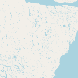
Ukkusiksalik National Park landscape and geographic character
The physical landscape of Ukkusiksalik centres on Wager Bay, an Arctic fjord of exceptional scale and dramatic character. The bay extends nearly 200 kilometres northwest from its entrance at Roes Welcome Sound, reaching widths up to 35 kilometres and depths exceeding 250 metres in places. The entrance presents a narrow bottleneck where tides rise and fall up to eight metres, creating extraordinary current dynamics that accumulate massive ice formations throughout most of the year. At the bay's western end, the remarkable reversing falls phenomenon occurs between Wager Bay and Ford Lake, where tidal currents reverse direction twice daily. This is one of only three such occurrences in Canada. The surrounding terrain consists of typical Canadian Shield geology, with exposed bedrock, glacial deposits, and tundra vegetation covering the undulating terrain. A steep mountain range along the south shore of Wager Bay influences local weather patterns, while the landscape extends from coastal mudflats at Hudson Bay through rolling tundra uplands to the western Barrenlands approaching the Arctic Circle. The Sila River traverses the landscape with a series of dramatic waterfalls descending through the Canadian Shield terrain.
Ukkusiksalik National Park ecosystems, habitats, and plant life
The ecological character of Ukkusiksalik reflects the Arctic-maritime environment of far northern Canada. Vegetation consists of typical low tundra with dwarf birch, willow, and mountain avens dominating the plant communities. Despite the harsh conditions, the park supports approximately 25 families of flowering plants, including species such as purple saxifrage (Nunavut's territorial flower), mountain avens (flower of the Northwest Territories), Lapland rose-bay, and cloudberry. Scattered patches of boreal forest occur in river valleys, representing the northern limit of tree growth in this region. The marine environment of Wager Bay supports productive ecosystems despite the extreme seasonal ice conditions, with tidal currents bringing nutrients that support diverse marine life. The transition from coastal to inland environments creates diverse habitat types that support the park's varied wildlife populations.
Ukkusiksalik National Park wildlife and species highlights
Ukkusiksalik supports remarkable Arctic wildlife diversity across its terrestrial, freshwater, and marine environments. The park is particularly significant for polar bears, with a major denning area along Wager Bay's south shore allowing close observation of bears on ice floes and islands during July and early August. Other terrestrial mammals include barren-ground caribou, Peary caribou, Arctic wolves, grizzly bears, Arctic foxes, Arctic hares, lemmings, muskoxen, and wolverines. Marine mammals are abundant in Wager Bay, with large populations of ringed seals and bearded seals, while walruses, belugas, narwhals, and bowhead whales appear periodically. The bird population includes approximately 40 species, notably birds of prey such as golden eagles, gyrfalcons, peregrine falcons, and snowy owls. Waterfowl and shorebirds are well represented, with species including common eider, king eider, snow goose, tundra swan, and numerous sandpiper species. Arctic char and lake trout occur in the park's freshwater systems.
Ukkusiksalik National Park conservation status and protection priorities
Ukkusiksalik holds significant conservation value as a protected Arctic wilderness area preserving both ecological systems and cultural heritage. The park protects critical polar bear habitat, including one of the major denning areas along Wager Bay's southern shore. The coastal and marine environments of the bay support important populations of ringed seals and other Arctic marine mammals in an era of changing sea ice conditions. The landscape preserves the transition zone between Hudson Bay coastal ecosystems and the western Barrenlands, representing ecological diversity within the Arctic region. The archaeological sites scattered throughout the park document thousands of years of human-environment interaction, making the cultural heritage dimension as important as the natural values. As Canada's 41st national park and the smallest of Nunavut's four national parks, Ukkusiksalik demonstrates the nation's commitment to preserving representative samples of northern wilderness ecosystems.
Ukkusiksalik National Park cultural meaning and human context
The cultural dimension of Ukkusiksalik is profound, with archaeological evidence demonstrating continuous human habitation for over a thousand years. The region was home to diverse Inuit groups who adapted to the Arctic environment through hunting, fishing, and seasonal mobility patterns. The Barrenland Inuit or Caribou Inuit represented several distinct family groups who moved through the region following caribou herds and exploiting marine resources at Wager Bay. Evidence of this long occupation includes numerous tent rings, food caches, fox traps, qarmaq (stone ring structures), inuksuit (stone markers), and the remains of the Hudson's Bay Company trading post at Ford Lake. The park preserves tangible connections to the Thule people who preceded the historic Inuit, as well as earlier Dorset culture occupants. The Inuktitut name Ukkusiksalik itself reflects the indigenous relationship with local resources, specifically the steatite (soapstone) used for making qulliq (stone pots). This living cultural landscape, though now unoccupied, maintains deep connections to Inuit communities in nearby settlements.
Top sights and standout views in Ukkusiksalik National Park
Ukkusiksalik offers exceptional Arctic wilderness experiences centred on its dramatic fjord landscape, wildlife viewing opportunities, and archaeological heritage. Wager Bay itself is the highlight, a 100-kilometre inlet with dramatic scenery, exceptional tidal phenomena, and abundant wildlife. The reversing falls where tides create bidirectional currents between Wager Bay and Ford Lake represents one of Canada's most remarkable natural phenomena. The Sila River waterfall system, with multiple cascades including the Upper Falls, offers accessible hiking destinations from Sila Lodge. Wildlife viewing peaks during the brief summer season when polar bears can be observed on ice floes and islands, and migratory birds congregate in the coastal wetlands. The park's archaeological sites, including the former Hudson's Bay Company trading post and numerous Thule and Dorset period remains, provide windows into centuries of Inuit occupation. The sense of remote Arctic wilderness, far from any permanent human settlement, defines the park's character.
Best time to visit Ukkusiksalik National Park
The visiting window for Ukkusiksalik is extremely limited due to Arctic conditions. The park can only be accessed by boat during a few summer weeks, typically from the beginning of July until the beginning of August. Before this period, Wager Bay remains locked in ice and cannot be navigated safely. By late summer, conditions begin to deteriorate rapidly, and local Inuit advise that polar bears become more hazardous as they return to the bay in greater numbers. The brief summer season offers the best opportunities for wildlife viewing, particularly polar bears visible from boats on ice floes and swimming in the bay. Birdwatching is excellent during migration periods. The Sila Lodge provides the only developed accommodation within the park, operating during the short summer season. Visitors should be prepared for extreme Arctic conditions even during the brief open water period, with temperatures ranging from cool to warm but with potential for sudden weather changes and fog, particularly near the bay's south shore where mountain influences create localized climate patterns.