Mori Atlas logo
National parkTuktut Nogait National Park

Explore the mapped boundaries and regional geography of this Canadian national park.

Tuktut Nogait National Park: A Protected Landscape in the Northwest Territories

Tuktut Nogait National Park represents a significant protected area within Canada's Northwest Territories, offering a unique focal point for geographic discovery. As a designated national park, its primary value lies in understanding its mapped boundaries, its place within the regional landscape, and its contribution to the broader atlas of protected natural areas. This page facilitates a detailed exploration of Tuktut Nogait National Park's identity as a conservation landscape, providing foundational context for those interested in mapped terrain and regional geography.

Arctic wildernessCaribou calving groundsNorthern Canada national parksTundra ecosystemsProtected caribou habitatRemote wilderness

Tuktut Nogait National Park

National park

Park overview

Structured park overview, official facts, and landscape profile for Tuktut Nogait National Park

Tuktut Nogait National Park park facts, protected area profile, and essential visitor context
Review the core facts for Tuktut Nogait National Park, including designation, size, terrain, visitor scale, habitats, and operating context in one park-focused overview.

About Tuktut Nogait National Park

Tuktut Nogait National Park occupies a remote corner of Canada's Arctic, representing a landscape of immense ecological and cultural significance. The protected area spans approximately 18,100 square kilometres of tundra, river valleys, and rolling terrain in the northeastern mainland Northwest Territories. The park lies entirely above the Arctic Circle, placing it in one of Canada's most northerly terrestrial ecosystems. The Hornaday River, flowing through the park's heart, has carved dramatic canyons with steep walls that provide essential nesting habitat for birds of prey. The landscape is characterized by vast expanses of tundra, interrupted by river corridors and glacial features from past ice ages. This Arctic environment supports a delicate web of life adapted to extreme conditions, including long winters, brief summers, and the constant presence of permafrost. The park's establishment in 1998 marked a significant milestone in Arctic conservation, providing formal protection for one of North America's most important caribou calving grounds while also preserving the cultural landscape that has supported Indigenous peoples for centuries.

Quick facts and research context for Tuktut Nogait National Park

Tuktut Nogait covers 18,100 square kilometres of Arctic terrain in the Northwest Territories, making it one of Canada's larger national parks. The park was established in 1998 under the Canada National Parks Act and is governed by Parks Canada in coordination with Inuvialuit stakeholders. The landscape features three major river systems, the Hornaday River, Brock River, and Roscoe River, which have carved deep canyons through the tundra. The park is situated in a region where the Bluenose-West caribou herd migrates annually to calve, making it critical for the species' survival. Human presence in the area dates back to around AD 1000, with over 400 archaeological sites documented within the park boundaries.

Park context

Deeper park guide and search-rich context for Tuktut Nogait National Park

Tuktut Nogait National Park history, landscape, wildlife, and travel context
Explore Tuktut Nogait National Park through its history, landscape character, ecosystems, wildlife, conservation priorities, cultural context, and seasonal travel timing in a structured park guide built for atlas discovery and search intent.

Why Tuktut Nogait National Park stands out

Tuktut Nogait is most renowned for protecting the calving grounds of the Bluenose-West caribou herd, one of the four major barren-ground caribou herds in the Northwest Territories. The park serves as a critical refuge for this herd, which has shown recovery following the establishment of protected area status, with populations reaching approximately 122,000 in 2010. The dramatic river canyons, particularly along the Hornaday River, provide nesting habitat for impressive raptors including peregrine falcons, rough-legged hawks, gyrfalcons, and golden eagles. The park's extreme remoteness and harsh Arctic environment create one of Canada's most pristine wilderness experiences, where visitors venture into a landscape largely untouched by modern development.

Tuktut Nogait National Park history and protected-area timeline

Human occupation of Tuktut Nogait extends back to approximately AD 1000, with archaeological surveys identifying over 400 sites within the park boundaries. These sites include remnants of campsites, food caches, graves, and kayak rests, representing Thule and Copper Inuit cultures from the period between AD 1200 and 1500. The first European to reach the area was Father Émile Petitot, a French Oblate missionary who traveled through the region in 1867-68. In 1930, the Hudson's Bay Company established a trading outpost at Letty Harbour, though it closed in 1937 due to insufficient trade. A Roman Catholic mission was established at Paulatuk in 1935 and operated a small trading post until 1954. The park was formally established in 1998 as part of Canada's national parks system, created in conjunction with the Inuvialuit Final Agreement. The Tuktut Nogait Agreement outlines specific provisions for Inuvialuit beneficiaries to pursue subsistence harvesting within the park, primarily fishing for Arctic char, hunting caribou, and selective trapping in the northwestern portion of the protected area.

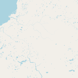
Tuktut Nogait National Park landscape and geographic character

The terrain of Tuktut Nogait National Park represents classic Arctic tundra landscape shaped by glacial processes and the persistent influence of permafrost. The park's three major rivers, the Hornaday River, Brock River, and Roscoe River, have carved significant valleys through the tundra, creating distinctive canyon features with steep walls that rise above the river corridors. These canyon walls provide sheltered microhabitats and critical nesting sites for raptorial birds. The overall landscape consists of gently rolling tundra broken by river valleys, with exposed bedrock in some areas and extensive wetland zones in low-lying regions. The Arctic environment supports limited vegetation, primarily mosses, lichens, sedges, and dwarf shrubs adapted to the short growing season and extreme cold. The absence of trees defines the visual character of the landscape, with the horizon stretching unbroken across vast expanses of tundra interrupted only by river courses and the occasional rocky outcrop.

Tuktut Nogait National Park ecosystems, habitats, and plant life

The ecological character of Tuktut Nogait is defined by its position in the Arctic tundra biome, where biodiversity is shaped by the extreme climate and short summer growing season. The park protects one of North America's most significant caribou calving grounds, supporting the Bluenose-West herd whose population has shown meaningful recovery since the park's establishment. The river systems support healthy populations of Arctic char, a cold-water fish species essential to both ecological function and local subsistence harvesting. Wetland areas, though limited in tree growth, support productive ecosystems for migratory birds and small mammals. The vegetation patterns reflect the harsh Arctic conditions, with mosses and lichens dominating in many areas while sedge meadows occur in better-drained locations. The park's ecological integrity depends on the maintenance of natural processes including caribou migration, predator-prey relationships, and the seasonal patterns that have shaped Arctic ecosystems for millennia.

Tuktut Nogait National Park wildlife and species highlights

Tuktut Nogait supports a diverse assembly of Arctic wildlife adapted to the harsh northern environment. The park is best known as the calving ground for the Bluenose-West barren-ground caribou herd, whose recovery has been attributed in part to the protection afforded by the park. Muskoxen roam the tundra in small groups, their thick coats providing insulation against Arctic temperatures. Grizzly bears, though rarely encountered, roam the landscape in search of berries and carrion. The river systems support Arctic char, a prized sport and food fish that also attracts wildlife to the water's edge. Smaller mammals include red foxes, wolverines, Arctic ground squirrels, and collared lemmings, each filling important ecological niches in the Arctic food web. The park is particularly significant as a breeding and nesting ground for migratory birds, with raptors including peregrine falcons, rough-legged hawks, gyrfalcons, and golden eagles nesting along the steep canyon walls. The Dolphin-Union caribou herd, which normally occupies Victoria Island and winters in Nunavut, occasionally migrates to the park area following the shoreline in search of wind-swept grazing areas.

Tuktut Nogait National Park conservation status and protection priorities

Tuktut Nogait National Park plays a crucial role in conserving one of Canada's most important Arctic ecosystems and one of North America's last great caribou migrations. The protection of Bluenose-West caribou calving grounds has been instrumental in the herd's recovery, with population estimates reaching approximately 122,000 individuals in 2010 following the park's establishment. This represents a significant conservation success story, particularly given that other regional caribou herds have experienced substantial declines of 84-93 percent from their peak populations in the 1980s and 1990s. The park is designated as an IUCN Category II protected area, reflecting its primary purpose of ecosystem conservation. Management of the park operates under the framework of the Inuvialuit Final Agreement, which recognizes Indigenous rights to subsistence harvesting while maintaining the protected status of the area. Current initiatives focus on establishing base camp facilities at Uyarsivik Lake to support ecological monitoring, cultural resource preservation, and visitor programming.

Tuktut Nogait National Park cultural meaning and human context

The cultural landscape of Tuktut Nogait reflects over a millennium of continuous Indigenous human presence in the Arctic. Archaeological evidence documents occupation dating to approximately AD 1000, with the oldest known sites likely representing Thule and Copper Inuit cultures from between AD 1200 and 1500. The region's traditional inhabitants were Mackenzie and Alaskan Inuit who came to the Paulatuk and Darnley Bay area. Under the Inuvialuit Final Agreement and the Tuktut Nogait Agreement, Inuvialuit beneficiaries retain the right to pursue subsistence harvesting within the park, a provision that recognizes the deep connection between Indigenous peoples and this Arctic landscape. This subsistence activity primarily involves fishing for Arctic char, hunting caribou, and limited trapping, concentrated in the northwestern portion of the park. The coexistence of national park protection with Indigenous subsistence rights represents a model of collaborative conservation that honors both ecological preservation and cultural continuity.

Top sights and standout views in Tuktut Nogait National Park

Tuktut Nogait offers a rare glimpse into one of North America's last great Arctic wilderness areas, where the annual caribou migration remains a living ecological process. The dramatic Hornaday River canyon provides both scenic grandeur and crucial raptor nesting habitat. The park's extreme remoteness, with only 12 visitors recorded in 2022-23, ensures an authentic wilderness experience for those who venture to this northern frontier. The combination of caribou calving grounds, significant archaeological sites, and ongoing Indigenous cultural connections creates a layered landscape of ecological and human significance. The Bluenose-West caribou herd's recovery demonstrates the value of protected areas in safeguarding critical habitat.

Best time to visit Tuktut Nogait National Park

Visiting Tuktut Nogait National Park requires planning around the Arctic's extreme seasonal patterns. The brief summer season, typically from late June through August, offers the most accessible conditions for visitation, with temperatures occasionally reaching above freezing and the tundra displaying its brief but vibrant green period. This is also when wildlife viewing opportunities are most accessible, as caribou are more active and migratory birds are nesting. The park's remote location and lack of developed infrastructure means that most visits occur through organized expeditions with Parks Canada or authorized operators. Winter visitation is essentially impossible due to extreme cold, darkness, and the absence of any support facilities. The shoulder seasons of spring and fall offer transitional conditions but present significant logistical challenges. The best opportunities for experiencing this remote protected area come through planning well in advance and understanding the expedition-style nature of Arctic park visits.

Park location guide

Geography guide, regional context, and park location map for Tuktut Nogait National Park

Tuktut Nogait National Park park geography, regions, and map view in Canada
Understand where Tuktut Nogait National Park sits in Canada through a broader geographic reading of the surrounding landscape, nearby location context, and its mapped position within the national park landscape.

How Tuktut Nogait National Park fits into Canada

Canada is a federal parliamentary constitutional monarchy spanning North America from the Atlantic to the Pacific and Arctic Oceans. With a population of over 41 million, it is officially bilingual in English and French at the federal level. The country gained independence from the United Kingdom through a gradual process culminating in 1982.

Wider geography shaping Tuktut Nogait National Park in Canada

Canada occupies the northern portion of North America, sharing its longest international border with the United States. The country extends from the Atlantic Ocean to the Pacific Ocean and northward into the Arctic Ocean, giving it the longest coastline of any nation.

Map view of Tuktut Nogait National Park

Use this park location map to pinpoint Tuktut Nogait National Park in Canada, understand its exact geographic position, and read its mapped placement within the surrounding landscape more clearly.

Pigeon | © OpenStreetMap contributors

Location context for Tuktut Nogait National Park

Northwest Territories
Park atlas

Trace the regional spread of Canada's Arctic protected landscapes and discover further park geography for comparison.

Explore Related Arctic National Parks and Protected Areas Near Tuktut Nogait National Park
Explore additional national parks and protected areas situated in the broader Arctic region, extending your geographic context beyond Tuktut Nogait National Park. This comparison helps you understand the diverse conservation landscapes of Northern Canada, mapping similar tundra ecosystems and unique wilderness areas.
National parkNorthwest Territories

Aulavik National Park: Northwest Territories National Park Protected Landscape and Geographic Context

Explore the mapped boundaries and regional park geography.

Gain a clear understanding of Aulavik National Park's protected status and its placement within the Northwest Territories. This detail page offers focused atlas exploration of the park's geographic identity, mapped features, and its significance as a National Park within Canada's northern geography. Discover the unique landscape context of this protected area for in-depth geographic study and discovery.

Area
12,200 km²
Established
1992
IUCN
II
Visitors
34 annual
National parkYukon

Ivvavik National Park: Yukon National Park Protected Landscape and Geography

Explore mapped boundaries and regional context.

Ivvavik National Park is a designated national park within Yukon, representing a significant protected landscape. This page offers a focused exploration of its geographic identity, mapped boundaries, and its place within the broader atlas of Canada's natural areas. Understand Ivvavik National Park as a defined entity contributing to the regional geography and protected land distribution of Yukon.

Area
10,168 km²
Established
1984
IUCN
II
Visitors
179 annual
National parkYukon

Vuntut National Park: Yukon National Park Protected Area Map Exploration

Understanding its mapped protected boundaries and regional geography.

Delve into the specifics of Vuntut National Park, a designated national park situated within the Yukon region. This detail offers a focused look at its protected landscape identity, providing critical context for its geographic boundaries and role as a mapped natural area. Users can explore the core attributes of Vuntut National Park to enrich their understanding of its contribution to the protected lands atlas and regional geography.

Area
4,345 km²
Established
1995
IUCN
II
Relief
Lowland
National parkNorthwest Territories

Nááts'ihch'oh National Park Reserve: Mapped Protected Landscape in Northwest Territories

Explore its geographic boundaries and regional context.

Gain a structured understanding of Nááts'ihch'oh National Park Reserve, a significant protected national park within the Northwest Territories. This detail provides context for its geographical placement and the extent of its protected landscape, vital for anyone exploring the region's natural areas through maps and atlas data.

Area
4,850 km²
Established
2014
IUCN
II
Visitors
109 annual
National parkNorthwest Territories

Nahanni National Park Reserve National Park: Protected Landscape and Geographic Mapping

Explore the mapped terrain and protected area boundaries in Northwest Territories.

Navigate the protected landscape of Nahanni National Park Reserve, a designated national park within the Northwest Territories. This entry provides detailed insight into the park's mapped geographic boundaries and its role as a significant protected area. Understanding its place within the regional atlas allows for a deeper appreciation of its natural terrain and conservation significance, offering factual context for geographic exploration.

Area
30,050 km²
Established
1972
IUCN
II
Visitors
1.1K annual
National parkNorthwest Territories

Thaidene Nëné National Park Reserve: Northwest Territories National Park Atlas Overview

Mapped geography and protected landscape context.

Investigate Thaidene Nëné National Park Reserve, a key national park within the Northwest Territories. This detailed entry focuses on its protected area status, mapped geographic boundaries, and regional landscape context, crucial for understanding its role in the broader atlas of conservation lands.

Area
14,070 km²
Established
2019
IUCN
II
Relief
Highland
National parkNunavut

Qausuittuq National Park: Explore Nunavut's Protected National Park Landscape and Geography

Mapped protected area boundaries and regional geographic context.

Delve into Qausuittuq National Park, a key protected area in Nunavut offering rich opportunities for geographic exploration. This destination provides detailed mapping of its protected boundaries and a comprehensive overview of its landscape context within the Arctic region. Discover how Qausuittuq National Park contributes to the mapped protected lands of Canada, ideal for users seeking structured geographic data and atlas-style discovery.

Area
11,000 km²
Established
2015
IUCN
II
Relief
Upland
National parkNorthwest Territories

Wood Buffalo National Park: Mapped Protected Landscape and Geographic Context

Explore Canada's Wood Buffalo National Park mapped boundaries.

Wood Buffalo National Park serves as a critical protected area, offering a detailed view of its mapped boundaries and regional geographic setting within Northwest Territories. As a national park, it represents a significant natural landscape to explore. This entry provides structured information ideal for understanding the park's specific location and its role in the broader atlas of protected lands.

Area
44,741 km²
Established
1922
IUCN
II
Visitors
2.4K annual

Common questions about visiting, size, designation, and location context for Tuktut Nogait National Park

Tuktut Nogait National Park FAQs for park facts, access, geography, and protected area context
Find quick answers about Tuktut Nogait National Park, including protected-area facts, park geography, trail and visitor context, and how the park fits into its surrounding country and regional landscape.
MoriAtlas Explorer

Continue Your Protected Areas Search Across the Global Atlas

Deepen your exploration by continuing the structured search for national parks and protected areas worldwide. Utilize the comprehensive filtering capabilities to compare different conservation landscapes and refine your understanding of global park geography. Discover more about the distribution and characteristics of protected natural areas.

Global natural geography