
Mori Atlas logo
Protected landscapePaisaje protegido Quebrada de los Cuervos y Sierras del Yerbal

Trace the dramatic gorge formations and subtropical forest mosaic within the Treinta y Tres Department.

Paisaje protegido Quebrada de los Cuervos y Sierras del Yerbal: Mapped Geography and Protected Landscapes

The Paisaje protegido Quebrada de los Cuervos y Sierras del Yerbal encompasses a dramatic gorge system and rolling hill country in eastern Uruguay. This protected area features ancient metamorphic rock formations, clear stream corridors, and diverse microclimates that foster a mosaic of subtropical forests and native grasslands. Mapping the terrain reveals deep erosional valleys and significant ecological habitats for threatened birdlife and native vegetation.

protected landscapegorgequebradasierrasmetamorphic rockssubtropical ravine
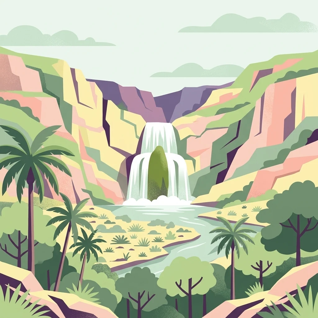
A flat-style graphic illustration of a deep river gorge with a tiered waterfall, surrounding cliffs, palm trees, and native forest vegetation.

Paisaje protegido Quebrada de los Cuervos y Sierras del Yerbal

Protected landscape

Park overview

Structured park overview, official facts, and landscape profile for Quebrada de los Cuervos y Sierras del Yerbal Protected Landscape

Quebrada de los Cuervos y Sierras del Yerbal Protected Landscape park facts, protected area profile, and essential visitor context

Review the core facts for Quebrada de los Cuervos y Sierras del Yerbal Protected Landscape, including designation, size, terrain, visitor scale, habitats, and operating context in one park-focused overview.

About Quebrada de los Cuervos y Sierras del Yerbal Protected Landscape

Quebrada de los Cuervos y Sierras del Yerbal covers a substantial portion of Uruguay's eastern hill country, where ancient rocks, deeply incised streams, and varied vegetation create a landscape that feels distinct from the country's better-known coastal and prairie environments. The site's centerpiece is a geological gorge formed by the prolonged erosive action of the Yerbal Chico stream, which has cut downward into metamorphic bedrock to produce steep, sometimes near-vertical walls and a striking elevation contrast within a relatively small area.

The protected landscape combines public and private lands, and is shaped by centuries of extensive grazing. The resulting mosaic of native grasslands, hillside shrubs, gallery forests, and quebrada forests gives the area a layered ecological structure. Near the streambed, sheltered conditions allow subtropical-style vegetation, including palms, climbing plants, lianas, ferns, and even certain cacti on rocky exposures, to flourish. Yerbales, the native stands of yerba mate, are a particular botanical highlight. Higher on the slopes, native grasses and sedges dominate, creating a more open, hillside landscape.

From an administrative and historical perspective, this protected area is significant for the development of conservation in Uruguay. The original quebrada reserve was donated in 1944 by local landowners and later formally recognized as a Natural Protected Area in 1986, becoming the first of its kind in the country. Its inclusion in the national SNAP system in 2008 and its major expansion in 2020 broadened both its ecological role and its mandate. Today it functions as a reference site for managing the eastern sierras, with explicit goals of preserving the landscape, biodiversity, and cultural values of the region while sustaining compatible productive activities such as extensive livestock farming, agroecological initiatives, and nature-based tourism.

Quick facts and research context for Quebrada de los Cuervos y Sierras del Yerbal Protected Landscape

Quebrada de los Cuervos y Sierras del Yerbal is a protected landscape situated in the department of Treinta y Tres in eastern Uruguay, roughly 45 km from the city of Treinta y Tres. It is administered jointly by Uruguay's Ministry of Environment and the local departmental government, and was formally incorporated into the Sistema Nacional de Áreas Protegidas (SNAP) on 29 September 2008 as Uruguay's landscape protection category. The site was significantly expanded in 2020, growing to a total area of around 19,395 hectares and adopting its current extended name.

The defining landform is a deep gorge cut by the Yerbal Chico stream through very old metamorphic rocks, with elevation differences of more than 100 meters between the stream and the surrounding hilltops. This terrain produces a localized subtropical microclimate that contrasts with the broader sierras and peneplains of the region. The area is classified as an Important Bird Area (IBA) and functions as a reference ecosystem site for Uruguay's eastern sierras, while integrating both public and private land and supporting traditional extensive livestock production as well as conservation and tourism activities.

Protection and recognition

Documented terrestrial protection scope, designation history, and recognition details

Paisaje protegido Quebrada de los Cuervos y Sierras del Yerbal Protection Status

Terrestrial protection status for Paisaje protegido Quebrada de los Cuervos y Sierras del Yerbal traces back to the 2008 designation year. Official records provide structured facts regarding conservation management scope and international recognition sources.

Protection details

Protection scope
Terrestrial
Designated year
2008
Transboundary protection
No
Park context

Deeper park guide and search-rich context for Quebrada de los Cuervos y Sierras del Yerbal Protected Landscape

Quebrada de los Cuervos y Sierras del Yerbal Protected Landscape history, landscape, wildlife, and travel context

Explore Quebrada de los Cuervos y Sierras del Yerbal Protected Landscape through its history, landscape character, ecosystems, wildlife, conservation priorities, cultural context, and seasonal travel timing in a structured park guide built for atlas discovery and search intent.

Why Quebrada de los Cuervos y Sierras del Yerbal Protected Landscape stands out

Quebrada de los Cuervos is best known for its striking gorge landscape, in which the Yerbal Chico stream has carved a narrow, steep-walled valley through ancient metamorphic rocks of the eastern sierras. The contrast between the crystalline, cold waters of the stream, the vertical rocky walls, the dense subtropical-like forests clinging to the slopes, and the grasslands on the higher terrain makes this gorge widely regarded as one of Uruguay's most scenic and ecologically distinctive sites. The area is also recognized as a stronghold for threatened birdlife, with several endangered bird species recorded within its boundaries. Together with its microclimate, its mixed vegetation patterns, and its historical status as one of Uruguay's earliest local conservation initiatives, these features have made the quebrada a symbol of landscape-scale protection in the country. The presence of large cathartid vultures circling above the cliffs, which gave the place its evocative name, remains one of its most iconic visual associations.
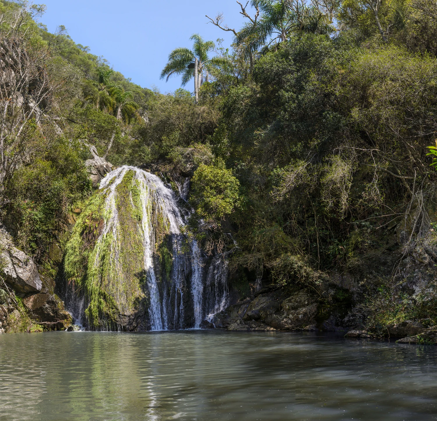
A waterfall cascading over a mossy rock face into a calm, dark pool, surrounded by dense green forest and palm trees under a clear blue sky.
Cascada del Brujo waterfall, a notable natural feature in the Quebrada de los Cuervos y Sierras del Yerbal protected landscape.

Quebrada de los Cuervos y Sierras del Yerbal Protected Landscape history and protected-area timeline

The origin of Quebrada de los Cuervos as a protected area dates back to 1944, when the local figure Dr. Francisco Nicasio Oliveres donated approximately 365 hectares of the gorge and surrounding terrain to the Intendencia Municipal de Treinta y Tres. For decades afterward, the area remained in a largely natural state, preserved largely through the efforts of local residents. Its rugged topography and difficult access meant that the quebrada was largely unknown outside the region, retaining much of its original wild character.

In 1986, the then departmental intendente Wilson Elso Goñi formally recognized the quebrada as a Natural Protected Area through decree N.º 1824/1986, making it the first officially designated protected natural area in Uruguay. This recognition transferred administrative responsibility for the site to the departmental government, anchoring its status as a long-term conservation priority within the department of Treinta y Tres.

A new era began on 29 September 2008, when the national government, through decree N.º 462/008, incorporated the situation into the Sistema Nacional de Áreas Protegidas (SNAP), elevating it to the category of Paisaje Protegido, or Protected Landscape, and at that time bringing the protected area to around 4,413 hectares. In 2020, a further decree significantly expanded the protected landscape to its current size of approximately 19,395 hectares and added the Sierras del Yerbal to its formal name, signaling a broader, landscape-scale vision that integrates the surrounding sierras, pastures, and productive activities into the conservation framework.

Quebrada de los Cuervos y Sierras del Yerbal Protected Landscape landscape and geographic character

The landscape of Quebrada de los Cuervos y Sierras del Yerbal is defined by a deeply incised gorge embedded within a broader terrain of rolling, strongly undulating hills and sierras. The Yerbal Chico stream has cut downward through very ancient metamorphic rocks, producing a steep-walled valley with elevation differences that often exceed 100 meters; hilltops and viewpoints in the area reach roughly 270 to 300 meters above sea level, while the streambed itself lies around 150 meters above sea level. Slopes in the gorge transition from gentle gradients of 5 to 10 percent to steep sections reaching 20 to 30 percent or more.

Geologically, the area reflects an exceptionally old formation history. To the east, the rocks are metamorphic, crystallized during a younger geological cycle of around 700 million years, and include quartzites, gneisses, mica schists, and associated limestones. To the west, older formations dominate, including granites, migmatites, gneisses, and quartzites from an orogenic cycle between roughly 1800 and 2000 million years ago. The gorge itself is the result of long-term headward erosion by the Yerbal Chico stream, influenced by the proximity of the subsiding Merín Lagoon tectonic basin throughout much of the Tertiary.

The microclimate created within the gorge is subtropical in feel and stands in sharp contrast to the surrounding sierras and peneplains. Combined with the very clear, cold waters of the Yerbal Chico, which run over beds of stones and fine sand, the landscape creates a visually dramatic and ecologically unusual setting, including waterfalls such as the well-known Cascada del Brujo, vertical forested walls, and sweeping viewpoints over the broken terrain of the eastern sierras.
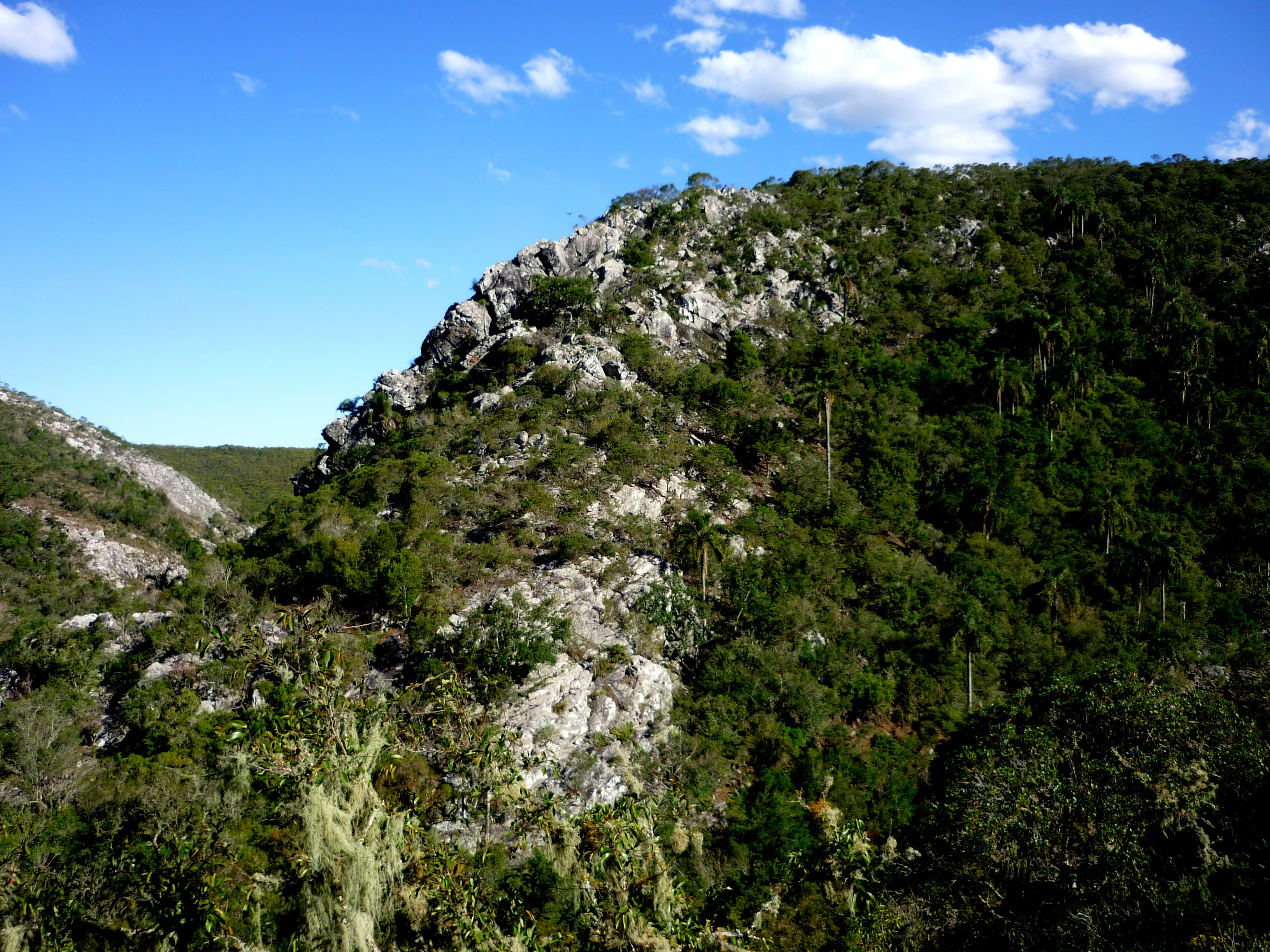
A steep, rocky, tree-covered hillside under a clear blue sky, showing the varied textures of the Quebrada de los Cuervos gorge.
Rugged rocky slopes and dense vegetation typical of the gorge landscape in Paisaje protegido Quebrada de los Cuervos.

Quebrada de los Cuervos y Sierras del Yerbal Protected Landscape ecosystems, habitats, and plant life

Ecologically, Quebrada de los Cuervos y Sierras del Yerbal displays a distinctive vegetation mosaic shaped by sharp differences in slope, exposure, and moisture. On the upper parts of the gorge, native grasslands prevail, characterized by large stands of tall paja brava, paja mansa, and estrella grasses, along with sedges and shrubs typical of the monte serrano. These grasslands give the higher slopes and plateau edges an open, herbaceous character that supports a specialized grassland fauna.

Along the streambed and on the more sheltered, lower slopes, the vegetation transitions into a denser, subtropical-like quebrada forest. There, palms, climbing plants, lianas, ferns, and a wide variety of native tree species combine to create a stratified forest structure with strong vertical layering. Rocky areas, including some exposed cliff faces and more open stony sections, host additional specialized plants such as certain cacti. A particularly notable botanical presence is the wild stands of yerba mate, which thrive in the humid conditions along the quebrada's lower elevations.

Surveys conducted within and around the gorge have documented substantial biodiversity, including significant shares of Uruguay's native arboreal flora and numerous ferns. The site is recognized as an Important Bird Area (IBA), with important populations of threatened grassland and forest bird species, and it functions as a regional reference point for the ecology of Uruguay's eastern hill country, including its gallery forests along streams, its native pastures, and more restricted species occurrences that depend on the area's complex terrain.
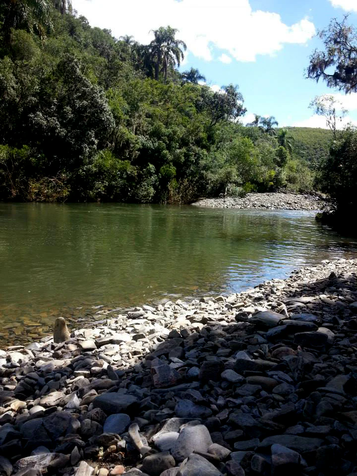
A view of a river with a rocky shoreline in the foreground, leading to a dense forest and palm trees under a partly cloudy sky.
The riverbed and lush vegetation of the Quebrada de los Cuervos landscape.

Quebrada de los Cuervos y Sierras del Yerbal Protected Landscape wildlife and species highlights

The wildlife profile of Quebrada de los Cuervos y Sierras del Yerbal is particularly notable for its birdlife, both in richness and conservation significance. The site is classified as an Important Bird Area, and it supports several threatened bird species, including species such as the saffron-cowled blackbird, the dominican monjita, the straight-billed reedhaunter, and seedeaters of the Sporophila genus, all of which depend on the combination of native grasslands, gallery forests, and quebrada habitats that the landscape provides.

Alongside these threatened species, the gorge is also important for large cathartid vultures, including American black vultures, turkey vultures of the regional subspecies, and lesser yellow-headed vultures. These soaring scavengers are commonly seen circling above the cliffs of the quebrada, and are the source of the place's evocative name, which translates loosely as 'Ravine of the Ravens/Crows' even though the birds in question are vultures rather than true corvids. Beyond birds, the area hosts a wide range of mammals, reptiles, insects, and arachnids, including venomous species typical of eastern Uruguay. Among the more charismatic or regionally significant mammals is the southern tamandua, a small anteater that inhabits forested environments in the area. The overall wildlife assemblage reflects the ecological complexity created by the site's rugged topography and microclimatic variation.

Quebrada de los Cuervos y Sierras del Yerbal Protected Landscape conservation status and protection priorities

Quebrada de los Cuervos y Sierras del Yerbal holds a foundational place in Uruguay's conservation history. The original 365-hectare donation in 1944 made it one of the earliest locally protected natural sites in the country, and its formal recognition as a Natural Protected Area in 1986 marked the first such designation in Uruguay. The site's later inclusion in the national SNAP system in 2008 extended its legal protection and brought it into a coherent national framework of protected area governance.

The 2020 expansion significantly enlarged the protected landscape to roughly 19,395 hectares, repositioning it as a large-scale reference site for the ecological management of Uruguay's eastern sierras. Its conservation goal is to maintain ecological integrity while improving the quality of life of local communities, balancing objectives of biodiversity conservation and protection of cultural values with the sustainable continuation of traditional extensive livestock production, emerging agroecological practices, and nature-based tourism.

The area focuses on protecting key elements of the landscape and its biodiversity, including the quebrada and gallery forests, native grasslands, and riverside ecosystems, as well as priority species with restricted distributions. At the same time, pressures from the advance of forestry plantations and extractive-mining projects in the surrounding zone are recognized as growing threats to ecological functionality and to the long-term delivery of ecosystem services on which sustainable productive activities and tourism depend. As a result, the landscape serves both as a conservation site and as a strategic test case for integrating ecological protection with rural productive landscapes.

Quebrada de los Cuervos y Sierras del Yerbal Protected Landscape cultural meaning and human context

The cultural significance of Quebrada de los Cuervos y Sierras del Yerbal is closely tied to the rural identity of Uruguay's eastern hill country. The protected area integrates public and private lands shaped by extensive cattle-raising, one of the traditional productive activities of the region, and this pastoral heritage is part of the cultural values explicitly cited in the management objectives of the site. Local communities have historically played a role in maintaining the gorge, with neighbors helping preserve the area in its natural state for decades after the original 1944 donation.

In more recent years, the landscape has become a focal point for emerging agroecological and nature-tourism initiatives, and small visitor-service operations have developed both within the public area and on private establishments in the surrounding zone. Local organizations, including NGOs focused on native plant conservation such as Pindó Azul, contribute to the protection and study of native flora in the quebrada, while the broader recognition of the area through national decree and SNAP membership has reinforced its status as a regional cultural and ecological landmark within the department of Treinta y Tres.

Top sights and standout views in Quebrada de los Cuervos y Sierras del Yerbal Protected Landscape

Among the standout features of Quebrada de los Cuervos y Sierras del Yerbal are the steep-walled gorge itself, with elevation drops of more than 100 meters producing one of Uruguay's most dramatic erosional landforms, and waterfalls such as the Cascada del Brujo, which exemplify the powerful stream dynamics that shaped the quebrada. The microclimatic contrast between the cooler, more humid gorge and the surrounding sierras creates a vegetation mosaic featuring native grasslands on the heights and dense subtropical-type quebrada forest, including palms, ferns, lianas, and notably wild stands of yerba mate, along the streambed.

Equally important are the area's biodiversity credentials. As a recognized Important Bird Area, the landscape supports multiple threatened bird species and is regularly frequented by large cathartid vultures. Combined with extremely clear, cold waters running over bedrock and sand, panoramic viewpoints overlooking the gorge, and a protected area status that integrates ecological, productive, and cultural values, these features collectively define one of the most distinctive protected landscape experiences in Uruguay.

Best time to visit Quebrada de los Cuervos y Sierras del Yerbal Protected Landscape

Because the protected landscape sits in a region with generally mild seasons and is shaped primarily by its topography and microclimate, visiting at any time of year can offer a different but rewarding experience. Spring and summer tend to bring lusher vegetation, higher bird activity, and stronger stream flow, which can make waterfalls like the Cascada del Brujo especially vivid and improve chances of spotting both birdlife and the soaring vultures that circle above the cliffs. Cooler months, by contrast, may offer clearer viewpoints, more comfortable walking conditions in the rocky terrain, and a quieter atmosphere, since the dense quebrada forest retains much of its greenery year-round due to the subtropical microclimate within the gorge.

Because conditions can vary, visitors interested in combining stream scenery, birdwatching, and panoramic hill-country views often find spring and early summer to be a particularly attractive window, while those drawn to the rugged geology of the gorge and a more contemplative experience may appreciate the calmer feel of the cooler season. Local weather, including rainfall that can affect the gravel access road and trail conditions, should always be taken into account when planning a visit.
Monthly climate preview

Long-term representative monthly temperature and precipitation data spanning 1991 to 2020

Climate Normals and Annual Temperature Rhythm for Paisaje protegido Quebrada de los Cuervos y Sierras del Yerbal

Representative coordinate measurements record monthly mean temperatures ranging from 9.71 degrees Celsius in July to 22.14 degrees Celsius in January alongside steady year-round precipitation. Detailed monthly climate records provide deeper baseline context for analyzing annual thermal and moisture patterns across the protected landscape.
Annual mean16 °C
10 °C22 °C
Jan22°
Feb22°
Mar20°
Apr17°
May13°
Jun11°
Jul10°
Aug11°
Sep13°
Oct16°
Nov18°
Dec21°
Warmest month
January

22.1 °C

Coolest month
July

9.7 °C

Wettest month
February

4.5 mm/day

Driest month
November

2.9 mm/day

Park location guide

Geography guide, regional context, and park location map for Quebrada de los Cuervos y Sierras del Yerbal Protected Landscape

Quebrada de los Cuervos y Sierras del Yerbal Protected Landscape park geography, regions, and map view in Uruguay

Understand where Quebrada de los Cuervos y Sierras del Yerbal Protected Landscape sits in Uruguay through a broader geographic reading of the surrounding landscape, nearby location context, and its mapped position within the national park landscape.

How Quebrada de los Cuervos y Sierras del Yerbal Protected Landscape fits into Uruguay

Uruguay is a unitary presidential republic located in southeastern South America. It covers approximately 176,215 km² and has a population of nearly 3.5 million people. The capital and largest city is Montevideo, where roughly 2 million people live in the metropolitan area. Uruguay gained independence between 1825 and 1828 following territorial disputes involving Portugal, Spain, Brazil, and the United Provinces of the Río de la Plata.

Wider geography shaping Quebrada de los Cuervos y Sierras del Yerbal Protected Landscape in Uruguay

Uruguay is situated in the southeastern part of South America, bordering Argentina to its west and southwest, Brazil to its north and northeast, the Río de la Plata estuary to the south, and the Atlantic Ocean to the southeast. The terrain consists primarily of rolling plains and low hills, with the highest point being Cerro Catedral at approximately 514 meters. The country has several rivers including the Uruguay River, Paraná River, and Negro River.

Map view of Quebrada de los Cuervos y Sierras del Yerbal Protected Landscape

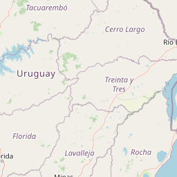
Use this park location map to pinpoint Quebrada de los Cuervos y Sierras del Yerbal Protected Landscape in Uruguay, understand its exact geographic position, and read its mapped placement within the surrounding landscape more clearly.

Pigeon | © OpenStreetMap contributors

Location context for Quebrada de los Cuervos y Sierras del Yerbal Protected Landscape

Treinta y Tres Department

Visualizing the rugged gorge terrain, subtropical ravine forests, and eastern Uruguay protected landscapes

Paisaje protegido Quebrada de los Cuervos y Sierras del Yerbal Photos and Landscape Scenery

Visual documentation reveals the dramatic gorge carved by the Yerbal Chico stream, contrasting vertical rock walls with sheltering ravine vegetation across the eastern sierras. Detailed photography helps interpret the geological topography, microclimate contrasts, and protected habitats that define this regional conservation landscape.

A waterfall cascading over a mossy rock face into a calm, dark pool, surrounded by dense green forest and palm trees under a clear blue sky.

A wide landscape view from a high rocky ridge looking down into a green forested valley with a winding river visible at the base.

A steep, rocky, tree-covered hillside under a clear blue sky, showing the varied textures of the Quebrada de los Cuervos gorge.

A view of a river with a rocky shoreline in the foreground, leading to a dense forest and palm trees under a partly cloudy sky.

Park atlas

Compare nearby protected landscapes, eastern hill country terrain, and regional conservation areas.

Parks Near Paisaje protegido Quebrada de los Cuervos y Sierras del Yerbal and Regional Protected Areas

Browsing other protected areas near Paisaje protegido Quebrada de los Cuervos y Sierras del Yerbal reveals how ancient metamorphic terrain and subtropical ravines connect to wider regional ecosystems. Comparing adjacent conservation landscapes provides valuable geographic context for understanding Uruguay's eastern hill country.
Biosphere reserveUruguay
About 76 km away#1 closest

Southeast

Reserva de biosfera Bañados del Este: Geographic Overview of Uruguay Wetlands

Mapping protected lagoons, sierras, and palm savannas

Reserva de biosfera Bañados del Este represents one of South America's most significant wetland systems. This overview highlights the ecological and physical geography of a protected area that stretches from rolling crystalline sierras down to the Atlantic coastal lagoons, examining the interplay of marshlands, grasslands, and forest remnants that shape this vital Uruguayan region.

Area
12,500 km²
Established
1976
IUCN
IV
Relief
Mixed relief
A wide, panoramic watercolor illustration showing a landscape of rolling green hills, grassy foreground vegetation, and distant pale mountains under a soft sky.
National parkDepartamento de Rocha
About 119 km away#2 closest

Southeast

Parque nacional San Miguel: Mapped Protected Landscapes of Departamento de Rocha

Volcanic hills, native woodlands, and seasonal wetlands

Parque nacional San Miguel serves as a vital protected area, showcasing the distinctive topography of the Sierra de San Miguel. The terrain transitions from rocky volcanic slopes to expansive low-lying wetlands, creating a layered environment of native forests and open prairies that define this essential segment of the regional geography in Departamento de Rocha.

Area
15.42 km²
Established
1937
Relief
Upland
Climate
Temperate
Watercolor painting of a wide, calm lake landscape with a sandy shoreline, sparse vegetation, and gentle hills in the background.
National parkRocha Department
About 138 km away#3 closest

Southeast

Parque Nacional Laguna Negra: Geographic Map and Protected Area Overview

Wetland and Savanna Landscapes in Rocha Department

Parque Nacional Laguna Negra protects a compressed mosaic of coastal environments in eastern Uruguay. The area integrates dense marshlands with native grasslands and patches of indigenous forest, providing a essential habitat corridor along the Atlantic coast. Use this atlas resource to understand its terrain and internal environmental distribution.

Area
7.15 km²
Established
2025
Relief
Lowland
Climate
Temperate
National parkRocha Department
About 142 km away#4 closest

Southeast

Santa Teresa National Park: Mapped Coastal Forest and Beach Protected Landscape

Explore Rocha Department's unique protected Atlantic coast geography.

Santa Teresa National Park, a designated national park in Uruguay's Rocha Department, offers a compelling example of a protected coastal environment. Its landscape is characterized by a distinctive blend of dense forests that reach down to the sandy shores of the Atlantic Ocean, a rare feature in the region's protected areas. This page provides detailed geographic context and map-based exploration for understanding this unique seaside national park and its place within Uruguay's conservation atlas.

IUCN
II
Relief
Lowland
Climate
Subtropical
Access
Easy access
Wildlife reserveDepartamento de Rocha
About 143 km away#5 closest

Southeast

Área de manejo de hábitats y/o especies Cerro Verde e Islas de la Coronilla Protected Landscape

Coastal and marine wildlife reserve in Departamento de Rocha

Spanning both land and sea, this reserve protects a rare combination of granite coastal hills, relict forests, and oceanic islands along the Uruguayan Atlantic. Learn about its integrated role within the Banos del Este biosphere and its importance as a habitat for endangered green sea turtles and migrating southern right whales.

Area
16.88 km²
Established
2011
Relief
Lowland
Climate
Temperate
Protected landscapeRocha
About 167 km away#6 closest

South

Paisaje protegido Laguna de Castillos: Mapped Geography and Protected Landscape Features

Coastal lagoon and native woodland terrain in Rocha, Uruguay

Investigate the geographic profile of Paisaje protegido Laguna de Castillos, an essential protected area in Rocha. This terrain features the largest continuous ombú forest in the country alongside shallow coastal lagoon waters and complex wetland habitats that support a high diversity of native waterfowl.

Area
82.64 km²
Established
2020
Relief
Lowland
Climate
Subtropical
Watercolor painting of a soft landscape with rolling hills in the background and grassy plains in the foreground on a white background.
National parkLavalleja Department
About 169 km away#7 closest

Southwest

Parque nacional Arequita: Protected Landscape and Volcanic Geography in Lavalleja

Mapped natural terrain and protected ecosystems of southeastern Uruguay.

Parque nacional Arequita preserves a unique volcanic landscape in the Lavalleja Department, centered on the ancient basalt hill of Cerro Arequita. The area protects diverse environments ranging from rocky cave systems and native forests to critical freshwater watersheds. This record offers a deep look into the geographical character, internal boundaries, and ecological importance of one of Uruguay's most prominent natural sites.

Area
5.6 km²
Established
2024
Relief
Upland
Climate
Temperate
Watercolor painting showing a hill with green landscape and distant mountains
National parkUruguay
About 169 km away#8 closest

Southwest

Arequita National Park: Uruguay's National Park Protected Landscape and Geography

Mapped boundaries and regional natural terrain context for a key protected area.

Delve into Arequita National Park, a designated national park contributing to Uruguay's protected land inventory. This resource explores the park's unique geographic setting, its mapped boundaries, and its significance within the natural landscape of the Southern Cone. Gain structured insight into its role as a protected area and its contribution to the regional geography of South America.

Scope
Terrestrial
Water
No major water

Common questions about visiting, size, designation, and location context for Quebrada de los Cuervos y Sierras del Yerbal Protected Landscape

Quebrada de los Cuervos y Sierras del Yerbal Protected Landscape FAQs for park facts, access, geography, and protected area context

Find quick answers about Quebrada de los Cuervos y Sierras del Yerbal Protected Landscape, including protected-area facts, park geography, trail and visitor context, and how the park fits into its surrounding country and regional landscape.
MoriAtlas Explorer

Continue Your Protected Areas Search Across the Global Atlas

Deepen your exploration by continuing the structured search for national parks and protected areas worldwide. Utilize the comprehensive filtering capabilities to compare different conservation landscapes and refine your understanding of global park geography. Discover more about the distribution and characteristics of protected natural areas.

Global natural geography