Mori Atlas logo
Wildlife reserveQuinn Canyon Wilderness

Trace high-altitude ridgelines, V-shaped canyon networks, and remote mountain ecosystems.

Quinn Canyon Wilderness: An Essential Protected Landscape in the Great Basin of Nevada

Quinn Canyon Wilderness represents a cornerstone of remote backcountry in central Nevada, featuring a dramatic ridgeline that ascends beyond 10,000 feet. This protected area within Nye County showcases a stark transition from pinyon pine woodlands and sagebrush flats to high-elevation bristlecone pine stands. The region offers significant mapped data for those studying Great Basin terrain, seasonal wildlife ranges, and the complex hydrology of narrow, perennial stream-fed canyons.

wilderness areaGreat Basinmountain rangehigh desertpinyon juniper woodlandsagebrush

Quinn Canyon Wilderness

Wildlife reserve

Park overview

Structured park overview, official facts, and landscape profile for Quinn Canyon Wilderness

Quinn Canyon Wilderness park facts, protected area profile, and essential visitor context

Review the core facts for Quinn Canyon Wilderness, including designation, size, terrain, visitor scale, habitats, and operating context in one park-focused overview.

About Quinn Canyon Wilderness

Quinn Canyon Wilderness occupies a rugged stretch of the Quinn Canyon Range, a linear mountain system in central Nevada that rises sharply out of the surrounding Great Basin desert. The wilderness is unusual in the American West for how sparsely connected it is to surrounding road networks. There are no developed communities within the wilderness itself, and the nearest cities, including Tonopah and Ely, lie many tens of miles away across largely unimproved terrain.

From the main ridgeline, which carries a roughly ten-mile crest above 9,000 feet, the terrain breaks westward and eastward into a series of narrower canyons and side drainages. These V-shaped valleys gather snowmelt and seasonal rainfall, sustaining four perennial streams and several springs that provide reliable water in an otherwise arid setting. The combination of high ridge and deeply cut drainages gives the wilderness a strong sense of topographic enclosure and distance from the outside world.

The ecological character of Quinn Canyon reflects the broader vertical zonation typical of Nevada's high desert mountains. Lower slopes support pinyon pine and juniper, a familiar plant community across the Great Basin. Above this zone, sagebrush becomes dominant, interspersed with white fir, aspen, and mountain mahogany in cooler, moister pockets. At the highest elevations, the wilderness harbors small stands of bristlecone pine, an ecologically and culturally iconic species that has helped make similar Great Basin ranges famous worldwide.

A single dirt road separates Quinn Canyon Wilderness from the larger Grant Range Wilderness to the north, and together the two protected areas form a substantial block of contiguous wild country in central Nevada. The wilderness is administered by the U.S. Forest Service and managed primarily to preserve its unimpaired natural character, consistent with its 1989 congressional designation.

Quick facts and research context for Quinn Canyon Wilderness

Quinn Canyon Wilderness is located in the Quinn Canyon Range of central Nye County, Nevada, in the western United States. It was designated as wilderness by the United States Congress in 1989 and is administered by the U.S. Forest Service within the Humboldt-Toiyabe National Forest as a wilderness area under IUCN Category Ib.

The wilderness spans roughly 26,000 acres and extends about 12 miles in length with a width of around 4 miles. Elevations range from about 6,700 feet at trailhead level to more than 10,100 feet at an unnamed summit on the southern edge. The nearest community is Tonopah, with Ely also referenced as a distant reference point more than 100 miles away.

Protection and recognition

Terrestrial conservation framework, management scope, and recognition data

Quinn Canyon Wilderness Protection Status and Geographic Designation Records

Quinn Canyon Wilderness maintains a documented terrestrial protection status within its regional conservation framework. Official records outline the established management scope and administrative designation details for the protected landscape.

Protection details

Protection scope
Terrestrial
Park context

Deeper park guide and search-rich context for Quinn Canyon Wilderness

Quinn Canyon Wilderness history, landscape, wildlife, and travel context

Explore Quinn Canyon Wilderness through its history, landscape character, ecosystems, wildlife, conservation priorities, cultural context, and seasonal travel timing in a structured park guide built for atlas discovery and search intent.

Why Quinn Canyon Wilderness stands out

Quinn Canyon Wilderness is best known for its extreme isolation in central Nevada, where a single high ridgeline drops into narrow V-shaped canyons forming four year-round streams. The wildlife value centers on seasonal ranges for mule deer and desert bighorn sheep, with summer use of the upper elevations especially pronounced. The wilderness is also recognized for its striking vegetation gradient, which shifts from pinyon-juniper woodland up through sagebrush slopes to higher stands of white fir, aspen, mountain mahogany, and small but ecologically significant populations of bristlecone pine, one of the longest-lived tree species on Earth.
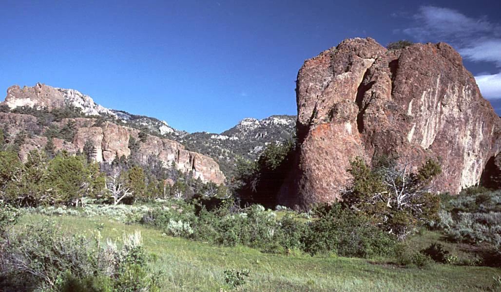
A large, weathered brown rock monolith stands prominently on the right side of the frame, with expansive cliff faces and distant mountains forming a rugged backdrop over a grassy, sagebrush-covered valley.
Rugged rock formations rising above the valley floor in the Quinn Canyon Wilderness.

Quinn Canyon Wilderness history and protected-area timeline

Quinn Canyon Wilderness was established by the United States Congress in 1989 as part of the broader effort during that era to formally protect large tracts of public land under the National Wilderness Preservation System. Its designation recognized the unusual combination of ecological value, scenic integrity, and profound isolation found in the Quinn Canyon Range.

Following designation, the wilderness has been managed by the U.S. Forest Service as a component of the Humboldt-Toiyabe National Forest, the national forest that encompasses much of central Nevada's forested mountain terrain. Its administrative history is closely tied to the long-running management of Humboldt-Toiyabe, which itself has undergone various organizational changes over the decades as Nevada's national forest units were consolidated and reorganized.

Because the area has remained largely undeveloped and largely unused for intensive commercial purposes, there is limited history of extractive industry or settlement within the wilderness itself. The most significant historical story is therefore one of preservation rather than exploitation, with the wilderness serving as a refuge for native species, undisturbed watersheds, and undisturbed older forest stands including bristlecone pine.

Quinn Canyon Wilderness landscape and geographic character

The landscape of Quinn Canyon Wilderness is shaped by a long, narrow mountain range that plunges from high ridgelines into deeply cut desert canyons. The defining feature is the Quinn Canyon Range itself, with its crest running roughly ten miles above 9,000 feet and rising to more than 10,100 feet at an unnamed peak on the southern edge of the wilderness.

From this ridgeline, numerous smaller parallel ridges and side canyons extend outward both east and west, generating the characteristic V-shaped cross-section of each drainage. The lowest point of the wilderness is around 6,700 feet at the Cherry Creek trailhead, producing an elevation span of more than 3,400 feet across a relatively compact area.

Four perennial streams and several springs occupy the canyon bottoms, fed by snowmelt and summer precipitation. These water sources cut narrow ribbons of green through an otherwise arid backdrop and contribute to the strong visual contrast between rugged ridge and sheltered valley that defines the wilderness scenery.

To the north, only a dirt road separates the wilderness from the larger Grant Range Wilderness, and together the two areas create a combined block of high, roadless Great Basin mountain country. There are no major roads crossing the wilderness itself, reinforcing the deep-backcountry character of the setting.

Quinn Canyon Wilderness ecosystems, habitats, and plant life

The ecological identity of Quinn Canyon Wilderness reflects the layered vertical zonation typical of high mountains in the central Great Basin. The lowest elevations support a pinyon pine and juniper woodland that drifts upward into sagebrush-dominated slopes, with scattered patches of white fir, aspen, and mountain mahogany appearing in cooler and moister microhabitats higher on the range.

A particularly significant ecological feature is the presence of small stands of bristlecone pine in the upper elevations. Bristlecone pines are among the longest-living non-clonal organisms on Earth, and their presence in the Quinn Canyon Range adds both ecological and scientific value to the wilderness. The combination of older bristlecone stands with aspen groves and montane mahogany communities creates a higher-elevation forest mosaic that is uncommon in this part of Nevada.

The watershed ecology is similarly layered. The four perennial streams and numerous springs sustain riparian vegetation along the canyon bottoms, providing habitat continuity through an otherwise dry landscape. These water sources support both resident wildlife and seasonal migrants, and they contribute to the broader hydrological role the wilderness plays within the surrounding desert basins of central Nevada.

Overall, the ecological significance of Quinn Canyon lies less in any single dramatic feature and more in the way its elevation gradient, drainage pattern, and relative isolation combine to support a representative cross-section of central Nevada's high desert ecology.

Quinn Canyon Wilderness wildlife and species highlights

Quinn Canyon Wilderness supports a wildlife community typical of Nevada's high desert mountain ranges, with strong seasonal use of the upper elevations by large ungulates. Mule deer are among the most characteristic species, moving into the higher parts of the range during summer to take advantage of cooler temperatures and more reliable forage.

Desert bighorn sheep also rely on the wilderness, particularly along the high crest of the Quinn Canyon Range. Roughly ten miles of ridgeline above 9,000 feet serve as important summer range for these sheep, providing the rugged, escape terrain and open sightlines that bighorn sheep depend on.

The presence of perennial water in the canyons, combined with the dense mix of sagebrush, juniper, and conifer habitats, supports a range of smaller mammals and birdlife typical of the central Great Basin. Riparian zones along the streams likely serve as particularly important habitat, especially during the dry late-summer months.

Because of its isolation and largely unmanaged character, the wilderness functions as a refuge where wildlife can move across substantial distances without encountering human infrastructure, which adds to its conservation value beyond simply its scenic or wilderness qualities.

Quinn Canyon Wilderness conservation status and protection priorities

Quinn Canyon Wilderness was designated by Congress in 1989 specifically to preserve its wilderness character, and its ongoing management reflects that core mission. As an IUCN Category Ib wilderness area, it is meant to be maintained in a largely undisturbed state, with minimal infrastructure and limited active manipulation of ecological processes.

The wilderness is adjacent to the larger Grant Range Wilderness, separated only by a dirt road, and the two areas together form a substantial contiguous block of protected wild country in central Nevada. This contiguity is significant from a conservation standpoint, because it expands the effective habitat available to wide-ranging species like mule deer and bighorn sheep.

The presence of small but persistent bristlecone pine stands elevates the conservation profile of the wilderness. Bristlecone pine ecosystems are recognized globally for their scientific value and their vulnerability to climate stress, insect outbreaks, and past land-use changes, and their protection here contributes to the broader conservation network for this species across the Great Basin.

Watershed protection is another key conservation function. The perennial streams and springs within the wilderness help maintain downstream water quality and ecological function in an otherwise arid region, giving the area conservation importance well beyond its own boundaries.

Top sights and standout views in Quinn Canyon Wilderness

The standout features of Quinn Canyon Wilderness include its exceptional isolation, a high ridgeline cresting above 10,000 feet, and four year-round streams running through narrow V-shaped canyons. The vegetation gradient from pinyon-juniper woodland up through sagebrush and into bristlecone pine stands gives the wilderness unusually rich ecological layering for its size.

Another defining highlight is the wilderness's role as summer habitat for both mule deer and desert bighorn sheep, with more than ten miles of high ridgeline serving as important bighorn range. The dirt-road-only separation from the neighboring Grant Range Wilderness also makes Quinn Canyon a notable component of one of the larger protected wildland complexes in central Nevada.

Best time to visit Quinn Canyon Wilderness

Visits to Quinn Canyon Wilderness are best framed around the spring through early fall window, when the combination of snowmelt in the higher elevations and warm-season rainfall keeps the four perennial streams and springs flowing. Summer is the most ecologically dynamic season, with migratory mule deer and bighorn sheep using the upper elevations.

Higher elevations retain snow well into spring, so spring visits typically emphasize the lower canyon trails and sagebrush zones. By late spring and early summer, the aspen and mahogany stands higher on the range leaf out and the bristlecone pine sites become more accessible. Late summer can be hot at lower elevations, and water sources become especially important for any backcountry travel.

Because the wilderness is remote and lacking significant road infrastructure, visitors should generally plan around stable seasonal weather windows rather than specific operational schedules, and should expect very limited services within the wilderness itself.

Monthly climate preview

Long-term temperature ranges and monthly precipitation patterns for Nye County

Quinn Canyon Wilderness Climate Normals and Monthly Weather Statistics

Quinn Canyon Wilderness records long-term monthly temperatures ranging from sub-zero winter minimums to warm summer maximums alongside stable daily precipitation rates. Reviewing the complete twelve-month profile provides a detailed breakdown of historical climate normals across the sampled representative elevation.
Annual mean11 °C
-1 °C25 °C
Jan
Feb
Mar
Apr
May14°
Jun21°
Jul25°
Aug24°
Sep18°
Oct11°
Nov
Dec-1°
Warmest month
July

24.7 °C

Coolest month
December

-0.8 °C

Wettest month
February

0.8 mm/day

Driest month
June

0.3 mm/day

Park location guide

Geography guide, regional context, and park location map for Quinn Canyon Wilderness

Quinn Canyon Wilderness park geography, regions, and map view in United States of America

Understand where Quinn Canyon Wilderness sits in United States of America through a broader geographic reading of the surrounding landscape, nearby location context, and its mapped position within the national park landscape.

How Quinn Canyon Wilderness fits into United States of America

The United States of America is a federal presidential republic and one of the world's largest countries by area and population. It consists of 50 states across a vast territory spanning multiple time zones, with its capital in Washington, D.C. and largest city in New York City. The nation has a diverse economy, influential political system, and significant cultural and military presence globally.

Wider geography shaping Quinn Canyon Wilderness in United States of America

The United States occupies a vast territory in North America, bordered by Canada to the north and Mexico to the south. The 48 contiguous states stretch from the Atlantic to the Pacific Ocean, while Alaska occupies the northwestern region and Hawaii is an archipelago in the Pacific. The country encompasses diverse terrain including the Rocky Mountains, Appalachian Mountains, Great Plains, and extensive river systems.

Map view of Quinn Canyon Wilderness

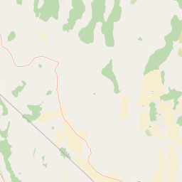
Use this park location map to pinpoint Quinn Canyon Wilderness in United States of America, understand its exact geographic position, and read its mapped placement within the surrounding landscape more clearly.

Pigeon | © OpenStreetMap contributors

Location context for Quinn Canyon Wilderness

NevadaNye County
Recorded earthquake history

Explore Historical Earthquake Records Near Quinn Canyon Wilderness

Browse the documented seismic history for the Quinn Canyon Wilderness area in central Nevada. This MoriAtlas catalogue provides structured access to historical earthquake data and associated epicentre metrics for the region.

Quinn Canyon Wilderness Earthquake History

Catalogued events

61 events

Strongest magnitude

Magnitude 4.4

Most recent event

Nov 17, 2025

This history includes earthquakes recorded inside the park or within 50 km of its borders

Visual reference of high desert terrain, rugged ridgelines, and isolated Great Basin habitats

Quinn Canyon Wilderness Photos and Scenery: Exploring the Protected Landscapes

Examine detailed photography showcasing the dramatic topography, V-shaped canyons, and diverse vegetation gradients of Quinn Canyon Wilderness. Visual documentation reveals the stark contrast between arid lower valleys and high elevation bristlecone pine stands across remote Nevada wildlands.

A large, weathered brown rock monolith stands prominently on the right side of the frame, with expansive cliff faces and distant mountains forming a rugged backdrop over a grassy, sagebrush-covered valley.

Park atlas

Compare regional high desert terrain and connected mountain wilderness blocks.

Other Parks Near Quinn Canyon Wilderness and Surrounding Protected Landscapes

Browse protected areas and rugged mountain ranges adjacent to Quinn Canyon Wilderness in central Nevada. Compare surrounding Great Basin wildlands and trace regional topography across connected high desert ecosystems.
A watercolor painting showing soft green hills, distant pink-hued mountains, and a pale blue lake in a serene, stylized landscape.
Protected landscapeNevada
Park boundaries overlap#1 closest

Northwest

Humboldt, Toiyabe National Forest: Protected Landscape and Regional Mountain Geography

A vast network of Nevada mountain ranges and alpine wilderness

Humboldt, Toiyabe National Forest serves as a defining public land entity across Nevada and eastern California. As the largest national forest in the contiguous United States, it preserves a striking collection of isolated mountain ranges, including the Ruby Mountains and the rugged Jarbidge wilderness, within a broader basin-and-range landscape. Examine the boundaries and terrain that characterize this complex, high-desert ecosystem.

Area
25,454 km²
Established
1908
Relief
Mountain
Access
Easy access
Wildlife reserveNevada
About 78 km away#2 closest

North

Red Mountain Wilderness: Mapping Protected Volcanic Terrain in Eastern Nevada

High-desert wilderness, ancient pines, and volcanic geography.

Red Mountain Wilderness encompasses a rugged block of protected high-country featuring dramatic, iron-rich volcanic slopes. This arid landscape stands out in the White Pine Range for its deep red coloration and the presence of long-lived bristlecone pine. Analyze the boundaries and geographic context of this significant Great Basin wilderness through our structured atlas and map resources.

Area
82.9 km²
Established
2006
IUCN
Ib
Relief
Mountain
Wildlife reserveNevada
About 90 km away#3 closest

Northeast

Mount Grafton Wilderness: Protected Mountain Geography and Forested Landscapes in Nevada

High-elevation wilderness within the Schell Creek Range.

Mount Grafton Wilderness offers a deep dive into the high-desert mountain geography of eastern Nevada. This protected area features a striking 10,990-foot peak and a wide range of forest types, including rare bristlecone pine stands. The region provides a critical look at the complex topography and ecological structure of the Schell Creek Range for those researching protected land boundaries and Great Basin habitats.

Area
318.71 km²
Established
2006
IUCN
Ib
Relief
Mountain
Wildlife reserveNevada
About 106 km away#4 closest

Northeast

Fortification Range Wilderness: Mapping Volcanic Terrain in the Nevada Great Basin

A protected volcanic mountain chain in Lincoln County.

This wilderness preserves the entirety of the Fortification Range, a significant volcanic block rising above the surrounding desert basins. The protected land is characterized by its dramatic northern cliffs and expansive southern woodlands, offering an exceptional look at the varied natural terrain of the eastern Great Basin. Learn about its geographic boundaries, unique volcanic geology, and the diverse pinyon-juniper forest communities that define this remote high-country landscape.

Area
124.06 km²
Established
2004
IUCN
Ib
Relief
Mountain
National parkNevada
132 km away#5 closest

Northeast

Great Basin National Park: Nevada's Protected National Park Geography and Map Details

Understanding its mapped boundaries and regional context.

Delve into the protected landscape of Great Basin National Park, a significant national park located in Nevada. This entry focuses on the park's geographic attributes, providing users with essential map context, details on its protected area boundaries, and an understanding of its place within the broader regional geography. It serves as a focused resource for exploring the park's unique natural terrain and landscape characteristics through an atlas-driven lens.

Area
312.3 km²
Established
1986
IUCN
II
Visitors
144.9K annual
National parkCalifornia
157 km away#6 closest

Southwest

Death Valley National Park: Exploring California's Mapped Protected Landscape

View the geographic boundaries and desert terrain.

Access a detailed atlas perspective of Death Valley National Park, a protected national park situated in California. Understand the park's distinct mapped boundaries and its role within the regional geography. This resource highlights the unique desert landscape, offering focused insights into its protected-area identity and natural terrain for geographic discovery.

Area
13,848.4 km²
Established
1994
IUCN
II
Visitors
1.1M annual
Protected areaNevada
About 167 km away#7 closest

Northeast

Mount Moriah Wilderness: A Geographic Profile of the Northern Snake Range Protected Area

High elevation limestone terrain in eastern Nevada

The Mount Moriah Wilderness represents a significant protected area in eastern Nevada, anchored by the iconic 12,050-foot Mount Moriah and the expansive flat-topped Table plateau. This rugged high-country landscape displays deep limestone exposures, shallow caves, and a rich array of riparian habitats. Spanning an entire elevational gradient of the Great Basin, the wilderness preserves ancient bristlecone pine groves alongside critical archaeological sites that document long-term human use of these mountains.

Area
363.4 km²
Established
1989
Relief
Mountain
Water
Minor water
Watercolor painting of green rolling hills and distant purple mountains with a small waterfall flowing into a body of water in the foreground.
Protected landscapeNevada
178 km away#8 closest

South

Spring Mountains National Recreation Area: Alpine Geography and Protected Mountain Landscapes

A rugged mountain anchor in the southern Nevada desert

Rising sharply from the desert floor, Spring Mountains National Recreation Area features dramatic elevation shifts across 316,000 acres of forested canyons and rocky ridges. This protected landscape preserves vital mountain habitat and diverse terrain, ranging from pinyon-juniper woodlands to high-alpine environments near Mount Charleston, serving as a distinct natural contrast to the Mojave surroundings.

Area
1,280 km²
Established
1993
IUCN
V
Relief
Mountain

Common questions about visiting, size, designation, and location context for Quinn Canyon Wilderness

Quinn Canyon Wilderness FAQs for park facts, access, geography, and protected area context

Find quick answers about Quinn Canyon Wilderness, including protected-area facts, park geography, trail and visitor context, and how the park fits into its surrounding country and regional landscape.
MoriAtlas Explorer

Continue Your Protected Areas Search Across the Global Atlas

Deepen your exploration by continuing the structured search for national parks and protected areas worldwide. Utilize the comprehensive filtering capabilities to compare different conservation landscapes and refine your understanding of global park geography. Discover more about the distribution and characteristics of protected natural areas.

Global natural geography