
Mori Atlas logo
Protected landscapeQuirino Protected Landscape

A vital forest biodiversity corridor protecting the Upper Cagayan River headwaters

Quirino Protected Landscape: Mapping the Watershed and Mountainous Terrain of Northern Luzon

The Quirino Protected Landscape serves as a fundamental ecological pillar within the Philippines, covering vast forested sections of the Sierra Madre and Caraballo mountain ranges. This expansive protected area functions as the primary headwater source for the Cagayan River, supporting complex hydrology and rare endemic wildlife across a rugged expanse of old-growth and second-growth rainforest. Its geography defines the mountainous heartland of the province, acting as a critical biodiversity corridor within the broader Luzon landscape.

protected landscapewatershed reserveSierra MadreCaraballo Mountainsrainforestold-growth forest
A flat-style vector illustration showing a tall waterfall cascading down lush green mountains, surrounded by tropical foliage and a flat grassy foreground under a blue sky.

Quirino Protected Landscape

Protected landscape

Park overview

Structured park overview, official facts, and landscape profile for Quirino Protected Landscape

Quirino Protected Landscape park facts, protected area profile, and essential visitor context

Review the core facts for Quirino Protected Landscape, including designation, size, terrain, visitor scale, habitats, and operating context in one park-focused overview.

About Quirino Protected Landscape

Quirino Protected Landscape sits in the interior of northern Luzon, occupying a sweeping stretch of mountainous terrain in the province of Quirino. Its location places it at a hinge between the Sierra Madre mountain range along eastern Luzon and the Caraballo range that connects to the central Cordillera system, giving it both structural and ecological importance.

The protected area was declared through a national proclamation in 2004, with an initial extent of more than 200,000 hectares. A subsequent amendment reduced and reconfigured the landscape into a total aggregate area of about 175,000 hectares divided into three parcels. This reorganization reflected the practical reality of managing a vast protected landscape that also contains resource interests, including areas where mining activities were subsequently permitted within the broader watershed framework.

Ecologically, the reserve is dominated by tropical rainforest, with the great majority of its forest cover classified as second growth that has regrown after past disturbance, alongside a smaller but ecologically critical portion of old growth. The forest structure supports complex understory plant communities, large emergent trees, and the microclimates that rare species depend on.

Hydrologically, the landscape's defining role is as the headwaters zone for three major river systems: the Upper Cagayan River, the Addalam River, and the Ganano River. These waters ultimately feed the Cagayan Valley downstream, sustaining irrigation systems and agricultural lands as well as communities far beyond the province of Quirino.

Geographically, the protected area extends across five municipalities of Quirino, including Maddela, Nagtipunan, Cabarroguis, Aglipay, and Diffun. Nagbukel Mountain, situated in Diffun, is one of the landscape's recognizable geographic landmarks and a destination linked with the reserve's scenery and biodiversity values.

Quick facts and research context for Quirino Protected Landscape

Quirino Protected Landscape is a declared protected area in the province of Quirino on the island of Luzon, Philippines, managed under the Department of Environment and Natural Resources. It occupies a substantial portion of the province's land area and was established on February 9, 2004 to protect the watershed supplying the Cagayan River system.

The landscape lies within the Sierra Madre and Caraballo mountain ranges, forming part of the broader Sierra Madre Biodiversity Corridor. It is classified under IUCN Category V as a protected landscape, and combines extensive rainforest cover with critical river headwaters that support downstream agriculture and communities across the Cagayan Valley.

Protection and recognition

Documented terrestrial protection scope and historical designation data

Quirino Protected Landscape Protection Status and Designation History

Quirino Protected Landscape maintains a documented terrestrial protection scope established in the designation year 2004. Official conservation records outline the structural management framework and administrative history associated with this protected area.

Protection details

Protection scope
Terrestrial
Designated year
2004
Transboundary protection
No
Park context

Deeper park guide and search-rich context for Quirino Protected Landscape

Quirino Protected Landscape history, landscape, wildlife, and travel context

Explore Quirino Protected Landscape through its history, landscape character, ecosystems, wildlife, conservation priorities, cultural context, and seasonal travel timing in a structured park guide built for atlas discovery and search intent.

Why Quirino Protected Landscape stands out

Quirino Protected Landscape is best known for its role as the principal watershed reserve of the Upper Cagayan River Basin, protecting the headwaters that feed the longest river in the Philippines. Its vast tracts of rainforest in the Sierra Madre mountains also place it among the most important biodiversity corridors on Luzon. The area is additionally recognized for its rare and endemic wildlife, including significant populations of threatened birds, reptiles, and freshwater species, as well as for hosting newly documented plant species such as rafflesia. This combination of hydrological importance and high biodiversity gives the protected landscape a profile that goes well beyond a typical provincial reserve.
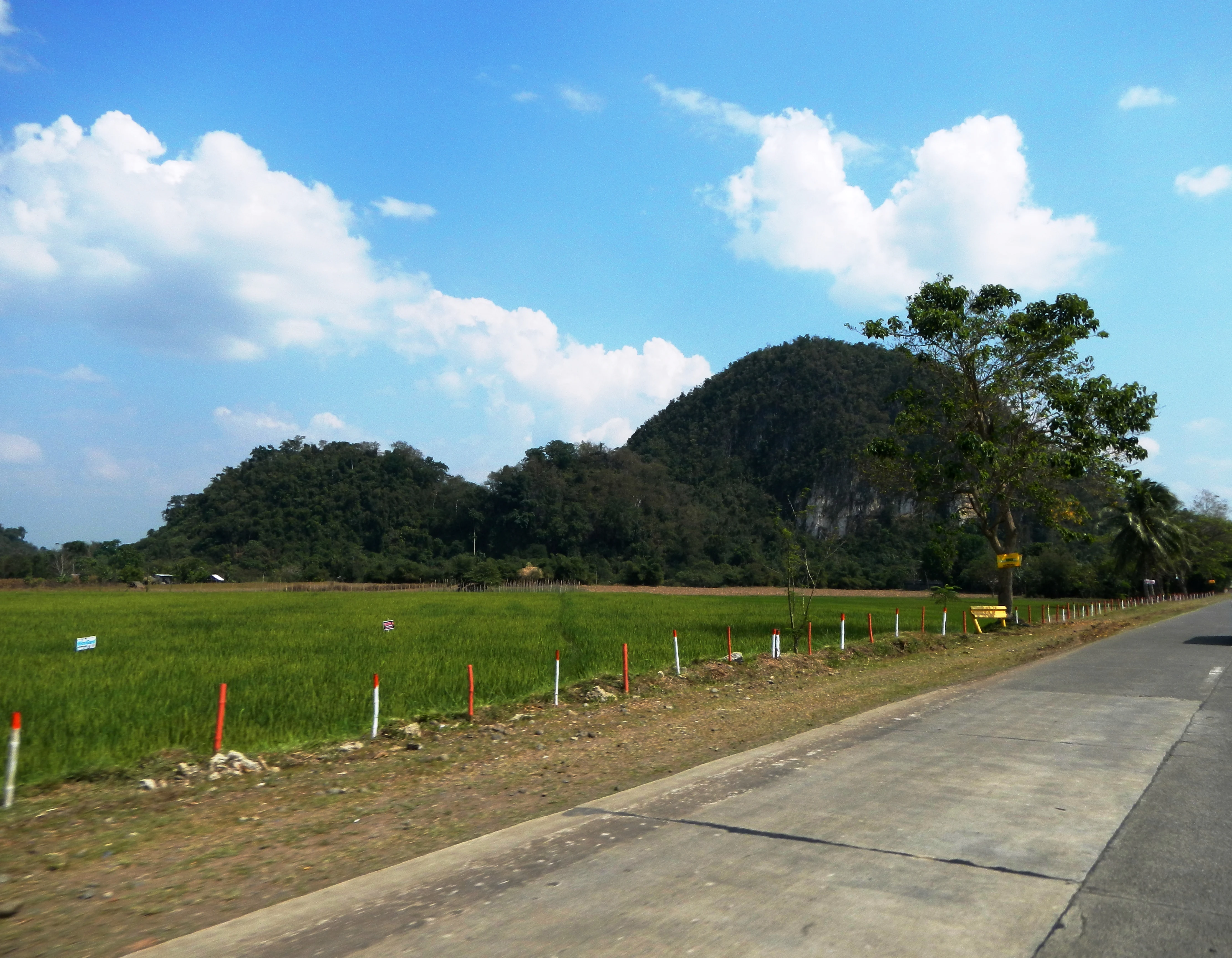
A wide, eye level shot of a rounded, forested limestone hill rising above a green field, next to a paved road.
The dome shaped hill containing Nagbukel Cave viewed from the roadside in Quirino.

Quirino Protected Landscape history and protected-area timeline

The Quirino Protected Landscape was formally established on February 9, 2004 through national proclamation, recognizing the need to protect a vast tract of forested terrain that supplies the headwaters of the Cagayan River system. The declaration created one of the largest single protected areas on Luzon and reflected growing awareness of the strategic importance of the upper watersheds of northern Luzon for downstream agriculture, water security, and biodiversity conservation.

At its creation, the protected landscape encompassed an initial footprint of about 206,875 hectares, reflecting an ambitious watershed protection vision. In 2005, an amendment reshaped the boundaries and reduced the total aggregate area to its current extent of roughly 175,943 hectares, divided into three distinct parcels. This reorganization allowed certain areas within the broader zone to be opened to mining activities, illustrating the ongoing negotiation between conservation goals and resource extraction in Philippine protected area policy.

Since its establishment, the landscape has continued to gain recognition as part of the larger Sierra Madre Biodiversity Corridor, a network that connects protected forests across northern Luzon. Discoveries such as the new rafflesia species recorded in 2009 underscored the area's ongoing scientific significance and helped reinforce arguments for stronger watershed and habitat protection in the region.

Quirino Protected Landscape landscape and geographic character

The terrain of Quirino Protected Landscape is shaped by the mountainous backbone of northern Luzon, where the ridges and valleys of the Sierra Madre and Caraballo ranges converge. Elevation changes across the reserve create a varied topography of forested ridges, deep river valleys, and intervening lowland stretches that give the landscape its characteristic mix of rugged interior scenery and more accessible foothills.

The three major river systems that drain the area, the Upper Cagayan, Addalam, and Ganano rivers, have carved extensive valleys through the mountains. These river corridors create natural breaks in the forest canopy, expose rock formations in steep sections, and supply the perennial flow that makes the watershed so vital.

Nagbukel Mountain, located within the municipality of Diffun, is among the notable topographic features within the landscape and is often associated with the protected area's most photogenic scenery. The pattern of peaks, ridges, and forest-covered slopes across the reserve supports both aesthetic value and the ecological functions of a high-quality watershed.

Quirino Protected Landscape ecosystems, habitats, and plant life

Quirino Protected Landscape is ecologically defined by its extensive tropical rainforest, which blankets the rugged interior of the Sierra Madre and Caraballo mountains. About three-quarters of the forested area is classified as second growth, regrown after past logging or cultivation, while roughly a quarter remains as old-growth forest, providing the structural complexity and microhabitats that many rare species require.

The convergence of the Sierra Madre and Caraballo ranges creates an interface zone where plant communities from different elevations and slopes meet. Riverbank habitats along the Cagayan, Addalam, and Ganano systems support distinct riparian vegetation and the moist microclimates that amphibians, reptiles, and freshwater species rely on.

Within the broader landscape, the protected area functions as a key biodiversity corridor of the Sierra Madre system, connecting forest habitats across northern Luzon. The combination of extensive forest cover, varied topography, and major river systems gives the reserve a layered ecological character rather than a single dominant habitat type.

Quirino Protected Landscape wildlife and species highlights

The protected area's wildlife profile is shaped by its extensive rainforest cover and the convergence of major river systems that create diverse aquatic and terrestrial habitats. More than forty threatened animal species have been recorded within its boundaries, signaling that the area retains significant populations of rare and endemic fauna despite pressures from past logging and land use.

Among the most notable species recorded are birds such as the Philippine eagle, the country's national symbol and one of the rarest raptors in the world, and the Isabela oriole, a regionally significant bird species. Reptiles are represented by species like Cantor's giant softshell turtle, a highly threatened freshwater species, and the Sierra Madre fringed gecko, an endemic gecko restricted to the mountain range in which the landscape sits.

Freshwater wildlife is also part of the area's ecological identity, with species like the lobed river mullet inhabiting the river systems that originate in the protected landscape. The presence of such species across birds, reptiles, and fish indicates that the reserve supports functioning ecosystems from canopy to river, rather than isolated pockets of biodiversity.

Quirino Protected Landscape conservation status and protection priorities

From a conservation perspective, Quirino Protected Landscape carries importance that extends well beyond its provincial boundaries. As the principal watershed protection zone for the Upper Cagayan River Basin, it underwrites the long-term water supply for major irrigation systems and downstream communities across the Cagayan Valley, including one of the most important agricultural regions in the Philippines.

Ecologically, the reserve is a recognized component of the Sierra Madre Biodiversity Corridor, a network of protected forests that supports connectivity for species movement and gene flow across northern Luzon. Its documented populations of threatened and endemic species, including the Philippine eagle and Cantor's giant softshell turtle, give it strong national significance for biodiversity conservation.

The area's management also reflects the broader challenges of protected area governance in the Philippines. The 2005 boundary amendment that opened certain zones to mining illustrates the tension between resource extraction and watershed preservation, while the continuing discovery of new species, such as a previously unknown rafflesia documented in 2009, reinforces arguments for sustained protection of the forest cover and river systems.

Quirino Protected Landscape cultural meaning and human context

The protected area intersects with the traditional lifeways and rural economies of several municipalities in Quirino. Communities within and around Maddela, Nagtipunan, Cabarroguis, Aglipay, and Diffun have long-standing relationships with the forest and river resources that the landscape protects, including subsistence use of forest products and dependence on the rivers for household and agricultural water.

Indigenous cultural groups living in the broader Sierra Madre region maintain traditional knowledge of forest resources, and the mountains and rivers of Quirino form part of the cultural as well as physical geography of northern Luzon. The recognition of the landscape as a watershed reserve also reflects an understanding among local populations that the integrity of upstream forests directly shapes the prosperity of downstream communities.

Top sights and standout views in Quirino Protected Landscape

Quirino Protected Landscape stands out for the sheer scale of rainforest it protects within northern Luzon, the strategic significance of its three major river systems as headwaters of the Cagayan, and its recognized role within the Sierra Madre Biodiversity Corridor. The reserve's record of threatened species, including the Philippine eagle and Cantor's giant softshell turtle, places it among the country's more ecologically important protected areas.

The 2009 discovery of a new rafflesia species within its forests added a botanical highlight and reinforced the area's profile as a frontier for scientific discovery. Combined with landmarks such as Nagbukel Mountain, these features give the protected landscape a distinctive identity shaped by rivers, rainforest ridges, and rare wildlife.

Best time to visit Quirino Protected Landscape

The character of a visit to Quirino Protected Landscape shifts with the seasonal climate of northern Luzon. The dry season, generally associated with calmer weather and clearer views of forested ridges and river valleys, tends to favor outdoor exploration, photography, and wildlife observation in the more accessible areas of the reserve.

The rainy season brings heavier rainfall that supports the lushness of the rainforest and elevates river levels, which can enrich scenery but also limit access to more remote trails and certain high-elevation areas. For visitors interested in observing forest health, waterfalls, and river flow, the wet season offers its own rewards, though conditions can be more demanding for travel within mountainous terrain.
Monthly climate preview

Long-term monthly temperature and precipitation patterns across representative terrain

Quirino Protected Landscape Climate Normals and Annual Temperature Rhythm

Quirino Protected Landscape exhibits a measured annual temperature range from cooler baseline months to warmer peaks alongside distinct monthly precipitation variations recorded between 1991 and 2020. Reviewing the complete twelve-month climatology profile provides deeper analytical context for long-term temperature averages and monthly precipitation distributions.
Annual mean25 °C
22 °C27 °C
Jan22°
Feb23°
Mar24°
Apr26°
May27°
Jun27°
Jul26°
Aug26°
Sep26°
Oct25°
Nov24°
Dec23°
Warmest month
May

26.8 °C

Coolest month
January

22 °C

Wettest month
November

11.4 mm/day

Driest month
April

3.6 mm/day

Park location guide

Geography guide, regional context, and park location map for Quirino Protected Landscape

Quirino Protected Landscape park geography, regions, and map view in Philippines

Understand where Quirino Protected Landscape sits in Philippines through a broader geographic reading of the surrounding landscape, nearby location context, and its mapped position within the national park landscape.

How Quirino Protected Landscape fits into Philippines

The Philippines, officially the Republic of the Philippines, is an archipelagic nation in Southeast Asia comprising approximately 7,641 islands categorized into three main geographical divisions: Luzon, Visayas, and Mindanao. Located in the western Pacific Ocean, it shares maritime borders with Taiwan, Japan, Palau, Indonesia, Malaysia, Vietnam, and China. Manila serves as the capital city, while Quezon City is the most populated city, both within Metro Manila.

Wider geography shaping Quirino Protected Landscape in Philippines

The Philippines is an archipelagic nation in Southeast Asia, positioned in the western Pacific Ocean. Its islands are bounded by the South China Sea to the west, Philippine Sea to the east, and Celebes Sea to the south. The country shares maritime borders with Taiwan to the north, Japan to the northeast, Palau to the east and southeast, Indonesia to the south, Malaysia to the southwest, Vietnam to the west, and China to the northwest.

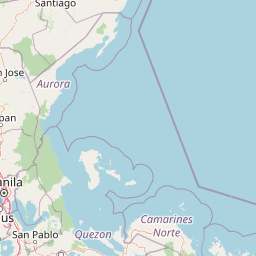
Map view of Quirino Protected Landscape

Use this park location map to pinpoint Quirino Protected Landscape in Philippines, understand its exact geographic position, and read its mapped placement within the surrounding landscape more clearly.

Pigeon | © OpenStreetMap contributors

Location context for Quirino Protected Landscape

Quirino

Visual exploration of mountain ridges, river valleys, and rainforest habitats

Quirino Protected Landscape Photos and Scenery

Photographic views document the rugged terrain and dense rainforest canopy spanning the Sierra Madre ranges. Visual records reveal the river headwaters and forested slopes that define the protected landscape character.

A wide, eye level shot of a rounded, forested limestone hill rising above a green field, next to a paved road.

Park atlas

Compare regional protected areas and connected mountain conservation zones across northern Luzon.

Explore Parks Near Quirino Protected Landscape and Surrounding Luzon Reserves

Browsing other parks near Quirino Protected Landscape reveals connected forest reserves and mountain ecosystems throughout the northern Luzon interior. Comparing these protected areas provides broader geographic context on regional watersheds, river basins, and wildlife corridors.
Protected landscapeAurora
About 27 km away#1 closest

Southeast

Talaytay Protected Landscape: Geography and Protected Area Mapping in Aurora Province

Sierra Madre mountain-to-coast watershed exploration

Analyze the topographic profile and protected boundaries of Talaytay Protected Landscape. This reserve serves as a significant ecological corridor in Aurora, connecting the Sierra Madre interior to the Pacific coast through a series of forested riverine valleys and steep mountain slopes.

Area
35.26 km²
Established
2000
IUCN
V
Relief
Mountain
Protected landscapeAurora
About 30 km away#2 closest

South

Simbahan-Talagas Protected Landscape: Geographic Profile and Sierra Madre Forest Mapping

An essential watershed and dipterocarp habitat in Aurora province.

Analyze the protected boundaries and hydrological features of the Simbahan-Talagas Protected Landscape. This region features a dense network of river systems and continuous dipterocarp forest cover that extends across the eastern foothills of the Sierra Madre mountain range in Luzon.

Area
22.66 km²
Established
2000
IUCN
V
Relief
Mountain
National parkNueva Vizcaya
About 50 km away#3 closest

West

Bangan Hill National Park: A Protected Landscape within Nueva Vizcaya's Geography

Explore its mapped terrain and cultural significance.

Bangan Hill National Park is a crucial protected area nestled in Nueva Vizcaya, Philippines. This page details its specific geography, including its role as a distinct hill within the broader Cagayan Valley landscape. Users can explore the park's mapped boundaries, understand its role as a national park, and discover the surrounding mountain context of the Caraballo and Cordillera Central ranges. It offers a unique perspective on the region's natural and historical significance, serving as a focal point for protected landscape exploration.

Area
0.139 km²
Established
1995
IUCN
II
Relief
Mixed relief
National parkPhilippines
About 80 km away#4 closest

North

Fuyot Springs National Park: Philippines Protected Area with Springs, Caves & Waterfalls

Explore Sierra Madre mountain terrain and natural landscape features.

Fuyot Springs National Park offers a detailed look at a unique protected landscape within the Philippines' Sierra Madre mountain range. This atlas perspective focuses on the park's defining natural springs, its exploration-ready cave systems such as Main Cave and Altar Cave, and scenic features like Pinzal Falls. Understand the geographic context of this protected area and its mountainous terrain for landscape discovery.

Area
8.19 km²
Established
1938
IUCN
V
Relief
Mountain
A horizontal watercolor painting showing layers of distant rolling mountains behind a forested midground and a foreground of light vegetation.
Wildlife reserveNueva Ecija
About 89 km away#5 closest

Southwest

Pantabangan, Carranglan Watershed Forest Reserve: Geography and Protected Area Context

Mountainous watershed landscapes in Northern Nueva Ecija

Spanning the meeting point of the Sierra Madre and Caraballo mountains, this protected wildlife reserve encompasses the massive Pantabangan Lake reservoir. The region provides a complex look at how natural forest ecosystems and large-scale water management infrastructure integrate within the Philippine landscape, offering a unique perspective on regional hydrology and botanical biodiversity.

Area
845 km²
Established
1969
IUCN
VI
Relief
Mountain
National parkPhilippines
About 108 km away#6 closest

South

Aurora Memorial National Park: A Protected Landscape in the Philippines' Sierra Madre

Explore mapped boundaries and endemic avian habitat.

Aurora Memorial National Park represents a critical conservation area situated within the Philippines' Sierra Madre mountain range. Spanning a significant stretch along the eastern mountain slopes, this national park is characterized by its lowland dipterocarp forest ecosystem, recognized for supporting diverse flora and fauna. It is particularly noted as an Important Bird Area, crucial for endemic species like the Philippine eagle and various other avian populations, highlighting its ecological significance within the archipelago's geography.

Area
56.76 km²
Established
1937
IUCN
V
Relief
Mountain
A soft, artistic watercolor illustration of a river winding through green rolling hills and mountain terrain.
Protected landscapePhilippines
About 111 km away#7 closest

West

Lower Agno Watershed Forest Reserve: Watershed Geography and Mountain Terrain in the Philippines

A vital river corridor and pine forest protected landscape

Explore the structured geography of the Lower Agno Watershed Forest Reserve, defined by its 34.59 kilometer river corridor and dense network of tributaries. From the Benguet pine forests of the Cordillera Central to the industrial landscape surrounding the San Roque Dam, this reserve serves as a complex model of water management, rugged mountain topography, and long term mining heritage in the Philippine highlands.

Area
393.04 km²
Established
1983
IUCN
V
Relief
Mountain
Protected landscapeBenguet
About 112 km away#8 closest

West

Upper Agno River Basin Resource Reserve: Mapping the Benguet Watershed Protected Landscape

High-elevation forest, river catchment, and Cordillera peaks

Spanning from the Mount Data area to the Binga Dam, this reserve serves as a pivotal hydropower catchment and mountain sanctuary. Explore the geographic extent of these pine-clad slopes, mossy dwarf forests, and high-altitude grasslands that define the southern Cordillera landscape.

Area
775.61 km²
Established
1966
IUCN
VI
Relief
Mountain

Common questions about visiting, size, designation, and location context for Quirino Protected Landscape

Quirino Protected Landscape FAQs for park facts, access, geography, and protected area context

Find quick answers about Quirino Protected Landscape, including protected-area facts, park geography, trail and visitor context, and how the park fits into its surrounding country and regional landscape.
MoriAtlas Explorer

Continue Your Protected Areas Search Across the Global Atlas

Deepen your exploration by continuing the structured search for national parks and protected areas worldwide. Utilize the comprehensive filtering capabilities to compare different conservation landscapes and refine your understanding of global park geography. Discover more about the distribution and characteristics of protected natural areas.

Global natural geography