Mori Atlas logo
Protected areaRaggeds Wilderness

Mapping the vertical transition from forested canyon floors to high alpine summits in Colorado.

Raggeds Wilderness: A Comprehensive Geographic Atlas of Protected Elk Mountains Terrain

Raggeds Wilderness represents a critical protected landscape within the Elk Mountains of west-central Colorado, encompassing a vast vertical span from the depths of Dark Canyon to the towering heights of Treasure Mountain. This high-country wilderness acts as a central node in the regional backcountry network, linking diverse coniferous forests, expansive aspen groves, and rugged alpine tundra. Through focused geographic analysis, visitors can trace the boundaries of this extensive national forest unit as it anchors one of the most prominent wilderness corridors in the Gunnison region.

wilderness areaElk Mountainsalpine terrainmontane forestaspen groveshigh country

Raggeds Wilderness

Protected area

Park overview

Structured park overview, official facts, and landscape profile for Raggeds Wilderness

Raggeds Wilderness park facts, protected area profile, and essential visitor context

Review the core facts for Raggeds Wilderness, including designation, size, terrain, visitor scale, habitats, and operating context in one park-focused overview.

About Raggeds Wilderness

Raggeds Wilderness occupies a substantial portion of the Elk Mountains in western Colorado, set between the better-known Maroon Bells Snowmass Wilderness to the north and the West Elk Wilderness to the southwest. It surrounds the backcountry northwest of Crested Butte, a region famous for outdoor recreation. The wilderness sits on national forest land shared between the White River National Forest and the Gunnison National Forest, an administrative arrangement that reflects the way the Elk Mountains straddle several forest districts.

In ecological terms, the wilderness preserves a full cross-section of the Elks' altitudinal gradient. Lower elevations in Dark Canyon hold montane vegetation typical of the Colorado Rockies, while mid-elevation slopes carry mixed stands of conifers and aspen that give way to open alpine basins higher up. The summit of Treasure Mountain, the highest point in the wilderness, rises above the natural tree line and supports the kind of exposed rock, krummholz, and tundra conditions more typical of higher Colorado fourteeners, though Treasure Mountain itself falls just short of the 14,000-foot threshold.

The wilderness is administered as a U.S. Wilderness Area under the management of the U.S. Forest Service, and its protected status is intended to preserve the area's primitive, unroaded character. Trail access into the wilderness branches off from the network around Gothic, Crested Butte, and Marble, drawing hikers, backpackers, and equestrians into the area during the snow-free months. Because it shares boundaries with other wilderness units, Raggeds functions less as an isolated pocket and more as a central anchor in a broader system of high-country protected lands across the Gunnison basin.

For the Colorado wilderness system as a whole, Raggeds represents the late-period wave of designations that expanded the state's network in 1980, adding a substantial new piece to the recreation and conservation fabric of the Gunnison country. Its combination of geographic scale, vertical range, and connectivity to neighboring wilderness areas has made it an important component of the regional backcountry experience.

Quick facts and research context for Raggeds Wilderness

Raggeds Wilderness is a U.S. Wilderness Area located in Gunnison County, Colorado, northwest of Crested Butte. It lies within both the White River and Gunnison National Forests and was officially designated in 1980.

Elevations in the wilderness extend from 6,840 feet in Dark Canyon up to 13,535 feet at the summit of Treasure Mountain, giving the area a dramatic high-country elevation profile. The protected landscape covers roughly 65,393 acres of the Elk Mountains and contains nearly 90 miles of marked trails.

Protection and recognition

Documented terrestrial conservation scope and official designation records

Raggeds Wilderness Protection Status and International Recognition Data

Raggeds Wilderness maintains a documented terrestrial protection status within official conservation inventories. Terrestrial conservation records outline management scope and international recognition parameters without supplementary designation sources.

Protection details

Protection scope
Terrestrial
Transboundary protection
No
Park context

Deeper park guide and search-rich context for Raggeds Wilderness

Raggeds Wilderness history, landscape, wildlife, and travel context

Explore Raggeds Wilderness through its history, landscape character, ecosystems, wildlife, conservation priorities, cultural context, and seasonal travel timing in a structured park guide built for atlas discovery and search intent.

Why Raggeds Wilderness stands out

Raggeds Wilderness is best known for the rugged Elk Mountains terrain it protects, especially the dramatic vertical climb from forested canyon floors to the summit of Treasure Mountain. Its combination of wilderness-scale forests and true alpine elevation in a single unit makes it one of the most visually distinctive wilderness areas around the Crested Butte region. The area is also known for the density of its backcountry trail network. With nearly ninety miles of trails crossing the wilderness, it serves as a major connection point between surrounding wilderness corridors and is widely recognized as one of the larger Colorado wildernesses of the late-twentieth-century designation period.

Raggeds Wilderness history and protected-area timeline

Raggeds Wilderness was formally designated in 1980 as part of the wave of new U.S. Wilderness Areas created by the Colorado Wilderness Act. The designation drew together national forest lands managed by the White River and Gunnison National Forests and placed them under U.S. Wilderness Area protections.

The unit was created at a time when conservation priorities across the western United States increasingly emphasized preserving large, unroaded blocks of public land. By designating Raggeds, the federal government added a sizable, ecologically varied piece of the Elk Mountains to the National Wilderness Preservation System, locking in protections that limited future road construction and major development within its boundaries.

Raggeds Wilderness landscape and geographic character

The physical landscape of Raggeds Wilderness is dominated by the jagged peaks, deep basins, and forested slopes typical of the Elk Mountains in west-central Colorado. The terrain is shaped by uplift and glacial erosion, producing sharp ridgelines, bowl-shaped cirques, and U-shaped valleys that descend into the broader Gunnison drainage system.

Within the wilderness, the topography drops nearly 6,700 vertical feet, descending from the high summit of Treasure Mountain down through rocky alpine bowls and eventually into the forested depths of Dark Canyon. This vertical range gives the area a layered visual character, with open sky country above the tree line giving way to thick coniferous forest below. The combination of broad basins, isolated peaks, and dark forested drainages produces some of the most visually dramatic scenery in the entire Elk Mountains chain.

Dark Canyon sits at the bottom of the wilderness and acts as a major low-elevation drainage, while Treasure Mountain rises above as the highest visible landmark. Between these two extremes, the landscape passes through dense mid-elevation forest, exposed rocky benches, and high meadows typical of the Colorado Rockies.

Raggeds Wilderness ecosystems, habitats, and plant life

The wilderness protects a broad ecological gradient that reflects the full altitudinal range of the Elk Mountains. At the lowest elevations in Dark Canyon and similar drainages, vegetation patterns resemble those found across the broader montane forests of the Colorado Rockies, with mixed conifer stands dominating river bottoms and side slopes.

As elevation rises through the mid-range of the wilderness, the forest character shifts toward denser stands of spruce, fir, and aspen that thrive in the cooler, moister higher elevations. These mid-elevation forests are typically where the wilderness's most extensive tree cover is found, covering broad ridges and back-country basins between the more exposed peaks.

Near and above the tree line, around Treasure Mountain and neighboring summits, the environment becomes much harsher. Here the natural forest fragments into stunted wind-shaped growth and rocky alpine turf, while the gentler basins and saddles hold high-country meadows that bloom briefly each summer. The transition from canyon-bottom forest to rocky alpine tundra over such a short horizontal distance is one of the defining ecological features of the Raggeds.

Raggeds Wilderness wildlife and species highlights

The wildlife of Raggeds Wilderness reflects the broader patterns seen across the Elk Mountains and the surrounding Gunnison country. Mule deer and elk are commonly associated with the forested slopes and meadows of the wilderness, and these ungulates make use of the seasonal range between the lower canyons and the open high country as conditions shift through the year.

The mid-elevation forests and willow-lined drainages of the wilderness also provide habitat for smaller mammals typical of Colorado's montane zone, while the high basins and rocky ridges offer nesting territory and hunting ground for raptors. The combination of dense forest cover and open alpine space makes the area attractive to species that depend on ecological transitions rather than a single habitat type.

Because of its wildlife habitat diversity and its protected wilderness status, Raggeds functions as an important refuge within the wider corridor of protected lands that includes the Maroon Bells Snowmass and West Elk Wilderness areas. Predator and prey species move through this landscape with relatively limited human disturbance, and the area's mixed forest, meadow, and alpine environments continue to support a healthy ecological balance.

Raggeds Wilderness conservation status and protection priorities

Raggeds Wilderness is part of the National Wilderness Preservation System and is managed by the U.S. Forest Service, which oversees both the White River and Gunnison National Forest portions of the area. As a U.S. Wilderness Area, it is subject to the protections of the Wilderness Act, which limits road construction, motorized access, and other development in order to preserve its primitive and unconfined character.

The wilderness plays a meaningful conservation role because it protects a large, contiguous block of the Elk Mountains from logging, roadbuilding, and other industrial uses. Its position between the Maroon Bells Snowmass Wilderness and the West Elk Wilderness helps create a much larger continuous corridor of protected land across the Gunnison region, allowing wildlife and ecological processes to function across a broad landscape rather than in small, isolated patches.

The elevation range from canyon forest to alpine tundra also gives the wilderness strong ecological value. By protecting this gradient, Raggeds helps preserve habitat variety, watershed integrity, and the scenic character of a region that draws visitors, scientists, and outdoors enthusiasts from across Colorado and beyond.

Top sights and standout views in Raggeds Wilderness

Raggeds Wilderness offers one of the largest protected high-country landscapes in the Colorado Elk Mountains, with nearly 65,393 acres of national forest land formally protected as wilderness. The combination of canyon-depth forests and towering alpine terrain, anchored by Treasure Mountain at over 13,500 feet, gives the area a striking vertical character rarely matched in nearby wilderness units.

The wilderness is also notable for its connectivity and trail resources. Nearly ninety miles of trails crisscross its basins and ridgelines, and its borders touch neighboring protected areas that together form one of the most extensive wilderness corridors in the Gunnison region.

Best time to visit Raggeds Wilderness

Snow conditions and high-country weather strongly shape the experience of Raggeds Wilderness, so the late spring through early fall snow-free window is the most practical season for backcountry exploration. From roughly June through September, the lower trails around Dark Canyon and the mid-elevation forest zones become accessible, while the higher basins and the slopes leading toward Treasure Mountain typically clear later in the season, often in mid to late summer.

Summer and early fall also offer the most rewarding conditions for experiencing the wilderness's full ecological range, with forest understory, high-country meadows, and exposed alpine terrain all reachable in a single trip. Winters transform the area into a deeply snow-covered landscape best suited to experienced winter travelers, but most visitors encounter Raggeds during the warmer and drier months when its trails are most reliably accessible.
Monthly climate preview

Track monthly average temperatures and precipitation patterns across the protected landscape

Raggeds Wilderness Climate Normals, Long Term Temperature and Precipitation Rhythm

Representative coordinate records show sustained subzero winter lows alongside moderate summer warmth paired with steady year round precipitation. Examining the complete monthly climate normals reveals full seasonal variations and long term meteorological patterns for the protected area.
Annual mean-1 °C
-12 °C13 °C
Jan-12°
Feb-12°
Mar-8°
Apr-3°
May
Jun
Jul13°
Aug11°
Sep
Oct
Nov-7°
Dec-12°
Warmest month
July

12.8 °C

Coolest month
January

-12.4 °C

Wettest month
April

1.8 mm/day

Driest month
June

0.8 mm/day

Park location guide

Geography guide, regional context, and park location map for Raggeds Wilderness

Raggeds Wilderness park geography, regions, and map view in United States of America

Understand where Raggeds Wilderness sits in United States of America through a broader geographic reading of the surrounding landscape, nearby location context, and its mapped position within the national park landscape.

How Raggeds Wilderness fits into United States of America

The United States of America is a federal presidential republic and one of the world's largest countries by area and population. It consists of 50 states across a vast territory spanning multiple time zones, with its capital in Washington, D.C. and largest city in New York City. The nation has a diverse economy, influential political system, and significant cultural and military presence globally.

Wider geography shaping Raggeds Wilderness in United States of America

The United States occupies a vast territory in North America, bordered by Canada to the north and Mexico to the south. The 48 contiguous states stretch from the Atlantic to the Pacific Ocean, while Alaska occupies the northwestern region and Hawaii is an archipelago in the Pacific. The country encompasses diverse terrain including the Rocky Mountains, Appalachian Mountains, Great Plains, and extensive river systems.

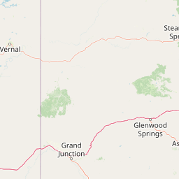
Map view of Raggeds Wilderness

Use this park location map to pinpoint Raggeds Wilderness in United States of America, understand its exact geographic position, and read its mapped placement within the surrounding landscape more clearly.

Pigeon | © OpenStreetMap contributors

Location context for Raggeds Wilderness

ColoradoGunnison County
Recorded earthquake history

Examine the Recorded Earthquake History of the Raggeds Wilderness

Delve into the documented seismic records associated with the rugged terrain of the Raggeds Wilderness. This MoriAtlas collection provides a transparent view of historical earthquake events in the Elk Mountains region to support thorough geographic discovery.

Raggeds Wilderness Earthquake History

Catalogued events

11 events

Strongest magnitude

Magnitude 3.5

Most recent event

Jul 8, 1993

This history includes earthquakes recorded inside the park or within 50 km of its borders

Park atlas

Compare surrounding Elk Mountains terrain and connected regional wilderness corridors.

Explore Other Parks Near Raggeds Wilderness and Protected Landscapes

Browse protected areas near Raggeds Wilderness to examine matching alpine terrain and high-country ecosystems across the surrounding region. Comparing adjacent mountain wilderness units reveals broader conservation patterns within the Colorado Rockies.
A horizontal watercolor illustration depicting soft layers of green rolling hills, a band of trees, and distant pinkish mountain peaks against a white background.
Protected landscapeColorado
About 21 km away#1 closest

South

Gunnison National Forest: Atlas and Geographic Overview of a Colorado Protected Landscape

Mapping deep wilderness areas and high mountain watersheds

Spanning over one million acres in western Colorado, this protected landscape features dramatic glaciated valleys, subalpine meadows, and iconic volcanic features. The forest anchors the Gunnison River headwaters and offers significant insights into the ecological structure of the Southern Rocky Mountains and its dense concentration of wilderness zones.

Area
6,766.89 km²
Established
1905
Relief
Mountain
Climate
Alpine
A soft watercolor illustration depicting a flat-topped mountain landscape with a line of trees and a foreground meadow.
Protected landscapeColorado
24 km away#2 closest

West

Grand Mesa National Forest: A Comprehensive Atlas of Colorado High-Plateau Geography

Mapping the basalt-capped flat-top mountain terrain

Grand Mesa National Forest stands as a primary protected landscape within the Colorado Rockies, characterized by its signature basalt-capped plateau. This forest unit serves as a vital geographic landmark, offering unique insights into high-altitude mountain terrain, subalpine water systems, and historical forest conservation. Learn about the boundaries and physical landscape features that define this massive elevated tableland above the surrounding dry valleys.

Area
1,402.46 km²
Established
1892
Relief
Highland
Climate
Alpine
Watercolor painting of a serene mountain landscape featuring rolling hills, coniferous trees, and a lake in the foreground, rendered in light pastel tones.
Protected landscapeColorado
41 km away#3 closest

Southeast

San Isabel National Forest: Geographic Overview and Protected Mountain Landscape Atlas

Central Colorado alpine terrain and designated wilderness areas

Spanning eleven counties in central Colorado, San Isabel National Forest serves as a cornerstone of the Southern Rocky Mountains. The forest landscape is dominated by the Sawatch and Sangre de Cristo ranges, offering a unique atlas of alpine tundra, dense coniferous forests, and high-altitude peaks that define the character of the region. This protected area provides a vital habitat and a vast, rugged environment characterized by volcanic formations like the Spanish Peaks and glacial geological features.

Area
4,533.42 km²
Established
1902
Relief
Mountain
Climate
Alpine
A wide watercolor illustration depicting a gentle landscape with green hills, scattered trees, and a pale sky with pink and purple hues.
Wildlife reserveGunnison County
About 44 km away#4 closest

Southeast

Fossil Ridge Wilderness: Mapped Geography and Protected Landscapes in Gunnison County

High-altitude ridges, Paleozoic geology, and alpine wilderness character.

Fossil Ridge Wilderness sits as a compact but geographically rich protected area within the Gunnison National Forest. This site offers an detailed look at high-elevation Rocky Mountain terrain, characterized by exposed carbonate rock, deep drainage corridors, and dramatic vertical relief that serves as essential habitat for bighorn sheep and mountain goats.

Area
56.62 km²
Established
1993
IUCN
Ib
Relief
Mountain
A soft watercolor painting of a mountain landscape with rolling green hills in the foreground and layered, pale purple peaks in the distance.
Wildlife reservePitkin County
About 46 km away#5 closest

Northeast

Hunter-Fryingpan Wilderness: Mapped Protected Geography in the Central Rocky Mountains

High-altitude wilderness area in Pitkin County, Colorado

Hunter-Fryingpan Wilderness encompasses approximately 82,000 acres of rugged terrain near the continental divide. This protected area acts as a headwaters sanctuary for the Fryingpan River and Hunter Creek, defined by its steep granite ridges, subalpine meadows, and clusters of pristine alpine lakes. Understanding its geography reveals the stark, glaciated character of the central Colorado Rockies.

Area
331.95 km²
Established
1978
IUCN
Ib
Relief
Mountain
A horizontal watercolor painting showing layers of pale green and soft pink mountain ridges behind a foreground of simple green and purple evergreen tree shapes.
Wildlife reserveColorado
47 km away#6 closest

Northeast

Mount Massive Wilderness: A Protected Alpine Landscape in the Colorado Sawatch Range

High-altitude wilderness geography and Continental Divide terrain.

Mount Massive Wilderness represents a critical protected landscape in the central Colorado Rockies, encompassing glacially carved valleys, alpine tundra, and the second-highest peak in the state. This wilderness area provides a window into the rugged vertical relief and subalpine ecosystems that define the high-altitude geography surrounding Leadville, anchored by the iconic Sawatch Range and Continental Divide.

Area
123.6 km²
Established
1980
IUCN
Ib
Relief
Mountain
National parkMontrose County
48 km away#7 closest

Southwest

Black Canyon of the Gunnison National Park: Protected Area Geography and Mapped Landscape

Explore the natural terrain and protected boundaries in Montrose County.

Black Canyon of the Gunnison National Park is a national park defined by its profound geological features and its status as a protected landscape. Located within Montrose County, it offers a distinct geographic profile for atlas-based exploration. Users can understand the park's mapped boundaries, its relation to the surrounding regional geography, and the unique natural terrain that defines this protected area, contributing to a structured discovery of its natural landscape identity.

Area
124.4 km²
Established
1999
IUCN
II
Visitors
357.1K annual
A minimalist watercolor illustration showing soft green hills, purple mountains in the background, and a reflective water body in the foreground.
Protected areaColorado
About 50 km away#8 closest

South

Curecanti National Recreation Area: Mapped Geography and Protected Landscapes of Western Colorado

River-based recreation and volcanic canyon terrain

Curecanti National Recreation Area stretches across Gunnison and Montrose counties, serving as a primary water-based protected landscape in Colorado. The area preserves the geologic transitions from the broad expanse of Blue Mesa Reservoir to the granite-walled canyons of Morrow Point and Crystal, offering a deep look into the regional geography and historical infrastructure of the Gunnison basin.

Area
174.4 km²
Established
1965
Visitors
807.1K annual
Relief
Mountain

Common questions about visiting, size, designation, and location context for Raggeds Wilderness

Raggeds Wilderness FAQs for park facts, access, geography, and protected area context

Find quick answers about Raggeds Wilderness, including protected-area facts, park geography, trail and visitor context, and how the park fits into its surrounding country and regional landscape.
MoriAtlas Explorer

Continue Your Protected Areas Search Across the Global Atlas

Deepen your exploration by continuing the structured search for national parks and protected areas worldwide. Utilize the comprehensive filtering capabilities to compare different conservation landscapes and refine your understanding of global park geography. Discover more about the distribution and characteristics of protected natural areas.

Global natural geography