
Mori Atlas logo
Nature reserveRainbow Valley Conservation Reserve

Examining the ancient sandstone formations and arid-zone heritage of this Northern Territory reserve.

Rainbow Valley Conservation Reserve: A Detailed Geographic and Landscape Map Analysis

Rainbow Valley Conservation Reserve represents a striking protected landscape in the heart of Australia's Northern Territory. Spanning 24 square kilometres of arid terrain, the area is defined by its vibrant, horizontally banded sandstone bluffs and fragile claypan ecosystems. This analysis explores the geological profile, ancient sedimentary features, and significant archaeological sites that characterize this unique conservation area, offering a clear perspective on its regional geographic importance.

arid landscapesandstone formationsAboriginal heritagejoint managementclaypanspinifex grasslands
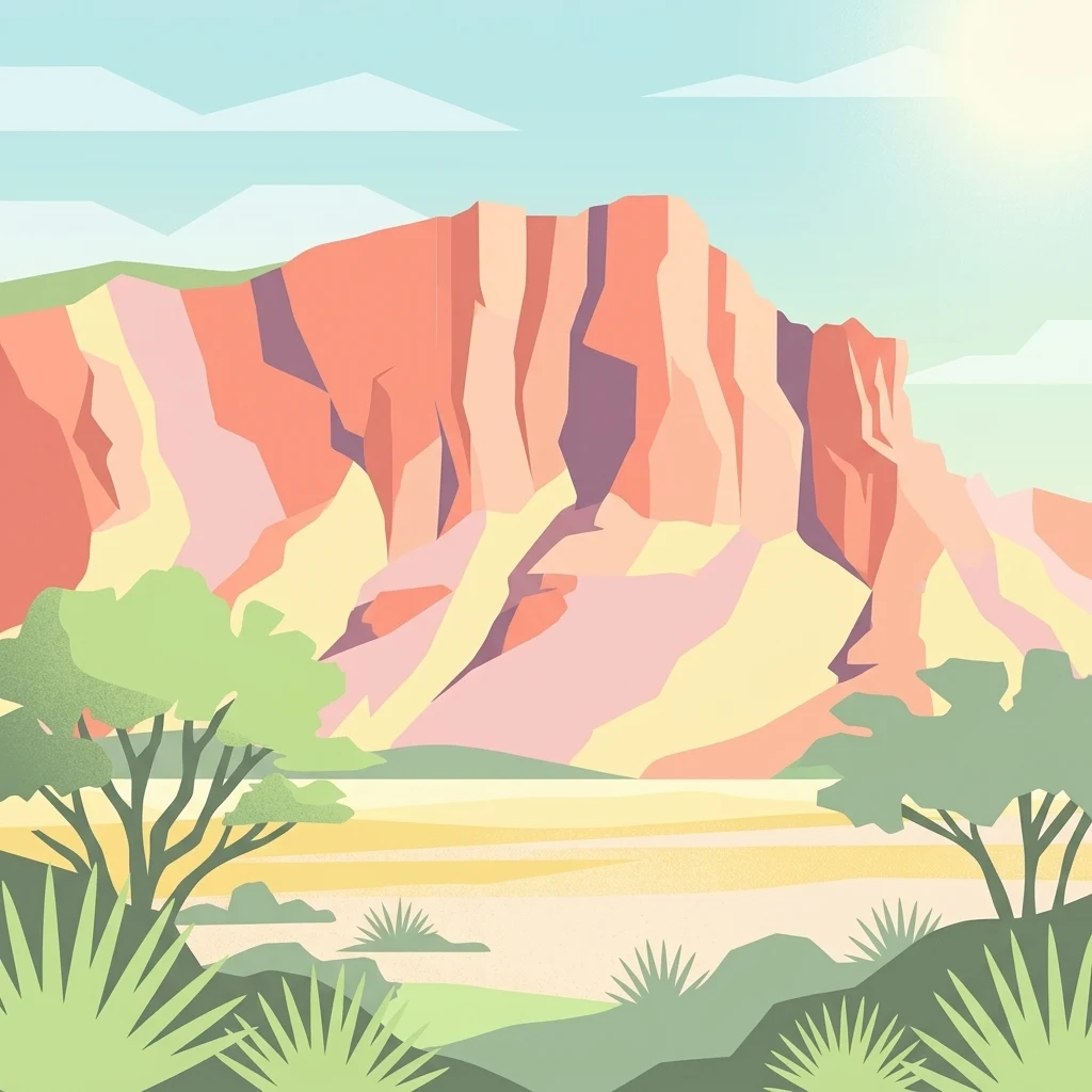
A graphic illustration showing a large, red, multi-layered sandstone cliff face under a bright sun, with desert scrub and small trees in the foreground.

Rainbow Valley Conservation Reserve

Nature reserve

Park overview

Structured park overview, official facts, and landscape profile for Rainbow Valley Conservation Reserve

Rainbow Valley Conservation Reserve park facts, protected area profile, and essential visitor context

Review the core facts for Rainbow Valley Conservation Reserve, including designation, size, terrain, visitor scale, habitats, and operating context in one park-focused overview.

About Rainbow Valley Conservation Reserve

Rainbow Valley Conservation Reserve occupies a remote pocket of the Australian outback south of Alice Springs, where the ochre and rust tones of central Australia's desert landscape take on an unusually vivid, banded character. The reserve's defining feature is a large freestanding sandstone bluff whose exposed rock face displays alternating layers of iron-stained red, white, and pale yellow sandstone, producing the rainbow-like striping for which the place is named. This dramatic geological canvas is amplified by the area's isolation, low humidity, and clean desert light, especially during the late-day sun when the northwest-facing cliffs glow with warm gold tones.

The reserve was created in 1990 specifically to safeguard these unusual sandstone formations and the Aboriginal cultural heritage surrounding them. Its landscape combines eroded cliffs, honeycomb weathering patterns, fossil-bearing sandstone, claypans, spinifex-dominated sandplains, and zones of mulga woodland growing almost directly out of the rock. A marked walking trail leads to a smaller formation commonly known as Mushroom Rock, where fairy martins build nests high on the rock wall. Together, the bluff, the claypans, and the broader sandplain form a self-contained arid environment that feels far removed from any town, despite being within a day's drive of Alice Springs.

A defining feature of Rainbow Valley's identity is its cultural and management relationship with the Twertentyeye people of the Upper Southern Arrernte. The Twertentyeye refer to the main bluff as Wurre and to the broader country as Imarnte, and their connection to the reserve goes back countless generations. From 2008 onward, Rainbow Valley became the first conservation reserve in the Northern Territory to operate under a joint management plan between an Aboriginal traditional owner group and the Parks and Wildlife Commission of the Northern Territory. This arrangement both recognises Aboriginal authority over the land and integrates conservation, access controls, and cultural protection into a single framework, ensuring that the rock art, sacred sites, and delicate formations remain protected while remaining accessible to respectful visitors.

Quick facts and research context for Rainbow Valley Conservation Reserve

Rainbow Valley Conservation Reserve sits in the central Australian arid zone, about 75 kilometres south of Alice Springs along a turn-off from the Stuart Highway. It protects roughly 24.83 square kilometres of sandstone formations, claypans, spinifex sandplains, and mulga woodland under IUCN Category V protected landscape status.

Established in 1990, Rainbow Valley was the first Northern Territory conservation reserve to be placed under joint Indigenous and government management, with the Twertentyeye group of Upper Southern Arrernte people and the Parks and Wildlife Commission of the Northern Territory sharing stewardship from 2008. The reserve protects both the 350-million-year-old Hermannsburg Sandstone formations and a remarkable concentration of Aboriginal heritage sites in central Australia.

Protection and recognition

Terrestrial conservation scope, designation history, and recognition data

Rainbow Valley Conservation Reserve Protection Status and Recognition

Rainbow Valley Conservation Reserve maintains a documented terrestrial protection scope and structured conservation parameters. Official records compile available management parameters, designation history, and international recognition records for public analysis.

Protection details

Protection scope
Terrestrial
Transboundary protection
No
Park context

Deeper park guide and search-rich context for Rainbow Valley Conservation Reserve

Rainbow Valley Conservation Reserve history, landscape, wildlife, and travel context

Explore Rainbow Valley Conservation Reserve through its history, landscape character, ecosystems, wildlife, conservation priorities, cultural context, and seasonal travel timing in a structured park guide built for atlas discovery and search intent.

Why Rainbow Valley Conservation Reserve stands out

Rainbow Valley is best known for its vivid, horizontally banded sandstone bluff, where deep red-orange iron-rich layers alternate with pale yellow and white strata that glow in late afternoon sunlight. The formations are composed of 350-million-year-old Hermannsburg Sandstone, and the dramatic colour pattern is the result of ancient wetter climates washing iron minerals through the rock and re-cementing them along the surface. The reserve is also distinguished by its pioneering joint management arrangement with the Twertentyeye, its restricted-access cultural sites containing petroglyphs, pictographs, grinding stones, and the sacred massif Ewerre, and its combination of ancient geology with fragile arid-zone habitats that support rare plants such as Eremophila Rainbow Valley and the vulnerable black-flanked rock-wallaby.
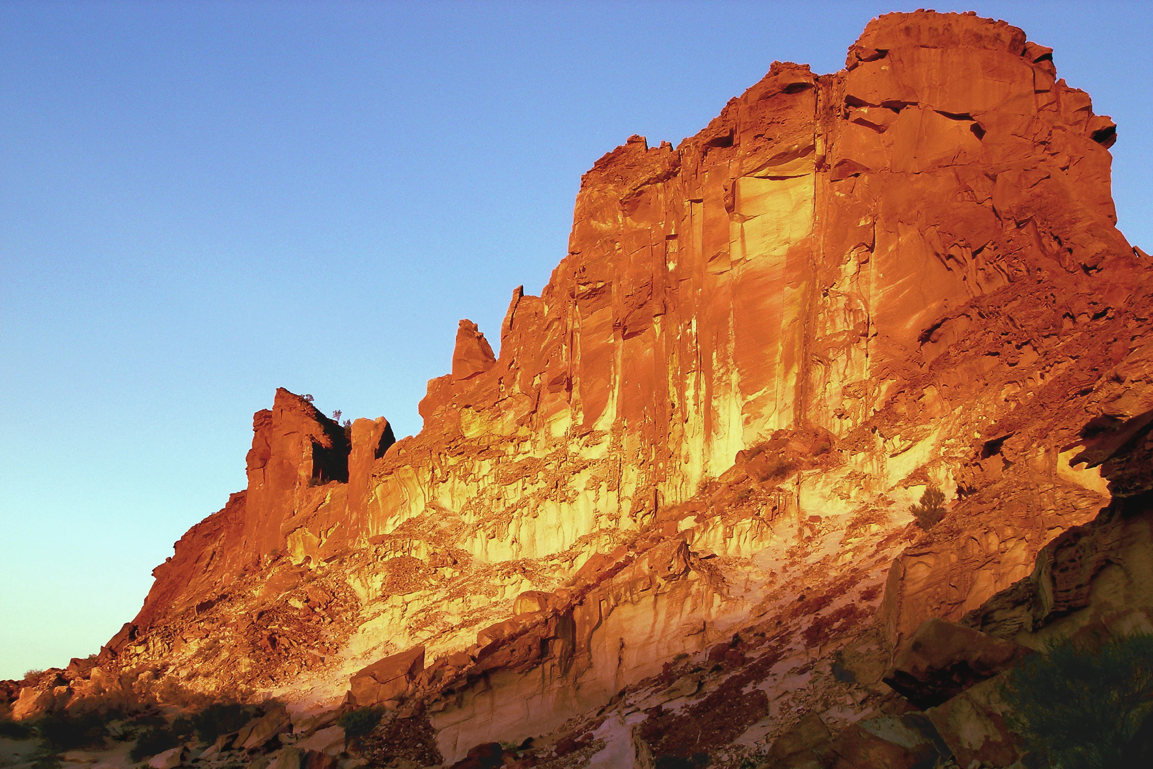
A large sandstone rock formation with deep red and orange colors lit by sunset against a clear blue sky in Rainbow Valley Conservation Reserve.
Sunset light illuminating the sandstone cliffs of Rainbow Valley Conservation Reserve.

Rainbow Valley Conservation Reserve history and protected-area timeline

Rainbow Valley Conservation Reserve was formally established in 1990 to protect a striking cluster of sandstone formations and the significant Aboriginal heritage surrounding them. From the outset, the reserve's purpose was twofold: to conserve the geological character of the colourful bluff and surrounding rock outcrops, and to protect the petroglyphs, pictographs, grinding stones, stone tools, quarries, and camp sites recorded within the landscape.

The reserve's history is closely intertwined with the long-standing presence of the Twertentyeye group of Upper Southern Arrernte people, who identify the main bluff as Wurre and the surrounding country as Imarnte, and who consider the massif Ewerre to the south and the dark rocks on the northern side of the bluff as sacred natural objects. In 2008, the reserve entered a new chapter when management was formally shared between the Twertentyeye traditional owners and the Parks and Wildlife Commission of the Northern Territory. This made Rainbow Valley the first conservation reserve in the Northern Territory to operate under a joint management plan, recognising Aboriginal custodianship while keeping the reserve within the formal protected-area system of the Territory.

Rainbow Valley Conservation Reserve landscape and geographic character

The landscape of Rainbow Valley Conservation Reserve is dominated by a single bold geological feature: a large sandstone bluff that rises abruptly from a broad, flat claypan. The bluff is formed of Hermannsburg Sandstone roughly 350 million years old, and its layered face is the source of the reserve's name. Distinct reddish bands, created by iron-rich minerals that once dissolved and were re-deposited across the rock surface, alternate with lighter, almost white or pale gold layers. On top, a darker red iron-rich caprock resists erosion more effectively than the softer sandstone below, delaying the structural collapse of the formation and giving the bluff its blocky, table-like profile.

Around and beneath the bluffs, the terrain shifts into a mixture of features typical of the central Australian arid zone. There are weathered rocky outcrops patterned with honeycomb erosion, exposed sandstone joints and fossils, and a fragile claypan that spreads to the northwest of the main bluff. The sandplains around the reserve carry a sparse cover of spinifex, while mulga trees take hold in cracks and shelves on the rock itself, and desert oaks and coolibahs occupy different flanks of the formation. The reserve lies in one of the driest parts of the country, where median annual rainfall near Alice Springs is well under 300 millimetres per year and evaporation vastly exceeds precipitation, so the modern landscape is shaped as much by aridity as by ancient sedimentary processes.

Rainbow Valley Conservation Reserve ecosystems, habitats, and plant life

Despite its small size and harsh setting, Rainbow Valley Conservation Reserve supports a rich cross-section of arid-zone plant communities. More than four hundred plant species have been recorded across the reserve. Spinifex grasslands dominate the open sandplains, acacia shrubs are widespread, and coolibah trees cluster in the western parts of the reserve. Mulga grows remarkably close to the sandstone formations and is even able to take root in cracks on the rock faces themselves, while desert oaks are more characteristic of the eastern side of the main bluff.

Particular botanical interest lies in rare and restricted-range shrubs. Eremophila Rainbow Valley is a sandplain shrub listed as vulnerable under the Environment Protection and Biodiversity Conservation Act 1999 and survives only in a very restricted range with no protection in any other reserve. Daviesia arthropoda is another rare shrub tied to the reserve's sand dunes. Together with grevillea and eremophila shrubs, these plants form important habitat for migratory and resident desert bird species, while zygochloa and spinifex provide structural cover for ground-dwelling wildlife. The reserve's vegetation patterns shift with subtle changes in soil, slope, and exposure, producing a patchwork habitat despite the uniformity of the surrounding outback.

Rainbow Valley Conservation Reserve wildlife and species highlights

Rainbow Valley Conservation Reserve is home to a diverse arid-zone fauna, with 110 bird species, 20 mammal species, 46 reptile species, and three frog species recorded within its small footprint. The euro, or common wallaroo, is the most commonly observed mammal, while the black-flanked rock-wallaby is the only mammal with a formal conservation listing, recognised as vulnerable under the EPBC Act and near threatened under the Territory Parks and Wildlife Conservation Act. Emus, dingoes, bats, and honeypot ants are also present, and the latter three groups carry particular significance in local Aboriginal culture. Bat species recorded include Gould's wattled bat and the lesser long-eared bat.

Birdlife is one of the reserve's strongest wildlife features, drawing on grevillea and eremophila shrubs for breeding habitat and on the spinifex and zygochloa grasslands for ground cover. Migratory black, brown, and pied honeyeaters nest in the flowering shrubs, while the white-winged fairywren occupies the grassland understorey. Other notable species include the grey falcon, redthroat, and red-tailed black cockatoo, all listed as lower risk near threatened under the Territory Parks and Wildlife Conservation Act. Fairy martins build colonies high on the rock walls near Mushroom Rock. Reptiles such as the thorny devil and the trilling frog are also part of the reserve's wildlife profile, rounding out a community well adapted to one of the driest parts of the continent.

Rainbow Valley Conservation Reserve conservation status and protection priorities

Rainbow Valley Conservation Reserve plays an important conservation role despite its modest size, protecting a tightly defined set of values that are difficult to replicate elsewhere. Its 24.83 square kilometres safeguard a particularly expressive example of central Australian sandstone geomorphology, including the characteristic iron-stained banding, fossil-bearing strata, and fragile honeycomb weathering that could easily be damaged by human activity. Climbing on or disturbing the formations is prohibited, and access to sensitive areas such as the claypans requires a permit when conditions are appropriate.

Vegetation conservation is another key focus. The reserve protects more than four hundred plant species in an arid environment where habitat is fragile, and it hosts the only known protected populations of Eremophila Rainbow Valley, listed as vulnerable under the Environment Protection and Biodiversity Conservation Act 1999. It also supports Daviesia arthropoda on its sand dunes and provides important habitat for the vulnerable black-flanked rock-wallaby. Bird species of conservation concern, including the grey falcon, redthroat, and red-tailed black cockatoo, benefit from the structural diversity of the shrub and grassland mosaic. The reserve's significance is reinforced by its pioneering joint management arrangement with the Twertentyeye people, which combines Western protected-area governance with Aboriginal cultural custodianship, creating a model that has shaped how other Northern Territory reserves are managed.

Rainbow Valley Conservation Reserve cultural meaning and human context

Rainbow Valley carries deep and continuing cultural meaning for the Twertentyeye group of Upper Southern Arrernte people, who consider the main bluff, known to them as Wurre, and the surrounding country, known as Imarnte, to be part of their traditional homeland. Their long connection to this landscape is reflected in more than forty recorded Aboriginal archaeological sites throughout the reserve. These include engraved rock art (petroglyphs), painted rock art (pictographs), grinding stones, stone tools, quarries, and camp sites that together document a sustained human relationship with the valley.

Certain features hold particular cultural weight. The massif known as Ewerre, lying to the south of the main formation, is registered as a sacred site, as is the surrounding buffer zone. The dark rocks along the northern side of the bluff are considered significant natural objects and are not to be moved or disturbed. All archaeological sites fall within a restricted-access zone, and entry requires permission and a guide. Since 2008, the Twertentyeye have shared formal management of the reserve with the Parks and Wildlife Commission of the Northern Territory, making Rainbow Valley not only a place of natural and geological significance but also a working example of cultural authority and conservation working together in central Australia.

Top sights and standout views in Rainbow Valley Conservation Reserve

Rainbow Valley Conservation Reserve's standout qualities are its geological spectacle, its pioneering joint management model, and the depth of its Aboriginal heritage. The vivid banded bluff of Hermannsburg Sandstone, with its dark red iron-rich caprock over paler yellow and white layers, is the most visually arresting feature and changes character dramatically through the day. Nearby, Mushroom Rock offers a secondary geological attraction combined with active fairy martin nesting colonies high on the rock walls.

Equally notable is the reserve's status as the first conservation reserve in the Northern Territory to operate under a joint management plan with Aboriginal traditional owners, and its concentration of more than forty archaeological sites, including petroglyphs, pictographs, sacred sites, and the Ewerre massif. These features combine with rare arid-zone plants such as Eremophila Rainbow Valley and threatened wildlife like the black-flanked rock-wallaby to make a small reserve with an unusually rich mix of values.

Best time to visit Rainbow Valley Conservation Reserve

Rainbow Valley's character changes with the central Australian seasons, and timing a visit around light and temperature can make a major difference. The cooler months, broadly from late autumn through early spring, are generally the most comfortable period for being outdoors in this arid environment, when daytime heat is less intense and overnight camping conditions at the reserve's designated sites are more pleasant.

Late afternoon to sunset is widely considered the most rewarding time of day to experience the reserve. Low-angle sunlight rakes across the northwest-facing cliffs, intensifying the red iron-rich bands and turning the paler sandstone into glowing gold. After significant rain, the landscape can briefly transform, with the single rockhole holding water for extended periods and temporary changes in vegetation cover and claypan condition. Because the area lies in a drought-prone region with irregular rainfall, visitors should be prepared for hot, dry conditions at any time of year and for the access road's suitability to vary with weather and recent traffic.
Monthly climate preview

Long-term monthly temperature and precipitation patterns across representative terrain

Rainbow Valley Conservation Reserve Climate Normals and Temperature Rhythms

Historical NASA Power climatology measurements reveal distinct monthly temperature swings and precipitation patterns across the representative point of Rainbow Valley Conservation Reserve. Analyzing twelve-month averages provides precise historical context for long-term temperature ranges and precipitation metrics.
Annual mean23 °C
13 °C31 °C
Jan31°
Feb30°
Mar27°
Apr22°
May17°
Jun13°
Jul13°
Aug15°
Sep21°
Oct25°
Nov28°
Dec30°
Warmest month
January

31.3 °C

Coolest month
July

12.8 °C

Wettest month
February

1.5 mm/day

Driest month
August

0.1 mm/day

Park location guide

Geography guide, regional context, and park location map for Rainbow Valley Conservation Reserve

Rainbow Valley Conservation Reserve park geography, regions, and map view in Australia

Understand where Rainbow Valley Conservation Reserve sits in Australia through a broader geographic reading of the surrounding landscape, nearby location context, and its mapped position within the national park landscape.

How Rainbow Valley Conservation Reserve fits into Australia

Australia is a constitutional monarchy and federal parliamentary democracy comprising six states and ten territories. With a population of nearly 28 million, it is one of the world's most urbanised countries, with most people concentrated on the eastern seaboard. The country has a high Human Development Index and is known for its cultural diversity, ancient Aboriginal heritage, and unique wildlife.

Wider geography shaping Rainbow Valley Conservation Reserve in Australia

Australia occupies the entire Australian continent, the island of Tasmania, and numerous smaller islands. It is the world's flattest and driest inhabited continent, featuring vast deserts in the interior (the Outback), tropical rainforests along the eastern coast, and a coastline bordering the Indian and Pacific Oceans.

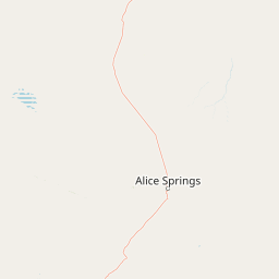
Map view of Rainbow Valley Conservation Reserve

Use this park location map to pinpoint Rainbow Valley Conservation Reserve in Australia, understand its exact geographic position, and read its mapped placement within the surrounding landscape more clearly.

Pigeon | © OpenStreetMap contributors

Location context for Rainbow Valley Conservation Reserve

Northern Territory

Visualizing the sandstone bluffs, arid terrain, and protected habitats of Central Australia

Rainbow Valley Conservation Reserve Photos, Landscapes, and Scenery

Examinations of Rainbow Valley Conservation Reserve imagery reveal the striking geological layers, iron-stained sandstone bluffs, and fragile arid-zone terrain that define the protected landscape. Detailed visual documentation helps researchers and visitors analyze the distinctive regional environment, native vegetation, and sedimentary formations without relying on generic descriptions.

A large sandstone rock formation with deep red and orange colors lit by sunset against a clear blue sky in Rainbow Valley Conservation Reserve.

A panoramic wide shot of red sandstone bluffs with vertical striations, rising above a flat, sandy desert floor under a clear blue sky.

Park atlas

Compare surrounding desert terrain, sandstone formations, and regional reserves

Exploring Other Parks and Protected Areas Near Rainbow Valley Conservation Reserve

Browsing nearby national parks and protected areas provides broader regional context for the geological features found around Rainbow Valley Conservation Reserve. Comparing adjacent desert terrain and arid landscapes helps connect individual conservation sites into a wider geographical network.
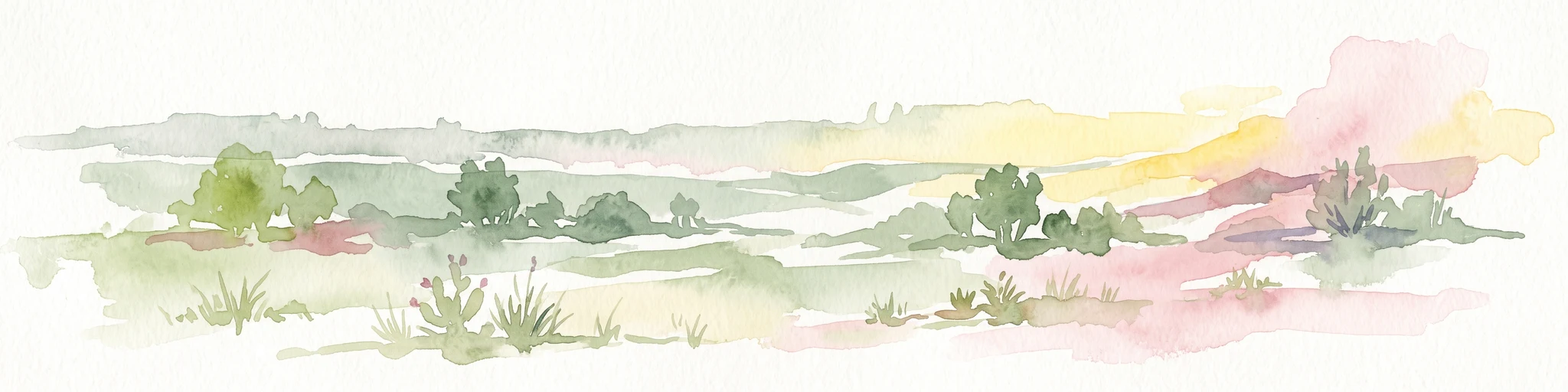
Watercolor painting of a soft, abstract landscape with a line of trees against rolling hills and light, hazy colors.
Nature reserveNorthern Territory
About 46 km away#1 closest

Northeast

Napwerte / Ewaninga Rock Carvings Conservation Reserve: Protected Desert Landscape Map

Cultural heritage and arid basin geography in the Northern Territory

Napwerte / Ewaninga Rock Carvings Conservation Reserve protects a unique desert site defined by its extensive collection of prehistoric Arrernte rock engravings. The landscape encompasses rocky outcrops, red sand dunes, and a seasonal claypan that captures rare rainfall, creating a significant intersection of archaeological history and arid-zone ecology in central Australia.

Area
0.06 km²
Established
1970
IUCN
V
Relief
Lowland
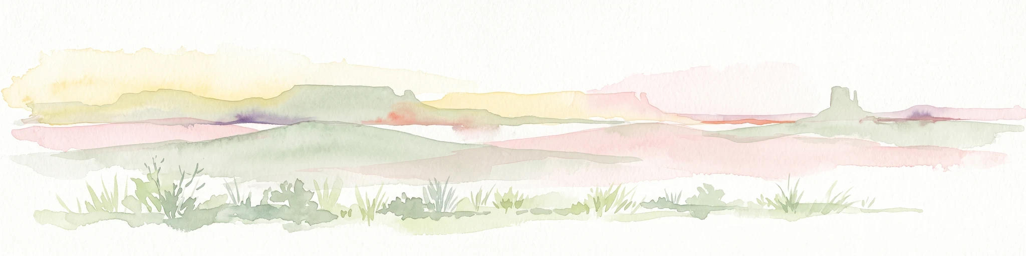
A pale, minimalist watercolor painting of an arid, desert-like landscape with sparse green shrubs and grasses against a soft pastel background.
Natural monumentNorthern Territory
About 57 km away#2 closest

Southwest

Henbury Meteorites Conservation Reserve: Geological and Cultural Impact Site Mapping

Northern Territory desert monument and crater field atlas

Henbury Meteorites Conservation Reserve preserves a series of striking impact craters in the heart of the Northern Territory desert. This protected area offers insights into the geological mechanics of meteorite falls and the enduring cultural significance of the site within central Australian history. Its compact crater field creates a distinct topography against the surrounding arid plains, making it a focal point for understanding terrestrial impact morphology.

Area
0.16 km²
Established
1964
IUCN
III
Relief
Lowland
Wildlife reserveNorthern Territory
About 60 km away#3 closest

North

Kuyunba Conservation Reserve: Wildlife Protected Landscape in Central Australia

Mapped geography and rocky habitat near Alice Springs

Kuyunba Conservation Reserve represents a focused approach to habitat protection in the Northern Territory. The terrain is defined by its rocky hills and boulder-filled escarpments, offering critical shelter for wildlife in an arid, drought-adapted desert region. This site provides a clear view of how targeted land management supports specialized ecological niches in inland Australia.

Area
6.29 km²
Established
1970
IUCN
V
Relief
Upland
A soft watercolor painting of a desert landscape featuring rolling plains and a prominent, pillar-like rock formation on the horizon under a pale sky.
Natural monumentNorthern Territory
About 61 km away#4 closest

South

Chambers Pillar Historical Reserve: An Atlas of a Significant Northern Territory Sandstone Landmark

Geographic analysis of an iconic Australian outback desert monument

Chambers Pillar is a striking 50-meter sandstone column anchored in the arid plains of central Australia. This historical reserve serves as an essential subject for geological and regional mapping, offering a clear look at how isolated formations define the vast outback horizon. Explore the intersection of 350-million-year-old rock formations and the shifting desert sands that shape this protected cultural and natural site.

Area
3.4 km²
Relief
Lowland
Climate
Arid
Access
Remote access
National parkNorthern Territory
About 62 km away#5 closest

Northwest

Tjoritja / West MacDonnell National Park: National Park Atlas and Protected Landscape

Explore the dramatic MacDonnell Ranges terrain and geography.

Delve into the protected geography of Tjoritja / West MacDonnell National Park, a significant national park in Australia's Northern Territory. This landscape features striking mountain formations, deep gorges like Standley Chasm and Glen Helen, and is intrinsically linked to the famous Larapinta Trail and the Arrernte people's cultural heritage. Understanding its mapped boundaries and regional context provides essential insight into this iconic Central Australian protected area.

Area
2,568.61 km²
Established
1992
IUCN
II
Relief
Mountain
Watercolor painting of a landscape with green valleys, pink and yellow mountain peaks, and distant hills
National parkNorthern Territory
About 77 km away#6 closest

Northwest

Finke Gorge National Park: Explore Its Protected Landscape and Geographic Identity

Mapped boundaries and natural terrain within Northern Territory.

Finke Gorge National Park represents a significant protected area within the Northern Territory, Australia. This national park offers valuable insights into the region's geography, mapped landscapes, and natural terrain. Detailed information helps users understand the park's protected boundaries and its role in the broader context of Australian conservation lands, ideal for focused atlas exploration.

Area
452.85 km²
Established
1966
IUCN
V
Visitors
18K annual
National parkAustralia
About 89 km away#7 closest

Northwest

West MacDonnell National Park: Australia's Outback Mountain Landscape and Protected Area

Explore mapped gorges, waterholes, and regional geography in the Red Centre.

West MacDonnell National Park serves as a key protected area within Australia's arid interior, delineating the dramatic western MacDonnell Ranges. This national park offers a unique opportunity to study its mapped landscape, characterized by ancient sandstone ridges, deep gorges, and permanent water sources that support endemic biodiversity. Its profound connection to Aboriginal cultural heritage and its status as a conservation reserve make it essential for understanding the geography and protected lands of central Australia's Red Centre.

Area
2,048 km²
Established
1992
IUCN
II
Relief
Mountain
Protected landscapeNorthern Territory
About 92 km away#8 closest

Northeast

Corroboree Rock Conservation Reserve: Geological and Cultural Protected Area in Central Australia

Mapped protected landscape within the East MacDonnell Ranges

Corroboree Rock Conservation Reserve features a striking dolomite rock formation tied to ancient Precambrian salt lake sediments. Located east of Alice Springs, the reserve provides a protected glimpse into central Australian arid range geography and holds profound cultural importance for the Eastern Arrernte Traditional Owners within the surrounding pastoral landscape.

Area
0.07 km²
Established
1962
IUCN
V
Visitors
15K annual

Common questions about visiting, size, designation, and location context for Rainbow Valley Conservation Reserve

Rainbow Valley Conservation Reserve FAQs for park facts, access, geography, and protected area context

Find quick answers about Rainbow Valley Conservation Reserve, including protected-area facts, park geography, trail and visitor context, and how the park fits into its surrounding country and regional landscape.
MoriAtlas Explorer

Continue Your Protected Areas Search Across the Global Atlas

Deepen your exploration by continuing the structured search for national parks and protected areas worldwide. Utilize the comprehensive filtering capabilities to compare different conservation landscapes and refine your understanding of global park geography. Discover more about the distribution and characteristics of protected natural areas.

Global natural geography