
Mori Atlas logo
Protected areaRamla Bay

Tracing the distinctive red sand beaches, limestone cliff formations, and agricultural terrain of the Maltese archipelago.

Ramla Bay Protected Area: A Coastal Landscape Map and Geographic Overview of Northern Gozo

Ramla Bay occupies a wide, low valley on the north-east coast of Gozo, defined by its signature reddish-orange sands and surrounding limestone headlands. This protected landscape extends from the coastal edge into the rural interior of Xagħra, where terraced fields and dry stone walls create a cohesive Mediterranean environment. Examine the mapped boundaries and natural terrain context of this iconic bay as it anchors the northern coastline of the island.

Mediterranean coastGozosandy beachred sandcoastal baylimestone cliffs
A flat-style vector illustration depicting a coastal beach scene with reddish sand, rolling green hills in the background, a blue ocean with gentle waves, and a few beach umbrellas in the foreground.

Ramla Bay

Protected area

Park overview

Structured park overview, official facts, and landscape profile for Ramla Bay

Ramla Bay park facts, protected area profile, and essential visitor context

Review the core facts for Ramla Bay, including designation, size, terrain, visitor scale, habitats, and operating context in one park-focused overview.

About Ramla Bay

Ramla Bay is a small but visually striking bay on the north-east coast of Gozo, in the central Mediterranean. Unlike many of the more sheltered inlets around the Maltese Islands, Ramla Bay opens directly onto a sandy beach backed by a wide, low valley that runs inland toward the surrounding countryside. The bay's most immediately recognisable feature is the colour of its sand, which carries a distinct reddish tone rather than the pale yellow or white sand found at most other Maltese beaches. This unusual coloration gives the bay its Maltese name, Ir-Ramla l-Ħamra, literally 'the red sands'.

Geographically, the bay is framed between two other coastal indentations: Marsalforn, a larger resort and fishing inlet further to the west, and San Blas, a quieter, narrower beach closer to the eastern side. Inland, the terrain rises toward the village of Xagħra, which has historically been the main access point and service centre for visitors to the beach. The beach itself is relatively broad and flat, bordered by rocky headlands that help shelter the bay and give it a contained, almost amphitheatre-like profile when viewed from the surrounding slopes.

A key element of Ramla Bay's identity is its proximity to Calypso Cave, a large natural cave in the limestone cliff above the northern end of the beach. The cave has long been linked in local tradition and popular imagination with the legend of Calypso from Homer's Odyssey, and it forms part of what makes Ramla Bay memorable to visitors beyond the beach itself. Although Ramla Bay is not technically a protected national park, it functions as one of Gozo's most iconic natural landmarks and is central to the island's tourism image.

The bay sits within a landscape that combines agricultural terracing, low cliffs, Mediterranean scrubland, and pockets of remnant woodland typical of Gozo's rural interior. This combination of scenic coastline, distinctive sand, and nearby cultural landmarks has made Ramla Bay one of the most recognised and photographed coastal locations in the Maltese archipelago.

Quick facts and research context for Ramla Bay

Ramla Bay is located on the north-east coast of Gozo in the Maltese Islands, an archipelago in the central Mediterranean Sea. The bay sits between the neighbouring coastal indentations of Marsalforn and San Blas, with the inland village of Xagħra serving as the closest settlement. The defining physical feature of Ramla Bay is its reddish-coloured sand, which is unusual within Malta and gives the bay its Maltese name, Ir-Ramla l-Ħamra. The bay is also closely associated with Calypso Cave, a prominent feature in the headland above the beach.

Protection and recognition

Terrestrial protected area records and international recognition history

Ramla Bay Protection Status and Designated Conservation Frameworks

Ramla Bay holds documented terrestrial protection status within official conservation frameworks. Official records track administrative management scope and designation history across the protected landscape.

Protection details

Protection scope
Terrestrial
Transboundary protection
No
Park context

Deeper park guide and search-rich context for Ramla Bay

Ramla Bay history, landscape, wildlife, and travel context

Explore Ramla Bay through its history, landscape character, ecosystems, wildlife, conservation priorities, cultural context, and seasonal travel timing in a structured park guide built for atlas discovery and search intent.

Why Ramla Bay stands out

Ramla Bay is best known for its beach of reddish-orange sand, a colour that sets it apart from the paler sands more typical of the Maltese coast. The bay is equally recognised for its direct association with Calypso Cave, which overlooks the beach and ties the location to the legendary figure of Calypso from Greek mythology. Together, the vivid sand and the mythological setting give the bay a strong visual and cultural identity that distinguishes it from other coastal spots on Gozo and Malta.
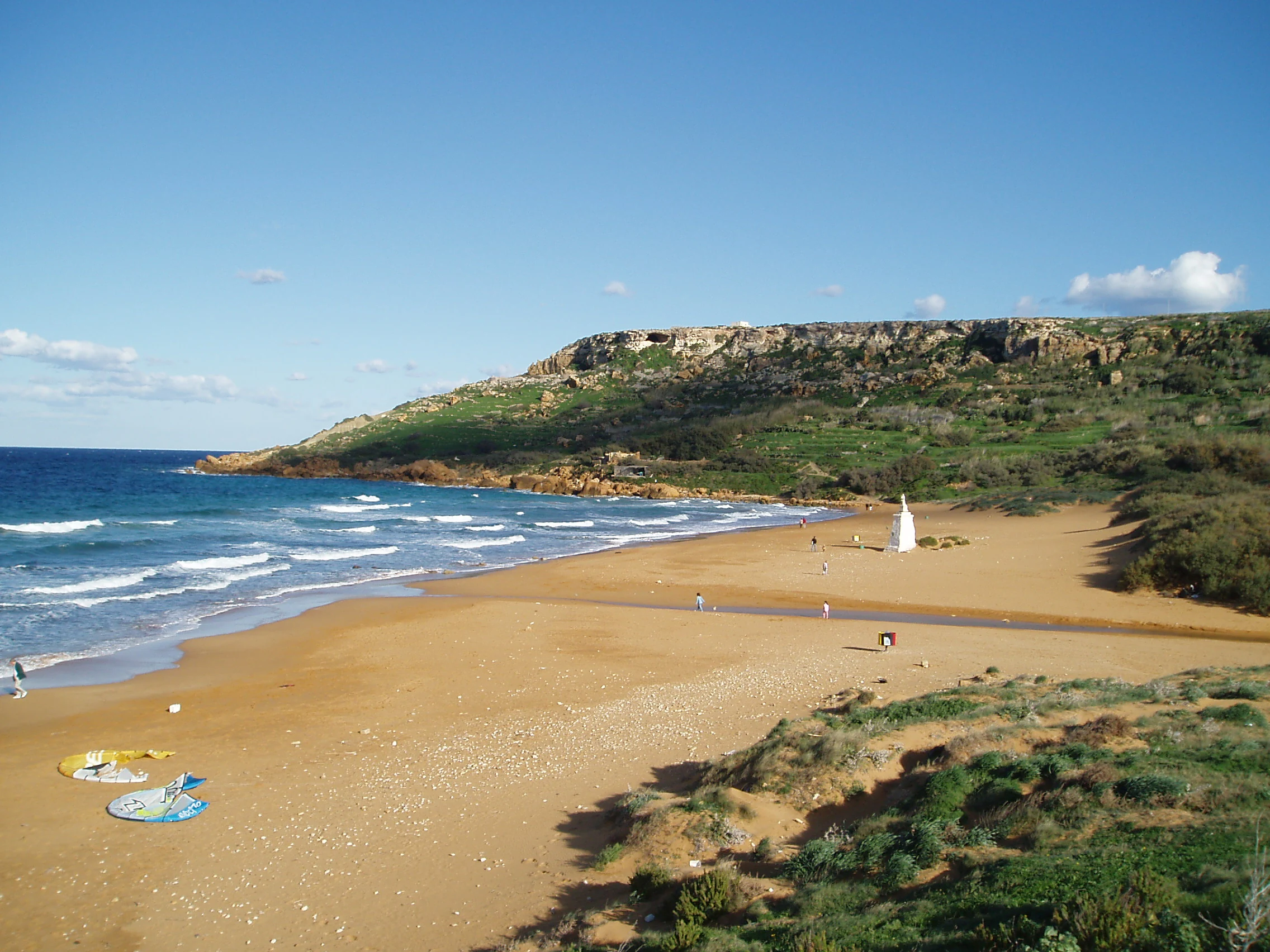
A wide coastal landscape showing a sandy beach with reddish-hued sand meeting the blue sea, framed by a prominent rocky cliff in the background and low dunes in the foreground.
A view of the reddish-sand beach and surrounding coastal cliffs at Ramla Bay, Gozo.

Ramla Bay history and protected-area timeline

Ramla Bay's broader historical significance is tied to its proximity to Calypso Cave, which has been associated with classical mythology for centuries. Locally, the bay has long served as a recreational and cultural focal point for Gozo, accessible from the inland village of Xagħra.

A specific modern chapter in the bay's history opened on June 6, 2007, when the Malta Environment and Planning Authority approved a proposal for the construction of 23 villas next to Calypso Cave. The decision attracted significant opposition from the Superintendent of Cultural Heritage, the Labour Party, Alternattiva Demokratika, and Malta's principal environmental organisations, none of which supported the development. Opponents criticised MEPA for approving the project without requesting a formal environmental impact assessment and called for the resignations of those responsible. The case was expected to be raised with the European Union environment commissioner of the time, Stavros Dimas. Controversy also arose over claims that archaeologists had not objected to the project; the consultants involved publicly clarified that their original report had been prepared to help assess a heritage trail proposal, not a large-scale residential development adjacent to the cave.

Ramla Bay landscape and geographic character

Ramla Bay occupies a relatively wide, low valley that opens northward onto the Mediterranean between two rocky headlands. The beach itself is a broad stretch of sand, notable in the Maltese context for its reddish-orange colour, which contrasts with the pale limestone of the surrounding cliffs and the deeper tones of the inland soil.

Behind the beach, the landscape rises into the gently undulating terrain typical of Gozo's rural interior, with terraced fields, dry stone walls, scattered farmhouses, and patches of Mediterranean vegetation. To the north, the headland carries the limestone formation known as Calypso Cave, a large natural opening in the cliff face that dominates the bay from above.

The combination of open sandy beach, enclosing rocky slopes, and agricultural backdrop gives Ramla Bay a clearly defined, contained visual setting. The overall impression is of a coastal pocket where agricultural countryside meets the sea, framed by limestone cliffs and broken only by the path of the valley that leads down from Xagħra to the shore.

Ramla Bay cultural meaning and human context

Ramla Bay carries strong cultural resonance through its association with Calypso Cave, a large natural cavern in the headland above the beach. The cave has long been linked in local tradition and popular imagination with the figure of Calypso from Homer's Odyssey and has become a symbolic feature of Gozo's identity in tourism and cultural narratives.

The 2007 planning controversy over the proposed villas next to the cave also reflects a wider cultural and environmental tension around how sensitive heritage sites near the bay should be managed. Opponents of the development, including heritage authorities, political parties, and environmental organisations, framed the issue as much about cultural and landscape protection as about building policy, demonstrating how closely the natural setting of Ramla Bay is intertwined with local heritage values.

Top sights and standout views in Ramla Bay

The single most distinctive highlight of Ramla Bay is its reddish-orange sand, a colour rarely seen elsewhere in the Maltese archipelago and one that gives the bay its evocative local name. Equally important is the immediate presence of Calypso Cave in the cliff above the beach, which links the natural landscape of Gozo with one of the most familiar classical legends attached to the island.

The bay's visual setting, framed by low limestone headlands and backed by the agricultural terrain of the Xagħra plateau, adds a sense of openness and rural calm that contrasts with some of the busier coastal areas elsewhere in Malta. Together, these features make Ramla Bay a compact but memorable coastal landmark.

Best time to visit Ramla Bay

Ramla Bay is most rewarding to visit during the warmer months, when the Mediterranean climate offers the stable sea conditions and long daylight hours that suit a sandy bay of this kind. Late spring and early summer typically combine pleasant temperatures with quieter conditions, while the height of summer brings the warmest sea temperatures and the busiest atmosphere on the beach.

Outside the peak summer period, the cooler months still allow visitors to appreciate the bay's distinctive red sand, the headland scenery, and the view of Calypso Cave, though sea conditions are generally more variable. Choosing a time with calm weather helps reveal the full warm tones of the sand against the surrounding limestone, which is one of the bay's most characteristic visual qualities.
Monthly climate preview

Long-term representative measurements for average temperature and monthly precipitation at Ramla Bay

Ramla Bay Climate Normals, Annual Temperature and Precipitation Rhythm

Representative coordinate records from 1991 to 2020 outline the measured annual temperature rhythm and monthly precipitation patterns across Ramla Bay. Examining the complete twelve-month profile provides deeper analytical context for long-term climate behavior at this location.
Annual mean20 °C
14 °C27 °C
Jan15°
Feb14°
Mar15°
Apr16°
May19°
Jun22°
Jul25°
Aug27°
Sep25°
Oct23°
Nov19°
Dec16°
Warmest month
August

26.6 °C

Coolest month
February

13.9 °C

Wettest month
November

3 mm/day

Driest month
July

0.1 mm/day

Park location guide

Geography guide, regional context, and park location map for Ramla Bay

Ramla Bay park geography, regions, and map view in Malta

Understand where Ramla Bay sits in Malta through a broader geographic reading of the surrounding landscape, nearby location context, and its mapped position within the national park landscape.

How Ramla Bay fits into Malta

Malta is a small island nation in the Mediterranean, located between Italy, Tunisia, and Libya. With a population of about 520,000 spread over 316 km², it is one of the world's most densely populated countries. The country has a long history of foreign rule and is known for its strategic position, historic sites, and membership in the EU, Commonwealth, and UN.

Wider geography shaping Ramla Bay in Malta

Malta is located in the Mediterranean Sea between Sicily and North Africa, approximately 80 km south of Italy, 284 km east of Tunisia, and 333 km north of Libya. The archipelago sits at coordinates 35°54′N 14°31′E.

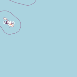
Map view of Ramla Bay

Use this park location map to pinpoint Ramla Bay in Malta, understand its exact geographic position, and read its mapped placement within the surrounding landscape more clearly.

Pigeon | © OpenStreetMap contributors

Location context for Ramla Bay

Gozo

Visual reference guide to red sands, limestone cliffs, and rural Gozo terrain

Ramla Bay Photos and Coastal Landscape Scenery

Explore detailed photography documenting the reddish orange shoreline, rocky headlands, and agricultural valley surrounding Ramla Bay. Visual archives provide clear geographic context for understanding the coastal terrain and protected environment of the Maltese coast.

A wide coastal landscape showing a sandy beach with reddish-hued sand meeting the blue sea, framed by a prominent rocky cliff in the background and low dunes in the foreground.

Park atlas

Compare regional protected areas and connected coastal terrain across Gozo

Explore Parks Near Ramla Bay and Surrounding Protected Coastal Landscapes

Visitors exploring Ramla Bay can browse other parks and protected areas located throughout the surrounding coastal region. Continued comparison reveals broader geographic patterns across Maltese coastal terrain and regional park networks.
A horizontal watercolor painting showing soft green hills, grassy marshland, and a calm water channel under a light, hazy sky.
Nature reserveGozo
About 7.4 km away#1 closest

Southeast

Comino Nature Reserve: Geography, Protected Marine Areas, and Karst Terrain in Gozo

Island ecology and coastal landscape mapping

Examine the protected geography of Comino, an island nature reserve near Gozo defined by limestone plateaus and sheltered bays. This overview covers the ecological boundaries of the Natura 2000 marine area, the distribution of coastal sea caves, and the topographic patterns of this Important Bird Area.

Area
3.5 km²
Relief
Lowland
Climate
Mediterranean
Access
Moderate access
Watercolor painting of a reddish limestone sea arch or islet surrounded by water and faint coastal hills.
Nature reserveGozo
About 8.5 km away#2 closest

West

Fungus Rock: A Protected Limestone Nature Reserve on the Western Coast of Gozo

Geographic landmark and protected coastal terrain

Fungus Rock represents a critical protected landscape at the entrance to Dwejra bay, offering a unique look at Mediterranean limestone geology. Known for its vertical cliff faces and historical botanical significance, this nature reserve remains a defining feature of the Gozitan coastline and the surrounding marine environment.

Area
0.007 km²
Relief
Upland
Climate
Mediterranean
Access
Easy access
A pale, minimalist watercolor painting depicting St Paul's Island in Malta, showing green rolling landforms and a hint of a structure against a light background.
Protected areaMalta
About 15 km away#3 closest

Southeast

St Paul's Island Protected Landscape and Maltese Coastal Geography Overview

Uninhabited Mediterranean island and heritage landmark

St Paul's Island represents a unique Mediterranean limestone islet featuring maritime garigue habitat and historic ruins. Located near the Mellieħa coastline, this protected area provides a compact example of Maltese coastal geography, defined by exposed cliffs and an enduring connection to local maritime history.

Area
0.101 km²
Relief
Lowland
Scope
Mixed
Water
Water-dominated
A horizontal watercolor painting depicting a soft-toned, abstract coastal landscape with gentle green hills, grassy foreground patches, and a calm, pale pool of water against a white background.
Marine protected areaMalta
About 18 km away#4 closest

South

Ras ir-Raħeb Marine Protected Area: Geographic Profile and Mapped Coastal Landscape

Coastal cliffs and protected marine zones in north western Malta.

Ras ir-Raħeb serves as a pivotal marine protected area along the Malta coastline, where high limestone cliffs meet complex underwater habitats. This site links historical archaeological remnants with modern ecological conservation, offering a unique geographic snapshot of the Rabat plateau edge. Its mapped boundaries encompass both the terrestrial promontory and the essential seagrass meadows beneath the surface, providing a critical reference point for Mediterranean coastal geography and protected land status.

Established
2005
Relief
Upland
Climate
Mediterranean
Access
Moderate access
National parkMalta
About 23 km away#5 closest

Southeast

Ta' Qali National Park: Malta's Largest Urban Protected Landscape and Recreation Hub

Mapped Gardens, Event Venues, and Recreational Zones

Ta' Qali National Park serves as a vital green lung in central Malta, showcasing a landscape transformed from a wartime airfield into a modern urban protected area. This national park is recognized for its extensive recreational zones, meticulously designed formal gardens, and a prominent open-air concert venue that hosts major cultural events. Its relatively flat terrain and planned infrastructure offer a distinct map-based perspective on urban parkland, highlighting its significance as a major public amenity and a key feature of Malta's landscape.

Area
0.35 km²
IUCN
V
Relief
Lowland
Climate
Mediterranean
A soft, pastel-toned watercolor painting of a rolling green landscape with a small body of water in the foreground and a silhouette of a building on a hill in the distance.
Wildlife reserveMalta
About 25 km away#6 closest

Southeast

Buskett Gardens Wildlife Reserve: Geography and Protected Landscape Map of Malta

A rare sheltered woodland valley in the central Mediterranean

Buskett Gardens serves as a critical protected woodland in the heart of the Maltese islands. Nestled in the fertile Wied il-Luq valley, the site offers an unusually green, shaded environment of broadleaved trees and conifers. This reserve functions as an Important Bird Area and a historic cultural landscape, providing a lush contrast to the exposed limestone plateau of rural Malta.

Area
0.47 km²
Relief
Upland
Scope
Terrestrial
Water
Minor water
A pale, minimalist watercolor illustration showing soft, rolling green and yellow hills against a white background.
Nature reserveMalta
About 33 km away#7 closest

South

Filfla Nature Reserve: The Protected Limestone Plateau and Geography of Malta

Tracing the limestone cliffs and seabird sanctuary of the Maltese archipelago

Filfla is a small, uninhabited limestone islet lying 4.5 kilometres south of the main island of Malta. Defined by its 60-metre sea cliffs and flat plateau, this protected nature reserve functions as a crucial Important Bird Area and a landmark for regional Mediterranean biodiversity. Examine the mapped boundaries and geological profile of this site to understand its status as the southernmost extremity of the Maltese archipelago.

Area
0.06 km²
Established
1980
Relief
Upland
Climate
Mediterranean
A horizontal watercolor illustration showing soft, blended washes of green, yellow, and pale pink depicting an abstract rolling landscape or horizon line against a white background.
Natural monumentMalta
About 33 km away#8 closest

Southeast

Għar Dalam Natural Monument: A Protected Maltese Cave and Paleontological Landmark

Geological and prehistoric landscape context in southeastern Malta

Għar Dalam is a protected natural monument in Malta that preserves a complex phreatic cave passage and essential fossil records of extinct dwarf species. This cave site acts as a major cornerstone for understanding the prehistoric Mediterranean, documenting the arrival of early Neolithic cultures and the long-term evolution of island-bound animal life through stratified sediment analysis.

Established
1933
Relief
Lowland
Climate
Mediterranean
Access
Easy access

Common questions about visiting, size, designation, and location context for Ramla Bay

Ramla Bay FAQs for park facts, access, geography, and protected area context

Find quick answers about Ramla Bay, including protected-area facts, park geography, trail and visitor context, and how the park fits into its surrounding country and regional landscape.
MoriAtlas Explorer

Continue Your Protected Areas Search Across the Global Atlas

Deepen your exploration by continuing the structured search for national parks and protected areas worldwide. Utilize the comprehensive filtering capabilities to compare different conservation landscapes and refine your understanding of global park geography. Discover more about the distribution and characteristics of protected natural areas.

Global natural geography