
Mori Atlas logo
Nature reserveRatajské rybníky

A highland cascade of connected fishponds and peat mires within the Železné hory region

Ratajské rybníky Protected Nature Reserve in the Highland Terrain of Pardubický kraj

Ratajské rybníky sits within the Kameničská vrchovina highland ridge as a distinct protected landscape of man-made fishponds, wet Molinia meadows, and transitional mires. This site functions as a critical wetland refuge, preserving rare amphibian habitats and specific invertebrate populations otherwise uncommon on the elevated Železné hory terrain. Geography across this valley showcases the complex interplay of saturated peat soils and traditional hydraulic management typical of protected areas in the Czech Moravian Highlands.

fishpondswet meadowspeat miresNatura 2000natural monumenthighland valley
A flat vector-style illustration of a pond filled with lily pads, framed by birch and evergreen trees in the foreground, with hills in the background under a pale sun.

Ratajské rybníky

Nature reserve

Park overview

Structured park overview, official facts, and landscape profile for Ratajské rybníky

Ratajské rybníky park facts, protected area profile, and essential visitor context

Review the core facts for Ratajské rybníky, including designation, size, terrain, visitor scale, habitats, and operating context in one park-focused overview.

About Ratajské rybníky

Ratajské rybníky is a compact wetland reserve centred on a cascade of three fishponds, set in a broad, forested upland valley about two kilometres northeast of the centre of Hlinsko. The site belongs administratively to the Pardubický kraj and okres Chrudim, and physically sits on the southeastern slopes of the Kameničská vrchovina, a locally significant highland that forms part of the Železné hory mountains. Botanically and ecologically, the locality straddles the transitional zone between the warmer Železné hory (Iron Mountains) bioregion and the cooler Žďárské vrchy bioregion, which gives it a distinctive mixture of species from both regions.

The defining feature of the reserve is the relationship between the three small water bodies and the surrounding wet meadows and mires. The ponds were built over more than a century, with the upper, largest and oldest pond dating from around 1855, the lower pond built around 1910 and the smallest middle pond created around 1970. Their stepwise arrangement captures seepage and overland flow from the slopes of Čertovina hill, creating a stable, shallow and biologically productive aquatic environment, while their dams and outflows regulate the groundwater level across the adjacent meadows. The combination of pond edges, sedge-dominated marsh, peat and Molinia meadows, and patches of damp woodland produces a mosaic of habitats that is unusually rich for such a small area.

On the wider landscape scale, Ratajské rybníky is part of a triangle of similarly managed, water-rich protected sites that define the southeastern corner of the protected landscape area, with the other two anchors being the natural monument Bahna and the natural monument Louky v Jeníkově. Together these three sites, arranged around the summit of Pešava on the Železné hory ridge, preserve the cool, groundwater-fed mosaic of meadows, peatlands and ponds that characterises this corner of the Žďárské vrchy protected landscape.

Quick facts and research context for Ratajské rybníky

Ratajské rybníky is a Czech přírodní památka (natural monument) with IUCN management category IV status, also designated as a European Site of Community Importance under Natura 2000. It lies near the town of Hlinsko, in the okres Chrudim, Pardubický kraj, at elevations between roughly 585 and 602 metres within the Kameničská vrchovina highland, part of the Železné hory geomorphological region.

The protected natural monument covers about 11 hectares, while the overlapping Natura 2000 site covers about 20 hectares; both fall within the Chráněná krajinná oblast Žďárské vrchy. The site is built around three cascaded fishponds fed by small, partly seasonal streams on the slopes of Čertovina hill, with water ultimately draining via Blatenský potok to the Chrudimka river. It is recognised for peat and sedge meadows, amphibian-rich ponds, rare mire bryophytes and butterflies of European conservation interest.

Protection and recognition

Documented terrestrial protection history and official Natura 2000 registry data

Ratajské rybníky Protection Status and International Recognition Records

Ratajské rybníky maintains a documented terrestrial protection status established in the year 2005 alongside official Natura 2000 recognition records. Structured conservation data details the designation history and formal management framework associated with the protected landscape.

International recognition

Protection details

Protection scope
Terrestrial
Designated year
2005
Transboundary protection
No
Park context

Deeper park guide and search-rich context for Ratajské rybníky

Ratajské rybníky history, landscape, wildlife, and travel context

Explore Ratajské rybníky through its history, landscape character, ecosystems, wildlife, conservation priorities, cultural context, and seasonal travel timing in a structured park guide built for atlas discovery and search intent.

Why Ratajské rybníky stands out

Ratajské rybníky is best known for the combination of cascaded highland fishponds with surrounding peat and sedge meadows, which together support a sequence of rare and protected wetland species. The site is a notable locality for Maculinea butterflies (modrásek bahenní and modrásek očkovaný), whose caterpillars develop inside meadows of krvavec toten and then complete their cycle in ant nests. It is also one of the few Czech localities for the rare moss Hamatocaulis vernicosus and the tiny land snail Vertigo geyeri. Within the broader Chráněná krajinná oblast Žďárské vrchy, the ponds are recognised as a small but ecologically rich refuge where the cool, wet microclimate of a narrow upland valley preserves habitats that are otherwise uncommon on the surrounding, more continental Železné hory ridge. The presence of large amphibian breeding populations each spring, including common frogs, alpine newts and green toads, adds to the site's strong seasonal identity.
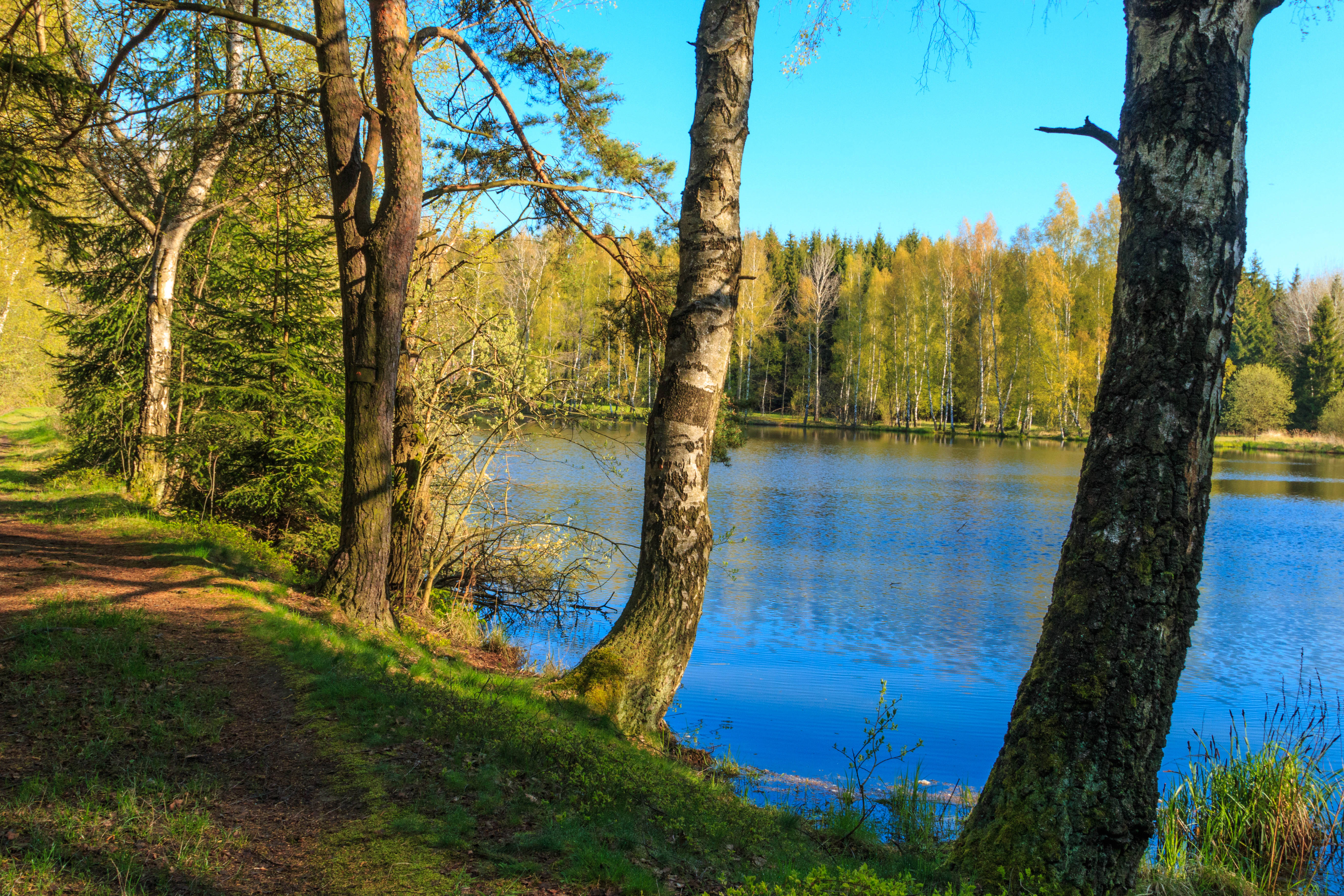
A path runs along the grassy shore of a blue pond, framed by several birch and coniferous trees with a forest in the background.
The tranquil bank of a pond at the Ratajské rybníky nature reserve.

Ratajské rybníky history and protected-area timeline

The landscape around Ratajské rybníky has been shaped by gradual human intervention over a long period. The oldest of the three ponds, now known as Horní Rataják, was built around 1855 and is already visible on maps from the so-called Second Military Survey of Bohemia. The lower pond, Dolní Rataják, was constructed around 1910, and the smallest, Prostřední Rataják, was added around 1970, completing the basic cascade that defines the present reserve.

The site itself became formally protected on 21 November 1990, when the former District National Committee in Chrudim established it as a chráněný přírodní výtvor, or protected natural creation, with effect from 1 December 1990. Under subsequent Czech conservation law, it was reclassified as a přírodní památka, a natural monument. A larger, overlapping European Site of Community Importance was then declared on 15 April 2005 under the Natura 2000 network, broadening legal protection around the ponds and their surrounding meadows.

Both designations are administered as part of the Chráněná krajinná oblast Žďárské vrchy by the regional office of the Czech Agency for Nature Conservation and Landscape Protection in Nasavrky. Conservation management in recent decades has focussed on traditional meadow use, controlled fishpond management with regular autumn harvests, control of shoreline shrubs, and the installation of visitor information panels and marked tourist trails suitable for the light recreational use the area receives.

Ratajské rybníky landscape and geographic character

The landscape of Ratajské rybníky is shaped by a broad, gently sloping highland valley oriented roughly from northeast to southwest, framed by forested ridges of the Kameničská vrchovina. To the north and northeast, the slopes rise towards Medkovy kopce at 638 metres and Čertovina at 655 metres, while to the east and southeast the broader ridge continues through Dědovský kopce at 676 metres towards the prominent peak of Pešava at 697 metres, which is locally regarded as a significant landmark of the Železné hory mountain system.

Inside the valley, the terrain is mostly gentle and waterlogged, with shallow peat-filled basins and slow-flowing seasonal channels. The three fishponds, separated by narrow green strips of dam vegetation, lie at elevations between 585 and 595 metres behind low earth dams whose surfaces serve as walking paths. South-west of the lower pond, the valley opens out towards Blatenský potok, which receives the outflow from the ponds and carries the water onward to the Chrudimka river at Blatno, part of the municipality of Hlinsko.

Geologically, the valley sits on the edge of the Hlinsko Proterozoic and Palaeozoic zone, with a basement of phyllitic shales and schistose phyllites, locally contact-metamorphosed, and in places intruded by Palaeozoic granite along the southeastern edge of the protected zone. Surface deposits are Quaternary clays, sands and gravels in the stream and pond beds, with sandy-loam soils giving rise to pseudogleys on the flats and waterlogged gleys and peats in the lowest, wettest sections.
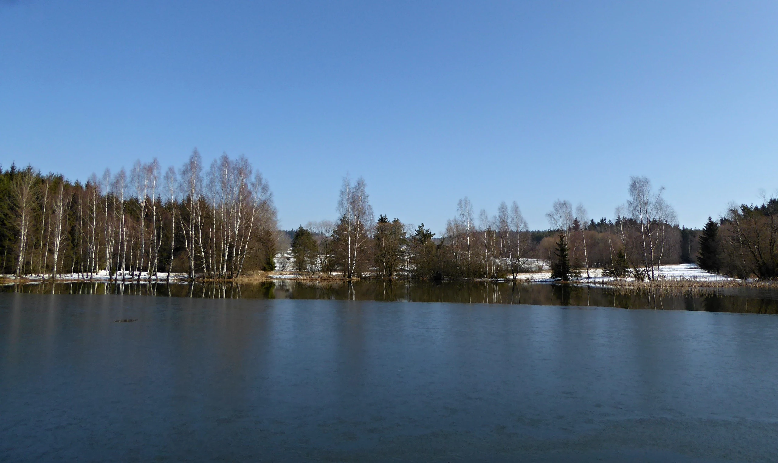
A calm, dark-water pond reflecting a clear blue sky, bordered by a line of bare deciduous trees and coniferous forest with small patches of snow on the banks.
A view of Horní ratajský pond in the Ratajské rybníky nature reserve, featuring leafless trees and patches of remaining snow along the shoreline.

Ratajské rybníky ecosystems, habitats, and plant life

Ecologically, Ratajské rybníky represents an unusually well-preserved fragment of mesotrophic to slightly calcareous wet grassland and mire habitat on the Železné hory, set in a small, groundwater-rich highland basin. The reserve stands at the contact between two biogeographical regions, the relatively warmer Železné hory and the distinctly cooler Žďárské vrchy, which produces an unusual mix of lowland and upland species.

The habitat mosaic includes mesotrophic and peat-forming meadows dominated by purple moor grass (Molinia caeruleae), sedge mires transitional to quaking mires, narrow belts of reeds and shoreline sedges around the ponds, willow and alder scrub on the dams, and patches of secondary woodland dominated by alder, birch and willow. These habitats fall within the protected European habitat types of Molinion caeruleae meadows on calcareous, peaty and clay-rich soils and of transitional mires and quaking bogs.

On the ponds themselves, the middle basin is heavily vegetated with planted white and pink water lily cultivars, providing extensive floating cover. The shoreline vegetation, the slow seasonal drawdown of water levels, and the stable presence of shallow, fish-free or low-density margins are critical to the amphibian, invertebrate and aquatic plant communities. The wet meadows are regularly mown, which helps maintain their open character and prevents succession into scrub.
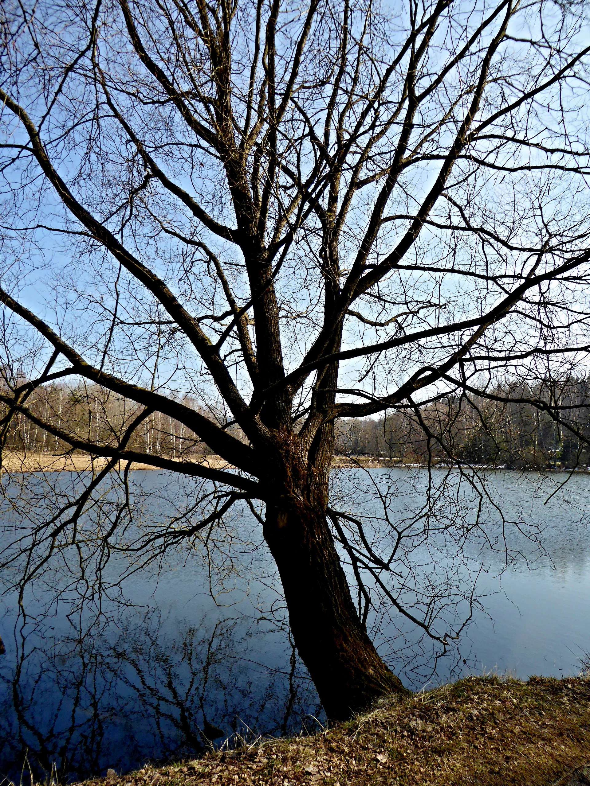
A large, leafless deciduous tree stands on the grassy bank of a pond, with its branches silhouetted against a bright, clear blue sky and calm water.
A leafless tree standing on the edge of the Dolni Ratajsky pond.

Ratajské rybníky wildlife and species highlights

The ponds and their immediate surroundings host dense populations of amphibians, particularly the common frog, whose breeding congregations and characteristic egg masses are a well-known spring feature of the site, together with the edible frog, the European tree frog, the common toad on the meadows, and both the smooth newt and the alpine newt. Each April, the site becomes one of the most conspicuous amphibian breeding localities in the local landscape.

The reserve is also notable for invertebrates of European conservation interest. It supports two strongly associated species of large blue butterfly, Maculinea nausithous and Maculinea teleius, whose caterpillars first feed inside flower heads of great burnet (Sanguisorba officinalis) in the wet meadows and then continue their development inside nests of the meadow ant, an unusually fragile ecological linkage that gives the site particular conservation value. Other notable invertebrates include the rare moss Hamatocaulis vernicosus and the minute land snail Vertigo geyeri, discovered here in 2011 and otherwise known only from a handful of similar mires elsewhere in the Czech Republic.

The fishponds are managed for traditional freshwater fish species, including common carp, tench, pikeperch, northern pike and roach, which are harvested in regular autumn drainings. Aquatic birdlife associated with the ponds and meadows includes mallard, tufted duck, coot, common snipe, whinchat, meadow pipit and the river warbler, while the common kingfisher is a regular visitor feeding along the pond margins.
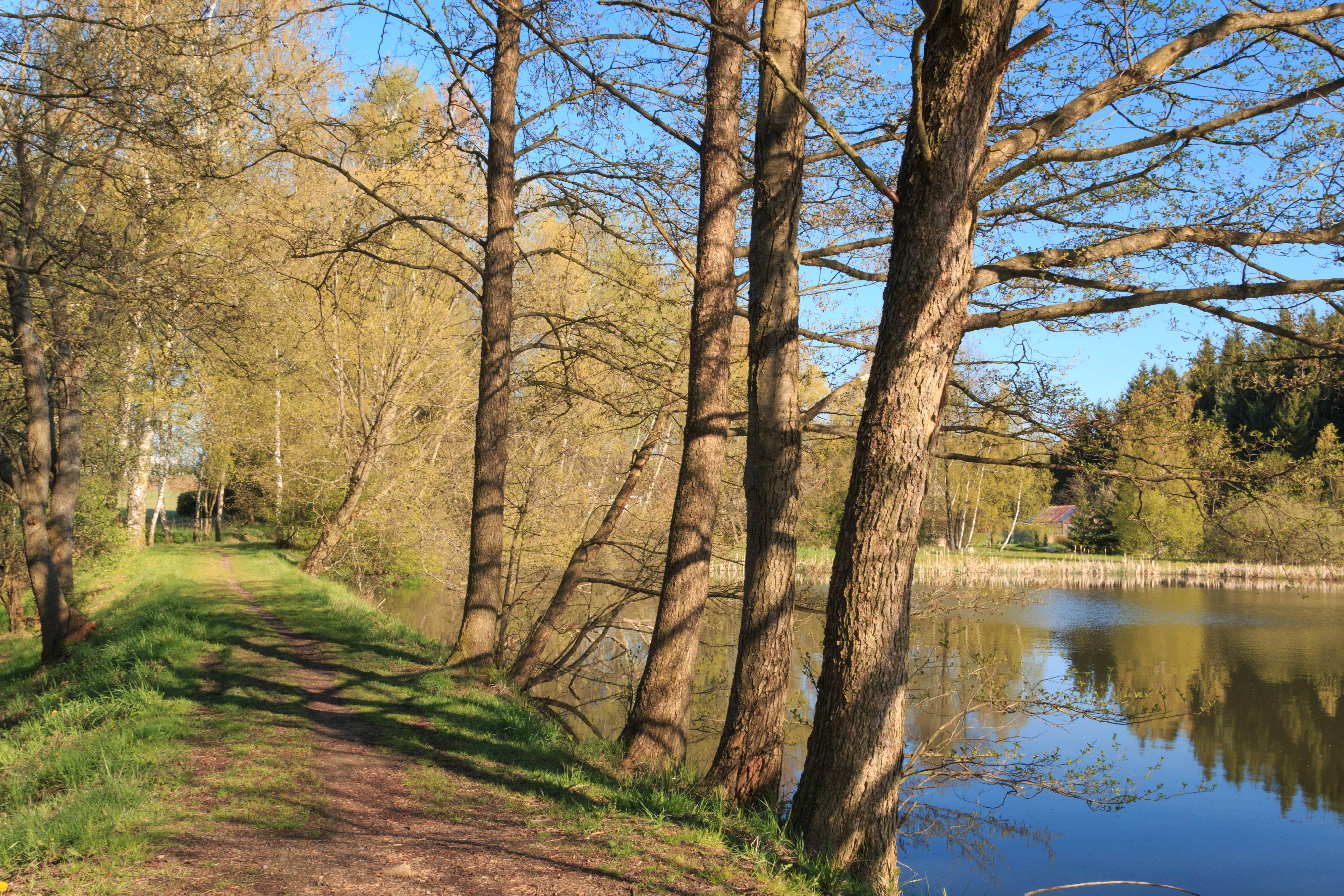
A dirt path runs alongside a pond, lined by a row of tall trees with budding leaves in early spring sunlight.
A view along the dam of the lower Ratajsky pond at the Ratajske rybniky nature reserve.

Ratajské rybníky conservation status and protection priorities

Ratajské rybníky is a recognised conservation site at both national and European levels. As a přírodní památka, it is a formally protected area in the Czech system with IUCN management category IV, focused on protecting a specific natural feature of clearly limited extent. As a European Site of Community Importance declared under the Natura 2000 network, it also forms part of the European Union's strategy for conserving threatened habitat types and species, particularly Molinion meadows, transitional mires and quaking bogs, the Maculinea butterflies, Hamatocaulis vernicosus and Vertigo geyeri.

The site is administered by the Czech Agency for Nature Conservation and Landscape Protection through its regional unit for the Chráněná krajinná oblast Žďárské vrchy, headquartered for this area at the office in Nasavrky, and is supported by adjacent municipal forest management at Hlinsko. Conservation management combines traditional fishpond use with controlled drawdowns, regular mowing of the surrounding wet meadows, light control of encroaching shrubs around the pond margins, and the protection of a 50-metre-wide buffer zone that extends into the surrounding forest.

The site's importance for conservation lies in the way a small area captures multiple interconnected ecological values: it preserves a sequence of increasingly rare mire habitats in the cool upper part of a largely drier mountain range, supports breeding populations of several nationally and European-protected species, and maintains the hydrological balance on which both the ponds and the surrounding wet meadows depend. Together with the nearby natural monuments Bahna and Louky v Jeníkově, it forms part of a network of small, water-rich reserves that buffer the larger protected landscape from drainage and land-use change.

Ratajské rybníky cultural meaning and human context

The ponds and their surrounding meadows have been part of the rural life of the Hlinsko area for well over a century. The oldest of the three water bodies was already in place by the mid-nineteenth century, and the pattern of pasturing, hay-making and small-scale fish farming that has shaped the surrounding landscape long predates the formal protection of the site. The local place name Rataje, shared with a street and a small settlement roughly 700 metres from the lower pond, is the source of the name Ratajské, which in the local dialectal form Rataják refers to the individual ponds.

In more recent decades, the area has become a popular local recreational landscape, with allotment gardens almost touching the outer edge of the wet meadows, paths along the pond dams being used for walking, and the ponds themselves being a familiar landmark for residents of Hlinsko and surrounding villages. Small information boards installed since 2015 at the dams, and a larger panel near the lower pond added in 2017 together with marked yellow and green tourist trails of the Czech Tourist Club, reflect a deliberate effort to combine conservation protection with low-intensity public access and education about the local natural values.
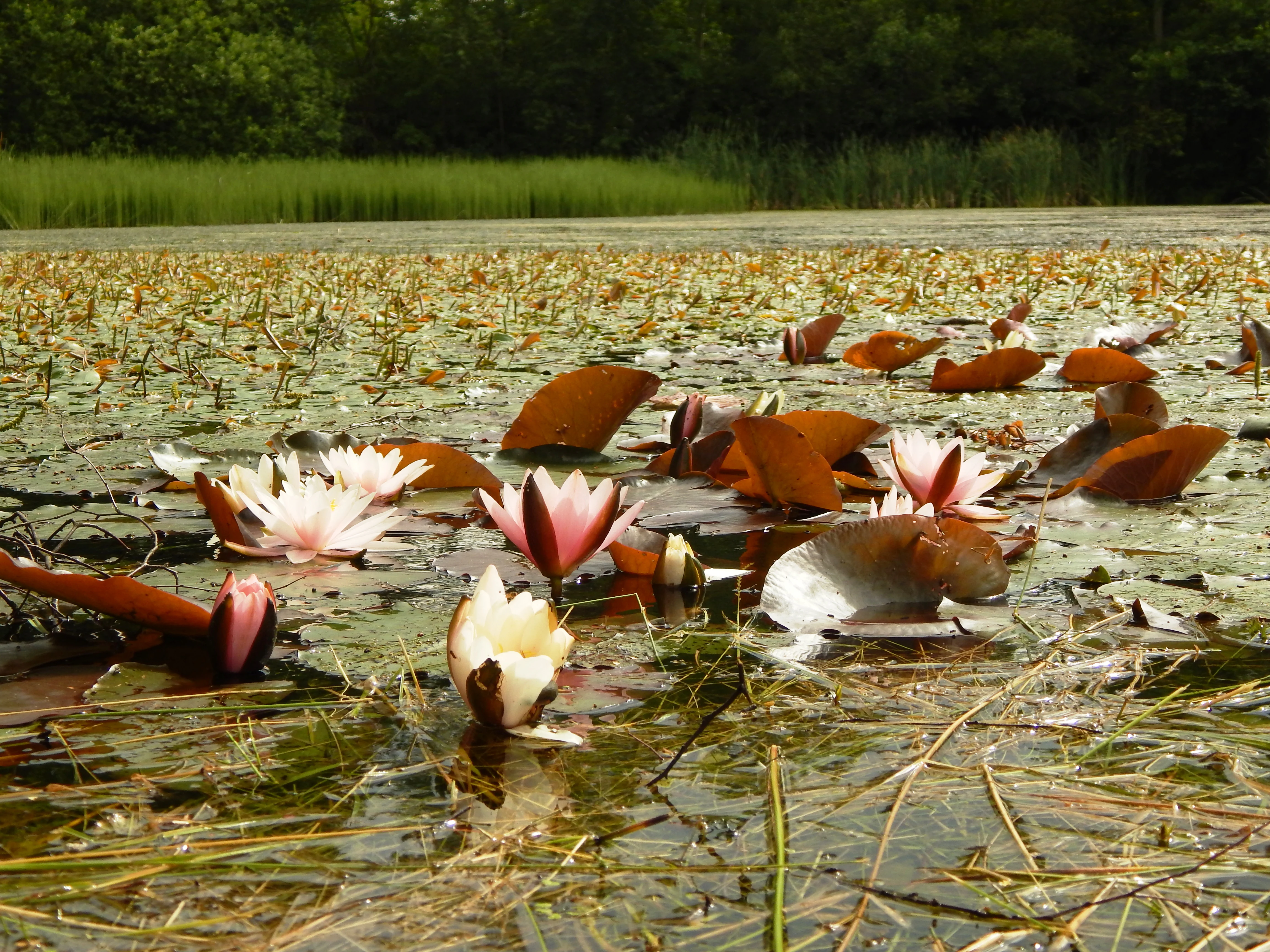
A close up view of several pale pink and white water lilies and their rounded leaves floating on the surface of a pond, with a blurred green grassy bank in the background.
Water lilies blooming on the surface of a pond in the Ratajské rybníky nature reserve.

Top sights and standout views in Ratajské rybníky

A compact highland cascade of three connected fishponds with unusually rich wet meadows and mires around them, all protected as both a Czech natural monument and a Natura 2000 site. A key Czech locality for Maculinea butterflies, the rare moss Hamatocaulis vernicosus and the minute land snail Vertigo geyeri, and an important amphibian breeding site with conspicuous spring frog activity. One of three small, water-rich reserves, alongside Bahna and Louky v Jeníkově, that together preserve the distinctive wet highland character of the southeastern Železné hory within the Žďárské vrchy protected landscape area.
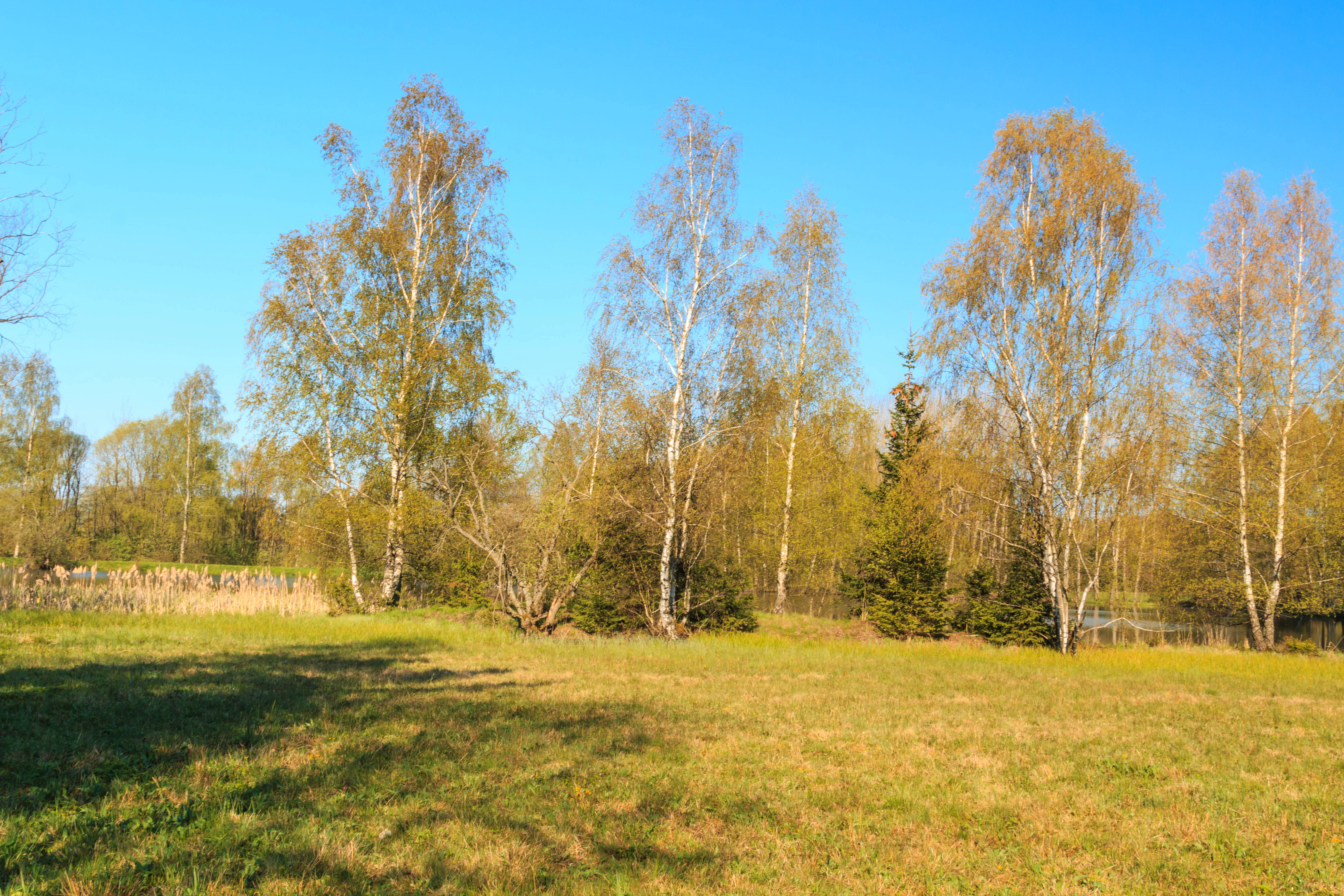
A sunny field with light green grass in the foreground, bordered by a cluster of tall white-barked birch trees against a clear blue sky.
Meadows and birch trees near the Horni pond in Ratajske rybniky Nature Reserve.

Best time to visit Ratajské rybníky

Late spring and early summer are the most rewarding periods to visit Ratajské rybníky. In April the ponds become a focal point of amphibian breeding, with large numbers of common frogs and other species congregating in and around the water, producing characteristic choruses of croaking and visible masses of spawn. Later in spring and into early summer, the surrounding wet meadows develop their richest flowering display, including the rare marsh gentian (Gentiana pneumonanthe), while the middle pond is at its most photogenic when its water lilies are in full bloom.

In high summer the meadows are regularly mown, which opens up views across the valley and makes the birdlife, including snipe, whinchat and meadow pipit, easier to observe. Autumn brings the traditional fish harvests in the ponds and strong colour in the surrounding deciduous trees along the dams, while winter, with snow cover and thin ice on the ponds, offers the clearest sense of the site's cool upland climate. Visitors should generally expect a noticeably colder and longer-winter microclimate here than in the lower surrounding country, and should plan accordingly.


Monthly climate preview

Long-term representative monthly temperature and precipitation rhythm for Ratajské rybníky

Ratajské rybníky Climate Normals and Measured Annual Temperature Patterns

Representative coordinates record lowest mean temperatures in mid winter alongside warmer peaks exceeding thirty degrees Celsius during mid summer months. Consulting the complete twelve month dataset clarifies the full annual cycle of precipitation and temperature variations.
Annual mean8 °C
-3 °C20 °C
Jan-3°
Feb-1°
Mar
Apr
May13°
Jun17°
Jul20°
Aug19°
Sep14°
Oct
Nov
Dec-1°
Warmest month
July

19.6 °C

Coolest month
January

-2.8 °C

Wettest month
July

2.8 mm/day

Driest month
April

1.2 mm/day

Park location guide

Geography guide, regional context, and park location map for Ratajské rybníky

Ratajské rybníky park geography, regions, and map view in Czechia

Understand where Ratajské rybníky sits in Czechia through a broader geographic reading of the surrounding landscape, nearby location context, and its mapped position within the national park landscape.

How Ratajské rybníky fits into Czechia

Czech Republic is a landlocked Central European country with a population of approximately 10.9 million people. The nation was established as an independent state on January 1, 1993, following the dissolution of Czechoslovakia. Its capital and largest city is Prague, with other major urban centers including Brno, Ostrava, Plzeň, and Liberec.

Wider geography shaping Ratajské rybníky in Czechia

The Czech Republic is a landlocked country in Central Europe. It is bordered by Germany to the west, Austria to the south, Poland to the northeast, and Slovakia to the southeast. The landscape is predominantly hilly, with the territory covering 78,871 square kilometers.

Map view of Ratajské rybníky

Use this park location map to pinpoint Ratajské rybníky in Czechia, understand its exact geographic position, and read its mapped placement within the surrounding landscape more clearly.

Pigeon | © OpenStreetMap contributors

Location context for Ratajské rybníky

Pardubický kraj
Recorded earthquake history

Explore Historical Earthquake Records Associated with Ratajské rybníky

Examine the recorded seismic history near Ratajské rybníky through a structured catalogue of documented events. MoriAtlas presents this historical data to clarify regional seismic context by mapping past events based on their proximity to the nature monument.

Ratajské rybníky Earthquake History

Catalogued events

1 event

Strongest magnitude

Magnitude 3

Most recent event

Mar 21, 2006

This history includes earthquakes recorded inside the park or within 50 km of its borders

Explore high-resolution imagery capturing the fishponds, peat mires, and rare wetland habitats of Ratajské rybníky.

Ratajské rybníky Photos and Landscape Scenery: Visualising the Protected Highland Valley

Visual documentation reveals the distinctive highland terrain, cascaded water bodies, and sedge meadows defining Ratajské rybníky. Examining field photography helps researchers and conservationists interpret the unique environmental character of this protected wetland ecosystem.

A path runs along the grassy shore of a blue pond, framed by several birch and coniferous trees with a forest in the background.

A calm, dark blue pond reflecting the clear sky, surrounded by a transition of deciduous and coniferous trees on a sunny spring day.

A calm, dark-water pond reflecting a clear blue sky, bordered by a line of bare deciduous trees and coniferous forest with small patches of snow on the banks.

A large, leafless deciduous tree stands on the grassy bank of a pond, with its branches silhouetted against a bright, clear blue sky and calm water.

A dirt path runs alongside a pond, lined by a row of tall trees with budding leaves in early spring sunlight.

A close-up view of a blooming pink water lily flower floating on the surface of a pond surrounded by lily pads and small aquatic plants.

A close up view of several pale pink and white water lilies and their rounded leaves floating on the surface of a pond, with a blurred green grassy bank in the background.

A sunny field with light green grass in the foreground, bordered by a cluster of tall white-barked birch trees against a clear blue sky.

A small pond covered with lily pads and aquatic vegetation, surrounded by dense green forest under a cloudy sky.

Panoramic view of a calm pond reflecting surrounding trees with autumn foliage under a clear sky.

A calm, reflective pond surrounded by lush green trees and a distant field under a clear blue sky.

A calm, still pond surrounded by trees with autumn foliage, featuring a fallen log extending into the water and dense green grasses in the foreground.

A landscape view of a pond with patches of snow on the grassy banks, two evergreen trees in the foreground, and bare trees in the background under a clear blue sky.

A group of brown frogs swimming in shallow water among clusters of frog eggs in a pond.

Two brown warty toads are in the water, one riding on the back of the other in an amplexus mating position.

A view through bare deciduous trees and shrubs at the edge of a pond, with patches of snow on the ground and a clear blue sky in the background.

Park atlas

Compare regional highland reserves and connected wetland habitats across the terrain

Explore Parks Near Ratajské Rybníky and Surrounding Protected Landscapes

Browse other protected areas and highland reserves situated near Ratajské rybníky across the surrounding regional terrain. Comparing adjacent wetland habitats and protected landscapes provides broader context for regional conservation geography.
A soft watercolor illustration featuring rolling hills in pink and green tones with stylized coniferous trees, set against a white background.
Natural monumentPardubický kraj
About 14 km away#1 closest

Southeast

Rybenské Perničky: Natural Monument and Geological Landmark of the Bohemian-Moravian Highlands

Geological rock outcrops and protected upland terrain in the Pardubice Region

Investigate the geological structure of Rybenské Perničky, a protected natural monument featuring unique orthogneiss outcrops and characteristic bowl-shaped weathering basins. Situated in the Pardubice Region, this site offers a focused look at the crystalline rock formations and undulating plateau terrain of the Bohemian-Moravian Highlands, providing essential geographic context for this noteworthy natural landmark.

Area
0.141 km²
Established
1980
Relief
Upland
Climate
Temperate
A horizontal watercolor painting depicting a soft, scenic view of hills with rocky outcrops in the foreground and a forested landscape in the distance.
Protected areaCzechia
About 15 km away#2 closest

Southeast

Malinská skála: Geomorphological Landmark and Viewpoint in the Czech-Moravian Highlands

Protected gneiss rock group and mountain ridge geography

Rising as a striking summit in the Žďárské vrchy, Malinská skála presents a concentrated group of named gneiss towers reaching 20 meters in height. The site functions as a geological monument, preserving classic examples of frost-shattered boulder streams and high-elevation landforms. With its panoramic vantage points, it serves as a central point for mapping the topography of the surrounding Czech upland ridges.

Area
0.058 km²
Established
1987
Relief
Mountain
Climate
Temperate
A watercolor painting showing a soft landscape of rolling hills, grassy meadows, and patches of vegetation in a pastel color palette.
Natural monumentKraj Vysočina
About 18 km away#3 closest

South

Sklenské louky Natural Monument: Wetland Landscapes in Kraj Vysočina

Highland geography and protected peatland habitats

Sklenské louky functions as a concentrated nature monument within the Kraj Vysočina region, preserving vital moisture-loving vegetation and peat-based ecosystems. The terrain features a characteristic mix of open meadows and spruce groupings, illustrating the diverse landscape character of the Bohemian-Moravian Highlands. This protected area provides a clear view into the region's unique upland hydrological and botanical patterns.

Area
0.063 km²
Established
1985
IUCN
IV
Relief
Upland
A soft watercolor painting of a serene landscape featuring a calm lake surrounded by trees and gentle rolling hills in the background.
Natural monumentKraj Vysočina
About 23 km away#4 closest

South

Rozštípená skála Natural Monument: Geological Mapping of the Vysočina Gneiss Outcrops

Protected rocky terrain in the Bohemian-Moravian Highlands

Rozštípená skála features a striking gneiss cliff formation split by long weathered fissures. Located in the Vysočina Region, this natural monument provides a focal point for understanding the geological patterns and river valley landscapes that define the mid-altitude terrain of the Czech Republic.

Area
0.008 km²
Established
1974
IUCN
III
Relief
Upland
Natural monumentKraj Vysočina
About 23 km away#5 closest

Southeast

Vávrova skála Natural Monument: Geological Exploration in the Kraj Vysočina Region

Metamorphic rock outcrops and highland protected habitats

Vávrova skála stands as a protected natural monument near Pohledec, showcasing a distinct orthogneiss formation shaped by Quaternary weathering. This site serves as a vital reference for the geological diversity of the Bohemian-Moravian highlands, protecting rare summit heath and dry grassland within the larger Žďárské vrchy protected landscape.

Area
0.001 km²
Established
1983
IUCN
III
Relief
Upland
An illustrative style digital painting of a tranquil park scene with a lake in the foreground, a path along the bank, and mountains in the distance, depicted with a muted, pastel-toned color palette.
Protected landscapeChrudim District
About 26 km away#6 closest

Northwest

Přírodní park Heřmanův Městec: Geographic Profile and Protected Landscape Boundaries

Tracing the elevation transitions of the Chrudim District foothills

This protected landscape in the Chrudim District merges man-made baroque vistas with natural oak woodlands. The park terrain rises over 100 metres from water-side flats to forested ridges, providing a distinct study in regional geology and calcareous soil habitats that support rare beetle and bat populations.

Area
3.41 km²
Established
1996
Relief
Mixed relief
Climate
Temperate
A watercolor painting of a soft, rolling landscape with green hills, patches of trees, and a pale sky.
Natural monumentPardubický kraj
About 27 km away#7 closest

East

Sněženky ve Vysokém lese: Exploring the Protected Natural Monument and Forest Geography

A small-scale Bohemian botanical reserve and valley landscape

Located in the Svitavy district of Pardubický kraj, Sněženky ve Vysokém lese is a natural monument dedicated to preserving a dense, naturally occurring population of wild snowdrops. The protected hollow, carved into the broader Vysoký les spruce woodland, illustrates how specific moisture conditions and soil patterns create essential habitats for rare local wildflowers within the Czech landscape.

Area
0.022 km²
Established
1994
IUCN
IV
Relief
Upland
A soft watercolor painting of a river landscape with rolling hills, grassy riverbanks, and light green vegetation under a pale sky.
Protected landscapePardubický kraj
About 28 km away#8 closest

West

Přírodní park Doubrava Protected Landscape and River Valley Geography

A detailed map-based overview of the Doubrava River protected corridor in the Czech Republic.

Navigate the linear terrain of Přírodní park Doubrava, where natural riverine habitats meet industrial heritage in the Pardubický kraj. The area features a significant water tunnel, rocky banks, and a historic quarry-stone dam, creating an ecologically rich corridor that bridges the gap between the Bohemian-Moravian Highlands and the Iron Mountains.

Area
0.65 km²
Established
1998
Relief
Upland
Climate
Temperate

Common questions about visiting, size, designation, and location context for Ratajské rybníky

Ratajské rybníky FAQs for park facts, access, geography, and protected area context

Find quick answers about Ratajské rybníky, including protected-area facts, park geography, trail and visitor context, and how the park fits into its surrounding country and regional landscape.
MoriAtlas Explorer

Continue Your Protected Areas Search Across the Global Atlas

Deepen your exploration by continuing the structured search for national parks and protected areas worldwide. Utilize the comprehensive filtering capabilities to compare different conservation landscapes and refine your understanding of global park geography. Discover more about the distribution and characteristics of protected natural areas.

Global natural geography