
Mori Atlas logo
Biosphere reserveReserva de la biosfera de los Ancares Leoneses

Mapping the deep river valleys and forest ecosystems of Spain's Sierra de Ancares

Reserva de la biosfera de los Ancares Leoneses: A Protected Mountain Landscape Atlas

(Reserva de la Biosfera de los Ancares Leoneses)

The Reserva de la biosfera de los Ancares Leoneses represents a vast protected territory situated within the mountainous terrain of the Provincia de León. This biosphere reserve encompasses the converging valleys of the Cúa, Ancares, and Burbia rivers, creating a distinct geographical profile defined by steep slopes, elevated ridgelines, and lush Atlantic forests. The area integrates diverse mountain ecosystems, ranging from oak and holly woodlands to expansive heather cover, providing a comprehensive look at the historical and environmental heritage of the Bierzo region through a structured geographic lens.

biosphere reserveUNESCOmountain valleysAtlantic forestoak woodlandholly forests
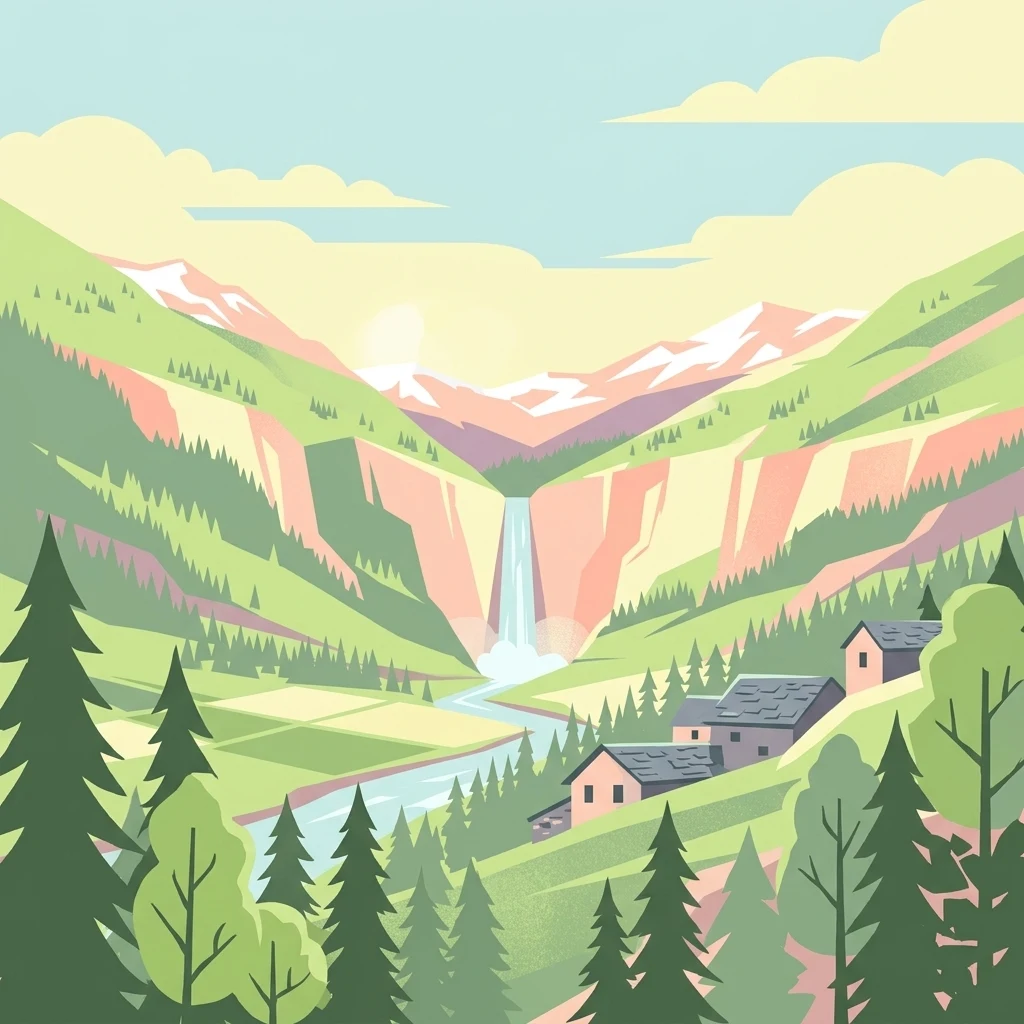
A flat-style digital illustration of a mountain valley featuring a central waterfall, a flowing river, green slopes with coniferous trees, and a cluster of rustic stone houses.

Reserva de la biosfera de los Ancares Leoneses

Biosphere reserve

Park overview

Structured park overview, official facts, and landscape profile for Reserva de la Biosfera de los Ancares Leoneses

Reserva de la Biosfera de los Ancares Leoneses park facts, protected area profile, and essential visitor context

Review the core facts for Reserva de la Biosfera de los Ancares Leoneses, including designation, size, terrain, visitor scale, habitats, and operating context in one park-focused overview.

About Reserva de la Biosfera de los Ancares Leoneses

The Reserva de la Biosfera de los Ancares Leoneses is a sizeable protected area in the Cantabrian Mountains fringe of northwestern Spain, embracing the upper valleys of the Sierra de Ancares where León meets Galicia. The terrain is shaped by long-established river systems, traditional rural settlements, and forested slopes that blend Atlantic and inland mountain influences, giving the area a distinctive ecological and cultural character.

Designated by UNESCO in 2006 under the Man and the Biosphere programme, the reserve recognizes territories with outstanding natural, social, and economic values. In the case of the Ancares Leoneses, this recognition highlights a mountain region where communities have lived for centuries and where conservation is closely tied to the maintenance of traditional land use, cultural heritage, and rural livelihoods. The reserve integrates 48 localities scattered across the four constituent municipalities, reflecting a strong human presence that coexists with the surrounding natural environment.

The area includes the valleys of the Cúa (Valle de Fornela), Ancares (Valle de Ancares), and Burbia rivers, each contributing its own microhabitats and settlement patterns. A consortium bringing together the four affected municipal councils and the Consejo Comarcal del Bierzo manages the reserve, supporting coordinated conservation work and local development initiatives that reinforce the link between ecological protection and the identity of the region.

Quick facts and research context for Reserva de la Biosfera de los Ancares Leoneses

The reserve is located in the northwest of León province, within the comarca of El Bierzo in Castilla y León, Spain, and was designated as a UNESCO biosphere reserve in 2006. It covers 56,786 hectares across parts of four municipalities and includes 48 designated localities. The territory encompasses the mountain valleys of the Cúa, Ancares, and Burbia rivers in the Sierra de Ancares. León province is notable for hosting one of the highest concentrations of biosphere reserves on Earth, with roughly 17 percent of its territory under this designation.

Protection and recognition

Documented terrestrial protection scope, designation history, and recognition data

Reserva de la biosfera de los Ancares Leoneses Protection Status

Reserva de la biosfera de los Ancares Leoneses features a documented terrestrial protection scope established in the designated year 2006. Structured records compile the official designation history and international recognition framework for this protected area.

Protection details

Protection scope
Terrestrial
Designated year
2006
Transboundary protection
No
Park context

Deeper park guide and search-rich context for Reserva de la Biosfera de los Ancares Leoneses

Reserva de la Biosfera de los Ancares Leoneses history, landscape, wildlife, and travel context

Explore Reserva de la Biosfera de los Ancares Leoneses through its history, landscape character, ecosystems, wildlife, conservation priorities, cultural context, and seasonal travel timing in a structured park guide built for atlas discovery and search intent.

Why Reserva de la Biosfera de los Ancares Leoneses stands out

The reserve is best known for its mosaic of Atlantic-influenced mountain vegetation, which includes oak, holly, and strawberry tree formations alongside heather and riverside flora, set around deep valleys in the Sierra de Ancares. Its large, continuous protected area and UNESCO-recognized status make it a defining landscape element of the Bierzo region.
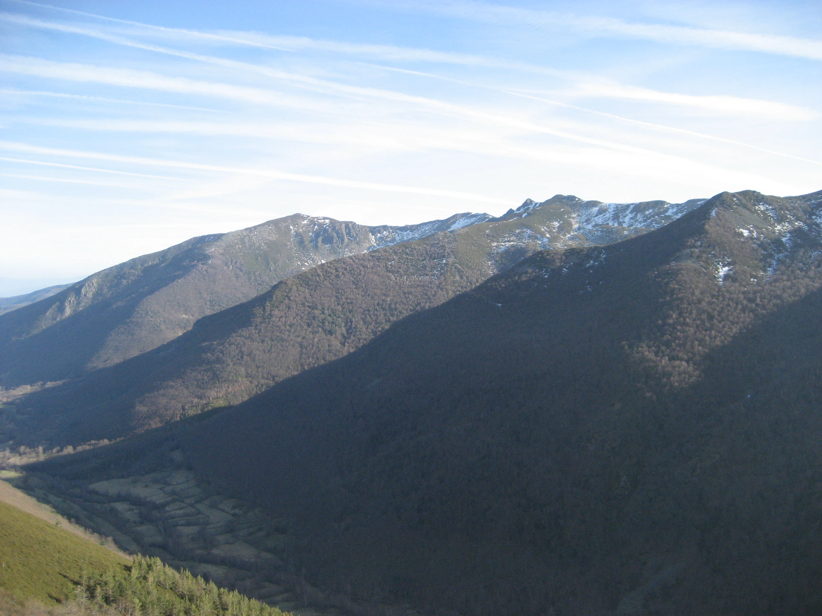
A wide view of rolling mountain slopes and ridges in the Ancares range, with patches of snow near the summits and a valley floor visible below.
A view of the Sierra de Ancares mountain range in the Reserva de la biosfera de los Ancares Leoneses.

Reserva de la Biosfera de los Ancares Leoneses history and protected-area timeline

The Reserva de la Biosfera de los Ancares Leoneses was formally created in 2006 under UNESCO's Man and the Biosphere programme, a designation reserved for territories with exceptional natural, social, and economic values. Its creation reflected an effort to give international recognition to a mountainous area of León that had long balanced human settlement with traditional resource use.

The reserve's institutional structure was built on existing local governance, bringing together the municipalities of Valle de Ancares, Vega de Espinareda, Villafranca del Bierzo, and Peranzares alongside the Consejo Comarcal del Bierzo. This consortium approach was intended to anchor conservation in regional administration and ensure that local communities continued to play a central role in managing their landscape.

Reserva de la Biosfera de los Ancares Leoneses landscape and geographic character

The landscape of the reserve is defined by the deep, forested valleys of the Sierra de Ancares and the converging river basins that give the area its shape. The valleys of the Cúa, known locally as Valle de Fornela, the Ancares valley, and the Burbia valley cut into the surrounding highland, creating a transition between steep slopes, riverbanks, and elevated ridgelines near the Ancares mountain pass. The result is a rugged yet varied terrain that combines mountain scenery with softer valley floors.

Reserva de la Biosfera de los Ancares Leoneses ecosystems, habitats, and plant life

The vegetation reflects an Atlantic-influenced mountain environment, with oak woodlands as a structural backbone alongside holly and strawberry tree, both characteristic of wetter Iberian uplands. Heather carpets cover open areas, while riverside formations of moisture-loving flora line the courses of rivers and streams, creating a layered mosaic of forest, scrub, and riparian habitats across slopes and valley floors.

Reserva de la Biosfera de los Ancares Leoneses wildlife and species highlights

The reserve hosts a range of large mammals typical of Iberian mountain ecosystems, including brown bears, red deer, wild goats, Eurasian wild boar, and common genets. The presence of bears in particular underscores the area's role as part of the wider brown bear range of northwestern Iberia, while raptors such as vultures circle the higher valleys, contributing to the region's distinctive upland fauna.

Reserva de la Biosfera de los Ancares Leoneses conservation status and protection priorities

The reserve's conservation value is rooted in its UNESCO biosphere designation, which acknowledges the area's combination of natural heritage and the ongoing relationship between its inhabitants and the land. Protection efforts focus on preserving the integrity of oak and riverside ecosystems, supporting habitat continuity for species such as brown bears and wild goats, and maintaining the cultural and rural landscape that has shaped the Sierra de Ancares over centuries.

Reserva de la Biosfera de los Ancares Leoneses cultural meaning and human context

The Ancares Leoneses carry a deep mountain cultural identity, expressed through traditional settlements, rural architecture, and the relationship between highland communities and their natural surroundings. The reserve recognizes this heritage along with the area's industrial and intangible legacies, integrating cultural conservation into its broader environmental mandate.

Top sights and standout views in Reserva de la Biosfera de los Ancares Leoneses

The reserve's highlights include its large continuous protected area across four municipalities, the convergence of three major river valleys within a single biosphere framework, and a forested environment that links oak, holly, and heather ecosystems. The combination of UNESCO recognition, community-led management through a local consortium, and the proximity of the Sierra de Ancares mountain pass gives the area a strong identity within the broader landscape of León.
Monthly climate preview

Long-term representative monthly averages for temperature and precipitation patterns

Reserva de la biosfera de los Ancares Leoneses Climate Normals and Annual Temperature Rhythm

Representative baseline measurements reveal the multi-year temperature ranges and monthly precipitation distribution recorded at a central coordinate within Reserva de la biosfera de los Ancares Leoneses. Examining the full twelve-month profile provides complete historical climate data and deeper analytical context for the protected landscape.
Annual mean11 °C
4 °C18 °C
Jan
Feb
Mar
Apr
May12°
Jun16°
Jul18°
Aug18°
Sep16°
Oct11°
Nov
Dec
Warmest month
July

18.4 °C

Coolest month
January

3.9 °C

Wettest month
November

3.6 mm/day

Driest month
July

0.9 mm/day

Park location guide

Geography guide, regional context, and park location map for Reserva de la Biosfera de los Ancares Leoneses

Reserva de la Biosfera de los Ancares Leoneses park geography, regions, and map view in Spain

Understand where Reserva de la Biosfera de los Ancares Leoneses sits in Spain through a broader geographic reading of the surrounding landscape, nearby location context, and its mapped position within the national park landscape.

How Reserva de la Biosfera de los Ancares Leoneses fits into Spain

Spain, officially the Kingdom of Spain, is a unitary parliamentary constitutional monarchy located in Southern and Western Europe. The country occupies most of the Iberian Peninsula and includes territories in the Mediterranean and Atlantic. With a population of approximately 49.6 million and an area of 506,030 km², Spain is a major European economy and cultural force. Its capital is Madrid, and the country is known for its diverse landscapes ranging from mountainous regions to coastal areas.

Wider geography shaping Reserva de la Biosfera de los Ancares Leoneses in Spain

Spain occupies the Iberian Peninsula in Southern and Western Europe. Peninsular Spain is bordered to the north by France, Andorra, and the Bay of Biscay; to the east and south by the Mediterranean Sea and Gibraltar; and to the west by Portugal and the Atlantic Ocean. The territory includes the Canary Islands in the Atlantic Ocean, the Balearic Islands in the Mediterranean Sea, and the autonomous cities of Ceuta and Melilla in mainland Africa. Spain features diverse terrain including the Pyrenees in the northeast, the Sierra Nevada in the south, and the Meseta Central plateau.

Map view of Reserva de la Biosfera de los Ancares Leoneses

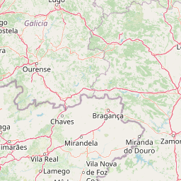
Use this park location map to pinpoint Reserva de la Biosfera de los Ancares Leoneses in Spain, understand its exact geographic position, and read its mapped placement within the surrounding landscape more clearly.

Pigeon | © OpenStreetMap contributors

Location context for Reserva de la Biosfera de los Ancares Leoneses

Provincia de León
Recorded earthquake history

Examine Historical Earthquake Records for Reserva de la biosfera de los Ancares Leoneses

Explore the structured MoriAtlas dataset of seismic events recorded in proximity to the Reserva de la biosfera de los Ancares Leoneses. This resource provides researchers and visitors with historical event data, including specific magnitude and epicentre location metrics for the region.

Reserva de la biosfera de los Ancares Leoneses Earthquakes

Catalogued events

190 events

Strongest magnitude

Magnitude 5.4

Most recent event

Sep 30, 2023

This history includes earthquakes recorded inside the park or within 50 km of its borders

Photographic documentation of mountain valleys, Atlantic forests, and protected terrain

Visual Exploration and Landscape Photography of Reserva de la biosfera de los Ancares Leoneses

Visual records capture the rugged topography, river basins, and forested slopes defining Reserva de la biosfera de los Ancares Leoneses. Photographic exploration reveals the protected landscape character, mountain vegetation, and varied terrain of the Sierra de Ancares.

A wide view of rolling mountain slopes and ridges in the Ancares range, with patches of snow near the summits and a valley floor visible below.

A cluster of stone houses with dark slate roofs sits in a lush green valley, backed by steep, grassy mountainsides under a clear sky.

Park atlas

Compare adjacent mountain valleys and connected protected landscapes across the region

Parks Near Reserva de la biosfera de los Ancares Leoneses and Surrounding Protected Areas

Browsing protected areas near Reserva de la biosfera de los Ancares Leoneses reveals shared mountain terrain and river valley ecosystems across the surrounding highland. Examining adjacent reserves provides deeper geographic context for understanding the broader conservation landscape of the Iberian highlands.
Watercolor painting of a wide, rolling mountain landscape with green and muted red hills under a soft, light background.
Biosphere reserveLugo
Park boundaries overlap#1 closest

West

Reserva de la Biosfera de Los Ancares Lucenses y Montes de Cervantes, Navia y Becerreá Protected Area Map

Mountainous terrain and river valley geography in Lugo, Spain

This protected area covers the dramatic Sierra de Ancares, featuring steep mountain slopes and deep river valleys that define the geography of Galicia. The reserve spans a significant vertical relief, providing essential habitats for brown bears and capercaillie while preserving traditional rural mountain land use systems and ancient forest ecosystems.

Area
536.64 km²
Established
2006
Relief
Mountain
Climate
Temperate
Watercolor illustration of a gentle river winding through green hills and forests with soft, hazy mountain silhouettes in the background.
Biosphere reserveGalicia
25 km away#2 closest

West

Reserva de la biosfera de las Tierras del Miño: Mapped Landscapes and Geographic Overview

Extensive riverine forests and wetland networks in northwestern Spain

Explore the expansive territory of Reserva de la biosfera de las Tierras del Miño, spanning a large portion of the Galician interior. This protected area features a mosaic of wetlands, riparian corridors, and mountainous terrain, offering a deep look into the ecological and cultural geography of the upper Miño river basin.

Area
3,636.69 km²
Established
2002
Relief
Lowland
Scope
Terrestrial
Watercolor depiction of green hills, a small pond, and distant mountains under a soft sky.
Protected landscapeBragança District
65 km away#3 closest

South

Montesinho Natural Park: Protected Landscape in Bragança District, Portugal

Explore mapped boundaries and regional landscape context.

Montesinho Natural Park is designated as a protected landscape in northeastern Portugal, located within the administrative region of Bragança District. This page serves as an entry point to understanding the park's protected area characteristics, its mapped geographic footprint, and its role in the broader natural landscape of the Trás-os-Montes region. Discover the atlas value of this significant protected territory and its relation to surrounding geography.

Area
742.25 km²
Established
1979
IUCN
V
Relief
Mountain
A watercolor painting showing a soft-toned landscape with a stone arch bridge spanning a river, framed by trees and gentle hills.
Biosphere reserveGalicia
87 km away#4 closest

Southwest

Área de Allariz Biosphere Reserve: Mapping the Protected Landscapes of Inland Galicia

Exploring the river basins, granitic massifs, and ecological frontiers

The Área de Allariz biosphere reserve serves as a vital transition zone in northwestern Spain, characterized by its flat-floored tectonic basin, the River Limia, and varied highland terrain. This protected area offers an instructive look at the integration of traditional rural land management with large-scale ecological recovery and conservation across its core, buffer, and transition zones.

Area
214.82 km²
Established
2005
Relief
Mixed relief
Scope
Terrestrial
A soft, horizontal watercolor painting showing a calm body of water with gentle grassy banks, trees on the left, and distant rolling hills.
Biosphere reserveGalicia
88 km away#5 closest

West

Reserva de la biosfera de las Mariñas Coruñesas y Tierras del Mandeo: Regional Geography and Maps

A diverse protected area across Galicia, Spain

This biosphere reserve serves as a vital ecological refuge along the Cantabrian-Atlantic coast. The protected area features a unique mosaic of marine and terrestrial habitats, ranging from rocky coastal cliffs and sandy estuaries to dense Atlantic forest fragments and the mountainous interior of the Sierra de la Cova da Serpe.

Area
1,139.7 km²
Established
2013
Relief
Mixed relief
Climate
Temperate
Watercolor illustration of a river winding through a valley with mountains, forests, and pink flowering trees.
National parkPortugal
115 km away#6 closest

Southwest

Peneda-Gerês National Park: A Distinct Protected Landscape in Northern Portugal

Granite peaks, glacial valleys, and cultural heritage mapped.

Peneda-Gerês National Park represents a cornerstone of protected landscapes in Portugal, celebrated for its rugged granite mountains and deep glacial valleys sculpted over millennia. This national park showcases a rare ecological transition zone with unique endemic species and features dramatic waterfalls and pristine river systems. The park's rich cultural tapestry, interwoven with its natural environment, offers a compelling subject for atlas-based geographic discovery and landscape exploration.

Area
695.93 km²
Established
1971
IUCN
II
Visitors
92.8K annual
Watercolor illustration of a mountain landscape with green forests and a body of water.
National parkSpain
121 km away#7 closest

East

Picos de Europa National Park: Dramatic Limestone Peaks and Protected Landscape Atlas

Explore Spain's historic national park and UNESCO Biosphere Reserve.

Picos de Europa National Park offers an unparalleled exploration of dramatic limestone peaks, deep glacial valleys, and extensive Atlantic forests. As Spain's oldest national park and a UNESCO Biosphere Reserve, it presents a remarkable study in karst landscape evolution and biodiversity conservation. This protected area, spanning significant territory across northern Spain, provides a rich geographic context for understanding regional natural heritage and mapped natural features.

Area
671.27 km²
Established
1918
IUCN
II
Relief
Mountain
Marine protected areaAsturias
148 km away#8 closest

Northeast

El Cachucho Marine Protected Area: Submarine Seamount and Cantabrian Sea Geography

Offshore protected landscapes and deep sea terrain mapping

El Cachucho represents a critical offshore protected area, defined by its massive seamount structure and proximity to the Asturian coastline. This marine habitat encompasses a complex array of geomorphological features, including rocky escarpments and submarine canyons that channel sediment across the narrow northern Iberian shelf, offering a detailed perspective on deep sea environmental architecture.

Area
57 km²
Relief
Upland
Climate
Temperate
Access
Remote access

Common questions about visiting, size, designation, and location context for Reserva de la Biosfera de los Ancares Leoneses

Reserva de la Biosfera de los Ancares Leoneses FAQs for park facts, access, geography, and protected area context

Find quick answers about Reserva de la Biosfera de los Ancares Leoneses, including protected-area facts, park geography, trail and visitor context, and how the park fits into its surrounding country and regional landscape.
MoriAtlas Explorer

Continue Your Protected Areas Search Across the Global Atlas

Deepen your exploration by continuing the structured search for national parks and protected areas worldwide. Utilize the comprehensive filtering capabilities to compare different conservation landscapes and refine your understanding of global park geography. Discover more about the distribution and characteristics of protected natural areas.

Global natural geography