Mori Atlas logo
Park earthquake history

A comprehensive catalogue of regional seismic events associated with this protected landscape

Recorded Seismic Activity and Earthquake History Near Reserva ecológica Manglares Churute

Review a structured compilation of historical earthquake data occurring in the vicinity of Reserva ecológica Manglares Churute in the Guayas Province. This archive displays event records, including specific dates, magnitude readings, and depths, associated by epicentre proximity to the reserve boundaries. Explore this factual resource to examine the documented seismic history of the surrounding coastal geography.

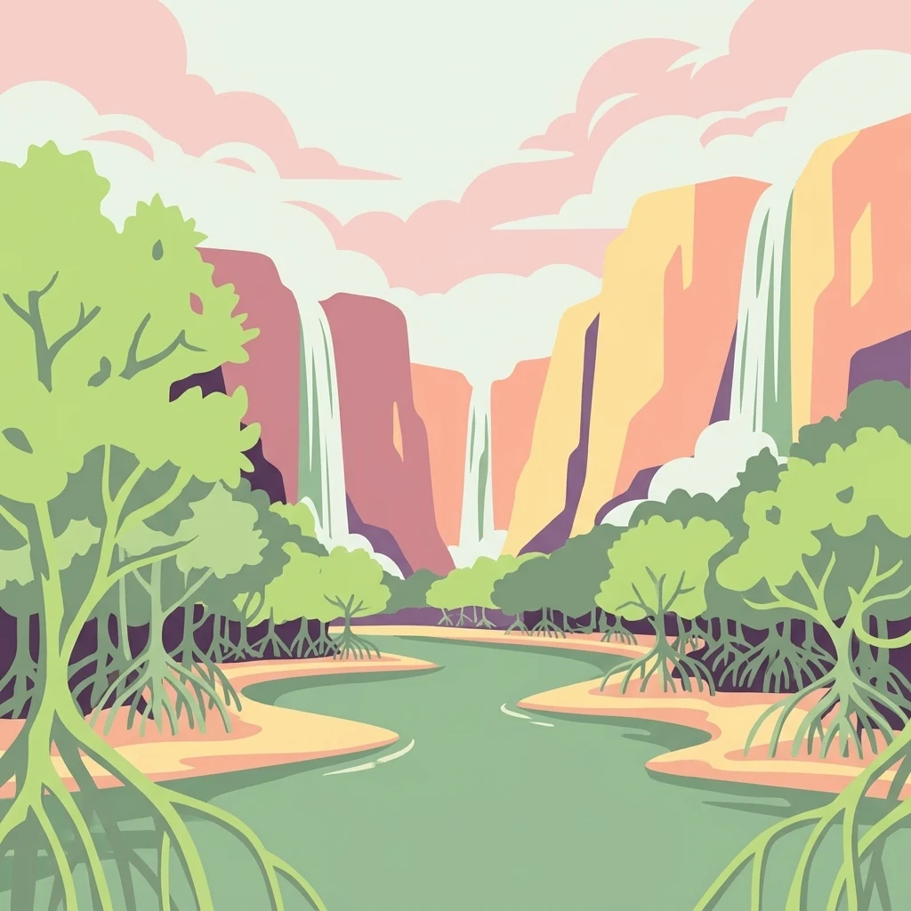
A graphic illustration showing a river winding through a mangrove forest with large prop roots in the foreground, leading toward distant cliffs and cascading waterfalls under a soft, pastel-colored sky.

A coastal Ecuadorian reserve where mangrove forests, dry forests, and humid cloud-forest hills converge near the Gulf of Guayaquil.

Manglares Churute Ecological Reserve

Manglares Churute Ecological Reserve is a protected natural area located in southeastern Guayas Province, Ecuador, between the cantons of Naranjal and Guayaquil. It stretches along the inner estuary of the Gulf of Guayaquil, where saltwater from the Pacific meets freshwater carried by rivers such as the Taura, Churute, Cañar, and Naranjal. The reserve protects a rare combination of ecosystems: extensive mangrove swamps, dry lowland forests on the lower hills, and humid cloud- or fog-forest vegetation on the higher cerros of the Churute range. The reserve's biodiversity reflects this ecological mixing. It contains one of the last large remnants of mangrove forest along the Gulf of Guayaquil, freshwater lagoons such as El Canclón, and forested hills like Cerro Masvale that rise enough to catch persistent fog. The combination of estuarine waters, mangrove channels, forested hills, and seasonal wetlands gives the park a layered character unusual among Ecuador's protected areas. Manglares Churute has national and international recognition. It is part of Ecuador's National System of Protected Areas, a designated Ramsar wetland site, and an Important Bird Area. It is valued not only for its scenic estuary landscapes but also for its role in protecting endemic Tumbesian species, migratory shorebirds, and the country's most important population of the threatened horned screamer (Anhima cornuta).

Location
Ecuador
Park type
Nature reserve
Established
1979
Area
471.7 km²
Highest point
1,000 m
Reserva ecológica Manglares Churute Nature Reserve

Review Reserva ecológica Manglares Churute events and distances

Investigate earthquakes near Reserva ecológica Manglares Churute

Reserva ecológica Manglares Churute’s earthquake view maps reported epicentres by calculated distance from its Guayas boundary, separating the records from mangroves, estuaries, dry forest, humid forest, and Gulf of Guayaquil waters. Each entry provides a date, magnitude, depth, locality, source, and reserve distance for historical comparison without claiming ecosystem effects, present hazard, or future activity.

Sort by
Magnitude
Location

This page describes catalogued earthquakes associated with the park by epicentre location and distance. It does not establish causation, assess current danger, or predict future earthquakes.

No earthquake records match the current filters

Park atlas

Move beyond Guayas mangroves, dry forest, and cloud-forest hills

Other park landscapes after Reserva ecológica Manglares Churute

The earthquake catalogue for Reserva ecológica Manglares Churute belongs to an Ecuadorian coastal mosaic near the Gulf of Guayaquil. Further links open unrelated protected-area stories rather than sites assumed to share mangrove habitat, ecological-reserve status, geology, seismic evidence, geographic proximity, hazards, or the same body of sources.
Wildlife reserveGuayas
About 17 km away#1 closest

Northwest

Reserva de producción de fauna Manglares El Salado: Coastal Geography and Protected Lands

A mangrove-dominated wildlife reserve in Guayas, Ecuador.

Analyze the protected landscape of Reserva de producción de fauna Manglares El Salado, which spans extensive mangrove forests and estuarine waters within the Guayas province. This wildlife reserve showcases a unique transition between intertidal mangrove zones, salt flats, and remnants of tropical dry forest, providing essential habitat context for the Gulf of Guayaquil coastal region.

Area
53.09 km²
Established
2002
IUCN
VI
Relief
Lowland
Nature reserveGuayas
About 27 km away#2 closest

Northwest

Bosque Protector La Prosperina Nature Reserve and Coastal Ecuador Forest Geography

Protected dry forest habitat and regional geographic terrain

Bosque Protector La Prosperina represents a critical survival of Ecuador's equatorial dry forest within the Guayas province. This nature reserve offers deep insight into seasonal ravine networks, drought-adapted vegetation, and the structural dynamics of fragmented coastal landscapes near Guayaquil.

Area
2.424 km²
Established
1994
Relief
Upland
Climate
Tropical
A horizontal watercolor painting showing a stylized forest landscape with soft pastel green, yellow, and pink hues representing trees and rolling hills.
Protected areaGuayas
About 28 km away#3 closest

Northwest

Bosque Protector Cerro Blanco: Protected Area and Tropical Dry Forest Geography in Guayas

Mapped terrain of the Chongon-Colonche mountain range

Bosque Protector Cerro Blanco functions as a major conservation site in coastal Ecuador, protecting rare Tumbesian forest ecosystems within the Guayas province. The reserve features diverse topography of ridges and valleys, serving as a critical buffer for regional endemic species and offering a unique look at seasonally dry forest landscapes near Guayaquil.

Area
60.78 km²
Established
1992
Visitors
12K annual
Relief
Upland
Wildlife reserveGuayas
34 km away#4 closest

West

Refugio de Vida Silvestre Manglares El Morro: Protected Coastal Landscape and Map

A strategic marine and mangrove ecosystem in the Guayas Province

The landscape of Refugio de Vida Silvestre Manglares El Morro consists of continuous mangrove forests and rocky farallones, linked by a complex network of tidal channels. This wildlife refuge serves as an essential marine habitat at the threshold of the Gulf of Guayaquil, showcasing the interplay between tidal aquatic systems and coastal vegetation across the southwestern Ecuadorian region.

Area
101.3 km²
Established
2007
IUCN
Ib
Visitors
23K annual
Watercolor painting of a mountain landscape with a lake, rolling hills, and coniferous trees in soft green and yellow tones.
National parkAzuay
44 km away#5 closest

Southeast

Parque nacional Cajas: Mapping the Glacial Lakes and Paramo of the Ecuadorian Andes

Geographic analysis of high-elevation protected lands

Parque nacional Cajas encompasses a rugged, glacial-sculpted plateau characterized by cushion vegetation, boggy wetlands, and frequent fog. This protected area offers deep insight into the highland Andean geography of Azuay, where water bodies and mountain ridges intersect to form an essential ecological and cultural corridor for the region.

Area
293.89 km²
Established
1977
IUCN
II
Visitors
53K annual
National parkEcuador
About 57 km away#6 closest

Southeast

El Cajas National Park National Park: Ecuador's Protected Landscape Geography and Map Context

Explore the mapped protected areas and regional geography of El Cajas National Park.

El Cajas National Park is a protected national park in Ecuador, serving as a focal point for atlas-driven geographic exploration. This page provides detailed insight into the park's mapped boundaries and its significance as a protected natural landscape within Ecuador's broader geography. Understand the context of El Cajas National Park for structured discovery of protected lands and natural terrains across South America.

Watercolor illustration showing a mountain landscape with a snow-capped peak, a lake, and green hills.
National parkEcuador
67 km away#7 closest

Northeast

Sangay National Park: Ecuador's National Park for Mapped Landscape and Geographic Discovery

Explore Ecuador's protected area boundaries and regional terrain.

Sangay National Park serves as a crucial protected landscape within Ecuador, offering rich opportunities for atlas and geography exploration. This page details the park's specific mapped boundaries and its natural terrain, providing essential context for understanding its place within South America's broader geographic tapestry. Investigate Sangay National Park's identity as a protected national park and its value for focused landscape and regional discovery.

Area
5,177.65 km²
Established
1979
IUCN
II
Wildlife reserveLos Rios
About 86 km away#8 closest

Northeast

Refugio de Vida Silvestre Samama Mumbes: Foothill Forest and Protected Area Map

Mapping the western Andean slopes and Chocó forest fragments

Refugio de Vida Silvestre Samama Mumbes protects one of the final remnants of the Chocó Ecuatorial forest in the Ecuadorian Andes. This reserve encompasses steep, dissected ridges and vital river catchments, supporting endemic orchids, birds, and amphibians within a highly modified regional landscape. Gain deeper insight into its forest boundaries and watershed contribution.

Area
21.456 km²
Established
2016
IUCN
IV
Relief
Mountain
MoriAtlas Explorer

Analyze the Protected Geography of Reserva ecológica Manglares Churute

Continue your geographic exploration of coastal Ecuador by analyzing the ecological structure of Reserva ecológica Manglares Churute. MoriAtlas provides a clear view of these protected boundaries, enabling a deeper understanding of how estuarine, forest, and wetland ecosystems converge in one of the most critical reserves near the Gulf of Guayaquil.