
Mori Atlas logo
Wildlife reserveReserva nacional de flora y fauna de Tariquía

A rugged wilderness of Yungas montane forests, deep river valleys, and subandean serranías in Tarija

Reserva nacional de flora y fauna de Tariquía: Mapping the Protected Landscapes of Southern Bolivia

(Reserva Nacional de Flora y Fauna de Tariquía)

Reserva nacional de flora y fauna de Tariquía represents a critical conservation stronghold in southern Bolivia, spanning from the Eastern Cordillera into the subandean mountain ranges. This wildlife reserve protects a stratified mosaic of pedemontan selva and cloud forests, defined by the headwaters of the Río Grande de Tarija and the Río Bermejo. The geography is characterized by parallel escarpments and steep, high-elevation terrain that anchors the Yungas Tucumano-Boliviano ecosystem.

subandean mountainsYungas Tucumano-Bolivianocloud forestriver valleyssubandean serraníasspectacled bear habitat
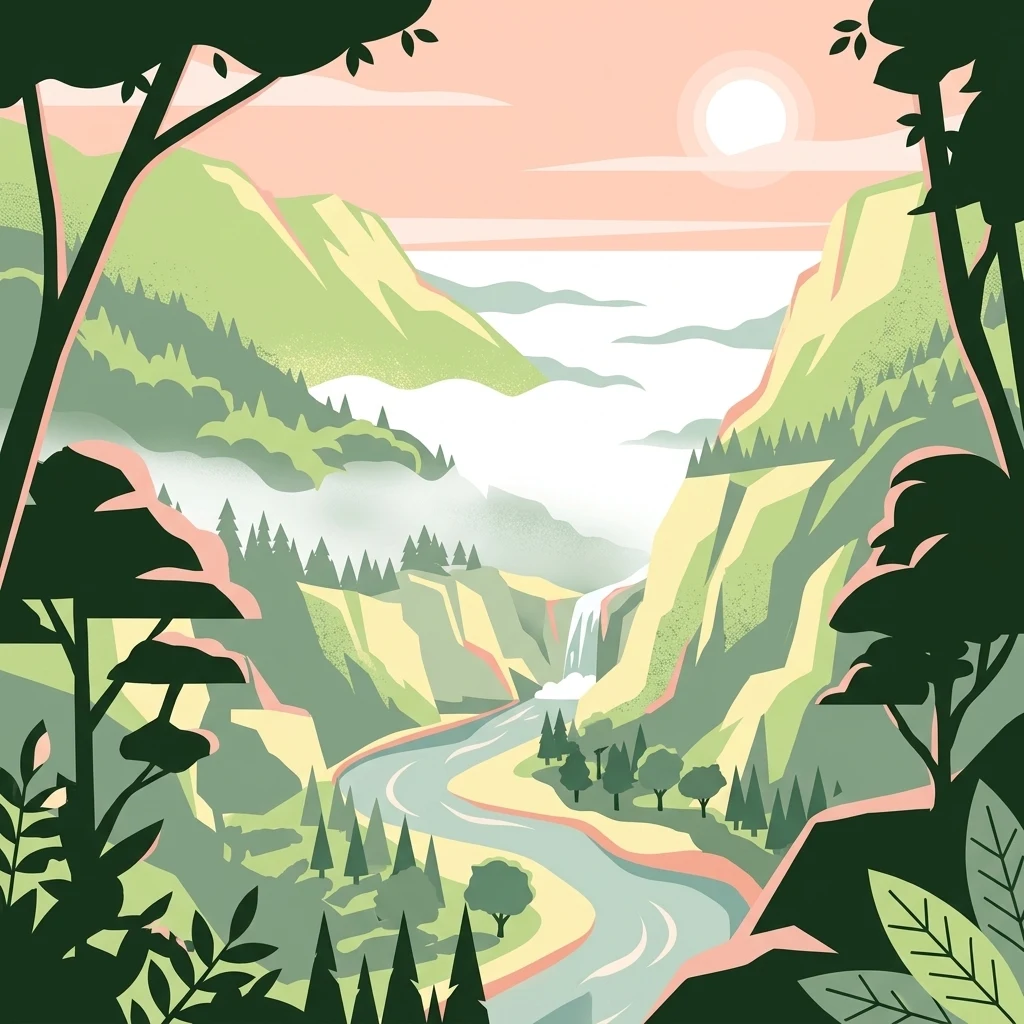
A stylized vector illustration of a mountain valley with a winding river, a small waterfall, and surrounding forest under a soft sunset sky.

Reserva nacional de flora y fauna de Tariquía

Wildlife reserve

Park overview

Structured park overview, official facts, and landscape profile for Tariquía National Flora and Fauna Reserve

Tariquía National Flora and Fauna Reserve park facts, protected area profile, and essential visitor context

Review the core facts for Tariquía National Flora and Fauna Reserve, including designation, size, terrain, visitor scale, habitats, and operating context in one park-focused overview.

About Tariquía National Flora and Fauna Reserve

The Reserva Nacional de Flora y Fauna de Tariquía occupies a strategic ecological position at the convergence of the Andes, the Subandean ranges, and the Chaco. Sitting in the department of Tarija near the Argentine border, it forms a continuous block of subandean mountain and valley terrain that protects one of the few remaining humid montane forest corridors of the Yungas Tucumano-Boliviano district in Bolivia. Its broad altitudinal range allows the reserve to encompass, within a relatively compact territory, a credible cross-section of the vegetation transitions that typically unfold over much longer distances: dry pedemontan selva in the lower valleys, extensive montane cloud forest in the middle elevations, and oligospecific high-elevation forests of mountain pine and alder near the upper limits.

The reserve's setting between roughly 900 and 3,400 meters produces a terrain that is overwhelmingly steep. Approximately 80 percent of the territory lies within the Subandean physiographic unit, characterized by elongated parallel ranges and a predominantly escarpment to very escarpment morphology, while the remaining 20 percent spills into the more dissected relief of the Eastern Cordillera. Hydrologically, the reserve integrates into the Río de la Plata basin, with about two thirds of its surface draining into the Río Grande de Tarija system and one third into the headwaters of the Río Bermejo. Subandean tributaries such as Chiquiacá, Salinas, Nogal, Cambarí, Orozas, Emborozú, and Salado shape dense networks of steep valleys that channel both wet-season floods and dry-season low flows into these larger river systems.

Ecologically, Tariquía represents a meeting point between Andean, Yungas, and Chaco influences. The vegetation transitions from deciduous subtropical formations in the warmer valleys to moist montane forests with families such as Fabaceae, Myrtaceae, Lauraceae, and Sapindaceae, and culminates in cloud forests and high-altitude grasslands of páramo affinity. The reserve sustains populations of threatened mammals such as the spectacled bear, jaguar, puma, taruca, and Andean hairy armadillo, alongside emblematic birds such as the military macaw, Tucuman amazon, and red-fronted macaw, reflecting the broader biogeographic importance of the Yungas Tucumano-Boliviano system.

Beyond its ecological role, Tariquía is also a deeply humanized landscape. It hosts around 22 campesino communities inside the reserve and another 33 in its buffer zone, organized in three territorial spaces that pursue agriculture, livestock raising, and small-scale forestry. Their presence adds layers of cultural heritage (including the historical Jesuit mission of Salinas and the founding of San Ignacio de Tariquea in 1691), local legend such as the Piedra Ombliguda, and ongoing socio-environmental tensions over hydrocarbon exploration that have shaped the reserve's recent political profile.

Quick facts and research context for Tariquía National Flora and Fauna Reserve

Tariquía is a national flora and fauna reserve located in the department of Tarija, southern Bolivia, very close to the border with Argentina. It was established on August 1, 1989 and is administered by Bolivia's Servicio Nacional de Áreas Protegidas. The reserve spans about 247,000 hectares across four Tarija provinces and occupies a transition zone between the Eastern Cordillera and the Subandean ranges.

Ecologically, the reserve is the only Bolivian protected area that conserves well-preserved Yungas Tucumano-Boliviano forests, complemented by Chaco serrano vegetation. The altitudinal gradient runs roughly from 900 to 3,400 meters, producing a stratified forest system from dry pedemontan selva to humid montane cloud forest and high-elevation oligospecific woodlands. Approximately 808 plant species have been recorded alongside 406 fauna species, including threatened Andean mammals such as the spectacled bear and jaguars, plus emblematic birds such as the military macaw.

Protection and recognition

Documented terrestrial protection scope, designation year, and management framework

Reserva nacional de flora y fauna de Tariquía Protection Status and Designation History

Reserva nacional de flora y fauna de Tariquía maintains a documented terrestrial protection status established in nineteen eighty-nine. Systematic records outline the official designation history and management scope associated with this protected area.

Protection details

Protection scope
Terrestrial
Designated year
1989
Transboundary protection
No
Park context

Deeper park guide and search-rich context for Tariquía National Flora and Fauna Reserve

Tariquía National Flora and Fauna Reserve history, landscape, wildlife, and travel context

Explore Tariquía National Flora and Fauna Reserve through its history, landscape character, ecosystems, wildlife, conservation priorities, cultural context, and seasonal travel timing in a structured park guide built for atlas discovery and search intent.

Why Tariquía National Flora and Fauna Reserve stands out

Tariquía is best known for protecting the southernmost, most intact stands of Yungas Tucumano-Boliviano montane forest within Bolivia, a humid Yungas-type ecosystem that is otherwise heavily fragmented in the country. Its elevation gradient compresses pedemontan selva, montane cloud forest, and high-elevation forests of Podocarpus parlatorei (mountain pine) and Alnus acuminata (alder) into a single protected territory, producing a striking vertical zonation of vegetation. The reserve is also recognized for its rugged subandean scenery of parallel escarpments and deep valleys, its Jesuit mission heritage in sites such as Salinas, and its river systems that connect both the Río Grande de Tarija and the headwaters of the Río Bermejo. Together, these elements make Tariquía one of the most ecologically distinct and contested protected landscapes in southern Bolivia.
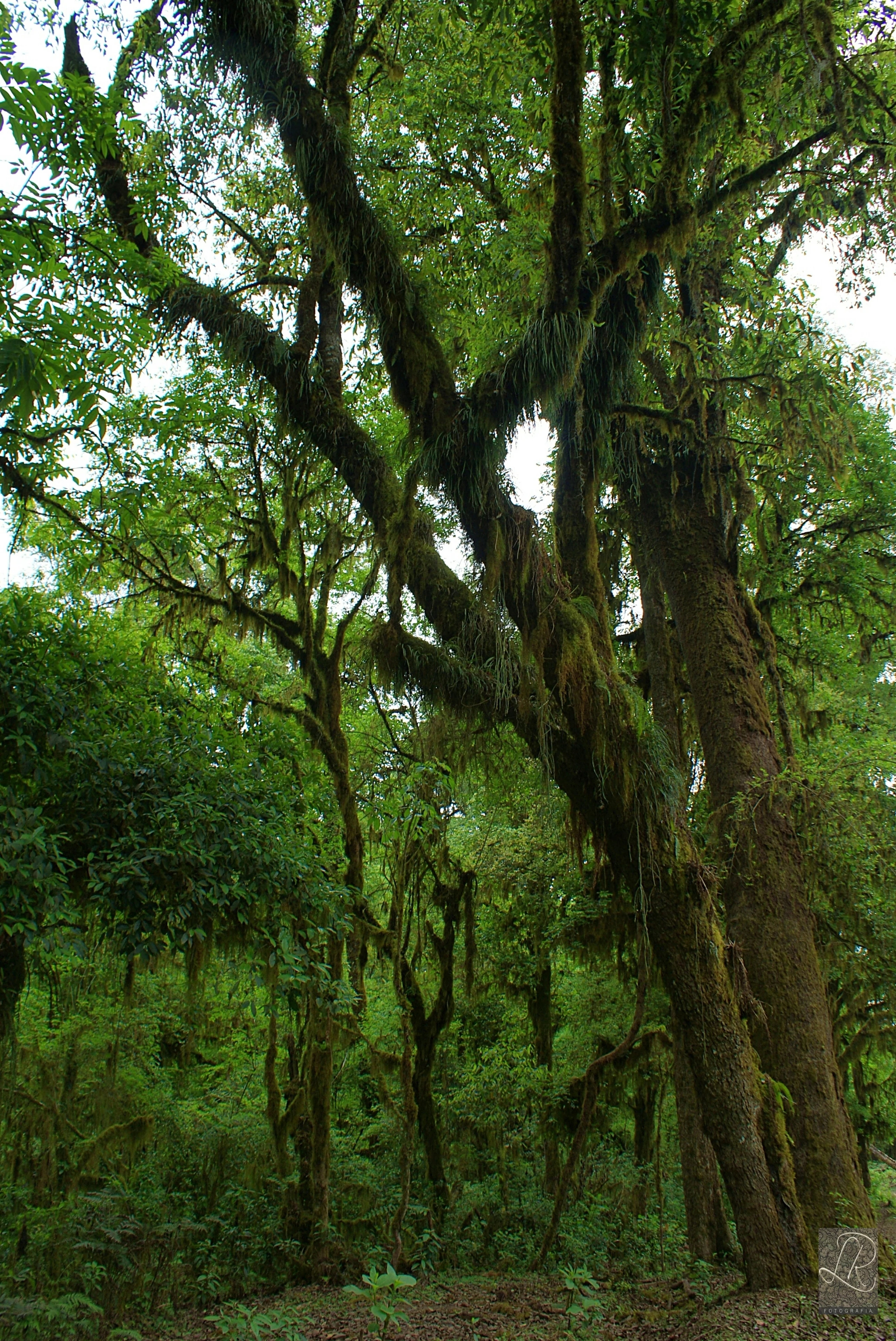
Dense forest scene featuring large, mature trees heavily draped in moss and epiphytes under a bright, overcast canopy.
Lush, moss-covered trees within the cloud forest environment of Reserva Nacional de Flora y Fauna de Tariquía.

Tariquía National Flora and Fauna Reserve history and protected-area timeline

The creation of the Reserva Nacional de Flora y Fauna de Tariquía on August 1, 1989 represented the formal recognition of a region whose identity had been forged over centuries. The name Tariquía traces back to 1691, when the Jesuit father José Francisco de Arce founded the mission of San Ignacio de Tariquea in the southern Pilcomayo region; Tariquea had long been the regional name for the surrounding territory and was eventually extended to the modern reserve.

Missionary activity shaped the cultural memory of the area through Jesuit and Dominican missions, including the foundation of Misión de Salinas in 1660, whose ruins still anchor local heritage. Over the twentieth century, the area became home to a mosaic of campesino communities descending from colonists, organized along river valleys and high serranías distinct enough to be grouped into three territorial spaces: Tariquía, Chiquiacá-Salinas, and La Planchada-El Cajón.

The late twentieth and early twenty-first centuries brought two intertwined storylines: growing recognition of the reserve's biodiversity value as the only Bolivian protected area conserving well-preserved Yungas Tucumano-Boliviano forest, and a long-running dispute over hydrocarbon exploration. Contracts signed in 2018 between YPFB and Petrobras over the San Telmo and Astillero areas inside the reserve triggered protests from local communities and civic groups in Tarija. Subsequent announcements of suspensions, resumptions of activity, and social mobilizations under the slogan "Tariquía no se toca" have turned the reserve into one of Bolivia's most visible arenas for the conflict between resource extraction and environmental protection. By mid-2026, court rulings had acquitted several defenders and the state company withdrew an appeal in the criminal case, while technical dialogue with communities was announced as a path forward.

Tariquía National Flora and Fauna Reserve landscape and geographic character

Tariquía's landscape is dominated by the abrupt, parallel relief of the Subandean ranges. Roughly 80 percent of the reserve consists of subandean serranías, colinas, plains, piedmonts, and hill fronts aligned north to south, with elongated ridges that can extend for tens of kilometers. The remaining 20 percent reaches into the more strongly dissected relief of the Eastern Cordillera, especially in the outer buffer zone near the former Orozas canton, where narrow valleys and a dense mosaic of mountains, hills, and plains produce sharper contrasts in elevation.

The overall topography is steep, with more than three quarters of the reserve classified as escarpment or very escarpment and only a small share of relatively flat land. This morphology carries ecological weight: the steep slopes concentrate orographic rainfall on exposed ridges and feed a dense hydrography dominated by the Río Grande de Tarija in the west and the headwaters of the Río Bermejo in the east, joined by numerous subandean tributaries. The combination of long ridges, deep valleys, and steep ravines gives the reserve an unusually high geomorphological fragility, with elevated erosion risk on its slopes.

Two layers of geology reinforce this scenery. A wide belt of Tertiary strata, grouped in the Estratos del Gran Chaco, fills the deepest synclines such as Tariquía's with conglomerates, fine sediments, and rolled clasts up to 60-70 cm across, occasionally containing carbonized tree trunks. Above them, Cretaceous rocks, including basaltic lavas, sandstones, conglomerates, siltstones, and limestones, build more sandy soils and shape the characteristic serranías scenery visible across much of the protected area.
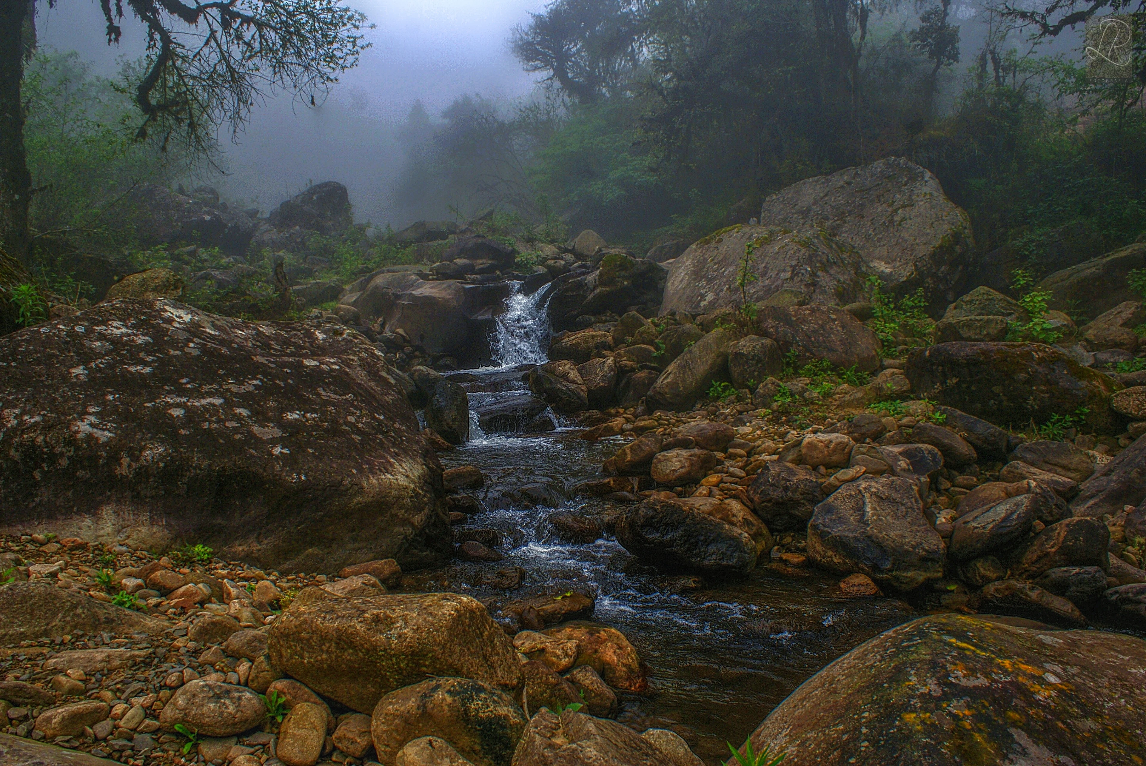
A small rocky stream cascades down a misty, forested slope in the Tariquía National Flora and Fauna Reserve.
A small stream flowing through the foggy, forested landscape of the Tariquía National Flora and Fauna Reserve.

Tariquía National Flora and Fauna Reserve ecosystems, habitats, and plant life

The reserve's vegetation reflects a vertical zonation compressed by its altitudinal range. From roughly 400 to 900 meters, a drier pedemontan selva occupies the warmer valley floors with annual rainfall around 900 mm. Between roughly 900 and 1,500 meters, the selva montana dominates, covering close to 80 percent of the reserve with the highest humidity levels, annual rainfall between 1,500 and 3,000 mm, and the richest plant diversity, including about 112 tree species such as cebil, tipa, barroso, nogal, laurel, cedro, tajibos or lapachos, and numerous Myrtaceae.

Above 1,500 meters, the vegetation transitions into a montano belt with cloud forests of ceja de monte, misty high-elevation grasslands showing páramo-like affinities, and oligospecific stands of mountain pine (Podocarpus parlatorei) and aliso (Alnus acuminata). In drier pockets, the forest shifts toward mesothermic dry-valley woodland and Chaco serrano woodland,

completing a vegetation mosaic that bridges Andean, Yungas, and Chaco floras within a single protected territory. Around 808 plant species have been recorded and about 1,500 higher plant species are estimated to occur, with Fabaceae, Myrtaceae, Lauraceae, and Sapindaceae among the best-represented families and notable diversity of orchids, bromeliads, and ferns in non-tree layers.
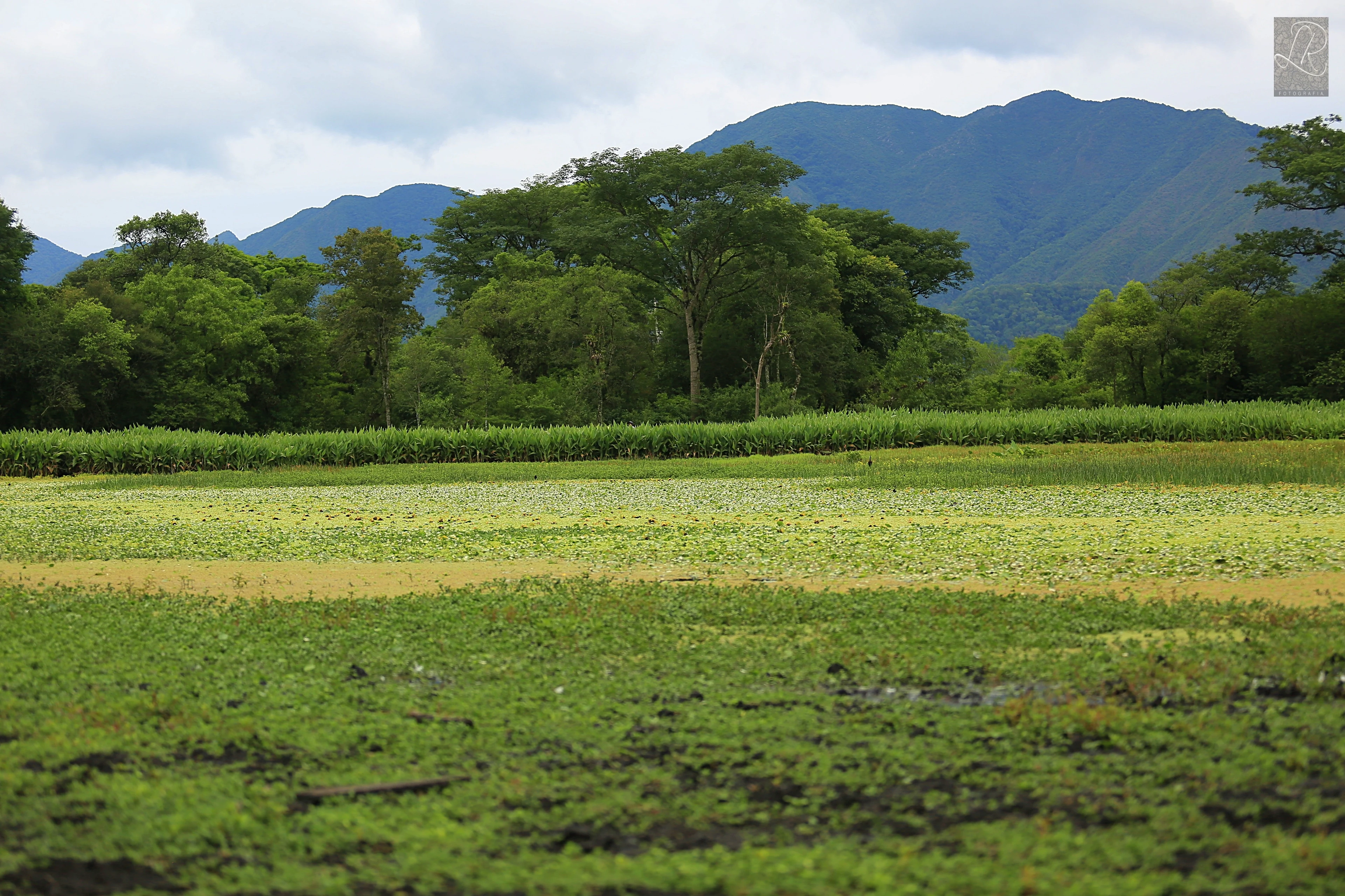
A wide shot showing a foreground of damp, grassy fields transitioning into a dense forest line beneath a range of distant, blue-toned mountains under a cloudy sky.
A view of the landscape within Tariquía National Flora and Fauna Reserve, showcasing low-lying vegetation and mountain ridgelines.

Tariquía National Flora and Fauna Reserve wildlife and species highlights

Tariquía supports roughly 406 recorded fauna species, an unusually high figure for a subandean reserve that combines Yungas habitats with Chaco serrano and high-elevation environments. Mammals include threatened Andean and Neotropical species such as the spectacled bear (Tremarctos ornatus), jaguar (Panthera onca), puma (Puma concolor), taruca or Andean deer (Hippocamelus antisiensis), armadillos of the family Dasypodidae, the collared peccary (Dicotyles tajacu), and the tufted capuchin (Sapajus apella), reflecting the reserve's position at the boundary between Andean and Chaco wildlife distributions.

Birdlife is exceptional. Approximately 400 species are estimated, with 241 species formally recorded across 47 families, including the military macaw (Ara militaris bolivianus), the toco toucan, the Tucuman amazon (Amazona tucumana), the red-faced guan (Penelope dabbenei), the southern lapwing, and the chajá. The herpetofauna comprises 43 species, with 24 amphibians and 19 reptiles recorded in montane and high-elevation grassland habitats, while the ichthyofauna falls within the Paraná ictiogeographic domain, with 64 recorded fish species dominated by Characiformes and Siluriformes and a small share of Cyprinodontiformes, some of them endemic or threatened by overfishing, hydrological regulation, and oil contamination. Insects and arachnids, although still incompletely inventoried, include 12 orders of insects and 2 orders of arachnids, with beetles (Coleoptera) and butterflies (Lepidoptera) as especially prominent indicators of forest health.
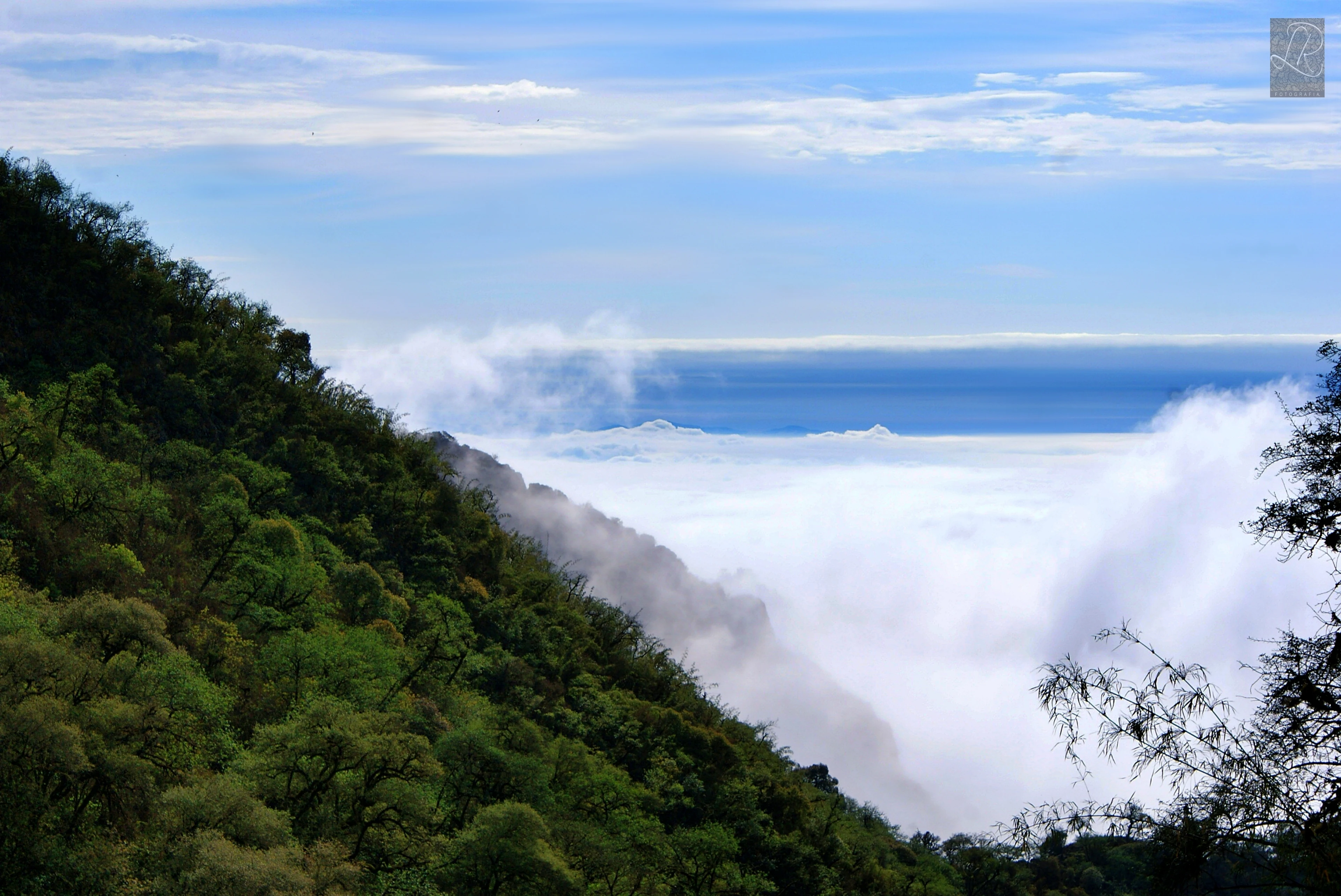
A steep, forested mountain slope rising from a thick layer of clouds that obscures the valley below.
A view of the cloud-covered slopes within the Reserva nacional de flora y fauna de Tariquía.

Tariquía National Flora and Fauna Reserve conservation status and protection priorities

As Bolivia's only protected area conserving well-preserved Yungas Tucumano-Boliviano forest, Tariquía holds an irreplaceable role in the country's network of natural areas. Its protection category (national flora and fauna reserve) gives it significant potential for wildlife management programs of regional relevance, while its altitudinal range preserves a rare continuous transition from Yungas to Chaco serrano vegetation, allowing ecological processes and species movements to be maintained across habitats that are otherwise being lost elsewhere in southern Bolivia.

The reserve also safeguards substantial genetic resources, particularly through its tree diversity and its populations of threatened mammals and birds. However, these conservation values face persistent pressures: agricultural frontier expansion and deforestation on steep slopes, logging, grazing impacts from cattle, sheep, and goats in forested areas, unregulated tourism operations, and, most prominently, hydrocarbon exploration.

Hydrocarbon activity has been the defining conservation controversy of recent years. Contracts signed in 2018 and renewed exploration efforts have driven community protests, lawsuits, and political disputes over whether drilling should be allowed within a protected area. Local communities under the slogan "Tariquía no se toca" have insisted on the intangibility of the reserve, and the issue has spilled into national politics, making Tariquía a reference point in Bolivia's broader debate over the balance between resource extraction, indigenous and campesino rights, and environmental protection.

Tariquía National Flora and Fauna Reserve cultural meaning and human context

The name Tariquía preserves the memory of the Jesuit mission of San Ignacio de Tariquea, founded in 1691 by father José Francisco de Arce in the southern Pilcomayo region. Subsequent missionary activity, including Dominican foundations and the Misión de Salinas established in 1660, left scattered ruins that remain part of the area's heritage landscape. The local population consists mainly of chapacos and, in part, chaqueños, identities that tie the territory to both the Tarija valley tradition and the wider Chaco cultural sphere.

Inside the reserve, 22 campesino communities coexist with 33 more in the surrounding buffer zone, forming a population that reaches roughly 9,800 inhabitants. Their organization reflects the geography: communities around Tariquía itself rely on maize, peanuts, and extensive cattle raising; in Chiquiacá-Salinas they combine extensive and mechanized agriculture with diversified livestock and domestic forestry; and in La Planchada-El Cajón, communities at the southern end practice more subsistence-oriented agriculture and permanent grazing. Temporary migration to Argentina and other parts of Bolivia is a central part of household economies.

Local folklore also colors the cultural context. The Piedra Ombliguda, a roughly three-meter stone near the community of Motoví, is said to call the rains when six children bathe its central indentation at dawn, a tradition that ties religious belief, communal ritual, and the area's dependence on seasonal rains. Tourism anchors such as Sidras, the mission of Salinas, the village of La Cueva in the Tucumano-Boliviano forest, and the El Cajón canyon in the Río Grande de Tarija together shape a regional identity in which landscape, livelihood, and legend are tightly interwoven.
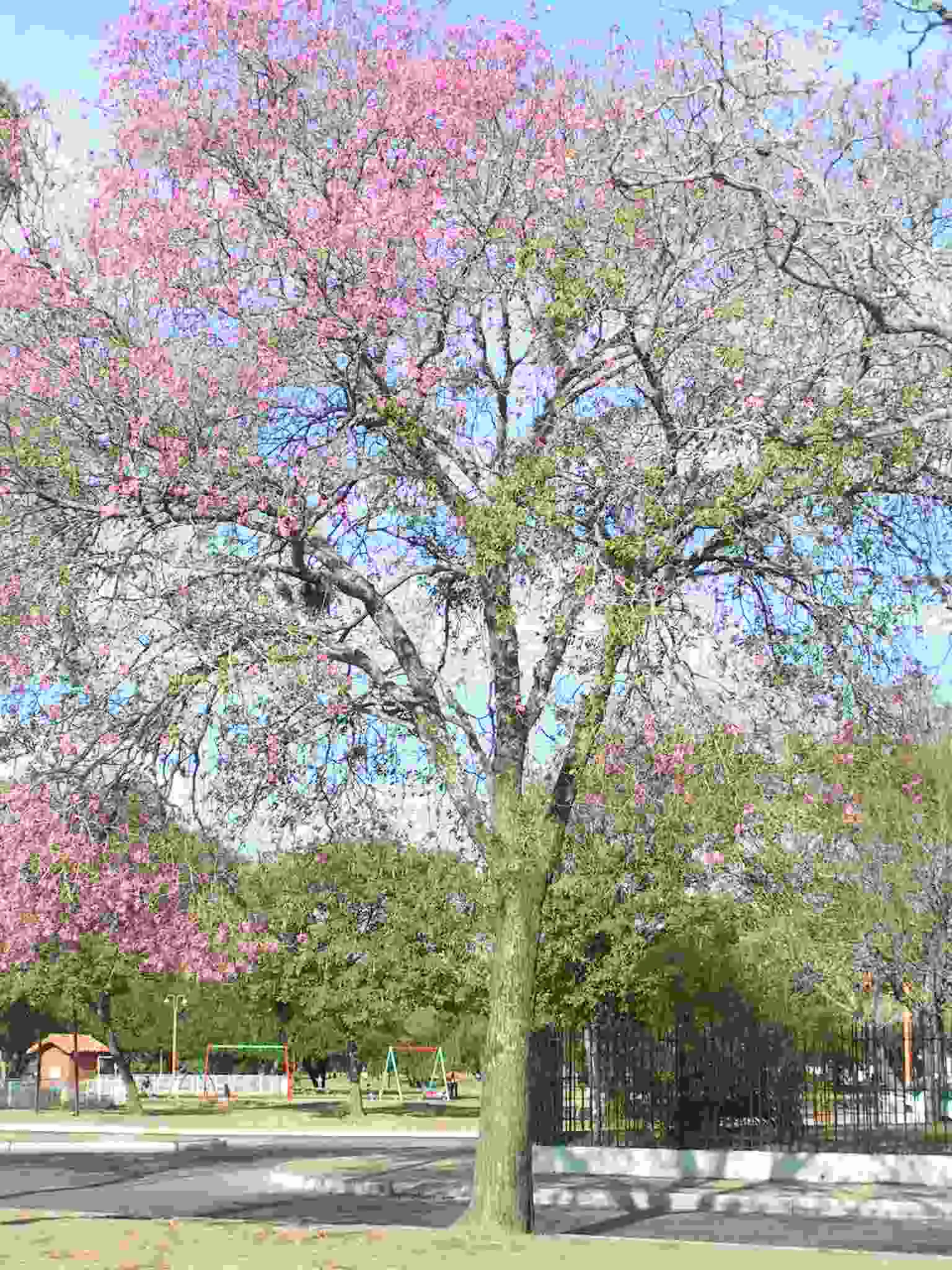
A mature pink lapacho tree with dense clusters of pink flowers and branches filling the center of the frame, set against a clear blue sky in an urban park.
A pink lapacho tree, Tabebuia impetiginosa, in full bloom within a park setting.

Top sights and standout views in Tariquía National Flora and Fauna Reserve

Tariquía's strongest identity signal is its role as the last well-conserved stronghold of the Yungas Tucumano-Boliviano forest in Bolivia, hosting a stratified vegetation system from dry pedemontan selva to high-elevation cloud forest and mountain pine woodlands within a single protected territory. The reserve also stands out for its rugged subandean scenery, its dense river network feeding both the Río Grande de Tarija and the Río Bermejo, and its unusually high recorded biodiversity for a comparatively compact area.
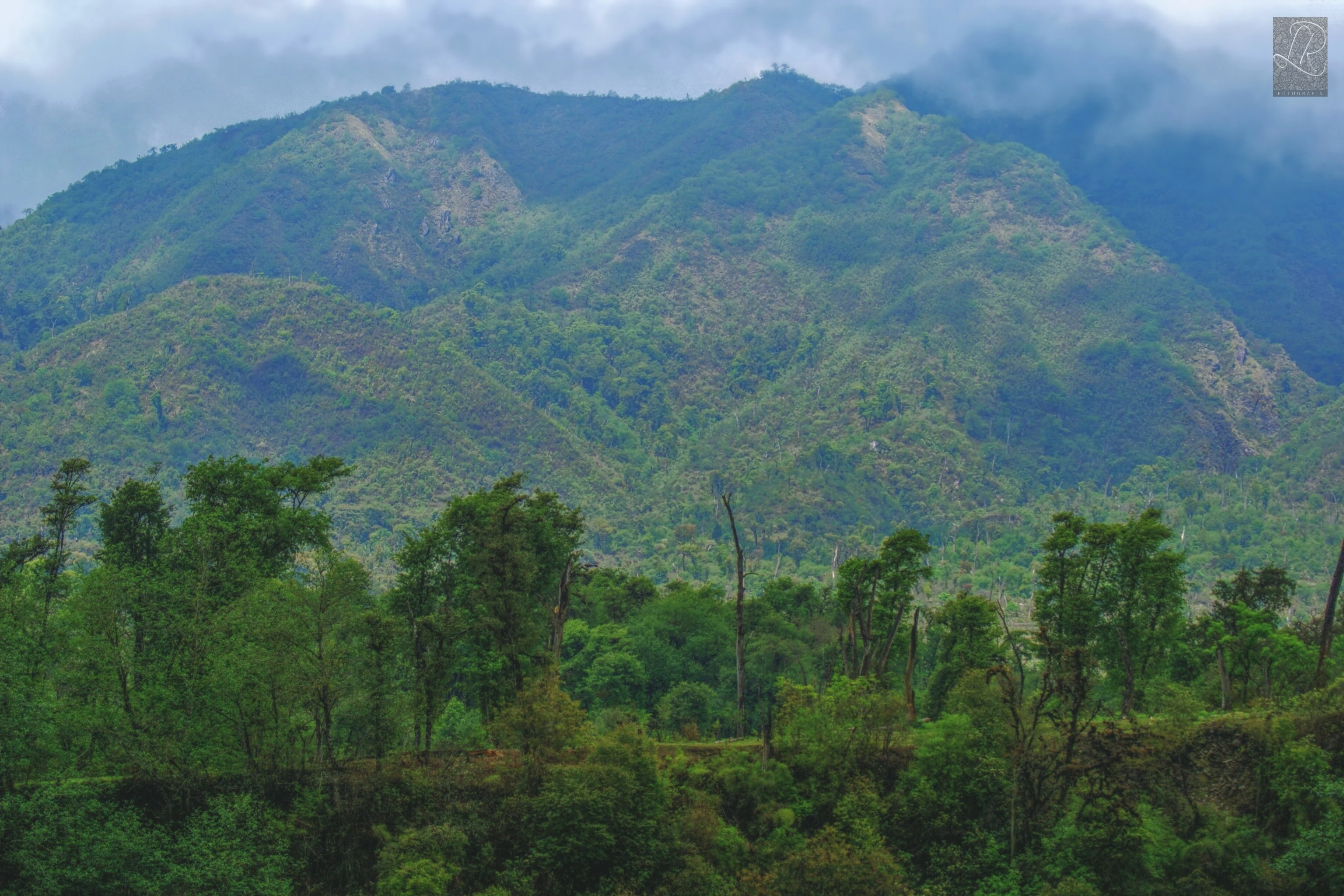
A wide shot of a green mountain range with forested slopes under an overcast sky.
View of the forested mountain slopes within the Reserva Nacional de Flora y Fauna de Tariquía.

Best time to visit Tariquía National Flora and Fauna Reserve

Tariquía's climate varies strongly with elevation, ranging from temperate in the higher zones to warm in the lower valleys and exposed ridges. Rainfall is concentrated in the wet season, which orographically intensifies on windward slopes and produces mist and persistent humidity that fuels cloud forests and the Páramo-like upper grasslands. The dry season, by contrast, brings lower river levels, clearer skies, easier foot access to high-elevation viewpoints and missions such as Salinas, and a more comfortable climate in the warmer lower valleys. Travel during the wetter months offers lusher vegetation, fuller rivers, and more active birdlife, while the drier period generally allows better visibility and easier movement through steep valley terrain. Visitors should generally favor the cooler dry season for treks and the wetter season for birdwatching and river-related scenery.


Monthly climate preview

Long term representative temperature and precipitation rhythms across the protected landscape

Reserva nacional de flora y fauna de Tariquía Climate Normals and Annual Weather Patterns

Representative coordinates record distinct annual temperature ranges and monthly precipitation cycles across the protected terrain. Analyzing complete twelve month climate normals reveals detailed seasonal variations in regional weather patterns.
Annual mean19 °C
15 °C22 °C
Jan22°
Feb21°
Mar20°
Apr19°
May17°
Jun16°
Jul15°
Aug17°
Sep19°
Oct21°
Nov22°
Dec22°
Warmest month
December

22.4 °C

Coolest month
July

15.1 °C

Wettest month
January

5.7 mm/day

Driest month
July

0.5 mm/day

Park location guide

Geography guide, regional context, and park location map for Tariquía National Flora and Fauna Reserve

Tariquía National Flora and Fauna Reserve park geography, regions, and map view in Bolivia

Understand where Tariquía National Flora and Fauna Reserve sits in Bolivia through a broader geographic reading of the surrounding landscape, nearby location context, and its mapped position within the national park landscape.

How Tariquía National Flora and Fauna Reserve fits into Bolivia

Bolivia, officially the Plurinational State of Bolivia, is a landlocked country in central South America. It features diverse geography including the Andean mountain range, Amazonian plains, Gran Chaco, and the Pantanal wetland. The country has a population of approximately 11.4 million and is administratively divided into nine departments, with La Paz as the seat of government and Sucre as the constitutional capital.

Wider geography shaping Tariquía National Flora and Fauna Reserve in Bolivia

Bolivia is located in central South America, bordered by Brazil to the north and east, Paraguay to the southeast, Argentina to the south, Chile to the southwest, and Peru to the west. The country is divided between a western Andean region and tropical lowlands to the east and north. It includes the Amazonian plain, Gran Chaco, temperate valleys, the high-altitude Altiplano plateau, and part of the Pantanal wetland along its eastern border.

Map view of Tariquía National Flora and Fauna Reserve

Use this park location map to pinpoint Tariquía National Flora and Fauna Reserve in Bolivia, understand its exact geographic position, and read its mapped placement within the surrounding landscape more clearly.

Pigeon | © OpenStreetMap contributors

Location context for Tariquía National Flora and Fauna Reserve

Tarija

Visual exploration of subandean serranías, cloud forests, and river valleys

Reserva nacional de flora y fauna de Tariquía Photos and Landscapes

Visual documentation captures the rugged mountain topography and layered habitats of Reserva nacional de flora y fauna de Tariquía. Field imagery reveals the steep altitudinal zonation connecting pedemontan selva to high-elevation cloud forest.

Dense forest scene featuring large, mature trees heavily draped in moss and epiphytes under a bright, overcast canopy.

A brown squirrel with a bushy tail eating while perched on a thick tree branch covered in green moss.

A small rocky stream cascades down a misty, forested slope in the Tariquía National Flora and Fauna Reserve.

A wide shot showing a foreground of damp, grassy fields transitioning into a dense forest line beneath a range of distant, blue-toned mountains under a cloudy sky.

A steep, forested mountain slope rising from a thick layer of clouds that obscures the valley below.

A high angle shot looking down through tree branches onto a wide river with exposed gravel banks, surrounded by dense green forest.

A mature pink lapacho tree with dense clusters of pink flowers and branches filling the center of the frame, set against a clear blue sky in an urban park.

A wide shot of a green mountain range with forested slopes under an overcast sky.

A misty, green forest clearing in Tariquía National Flora and Fauna Reserve with a person on horseback, another person walking, and a cow standing near scattered trees.

Park atlas

Explore nearby national parks and connected subandean mountain landscapes across southern Bolivia

Parks Near Reserva nacional de flora y fauna de Tariquía and Surrounding Protected Areas

Compare Reserva nacional de flora y fauna de Tariquía with other protected areas across the surrounding subandean region and Andean foothills. Broaden your geographic understanding of southern Bolivia through connected forest reserves and mountain park terrain.
National parkArgentina
About 52 km away#1 closest

Southwest

Baritú National Park National Park: Mapped Protected Landscapes in Argentina's Geography

Understand the natural terrain and geographic setting of this Argentinian park.

Baritú National Park represents a distinct national park entity within Argentina, crucial for understanding the country's protected landscapes and regional geography. This page provides specific atlas-level detail on its mapped boundaries and the surrounding natural terrain. Explore Baritú National Park as a key geographic feature contributing to the broader understanding of conservation areas across South America, grounded in factual, map-oriented discovery.

Area
720 km²
Established
1974
IUCN
II
Relief
Mountain
Watercolor illustration showing a pale green rural landscape with rolling hills, scattered trees, a winding path or stream, and small buildings in the distance
Biosphere reserveBolivia
About 72 km away#2 closest

Northwest

Reserva Biológica de la Cordillera de Sama: Protected Mountain Landscapes of Southern Bolivia

High-Andean biosphere reserve featuring lagoons, dunes, and ancient pathways.

Reserva Biológica de la Cordillera de Sama encompasses a vast elevation range from dry inter-Andean valleys to the 4,700-meter peaks of the Cordillera Oriental. This reserve protects the endorheic Tajzara basin, where seasonal lagoons and sand dunes contrast with relict forests and steep mountain ravines. Its geography offers a complex mosaic of ecosystems, providing essential water sources and specialized habitat for endemic fauna within the southern Bolivian highlands.

Area
1,085 km²
Established
1991
Relief
Mountain
Climate
Alpine
Wildlife reserveTarija Department
About 81 km away#3 closest

West

Tajzara Wildlife Reserve: Geographic and Landscape Overview of the Tarija Basin

High-altitude wetlands and saline lagoons in the Bolivian Andes

Tajzara Wildlife Reserve stands as a critical high-altitude wetland complex within the Tarija Department. This protected landscape sustains life across saline lake beds, seasonal pools, and marshy margins, functioning as a vital refuge for migratory waders and flamingo populations in the harsh, arid climate of the Bolivian Altiplano.

Area
13 km²
Established
1999
Relief
Highland
Climate
Alpine
A watercolor painting of a simplified, abstract landscape with rolling hills in shades of green, yellow, and muted pink against a white background.
Protected landscapeTarija
About 86 km away#4 closest

Northwest

Parque natural y área de manejo integrado El Cardón: Geography and Protected Area Atlas

High-altitude puna landscapes and cactus diversity in Tarija, Bolivia.

Spanning the high-altitude plateaus of southern Bolivia, this protected area features a unique mosaic of arid terrain, specialized cactus ecosystems, and vital wildlife corridors. The landscape provides a deep look into the puna and pre-puna geography of the Tarija department, including significant archaeological sites and thriving populations of wild vicuñas within a dramatic, high-elevation Andean environment.

Area
300.56 km²
Established
2003
Relief
Mountain
Climate
Arid
Protected areaGran Chaco Province
About 94 km away#5 closest

Northeast

Aguaragüe National Park and Integrated Management Natural Area: Bolivia's Easternmost Sub-Andean Protected Landscape

Explore its mapped mountain geography and ecological diversity.

Aguaragüe National Park and Integrated Management Natural Area is a crucial protected area in Bolivia's Gran Chaco Province, defined by the Serranía del Aguaragüe mountain range. This landscape offers a unique opportunity to explore a geographic transition zone where Southern Andean Yungas montane forests converge with Dry Chaco ecosystems. The park's protected boundaries encompass a rugged mountain backbone rising from the lowlands, representing a vital segment of Bolivia's Sub-Andean geography and protected natural areas.

Area
1,083.07 km²
Established
2000
IUCN
II
Relief
Mountain
Protected areaPotosí
About 126 km away#6 closest

West

Pampa Tholar de las Vicuñas: Protected Andean Puna Landscapes and Geographic Overview

Integrated management area and high-altitude habitat in Potosí, Bolivia.

Pampa Tholar de las Vicuñas covers nearly 60,000 hectares of arid puna in the municipality of Villazón, representing a key intersection of biodiversity and local pastoral traditions. The area features a complex mosaic of piedmont slopes, rolling foothills, and seasonal water networks that provide essential habitat for the Andean condor and large vicuña populations. This protected landscape offers a unique look at high-altitude land management in the transitional zone between the Altiplano and the Eastern Cordillera.

Area
584.8 km²
Established
2018
Relief
Highland
Climate
Arid
A soft watercolor painting depicting gentle, rolling hills and plains in muted shades of green, yellow, and violet.
Natural monumentSud Chichas
About 157 km away#7 closest

West

Área protegida municipal Ecoparque Encantado: Geographic Atlas and Natural Monument Overview

Mapped canyon landscapes and dry valley geography in the Sud Chichas province.

Analyze the topographic features of Área protegida municipal Ecoparque Encantado, a protected municipal monument in southern Bolivia. This area captures the dramatic transition between high-altitude puna grasslands and warm inter-Andean dry valleys. Learn about the geological history of the Tupiza Formation, the preservation of endemic vegetation, and the specific terrain dynamics that define this unique canyon-rich protected landscape.

Area
38.2 km²
Established
2015
IUCN
III
Relief
Mountain
National parkArgentina
About 166 km away#8 closest

South

Calilegua National Park: Mapped Protected Landscape in Argentinian Geography

Explore the national park's boundaries and regional terrain.

Calilegua National Park represents a vital protected landscape within Argentina's extensive geography. This detail page provides an atlas-focused view, highlighting the park's specific geographic setting and its importance as a national park. Understand its mapped terrain and how it fits within the broader conservation context of South America. This resource is crafted for in-depth geographic discovery and map-based analysis of the park's protected area features.

Area
763.06 km²
Established
1979
IUCN
II
Relief
Mountain

Common questions about visiting, size, designation, and location context for Tariquía National Flora and Fauna Reserve

Tariquía National Flora and Fauna Reserve FAQs for park facts, access, geography, and protected area context

Find quick answers about Tariquía National Flora and Fauna Reserve, including protected-area facts, park geography, trail and visitor context, and how the park fits into its surrounding country and regional landscape.
MoriAtlas Explorer

Continue Your Protected Areas Search Across the Global Atlas

Deepen your exploration by continuing the structured search for national parks and protected areas worldwide. Utilize the comprehensive filtering capabilities to compare different conservation landscapes and refine your understanding of global park geography. Discover more about the distribution and characteristics of protected natural areas.

Global natural geography