


Mori Atlas logo
Nature reserveRéserve naturelle nationale de la casse de la Belle-Henriette

Mapping the lagoon, dune cordons, and saltmarshes of the Vendée coastline

Réserve naturelle nationale de la casse de la Belle-Henriette: Coastal Protected Landscape

(Réserve naturelle nationale de la casse de la Belle-Henriette (RNN174))

The Réserve naturelle nationale de la casse de la Belle-Henriette preserves a rare marine coastal lagoon along the Atlantic edge of Vendée, France. This protected area features a dynamic mosaic of mobile dunes, reedbeds, and brackish saltmarshes shaped by longshore drift. Through this geographic atlas, examine the spatial boundaries and complex salinity gradients that define this unique wetland system.

coastal lagoonAtlantic coastdune ecosystemreedbedsaltmarshmigratory birds
A flat, vector-style illustration of a green valley between steep rocky cliffs, featuring a winding river, a distant waterfall, and foreground pine trees under a light sun.

Réserve naturelle nationale de la casse de la Belle-Henriette

Nature reserve

Park overview

Structured park overview, official facts, and landscape profile for Réserve naturelle nationale de la casse de la Belle-Henriette

Réserve naturelle nationale de la casse de la Belle-Henriette park facts, protected area profile, and essential visitor context

Review the core facts for Réserve naturelle nationale de la casse de la Belle-Henriette, including designation, size, terrain, visitor scale, habitats, and operating context in one park-focused overview.

About Réserve naturelle nationale de la casse de la Belle-Henriette

The Réserve naturelle nationale de la casse de la Belle-Henriette occupies a five-kilometer stretch of Atlantic coastline at the seaward edge of the Marais poitevin, where soft sandy sediments have built shifting spits and enclosed shallow lagoons. The reserve takes its name from a historical fishing cabin that appears in 19th-century population records under variations such as Jeune Henriette and Marie Louise. Over time, the coastal landscape has been reshaped by the migration of the Lay estuary, the formation of new sand spits, and the slow enclosure of saline waters inland of the dunes.

Although the surrounding coast is heavily developed for seaside tourism, the reserve preserves a relatively intact coastal lagoon system, with open water, reedbeds, saltmarsh, and dune vegetation arranged in concentric zones. The salinity of the lagoon varies with tidal exchange and precipitation, generating micro-relief conditions that support a remarkable concentration of habitats in a small area. The site is recorded as hosting 22 habitat types, of which 13 are considered regionally rare or threatened and four are classified as priorities at the European level.

The reserve's protected status reflects both the fragility of these lagoonal systems and their disappearance elsewhere on the French Atlantic coast. By safeguarding the active dune, the saltmarsh, and the roselières together, the reserve maintains the natural processes of erosion and sedimentation that continue to shape this coast. Its management by a major bird-conservation NGO also underlines the site's significance for ornithology and for migratory bird conservation along the East Atlantic flyway.

Quick facts and research context for Réserve naturelle nationale de la casse de la Belle-Henriette

The Réserve naturelle nationale de la casse de la Belle-Henriette was created by decree on August 31, 2011, and covers about 337 hectares on the Vendée Atlantic coastline in the Pays de la Loire region, within the communes of La Faute-sur-Mer and La Tranche-sur-Mer. It holds IUCN Category IV status as a habitat and species management area and is recorded in the World Database on Protected Areas under ID 555513703. The reserve is managed primarily by the Ligue pour la protection des oiseaux (LPO), with the Office français de la biodiversité (OFB) acting as associated manager and the Vendée hunters' federation as a management partner. Almost all of the reserve lies on the maritime public domain and contains one of the last natural marine coastal lagoons on the French Atlantic seaboard.

Protection and recognition

Explore documented protection status, management scope, and conservation records.

Réserve Naturelle Nationale de la Casse de la Belle-Henriette Protection Status

Examine the recorded protection status, management scope, and official designation details established for Réserve naturelle nationale de la casse de la Belle-Henriette. Review documented administrative records and governance frameworks tied directly to this protected area.

Protection details

Protection scope
Mixed
Transboundary protection
No
WDPA ID
555513703
Park context

Deeper park guide and search-rich context for Réserve naturelle nationale de la casse de la Belle-Henriette

Réserve naturelle nationale de la casse de la Belle-Henriette history, landscape, wildlife, and travel context

Explore Réserve naturelle nationale de la casse de la Belle-Henriette through its history, landscape character, ecosystems, wildlife, conservation priorities, cultural context, and seasonal travel timing in a structured park guide built for atlas discovery and search intent.

Why Réserve naturelle nationale de la casse de la Belle-Henriette stands out

The reserve is most renowned for protecting one of the last remaining natural marine coastal lagoons on the Atlantic coast of France, a sheltered body of brackish water formed behind a migrating sand spit. It is equally recognized as a major bird area, supporting breeding, migratory, and wintering species across dune, beach, reedbed, and lagoon habitats. The junction of dune cordons, tidal flats, and salinity-variable pools creates a mosaic of microhabitats unusually rich for such a narrow coastal strip.
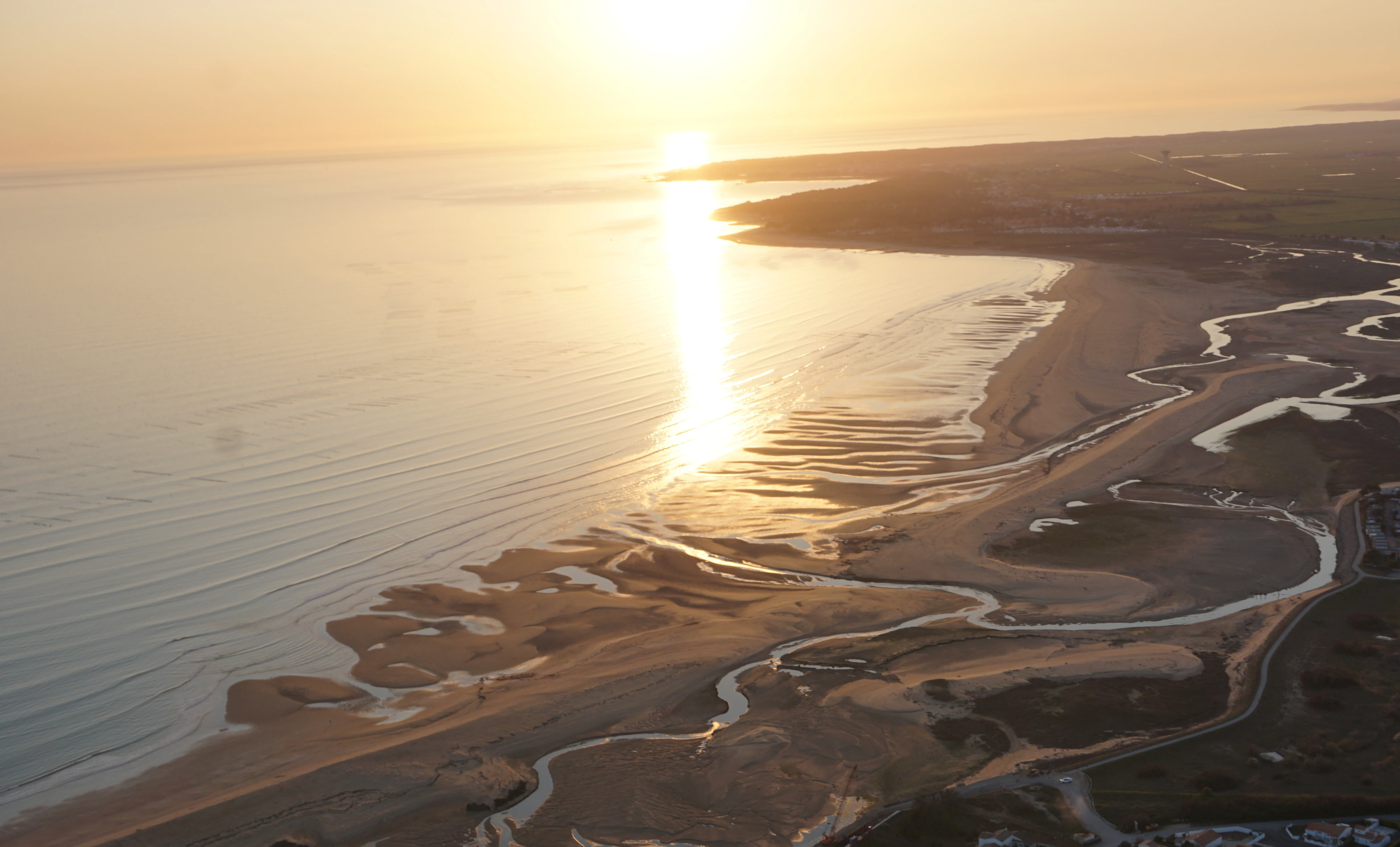
An aerial view of the Atlantic coastline at sunset, featuring winding tidal channels and sandy marshes in the Belle Henriette reserve.
Aerial view of the Belle Henriette National Nature Reserve at sunset, showcasing its unique coastal lagoon ecosystem.

Réserve naturelle nationale de la casse de la Belle-Henriette history and protected-area timeline

The protected lagoon at Belle-Henriette is the product of centuries of coastal change on the southern Vendée coast. In the 16th century, the present presqu'île of La Faute-sur-Mer and the Pointe d'Arçay did not yet exist, and historical maps show the Lay estuary lying further east, roughly at the location now called the Belle-Henriette. The earliest record of the promontory that would later push the Lay's mouth southward dates from around 1621, during accounts of fighting against the Huguenots, when the toponym "poincte de la Faute" began to appear in local records.

A second sand spit began forming at the very start of the 20th century. Its early development was first described in detail by Edmond Bocquier, a schoolteacher from Fontenay-le-Comte, who observed a tongue of sediment extending from the Sainte Anne rock in the direction of the Anse de la Belle Henriette, with a small saltmarsh ("herbu") already forming in its lee. Bocquier recognized that the young spit, then perhaps only a decade old, was enclosing a nascent lagoon. The salt meadows he described remain visible today from the passerelle des Mizottes.

The name itself evolved alongside the landscape. The 1846 population census records a "De la Jeune Henriette" cabin inhabited by Jean Violet, his wife, and his daughter; the form "Belle Henriette" appears only around 1861. Later censuses between 1866 and 1906 instead record the name Marie Louise, suggesting a shift in local usage over time. By the late 20th century, the lagoon and surrounding dune cordon had become recognized for their ecological value, and on August 31, 2011, a French national decree formally established the Réserve naturelle nationale de la casse de la Belle-Henriette to secure this evolving coastal system for the long term.

Réserve naturelle nationale de la casse de la Belle-Henriette landscape and geographic character

The reserve lies within a coastal system shaped by longshore drift and the eastward migration of the Lay estuary. Today, the protected area stretches as a narrow coastal strip roughly five kilometers long and between 500 meters and one kilometer wide, oriented along the Atlantic shoreline. Almost the entire reserve is composed of maritime public domain, dominated by an active dune cordon that protects a shallow brackish lagoon behind it.

Behind the dune front, the landscape transitions through a succession of low-energy environments: open lagoon water, fringing reedbeds, salt pans, and vegetated saltmarshes. These low-relief zones are crossed by tidal channels and seasonal pools whose salinity varies with rainfall and tidal exchange. Toward the inland edge, the lagoon gives way to wet meadows and the broader Marais poitevin wetland complex, creating a contact zone between marine and reclaimed polder landscapes.

The dynamic character of the site is one of its defining landscape features. Sand spits and dune ridges continue to migrate, the lagoon shoreline shifts with storms and tides, and the saltmarshes expand and contract with sediment deposition. This combination of mobile sand, sheltered water, and saltmarsh gives the reserve a distinctive coastal morphology that retains many of its natural processes despite the developed tourism coast on either side.
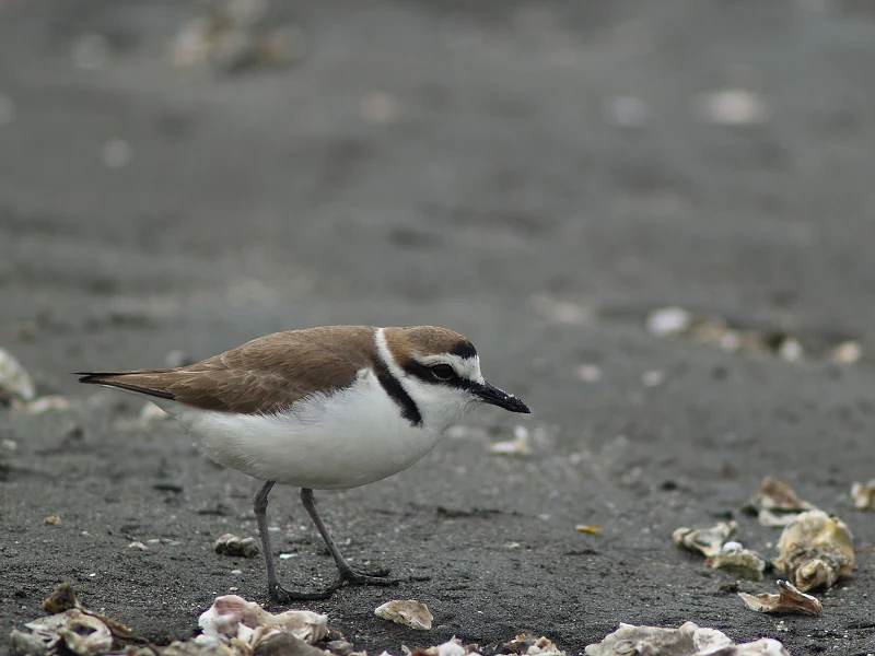
A Kentish plover bird standing on grey wet sand with scattered shell fragments.
A Kentish plover foraging on the coastal sands of the Réserve naturelle nationale de la casse de la Belle-Henriette.

Réserve naturelle nationale de la casse de la Belle-Henriette ecosystems, habitats, and plant life

The reserve is notable for the way it concentrates an unusually diverse set of coastal habitats into a narrow strip. It supports 22 habitat types, of which 13 are considered rare or threatened at the regional level and 4 are classified as priorities at the European scale. The principal habitats include Atlantic dune communities, a marine coastal lagoon with variable salinity, extensive reedbeds (roselières), tall-herb fen vegetation (mégaphorbiaie), and vegetated saltmarsh. The micro-relief within the lagoon, generated by slight differences in elevation and salinity, creates a fine mosaic of pools, channels, and vegetated edges.

This habitat diversity supports more than 360 plant species, of which 32 are considered patrimonial and 10 are formally protected. Among the most characteristic species is the Jersey pink (Œillet de France), a coastal flagship species that grows in stabilized dune sands. Other notable taxa include Jaubert's odontites (Odontite de Jaubert) and sea knotgrass (Renouée maritime), reflecting the salt- and sand-influued character of the site. The mixture of freshwater inputs from the inland marshes and saline inputs from the sea adds to the botanical richness of the lagoon fringes.

Ecologically, the reserve serves as a transitional space between marine and palustrine systems, where salt, freshwater, and human-influenced hydrology interact. This makes it an important reference site for studying coastal lagoon dynamics on the French Atlantic coast, where most comparable systems have been heavily modified.
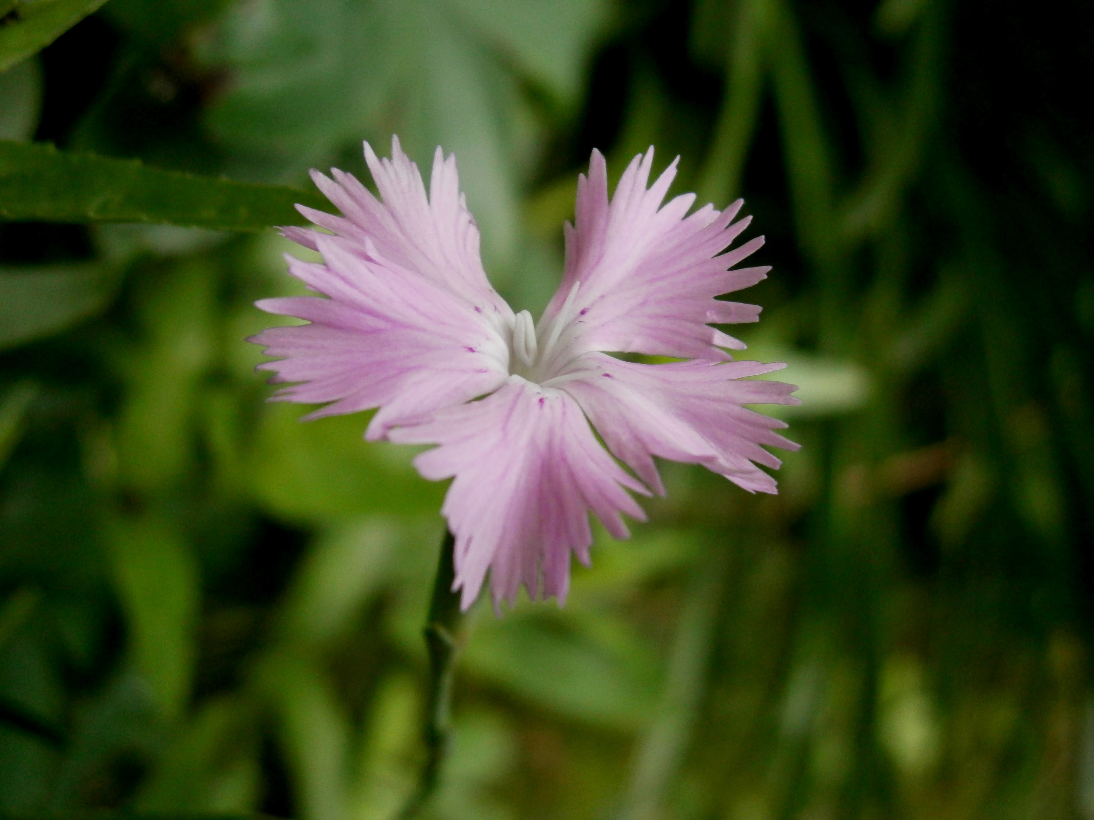
A close-up view of a pale pink Dianthus gallicus flower with fringed petals against a soft-focus green foliage background.
A close-up of a Dianthus gallicus, a flowering plant found in the coastal dunes of the nature reserve.

Réserve naturelle nationale de la casse de la Belle-Henriette wildlife and species highlights

The reserve's wildlife profile is dominated by birds, in keeping with the management focus of the LPO. A total of 234 bird species have been recorded, of which 43 are considered patrimonial. The diverse habitats support very different bird communities: reedbeds host species such as the marsh harrier (Busard des roseaux), Eurasian reed warbler (Rousserolle effarvatte), great reed warbler (Rousserolle turdoide), bluethroat (Gorgebleue à miroir), bearded reedling (Panure à moustaches), penduline tit (Rémiz penduline), and bittern (Butor étoilé); dunes support the tawny pipit (Pipit rousseline); and the open beach provides nesting habitat for the Kentish plover (Gravelot à collier interrompu).

In winter and during migration, the lagoon and adjacent tidal flats attract large numbers of shorebirds, including black-tailed godwits (Barges à queue noire), spotted crakes and Baillon's crakes (Marouettes ponctuée and de Baillon), various sandpipers (Bécasseaux), and greenshanks and other waders (Chevaliers). This seasonal turnover gives the reserve substantial importance within the network of sites used by migratory birds along the Atlantic flyway.

Beyond birds, the reserve supports 15 mammal species, including the European otter (Loutre d'Europe) and the water vole (Campagnol amphibie), which are tied to the lagoon and its fringing wetlands. Among insects, 15 patrimonial species are documented, including the dark spreadwing (Leste à grands stigmas) and the large copper butterfly (Cuivré des marais). Ten amphibian and reptile species complete the faunal inventory, including the western spadefoot toad (Pélobate cultripède), a species of conservation concern in fragmented coastal wetlands.

Réserve naturelle nationale de la casse de la Belle-Henriette conservation status and protection priorities

The reserve's principal conservation value lies in the protection of a complete and still-functional coastal lagoon system on the French Atlantic coast, a type of habitat that has largely been lost elsewhere through reclamation, port development, and shoreline modification. The combination of an active dune cordon, a salinity-variable lagoon, reedbeds, and saltmarsh means that the reserve preserves not only individual species but also the physical processes that sustain them, such as sediment transport, tidal exchange, and haline gradients.

Recognition of this value is reflected in the reserve's IUCN Category IV designation as a habitat and species management area, and in its listing in international and national databases of protected areas. The decree of August 31, 2011, established the reserve as a national nature reserve, conferring durable legal protection. The fact that 4 of the protected habitats are considered priorities at the European scale gives the site a significance that extends beyond the regional context of the Marais poitevin.

Management of the reserve is shared among three partners that reflect its ecological priorities: the LPO leads day-to-day management, with a strong emphasis on bird conservation and public awareness; the Office français de la biodiversité is the associated manager representing the state; and the Vendée departmental hunters' federation acts as a management partner on game-related issues and public outreach. Visitor access is restricted to marked trails, ensuring that the fragile dune, lagoon, and reedbed habitats remain undisturbed. The site thus functions as a living laboratory for coastal wetland conservation on the Atlantic seaboard.

Réserve naturelle nationale de la casse de la Belle-Henriette cultural meaning and human context

The reserve carries a quiet human history embedded in its very name. From the mid-19th century onwards, local census records traced the changing identity of a fishing cabin on this coast, first recorded as "De la Jeune Henriette" in 1846, then as "Belle Henriette" around 1861, and later under the personal name Marie Louise between 1866 and 1906. These shifting toponyms reflect the small but persistent presence of coastal inhabitants who depended on lagoon fisheries and saltmarshes at a time when the modern tourist coast did not yet exist.

The reserve also belongs to the wider cultural landscape of the Marais poitevin, where centuries of interaction between human hydrological management and natural coastal dynamics have shaped a distinctive regional identity. Although the reserve itself is a relatively recent designation, the lagoon, dunes, and saltmarshes it protects have long been recognized locally as part of the working coastal environment. Today, this working past is overlaid by a strong seasonal tourism economy on the surrounding communes, and the reserve's management balances ecological protection with public access and education.

Top sights and standout views in Réserve naturelle nationale de la casse de la Belle-Henriette

The reserve's strongest points of distinction converge around its lagoon-and-dune mosaic. It holds one of the last natural marine coastal lagoons on the Atlantic coast of France, formed and continually reshaped by a migrating sand spit. Its 22 documented habitats include 13 regionally rare or threatened types and 4 European priorities, an unusual concentration given the site's modest size. Birdwatching is exceptional here, with 234 recorded species and an active breeding, migratory, and wintering community across beach, dune, reedbed, and open water. The reserve is also notable for being one of the few national nature reserves in France managed primarily by an NGO, the LPO, with a strong bird-conservation focus. Finally, the protected landscape retains visible historical traces of the shifting Lay estuary, the toponym evolution of the Belle-Henriette cabin, and early 20th-century naturalist observations by Edmond Bocquier, all of which connect the site's ecological present to a longer coastal history.

Best time to visit Réserve naturelle nationale de la casse de la Belle-Henriette

The reserve can be visited year-round, but the experience varies sharply with the seasons. Spring is one of the richest periods for birdwatching, with breeding birds establishing territories in the reedbeds and along the dune fringe, including marsh harriers, reed warblers, and Kentish plovers on the upper beach. Summer brings warmer, drier conditions, a more crowded surrounding coast in La Faute-sur-Mer and La Tranche-sur-Mer, and the flowering of characteristic dune plants such as the Jersey pink; visitors should expect more human activity on the shoreline outside the reserve.

Autumn is typically the most rewarding season for observing migratory shorebirds, as species moving along the Atlantic flyway stop over on the lagoon and tidal flats. Winter brings a different bird community, with black-tailed godwits, crakes, and a wide variety of waders exploiting the milder Atlantic climate. Because the reserve is accessible only on marked trails, light, weather, and patience are more important than any specific month; quieter periods outside the peak summer tourism season usually offer the most rewarding wildlife experiences.
Monthly climate preview

Long-term monthly temperature averages and precipitation records for Vendée

Annual Temperature and Precipitation Normals for Réserve naturelle nationale de la casse de la Belle-Henriette

Representative coordinate records show average temperatures ranging from winter lows near freezing to summer maximums exceeding thirty degrees, alongside consistent monthly precipitation. Reviewing twelve-month climatology figures provides essential context for understanding the protected landscape rhythm.
Annual mean12 °C
6 °C20 °C
Jan
Feb
Mar
Apr11°
May14°
Jun18°
Jul20°
Aug20°
Sep17°
Oct13°
Nov
Dec
Warmest month
August

19.6 °C

Coolest month
January

5.9 °C

Wettest month
November

3.2 mm/day

Driest month
July

1.5 mm/day

Park location guide

Geography guide, regional context, and park location map for Réserve naturelle nationale de la casse de la Belle-Henriette

Réserve naturelle nationale de la casse de la Belle-Henriette park geography, regions, and map view in France

Understand where Réserve naturelle nationale de la casse de la Belle-Henriette sits in France through a broader geographic reading of the surrounding landscape, nearby location context, and its mapped position within the national park landscape.

How Réserve naturelle nationale de la casse de la Belle-Henriette fits into France

France is a unitary semi-presidential republic and one of the world's largest economies. It borders Belgium, Luxembourg, Germany, Switzerland, Italy, Monaco, Andorra, and Spain, with a maritime border to the United Kingdom. The country is known for its cultural influence, art, cuisine, and political history spanning centuries.

Wider geography shaping Réserve naturelle nationale de la casse de la Belle-Henriette in France

France is located in Western Europe. Metropolitan France extends from the Rhine to the Atlantic Ocean and from the Mediterranean Sea to the English Channel and North Sea. The country borders Belgium, Luxembourg, Germany, Switzerland, Italy, Monaco, Andorra, Spain, and has a maritime border with the United Kingdom.

Map view of Réserve naturelle nationale de la casse de la Belle-Henriette

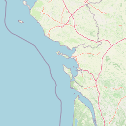
Use this park location map to pinpoint Réserve naturelle nationale de la casse de la Belle-Henriette in France, understand its exact geographic position, and read its mapped placement within the surrounding landscape more clearly.

Pigeon | © OpenStreetMap contributors

Location context for Réserve naturelle nationale de la casse de la Belle-Henriette

Vendée

Visualizing coastal lagoons, shifting dune cordons, and protected wetland habitats

Explore Réserve naturelle nationale de la casse de la Belle-Henriette Photos and Landscapes

Visual records reveal the complex terrain of Réserve naturelle nationale de la casse de la Belle-Henriette through active sand spits, brackish lagoons, and tidal saltmarshes. Examining these protected coastal environments provides direct insight into rare Atlantic habitats and dynamic shoreline morphology.

An aerial view of the Atlantic coastline at sunset, featuring winding tidal channels and sandy marshes in the Belle Henriette reserve.

An aerial view of the Belle-Henriette lagoon showing a narrow sand spit separating the lagoon from the open sea, with marshes and surrounding coastal land.

A Kentish plover bird standing on grey wet sand with scattered shell fragments.

A close-up view of a pale pink Dianthus gallicus flower with fringed petals against a soft-focus green foliage background.

Park atlas

Compare surrounding coastal ecosystems, dune cordons, and regional wetland protected areas

Parks Near Réserve Naturelle Nationale De La Casse De La Belle-Henriette And Related Atlantic Reserves

Browse national nature reserves and protected coastal landscapes situated near Réserve naturelle nationale de la casse de la Belle-Henriette along the Atlantic shoreline. Comparing adjacent wetland habitats and dune ecosystems provides broader geographic context for regional conservation corridors.
Nature reservePays de la Loire
About 8.4 km away#1 closest

Northeast

Réserve naturelle régionale de la ferme de Choisy: Marshland Protected Area and Regional Geography

Sub-brackish wet meadows of the Marais poitevin, Pays de la Loire.

Discover the unique ecological character of Réserve naturelle régionale de la ferme de Choisy, a vital wetland site in western France. This reserve showcases the intersection of traditional pastoral management and marshland conservation, hosting extensive bird populations and rare flora across its low-lying, reclaimed landscape.

Area
0.8 km²
Established
1991
IUCN
IV
Relief
Lowland
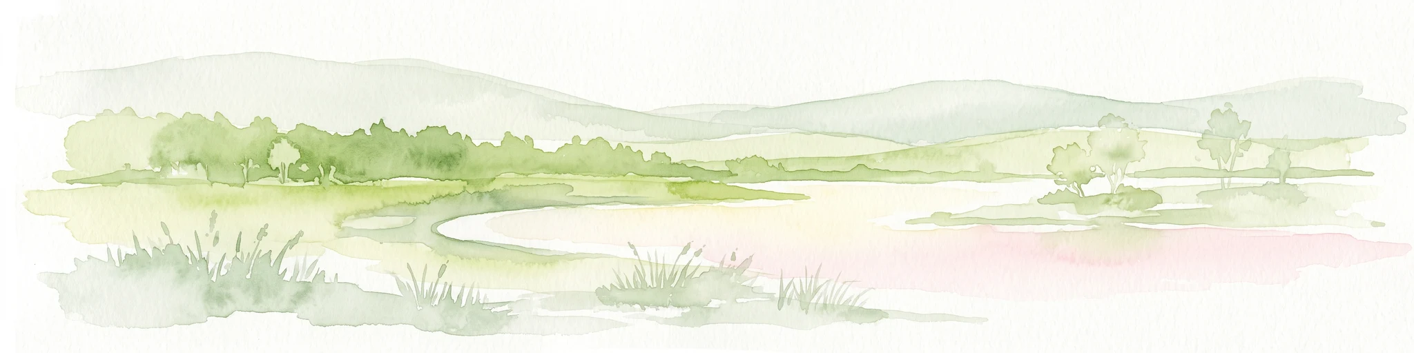
Watercolor painting of a wetland landscape featuring grassy banks, calm water, and soft rolling hills in the background.
Nature reservePays de la Loire
About 19 km away#2 closest

East

Réserve naturelle régionale du marais de la Vacherie: Protected Wetland Geography and Maps

Ecological mosaic of the Marais poitevin in Pays de la Loire

The Réserve naturelle régionale du marais de la Vacherie protects a high-quality fragment of historical marshland. Defined by flat terrain, winter-flooded depressions, and a complex system of drainage channels, the site serves as a crucial habitat for rare wetland flora and migratory waterbirds. This protected landscape offers insight into the sediment-rich, gently undulating terrain that characterizes the back-marsh zones of the Atlantic seaboard.

Area
1.81 km²
Established
2008
IUCN
IV
Relief
Lowland
Nature reservePays de la Loire
About 33 km away#3 closest

East

Réserve naturelle régionale du marais communal du Poiré-sur-Velluire Regional Nature Reserve

Mapping wetland biodiversity in the Pays de la Loire region

Spanning over 240 hectares of reclaimed marshland, this protected area stands as a unique ecological stronghold in France. The reserve demonstrates how traditional collective land management sustains a rich mosaic of freshwater and brackish habitats, supporting more than 177 bird species and heritage livestock breeds in an expansive, open terrain.

Area
2.41 km²
Established
2012
IUCN
IV
Scope
Terrestrial
Nature reserveNouvelle-Aquitaine
About 65 km away#4 closest

East

Réserve naturelle régionale du marais de Galuchet et des boucles de la Sèvre Niortaise Geography and Map

Urban protected wetland in the Nouvelle-Aquitaine region of France

This urban nature reserve protects 151 hectares of diverse wetland habitats along the Sèvre Niortaise. The landscape is defined by river meanders, wet meadows, and riparian corridors, making it a critical site for regional biodiversity and urban ecological connectivity in the Deux-Sèvres department.

Area
1.51 km²
Established
2025
IUCN
IV
Relief
Lowland
Nature reserveNouvelle-Aquitaine
About 70 km away#5 closest

Southeast

Réserve naturelle régionale de la Massonne: Geographic Atlas and Protected Area Map

Mapped ecosystems within the Nouvelle-Aquitaine marshlands

Réserve naturelle régionale de la Massonne serves as a significant ecological corridor in western France, defined by its abrupt transition from coastal Brouage marshes to acidic heath. This atlas entry provides essential data on the reserve boundaries, mapped terrain types, and the structural diversity of its protected wetlands and shrublands, highlighting its role as a sanctuary for diverse nocturnal fauna.

Area
2.023 km²
Established
1997
IUCN
IV
Relief
Lowland
Nature reserveDeux-Sèvres
About 77 km away#6 closest

East

Réserve naturelle régionale du bocage des Antonins: Protected Landscape and Geographic Atlas

Detailed ecological mapping of the Gâtine armoricaine countryside

The Réserve naturelle régionale du bocage des Antonins occupies a distinct space in the Deux-Sèvres department. This protected area serves as a repository for the traditional bocage countryside, featuring a complex arrangement of pollarded trees, wet meadows, and the historic étang des Forges. The site offers a significant look at the structural history of rural western France through its preserved environmental matrix.

Area
0.226 km²
Established
2015
IUCN
IV
Relief
Lowland
Nature reservePays de la Loire
About 79 km away#7 closest

North

Réserve naturelle régionale du bocage humide des Cailleries: Protected Landscape and Regional Map

Wet bocage and oak woodland in the Lake Grand-Lieu watershed

Covering roughly 18 hectares, this protected area features a fine-textured mosaic of woody hedgerows, wet meadows, and multiple small ponds. The site acts as a functional refuge for varied flora and fauna, illustrating the traditional Atlantic landscape character within western France through its structured management of meadows and pond systems.

Area
0.182 km²
Established
2012
IUCN
IV
Relief
Lowland
Nature reserveRomania
About 82 km away#8 closest

Northwest

Réserve naturelle régionale des marais du Bout de Sac: Protected Marsh Geography

Coastal wetland habitat and protected marshland terrain

The Réserve naturelle régionale des marais du Bout de Sac represents 187.1 hectares of preserved wetland habitat. Its landscape includes reclaimed polders, wet meadows, and a network of tidal channels. This site offers significant value for understanding the ecological structure of coastal marshlands and their role as habitats for waterbird populations near the Atlantic interface.

Established
2025
Relief
Lowland
Water
Water-dominated

Common questions about visiting, size, designation, and location context for Réserve naturelle nationale de la casse de la Belle-Henriette

Réserve naturelle nationale de la casse de la Belle-Henriette FAQs for park facts, access, geography, and protected area context

Find quick answers about Réserve naturelle nationale de la casse de la Belle-Henriette, including protected-area facts, park geography, trail and visitor context, and how the park fits into its surrounding country and regional landscape.
MoriAtlas Explorer

Continue Your Protected Areas Search Across the Global Atlas

Deepen your exploration by continuing the structured search for national parks and protected areas worldwide. Utilize the comprehensive filtering capabilities to compare different conservation landscapes and refine your understanding of global park geography. Discover more about the distribution and characteristics of protected natural areas.

Global natural geography
