
Mori Atlas logo
Nature reserveRéserve naturelle nationale de la forêt de la Massane

Understanding the mapped boundaries and old-growth mountain terrain in the Albères massif

Réserve naturelle nationale de la forêt de la Massane: Geography and Protected Land Atlas

The Réserve naturelle nationale de la forêt de la Massane serves as a vital protected landscape in the Pyrénées-Orientales department of Occitanie, France. This nature reserve protects a significant expanse of ancient, free-evolving beech forest within the Albères massif. As a registered UNESCO World Heritage site and long-term scientific observatory, the area offers a unique geographic window into the natural self-organization of Mediterranean mountain ecosystems.

ancient beech forestfree-evolving forestMediterranean mountainsAlbères massifnational nature reserveUNESCO World Heritage
A graphic illustration showing a tall waterfall cascading down between steep rocky cliffs into a stream. The surrounding environment features bare trees, pine trees, and a rocky foreground with fallen logs.

Réserve naturelle nationale de la forêt de la Massane

Nature reserve

Park overview

Structured park overview, official facts, and landscape profile for Réserve naturelle nationale de la forêt de la Massane

Réserve naturelle nationale de la forêt de la Massane park facts, protected area profile, and essential visitor context

Review the core facts for Réserve naturelle nationale de la forêt de la Massane, including designation, size, terrain, visitor scale, habitats, and operating context in one park-focused overview.

About Réserve naturelle nationale de la forêt de la Massane

Tucked into the southeastern foothills of the Pyrenees just a few kilometres from the Mediterranean coast, the Réserve naturelle nationale de la forêt de la Massane is a compact but extraordinarily rich national nature reserve. It occupies the entire upper valley of the Massane, a short coastal river that flows from the Albères massif down to the sea near Argelès-sur-Mer. Within this small territory, the reserve preserves a complete altitudinal gradient of mostly forested terrain, from the Place d'Armes near the Tour Massane at roughly 600 metres up to the Pic des Quatre Termes at about 1,158 metres.

What makes the Massane unusual is its ecological position. Despite sitting well within the Mediterranean bioclimatic zone, its slopes harbour an ancient beech forest that has survived precisely because of its altitude, exposure and the forest's long history without intensive management. The presence of beech at this elevation, surrounded by typically Mediterranean vegetation, has intrigued naturalists for more than a century and continues to shape the reserve's identity today.

The reserve is administered as a national nature reserve under French law, with management led by the Association des Amis de la Massane together with the Fédération des réserves naturelles catalanes. Access remains deliberately light-touch: visitors are welcome, but activities that would alter the state or appearance of the reserve are prohibited, and bivouac is the only form of camping tolerated. The combination of strict protection, long-standing scientific attention and the works carried out here since the late 19th century has turned the Massane into both a preserved ecosystem and a working outdoor laboratory.

In 2021, the beech forest component of the reserve was added to the UNESCO World Heritage list as part of the transnational serial site "Ancient and Primeval Beech Forests of the Carpathians and Other Regions of Europe," recognising the Massane as one of the most important surviving fragments of free-evolving European beech forest in a Mediterranean setting.

Quick facts and research context for Réserve naturelle nationale de la forêt de la Massane

The reserve lies in the Occitanie region of France, within the Pyrénées-Orientales department and the commune of Argelès-sur-Mer, in the heart of the Albères massif at the eastern end of the Pyrenees. It is classified as a Réserve naturelle nationale (national nature reserve) under IUCN Category IV, and its creation in 1973 preceded France's foundational 1976 nature protection law.

The protected area covers about 336 hectares, almost entirely forested, ranging in elevation from roughly 600 metres at the Place d'Armes near the Tour Massane up to about 1,158 metres at the Pic des Quatre Termes. Its beech-dominated core is part of a UNESCO World Heritage site inscribed in 2021, recognising it as one of Europe's most important surviving examples of free-evolving beech forest in a Mediterranean setting.

Protection and recognition

Documented terrestrial protection scope, designation year, and official recognition records

Protection Status and Official Designation History for Réserve naturelle nationale de la forêt de la Massane

Terrestrial protection status records for Réserve naturelle nationale de la forêt de la Massane establish the official designation year of 2021 within global databases. Verified protection parameters compile official management scope and designation history for structured reference.

Protection details

Protection scope
Terrestrial
Designated year
2021
Transboundary protection
No
WDPA ID
4042
Park context

Deeper park guide and search-rich context for Réserve naturelle nationale de la forêt de la Massane

Réserve naturelle nationale de la forêt de la Massane history, landscape, wildlife, and travel context

Explore Réserve naturelle nationale de la forêt de la Massane through its history, landscape character, ecosystems, wildlife, conservation priorities, cultural context, and seasonal travel timing in a structured park guide built for atlas discovery and search intent.

Why Réserve naturelle nationale de la forêt de la Massane stands out

The Massane is best known for being one of the very few ancient beech forests in France allowed to follow a process of free evolution, with no active forestry management for well over a century. This combination of naturalness, longevity and Mediterranean setting makes its roughly 120-hectare beech stand a reference site for understanding how beech forests self-organise when left undisturbed. It is also known internationally for its astonishing level of scientific documentation. More than 10,200 species, mostly invertebrates, have been recorded across just 336 hectares, supported by a long-running meteorological station and a 50,000-tree observation network. These features have made the reserve a benchmark site for studying the effects of droughts, heatwaves and other climate disturbances on Mediterranean mountain forests.
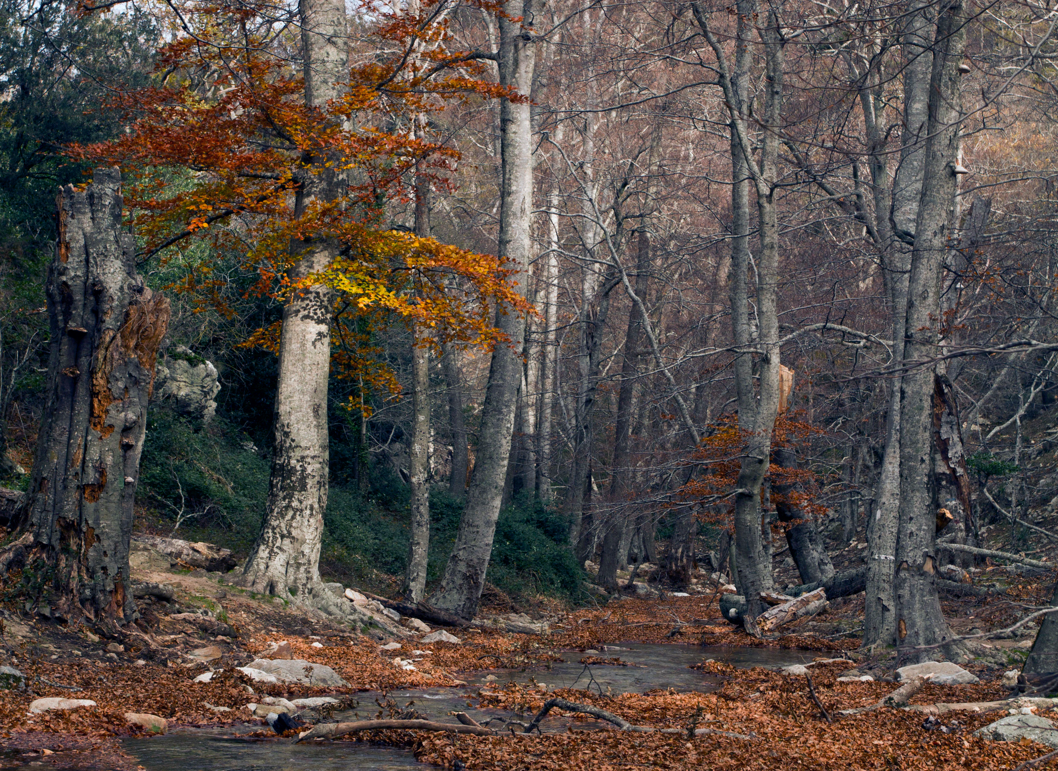
A view into a dense woodland during autumn with tall, light-barked beech trees, some standing and some fallen, with dry leaves covering the forest floor.
Autumn foliage in the ancient beech forest of the Massane National Nature Reserve.

Réserve naturelle nationale de la forêt de la Massane history and protected-area timeline

The forest of the Massane has attracted naturalists since well before it became a nature reserve. Archives linked to the nearby abbey of Valbonne record the passage of Joseph Pitton de Tournefort, botanist to Louis XIV, who is believed to have botanised in the forest nearly three hundred years ago. By the late 19th century, with the founding of the Laboratoire Arago in 1882, the Massane had become a regular fieldwork site for visiting scientists, who were drawn by the unexpected presence of beech in a Mediterranean setting and by the forest's exceptional naturalness.

In the late 19th century, the commune of Argelès-sur-Mer repeatedly called, through deliberations of 20 July 1883 and 10 May 1886, for a halt to forestry exploitation on the site. Charcoal production was gradually abandoned and, by the end of the 19th century, the only human activity left in the valley was extensive cattle grazing. A fenced study area of about nine hectares was set up in 1954 to formalise the site's role as a long-term research platform. In 1973, the French government created the national nature reserve by ministerial decree, several years before the country's general 1976 law on nature protection, reflecting the unusually long and well-organised scientific mobilisation behind the site.

The most recent landmark in the reserve's history came on 28 July 2021, when the beech forest component of the Massane was inscribed on the UNESCO World Heritage list as part of the "Ancient and Primeval Beech Forests of the Carpathians and Other Regions of Europe." This recognition confirmed the reserve's status not only as a national conservation site but also as a member of a transnational network of the most significant surviving beech forests in Europe.

Réserve naturelle nationale de la forêt de la Massane landscape and geographic character

The Massane reserve sits within the Albères massif, the easternmost range of the Pyrenees where the mountains plunge down towards the Mediterranean. Geologically, the massif is built mainly from orthogneiss, overlain by micaschistes and marbles that represent parts of the ancient Precambrian–Cambrian base of the post-Cadomian cover, deformed, metamorphosed and injected by pegmatites and aplites during the Hercynian orogeny several hundred million years ago. The soft, rounded morphology of the upper Massane valley reflects ancient Miocene planation surfaces that were subsequently uplifted during the Pliocene.

The valley itself is a narrow, forested corridor carved by the short Massane river, which eventually flows into the Mediterranean. Elevations rise from the Place d'Armes near the Tour Massane at around 600 metres up to the Pic des Quatre Termes at about 1,158 metres, giving the landscape a relatively gentle but distinctly montane character. South-facing slopes, north-facing slopes and valley bottoms each carry different combinations of vegetation, creating a richly patterned mosaic of exposures and microhabitats within a tight geographic footprint.
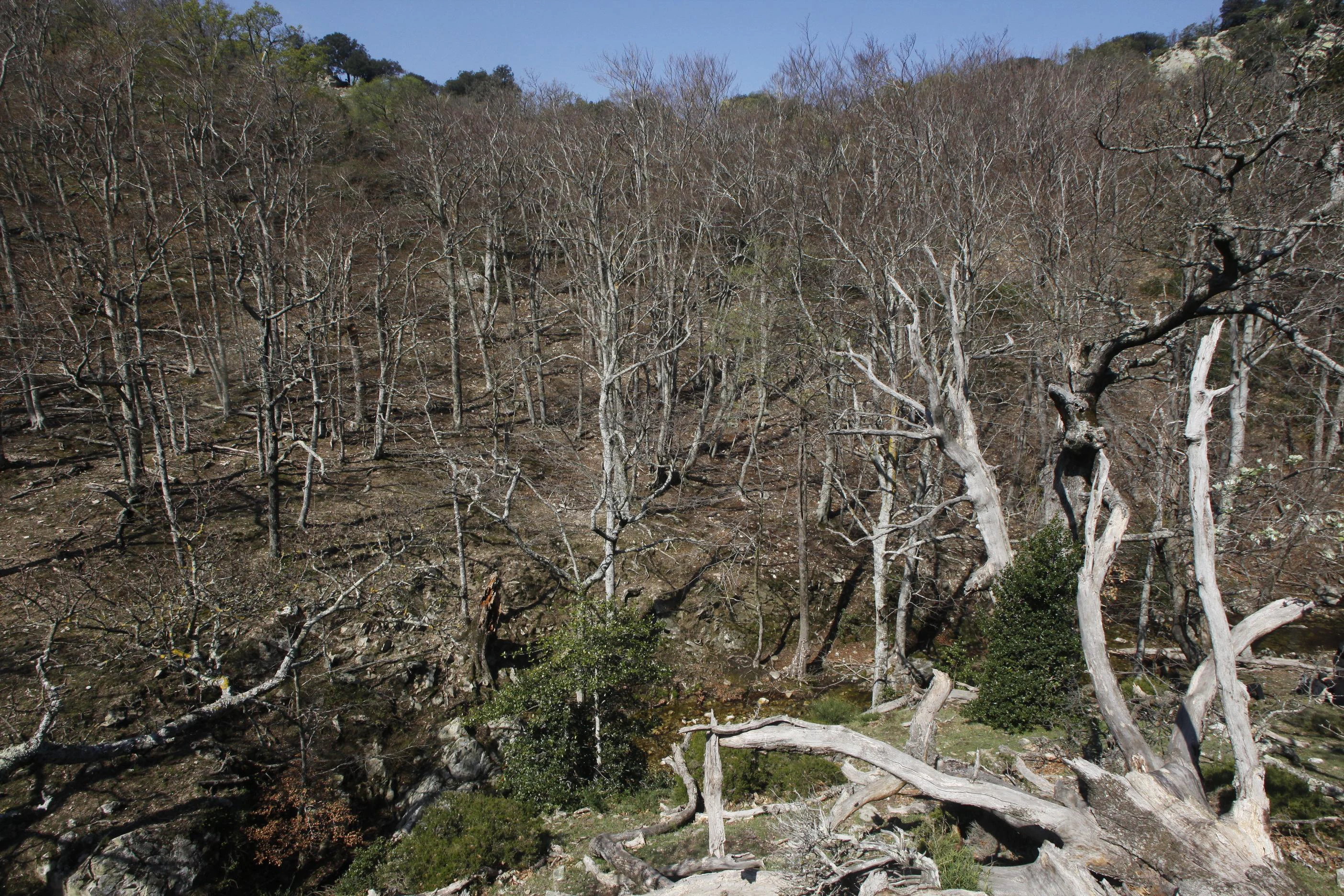
A hillside covered in a dense, deciduous forest during late winter or early spring with bare branches and some dead standing timber.
The southern slope of the Massane forest, showcasing dense, leafless trees and natural forest decay.

Réserve naturelle nationale de la forêt de la Massane ecosystems, habitats, and plant life

Ecologically, the Massane occupies a remarkable biogeographical crossroads. Despite its clearly Mediterranean climatic context, the valley's altitude and humidity support a temperate-cool beech forest at its core, while typical Mediterranean species persist on drier, sun-exposed slopes. The result is a compressed mosaic within a few hundred hectares of habitats that, elsewhere in the region, would be separated by much larger distances.

The most ecologically distinctive feature is the ancient beech forest itself, dominated by European beech (Fagus sylvatica) and interspersed with holm oak, sessile oak, downy oak, holly, maple, ash and yew. The forest has now been left to evolve freely for more than 120 years, allowing the accumulation of large old trees, abundant deadwood and complex structural layering that sustain many specialised organisms. The presence of more than 360 lichen species, including Lobaria pulmonaria, a classic indicator of long forest continuity, demonstrates how the lack of recent management disturbance has shaped the site's biological character.
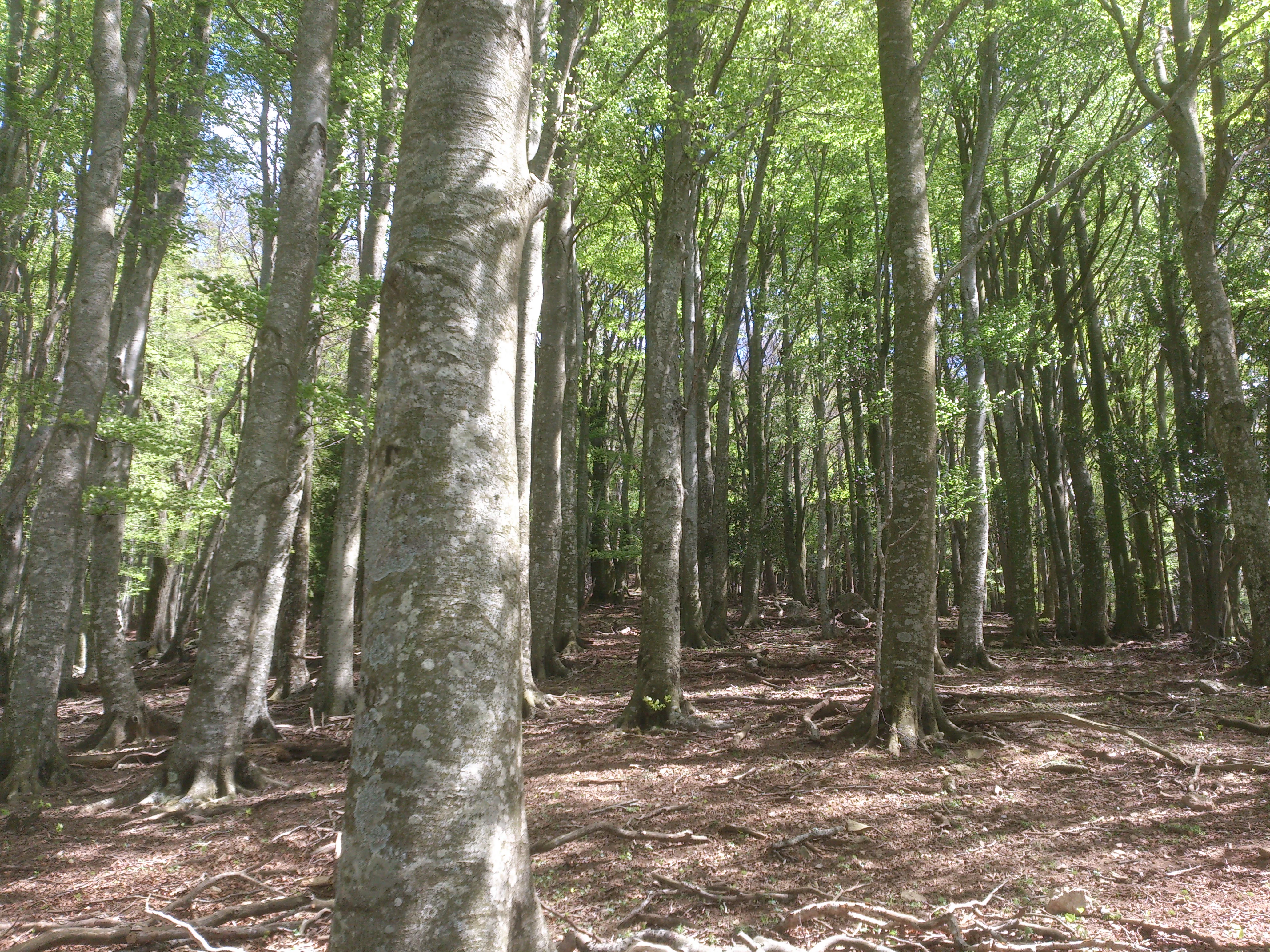
A dense forest of tall beech trees with smooth grey trunks and bright green leaves, the ground is covered in leaf litter and branches.
A view into the beech forest of the Massane Nature Reserve.

Réserve naturelle nationale de la forêt de la Massane wildlife and species highlights

The Massane is overwhelmingly an invertebrate site, but in absolute terms its most celebrated asset is the sheer number of species packed into a small area. Around 10,200 species have been recorded across the reserve, with diptera (flies) alone accounting for more than 1,360 species, including many that depend on the large volumes of deadwood and very old trees produced by the free-evolving forest. Saproxylic insects tied to old-growth forest structures are a particular focus of the reserve's entomological research.

Among vertebrates, more than eleven bat species have been recorded, including the lesser horseshoe bat and Schreiber's bent-winged bat, alongside typical forest mammals such as badger, beech marten and genet, with the water shrew frequenting the riverine habitat. The forest and cliffs also support a notable community of raptors and other birds, including short-toed snake eagle, golden eagle, peregrine falcon, Eurasian eagle-owl, European nightjar, woodlark, tawny pipit, common rock thrush, Dartford warbler, red-backed shrike and ortolan bunting. Amphibians such as the fire salamander, midwife toad, common toad and painted frog coexist with reptiles like the green lizard, common wall lizard and Aesculapian snake. Although eels were historically present in the Massane stream, by the early 1990s they appear to have disappeared from this stretch of the river.
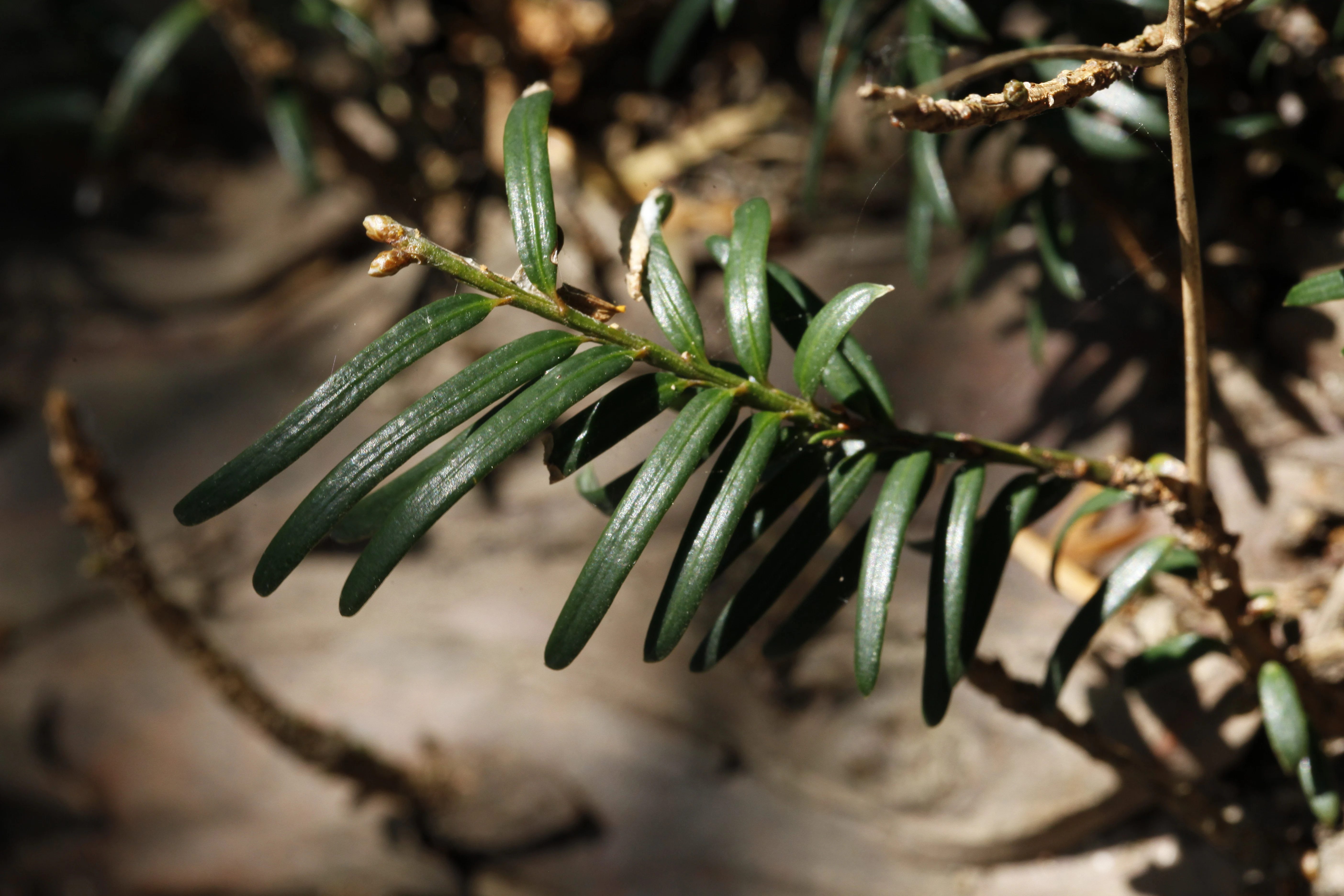
A detailed close-up of dark green, needle-like yew leaves attached to a branch, with a soft-focus forest floor in the background.
A close-up view of yew tree leaves within the Massane Forest National Nature Reserve.

Réserve naturelle nationale de la forêt de la Massane conservation status and protection priorities

Conservation at the Massane combines strict legal protection with active scientific monitoring. The reserve's national nature reserve status prohibits any public or private work likely to alter the state or appearance of the site, and its legal framework predates the general French nature protection law of 1976. It is also embedded in a network of complementary designations, including a ZNIEFF of type I, a ZNIEFF of type II covering the broader Albères mountain forests, and an Important Bird Conservation Area over the Albères massif.

A key conservation challenge is the reserve's vulnerability to climate change. Since the 2003 European heatwave, the Massane has experienced repeated droughts and heat stress, producing progressive crown dieback in some trees, beginning with a characteristic "descent of the crown" before eventual mortality. To monitor and understand these impacts, the reserve operates a meteorological station installed in 1959 and has built up a network observing some 50,000 trees, allowing scientists to quantify the precise effects of droughts, heatwaves, windstorms, snow, frost and heavy rainfall on the forest.

Human pressure is also part of the conservation equation. With around 40,000 visitors each year, the reserve faces risks from overuse, including illegal camping (only bivouac is tolerated), abandoned waste and wildfires. Outreach, regulation and on-site presence by the Association des Amis de la Massane and the Fédération des réserves naturelles catalanes are central to keeping these pressures manageable while preserving the site as a working scientific observatory and a reference for free-evolving forest conservation in a Mediterranean context.

Réserve naturelle nationale de la forêt de la Massane cultural meaning and human context

The forest's identity is deeply rooted in the cultural geography of the Catalonian Pyrenees. The river Massane takes its name, via the Catalan forms Massana or Maçana, from the Latin Mala Mattiana, itself a variety of apple named after the Roman gastronome and agronomist Caius Matius in the 1st century. The forest is also known historically as the "forêt des Couloumates," a local name that still circulates alongside the dominant toponym.

Human presence in the valley long predates the reserve. Until the late 19th century, the forest was exploited for the production of charcoal, and the eventual abandonment of that activity, formalised by communal deliberations in 1883 and 1886, was the precondition for the natural state that scientists later documented. Today the only customary land use within the reserve is extensive cattle grazing, a low-intensity form of activity that has coexisted with the site's strict protection since the 19th century. The reserve sits within an active network of Catalonian nature reserves, connecting it to broader regional traditions of Mediterranean mountain stewardship.
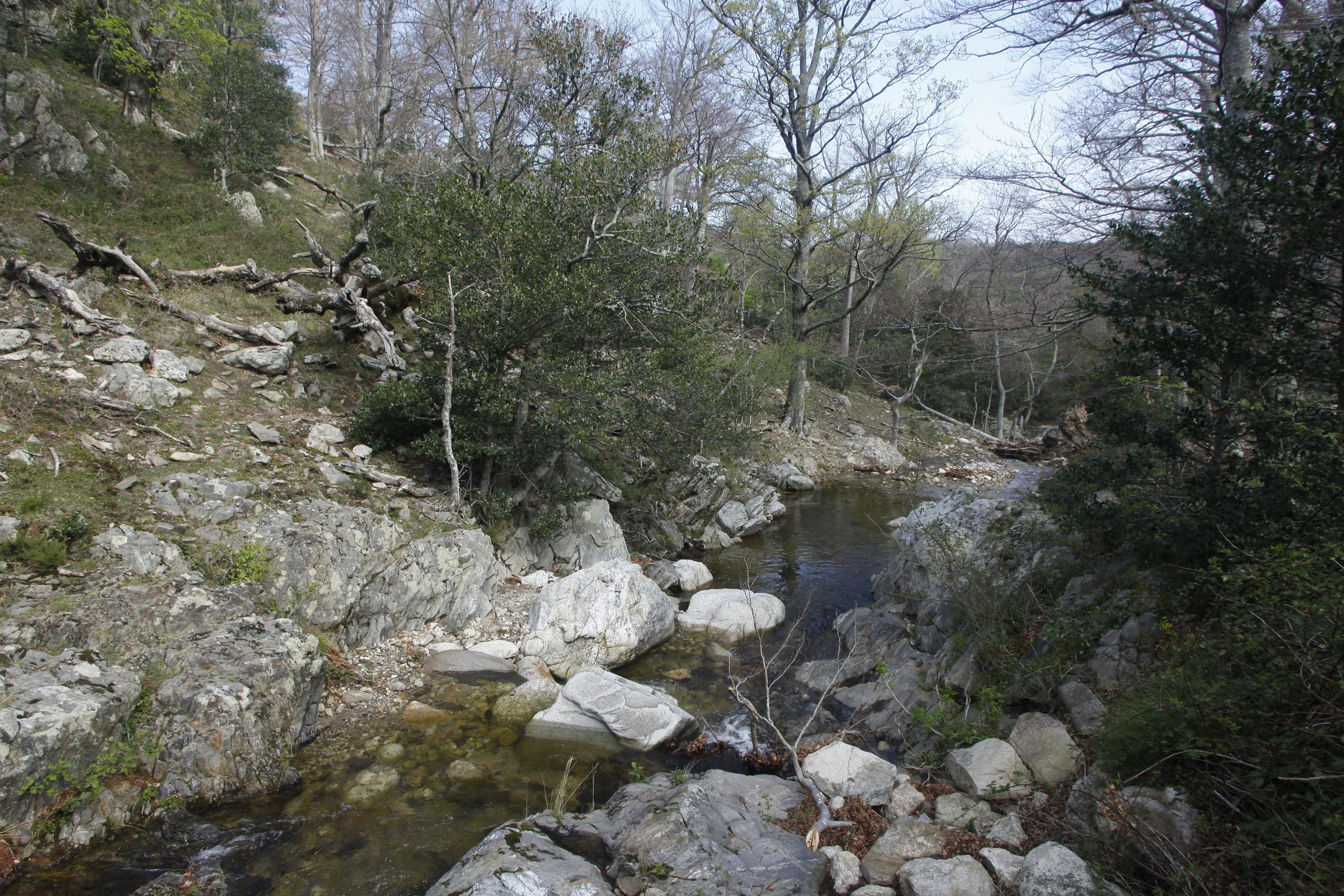
A small, clear stream flows through a rocky forest landscape in the Massane nature reserve.
The Massane River flowing through the ancient beech forest within the reserve.

Top sights and standout views in Réserve naturelle nationale de la forêt de la Massane

Among the reserve's strongest identity markers are its ancient beech forest in free evolution, its inscription on the UNESCO World Heritage list in 2021, and its extraordinary status as one of the best-inventoried natural sites of its size in the world, with more than 10,200 recorded species on just 336 hectares. The 50,000-tree observation network and the long-running meteorological station, in place since the 1950s and 1960s, reinforce its role as a reference observatory for climate impacts on Mediterranean mountain forests.

These features together set the Massane apart: a compact, strictly protected national nature reserve that is simultaneously a living ancient forest, an outdoor laboratory and a transnational World Heritage component, all set within a short walk of the Mediterranean coast.
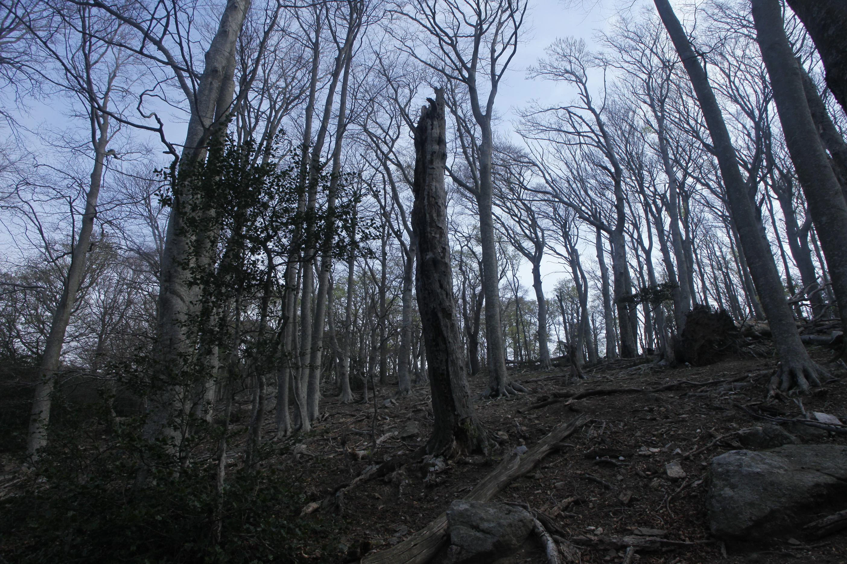
A low-angle view looking up into a dense forest with bare, deciduous trees and a tall, broken tree trunk in the center, set against a muted sky.
A view of the beech forest within the Massane National Nature Reserve, featuring tall, bare-branched trees and a prominent snag.

Best time to visit Réserve naturelle nationale de la forêt de la Massane

The Massane enjoys a Mediterranean precipitation regime with relatively dry, warm summers and cooler, wetter conditions the rest of the year. Summers are the driest season and also the time when heat stress on the forest is most visible, including the progressive crown dieback documented since the 2003 heatwave, which can make the landscape feel more exposed and parched.

Spring and autumn generally offer the most balanced conditions for a visit, with milder temperatures, more reliable rainfall and richer ground-level activity in the understorey. Winters are cool with frequent frosts, and the beech forest takes on a starkly bare, structural character. Whatever the season, visitors should expect mountain weather in a Mediterranean setting: conditions can change rapidly, and rainfall, even outside summer, can be sudden and intense.
Monthly climate preview

Long-term representative monthly temperature and precipitation patterns across the protected landscape

Annual Climate Normals and Average Temperatures for Réserve naturelle nationale de la forêt de la Massane

Representative coordinate records show average monthly temperatures ranging from 8.59 °C to 23.79 °C alongside baseline precipitation measurements spanning 0.76 mm to 2.63 mm per day. Detailed monthly breakdowns provide comprehensive insight into long-term climate normals and annual weather variations across the protected area.
Annual mean15 °C
9 °C24 °C
Jan
Feb
Mar11°
Apr13°
May17°
Jun21°
Jul24°
Aug24°
Sep20°
Oct17°
Nov12°
Dec
Warmest month
August

23.8 °C

Coolest month
January

8.6 °C

Wettest month
October

2.6 mm/day

Driest month
July

0.8 mm/day

Park location guide

Geography guide, regional context, and park location map for Réserve naturelle nationale de la forêt de la Massane

Réserve naturelle nationale de la forêt de la Massane park geography, regions, and map view in France

Understand where Réserve naturelle nationale de la forêt de la Massane sits in France through a broader geographic reading of the surrounding landscape, nearby location context, and its mapped position within the national park landscape.

How Réserve naturelle nationale de la forêt de la Massane fits into France

France is a unitary semi-presidential republic and one of the world's largest economies. It borders Belgium, Luxembourg, Germany, Switzerland, Italy, Monaco, Andorra, and Spain, with a maritime border to the United Kingdom. The country is known for its cultural influence, art, cuisine, and political history spanning centuries.

Wider geography shaping Réserve naturelle nationale de la forêt de la Massane in France

France is located in Western Europe. Metropolitan France extends from the Rhine to the Atlantic Ocean and from the Mediterranean Sea to the English Channel and North Sea. The country borders Belgium, Luxembourg, Germany, Switzerland, Italy, Monaco, Andorra, Spain, and has a maritime border with the United Kingdom.

Map view of Réserve naturelle nationale de la forêt de la Massane

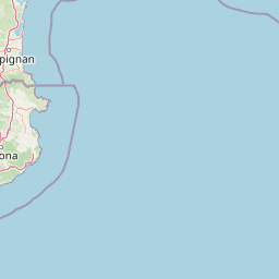
Use this park location map to pinpoint Réserve naturelle nationale de la forêt de la Massane in France, understand its exact geographic position, and read its mapped placement within the surrounding landscape more clearly.

Pigeon | © OpenStreetMap contributors

Location context for Réserve naturelle nationale de la forêt de la Massane

Occitanie

Explore the ancient beech forests, terrain, and protected landscapes of the Albères massif.

Visualizing Réserve naturelle nationale de la forêt de la Massane: Photos and Scenery

Visual records capture the old-growth canopy, rugged valley terrain, and diverse microhabitats defining Réserve naturelle nationale de la forêt de la Massane. Photographic evidence reveals the Mediterranean mountain environment and undisturbed forest structure across the protected reserve.

A view into a dense woodland during autumn with tall, light-barked beech trees, some standing and some fallen, with dry leaves covering the forest floor.

A brown-and-green frog with textured skin resting on a light-colored, rough, mineral-rich stone surface.

A hillside covered in a dense, deciduous forest during late winter or early spring with bare branches and some dead standing timber.

A dense forest of tall beech trees with smooth grey trunks and bright green leaves, the ground is covered in leaf litter and branches.

A detailed close-up of dark green, needle-like yew leaves attached to a branch, with a soft-focus forest floor in the background.

A green tiger beetle with spotted wing covers resting on gravelly forest soil.

A small, clear stream flows through a rocky forest landscape in the Massane nature reserve.

A low-angle view looking up into a dense forest with bare, deciduous trees and a tall, broken tree trunk in the center, set against a muted sky.

Park atlas

Compare regional mountain reserves and protected landscapes across the Mediterranean rim

Other Parks Near Réserve naturelle nationale de la forêt de la Massane and Surrounding Protected Areas

Browsing other parks near Réserve naturelle nationale de la forêt de la Massane reveals broader ecological patterns across the Albères massif and Mediterranean mountain slopes. Examining connected protected landscapes helps place ancient beech forests and regional reserves into a wider geographical perspective.
Nature reserveOccitanie
About 61 km away#1 closest

West

Réserve naturelle régionale de Nyer: Mapped Geography and Protected Mountain Landscapes

Exploring the vertical terrain of a Pyrenean regional nature reserve

The Réserve naturelle régionale de Nyer offers a remarkable study in vertical zonation, featuring deep gorges and high alpine summits within the Pyrénées-Orientales. This protected area stands as a focal point for understanding the convergence of Mediterranean and mountain climates across the diverse topographical landscape of the Occitanie region.

Area
21.9 km²
Established
1998
Relief
Mountain
Climate
Mediterranean
Watercolor painting depicting a landscape with marshy green foreground, winding water, distant trees, and mountains under a light sky.
Nature reserveOccitanie
About 64 km away#2 closest

North

Réserve naturelle régionale de Sainte-Lucie: Protected Coastal Geography in Occitanie

Coastal lagoons, island habitats, and Mediterranean marshlands.

This protected area profile explores the physical geography of Réserve naturelle régionale de Sainte-Lucie. Understand the interplay between the central island landform, brackish lagoon networks, and the Mediterranean beach ecosystems that define this unique French conservation landscape.

Area
8.25 km²
Established
2009
IUCN
IV
Relief
Lowland
Nature reserveOccitanie
About 83 km away#3 closest

Northwest

Réserve naturelle nationale de la Grotte du T.M. 71: Geological Protected Area Map

Subterranean karst exploration in the Aude department of Occitanie

Located in the foothills bordering the Pyrenees, the Réserve naturelle nationale de la Grotte du T.M. 71 protects a sprawling network of limestone passages. This site represents a key protected area for the study of subterranean mineral formations and Pyrenean karst evolution, featuring kilometres of mapped galleries maintained under a strict integral conservation framework.

Area
0.96 km²
Established
1987
IUCN
III
Protected areaAndorra
About 111 km away#4 closest

West

Madriu-Perafita-Claror Valley: Geographic Overview of Andorra's Premier Protected Landscape

An examination of glacial landforms and historic mountain heritage.

Spanning nine percent of Andorra, the Madriu-Perafita-Claror Valley remains a rare example of a preserved Pyrenean cultural landscape. This protected area features granite cliffs, glacial cirques, and historic ironworking remnants, offering a deep look into the environmental legacy of mountain societies within a remote, foot-access-only basin.

Area
42.47 km²
Established
2004
Relief
Mountain
Climate
Alpine
Watercolor painting of a low lying landscape with calm water, grassy wetlands in the foreground, and distant green hills under a soft sunset sky.
Protected areaHérault
About 125 km away#5 closest

Northeast

Salins de Frontignan: An Atlas of Protected Coastal Wetlands in the Hérault Region

Explore saline landscapes and marshland geography on the Gulf of Lion.

Located in the Hérault department, Salins de Frontignan offers a fascinating study in coastal geography and ecological reclamation. This protected area features abandoned salt marshes that have evolved into a vital network of evaporation basins, salt steppes, and lagoon margins. The site serves as a crucial habitat for specialized halophytic plants, positioned uniquely between the Mediterranean shoreline and the limestone foothills of the Gardiole range.

Area
2.795 km²
Established
1980
IUCN
IV
Relief
Lowland
Watercolor painting of a river winding through a valley with green fields, trees, and distant hills
Protected areaAndorra
About 125 km away#6 closest

West

Parc Natural Comunal de les Valls del Comapedrosa: Andorra's Highest Protected Alpine Landscape

Explore the Pyrenean terrain and mapped boundaries of Andorra's summit park.

Parc Natural Comunal de les Valls del Comapedrosa is the primary high-altitude protected area in Andorra, defined by its rugged alpine terrain and the presence of Coma Pedrosa, the country's highest peak. This protected landscape offers a significant geographic anchor for exploring the Pyrenees, highlighting the unique mountain conservation efforts. Its mapped boundaries encompass dramatic valleys and steep ridges, providing a clear context for understanding Andorra's mountainous geography through a structured atlas lens.

Area
15.43 km²
Established
2003
IUCN
IV
Relief
Mountain
Natural monumentHérault
About 130 km away#7 closest

North

Site paléontologique de La Lieude: Geological Heritage and Permian Fossil Site in Hérault

Tracing ancient reptile pathways across preserved sedimentary rock

Located on the edge of the Massif Central, the Site paléontologique de La Lieude is a protected natural monument in the Hérault department. It showcases an exceptional Permian-age surface embedded with hundreds of trackways left by early synapsids, providing an essential geographic and scientific record of prehistoric life in France.

Nature reserveOccitanie
About 142 km away#8 closest

Northwest

Réserve naturelle régionale de Cambounet-sur-le-Sor: Protected Wetland Geography

Alluvial floodplain habitat in the Tarn, Occitanie

Situated in the Tarn department of Occitanie, this nature reserve guards a dense wetland habitat shaped by the confluence of the Sor and Agout rivers. The area stands as an ecological centerpiece, providing sheltered riparian woodland and marshy terrain for more than one hundred and seventy recorded bird species, making it a distinct study in French riverine conservation.

Area
0.309 km²
Established
1990
IUCN
IV
Relief
Lowland

Common questions about visiting, size, designation, and location context for Réserve naturelle nationale de la forêt de la Massane

Réserve naturelle nationale de la forêt de la Massane FAQs for park facts, access, geography, and protected area context

Find quick answers about Réserve naturelle nationale de la forêt de la Massane, including protected-area facts, park geography, trail and visitor context, and how the park fits into its surrounding country and regional landscape.
MoriAtlas Explorer

Continue Your Protected Areas Search Across the Global Atlas

Deepen your exploration by continuing the structured search for national parks and protected areas worldwide. Utilize the comprehensive filtering capabilities to compare different conservation landscapes and refine your understanding of global park geography. Discover more about the distribution and characteristics of protected natural areas.

Global natural geography