
Mori Atlas logo
Nature reserveRéserve naturelle régionale d'Aulon

Exploring the vertical terrain and diverse habitat gradients of this central Pyrenean nature reserve.

Réserve naturelle régionale d'Aulon: Mapping Protected Mountain Landscapes in the Pyrenees

The Réserve naturelle régionale d'Aulon encompasses a striking vertical expanse in the central Pyrenees, rising from lush valley pastures to the rugged crests of the Arbizon massif. This protected landscape preserves a complex mosaic of subalpine grasslands, alpine heathlands, and granite-rich rocky outcrops within the Occitanie region. Through detailed geographic mapping, observers can trace the transitions between streams, mountain mires, and high-elevation cliffs that support rare Pyrenean flora and fauna.

regional nature reservePyreneesHautes-Pyrénéesalpine habitatssubalpine grasslandsmountain mires
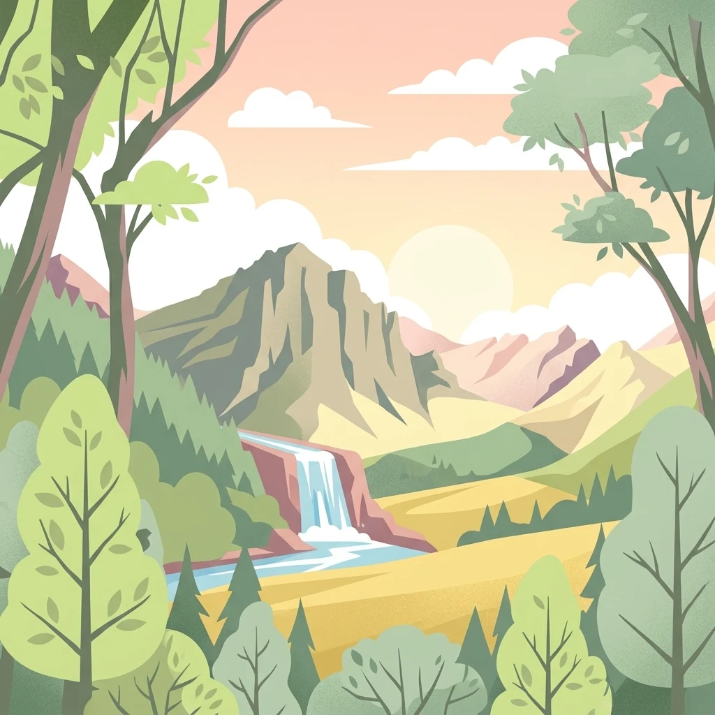
A flat style digital illustration of a mountainous park landscape with a waterfall flowing from a rocky peak into a river valley, surrounded by deciduous and coniferous trees under a soft sunrise sky.

Réserve naturelle régionale d'Aulon

Nature reserve

Park overview

Structured park overview, official facts, and landscape profile for Réserve naturelle régionale d'Aulon

Réserve naturelle régionale d'Aulon park facts, protected area profile, and essential visitor context

Review the core facts for Réserve naturelle régionale d'Aulon, including designation, size, terrain, visitor scale, habitats, and operating context in one park-focused overview.

About Réserve naturelle régionale d'Aulon

The Réserve naturelle régionale d'Aulon is a protected mountain area set above the small commune of Aulon in the Hautes-Pyrénées, a department that forms part of the historic Vallée d'Aure in the central French Pyrenees. Geographicaily, it occupies a vertical slice of terrain stretching from the hamlet of Lurgues and the confluence of the Auloueilh and Rabat streams, through the villages of Espigous and Auloueilh, up to the high crests of the Pics de Cettiou, Portarras, and Bastan. Its territory is enclosed within a larger protected landscape, lying inside the wider zone of the Pyrenees National Park and immediately adjacent to the Néouvielle National Nature Reserve.

Although modest in size, the reserve is ecologically dense because of its dramatic altitude range and geological complexity. The combination of Eocarboniferous and Carboniferous limestone, clay, and pelite formations, Devonian schists and limestones, moraines, alluvial cover, and granite outcrops in the northern part gives the site a striking diversity of substrates. The resulting habitat mosaic supports communities that are highly valued for conservation, including Pyrenean Festuca eskia grasslands, Elyna myosuroides wind-exposed crests, steppe-like Festuca gautieri swards, alpine and subalpine tall-herb communities, petrifying springs, wet mires, siliceous screes, central Pyrenean limestone cliffs, and Pinus uncinata forests.

A network of streams, small torrents, mires, ponds, and a small lake (Lac de Portarras, which can dry up in summer) connects these habitats. The reserve's identity is shaped by the coexistence of wild species and traditional mountain land use. Each summer, more than 4,000 sheep and around 400 cattle are brought onto the high pastures, tended by two shepherds and a herdsman. This long-running pastoral activity is essential to maintaining open habitats that would otherwise revert to scrub, supporting the very conditions necessary for the reserve's rare plants, galliformes, raptors, and invertebrates to thrive.

Quick facts and research context for Réserve naturelle régionale d'Aulon

The Aulon Regional Nature Reserve is a small but ecologically dense protected area in the central French Pyrenees. It lies within the Occitanie region, in the Hautes-Pyrénées department, and sits inside the influence zone of the Pyrenees National Park, directly adjacent to the Néouvielle National Nature Reserve. The reserve was first designated as a voluntary nature reserve in 2001 and was reclassified as a regional nature reserve at the beginning of 2011.

It covers about 12.37 square kilometres, with elevations ranging from roughly 1,365 metres at the lowest point up to 2,738 metres at Pic d'Aulon. The territory is managed by the local association La Frênette, which oversees conservation, scientific monitoring, public engagement, and coordination with pastoral users. The site is recognized as a reservoir of remarkable biodiversity and remains an actively grazed summer mountain landscape.

Protection and recognition

Review documented terrestrial protection scope and baseline designation data for this protected area.

Protection Status and Official Designation History for Réserve naturelle régionale d'Aulon

Terrestrial protection status for Réserve naturelle régionale d'Aulon reflects structured designation records established in 2011. Official conservation scope and baseline management history outline the foundational protection framework for the territory.

Protection details

Protection scope
Terrestrial
Designated year
2011
Transboundary protection
No
WDPA ID
555514321
Park context

Deeper park guide and search-rich context for Réserve naturelle régionale d'Aulon

Réserve naturelle régionale d'Aulon history, landscape, wildlife, and travel context

Explore Réserve naturelle régionale d'Aulon through its history, landscape character, ecosystems, wildlife, conservation priorities, cultural context, and seasonal travel timing in a structured park guide built for atlas discovery and search intent.

Why Réserve naturelle régionale d'Aulon stands out

The reserve is best known for its mosaic of Pyrenean mountain habitats layered above the village of Aulon and below the peaks of the Arbizon, Portarras, Bastan, and Cettiou ranges. Its elevation range packs together subalpine grasslands, alpine heathlands, peat-influenced wet mires, rock formations, and conifer forests featuring Pyrenean pine (Pinus uncinata) on calcareous substrates. It is also well known for its rich high-mountain fauna, including Pyrenean chamois (isard), marmots, golden eagles, bearded vultures, Egyptian vultures, and rock ptarmigan, as well as iconic Pyrenean plants such as the Pyrenean lily, Pyrenean iris, Ramonda pyrenaica, and round-leaved sundew, which thrive in the reserve's mires and rocky grasslands. The continued presence of traditional livestock grazing, which maintains these open landscapes, is itself a defining feature of the site.
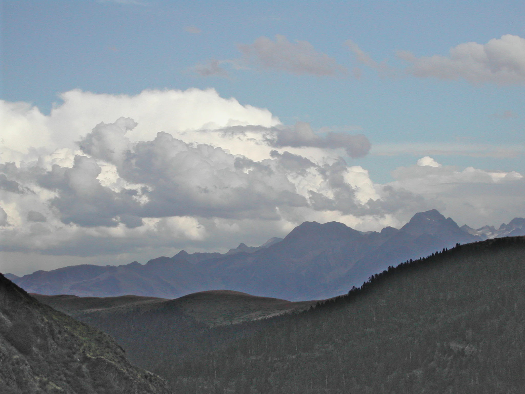
A wide mountain landscape showing a series of distant rugged peaks under a partly cloudy sky, with dark, shadowed mountain slopes framing the view in the foreground.
Panoramic mountain view from the trail leading to Arbizon in the Aulon Regional Nature Reserve.

Réserve naturelle régionale d'Aulon history and protected-area timeline

The reserve's story begins on 16 February 2001, when its territory was formally classified as a réserve naturelle volontaire, an early French status for locally initiated voluntary nature reserves. From the outset, the goal was to protect the flora and fauna of the mountain spaces above the commune of Aulon while respecting the area's deep-rooted pastoral traditions. A small local association quickly became the driving force behind the reserve's daily operation and public engagement.

In early 2011 the reserve's status was upgraded to réserve naturelle régionale, aligning it with the post-2006 reform of French nature reserve categories and strengthening its long-term protection. At the same time, the management association rebranded itself as La Frênette, which still administers the reserve. The year 2011 also saw the opening of a Maison de la nature, built from a former village house and equipped with a botanical garden and exhibition space, giving the reserve a permanent base for public outreach and environmental education. Equine grazing, once part of the landscape, ended in 2011, while sheep and cattle husbandry continues as the cornerstone of open-habitat management.

Réserve naturelle régionale d'Aulon landscape and geographic character

The Aulon reserve spans a striking vertical band of central Pyrenean terrain. Its lowest point lies near 1,365 metres, at the confluence of the Auloueilh and Rabat streams, while its highest point is Pic d'Aulon at 2,738 metres. The reserve covers roughly 1,237 hectares across close to 1,400 metres of vertical relief, which gives it a layered visual character: green valley pastures and meadows at the base, dense mid-mountain pastures and mires in the middle, and rugged alpine slopes, crests, and rock faces at the top.

Geologically, the landscape is a patchwork. The Carboniferous and Eocarboniferous layers bring calcareous, clayey, and pelitic formations, while Devonian rocks contribute schists and limestones. Glacial and post-glacial processes have left a cover of moraines, alluvium, and scree, while the northern part of the reserve is marked by significant granite outcrops. These varied substrates shape both scenery and ecology, generating abrupt transitions between gentle pastureland, rocky swards, wet basins, and steep cliffs.

Hydrological features are equally varied. Numerous small streams and snowmelt-fed torrents cross the reserve, alongside mires, marshes, and ponds, and the small Lac de Portarras. The upper boundary is defined by dramatic ridgelines, including the Mailh d'Aulon, the Pics de Cettiou, Pics de Portarras, Pic de Bastan, and surrounding summits that frame views toward Clarabide, Gourgs Blancs, and Gourdon.
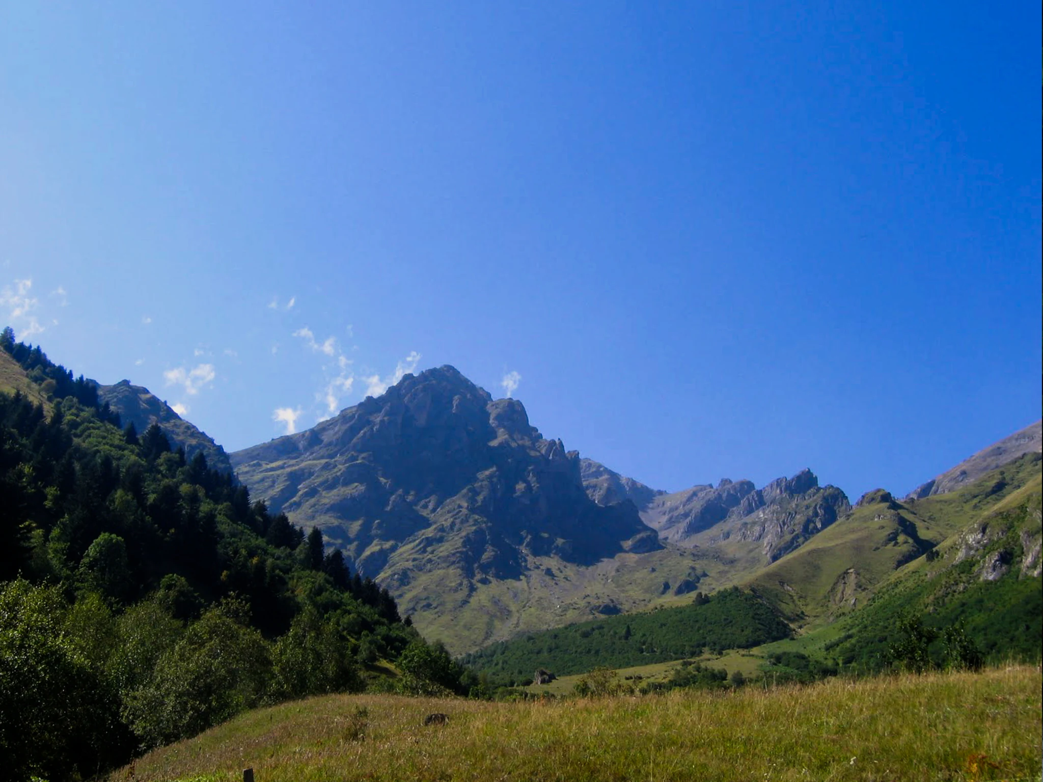
A clear, sunny day view of a rugged, rocky mountain peak, the Mailh d'Aulon, rising above a green valley and forest slopes.
The Mailh d'Aulon peak rising above the landscape of the Aulon Regional Nature Reserve in the Pyrenees.

Réserve naturelle régionale d'Aulon ecosystems, habitats, and plant life

Ecologically, the Aulon reserve is a textbook example of how geological diversity and steep elevation gradients combine to produce rich mountain biodiversity in the Pyrenees. Its open landscapes include subalpine and alpine heathlands, Pyrenean siliceous Festuca eskia grasslands, Elyna myosuroides ridges shaped by wind exposure, and Festuca gautieri steppe-like swards arranged in terraces and garlands. These are interspersed with alpine and subalpine tall-herb communities, especially where soils are richer and moisture is greater.

Wetland habitats add a distinctive layer. Petrifying springs, seepage areas, and the mires known locally as mouillères (including the Coume d'Espigous) form the hydrological backbone of the reserve and host moisture-loving plants such as the round-leaved sundew (Drosera rotundifolia). Rock formations, including siliceous screes and central-Pyrenean limestone cliffs, support specialised cliff and scree flora. In the forested zones, Pyrenean pine (Pinus uncinata) communities thrive on calcareous substrate, giving the reserve important treeline and forest habitat. Rhododendron, heather, saxifrages, houseleeks, Ramonda pyrenaica, Pyrenean iris (Iris latifolia), and Pyrenean lily (Lilium pyrenaicum) populate meadows and rocky ledges, alongside bearberry, Martagon lily, and Pyrenean forget-me-not.

The overall ecological pattern is shaped by a long coexistence between wild species and active pastoral management: the open meadows and heathlands of today are not natural wilderness but cultural landscapes maintained by transhumant livestock grazing, which prevents encroachment by shrubs and trees and protects the conditions that many of the reserve's rarest species depend on.
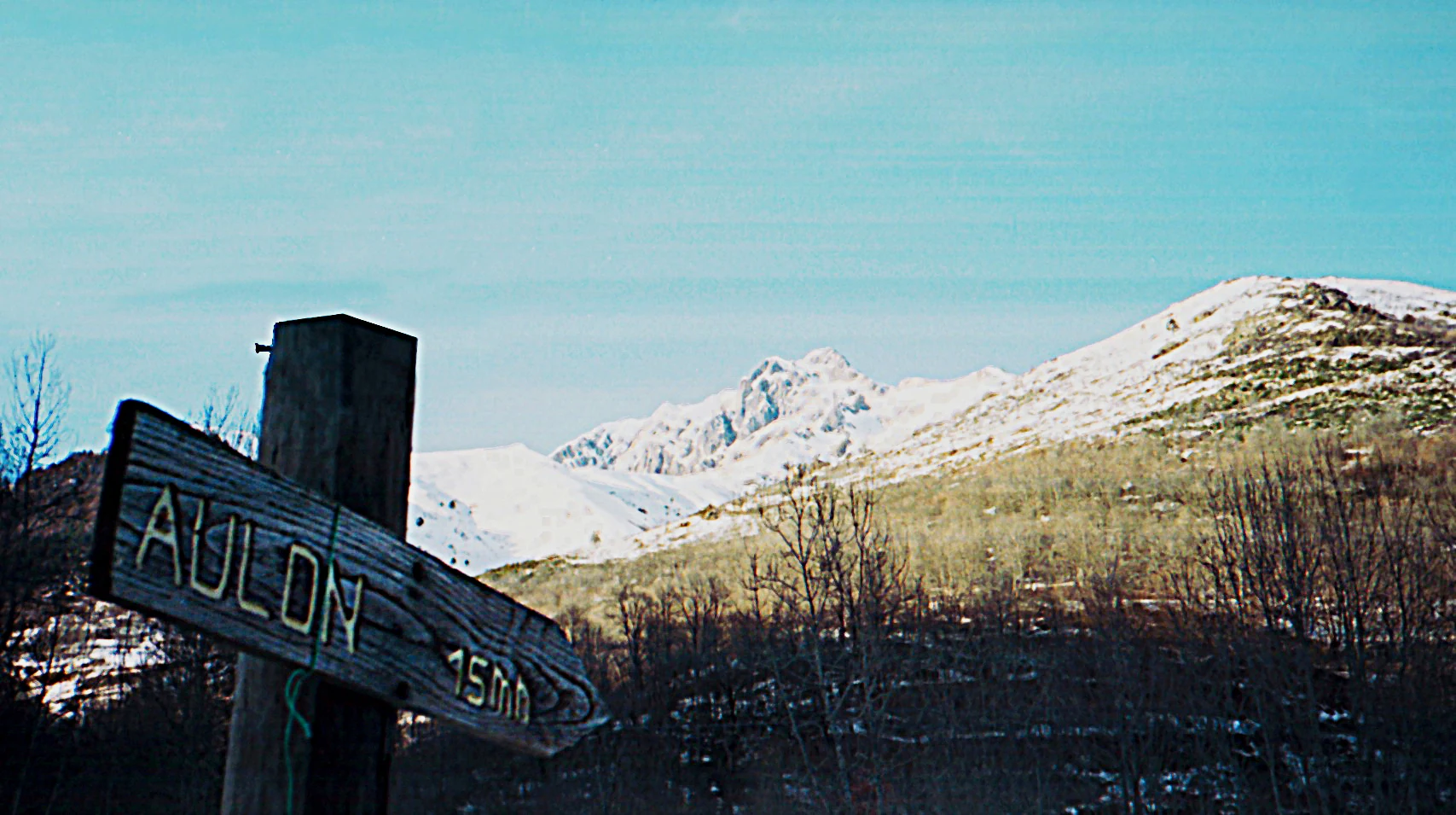
A weathered wooden hiking signpost with the text Aulon 15 min pointing to the left, set against a backdrop of snow-covered Pyrenean mountains and sparse winter forest.
A wooden hiking sign pointing toward Aulon with a snowy mountain landscape in the background.

Réserve naturelle régionale d'Aulon wildlife and species highlights

The reserve harbours a remarkable variety of Pyrenean fauna, reflecting both its wild habitat mosaic and its position within a larger network of protected areas. Mammals are particularly well represented. The Pyrenean chamois (isard) is the most emblematic large mammal and a focus of monitoring, alongside roe deer, red deer, marmot, red fox, pine marten, stoat, snow vole, pygmy shrew, and European hare. More elusive species such as the wildcat and the Pyrenean desman also occur in the area.

Birdlife is among the richest draws of the reserve. Mountain galliformes, including the capercaillie (grand tétras), rock ptarmigan (lagopède), and grey partridge, are present and carefully monitored. Alpine passerines such as the rock thrush and ring ouzel breed on rocky slopes, while the open skies above the reserve are frequented by some of Europe's most charismatic raptors: the red kite, golden eagle, griffon vulture, Egyptian vulture, and the prized bearded vulture (gypaète barbu).

Reptiles include protected species such as the slow worm, asp viper, and the Pyrenean mountain lizard (Lézard montagnard des Pyrénées centrales), listed under Annex I of the EU Habitats Directive. Amphibians are notable for the presence of the Pyrenean newt (euprocte), the agile frog, Iberian frog, common frog, fire salamander, and palmate newt. The reserve also supports a strong community of butterflies, including protected and vulnerable species such as the Apollo butterfly, the Pyrenean ringlet (Moiré pyrénéen), and the Rondou ringlet (Moiré de Rondou), along with diverse blue butterflies (azurés).
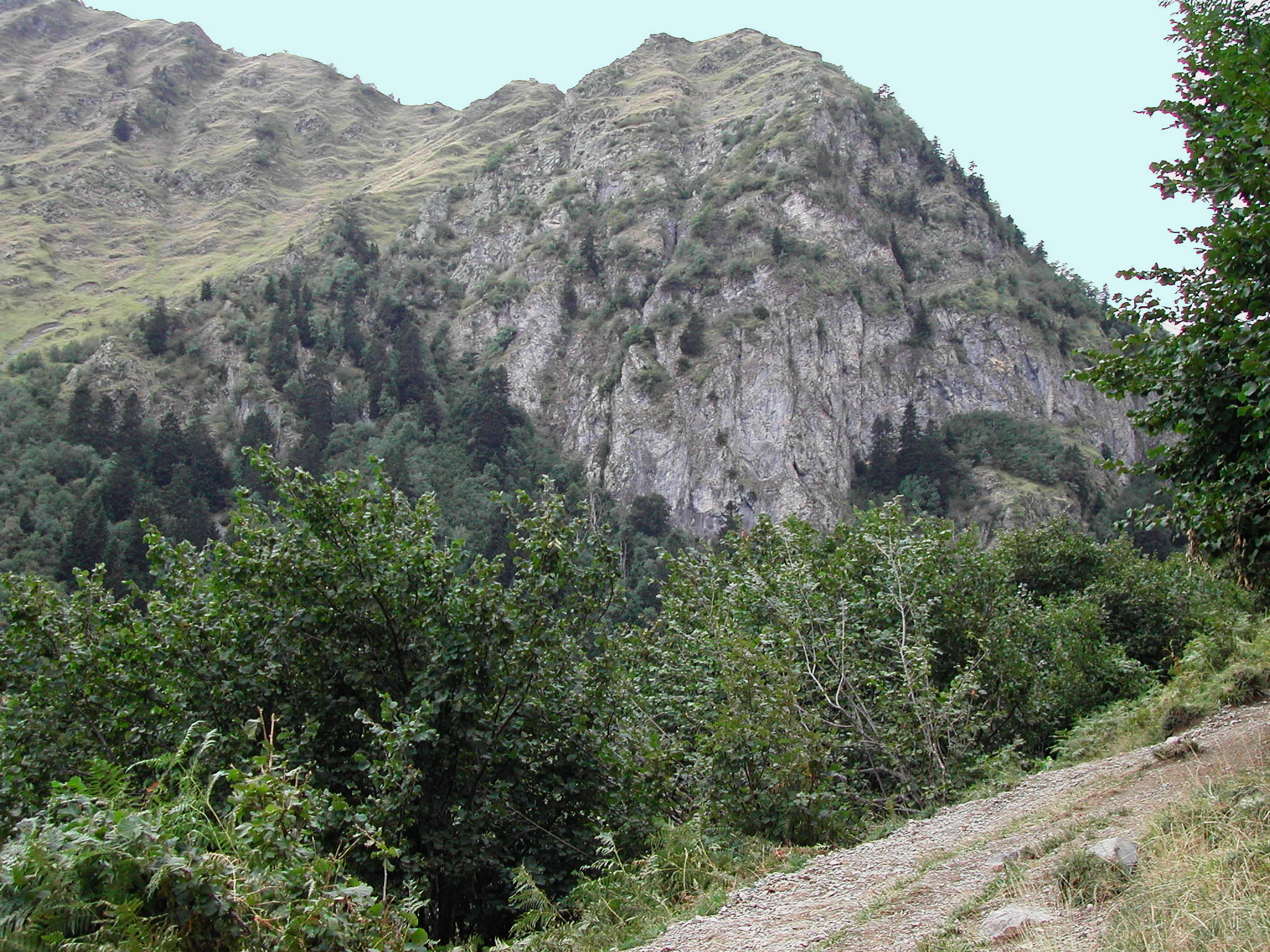
A dirt mountain hiking path leads toward a large, rocky mountain face covered in patches of evergreen forest and scrubby vegetation.
A mountain trail winding through the verdant landscape of the Aulon Regional Nature Reserve, with the dramatic slopes of the Pyrenees in the background.

Réserve naturelle régionale d'Aulon conservation status and protection priorities

The Aulon reserve exists primarily to safeguard the ecological richness of the Aulon valley and to act as a reservoir of remarkable biodiversity within the central Pyrenees. Its protection is significant because it preserves not just one ecosystem, but a layered mosaic of calcareous, schist, pelitic, and granitic habitats across more than 1,300 metres of elevation, each supporting specialised flora and fauna. The reserve contributes directly to the conservation of several legally protected species, including the Pyrenean lily, Pyrenean iris, Ramonda pyrenaica, Pyrenean androsace, round-leaved sundew, Alpine clubmoss, Apollo butterfly, and bearded vulture.

Management is led by the La Frênette association and combines scientific monitoring, habitat stewardship, and pastoral coordination. Regular surveys track populations of bats, ungulates (especially isards), galliformes, and raptors, while ongoing botanical and invertebrate surveys document rare species. A central pillar of conservation here is the integration of traditional grazing: livestock prevent shrub encroachment and maintain the open swards and heath that many rare plants and ground-nesting birds depend on, demonstrating how cultural land use and biodiversity protection can coexist.

The reserve is part of a broader conservation fabric, working alongside the LPO (League for the Protection of Birds), the Pyrenees National Park, the Conservatoire botanique national de Midi-Pyrénées, Nature Midi-Pyrénées, pastoralism resource centres, and neighbouring protected areas such as the Pibeste-Aoulhet Regional Nature Reserve. Together, these partnerships strengthen the role of Aulon as a key ecological hub in a regional network of protected Pyrenean landscapes.

Réserve naturelle régionale d'Aulon cultural meaning and human context

The reserve sits within a working Pyrenean mountain community whose identity is inseparable from transhumant pastoralism. Every summer, more than 4,000 sheep and around 400 cattle graze the high pastures (estives) of Aulon under the watch of two shepherds and a herdsman, from early June to mid-September. This seasonal activity is not a relic: it is a living practice that shapes both the landscape and the local economy.

The village of Aulon has long been a centre for mohair wool, sheep's cheeses, mountain honey, and traditional dishes based on wild plants such as nettles, reflecting the relationship between local people, livestock, and the surrounding habitats. A village inn, gîtes, and guest rooms sustain a small but active hospitality tradition, while the Maison de la nature, opened in 2011 from a renovated village building, links local heritage with environmental education. Although horses were once part of the estive landscape, that practice ended in 2011, leaving sheep and cattle as the principal shapers of today's open habitats.

Top sights and standout views in Réserve naturelle régionale d'Aulon

The Aulon reserve's defining strengths are its dramatic altitudinal range, its diversity of geological substrates, and the way traditional pastoral land use continues to reinforce rare high-mountain biodiversity. Within a relatively compact footprint, visitors and researchers encounter alpine and subalpine heathlands, Pyrenean Festuca grasslands, mires with sundews, cliff ecosystems, and Pinus uncinata forests, all framed by peaks such as Pic d'Aulon, Pic d'Aulon, Portarras, Bastan, and Cettiou.

Its wildlife roster is another major highlight, mixing Pyrenean chamois, marmots, capercaillie, and rock ptarmigan with raptor spectacles involving golden eagles, griffon vultures, Egyptian vultures, and bearded vultures. The reserve's integration of working mountain culture, scientific monitoring, and public education through the Maison de la nature gives it a distinctive dual identity, as both a biodiversity stronghold and a living Pyrenean cultural landscape.

Best time to visit Réserve naturelle régionale d'Aulon

The character of the Aulon reserve changes sharply with the seasons, and timing depends largely on what visitors hope to experience. Spring is the most dynamic period hydrologically: snowmelt feeds the streams, torrents, and mires that criss-cross the reserve, reviving waterfalls and saturating wetlands. This is when alpine meadows and rocky ledges come back to life, with early-flushing species and returning birdlife, although higher trails may still carry snow well into late spring.

Summer is the season when most of the reserve's mountain pastoral activity unfolds, with sheep and cattle grazing the estives from early June to mid-September. The open landscapes are at their most accessible, and large raptors soar above the cliffs, while smaller mountain birds and butterflies are active in the meadows and rock gardens. Several trails remain accessible, and the Maison de la nature and Granges de Lurgues provide access points. However, some small waterbodies such as Lac de Portarras can partly dry out during hot, dry summers.

Autumn brings quieter conditions, cooler weather, and visible seasonal change in alpine vegetation. Winter transforms the area into a snow-covered landscape, with the massif of Arbizon and surrounding peaks dominating views from the village and lower pastures. Winter visits are more demanding and require proper equipment, but the reserve's scenery is at its most austere and dramatic in this season, when large raptors and hardy galliformes remain present.
Monthly climate preview

Long-term temperature ranges and precipitation averages recorded at reference coordinates

Climate Normals and Monthly Weather Patterns for Réserve naturelle régionale d'Aulon

Representative coordinate records show monthly mean temperatures spanning from 1.97 to 18.46 degrees Celsius alongside steady precipitation cycles across the monitored period. Reviewing the complete twelve-month statistical profile provides deeper clarity into long-term climate behavior and seasonal temperature extremes.
Annual mean10 °C
2 °C18 °C
Jan
Feb
Mar
Apr
May12°
Jun16°
Jul18°
Aug18°
Sep15°
Oct11°
Nov
Dec
Warmest month
August

18.5 °C

Coolest month
January

2 °C

Wettest month
November

3.2 mm/day

Driest month
August

1.7 mm/day

Park location guide

Geography guide, regional context, and park location map for Réserve naturelle régionale d'Aulon

Réserve naturelle régionale d'Aulon park geography, regions, and map view in France

Understand where Réserve naturelle régionale d'Aulon sits in France through a broader geographic reading of the surrounding landscape, nearby location context, and its mapped position within the national park landscape.

How Réserve naturelle régionale d'Aulon fits into France

France is a unitary semi-presidential republic and one of the world's largest economies. It borders Belgium, Luxembourg, Germany, Switzerland, Italy, Monaco, Andorra, and Spain, with a maritime border to the United Kingdom. The country is known for its cultural influence, art, cuisine, and political history spanning centuries.

Wider geography shaping Réserve naturelle régionale d'Aulon in France

France is located in Western Europe. Metropolitan France extends from the Rhine to the Atlantic Ocean and from the Mediterranean Sea to the English Channel and North Sea. The country borders Belgium, Luxembourg, Germany, Switzerland, Italy, Monaco, Andorra, Spain, and has a maritime border with the United Kingdom.

Map view of Réserve naturelle régionale d'Aulon

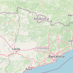
Use this park location map to pinpoint Réserve naturelle régionale d'Aulon in France, understand its exact geographic position, and read its mapped placement within the surrounding landscape more clearly.

Pigeon | © OpenStreetMap contributors

Location context for Réserve naturelle régionale d'Aulon

Occitanie

Visual exploration of subalpine grasslands, rocky crests, and mountain habitats

Réserve naturelle régionale d'Aulon Photos and Pyrenean Landscape Imagery

Photographic archives capture the dramatic altitudinal relief and varied geological terrain defining Réserve naturelle régionale d'Aulon. Visual references reveal how traditional pastoral practices maintain open meadows and high-elevation habitats across the Arbizon massif.

A wide mountain landscape showing a series of distant rugged peaks under a partly cloudy sky, with dark, shadowed mountain slopes framing the view in the foreground.

A snowy mountain landscape viewed through silhouetted tree trunks, with golden light illuminating a slope in the midground and distant snow-covered peaks.

A clear, sunny day view of a rugged, rocky mountain peak, the Mailh d'Aulon, rising above a green valley and forest slopes.

A weathered wooden hiking signpost with the text Aulon 15 min pointing to the left, set against a backdrop of snow-covered Pyrenean mountains and sparse winter forest.

A dirt mountain hiking path leads toward a large, rocky mountain face covered in patches of evergreen forest and scrubby vegetation.

Park atlas

Compare adjacent mountain terrain and protected landscapes across the central Pyrenees.

Parks Near Réserve naturelle régionale d'Aulon and Surrounding Pyrenean Reserves

Browsing other protected areas near Réserve naturelle régionale d'Aulon reveals a connected network of alpine valleys, high ridges, and glacial massifs. Comparing these adjacent mountain environments provides essential regional context for understanding central Pyrenean biodiversity and topography.
National parkHautes-Pyrénées
About 11 km away#1 closest

West

Pyrénées National Park: Protected Landscape & Transboundary Protected Area Atlas

Discover Hautes-Pyrénées' dramatic glacial terrain and alpine environments.

Pyrénées National Park is a significant protected area in France's Hautes-Pyrénées department, renowned for its dramatic glacial cirques, high-altitude lakes, and extensive mountain landscapes. Established as a national park, it offers rich geographic context for atlas exploration, showcasing millions of years of geological formation shaped by tectonic uplift and glacial carving. This park is also notable for its transboundary conservation efforts with Spain, contributing to a broader protected region. Explore its unique terrain, from towering limestone formations to alpine meadows, and understand its place within the Pyrenean mountain range.

Area
458 km²
Established
1967
IUCN
II
Relief
Mountain
A watercolor painting of a serene mountain landscape featuring gentle rolling hills, small clusters of trees, and soft, muted tones of green, pink, and purple, set against a light background.
Nature reserveOccitanie
About 12 km away#2 closest

East

Réserve naturelle régionale du Massif du Montious: Regional Nature Reserve in Occitanie

Granitic massif geography and Pyrenean protected landscapes

Located in the heart of the Hautes-Pyrénées, this reserve captures the geological and biological essence of the Central Pyrenees. From the summit grasslands at 2,171 metres to the sheltered glacial basins, the terrain provides a comprehensive look at regional mountain ecosystems and Hercynian geological heritage.

Area
7.38 km²
Established
2020
IUCN
IV
Watercolor painting showing a mountain range with a winding river through a valley
National parkSpain
About 25 km away#3 closest

Southwest

Ordesa y Monte Perdido National Park: Glacial Terrain and Pyrenean Protected Landscape

Explore its dramatic valleys, cliffs, and alpine geography.

Ordesa y Monte Perdido National Park is a critical protected area within the Pyrenean geography, defined by its spectacular glacial valleys, towering limestone massifs, and unique karst formations. As a National Park and UNESCO World Heritage Site, it offers a rich environment for exploring mapped terrain and understanding the interplay of geology and high-alpine ecosystems. Delve into the mapped boundaries and distinct landscape features that characterize this significant protected landscape.

Area
156.08 km²
Established
1918
IUCN
II
Relief
Mountain
A soft watercolor painting of rolling green hills, distant mountain peaks, and a calm water body against a white background.
National parkOccitanie
About 31 km away#4 closest

Southwest

Pyrénées-Mont Perdu National Park: Alpine Geography and Transboundary Protected Landscapes

Glacial cirques, limestone canyons, and alpine pastoral heritage.

Spanning the high Pyrenees, Pyrénées-Mont Perdu represents a rare union of dramatic geological formations and human cultural heritage. The terrain features vertical limestone walls, deep carved canyons, and expansive cirques that host both diverse alpine ecosystems and active seasonal migration routes. This protected area remains a benchmark for studying the interplay between powerful glacial geography and historic mountain pastoralism in Europe.

Area
306.39 km²
Established
1997
Relief
Mountain
Climate
Alpine
A watercolor illustration of rolling mountain ranges and stylized forest patches in soft green and earth tones against a pale background.
Nature reserveOccitanie
About 43 km away#5 closest

Northwest

Réserve naturelle régionale du massif du Pibeste-Aoulhet: Mountain Reserve Atlas

Regional protected landscape mapping in the French Pyrenees

Spanning over 5,000 hectares in the Occitanie region, the Réserve naturelle régionale du massif du Pibeste-Aoulhet serves as a critical biological corridor. This detailed record examines the massif's varied elevations, from lower broadleaf forests to high-altitude rocky cliffs, highlighting its status as one of the largest regional nature reserves in France.

Area
51.103 km²
Established
2012
IUCN
IV
Relief
Mountain
Watercolor illustration of a mountainous landscape with a river, green vegetation, and distant peaks under a light sky
National parkProvince of Lleida
About 51 km away#6 closest

Southeast

Aigüestortes i Estany de Sant Maurici National Park: Pyrenean High Mountain National Park Landscape

Explore glacial lakes and winding waterways in Catalonia.

Aigüestortes i Estany de Sant Maurici National Park is a premier national park in the Pyrenees, celebrated for its extensive network of almost 200 glacial lakes and the dramatic natural beauty of the Sant Maurici lake. Its landscape is defined by high mountain terrain, characterized by U-shaped valleys, sharp ridges, and unique hydrological features like the Aigüestortes plain's meandering streams. This protected area in the Province of Lleida offers a rich setting for understanding alpine environments and Pyrenean geography through detailed mapping and atlas exploration.

Area
141 km²
Established
1955
IUCN
II
Visitors
525K annual
Nature reservePyrénées-Atlantiques
About 54 km away#7 closest

West

Vallée du Soussouéou Protected Nature Reserve: Geographic Atlas and Mountain Terrain

A roadless glacial valley in the French Pyrénées-Atlantiques

Vallée du Soussouéou offers a rare glimpse into a roadless Pyrenean landscape. This protected area features a classic glacial U-shaped valley, significant peatland ecosystems, and diverse alpine habitats that support Pyrenean fauna. As a quiet extension of the ecological network in the Western Pyrenees, the valley remains an important site for understanding mountain geography and glacial geomorphology in southwestern France.

Area
45.39 km²
Established
1995
Relief
Mountain
Scope
Terrestrial
Watercolor painting of a river winding through a valley with green fields, trees, and distant hills
Protected areaAndorra
About 97 km away#8 closest

East

Parc Natural Comunal de les Valls del Comapedrosa: Andorra's Highest Protected Alpine Landscape

Explore the Pyrenean terrain and mapped boundaries of Andorra's summit park.

Parc Natural Comunal de les Valls del Comapedrosa is the primary high-altitude protected area in Andorra, defined by its rugged alpine terrain and the presence of Coma Pedrosa, the country's highest peak. This protected landscape offers a significant geographic anchor for exploring the Pyrenees, highlighting the unique mountain conservation efforts. Its mapped boundaries encompass dramatic valleys and steep ridges, providing a clear context for understanding Andorra's mountainous geography through a structured atlas lens.

Area
15.43 km²
Established
2003
IUCN
IV
Relief
Mountain

Common questions about visiting, size, designation, and location context for Réserve naturelle régionale d'Aulon

Réserve naturelle régionale d'Aulon FAQs for park facts, access, geography, and protected area context

Find quick answers about Réserve naturelle régionale d'Aulon, including protected-area facts, park geography, trail and visitor context, and how the park fits into its surrounding country and regional landscape.
MoriAtlas Explorer

Continue Your Protected Areas Search Across the Global Atlas

Deepen your exploration by continuing the structured search for national parks and protected areas worldwide. Utilize the comprehensive filtering capabilities to compare different conservation landscapes and refine your understanding of global park geography. Discover more about the distribution and characteristics of protected natural areas.

Global natural geography