Mori Atlas logo
Nature reserveRéserve naturelle régionale de Cambounet-sur-le-Sor

A vital riverine landscape and waterbird sanctuary within the Tarn department of Occitanie

Réserve naturelle régionale de Cambounet-sur-le-Sor: Protected Alluvial Wetland Geography

The Réserve naturelle régionale de Cambounet-sur-le-Sor protects thirty-one hectares of essential alluvial wetland at the confluence of the Sor and Agout rivers. This protected area functions as a critical sanctuary for diverse waterbird populations, including a large, multi-species heron colony. Its low-lying floodplain terrain serves as a representative example of riverine ecosystem dynamics in southwestern France, providing habitat for migratory birds and year-round nesting populations.

wetland reserveregional nature reserveheron colonybirdwatchingalluvial plainriverine habitat

Réserve naturelle régionale de Cambounet-sur-le-Sor

Nature reserve

Park overview

Structured park overview, official facts, and landscape profile for Réserve naturelle régionale de Cambounet-sur-le-Sor

Réserve naturelle régionale de Cambounet-sur-le-Sor park facts, protected area profile, and essential visitor context

Review the core facts for Réserve naturelle régionale de Cambounet-sur-le-Sor, including designation, size, terrain, visitor scale, habitats, and operating context in one park-focused overview.

About Réserve naturelle régionale de Cambounet-sur-le-Sor

The Réserve naturelle régionale de Cambounet-sur-le-Sor is a compact yet ecologically significant protected area in the southern part of the Massif Central region of France. It occupies part of the alluvial floodplain of the Sor, where the small river meets the larger Agout, forming a mosaic of still waters, riparian vegetation, and open wetland habitat that supports an exceptionally dense community of waterbirds for its size.

Although the reserve is modest in spatial extent, its conservation value is amplified by the concentration of breeding waterbirds gathered in this single floodplain sector. The heron colony alone places the site among the most important heronries in the historic Midi-Pyrénées region, anchoring its regional and national ecological identity.

For visitors, the reserve is presented as a free-access site with a marked trail and several observation posts, allowing birdwatchers and amateur naturalists to approach the wetland without disturbing nesting birds. An intercommunal leisure base next to the reserve adds canoeing, fishing, and equestrian activities, integrating the wetland within a broader local outdoor recreation landscape managed by the Communauté de communes Sor et Agout.

Quick facts and research context for Réserve naturelle régionale de Cambounet-sur-le-Sor

The Réserve naturelle régionale de Cambounet-sur-le-Sor is a French regional nature reserve (réserve naturelle régionale, code RNR272) covering about 30.87 hectares in the Tarn department of the Occitanie region. It was first established as a voluntary nature reserve on 19 September 1990, became part of the Réserves Naturelles de France network in 1993, and was reclassified as a regional nature reserve on 29 November 2013. The reserve lies in the alluvial plain of the Sor and the Agout, within a ZNIEFF type 1 area, and is administered by the Communauté de communes Sor et Agout. Its most notable feature is a major mixed heron colony, with documented breeding by five heron species and around 170 bird species recorded overall.

Protection and recognition

Documented terrestrial protection scope, designation year, and international recognition facts

Protection Status and Designation History for Réserve naturelle régionale de Cambounet-sur-le-Sor

Terrestrial protection status for Réserve naturelle régionale de Cambounet-sur-le-Sor spans official records established in the designated year 2013. Structured database facts trace the recorded administrative scope and historical designation data without imported international recognition sources.

Protection details

Protection scope
Terrestrial
Designated year
2013
Transboundary protection
No
WDPA ID
555562006
Park context

Deeper park guide and search-rich context for Réserve naturelle régionale de Cambounet-sur-le-Sor

Réserve naturelle régionale de Cambounet-sur-le-Sor history, landscape, wildlife, and travel context

Explore Réserve naturelle régionale de Cambounet-sur-le-Sor through its history, landscape character, ecosystems, wildlife, conservation priorities, cultural context, and seasonal travel timing in a structured park guide built for atlas discovery and search intent.

Why Réserve naturelle régionale de Cambounet-sur-le-Sor stands out

The reserve is particularly recognized for hosting one of the largest heron colonies of the former Midi-Pyrénées region, with an estimated 700 to 800 breeding pairs documented at peak counts. Up to five heron species reproduce simultaneously in the wetland, including Black-crowned Night Heron, Cattle Egret, Grey Heron, Little Egret, and occasionally Squacco Heron. It is also valued as a habitat for a wide range of associated wetland birdlife. Moorhens, Coots, Common Pochards, Kingfishers, and Little Grebes nest in the reserve, while European Bee-eaters breed nearby on a lake. The site also serves as a wintering ground for ducks and Common Snipe, and as a stopover during spring and autumn migrations for species such as White Stork, Osprey, Black and Whiskered Terns, and various waders.
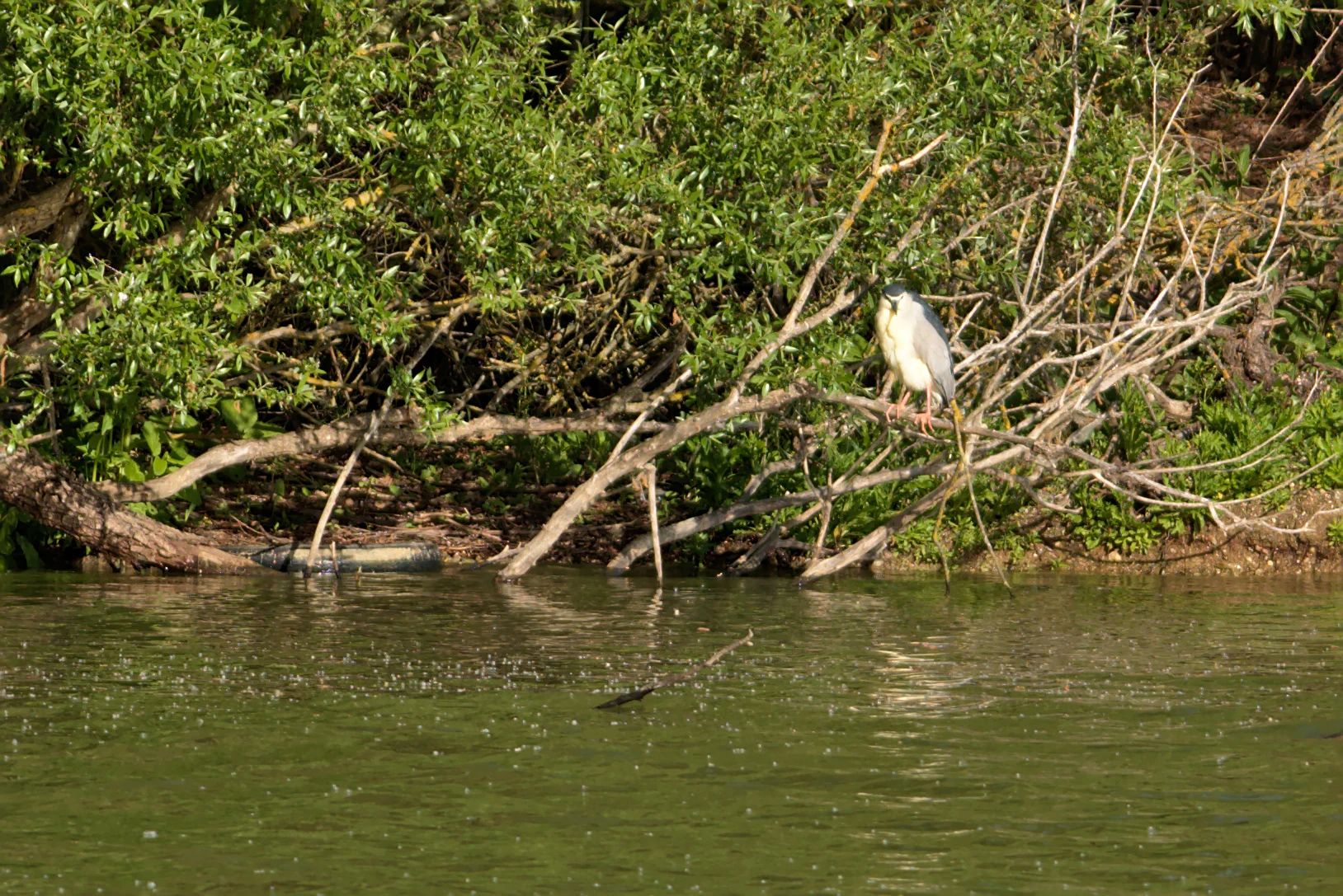
A black-crowned night heron perched on a thin branch overhanging a green pond at the edge of a wooded area.
A black-crowned night heron perched on a branch above the water at the Cambounet-sur-le-Sor Regional Nature Reserve.

Réserve naturelle régionale de Cambounet-sur-le-Sor history and protected-area timeline

The reserve was first created as a Réserve Naturelle Volontaire (voluntary nature reserve) by deliberation on 19 September 1990, in recognition of the area's growing importance for waterbirds, particularly its expanding heron colony. It joined the Réserves Naturelles de France national network in 1993, helping to formalize its management and monitoring practices.

In 2013, the site underwent a legal reclassification. By deliberation dated 29 November 2013, it became a Réserve Naturelle Régionale, aligning it with the modern French regional reserve framework and providing a more durable and structured administrative status under the Communauté de communes Sor et Agout. This reclassification preserved the reserve's core mission of protecting the wetland and its birds while standardizing its governance under regional nature reserve rules.

Réserve naturelle régionale de Cambounet-sur-le-Sor landscape and geographic character

The reserve sits in the alluvial plain of the Sor river, just upstream of where the Sor flows into the Agout. The terrain is low-lying and shaped by river dynamics, with still or slow-moving waters, marshy edges, and bands of riparian woodland and scrub that frame the wetland. This floodplain setting, typical of southwestern French lowland river valleys, creates the soft topography and sheltered conditions that herons and other waterbirds require for nesting and feeding.

The immediate surroundings blend agricultural land of the Tarn plain with the small built environments of Cambounet-sur-le-Sor and Saïx, while a nearby lake adds complementary habitat, particularly for European Bee-eaters. Together, the rivers, floodplain marshes, and adjacent managed leisure areas form a coherent landscape mosaic in which the protected wetland is the ecological centerpiece.
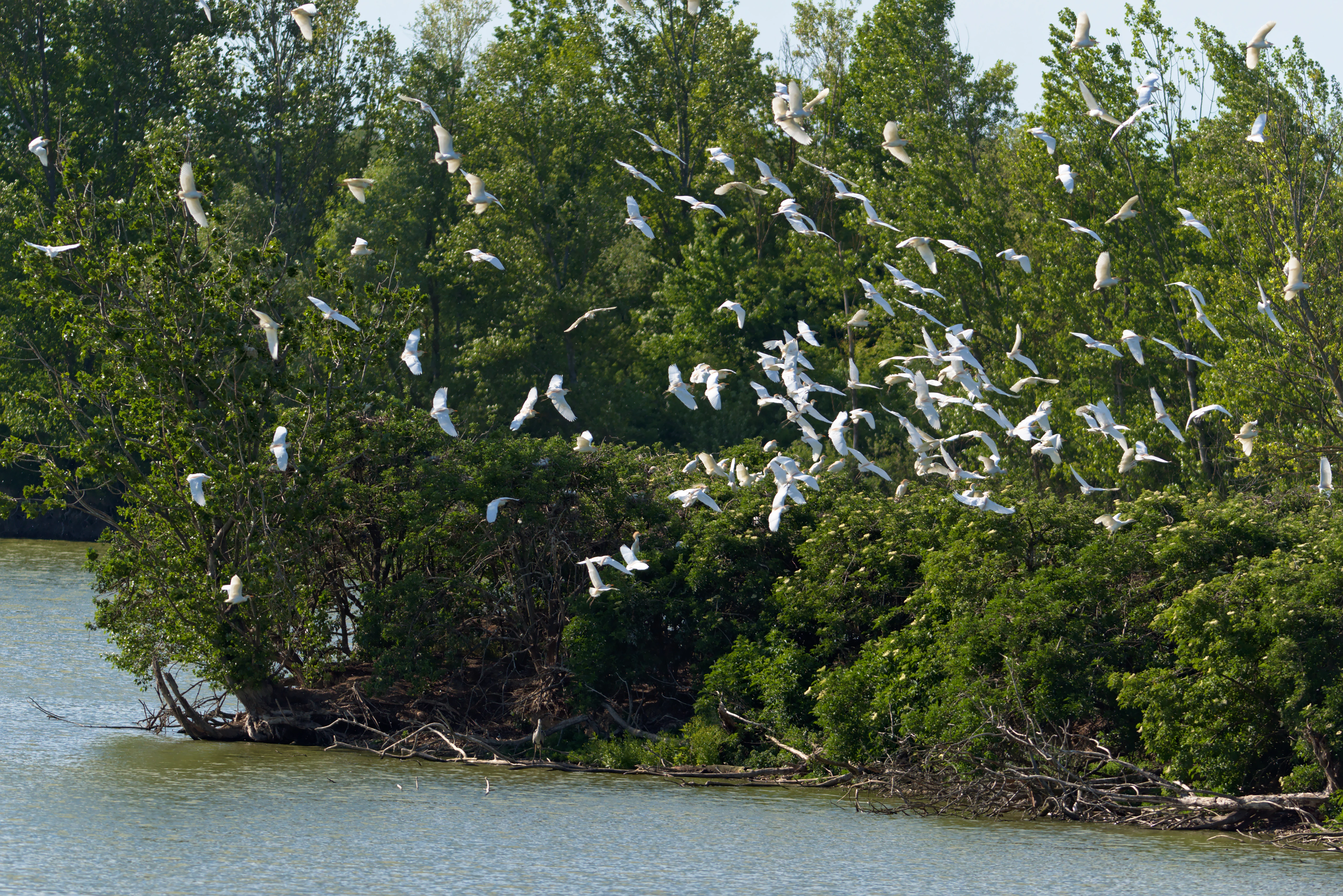
A large flock of many white birds flying in a scattered formation over a riverbank lined with dense green trees.
A large flock of white birds, likely herons or egrets, in flight above the wetlands of the Cambounet-sur-le-Sor Regional Nature Reserve.

Réserve naturelle régionale de Cambounet-sur-le-Sor ecosystems, habitats, and plant life

Ecologically, the reserve is dominated by alluvial wetland habitat types: slow-moving river margins, backwaters, reed-fringed marsh, and adjacent damp woodland. These habitats together qualify the site as a ZNIEFF type 1 zone, a designation reserved for areas of strong ecological interest at the flora and fauna level. The mixture of open water, emergent vegetation, and trees provides vertical structure that supports both ground-nesting and tree-nesting bird species.

Although the flora section of the available documentation is sparse, the wetland character of the reserve is clearly defined. The habitats present are characteristic of the Tarn plain's smaller river systems, where shallow water levels, seasonal flooding, and riparian vegetation create conditions favorable for herons, ducks, grebes, and a wide range of seasonal migrants.
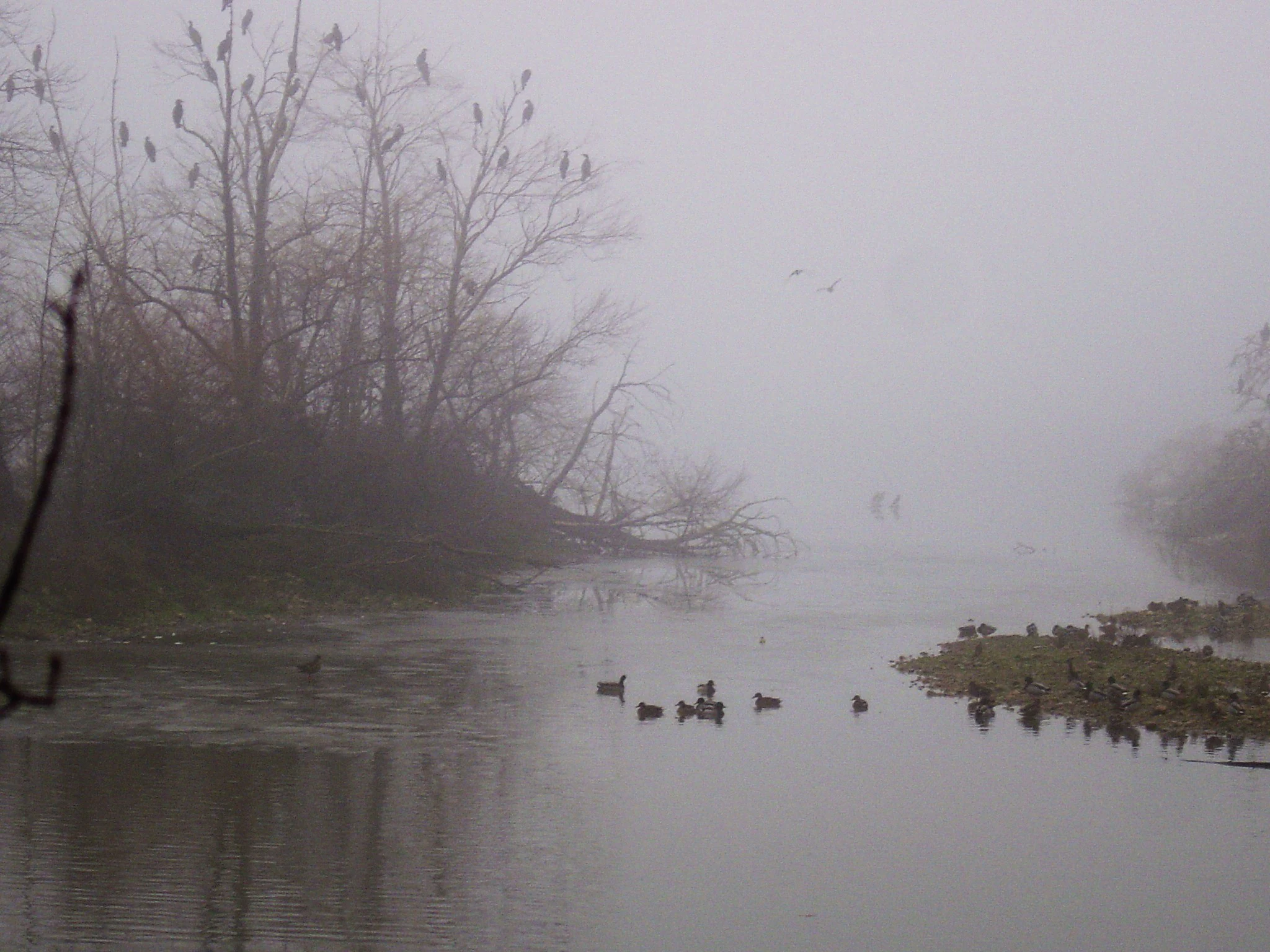
A foggy scene at a wetland, with many dark birds perched in bare trees on the left and swimming in the calm water.
A foggy winter morning at the Cambounet-sur-le-Sor nature reserve, featuring birds resting in trees and on the water.

Réserve naturelle régionale de Cambounet-sur-le-Sor wildlife and species highlights

Ornithological diversity is the reserve's defining wildlife feature. More than 170 bird species have been recorded, nearly 90 of which are tied to wetland habitats. The breeding bird community is dominated by herons: Black-crowned Night Heron, Cattle Egret, Grey Heron, Little Egret, and occasionally Squacco Heron all reproduce here, alongside a colony that historically numbered between roughly 700 and 800 pairs.

Other typical wetland nesters include Common Moorhen, Eurasian Coot, Common Pochard, Common Kingfisher, and Little Grebe. Nearby, a lake-hosted colony of European Bee-eaters holds around ten individuals during the breeding season, with larger pre-migratory gatherings of roughly one hundred birds. Winter brings a turnover of visiting ducks such as Northern Shoveler, Gadwall, Northern Pintail, and Eurasian Teal, plus Common Snipe, while passage seasons add White Stork, Osprey, Black Tern, Whiskered Tern, and various sandpipers and other shorebirds.

Réserve naturelle régionale de Cambounet-sur-le-Sor conservation status and protection priorities

The reserve's principal conservation significance lies in the protection of one of the most important heron colonies in the former Midi-Pyrénées region, alongside a broader waterbird assemblage of regional and migratory importance. As a ZNIEFF type 1 site and a formally classified regional nature reserve, it represents a durable commitment to preserving riverine wetland habitat in an area where agriculture and human settlement otherwise dominate the landscape.

Its small size is offset by a high density of breeding and wintering birds, making it an efficient conservation investment per hectare. The reserve also functions as a reference site for waterbird monitoring in the Tarn plain and contributes to national datasets on protected areas and bird populations through its links with Réserves Naturelles de France and partner organizations.

Réserve naturelle régionale de Cambounet-sur-le-Sor cultural meaning and human context

The reserve is part of the broader cultural and ecological identity of the Sor and Agout valleys in the Tarn, two small river systems that have shaped local settlement patterns, agriculture, and traditional land use for centuries. The Communauté de communes Sor et Agout, which administers the reserve, ties the site directly to local territorial identity and community life.

A free public trail, observation posts, and the adjacent intercommunal leisure base reflect a regional tradition of making small natural areas accessible to residents and visitors. This combination of conservation, education, and local recreation situates the reserve within the everyday cultural landscape of the Tarn plain rather than as a remote wilderness site.

Top sights and standout views in Réserve naturelle régionale de Cambounet-sur-le-Sor

A standout feature of the reserve is its dense mixed heron colony, supported by up to five breeding heron species and historically reaching several hundred pairs. The site is equally notable for the exceptional species richness packed into a small footprint, with more than 170 recorded bird species.

Its accessibility is another key highlight: a free, family-friendly trail with observation posts, paired with an adjacent intercommunal leisure base, makes the reserve a practical entry point into wetland birdwatching in the Tarn. The reserve also stands out as a compact example of how regional reserves in France can combine species protection, ecological monitoring, and public engagement on a small spatial scale.

Best time to visit Réserve naturelle régionale de Cambounet-sur-le-Sor

Spring and early summer are typically the most rewarding periods for visiting the reserve, when the heron colony is at peak breeding activity and multiple species of waterbirds are nesting in the wetland. Migratory passages in spring and autumn add extra layers of diversity, with species like storks, Osprey, and terns passing through.

Winter also has its own character: the reserve hosts gatherings of wintering ducks and Common Snipe, and the calm winter atmosphere around the ponds offers a quieter but still bird-rich experience. The free trail and observation posts make year-round visits feasible, though the visible activity around the colony is most dramatic during the breeding season.
Monthly climate preview

Long-term representative monthly climate patterns across the protected regional reserve

Annual Temperature and Precipitation Normals for Réserve naturelle régionale de Cambounet-sur-le-Sor

Historical data records monthly temperature ranges and precipitation averages from a representative coordinate within Réserve naturelle régionale de Cambounet-sur-le-Sor. Examining the complete twelve-month climatology profile reveals comprehensive variations in thermal conditions and moisture distribution.
Annual mean13 °C
5 °C23 °C
Jan
Feb
Mar
Apr11°
May15°
Jun20°
Jul23°
Aug23°
Sep19°
Oct14°
Nov
Dec
Warmest month
August

23 °C

Coolest month
January

4.9 °C

Wettest month
November

2.6 mm/day

Driest month
July

1.4 mm/day

Park location guide

Geography guide, regional context, and park location map for Réserve naturelle régionale de Cambounet-sur-le-Sor

Réserve naturelle régionale de Cambounet-sur-le-Sor park geography, regions, and map view in France

Understand where Réserve naturelle régionale de Cambounet-sur-le-Sor sits in France through a broader geographic reading of the surrounding landscape, nearby location context, and its mapped position within the national park landscape.

How Réserve naturelle régionale de Cambounet-sur-le-Sor fits into France

France is a unitary semi-presidential republic and one of the world's largest economies. It borders Belgium, Luxembourg, Germany, Switzerland, Italy, Monaco, Andorra, and Spain, with a maritime border to the United Kingdom. The country is known for its cultural influence, art, cuisine, and political history spanning centuries.

Wider geography shaping Réserve naturelle régionale de Cambounet-sur-le-Sor in France

France is located in Western Europe. Metropolitan France extends from the Rhine to the Atlantic Ocean and from the Mediterranean Sea to the English Channel and North Sea. The country borders Belgium, Luxembourg, Germany, Switzerland, Italy, Monaco, Andorra, Spain, and has a maritime border with the United Kingdom.

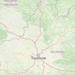
Map view of Réserve naturelle régionale de Cambounet-sur-le-Sor

Use this park location map to pinpoint Réserve naturelle régionale de Cambounet-sur-le-Sor in France, understand its exact geographic position, and read its mapped placement within the surrounding landscape more clearly.

Pigeon | © OpenStreetMap contributors

Location context for Réserve naturelle régionale de Cambounet-sur-le-Sor

Occitanie

Visualizing the alluvial wetlands, riverine habitats, and protected terrain of southwestern France

Réserve naturelle régionale de Cambounet-sur-le-Sor Photos and Landscape Scenery

Photographic views reveal the alluvial wetlands, slow-moving river channels, and riparian woodland that characterize the protected landscape of Réserve naturelle régionale de Cambounet-sur-le-Sor. Visual records illustrate the low-lying terrain and marshy habitats that support dense waterbird populations across the Sor river valley.

A black-crowned night heron perched on a thin branch overhanging a green pond at the edge of a wooded area.

A grey heron standing on a fallen log in a shallow pond with a smaller white egret standing in the water nearby.

A large flock of many white birds flying in a scattered formation over a riverbank lined with dense green trees.

A foggy scene at a wetland, with many dark birds perched in bare trees on the left and swimming in the calm water.

Park atlas

Compare surrounding protected areas and regional wetland landscapes

Other Parks Near Réserve naturelle régionale de Cambounet-sur-le-Sor

Browse protected areas near Réserve naturelle régionale de Cambounet-sur-le-Sor to examine similar lowland river ecosystems across the Tarn department. Expanding the regional park comparison reveals wider conservation patterns throughout southwestern French floodplains.
A wide, soft-focus watercolor painting showing a winding river through a lush green valley with rolling hills in the background.
Nature reserveOccitanie
About 59 km away#1 closest

West

Réserve naturelle régionale Confluence Garonne-Ariège: Protected Riverine Geography and Mapping

A significant riparian landscape in the Occitanie region

Discover the protected river corridors and diverse natural terrain of the Réserve naturelle régionale Confluence Garonne-Ariège. This regional nature reserve marks the confluence of the Garonne and Ariège rivers, showcasing a complex mosaic of alluvial forest, riparian wetlands, and dry hillside woodlands that characterize the geography south of Toulouse.

Area
5.791 km²
Established
2015
IUCN
IV
Relief
Mixed relief
A soft, horizontal watercolor painting depicting a gentle, rolling landscape with green hills, sparse trees, and a hazy background in pale green and pink tones.
Regional parkOccitanie
About 85 km away#2 closest

North

Parc naturel régional des Causses du Quercy: Protected Karst Plateaus and River Valleys

Geographic atlas of the Causses du Quercy karst landscapes

An essential look at the geography of Parc naturel régional des Causses du Quercy. This protected area in Occitanie features an expansive network of limestone plateaus and carved river gorges. Learn about the karst terrain, sedimentary history, and the natural boundaries that define this French regional park and internationally recognized geopark.

Area
1,855 km²
Established
1999
IUCN
V
Nature reserveOccitanie
About 91 km away#3 closest

South

Réserve naturelle nationale de la Grotte du T.M. 71: Geological Protected Area Map

Subterranean karst exploration in the Aude department of Occitanie

Located in the foothills bordering the Pyrenees, the Réserve naturelle nationale de la Grotte du T.M. 71 protects a sprawling network of limestone passages. This site represents a key protected area for the study of subterranean mineral formations and Pyrenean karst evolution, featuring kilometres of mapped galleries maintained under a strict integral conservation framework.

Area
0.96 km²
Established
1987
IUCN
III
Natural monumentHérault
About 92 km away#4 closest

East

Site paléontologique de La Lieude: Geological Heritage and Permian Fossil Site in Hérault

Tracing ancient reptile pathways across preserved sedimentary rock

Located on the edge of the Massif Central, the Site paléontologique de La Lieude is a protected natural monument in the Hérault department. It showcases an exceptional Permian-age surface embedded with hundreds of trackways left by early synapsids, providing an essential geographic and scientific record of prehistoric life in France.

Watercolor painting depicting a landscape with marshy green foreground, winding water, distant trees, and mountains under a light sky.
Nature reserveOccitanie
About 94 km away#5 closest

Southeast

Réserve naturelle régionale de Sainte-Lucie: Protected Coastal Geography in Occitanie

Coastal lagoons, island habitats, and Mediterranean marshlands.

This protected area profile explores the physical geography of Réserve naturelle régionale de Sainte-Lucie. Understand the interplay between the central island landform, brackish lagoon networks, and the Mediterranean beach ecosystems that define this unique French conservation landscape.

Area
8.25 km²
Established
2009
IUCN
IV
Relief
Lowland
Watercolor illustration of green fields, a river, and mountains under a soft pink and yellow sky
National parkOccitanie
About 111 km away#6 closest

Northeast

Cévennes National Park: Explore its Mapped Terrain and Protected Landscape in Occitanie

Discover the unique geographic context and park boundaries.

Cévennes National Park, situated in Occitanie, France, offers a rich exploration of mid-mountain Mediterranean geography. As a protected landscape, its mapped terrain features dramatic limestone plateaus, deep river gorges, and distinct granite massifs. This entry provides essential geographic context for Cévennes National Park, highlighting its unique natural features and its significance as a protected area within the broader regional atlas.

Area
937 km²
Established
1970
IUCN
V
Visitors
800K annual
Watercolor painting of a river winding through a valley with green fields, trees, and distant hills
Protected areaAndorra
About 121 km away#7 closest

Southwest

Parc Natural Comunal de les Valls del Comapedrosa: Andorra's Highest Protected Alpine Landscape

Explore the Pyrenean terrain and mapped boundaries of Andorra's summit park.

Parc Natural Comunal de les Valls del Comapedrosa is the primary high-altitude protected area in Andorra, defined by its rugged alpine terrain and the presence of Coma Pedrosa, the country's highest peak. This protected landscape offers a significant geographic anchor for exploring the Pyrenees, highlighting the unique mountain conservation efforts. Its mapped boundaries encompass dramatic valleys and steep ridges, providing a clear context for understanding Andorra's mountainous geography through a structured atlas lens.

Area
15.43 km²
Established
2003
IUCN
IV
Relief
Mountain
Nature reserveOccitanie
About 122 km away#8 closest

South

Réserve naturelle régionale de Nyer: Mapped Geography and Protected Mountain Landscapes

Exploring the vertical terrain of a Pyrenean regional nature reserve

The Réserve naturelle régionale de Nyer offers a remarkable study in vertical zonation, featuring deep gorges and high alpine summits within the Pyrénées-Orientales. This protected area stands as a focal point for understanding the convergence of Mediterranean and mountain climates across the diverse topographical landscape of the Occitanie region.

Area
21.9 km²
Established
1998
Relief
Mountain
Climate
Mediterranean

Common questions about visiting, size, designation, and location context for Réserve naturelle régionale de Cambounet-sur-le-Sor

Réserve naturelle régionale de Cambounet-sur-le-Sor FAQs for park facts, access, geography, and protected area context

Find quick answers about Réserve naturelle régionale de Cambounet-sur-le-Sor, including protected-area facts, park geography, trail and visitor context, and how the park fits into its surrounding country and regional landscape.
MoriAtlas Explorer

Continue Your Protected Areas Search Across the Global Atlas

Deepen your exploration by continuing the structured search for national parks and protected areas worldwide. Utilize the comprehensive filtering capabilities to compare different conservation landscapes and refine your understanding of global park geography. Discover more about the distribution and characteristics of protected natural areas.

Global natural geography