Mori Atlas logo
Nature reserveRéserve naturelle régionale de la ferme de la Chauffetière

Examining the ecological diversity and geographic boundaries of a traditional French nature reserve

Réserve naturelle régionale de la ferme de la Chauffetière: A Protected Bocage Landscape and Atlas

The Réserve naturelle régionale de la ferme de la Chauffetière represents a distinctive protected landscape within the Pays de la Loire, France. This regional nature reserve preserves a traditional bocage mosaic, linking wet meadows, dry slopes, and hedgerow networks through its unique administrative stewardship. The site serves as a vital ecological corridor, hosting rare flora and fauna within a compact, hilly agricultural terrain near the Loire valley.

bocage farmlandhedgerow landscapewet meadowsdry slopesregional nature reserveprivate nature reserve

Réserve naturelle régionale de la ferme de la Chauffetière

Nature reserve

Park overview

Structured park overview, official facts, and landscape profile for Réserve naturelle régionale de la ferme de la Chauffetière

Réserve naturelle régionale de la ferme de la Chauffetière park facts, protected area profile, and essential visitor context

Review the core facts for Réserve naturelle régionale de la ferme de la Chauffetière, including designation, size, terrain, visitor scale, habitats, and operating context in one park-focused overview.

About Réserve naturelle régionale de la ferme de la Chauffetière

The Réserve naturelle régionale de la ferme de la Chauffetière is a compact yet ecologically diverse regional nature reserve situated in the southwestern part of the Maine-et-Loire department. Lying on the slopes above the right bank of the Loire, within the historical Mauges region, it captures the essence of the traditional western French bocage: small fields enclosed by dense hedgerows, scattered woodlands, farm tracks, and modest watercourses. The reserve's 30 hectares may be small compared to many French protected areas, but the convergence of dry slopes, wet vales, and cultivated plateaus creates a remarkable density of habitats within walking distance of one another.

At the heart of the reserve is an active farm that continues to shape the landscape. The site's identity is inseparably tied to this agricultural activity, which has historically maintained the open character of the meadows and the mosaic structure of fields and hedges. The reserve's establishment recognized that this centuries-old farming tradition was itself a form of cultural and ecological heritage worth preserving, rather than a barrier to nature protection. Today, the farm still produces crops and livestock while also functioning as an educational site for groups learning about agroecology, hedgerow management, and rural biodiversity.

Ecologically, the Chauffetière reserve lies at the meeting point of several biogeographical influences. The dry, sun-exposed slopes host communities reminiscent of more southern French grasslands, while the cool, wet bottoms along the Robinets stream support northern-style wet meadow and woodland species. This juxtaposition explains why a site of just 30 hectares can host more than 260 vascular plant species, a diverse avifauna, and a notable insect fauna including several protected beetles of conservation concern. The reserve thus serves as a microcosm of the Loire Valley's ecological complexity, compact enough to be studied in detail yet representative of broader regional patterns.

Its position in the landscape also gives it connectivity value. The Robinets stream valley, classified as a ZNIEFF type 2 area, links the reserve ecologically to the Loire itself, and the site lies within the broader Natura 2000 perimeter covering the Loire between Nantes and the Ponts-de-Cé. In this way, the farm reserve functions not just as an isolated patch but as one element of a wider network of protected natural spaces along France's longest river.

Quick facts and research context for Réserve naturelle régionale de la ferme de la Chauffetière

The Réserve naturelle régionale de la ferme de la Chauffetière is a regional nature reserve (RNR) located in the commune of Drain, around 10 kilometers south of Ancenis in the Maine-et-Loire department of the Pays de la Loire region. Created on 15 December 2008, it covers approximately 30 hectares of mixed bocage farmland.

The reserve protects a mosaic of wet meadows, dry hillsides, hedgerows, and cultivated plateaus typical of the Mauges area, traversed by the Robinets stream, a tributary of the Loire. Its IUCN management category is IV (habitat/species management area), and the site is connected to a ZNIEFF type 2 zone and to the broader Natura 2000 Loire valley network.

Protection and recognition

Review documented terrestrial protection scope and baseline conservation parameters.

Réserve naturelle régionale de la ferme de la Chauffetière Protection Status and Protected Area Designation Facts

Terrestrial protection status records outline the administrative parameters established for Réserve naturelle régionale de la ferme de la Chauffetière within national databases. Documented management scope details provide structured reference data for exploring international recognition parameters and official conservation frameworks.

Protection details

Protection scope
Terrestrial
Transboundary protection
No
WDPA ID
555513707
Park context

Deeper park guide and search-rich context for Réserve naturelle régionale de la ferme de la Chauffetière

Réserve naturelle régionale de la ferme de la Chauffetière history, landscape, wildlife, and travel context

Explore Réserve naturelle régionale de la ferme de la Chauffetière through its history, landscape character, ecosystems, wildlife, conservation priorities, cultural context, and seasonal travel timing in a structured park guide built for atlas discovery and search intent.

Why Réserve naturelle régionale de la ferme de la Chauffetière stands out

The reserve is best known for its preservation of an authentic working bocage farm within a small protected area, showcasing the traditional Mauges landscape of hedgerows, meadows, and stream valleys. It is also notable for the rich biodiversity packed into its modest size, including rare orchids, the Little Owl, the European kingfisher, the great crested newt, and several protected saproxylic beetles such as the Rosalia longhorn beetle. Its administrative model is distinctive as well: the reserve is managed by the landowner himself, making it one of the examples of privately led regional nature reserves in France. This blend of cultural landscape conservation, ecological richness, and private stewardship gives the Chauffetière farm its unique identity among French regional reserves.

Réserve naturelle régionale de la ferme de la Chauffetière history and protected-area timeline

The reserve is the product of a deliberate, private initiative to protect a working bocage farm in the Mauges region. The current owner acquired the property in 1990 and over the following years developed a vision for conserving both its agricultural character and its ecological value. In 2005, he initiated the formal classification procedure for a regional nature reserve, a process that culminated in the Regional Council's deliberation of 15 December 2008, which officially created the Réserve naturelle régionale de la ferme de la Chauffetière.

Unlike many French nature reserves, which are managed by public agencies, communes, or conservation NGOs, the Chauffetière reserve has been administered by the landowner himself since its creation. This arrangement has remained in place for an initial renewable six-year term at a time, reflecting the close link between the site's ecological condition and the farming practices carried out on it. The classification is renewable, and the reserve has continued operating under this private stewardship model since its founding.

The site's history is also one of continuity with older rural land use patterns. The bocage structures, traditional field boundaries, and mixed land use of slopes, meadows, and small cultivated areas reflect centuries of Mauges farming tradition. The reserve's establishment can therefore be seen as a formal recognition of long-standing human stewardship of the landscape, rather than the creation of a new wilderness. It represents an attempt to embed conservation within an active agricultural setting, allowing farming and biodiversity protection to reinforce one another rather than conflict.

Réserve naturelle régionale de la ferme de la Chauffetière landscape and geographic character

The Chauffetière reserve occupies a typical Mauges bocage landscape, a dissected plateau shaped by small valleys and streams. Its terrain is gently to moderately hilly, with slopes alternating between sunny exposures suitable for dry grassland and shaded slopes where woodland and hedges dominate. From the higher ground, the land falls toward the Robinets stream, a modest watercourse that meanders through the bottom of the reserve before joining the Loire near Ancenis.

The visual character of the site is defined by the dense network of hedgerows that enclose small fields and meadows. These hedgerows, combined with scattered trees, create the patchwork appearance distinctive to the western French countryside. They also shape the way the land is perceived from within: views are typically framed by green corridors of vegetation, with sudden openings where fields widen or where the slopes break.

Three main landscape units can be distinguished within the reserve. The dry hillsides support thin, species-rich grasslands on shallow soils, often with exposed rocky elements. The wetter valley floor along the Robinets features waterlogged meadows, reed beds, and small streamside woods. Between these extremes lie cultivated plateaus where traditional crops are still grown as part of the farm's activity. The interplay of these units creates a compact but varied scenic environment, characteristic of the agricultural countryside south of the Loire.

Réserve naturelle régionale de la ferme de la Chauffetière ecosystems, habitats, and plant life

Ecologically, the Chauffetière reserve is defined by the close juxtaposition of contrasting habitats. Dry calcareous or acidic grasslands on the slopes sit alongside humid meadows and stream-side woodland along the Robinets, while hedgerow systems and small cultivated areas link the two. This compact mosaic supports a level of biodiversity disproportionate to the reserve's modest size and is the central reason for its protected status.

The wet habitats along the stream are particularly important. These areas sustain hydrophilic plant communities and provide breeding habitat for amphibians, including the great crested newt, one of the most conservation-relevant species recorded on the site. The humidity gradient from permanent wet zones up into the drier slopes allows species with very different moisture requirements to persist within a short distance of one another.

The dry, sun-exposed slopes and old hedgerows, especially those containing mature trees and dead wood, are equally significant. These habitats support specialized flora such as burnt-tip orchid and reddish stonecrop, and they host saproxylic insects that depend on veteran trees for their larval development. Meanwhile, the cultivated plateaus, though modified by farming, contribute open ground that benefits certain insects and ground-nesting birds. Together, these habitats and the transitions between them give the reserve its ecological coherence.

Réserve naturelle régionale de la ferme de la Chauffetière wildlife and species highlights

The wildlife of the Chauffetière reserve reflects the diversity of its habitats. Its avifauna includes the Little Owl, a small owl often associated with traditional farmland and old trees, as well as the European kingfisher, which finds suitable habitat along the Robinets stream. The mix of open ground, hedges, and woodland edges supports a varied community of breeding and foraging birds typical of well-structured bocage countryside.

The insect fauna is particularly noteworthy. The reserve hosts several protected saproxylic beetles associated with veteran trees, including the great capricorn beetle and the stag beetle, as well as the striking Rosalia longhorn beetle, a species of strong conservation interest in western Europe. Odonata are also represented, with species such as the metallic green dragonfly recorded along the stream.

Amphibians are well represented, with six species documented on the site. The presence of the great crested newt is especially significant from a conservation perspective, as the species is protected at the European level and requires a combination of clean water, suitable terrestrial habitat, and connected landscapes, all of which the reserve provides. Mammal fauna is similarly diverse for a small site, with 27 species recorded, ranging from small and elusive species like the water vole and stoat to the genet, a carnivore of conservation interest, and several bat species that use the site's woodlands, farm buildings, and stream corridors.

Réserve naturelle régionale de la ferme de la Chauffetière conservation status and protection priorities

The conservation significance of the Réserve naturelle régionale de la ferme de la Chauffetière lies in its demonstration that biodiversity protection and active farming can coexist within a small area. By protecting a working bocage farm, the reserve safeguards not only a set of species but also the agricultural practices and landscape structures that sustain them. This makes the site a reference example for agroecological conservation approaches in western France.

Several species recorded at Chauffetière carry strong national or European conservation status, including the great crested newt, the Rosalia longhorn beetle, the great capricorn beetle, and the stag beetle. Protecting their habitat through hedgerow management, retention of veteran trees, and maintenance of clean stream water is central to the reserve's purpose.

The site's position within broader ecological networks enhances its conservation value. The Robinets valley is recognized as a ZNIEFF type 2 area, and the reserve sits within the perimeter of the Natura 2000 site covering the Loire between Nantes and the Ponts-de-Cé. This connectivity means that the farm reserve is not an isolated ecological island but part of a larger conservation fabric along one of France's major river corridors. The private stewardship model further contributes to long-term continuity, as the landowner has a direct interest in maintaining the ecological quality of a site that simultaneously supports his farming activity.

Réserve naturelle régionale de la ferme de la Chauffetière cultural meaning and human context

The reserve is deeply rooted in the cultural identity of the Mauges, a historical rural region in the western part of Maine-et-Loire known for its bocage landscapes, strong agricultural traditions, and historical association with the events of the Vendée wars. The Mauges bocage defines both the physical environment of the reserve and the cultural patterns of land use that have shaped it: small family farms, dense hedgerows, mixed livestock and crop production, and tightly knit rural communities.

The Chauffetière farm itself embodies this rural heritage. By remaining an active agricultural property, it preserves a living example of how the Mauges countryside was traditionally managed. The site's official recognition as a regional nature reserve reflects a broader recognition that this traditional way of farming itself constitutes a form of cultural heritage worth protecting, alongside the species and habitats it supports.

The reserve also has an educational cultural role. Through organized training sessions and visits, it introduces groups to the practices, tools, and ecological knowledge associated with bocage farming. In this sense, it functions as a cultural bridge, transmitting rural know-how between generations while embedding conservation within a recognizable local landscape.

Top sights and standout views in Réserve naturelle régionale de la ferme de la Chauffetière

A small but unusually rich regional nature reserve, Chauffetière stands out for the density of its biodiversity within a working farm and for its strong habitat diversity packed into just 30 hectares. The presence of protected species such as the great crested newt and the Rosalia longhorn beetle gives it real conservation weight despite its modest size.

Its privately led management model and its close integration with the Mauges bocage cultural landscape further distinguish it from more conventional nature reserves. The connection of its stream valley to the Loire's broader Natura 2000 network ensures that its conservation value extends well beyond the borders of the site itself.

Best time to visit Réserve naturelle régionale de la ferme de la Chauffetière

The most rewarding times to experience the Chauffetière reserve are spring and early summer, when the meadows and slopes come alive with wildflowers, orchids, and active insect life. Late spring is particularly favorable for observing the dry-grassland flora adapted to the sunny slopes, while wetland areas along the Robinets stream are most attractive when amphibian and dragonfly activity peaks.

Autumn brings its own character, with mature hedgerows and farm landscapes taking on warmer tones and harvest work reshaping parts of the cultivated plateaus. Winter visits are quieter and highlight the structural landscape of hedges, streams, and old trees that underpins the reserve's biodiversity year-round. Visitors interested in birdlife or in reflections of the rural cultural landscape may find any of these seasons rewarding, depending on their focus.

Monthly climate preview

Long-term temperature and precipitation records measured at representative coordinates

Réserve naturelle régionale de la ferme de la Chauffetière Climate Normals Preview

Historical averages for Réserve naturelle régionale de la ferme de la Chauffetière record measured shifts in annual temperature and precipitation across twelve recorded periods. Accessing the complete monthly profile provides detailed historical normals for analyzing long-term climate patterns at this protected location.
Annual mean12 °C
5 °C19 °C
Jan
Feb
Mar
Apr10°
May14°
Jun17°
Jul19°
Aug19°
Sep16°
Oct12°
Nov
Dec
Warmest month
July

19.2 °C

Coolest month
January

5 °C

Wettest month
December

2.7 mm/day

Driest month
July

1.5 mm/day

Park location guide

Geography guide, regional context, and park location map for Réserve naturelle régionale de la ferme de la Chauffetière

Réserve naturelle régionale de la ferme de la Chauffetière park geography, regions, and map view in France

Understand where Réserve naturelle régionale de la ferme de la Chauffetière sits in France through a broader geographic reading of the surrounding landscape, nearby location context, and its mapped position within the national park landscape.

How Réserve naturelle régionale de la ferme de la Chauffetière fits into France

France is a unitary semi-presidential republic and one of the world's largest economies. It borders Belgium, Luxembourg, Germany, Switzerland, Italy, Monaco, Andorra, and Spain, with a maritime border to the United Kingdom. The country is known for its cultural influence, art, cuisine, and political history spanning centuries.

Wider geography shaping Réserve naturelle régionale de la ferme de la Chauffetière in France

France is located in Western Europe. Metropolitan France extends from the Rhine to the Atlantic Ocean and from the Mediterranean Sea to the English Channel and North Sea. The country borders Belgium, Luxembourg, Germany, Switzerland, Italy, Monaco, Andorra, Spain, and has a maritime border with the United Kingdom.

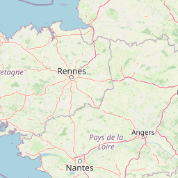
Map view of Réserve naturelle régionale de la ferme de la Chauffetière

Use this park location map to pinpoint Réserve naturelle régionale de la ferme de la Chauffetière in France, understand its exact geographic position, and read its mapped placement within the surrounding landscape more clearly.

Pigeon | © OpenStreetMap contributors

Location context for Réserve naturelle régionale de la ferme de la Chauffetière

Pays de la Loire
Park atlas

Compare surrounding regional nature reserves and connected protected landscapes in western France

Parks Near Réserve naturelle régionale de la ferme de la Chauffetière and Regional Protected Areas

Browsing nearby protected areas helps place the agricultural mosaic and hedgerow networks of Réserve naturelle régionale de la ferme de la Chauffetière into a wider regional context. Evaluating adjacent park geography reveals broader ecological corridors and conservation patterns across the Loire Valley.
Nature reservePays de la Loire
About 24 km away#1 closest

West

Réserve naturelle régionale de la tourbière de Logné: Protected Wetland Landscape Map

A rare peatland refuge in the Pays de la Loire administrative region

Located on the outskirts of Nantes, the Réserve naturelle régionale de la tourbière de Logné protects a delicate raised bog system. This atlas entry provides a detailed look at the basin terrain, its surrounding hills, and the wetland connectivity that supports its status as a critical botanical and invertebrate sanctuary within the Erdre valley.

Area
0.706 km²
Established
2011
IUCN
IV
Nature reservePays de la Loire
About 40 km away#2 closest

Southwest

Réserve naturelle régionale du bocage humide des Cailleries: Protected Landscape and Regional Map

Wet bocage and oak woodland in the Lake Grand-Lieu watershed

Covering roughly 18 hectares, this protected area features a fine-textured mosaic of woody hedgerows, wet meadows, and multiple small ponds. The site acts as a functional refuge for varied flora and fauna, illustrating the traditional Atlantic landscape character within western France through its structured management of meadows and pond systems.

Area
0.182 km²
Established
2012
IUCN
IV
Relief
Lowland
Nature reservePays de la Loire
About 42 km away#3 closest

East

Réserve naturelle régionale de Basses-Brosses et Chevalleries: Protected Area Mapping

A dense bocage landscape in the Pays de la Loire region

This regional nature reserve protects a well-preserved mosaic of meadows, cultivated plots, and wooded hedgerows across 90 hectares. The site serves as a vital ecological anchor in the Maine-et-Loire department, maintaining traditional land patterns and diverse species habitats that define the historic rural character of the Anjou countryside.

Area
0.9 km²
Established
2012
IUCN
IV
A soft watercolor illustration featuring a calm pond in the foreground, with reeds on the right and a distant treeline and rolling hills in the background.
Nature reservePays de la Loire
About 72 km away#4 closest

East

Réserve naturelle régionale des étang et boisements de Joreau: Protected Area Atlas Profile

Wetland and woodland mosaic in the Pays de la Loire region.

This profile examines the 92-hectare Réserve naturelle régionale des étang et boisements de Joreau, a protected area in the Maine-et-Loire department. The site features a specialized composition of freshwater ponds and mature woodlands, reflecting the traditional riverine landscapes found throughout the broader Loire Valley regional geography.

Area
0.92 km²
Established
2015
IUCN
IV
Nature reserveNouvelle-Aquitaine
About 79 km away#5 closest

Southeast

Réserve naturelle nationale du Toarcien: Protected Jurassic Stratotype and Geological Map

A vital paleontological heritage site in the Nouvelle-Aquitaine region

As the smallest national nature reserve in France, Réserve naturelle nationale du Toarcien provides a concentrated, scientifically essential view of Jurassic marine sediments. The protected quarries preserve ammonite-rich strata and complex geological unconformities, serving as the international definition for the Toarcian geological stage within the Thouet valley landscape.

Area
0.006 km²
Established
1987
IUCN
III
Relief
Lowland
A soft watercolor illustration depicting a serene wetland scene with a calm body of water, grassy marshland, and distant rolling hills under a pale sky.
Nature reservePays de la Loire
About 80 km away#6 closest

West

Réserve naturelle régionale du marais de Brière: Protected Wetland Geography in Western France

A vital conservation mosaic of reedbeds, canals, and flooded meadows.

Located in the Pays de la Loire region, this protected area preserves the distinctive Grande Brière marshland landscape. The reserve manages a complex network of channels, islands, and damp meadows, providing essential habitat for migratory waterbirds and wetland wildlife. It represents a significant effort to maintain the ecological integrity of inland marsh complexes through structured regional conservation.

Area
8.36 km²
Established
2012
IUCN
IV
Nature reserveNouvelle-Aquitaine
About 80 km away#7 closest

Southeast

Réserve naturelle régionale de la vallée du Pressoir: Protected Limestone Valley and Geoheritage

A rare natural and cultural mosaic in Nouvelle-Aquitaine

Trace the boundaries and natural features of the Réserve naturelle régionale de la vallée du Pressoir. This protected site in the Deux-Sèvres department is defined by thin calcareous soils, the historic Pommiers cascade, and fossil-rich limestone outcrops that form an unusual geoheritage landscape.

Area
0.56 km²
Established
2025
IUCN
IV
Visitors
10K annual
Nature reserveRomania
About 81 km away#8 closest

Southwest

Réserve naturelle régionale des marais du Bout de Sac: Protected Marsh Geography

Coastal wetland habitat and protected marshland terrain

The Réserve naturelle régionale des marais du Bout de Sac represents 187.1 hectares of preserved wetland habitat. Its landscape includes reclaimed polders, wet meadows, and a network of tidal channels. This site offers significant value for understanding the ecological structure of coastal marshlands and their role as habitats for waterbird populations near the Atlantic interface.

Established
2025
Relief
Lowland
Water
Water-dominated

Common questions about visiting, size, designation, and location context for Réserve naturelle régionale de la ferme de la Chauffetière

Réserve naturelle régionale de la ferme de la Chauffetière FAQs for park facts, access, geography, and protected area context

Find quick answers about Réserve naturelle régionale de la ferme de la Chauffetière, including protected-area facts, park geography, trail and visitor context, and how the park fits into its surrounding country and regional landscape.
MoriAtlas Explorer

Continue Your Protected Areas Search Across the Global Atlas

Deepen your exploration by continuing the structured search for national parks and protected areas worldwide. Utilize the comprehensive filtering capabilities to compare different conservation landscapes and refine your understanding of global park geography. Discover more about the distribution and characteristics of protected natural areas.

Global natural geography