
Mori Atlas logo
Nature reserveRéserve naturelle régionale de Mahistre et Musette

Map and geographic atlas of this essential Camargue wetland mosaic and restored marshland habitat

Réserve naturelle régionale de Mahistre et Musette: Protected Wetland Landscapes of Occitanie

(Réserve naturelle régionale de Mahistre et Musette (RNR266))

The Réserve naturelle régionale de Mahistre et Musette spans over 260 hectares within the Petite Camargue of southern France. This protected wetland environment, situated in the Gard department of the Occitanie region, preserves a complex mosaic of reedbeds, shallow ponds, salt meadows, and sansouires. By reconnecting fragmented landscapes to the flooding rhythms of the Vieux Vistre, the area serves as a significant sanctuary for diverse bird species and European pond turtle populations.

wetland reserveCamarguePetite Camargueregional nature reservereedbedssalt meadows
A flat-style digital illustration of a scenic valley, featuring a tall waterfall on the right plunging into a winding river that flows through the center. Pine trees and rocky cliffs frame the scene, under a pastel-colored sunset sky.

Réserve naturelle régionale de Mahistre et Musette

Nature reserve

Park overview

Structured park overview, official facts, and landscape profile for Réserve naturelle régionale de Mahistre et Musette

Réserve naturelle régionale de Mahistre et Musette park facts, protected area profile, and essential visitor context

Review the core facts for Réserve naturelle régionale de Mahistre et Musette, including designation, size, terrain, visitor scale, habitats, and operating context in one park-focused overview.

About Réserve naturelle régionale de Mahistre et Musette

The Réserve naturelle régionale de Mahistre et Musette sits in the heart of the Petite Camargue, a fragmented but still ecologically vital extension of the Rhône delta lying north of the main Camargue expanse. Within the commune of Saint-Laurent-d'Aigouze, just inland from the Mediterranean coast, the reserve occupies two historic agricultural estates that together form a continuous corridor of protected wetland habitats shaped by centuries of interaction between salt water, freshwater, and human land use.

The protected area is not a single contiguous block of land but rather two complementary domains. To the south lies the Mahistre estate, a remnant of the once-vast Souteyranne marshes that were largely drained in the 1970s. To the north lies the Musette estate, an older polder that had been farmed for rice, sunflower, and pasture since the late 1960s. A major feature of the reserve's geography is the Rhône to Sète canal, which cuts between the two domains, while the Vieux Vistre river runs along this same corridor, providing the hydrological backbone of the wetland system.

Ecologically, the reserve belongs squarely to the Camargue wetland family. Its northern half is dominated by extensive reedbeds and small ponds, while the southern portion includes patches of sansouires, the characteristic bare saline soils of the delta, along with salt meadows and tamarisk hedges. A small pond supporting pondweed, known locally as an étang à potamot, adds further habitat diversity, and riparian woodland fringes the waterways. What makes Mahistre et Musette stand out within the broader Camargue landscape is the combination of habitat diversity on a relatively compact footprint and the success of decades of restoration work that has gradually reestablished more natural flooding patterns across the site. The result is a reserve that, despite its modest size, punches well above its weight in terms of biodiversity value within the Gard department's protected area network.

Quick facts and research context for Réserve naturelle régionale de Mahistre et Musette

The Réserve naturelle régionale de Mahistre et Musette is a French regional nature reserve located in the commune of Saint-Laurent-d'Aigouze, in the Gard department, within the Occitanie region. It lies in the Petite Camargue, a northern extension of the larger Rhône delta wetlands, only a few kilometers from the Réserve naturelle régionale du Scamandre.

The reserve covers approximately 261 hectares and is split into two separate domains, the Mahistre estate to the south and the Musette estate to the north, divided by the Rhône to Sète canal. It was originally created as a voluntary nature reserve in 1999 and officially classified as a regional nature reserve in February 2013. It is managed by the Syndicat mixte pour la protection et la gestion de la Camargue gardoise and carries the IUCN Category IV designation.

Protection and recognition

Review documented protection status, management scope, and verified recognition metrics.

Protection Status and International Recognition for Réserve naturelle régionale de Mahistre et Musette

Examine the verified protection status, designation history, and administrative scope recorded for Réserve naturelle régionale de Mahistre et Musette. Structured records provide transparent access to official conservation data and baseline registry details.

Protection details

WDPA ID
555561967
Park context

Deeper park guide and search-rich context for Réserve naturelle régionale de Mahistre et Musette

Réserve naturelle régionale de Mahistre et Musette history, landscape, wildlife, and travel context

Explore Réserve naturelle régionale de Mahistre et Musette through its history, landscape character, ecosystems, wildlife, conservation priorities, cultural context, and seasonal travel timing in a structured park guide built for atlas discovery and search intent.

Why Réserve naturelle régionale de Mahistre et Musette stands out

Mahistre et Musette is best known for its Camargue wetland mosaic: large reedbeds, shallow ponds, salt meadows, and sansouires that together create a critical refuge for waterbirds and other wetland wildlife in the Petite Camargue. The reserve is particularly respected for its rich breeding bird community, with more than 218 recorded species, including bearded reedlings, moustached warblers, purple herons, glossy ibises, and red-crested pochards. The site is also notable as a stronghold for the European pond turtle, with more than a thousand individuals recorded, and for its ecological restoration story. Once drained agricultural land, the reserve has been progressively reconnected to the flooding rhythms of the Vieux Vistre, making it a textbook example of Camargue wetland rehabilitation on a small, carefully managed scale.
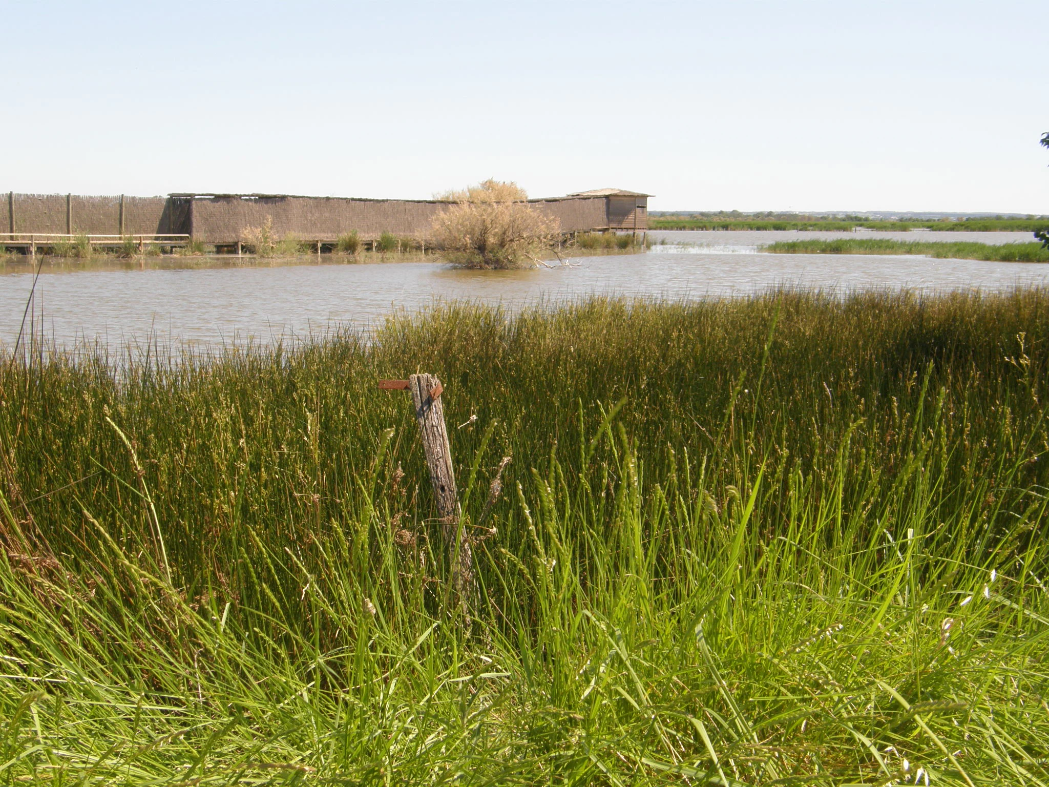
A wide shot of a marshy wetland with tall green grasses in the foreground and a long wooden birdwatching hide in the middle distance across the water.
A wooden wildlife observation hide located in the wetlands of the Réserve naturelle régionale de Mahistre et Musette.

Réserve naturelle régionale de Mahistre et Musette history and protected-area timeline

The history of Mahistre et Musette is closely tied to the long human transformation of the Petite Camargue wetlands. The Mahistre estate preserves a fragment of the old Souteyranne marshes, most of which were drained during the major agricultural drainage campaigns of the 1970s. By contrast, the Musette estate had already been converted into an agricultural polder by 1968, where rice, sunflower, and pasture crops were grown in rotation under the influence of the brackish water regime.

Recognition of the ecological value of these two estates grew over the following decades. The Conseil départemental du Gard acquired the Mahistre and Musette domains in 1993 and 1995 respectively, laying the groundwork for protection and restoration. Between 1995 and 2007, a series of ecological restoration works were carried out, including the lowering of embankments to roughly 40 centimeters in height to allow the Vieux Vistre to expand its natural flooding patterns across the former farmland.

On 23 April 1999, the two domains were classified as a voluntary nature reserve, a French designation reflecting private or local initiative in conservation. When that initial approval reached its renewal point, the Conseil départemental sought a stronger long-term status, and on 1 February 2013 the Languedoc-Roussillon regional council formally reclassified the site as a regional nature reserve. Since then it has carried the RNR designation with the identifier RNR266, marking its integration into France's permanent regional reserve network.

Réserve naturelle régionale de Mahistre et Musette landscape and geographic character

The landscape of the Réserve naturelle régionale de Mahistre et Musette is a classic Camargue wetland tableau, shaped by the interplay of freshwater, brackish water, and salt flats. The site is divided into two estates, Mahistre to the south and Musette to the north, separated by the broad waterway of the Rhône to Sète canal. This canal effectively splits the reserve in two, yet it also reinforces the wetland character of the surrounding land by maintaining a constantly present waterline.

The northern Musette domain is dominated by gently undulating expanses of reedbed, interspersed with small, shallow ponds where open water and emergent vegetation form a fine-grained mosaic. The Vieux Vistre, a slow-moving watercourse, runs along the corridor between the two estates and provides regular hydrological exchange. Tamarisk hedges and strips of riparian woodland edge the canals and water bodies, breaking up the open marsh with darker green lines of shrubs and small trees.

Further south, the Mahistre estate takes on a distinctly more saline character. Here, salt-tolerant vegetation gives way to sansouires, the bare or sparsely vegetated saline flats typical of the lower Camargue, while adjoining salt meadows carry a thin covering of halophytic plants. Across the whole site, the visual impression is one of horizontal horizons, reflection on still water, scattered low shrubs, and the sense of a working delta where land and water are still in active negotiation.

Réserve naturelle régionale de Mahistre et Musette ecosystems, habitats, and plant life

Ecologically, Mahistre et Musette functions as a compact but unusually diverse node within the Petite Camargue wetland system. The reserve is divided ecologically into two principal zones. The northern domain is centered on freshwater to mildly brackish habitats, supporting a wide expanse of reedbeds as well as a series of small ponds that vary through the year in depth and salinity. The southern domain is more strongly influenced by salt, with sansouires and salt meadows forming the dominant ecological matrix.

A small étang à potamot, a pondweed-rich open-water feature, adds microhabitat variety, while hedgerows of tamarisk and narrow bands of riparian woodland along the Vieux Vistre and the canal provide vertical structure that is otherwise scarce in open marshland. Over time, the historical freshwater balance has shifted; decreasing autumn rainfall and reduced water inputs from the Rhône to Sète canal have contributed to a gradual increase in salinity across the site, influencing both vegetation patterns and wildlife communities.

The reserve's plant flora includes several taxa of conservation interest, among them marsh spurge, a watercress species associated with pastel-leafed habitats, sea-lavender, summer snowflake, and annual glasswort. Notably, the site also serves as a foothold for invasive exotic plants such as Baccharis, an ongoing management challenge in Mediterranean wetlands of this kind.

Réserve naturelle régionale de Mahistre et Musette wildlife and species highlights

Wildlife is the heart of Mahistre et Musette's identity, and despite the reserve's compact size, its faunal record is impressive. More than 218 bird species have been documented on the site, reflecting both the diversity of habitats and the reserve's location along key flyways and within the wider Camargue ecosystem.

Among the breeding birds, the reserve supports several species that are emblematic of southern French wetlands. Bearded reedlings and moustached warblers are found within the dense reedbeds, while the strikingly colored purple swamphen moves through the marsh edges. Marsh harriers hunt over the reed canopy, glossy ibises forage in shallow water, and ducks such as red-crested pochard, gadwall, and common shelduck use the ponds and channels as feeding and resting habitat.

Beyond birds, the reserve is particularly notable for its population of European pond turtles, estimated at more than one thousand individuals, making Mahistre et Musette one of the significant strongholds for this species in the Petite Camargue. Otters have also been recorded on the site, confirming the continued functional quality of the wetland habitats for larger mammalian predators. Together, this combination of rich birdlife, charismatic reptiles, and recovering mammal presence makes the reserve a small but biologically dense component of the Camargue gardoise.

Réserve naturelle régionale de Mahistre et Musette conservation status and protection priorities

Conservation is the overarching purpose of Mahistre et Musette. The reserve belongs to France's regional nature reserve network, designated as IUCN Category IV, which recognizes areas managed primarily for the protection of habitats and species through active intervention. Its placement within the network reflects its role as a refugium for wetland species that have lost habitat elsewhere in the historic Camargue marshlands.

One of the central conservation stories of the site is its ecological restoration. The two estates that form the reserve were largely agricultural land until the 1990s, with the Musette domain cultivated for rice, sunflower, and pasture, and the Mahistre domain carrying the legacy of the drained Souteyranne marshes. The acquisition of the lands by the Conseil départemental du Gard and a multi-year program of habitat restoration, including lowering embankments to allow seasonal flooding by the Vieux Vistre, transformed the site from cultivated polder to functioning wetland.

Today, an emerging conservation concern is salinity change. Reduced freshwater inputs from the canal and shifting rainfall patterns have driven an increase in salinity across the reserve, encouraging the spread of salt-tolerant vegetation and sansouires into formerly fresher zones. Management also addresses invasive species, particularly Baccharis, which threatens native plant communities. The reserve is administered by the Syndicat mixte pour la protection et la gestion de la Camargue gardoise, which coordinates protection, monitoring, and public engagement across the Camargue gardoise landscape.

Réserve naturelle régionale de Mahistre et Musette cultural meaning and human context

The cultural context of Mahistre et Musette is intimately tied to the rural and agricultural heritage of the Petite Camargue. Both constituent estates were long working parts of the delta's farming economy: the Musette estate as a polder cultivated with rice, sunflower, and pasture, and the Mahistre estate as a surviving piece of the older Souteyranne marshland tradition before large-scale drainage in the 1970s. Their transition from productive farmland to protected wetland reflects a broader shift in how the Camargue is valued, moving from a primary emphasis on agricultural exploitation toward a stronger recognition of ecological, hydrological, and landscape heritage.

Management of the reserve by the Syndicat mixte pour la protection et la gestion de la Camargue gardoise also reflects a regional commitment to integrated landscape stewardship, weaving together local communes, departmental authorities, and conservation expertise. Although public access to the reserve is restricted to guided visits on specific occasions, the site remains part of the collective identity of the Camargue gardoise, representing how former working wetlands have been reframed as shared natural heritage.

Top sights and standout views in Réserve naturelle régionale de Mahistre et Musette

The standout features of Mahistre et Musette are its compact but exceptionally diverse wetland habitats and the way they support a disproportionately rich fauna for the reserve's size. The combination of reedbeds, ponds, salt meadows, and sansouires creates a layered Camargue landscape that supports more than 218 recorded bird species and one of the larger known populations of the European pond turtle in the Petite Camargue.

Equally significant is the reserve's restoration trajectory. From drained agricultural land and fragments of lost marshland, the site has been patiently rebuilt into a functioning wetland through embankment lowering, hydrological reconnection with the Vieux Vistre, and long-term stewardship. Its position alongside the Rhône to Sète canal and near the neighboring Scamandre reserve also makes Mahistre et Musette an important node in a wider network of Camargue gardoise protected areas.

Best time to visit Réserve naturelle régionale de Mahistre et Musette

The reserve has a distinctly seasonal character shaped by Camargue wetland dynamics. Spring and early summer are particularly rewarding periods, when breeding bird activity is at its peak and species such as bearded reedlings, moustached warblers, marsh harriers, and purple swamp hens are most easily observed around the reedbeds and ponds.

Late autumn and winter bring a different rhythm, with migratory waterfowl and overwintering birds using the ponds and channels, while the salt meadows and sansouires take on their most characteristic open, pale tones under low winter light. Because access is limited to guided visits arranged through the managing syndicate, prospective visitors should plan around the specific dates offered by the reserve rather than around a general tourist calendar, and should be prepared for conditions that reflect the wetland environment, including soft ground, mosquitoes in warmer months, and shifting water levels.
Monthly climate preview

Long-term representative temperature and monthly precipitation normals

Réserve naturelle régionale de Mahistre et Musette Climate and Weather by Month

Representative coordinates record measured average temperatures ranging from cool winter lows to warm summer maximums alongside varying monthly precipitation levels. Detailed monthly climate profiles provide complete twelve-month statistical comparisons for this protected area.
Annual mean16 °C
8 °C24 °C
Jan
Feb
Mar11°
Apr14°
May18°
Jun22°
Jul24°
Aug24°
Sep20°
Oct17°
Nov12°
Dec
Warmest month
July

24.5 °C

Coolest month
January

7.8 °C

Wettest month
November

2.6 mm/day

Driest month
July

0.6 mm/day

Park location guide

Geography guide, regional context, and park location map for Réserve naturelle régionale de Mahistre et Musette

Réserve naturelle régionale de Mahistre et Musette park geography, regions, and map view in France

Understand where Réserve naturelle régionale de Mahistre et Musette sits in France through a broader geographic reading of the surrounding landscape, nearby location context, and its mapped position within the national park landscape.

How Réserve naturelle régionale de Mahistre et Musette fits into France

France is a unitary semi-presidential republic and one of the world's largest economies. It borders Belgium, Luxembourg, Germany, Switzerland, Italy, Monaco, Andorra, and Spain, with a maritime border to the United Kingdom. The country is known for its cultural influence, art, cuisine, and political history spanning centuries.

Wider geography shaping Réserve naturelle régionale de Mahistre et Musette in France

France is located in Western Europe. Metropolitan France extends from the Rhine to the Atlantic Ocean and from the Mediterranean Sea to the English Channel and North Sea. The country borders Belgium, Luxembourg, Germany, Switzerland, Italy, Monaco, Andorra, Spain, and has a maritime border with the United Kingdom.

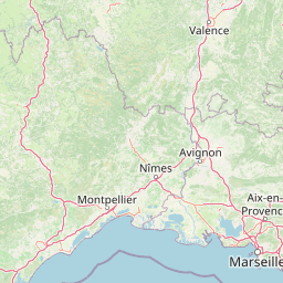
Map view of Réserve naturelle régionale de Mahistre et Musette

Use this park location map to pinpoint Réserve naturelle régionale de Mahistre et Musette in France, understand its exact geographic position, and read its mapped placement within the surrounding landscape more clearly.

Pigeon | © OpenStreetMap contributors

Location context for Réserve naturelle régionale de Mahistre et Musette

Occitanie

Visual exploration of wetland habitats, salt meadows, and protected delta terrain

Réserve naturelle régionale de Mahistre et Musette Photos and Landscape Scenery

Visual documentation captures the complex wetland mosaic, expansive reedbeds, and saline flats that define the protected landscape. Examining these field photographs reveals the distinctive terrain, water channels, and habitat structure across the regional nature reserve.

A wide shot of a marshy wetland with tall green grasses in the foreground and a long wooden birdwatching hide in the middle distance across the water.

Park atlas

Discover related protected areas across the surrounding Petite Camargue landscape

Explore Parks Near Réserve naturelle régionale de Mahistre et Musette

Compare Réserve naturelle régionale de Mahistre et Musette with other protected areas across the Rhône delta and surrounding wetlands. Broader regional browsing reveals connected conservation zones and adjacent wildlife habitats throughout southern France.
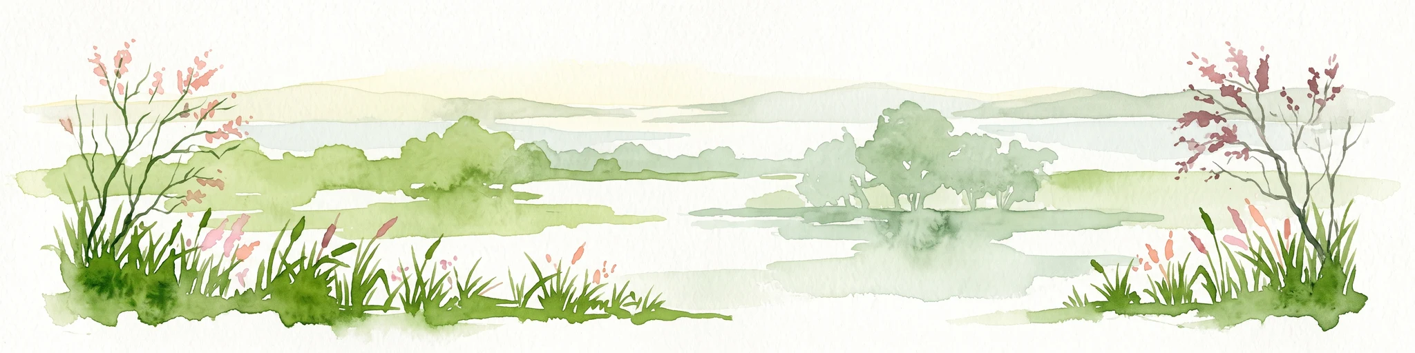
A horizontal watercolor illustration showing a marshy, grassy landscape with soft green and muted pink tones against a white background.
Regional parkProvence-Alpes-Côte d'Azur
About 8.5 km away#1 closest

East

Parc naturel régional de Camargue: Mapping the Rhône Delta Protected Wetland Landscape

Regional park geography and wetland conservation zones

Parc naturel régional de Camargue is a sprawling protected landscape at the confluence of the Rhône and the Mediterranean. This regional park contains significant saline lagoons, coastal dunes, and fertile marshes that serve as a crucial site for waterbird migration. Understand the interplay between traditional salt-making, pastoral ranching, and the strictly protected nature reserves that shape this delta territory.

Area
856.9 km²
Established
1970
IUCN
V
Relief
Lowland
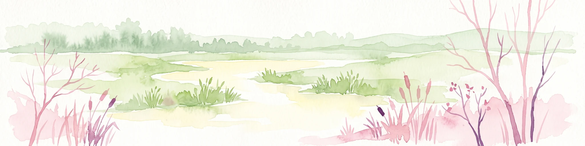
Watercolor painting of a marshy wetland scene with grassy foreground, scattered trees, and distant hills.
Nature reserveGard
About 9.3 km away#2 closest

East

Réserve naturelle régionale du Scamandre: Mapped Boundaries and Wetland Geography in Gard

Protected marshlands and salt steppe in southern France.

Deep dive into the ecological layout of Réserve naturelle régionale du Scamandre. Situated in the Gard department, this protected site preserves a mosaic of prairie, sansouïre, and marshland, creating a high-density wetland corridor essential for regional biodiversity and landscape analysis.

Area
1.467 km²
Established
2006
IUCN
IV
Relief
Lowland
A watercolor illustration of a tranquil marshland scene with soft green and muted pink tones, depicting reeds, sparse trees, and calm water.
Nature reserveFrance
About 37 km away#3 closest

East

Réserve naturelle régionale de la Tour du Valat: Mediterranean Wetland and Research Landscape Map

A critical protected area and ecological research estate in the Rhône delta of France.

Located in the Bouches-du-Rhône department, the Réserve naturelle régionale de la Tour du Valat serves as a reference point for Mediterranean wetland science. The reserve features an intricate landscape of marshes, salt meadows, and woodland patches that support diverse birdlife and habitats. This protected area demonstrates the integration of active pastoral land use with habitat management on a significant deltaic estate near Arles.

Area
18.44 km²
Established
2008
Relief
Lowland
Climate
Mediterranean
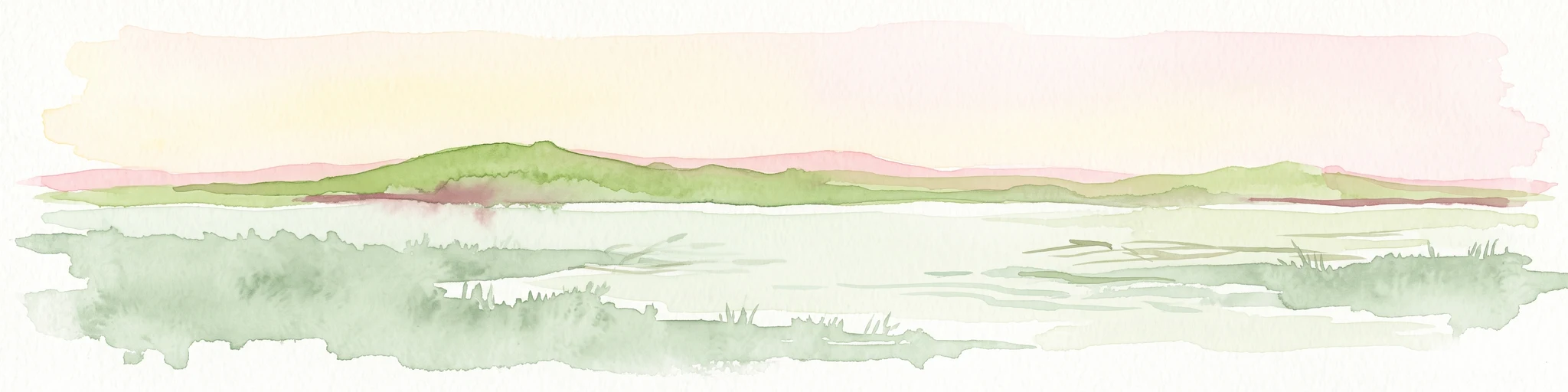
Watercolor painting of a low lying landscape with calm water, grassy wetlands in the foreground, and distant green hills under a soft sunset sky.
Protected areaHérault
About 40 km away#4 closest

Southwest

Salins de Frontignan: An Atlas of Protected Coastal Wetlands in the Hérault Region

Explore saline landscapes and marshland geography on the Gulf of Lion.

Located in the Hérault department, Salins de Frontignan offers a fascinating study in coastal geography and ecological reclamation. This protected area features abandoned salt marshes that have evolved into a vital network of evaporation basins, salt steppes, and lagoon margins. The site serves as a crucial habitat for specialized halophytic plants, positioned uniquely between the Mediterranean shoreline and the limestone foothills of the Gardiole range.

Area
2.795 km²
Established
1980
IUCN
IV
Relief
Lowland
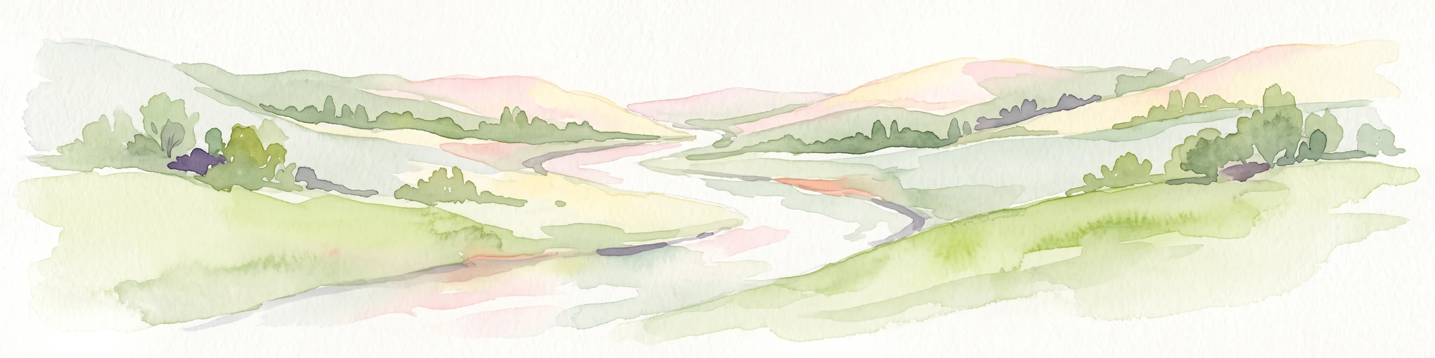
A soft watercolor painting of a winding river flowing through a gentle, rolling green valley with hills in the background.
Nature reserveOccitanie
About 40 km away#5 closest

North

Réserve naturelle régionale des gorges du Gardon: Geography and Protected Area Overview

Mediterranean river valley and raptor conservation corridor

Examine the distinct topography of the Réserve naturelle régionale des gorges du Gardon. The protected area features steep limestone cliffs and a river corridor that sustains dense Mediterranean oak forests. This site remains a critical node for raptor conservation, specifically supporting nesting Egyptian vultures and Bonelli eagles within its structured valley geography.

Area
4.913 km²
Established
2007
IUCN
IV
A horizontal watercolor painting depicting a soft-focus landscape of grassy wetlands in the foreground with gentle, rolling hills in the background.
Nature reserveProvence-Alpes-Côte d'Azur
About 44 km away#6 closest

East

Réserve naturelle régionale de l'Ilon: Protected Wetland Atlas and Geographic Context

Mapping Mediterranean marshes in the Alpilles foothills.

Covering 176 hectares of diverse wetland habitat, Réserve naturelle régionale de l'Ilon preserves critical marshlands and floodable meadows. This site demonstrates the interplay between lowland water systems and the rocky Alpilles range, providing a essential refuge for diverse dragonfly and bird species within the heart of Provence.

Area
1.76 km²
Established
2012
IUCN
IV
Nature reserveProvence-Alpes-Côte d'Azur
About 64 km away#7 closest

East

Réserve naturelle régionale de la Poitevine-Regarde-Venir: Steppe Conservation and Geography

Protected dry steppe landscapes in the French Crau region

Delve into the geography of the Réserve naturelle régionale de la Poitevine-Regarde-Venir, a specialized nature reserve that safeguards the distinctive pebbly coussoul of the Crau plain. The area represents a fundamental piece of Mediterranean pastoral history, balancing fragile steppe ecosystems with traditional agricultural meadows.

Area
2.207 km²
Established
2009
IUCN
IV
Nature reserveProvence-Alpes-Côte d'Azur
About 64 km away#8 closest

East

Réserve naturelle régionale du Pourra - Domaine du Ranquet: Coastal Lagoon Protected Landscape

Regional Nature Reserve in Provence-Alpes-Côte d'Azur

Spanning over 300 hectares near Port-de-Bouc, this protected area preserves interconnected Mediterranean lagoons and surrounding marshlands. It offers a distinct geographic perspective on transitional coastal habitats situated within the heavily developed Bouches-du-Rhône department.

Area
3.153 km²
Established
2020
IUCN
IV

Common questions about visiting, size, designation, and location context for Réserve naturelle régionale de Mahistre et Musette

Réserve naturelle régionale de Mahistre et Musette FAQs for park facts, access, geography, and protected area context

Find quick answers about Réserve naturelle régionale de Mahistre et Musette, including protected-area facts, park geography, trail and visitor context, and how the park fits into its surrounding country and regional landscape.
MoriAtlas Explorer

Continue Your Protected Areas Search Across the Global Atlas

Deepen your exploration by continuing the structured search for national parks and protected areas worldwide. Utilize the comprehensive filtering capabilities to compare different conservation landscapes and refine your understanding of global park geography. Discover more about the distribution and characteristics of protected natural areas.

Global natural geography