
Mori Atlas logo
Nature reserveRéserve naturelle régionale de Sainte-Lucie

Mapping the Mediterranean lagoons, salt-influenced flats, and woodland mosaics of the Aude coastline.

Réserve naturelle régionale de Sainte-Lucie: A Protected Coastal Wetland and Island Landscape

Réserve naturelle régionale de Sainte-Lucie encompasses 825 hectares of protected coastal terrain in the Occitanie region of southern France. The reserve features a distinct geography defined by Sainte-Lucie Island, which separates the brackish waters of the Étang de Bages-Sigean and the Étang de l'Ayrolle. Visitors can study the complex mosaic of garrigue-covered outcrops, reed-fringed marshes, and expansive Mediterranean shorelines through this detailed geographic atlas.

regional nature reserveMediterranean coastcoastal lagoonisland reservewetlandsMediterranean garrigue
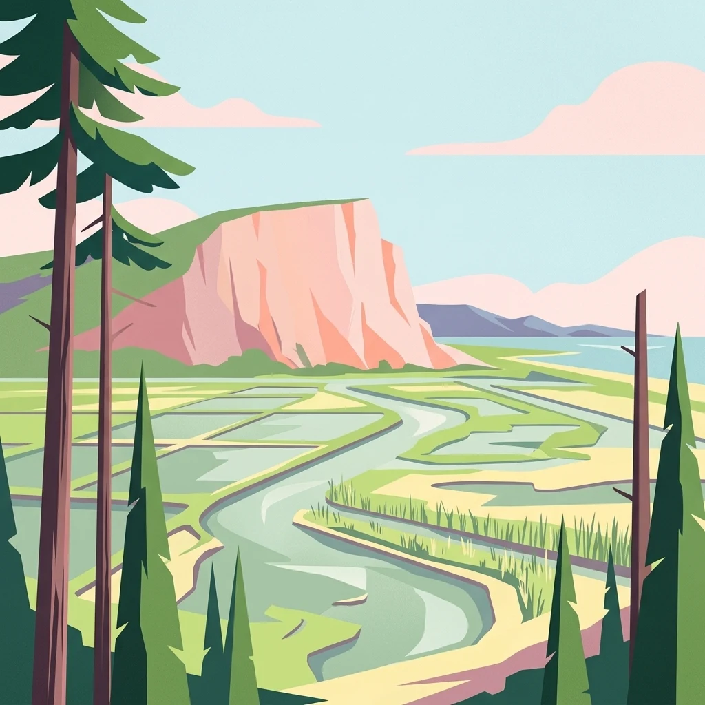
A stylized flat-design illustration showing a winding river flowing through wetlands towards a large pinkish cliff face near the coast, framed by coniferous trees in the foreground.

Réserve naturelle régionale de Sainte-Lucie

Nature reserve

Park overview

Structured park overview, official facts, and landscape profile for Sainte-Lucie Regional Nature Reserve

Sainte-Lucie Regional Nature Reserve park facts, protected area profile, and essential visitor context

Review the core facts for Sainte-Lucie Regional Nature Reserve, including designation, size, terrain, visitor scale, habitats, and operating context in one park-focused overview.

About Sainte-Lucie Regional Nature Reserve

The Sainte-Lucie Regional Nature Reserve protects a representative slice of the Mediterranean coastal landscape of the Aude department. Occupying 825 hectares near Port-la-Nouvelle, the reserve combines the small island of Sainte-Lucie with adjacent Mediterranean lagoons, marshes and beaches. Its strategic position bridging two large coastal lagoons and the open sea gives it strong ecological value as a transition zone between freshwater-influenced lagoons, brackish environments and marine shoreline.

The territory is split by the Canal de la Robine, an engineered waterway whose presence creates two separate reserve sectors. The western sector is Sainte-Lucie Island itself, whose highest point reaches 39 metres at the Roc Saint-Antoine; the island shelters pine woodland, holm oak silhouettes, garrigue and coastal scrub. The eastern sector consists of lagoons, reedbeds and a stretch of Mediterranean beach facing the open sea. The Sainte-Lucie lock (écluse de Sainte-Lucie) provides the main passage between the two halves of the reserve.

At a regional scale, the reserve forms an important ecological link between the Étang de Bages-Sigean, the Étang de l'Ayrolle, the Massif de la Clape and the Parc naturel régional de la Narbonnaise en Méditerranée, which co-manages the site together with the commune of Port-la-Nouvelle. The mix of island habitats, coastal wetlands and open Mediterranean shoreline makes it a strong example of the lagoonal conservation landscapes that characterise the French Mediterranean coast.

Quick facts and research context for Sainte-Lucie Regional Nature Reserve

The Sainte-Lucie Regional Nature Reserve sits in the Aude department of southern France, within the Occitanie region, and lies near the town of Narbonne on the Mediterranean coast. Created on 25 September 2009, it is administered as a Regional Nature Reserve (Réserve naturelle régionale) and carries the WDPA identifier 555514319.

The reserve covers 825 hectares and is divided into two distinct sectors separated by the Canal de la Robine. Sainte-Lucie Island constitutes the western portion, dividing the brackish Étang de Bages-Sigean from the Étang de l'Ayrolle, while the eastern portion consists of lagoons, wetlands and beaches facing the Mediterranean. It is co-managed by the Parc naturel régional de la Narbonnaise en Méditerranée and the commune of Port-la-Nouvelle and hosts 28 nesting bird species as well as notable amphibians, reptiles and insects.

Protection and recognition

Documented terrestrial protection scope and international recognition framework

Réserve Naturelle Régionale de Sainte-Lucie Protection Status and WDPA Records

Territorial protection status for Réserve naturelle régionale de Sainte-Lucie outlines the recorded designation history and management scope. Documented records provide verified administrative data regarding conservation boundaries without assuming external recognition sources.

Protection details

Protection scope
Terrestrial
Transboundary protection
No
WDPA ID
555514319
Park context

Deeper park guide and search-rich context for Sainte-Lucie Regional Nature Reserve

Sainte-Lucie Regional Nature Reserve history, landscape, wildlife, and travel context

Explore Sainte-Lucie Regional Nature Reserve through its history, landscape character, ecosystems, wildlife, conservation priorities, cultural context, and seasonal travel timing in a structured park guide built for atlas discovery and search intent.

Why Sainte-Lucie Regional Nature Reserve stands out

The reserve is best known for safeguarding Sainte-Lucie Island and the coastal lagoon-wetland complex that surrounds it. The island's position between two large coastal lagoons, combined with its proximity to open Mediterranean beaches, creates a distinctive mosaic of brackish waters, salt-affected flats, dunes and Mediterranean woodland. It is also recognized as a breeding and feeding area for the Mediterranean coastal fauna: 28 species of nesting birds, noteworthy amphibian, reptile and insect populations, and bats that travel from the Massif de la Clape to feed over the wetlands.
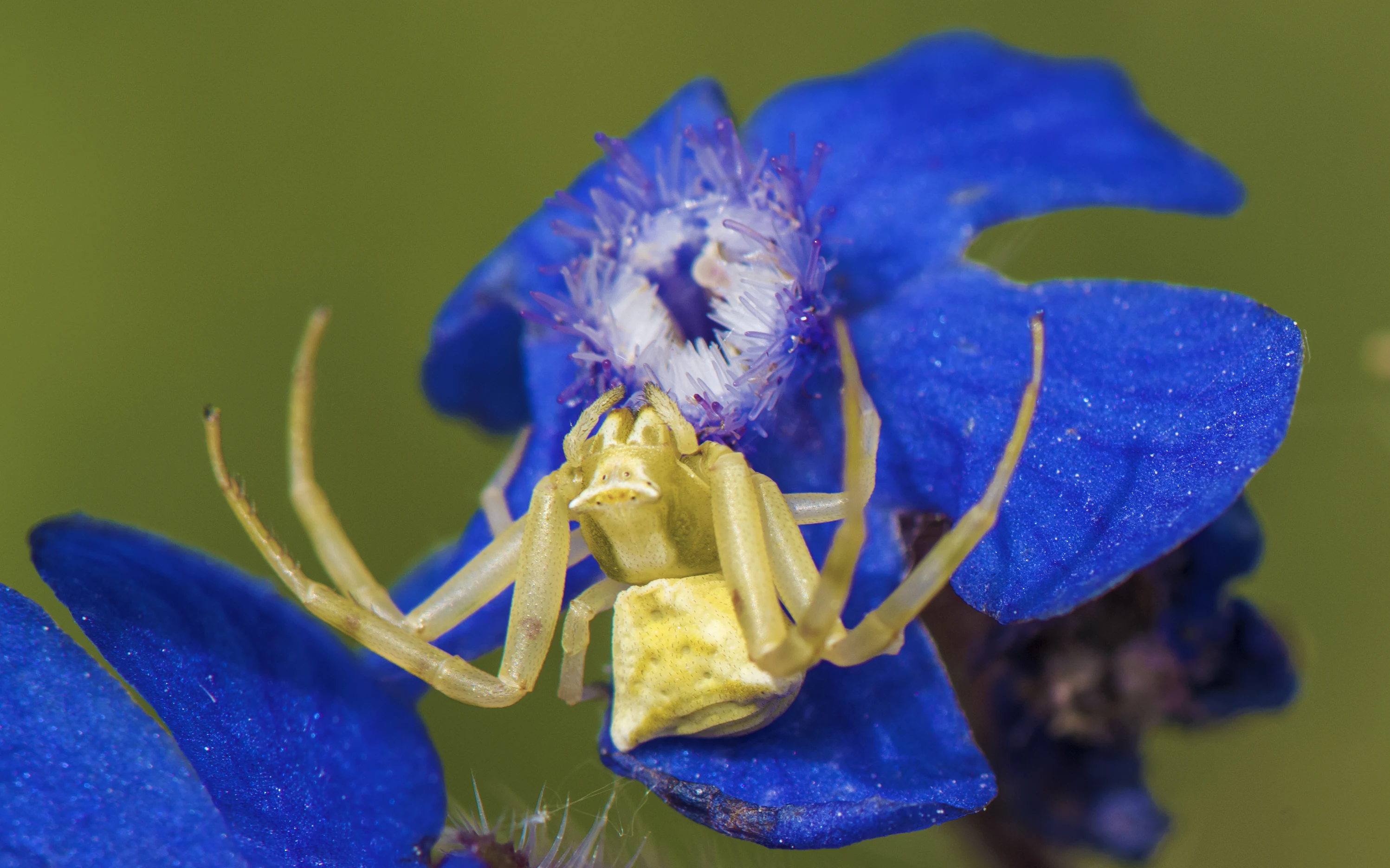
A close-up, top-down view of a small yellow flower crab spider sitting on a vibrant blue flower with a center of fine, pale-colored filaments.
A flower crab spider (Thomisus onustus) perched on a blue wildflower in the Réserve naturelle régionale de Sainte-Lucie.

Sainte-Lucie Regional Nature Reserve history and protected-area timeline

The reserve was formally established on 25 September 2009 by a deliberation of the Regional Council of Languedoc-Roussillon, the former administrative region in which the Aude department then sat. Its creation reflected a regional strategy to protect the natural character of Sainte-Lucie Island and its neighbouring coastal wetlands in the face of pressures from coastal development, lagoon modification and tourism.

Since its establishment, the site has been co-managed by the Parc naturel régional de la Narbonnaise en Méditerranée, which oversees broader conservation across the Narbonnaise coastline, together with the commune of Port-la-Nouvelle, on whose territory the reserve lies. Restoration work visible on site, including restored dry-stone walls ('murets de pierres sèches'), reinforced pinewoods at the island entrance and the incorporation of former salt pans into the protected area, suggests a history of past human use spanning salt-making, rail transport across the lagoon (visible as the old railway causeway) and rural land management, followed by deliberate rewilding and protection. Earlier 2010 management documents archived by the Parc naturel régional show that an active monitoring and management programme was already in place during the reserve's earliest years.

Sainte-Lucie Regional Nature Reserve landscape and geographic character

The reserve's landscape is defined by the juxtaposition of three environments: the elongated island of Sainte-Lucie, the brackish coastal lagoons on either side of it, and the open Mediterranean shore. Sainte-Lucie Island is the reserve's centerpiece. It is a narrow landform that physically separates the Étang de Bages-Sigean to the north from the smaller Étang de l'Ayrolle to the south. Its terrain is modest, with the highest point at the Roc Saint-Antoine reaching only 39 metres, but it rises distinctly above the surrounding water and provides varied microhabitats of pinewood, garrigue and rocky outcrops.

To the east of the island, a low-lying landscape of coastal lagoons, former salt pans, damp depressions and sandy beach stretches toward the Mediterranean Sea. The Canal de la Robine, a navigable waterway that cuts across the area, divides the reserve into western and eastern sectors, with the Sainte-Lucie lock providing the transition between them. The combination of lagoon shoreline, salt-influenced flats, dunes and an old rail causeway crossing the water creates a layered coastal scenery that is typical of the Narbonnaise coast.
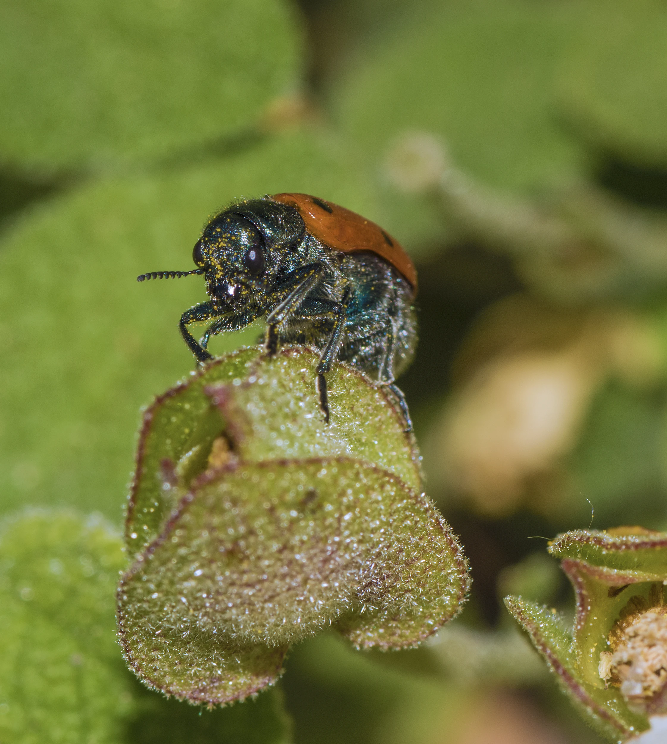
A close-up view of a small orange and black spotted beetle perched on the edge of a green textured leaf.
A Clytra quadripunctata beetle resting on foliage within the Réserve naturelle régionale de Sainte-Lucie.

Sainte-Lucie Regional Nature Reserve ecosystems, habitats, and plant life

Ecologically, the reserve represents a Mediterranean coastal transition zone between marine, brackish and terrestrial environments. The western sector on Sainte-Lucie Island offers pine-dominated woodland, holm oak formations and open garrigue with characteristic Mediterranean shrubs, while the eastern sector is dominated by lagoons, salt marshes and sandy shoreline facing the sea.

This combination of habitats supports a distinctive flora that includes broom (Spartium junceum), Italian bugloss (Anchusa azurea), and the poppy Papaver somniferum, alongside typical Mediterranean garrigue species such as sage-leaved cistus. The mosaic of dry island vegetation and wet lagoon edge vegetation creates a strong ecological contrast within a compact area, and the reserve's protected framework is designed to maintain that balance against coastal pressures and lagoon-edge modification.
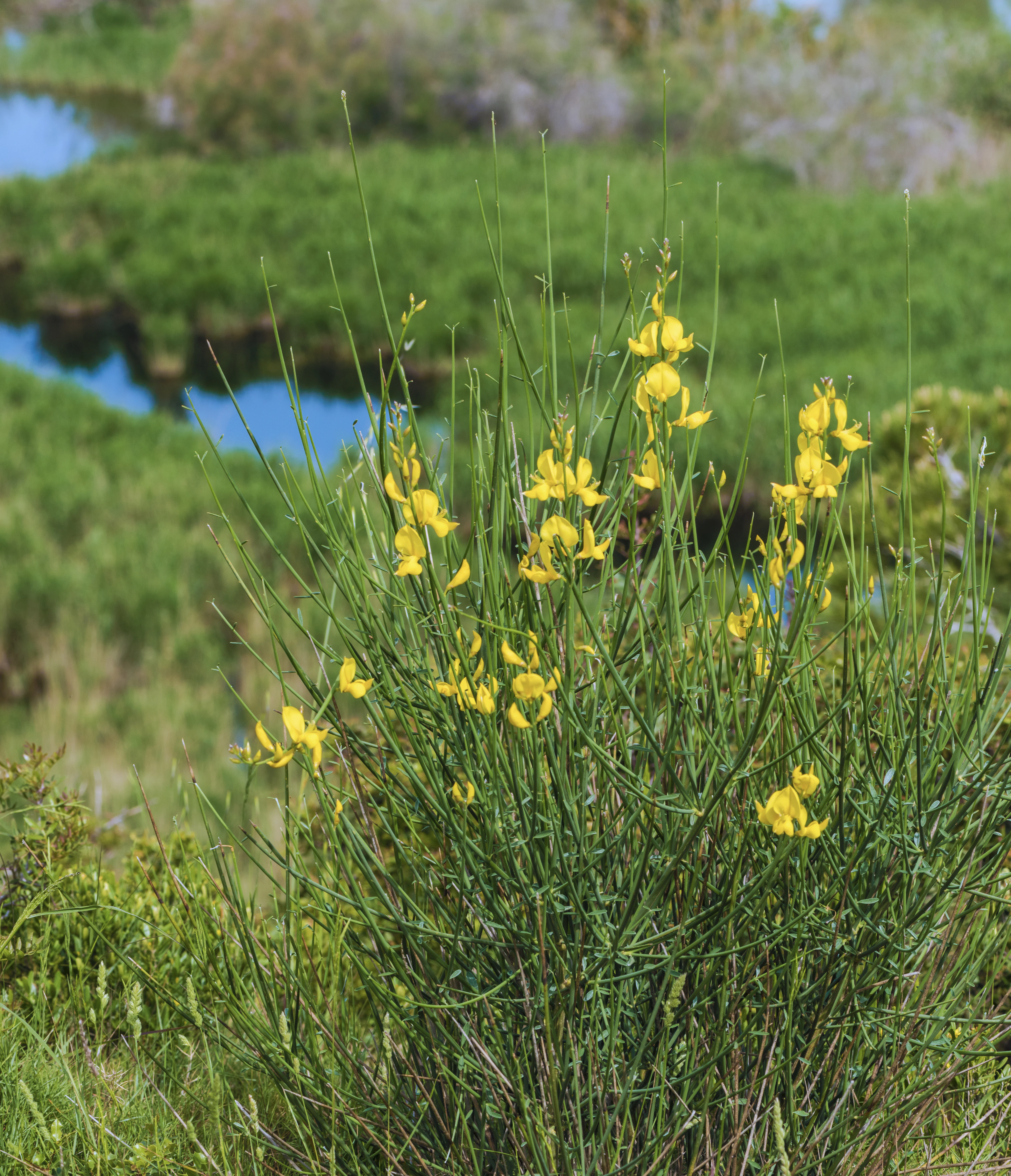
A close-up view of a Spanish broom shrub with bright yellow flowers, set against a background of green vegetation and a small pond.
Spanish broom (Spartium junceum) in bloom within the Sainte-Lucie nature reserve.

Sainte-Lucie Regional Nature Reserve wildlife and species highlights

The reserve's wildlife profile is shaped by the meeting of maritime and terrestrial habitats. Twenty-eight species of birds nest within the reserve's boundaries, using the island woodland, lagoon reedbeds and shoreline edge for breeding and feeding. The combination of brackish water, salty flats and dry island vegetation creates attractive conditions for coastal and wetland birdlife.

Beyond birds, the reserve shelters noteworthy populations of amphibians and reptiles that depend on the damp lagoon margins and Mediterranean scrub, as well as a notable insect fauna that includes crab spiders (Thomisus onustus) and beetles such as Clytra quadripunctata and Oedemera nobilis observed on cistus flowers. Bats from the nearby Massif de la Clape are known to cross into the reserve to feed over the wetlands, extending the site's ecological value beyond the strictly coastal fauna.
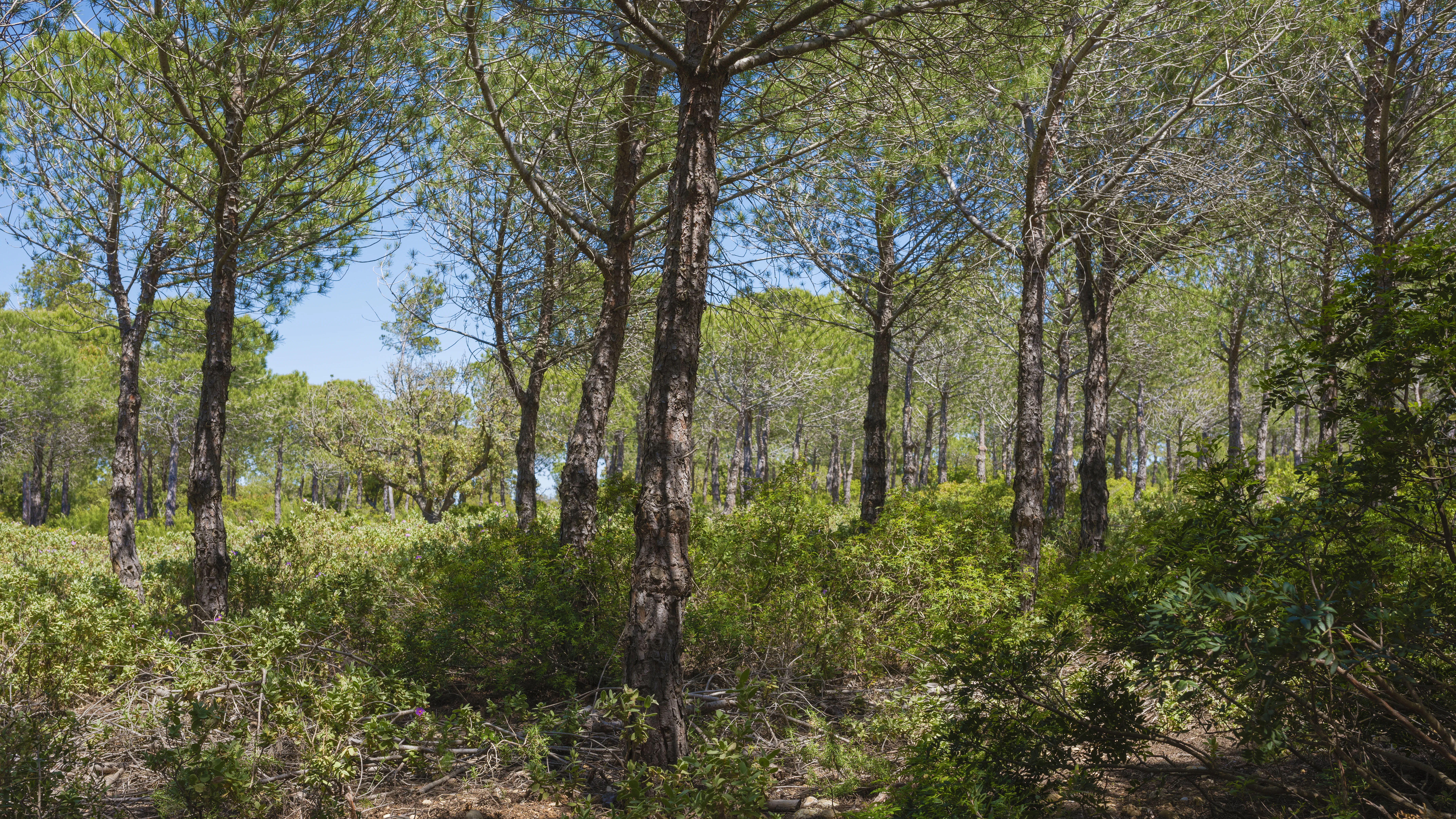
A sunny scene featuring a dense stand of pine trees with textured trunks and green canopy, set against a clear blue sky, with a lush, low-lying shrub understory.
A stand of pine trees within the Réserve naturelle régionale de Sainte-Lucie.

Sainte-Lucie Regional Nature Reserve conservation status and protection priorities

Sainte-Lucie Regional Nature Reserve exemplifies the French regional nature reserve model, created to protect a coherent mosaic of Mediterranean coastal ecosystems from fragmentation and degradation. Its 825-hectare territory is small but ecologically dense, anchoring a key segment of the Narbonnaise coast between the Étang de Bages-Sigean, the Étang de l'Ayrolle and the Mediterranean Sea.

The reserve protects island pinewood and garrigue habitats that are vulnerable to fire and coastal development, together with lagoon and beach ecosystems that are sensitive to water-quality changes and shoreline artificialisation. Co-management by the Parc naturel régional de la Narbonnaise en Méditerranée and the commune of Port-la-Nouvelle integrates the site into a broader regional conservation strategy and supports active stewardship in the form of restored dry-stone walls, managed pinewood edges, and the inclusion of former salt working areas as protected lagoon habitat.

Sainte-Lucie Regional Nature Reserve cultural meaning and human context

The reserve's cultural landscape reflects centuries of human interaction with the Narbonnaise coast. The old railway causeway crossing the water visible in photographs, the restored dry-stone walls ('murets'), and the former salt pans now incorporated into the protected area point to a history shaped by salt-making, rural land management, and transport infrastructure linking the lagoons.

The integration of these human elements into the reserve layout gives the protected area an explicitly cultural-geographical character. The site's co-management by the commune of Port-la-Nouvelle and the regional natural park reflects the importance of local municipal involvement in Mediterranean coastal conservation, and the Sainte-Lucie lock on the Canal de la Robine serves both as a functional waterway passage and as a marker of the engineered relationship between the lagoons and the inland transport network.
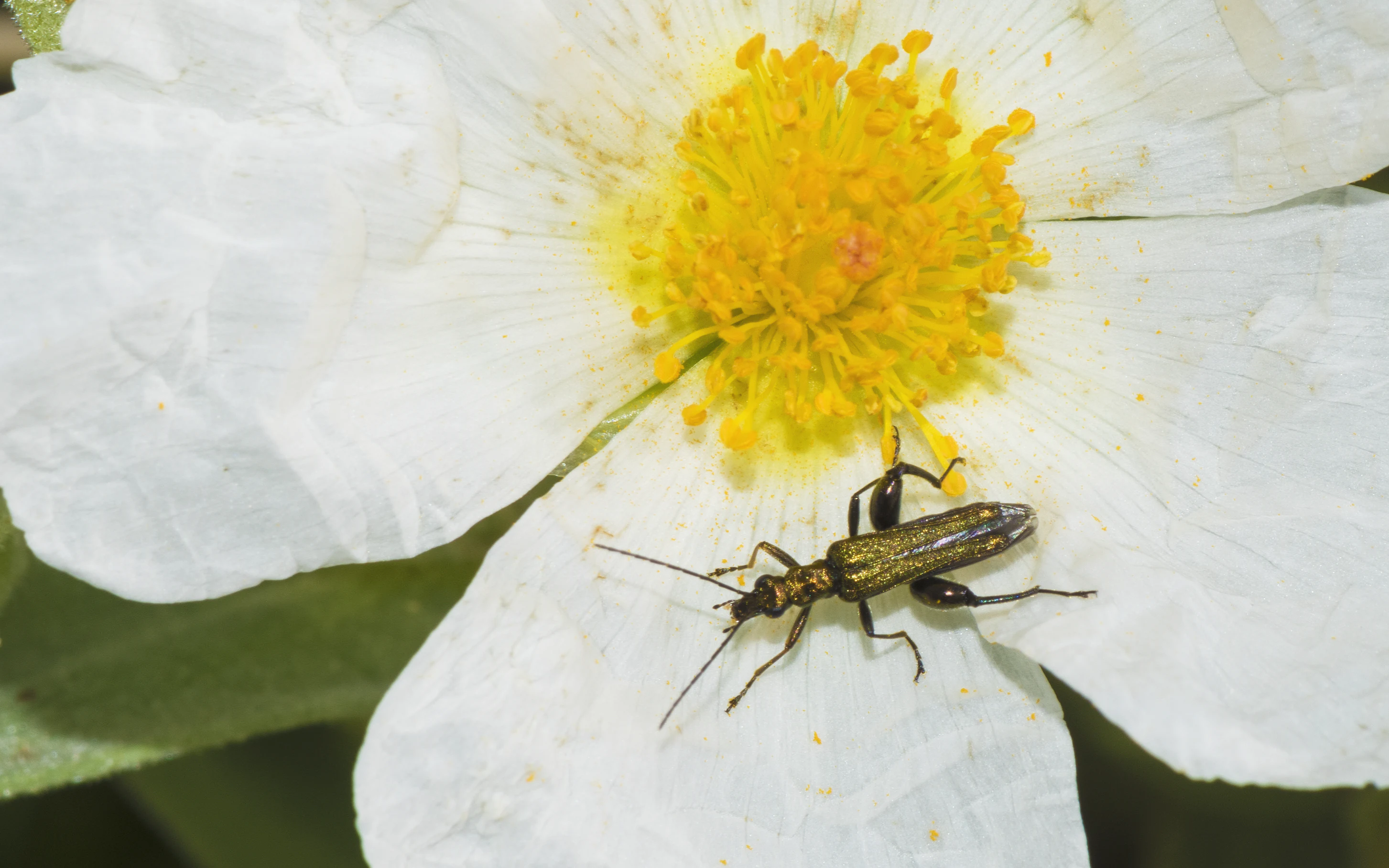
A close-up view of a metallic green thick-legged flower beetle perched on the white petal of a Cistus flower with a bright yellow center.
A thick-legged flower beetle resting on a Cistus salviifolius flower at Sainte-Lucie Island.

Top sights and standout views in Sainte-Lucie Regional Nature Reserve

The reserve's strongest point of distinction is its compact combination of three Mediterranean environments: a pine- and garrigue-covered island, a network of coastal lagoons and salt-influenced flats, and an open Mediterranean beach. This variety of habitats within a small territory gives the site disproportionate ecological richness.

It is also notable for its role as a stepping stone in the broader Narbonnaise conservation landscape, protecting 28 nesting bird species, supporting notable amphibian, reptile and insect populations, and receiving bats from the neighbouring Massif de la Clape. The visible traces of past human use, from former salt pans to restored dry-stone walls and the old rail causeway, add a cultural-geographical layer that complements the natural value of the reserve.
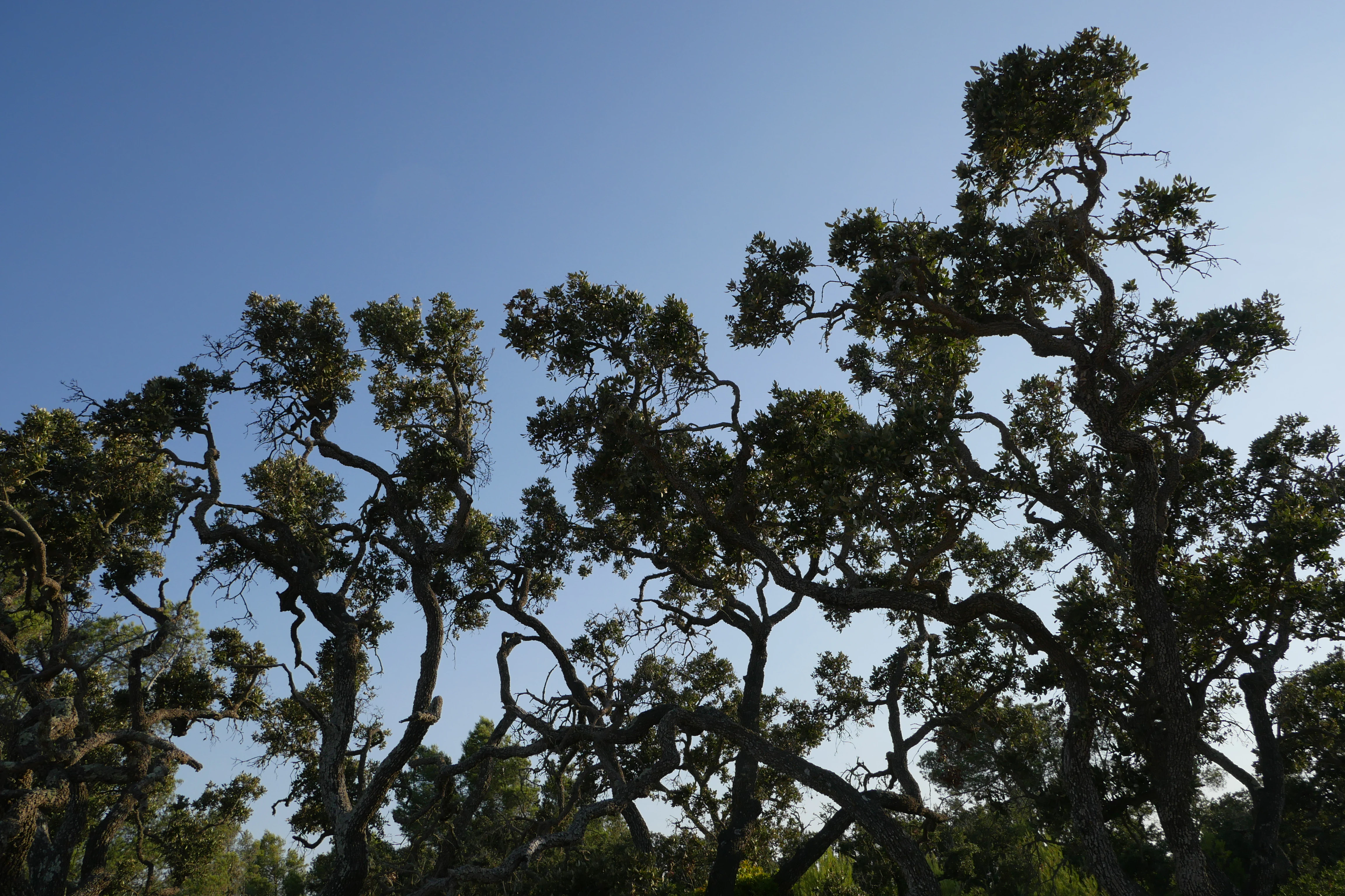
The twisted trunks and branches of holm oak trees silhouetted against a clear blue sky
Holm oak trees on Sainte-Lucie Island

Best time to visit Sainte-Lucie Regional Nature Reserve

The reserve experiences a typical Mediterranean coastal climate, with mild winters, hot dry summers and most rainfall concentrated in autumn and spring. Spring and early summer are generally the most rewarding periods for experiencing its ecological character, when lagoon-edge vegetation is active, birds are breeding and seabreeze conditions are more comfortable for walking the island paths.

Autumn can also be atmospheric, with softer light, quieter conditions and seasonal bird movement along the lagoons, while summer visits are best planned for cooler parts of the day given the intensity of Mediterranean sun and the dry, flammable nature of pine and garrigue habitats. In all seasons, visitors should expect outdoor, weather-exposed conditions typical of open coastal reserves near the Étang de Bages-Sigean and the Mediterranean shoreline.
Monthly climate preview

Long-term representative coordinate measurements for temperature and precipitation patterns

Réserve naturelle régionale de Sainte-Lucie Climate Normals and Annual Temperature Rhythm

Historical data recorded at a representative coordinate reveals monthly average temperatures spanning from 7.97 degrees Celsius up to 23.63 degrees Celsius alongside recorded precipitation rates. Examining the full twelve-month profile provides complete context on long-term temperature ranges and precipitation variations across the protected landscape.
Annual mean15 °C
8 °C24 °C
Jan
Feb
Mar11°
Apr13°
May17°
Jun21°
Jul24°
Aug24°
Sep20°
Oct16°
Nov12°
Dec
Warmest month
August

23.6 °C

Coolest month
January

8 °C

Wettest month
October

2.4 mm/day

Driest month
July

0.6 mm/day

Park location guide

Geography guide, regional context, and park location map for Sainte-Lucie Regional Nature Reserve

Sainte-Lucie Regional Nature Reserve park geography, regions, and map view in France

Understand where Sainte-Lucie Regional Nature Reserve sits in France through a broader geographic reading of the surrounding landscape, nearby location context, and its mapped position within the national park landscape.

How Sainte-Lucie Regional Nature Reserve fits into France

France is a unitary semi-presidential republic and one of the world's largest economies. It borders Belgium, Luxembourg, Germany, Switzerland, Italy, Monaco, Andorra, and Spain, with a maritime border to the United Kingdom. The country is known for its cultural influence, art, cuisine, and political history spanning centuries.

Wider geography shaping Sainte-Lucie Regional Nature Reserve in France

France is located in Western Europe. Metropolitan France extends from the Rhine to the Atlantic Ocean and from the Mediterranean Sea to the English Channel and North Sea. The country borders Belgium, Luxembourg, Germany, Switzerland, Italy, Monaco, Andorra, Spain, and has a maritime border with the United Kingdom.

Map view of Sainte-Lucie Regional Nature Reserve

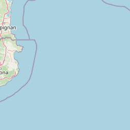
Use this park location map to pinpoint Sainte-Lucie Regional Nature Reserve in France, understand its exact geographic position, and read its mapped placement within the surrounding landscape more clearly.

Pigeon | © OpenStreetMap contributors

Location context for Sainte-Lucie Regional Nature Reserve

Occitanie

Visualizing coastal wetlands, Mediterranean garrigue, and lagoon terrain

Réserve naturelle régionale de Sainte-Lucie Photos and Landscapes

Visual documentation captures the complex terrain of pine woodlands, salt flats, and open Mediterranean beaches defining Réserve naturelle régionale de Sainte-Lucie. Examining these protected habitats provides clear visual reference for the unique ecological mosaic spanning the French coastline.

A close-up, top-down view of a small yellow flower crab spider sitting on a vibrant blue flower with a center of fine, pale-colored filaments.

A wide landscape view of a coastal lagoon and canal next to a cluster of small Mediterranean-style buildings, with a tall pine tree in the foreground.

A close-up view of a small orange and black spotted beetle perched on the edge of a green textured leaf.

A close-up view of a Spanish broom shrub with bright yellow flowers, set against a background of green vegetation and a small pond.

A sunny scene featuring a dense stand of pine trees with textured trunks and green canopy, set against a clear blue sky, with a lush, low-lying shrub understory.

A wide landscape shot of a coastal wetland with green grass and shrubs in the foreground leading to a large blue body of water, with a distant shoreline under a clear blue sky.

A close-up view of a metallic green thick-legged flower beetle perched on the white petal of a Cistus flower with a bright yellow center.

The twisted trunks and branches of holm oak trees silhouetted against a clear blue sky

A close up view of an Italian bugloss plant with clusters of small, vibrant blue flowers on a hairy stalk, surrounded by green grass.

A view through the branches of leaning pine trees looking out over a grassy coastal wetland with a body of water in the background.

A wide view of calm, shallow pools of water in former salt marshes, with grasses in the foreground and a pale, cloudy sky at sunset in the background.

A cluster of pale purple poppies with dark purple centers growing in green grass.

A wide view of a train traveling across a long railway embankment that cuts through a vast coastal wetland, with calm water and distant low hills under a soft light.

A low dry stone wall runs horizontally through a sunlit pine forest with dry grass on the ground.

An elevated, wide-angle view of a coastal wetland landscape, featuring a large, still lagoon bordered by green reeds, grasses, and low-lying vegetation under a clear sky.

A small clearing with wooden picnic tables under the canopy of pine trees in a Mediterranean-style forest.

Park atlas

Compare adjacent Mediterranean coastal reserves and regional wetland landscapes

Parks Near Réserve naturelle régionale de Sainte-Lucie and Surrounding Protected Areas

Browse other protected areas and regional parks located near Réserve naturelle régionale de Sainte-Lucie. Compare surrounding coastal wetlands, island habitats, and Mediterranean ecosystems to understand the broader regional geography.
Watercolor painting of a tranquil natural landscape with a stream flowing through grassy hills, wildflowers, and a backdrop of distant purple-toned mountains.
Nature reserveOccitanie
About 64 km away#1 closest

South

Réserve naturelle nationale de la forêt de la Massane: Geographic and Protected Area Map

Ancient beech forest terrain in the Occitanie mountain landscape

Situated in the upper valley of the Massane river, this protected reserve provides a rare glimpse into ancient forest evolution. With its dense concentration of documented species and unique geological base, it stands as a reference point for studying climate change impacts on Mediterranean mountain terrain and protected woodland architecture.

Area
3.4 km²
Established
1973
IUCN
IV
Visitors
40K annual
Natural monumentHérault
About 67 km away#2 closest

North

Site paléontologique de La Lieude: Geological Heritage and Permian Fossil Site in Hérault

Tracing ancient reptile pathways across preserved sedimentary rock

Located on the edge of the Massif Central, the Site paléontologique de La Lieude is a protected natural monument in the Hérault department. It showcases an exceptional Permian-age surface embedded with hundreds of trackways left by early synapsids, providing an essential geographic and scientific record of prehistoric life in France.

Watercolor painting of a low lying landscape with calm water, grassy wetlands in the foreground, and distant green hills under a soft sunset sky.
Protected areaHérault
About 75 km away#3 closest

Northeast

Salins de Frontignan: An Atlas of Protected Coastal Wetlands in the Hérault Region

Explore saline landscapes and marshland geography on the Gulf of Lion.

Located in the Hérault department, Salins de Frontignan offers a fascinating study in coastal geography and ecological reclamation. This protected area features abandoned salt marshes that have evolved into a vital network of evaporation basins, salt steppes, and lagoon margins. The site serves as a crucial habitat for specialized halophytic plants, positioned uniquely between the Mediterranean shoreline and the limestone foothills of the Gardiole range.

Area
2.795 km²
Established
1980
IUCN
IV
Relief
Lowland
Nature reserveOccitanie
About 84 km away#4 closest

West

Réserve naturelle nationale de la Grotte du T.M. 71: Geological Protected Area Map

Subterranean karst exploration in the Aude department of Occitanie

Located in the foothills bordering the Pyrenees, the Réserve naturelle nationale de la Grotte du T.M. 71 protects a sprawling network of limestone passages. This site represents a key protected area for the study of subterranean mineral formations and Pyrenean karst evolution, featuring kilometres of mapped galleries maintained under a strict integral conservation framework.

Area
0.96 km²
Established
1987
IUCN
III
Nature reserveOccitanie
About 88 km away#5 closest

Southwest

Réserve naturelle régionale de Nyer: Mapped Geography and Protected Mountain Landscapes

Exploring the vertical terrain of a Pyrenean regional nature reserve

The Réserve naturelle régionale de Nyer offers a remarkable study in vertical zonation, featuring deep gorges and high alpine summits within the Pyrénées-Orientales. This protected area stands as a focal point for understanding the convergence of Mediterranean and mountain climates across the diverse topographical landscape of the Occitanie region.

Area
21.9 km²
Established
1998
Relief
Mountain
Climate
Mediterranean
Nature reserveOccitanie
About 94 km away#6 closest

Northwest

Réserve naturelle régionale de Cambounet-sur-le-Sor: Protected Wetland Geography

Alluvial floodplain habitat in the Tarn, Occitanie

Situated in the Tarn department of Occitanie, this nature reserve guards a dense wetland habitat shaped by the confluence of the Sor and Agout rivers. The area stands as an ecological centerpiece, providing sheltered riparian woodland and marshy terrain for more than one hundred and seventy recorded bird species, making it a distinct study in French riverine conservation.

Area
0.309 km²
Established
1990
IUCN
IV
Relief
Lowland
A horizontal watercolor illustration showing a marshy, grassy landscape with soft green and muted pink tones against a white background.
Regional parkProvence-Alpes-Côte d'Azur
About 107 km away#7 closest

Northeast

Parc naturel régional de Camargue: Mapping the Rhône Delta Protected Wetland Landscape

Regional park geography and wetland conservation zones

Parc naturel régional de Camargue is a sprawling protected landscape at the confluence of the Rhône and the Mediterranean. This regional park contains significant saline lagoons, coastal dunes, and fertile marshes that serve as a crucial site for waterbird migration. Understand the interplay between traditional salt-making, pastoral ranching, and the strictly protected nature reserves that shape this delta territory.

Area
856.9 km²
Established
1970
IUCN
V
Relief
Lowland
Watercolor illustration of green fields, a river, and mountains under a soft pink and yellow sky
National parkOccitanie
About 107 km away#8 closest

North

Cévennes National Park: Explore its Mapped Terrain and Protected Landscape in Occitanie

Discover the unique geographic context and park boundaries.

Cévennes National Park, situated in Occitanie, France, offers a rich exploration of mid-mountain Mediterranean geography. As a protected landscape, its mapped terrain features dramatic limestone plateaus, deep river gorges, and distinct granite massifs. This entry provides essential geographic context for Cévennes National Park, highlighting its unique natural features and its significance as a protected area within the broader regional atlas.

Area
937 km²
Established
1970
IUCN
V
Visitors
800K annual

Common questions about visiting, size, designation, and location context for Sainte-Lucie Regional Nature Reserve

Sainte-Lucie Regional Nature Reserve FAQs for park facts, access, geography, and protected area context

Find quick answers about Sainte-Lucie Regional Nature Reserve, including protected-area facts, park geography, trail and visitor context, and how the park fits into its surrounding country and regional landscape.
MoriAtlas Explorer

Continue Your Protected Areas Search Across the Global Atlas

Deepen your exploration by continuing the structured search for national parks and protected areas worldwide. Utilize the comprehensive filtering capabilities to compare different conservation landscapes and refine your understanding of global park geography. Discover more about the distribution and characteristics of protected natural areas.

Global natural geography