
Mori Atlas logo
Nature reserveRéserve naturelle régionale des gorges de Daluis

Geological landscapes and canyon ecosystems in the Alpes-Maritimes region of southeastern France.

Réserve naturelle régionale des gorges de Daluis: A Protected Canyon of Red Rock Formations

Réserve naturelle régionale des gorges de Daluis represents a distinct protected area where the Var River has carved a deep, winding canyon through striking red Permian pelite. This unique geological landscape creates vertical relief of several hundred meters, forming a high-contrast terrain that serves as a vital refuge for raptors, cave-dwelling bats, and diverse endemic flora within Provence-Alpes-Côte d'Azur.

regional nature reservecanyonred rock cliffsPelite formationsAlpine geologyriver gorge
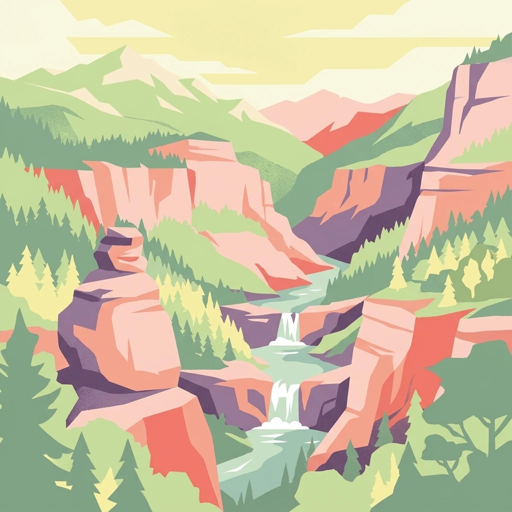
A stylized flat illustration of a deep canyon with reddish cliffs, a flowing river with small waterfalls, and coniferous forest.

Réserve naturelle régionale des gorges de Daluis

Nature reserve

Park overview

Structured park overview, official facts, and landscape profile for Gorges de Daluis Regional Nature Reserve

Gorges de Daluis Regional Nature Reserve park facts, protected area profile, and essential visitor context

Review the core facts for Gorges de Daluis Regional Nature Reserve, including designation, size, terrain, visitor scale, habitats, and operating context in one park-focused overview.

About Gorges de Daluis Regional Nature Reserve

The Gorges de Daluis Regional Nature Reserve is one of the more unusual protected sites in southeastern France, combining dramatic canyon scenery with an unusually rich concentration of biodiversity in a relatively small area. Located in the Alpes-Maritimes department of the Provence-Alpes-Côte d'Azur region, it falls primarily within the commune of Guillaumes, with secondary sectors on the commune of Daluis and additional buffer zones to the south and east.

The reserve's centerpiece is the deep gorge of the Var River, whose waters have cut into ancient Permian pelites to create cliffs rising on the order of 300 meters above the river bed. The pelite's rusty red coloration, the product of iron oxidation in sediments originally composed of volcanic ash and fine clastic material deposited more than 250 million years ago, gives the canyon a truly singular appearance in the Alpine context. Locals and visitors often compare the result to landscapes of the American Southwest, dubbing the site the "Colorado niçois."

This visually arresting setting is the foundation for the reserve's broader purpose. Because the canyon walls, ledges, and tributary valleys create a steep gradient of microhabitats, the reserve supports a wide variety of plant communities, birdlife, bats, reptiles, and a surprising number of endemic species. The area had long been recognized for its ecological value, but it was only in 2012 that the Communauté de communes des Alpes d'Azur and the Ligue pour la Protection des Oiseaux (LPO) successfully advanced its formal protection as a regional nature reserve (RNR262).

Today, the Gorges de Daluis reserve is valued as much for its scientific interest as for its scenic appeal. It is integrated into regional ecotourism networks, lies along the famous Route des Grandes Alpes, and offers marked hiking circuits that allow visitors to experience both the geology and biodiversity of the canyon in a single, relatively accessible day.

Quick facts and research context for Gorges de Daluis Regional Nature Reserve

The Gorges de Daluis Regional Nature Reserve lies in the Var River valley of the Alpes-Maritimes, in southeastern France. It was created on 29 October 2012 and covers roughly 1,082 hectares across the communes of Guillaumes and Daluis, with additional satellite sectors to the south and east.

The reserve centers on a deep canyon cut into Permian pelites, fine-grained sediments whose iron-rich oxidation has produced the gorge's distinctive wine-red color. It is classified as an IUCN Category IV protected landscape and is administered jointly by the Communauté de communes des Alpes d'Azur and LPO Provence-Alpes-Côte d'Azur.

Protection and recognition

Documented terrestrial protection history and designation records

Réserve Naturelle Régionale des Gorges de Daluis Protection Status

Terrestrial protection status for Réserve naturelle régionale des gorges de Daluis established in 2012 outlines official designation records. Structured conservation data provides verified protection context and administrative framing for this protected landscape.

Protection details

Protection scope
Terrestrial
Designated year
2012
Transboundary protection
No
WDPA ID
555559629
Park context

Deeper park guide and search-rich context for Gorges de Daluis Regional Nature Reserve

Gorges de Daluis Regional Nature Reserve history, landscape, wildlife, and travel context

Explore Gorges de Daluis Regional Nature Reserve through its history, landscape character, ecosystems, wildlife, conservation priorities, cultural context, and seasonal travel timing in a structured park guide built for atlas discovery and search intent.

Why Gorges de Daluis Regional Nature Reserve stands out

The reserve is best known for the "Colorado niçois," a vivid red-rock canyon landscape where the Var River has carved cliffs several hundred meters high through Permian pelite. These rusty, iron-oxide-stained rocks, locally called pélites, give the gorge an almost American Southwest appearance, completely unlike the surrounding Maritime Alps scenery. Equally distinctive is the ecological richness that comes from layering habitats across altitude, exposure, and rock type within a relatively compact canyon system. Cliffs, ledges, scree, caves, river margins, and upland slopes create microhabitats that support raptors, cave-roosting bats, rare alpine plants, and even endemic snails that live exclusively on these red rocks. The combination of striking geology and high biodiversity concentrated in a small, well-defined area is what most defines the reserve's identity.
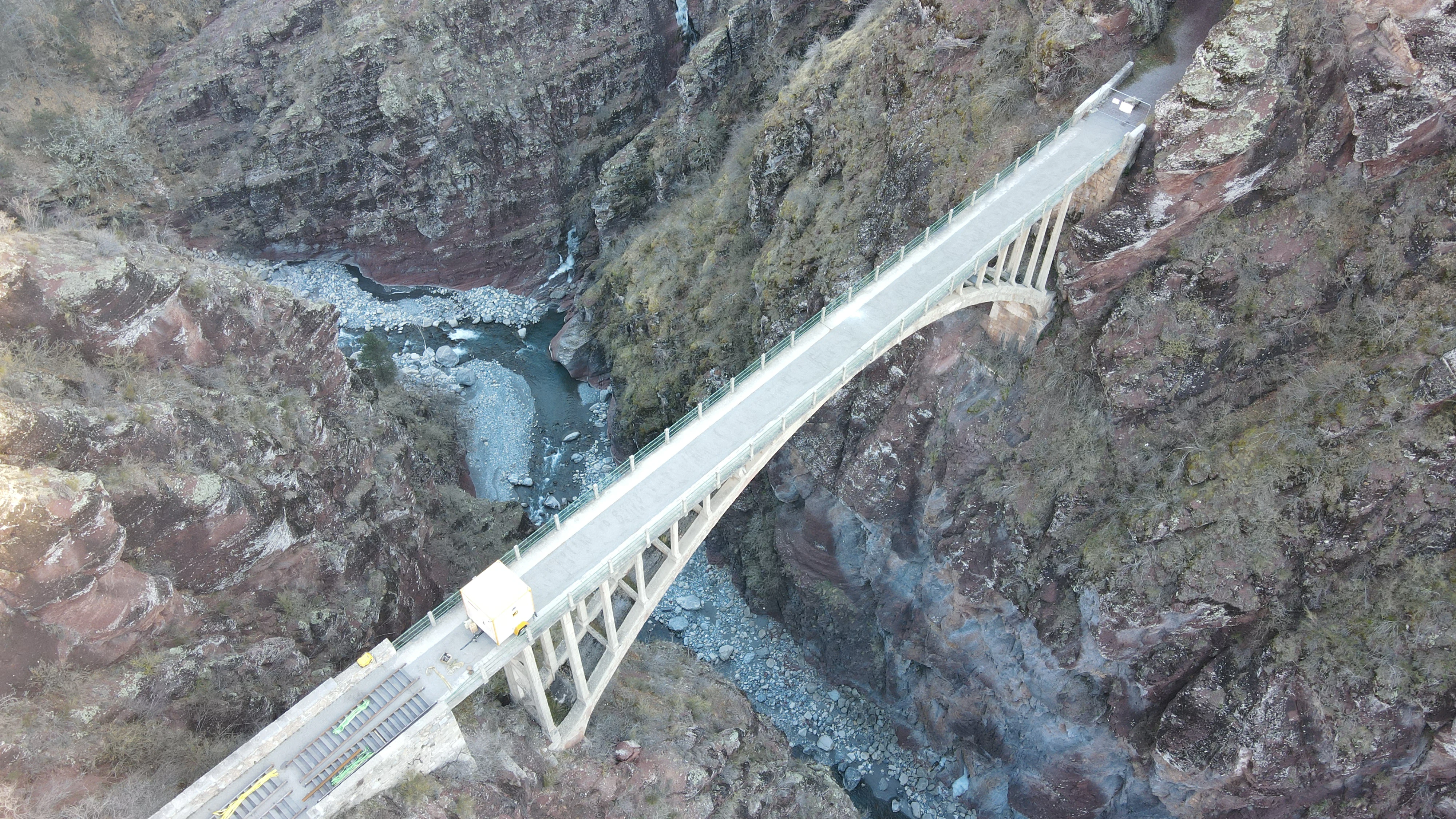
An aerial perspective of the arched Pont de la Marie bridge crossing a narrow, deep gorge with rugged red rock walls and a river flowing below.
Aerial view of the Pont de la Marie bridge spanning the dramatic gorges of Daluis.

Gorges de Daluis Regional Nature Reserve history and protected-area timeline

The gorges themselves have a natural history that vastly predates human protection. The red rocks exposed in the canyon are pelites, fine-grained sedimentary rocks originating in the Permian period, more than 250 million years ago. At that time, fine sediments and volcanic ash accumulated in shallow basins; over geological time these were compressed, mineralized, and oxidized, producing the iron-rich coloration that now defines the landscape. The Var River later incised deeply into these layers, carving the dramatic cliffs visible today.

In modern times, the site attracted attention for both its scenery and its biodiversity, but it lacked formal protection until the early 2010s. The Communauté de communes des Alpes d'Azur, working closely with LPO Provence-Alpes-Côte d'Azur, initiated the process that led to the reserve's official creation. By deliberation of 29 October 2012, the reserve was formally established as one of France's regional nature reserves, classified under the IUCN Category IV framework for habitat and species management.

The relatively recent designation reflects a broader recognition that even comparatively small protected areas can hold exceptional value when their geology, topography, and ecology combine in unusual ways. Since its creation, the reserve has been managed cooperatively by the intermunicipal authority and the regional branch of the LPO, marking it as one of the more active French regional nature reserves in the Alps.

Gorges de Daluis Regional Nature Reserve landscape and geographic character

The physical landscape of the Gorges de Daluis reserve is defined by the interplay between water, time, and exceptional rock. The Var River has carved a steep canyon through soft, colorful pelites, producing cliff walls of several hundred meters in places, with a total incision sometimes cited at around 900 meters of cumulative vertical relief. The result is a narrow, twisting gorge whose vertical rock faces, overhangs, and exposed ledges create a very different visual texture from the surrounding Maritime Alps.

Beyond the main canyon itself, the reserve's landscape includes two complementary zones to the south and east, expanding the range of terrain under protection. These areas encompass mid-elevation slopes, dry rocky habitats, and tributary valleys, adding to the diversity of exposures and microclimates that the reserve maintains.

The terrain within the canyon also preserves smaller-scale features of geological interest. Erosion along the Var has left ripple marks and fossil raindrop impressions preserved in the rock, while mineralization along mineral veins within the pelites has produced rare mineral specimens. Some of these minerals, notably barrotite and gilmarite, are known only from this site, reinforcing the sense that the Gorges de Daluis is a landscape shaped by uncommon geological events as much as by ordinary river erosion.
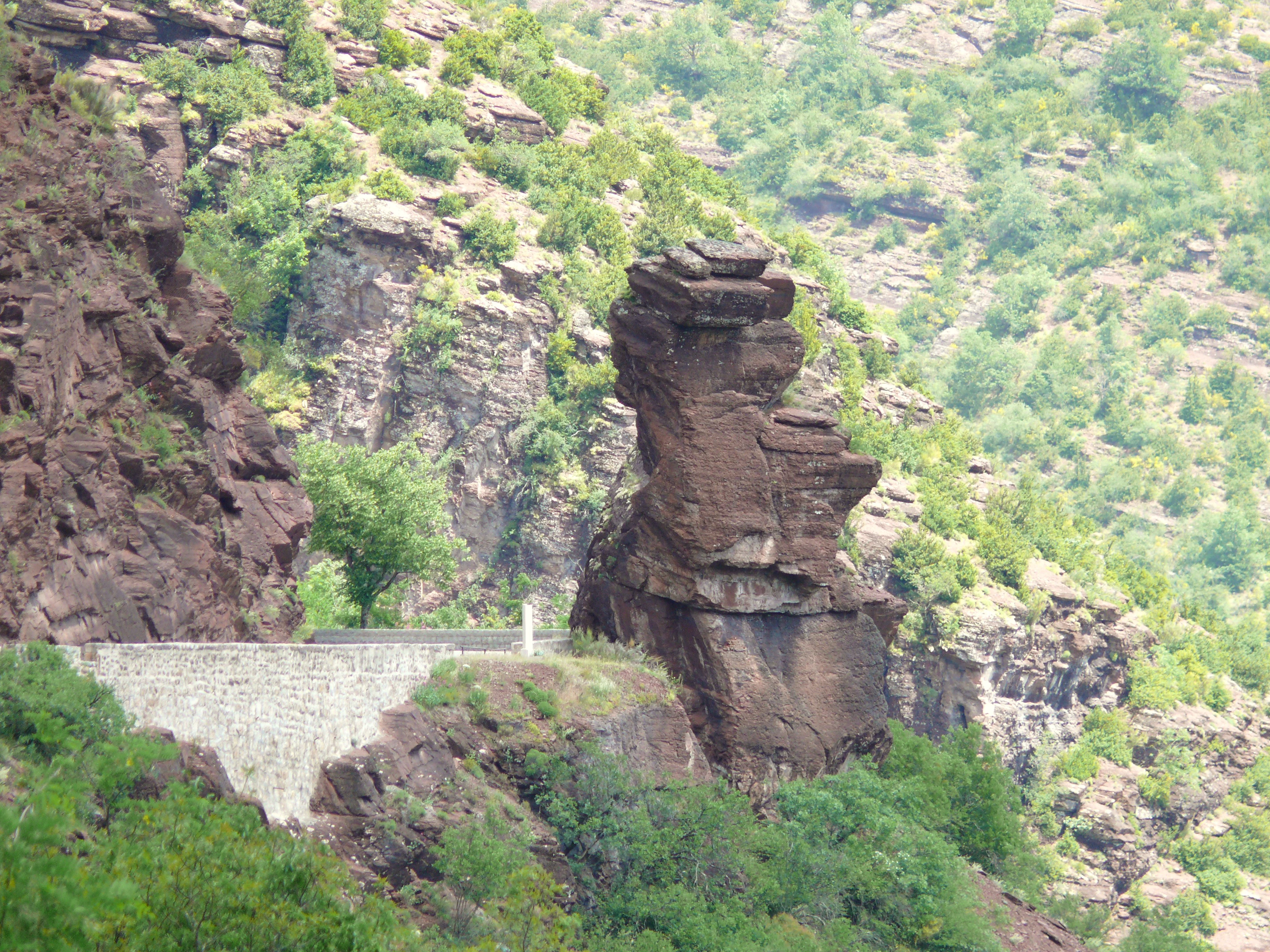
A distinctive red pelite rock formation known as Tete de Femme, set against a steep hillside with lush greenery and a stone retaining wall in the foreground.
The Tete de Femme rock formation, a distinctive geological feature within the Gorges de Daluis.

Gorges de Daluis Regional Nature Reserve ecosystems, habitats, and plant life

The ecological character of the reserve arises from the layering of habitats across altitude, exposure, and rock type within a relatively confined area. Because the canyon walls create sharply contrasting conditions over short distances, the Gorges de Daluis supports vegetation and animal communities that would normally be found across a much larger region.

Plants benefit from this habitat layering. The flora includes nationally protected species as well as a notable component of rare plants adapted to rocky Mediterranean-alpine conditions. Saxifraga callosa, the tongue-leaved saxifrage, is one of the characteristic rare species of the site, and overall the reserve hosts a high concentration of botanical diversity given its modest size.

The canyon also provides refuge for animals that depend on cliffs, caves, and dry rocky environments. Birdlife uses the vertical cliffs for nesting and winter shelter, bats roost in the many natural cavities, and reptiles and invertebrates find shelter in the talus and rock rubble along the valley margins. This stacking of habitats over altitude and rock type is the core of the reserve's ecological identity and a key reason for its formal protection.

Gorges de Daluis Regional Nature Reserve wildlife and species highlights

The wildlife of the Gorges de Daluis reserve reflects a balanced mix of Mediterranean and alpine influences, unusual even within the southern Alps. Bird inventories have recorded on the order of 84 species across the site, ranging from cliff-nesting raptors to upland gamebirds that use the gorge as a winter refuge.

The cliffs themselves are especially important for raptors and other rock-dependent birds. Golden eagle, peregrine falcon, short-toed snake eagle, eagle owl, and wallcreeper are all associated with the gorge's vertical faces. Rock partridge and black grouse use the site as winter shelter, finding refuge in the rocky terrain during the harshest months.

Caves and crevices in the pelite walls support a substantial bat population, with roughly 25 species recorded, including the lesser horseshoe bat. The reserve also hosts endemic species that depend directly on the unique geology. Strinati's cave salamander lives in the humid rock crevices, and two endemic land snails, the maillot des pélites and the marbrée des pélites, are found only on the red pelites of this kind of rock. These highly localized species underline how directly the reserve's wildlife is tied to its geology.

Gorges de Daluis Regional Nature Reserve conservation status and protection priorities

The reserve was established in 2012 specifically to protect the combined geological, botanical, and faunal interest of the Daluis canyon, an interest that had been increasingly recognized but lacked formal protection. By placing the gorge and its complementary zones under a single regional nature reserve designation, French authorities aimed to safeguard not only the scenic canyon but also the unusual concentrations of biodiversity tied to it.

Conservation management is shared between two partners. The Communauté de communes des Alpes d'Azur provides local administrative stewardship, while LPO Provence-Alpes-Côte d'Azur, the regional branch of France's leading bird protection organization, brings ecological expertise, particularly around bird monitoring and habitat management. This dual administration has become a model for regional nature reserves where strong local involvement is paired with specialist ecological support.

The reserve's conservation value is reinforced by the presence of mineralogical rarities such as barrotite and gilmarite, minerals unique to this locality, and by endemic species that depend on the red pelite rocks. Protecting such narrowly endemic organisms, in particular, requires maintaining habitat continuity and limiting disturbance, both central goals of the reserve's management framework.

Gorges de Daluis Regional Nature Reserve cultural meaning and human context

The Daluis gorge lies in a region with a long history of human adaptation to mountain terrain, including traditional pastoral and agricultural uses common to the Maritime Alps. Though the reserve's natural values dominate its contemporary identity, the surrounding communes of Guillaumes and Daluis retain their rural Alpine-Mediterranean character, and the gorge is woven into local heritage as a known landmark long before formal protection.

The nickname "Colorado niçois," referring to the landscape's resemblance to the American Southwest, has become part of the broader cultural identity of the area and has helped popularize the gorge as a regional landmark. The site is also integrated into the Route des Grandes Alpes, one of France's iconic scenic driving routes, which links the gorge to wider traditions of Alpine travel and discovery.

Top sights and standout views in Gorges de Daluis Regional Nature Reserve

The reserve's most distinctive features combine into a set of clear highlights: a deep red-rock canyon rising several hundred meters above the Var, mineralogical rarities unique to the site, and a layered set of habitats supporting raptors, cave bats, rare plants, and endemic snails.

Visitors encounter a landscape that is simultaneously geological spectacle and ecological refuge. The gorge's "Colorado niçois" appearance is rare within Europe, while the ecological richness concentrated along its cliffs and ledges makes the reserve an unusually complete example of how canyon topography can compress great biodiversity into a small area.

Best time to visit Gorges de Daluis Regional Nature Reserve

Spring and early autumn are generally the most rewarding seasons to visit the Gorges de Daluis. Spring brings mild temperatures suitable for walking the marked trails, active wildlife, and flowering saxifrages and other rare plants along the cliffs and ledges. Early autumn offers cooler, stable weather and continued good visibility into the canyon, while the lighting angles can enhance the red rock coloration.

In winter, the reserve still holds interest, especially for viewing raptors and winter-sheltering upland birds, but snow and shorter days reduce access and visibility. Summer can be hot, particularly within the sheltered canyon, though the higher ledges and viewpoints remain accessible early or late in the day. As with any mountain canyon site, conditions vary with altitude, and visitors should expect cooler, more alpine weather in the upper sectors.


Monthly climate preview

Trace long-term representative temperature ranges and monthly precipitation patterns.

Réserve naturelle régionale des gorges de Daluis Climate Normals and Weather by Month

Representative coordinates record measured monthly temperature swings and precipitation levels across the terrain. Reviewing the complete twelve-month profile provides deeper analytical depth for the local climate rhythm.
Annual mean9 °C
-1 °C19 °C
Jan-1°
Feb
Mar
Apr
May11°
Jun16°
Jul19°
Aug19°
Sep14°
Oct
Nov
Dec
Warmest month
July

19.2 °C

Coolest month
January

-0.7 °C

Wettest month
November

3.6 mm/day

Driest month
July

0.9 mm/day

Park location guide

Geography guide, regional context, and park location map for Gorges de Daluis Regional Nature Reserve

Gorges de Daluis Regional Nature Reserve park geography, regions, and map view in France

Understand where Gorges de Daluis Regional Nature Reserve sits in France through a broader geographic reading of the surrounding landscape, nearby location context, and its mapped position within the national park landscape.

How Gorges de Daluis Regional Nature Reserve fits into France

France is a unitary semi-presidential republic and one of the world's largest economies. It borders Belgium, Luxembourg, Germany, Switzerland, Italy, Monaco, Andorra, and Spain, with a maritime border to the United Kingdom. The country is known for its cultural influence, art, cuisine, and political history spanning centuries.

Wider geography shaping Gorges de Daluis Regional Nature Reserve in France

France is located in Western Europe. Metropolitan France extends from the Rhine to the Atlantic Ocean and from the Mediterranean Sea to the English Channel and North Sea. The country borders Belgium, Luxembourg, Germany, Switzerland, Italy, Monaco, Andorra, Spain, and has a maritime border with the United Kingdom.

Map view of Gorges de Daluis Regional Nature Reserve

Use this park location map to pinpoint Gorges de Daluis Regional Nature Reserve in France, understand its exact geographic position, and read its mapped placement within the surrounding landscape more clearly.

Pigeon | © OpenStreetMap contributors

Location context for Gorges de Daluis Regional Nature Reserve

Provence-Alpes-Côte d'Azur

Visual exploration of red rock canyon terrain, geological formations, and protected habitats

Réserve naturelle régionale des gorges de Daluis Photos, Landscapes, and Scenery

Visual records capture the striking red rock canyons, sheer cliffs, and diverse microhabitats of Réserve naturelle régionale des gorges de Daluis. Photographic documentation reveals the unique geological character, dramatic topography, and protected environment of the Var River reserve.

An aerial perspective of the arched Pont de la Marie bridge crossing a narrow, deep gorge with rugged red rock walls and a river flowing below.

An aerial view of an arched concrete bridge, Pont de la Mariee, spanning a deep, narrow canyon with steep, reddish-brown rock walls and a river flowing below.

A distinctive red pelite rock formation known as Tete de Femme, set against a steep hillside with lush greenery and a stone retaining wall in the foreground.

Park atlas

Compare nearby regional nature reserves and protected landscapes across the surrounding region

Parks Near Réserve Naturelle Régionale des Gorges de Daluis and Surrounding Protected Areas

Browsing other protected areas near Réserve naturelle régionale des gorges de Daluis reveals the broader geological and ecological patterns of the Maritime Alps. Comparing adjacent park geography provides essential context for understanding regional terrain, canyon formations, and protected landscapes.
Watercolor illustration of a mountainous landscape featuring a river, rolling hills, and green vegetation
National parkFrance
About 9.7 km away#1 closest

Northeast

Mercantour National Park: Mapped Alpine Protected Landscape and Regional Geography

Explore France's dramatic Alps, park boundaries, and unique ecotones.

Mercantour National Park stands as a premier protected area within the French Alps, distinguished by its remarkable geographic diversity and ecological significance. This national park encompasses mountainous terrain featuring dramatic peaks, deep glacial valleys, and a unique ecotone where Mediterranean and Alpine ecosystems converge. MoriAtlas facilitates a detailed atlas-style exploration of Mercantour National Park, highlighting its mapped protected boundaries, varied natural landscapes, and its pivotal role in regional geography and conservation efforts.

Area
679 km²
Established
1979
IUCN
II
Visitors
800K annual
State or regional parkAlpes-Maritimes
About 24 km away#2 closest

Southeast

Parc naturel départemental de l'Estéron: Riverside Geography in Alpes-Maritimes

A departmental park focusing on the wild Estéron River corridor

Located in the hinterland of the Côte d'Azur, Parc naturel départemental de l'Estéron provides a protected environment focused on the Estéron river valley. Its geography encompasses sun-exposed Mediterranean hillsides and riparian zones, reflecting the intersection of mountain terrain and historic cross-border heritage in the Alpes-Maritimes department.

Area
0.2 km²
Established
2011
Scope
Terrestrial
Water
Major water bodies
A soft watercolor illustration depicting a panoramic view of rolling green hills under a pale, warm sky with distant mountains.
State or regional parkProvence-Alpes-Côte d'Azur
About 38 km away#3 closest

Southeast

Parc naturel départemental du Plan des Noves: Protected Landscapes and Regional Geography

Upland limestone plateau in the French Baous massif

Covering 904 hectares above the town of Vence, this park features a unique combination of Mediterranean woodlands, open pastoral mosaics, and historic agricultural terraces. The terrain serves as a vital ecological corridor, recognized for its birdlife and reptiles, while its elevation offers expansive vistas across the surrounding regional geography from the coast to the high mountain summits.

Area
9.04 km²
Established
1987
Relief
Upland
Scope
Terrestrial
A soft watercolor painting of a rolling hilly landscape with muted greens, yellows, and purples on a white background.
Nature reserveProvence-Alpes-Côte d'Azur
About 43 km away#4 closest

West

Réserve naturelle géologique de Haute-Provence: Geological Protected Area and Map Atlas

Tracing fossil-rich outcrops across the French Pre-Alps regional landscape

Spanning 269 hectares, the Réserve naturelle géologique de Haute-Provence preserves iconic fossil sites like the Dalle aux Ammonites and diverse tectonic terrains. This repository offers insight into the reserve's unique sedimentary layers, folded mountain strata, and deeply incised river valleys that document prehistoric marine environments in France.

Area
2.69 km²
Established
1984
IUCN
III
Relief
Mountain
Marine protected areaFrance
About 51 km away#5 closest

Southeast

Sanctuaire Pelagos Marine Protected Area: Mediterranean Geography and Seascape

A transboundary conservation zone spanning 87,500 square kilometers.

Sanctuaire Pelagos represents a unique collaborative effort in marine conservation across the Mediterranean. Spanning the waters between France, Italy, and Monaco, this protected maritime area is defined by its deep-sea canyons and nutrient-rich currents that sustain diverse cetacean populations. Its immense scale and international governance make it a focal point for understanding Mediterranean marine biodiversity and environmental policy.

Area
87,500 km²
Established
1999
IUCN
IV
Relief
Lowland
Watercolor painting of a park landscape with a foreground pond, grassy areas, and rolling hills in the background.
State or regional parkProvence-Alpes-Côte d'Azur
About 51 km away#6 closest

Southeast

Parc de Vaugrenier: Regional Protected Area and Archaeological Landscape in France

Wetland habitats and historic trails in Alpes-Maritimes

Parc de Vaugrenier protects a diverse hundred-hectare expanse between Antibes and Villeneuve-Loubet. Its terrain bridges Mediterranean woodland and lush freshwater meadows, distinguished by a rare collection of exotic trees and remnants of the ancient Via Julia Augusta. This park provides a quiet geographic contrast to the surrounding coastal urbanization of the French Riviera.

Area
1 km²
Established
1995
Visitors
500K annual
Relief
Lowland
Watercolor painting of distant purple hills and foreground pine trees in soft washes of green, yellow, and red on a white background.
State or regional parkProvence-Alpes-Côte d'Azur
About 52 km away#7 closest

Southeast

Parc naturel départemental du Vinaigrier: Protected Limestone Landscapes near Nice

Regional state park with diverse Mediterranean woodland ecosystems

Parc naturel départemental du Vinaigrier offers a dense, 25 hectare mosaic of limestone plateaus and slopes near the Mediterranean coast. Its landscape is defined by traditional dry stone terraces and a rare flowering ash forest, creating a significant ecological bridge between the urban expansion of Nice and the hilly interior of the Alpes-Maritimes.

Area
0.25 km²
Established
1980
IUCN
IV
Nature reserveProvence-Alpes-Côte d'Azur
About 54 km away#8 closest

Southwest

Réserve naturelle régionale de Saint-Maurin: Geological Heritage in the Verdon Gorge

Travertine formations and cave habitats in Provence

Covering 25 hectares at the mouth of the Gorges du Verdon, this regional nature reserve protects a rare set of travertine terraces and tufa caves. Its geography creates a micro-refuge for specific cave-dwelling species and cliff-nesting raptors, standing as a significant example of geological and biological preservation in the Alpes-de-Haute-Provence department.

Area
0.248 km²
Established
2009
IUCN
IV
Relief
Upland

Common questions about visiting, size, designation, and location context for Gorges de Daluis Regional Nature Reserve

Gorges de Daluis Regional Nature Reserve FAQs for park facts, access, geography, and protected area context

Find quick answers about Gorges de Daluis Regional Nature Reserve, including protected-area facts, park geography, trail and visitor context, and how the park fits into its surrounding country and regional landscape.
MoriAtlas Explorer

Continue Your Protected Areas Search Across the Global Atlas

Deepen your exploration by continuing the structured search for national parks and protected areas worldwide. Utilize the comprehensive filtering capabilities to compare different conservation landscapes and refine your understanding of global park geography. Discover more about the distribution and characteristics of protected natural areas.

Global natural geography