
Mori Atlas logo
Nature reserveRéserve naturelle régionale des landes de Monteneuf

Understanding the mapped mosaic of acidic moorland, schist outcrops, and Neolithic heritage in Bretagne

Réserve naturelle régionale des landes de Monteneuf: Geographic Atlas of an Atlantic Heathland

Réserve naturelle régionale des landes de Monteneuf protects a distinct mosaic of humid and dry heathland in the Morbihan department of Bretagne, France. This landscape, shaped by nutrient-poor acidic schist soils and millennia of human interaction, features a rich variety of terrain including small wetlands, bracken stands, and rocky exposures. By examining the mapped boundaries of this nature reserve, users can discover how ecological preservation links directly to the cultural geography of the Brocéliande region.

heathlandAtlantic heathBrittanyMorbihanregional nature reservemegalithic site
A flat-style illustration showing a heathland landscape with several tall, vertical stone monoliths and a prominent horizontal rock in the foreground, surrounded by trees and purple flowering plants under a soft sunset.

Réserve naturelle régionale des landes de Monteneuf

Nature reserve

Park overview

Structured park overview, official facts, and landscape profile for Réserve naturelle régionale des landes de Monteneuf

Réserve naturelle régionale des landes de Monteneuf park facts, protected area profile, and essential visitor context

Review the core facts for Réserve naturelle régionale des landes de Monteneuf, including designation, size, terrain, visitor scale, habitats, and operating context in one park-focused overview.

About Réserve naturelle régionale des landes de Monteneuf

The Réserve naturelle régionale des landes de Monteneuf covers a compact but ecologically rich wedge of inland Brittany where ancient stones and relict heathland share the same ground. Located in the Morbihan department between Rennes and Vannes, the reserve protects a fragmented but remarkably varied set of open, acidic habitats typical of the inland Armorican Massif.

Heathland is the defining ecological theme of the site. The reserve's soils are shallow and acidic, resting largely on purple schist bedrock, with frequent rocky outcrops breaking through the vegetation. In these conditions, dense communities of heather, gorse, broom, and moor grass dominate, creating the soft, colorful, semi-open landscapes that characterize traditional Breton moorland. Because traditional grazing and cutting practices have largely faded, much of this heath in the wider region has been recolonized by forest. The Monteneuf reserve is one of the places where the original open character is being actively preserved.

The northern sector of the reserve, north of the RD776 road, is predominantly mesophilic and humid heath. Here the terrain is dotted with small pools and humid meadows that respond to seasonal rainfall and create distinct micro-habitats. The southern sector includes drier heath surrounding the Pierres Droites megalithic alignments, giving the reserve a dual identity as both a biological refuge and a cultural landscape shaped by prehistoric human activity. The mosaic extends beyond open heath to include small woodland patches, bracken-dominated zones (ptéridaies), and exposed rocky outcrops, producing both visual diversity and ecological complexity.

Visitors encounter the reserve through a network of themed interpretive trails, including a sound interpretation path, the Ozégan path, and an archaeology path that links the natural and prehistoric heritage of the area. The site is freely accessible year-round, allowing the megalithic alignments to be experienced alongside informative landscape and ecology interpretation. This combination of accessibility, biodiversity value, and prehistoric significance gives the reserve a strong dual identity as a place where Breton cultural memory and Atlantic heathland ecology meet.

Quick facts and research context for Réserve naturelle régionale des landes de Monteneuf

The Réserve naturelle régionale des landes de Monteneuf is a regional nature reserve (réserve naturelle régionale) in the Morbihan department of Brittany, France. Classified by deliberation on 28 June 2013 for a renewable period of ten years, it covers approximately 125 hectares of heathland habitat straddling the departmental road RD776.

Administratively, as of 1 January 2024, the reserve is managed by the intercommunality De l'Oust à Brocéliande Communauté, following about two decades of management by the local association Les Landes. It is registered in the World Database on Protected Areas under the IUCN management category IV, reflecting its focus on habitat and species conservation through active management.

Protection and recognition

Documented protection scope, management records, and official conservation designations

Protection Status and International Recognition for Réserve naturelle régionale des landes de Monteneuf

Terrestrial protection records for Réserve naturelle régionale des landes de Monteneuf outline official conservation boundaries and administrative frameworks. Structured verification data traces protected area parameters and international registry metrics for geographic analysis.

Protection details

Protection scope
Terrestrial
Transboundary protection
No
WDPA ID
555561982
Park context

Deeper park guide and search-rich context for Réserve naturelle régionale des landes de Monteneuf

Réserve naturelle régionale des landes de Monteneuf history, landscape, wildlife, and travel context

Explore Réserve naturelle régionale des landes de Monteneuf through its history, landscape character, ecosystems, wildlife, conservation priorities, cultural context, and seasonal travel timing in a structured park guide built for atlas discovery and search intent.

Why Réserve naturelle régionale des landes de Monteneuf stands out

Monteneuf is best known for its surviving Atlantic heathland mosaic, a habitat type that has become increasingly rare in Brittany as former grazed and cut moors have been abandoned and progressively overtaken by woodland. Acidic soils, exposed schist outcrops, and a mix of dry and humid conditions produce a varied heathland landscape supporting broom, gorse, heather, purple moor grass, broom heather, and early marsh orchid relatives. The reserve is equally known for encompassing part of the Pierres Droites megalithic site, one of the most concentrated alignments of standing stones in Brittany. Thousands of years of human presence, Neolithic stone-erecting activity, and later common-land use of the heath have shaped the open character of the landscape that the reserve now works to maintain.
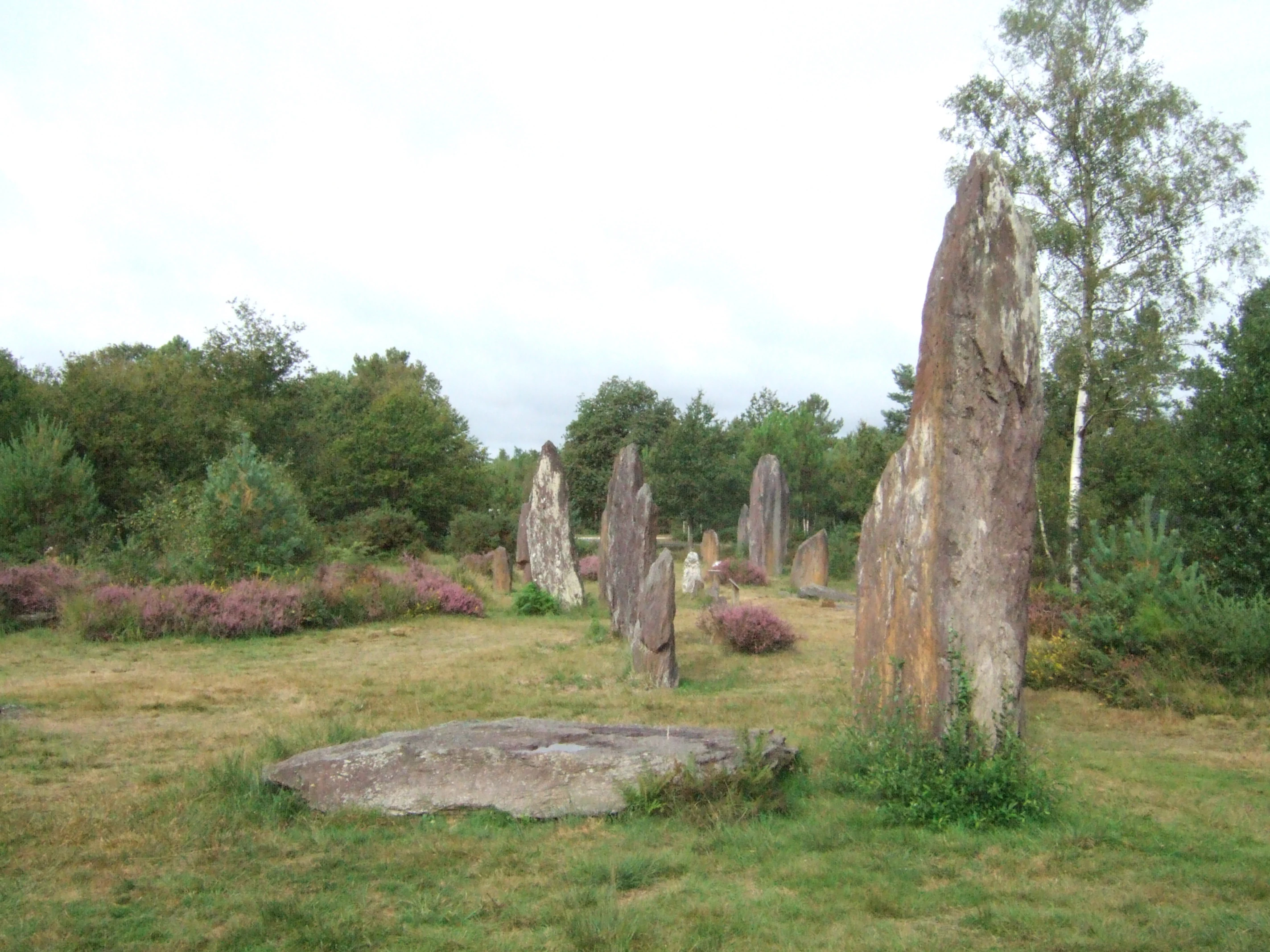
A row of large vertical megalithic stones standing in a field of grass and flowering heath plants, with trees in the background.
Megalithic stone alignments at the Pierres Droites site.

Réserve naturelle régionale des landes de Monteneuf history and protected-area timeline

The current character of the Monteneuf landscape is the cumulative product of thousands of years of human-environment interaction. The most visible historical layer is the Pierres Droites megalithic alignments, erected during the Neolithic period approximately five thousand years ago. These standing stones are part of one of the most remarkable concentrations of megalithic monuments in Brittany, and the modern reserve is shaped in part to protect the land around them.

The heathland itself is also a consequence of prehistoric activity. According to the site's historical context, the open character of the moors at Monteneuf takes its origin in Neolithic-era forest clearance. Once created, these open spaces entered the long history of common-land use in rural Brittany. For centuries, the heath was treated as a shared resource: communities harvested gorse, broom, heather, moor grass, rushes, alder buckthorn, and willow for fuel, fodder, bedding, and craft use. This common-property regime helped maintain the open character of the landscape and is one reason why such habitats persisted into the modern era.

In the modern era, the decline of small-scale agriculture and traditional land management led to widespread abandonment of these heaths, which then began reverting to woodland. Recognition of the ecological value of what remained prompted local conservation efforts. The reserve was formally created by deliberation on 28 June 2013, with an initial renewable term of ten years. For roughly twenty years prior to its official classification, the site had been actively managed by the local association Les Landes, which laid the groundwork for conservation work in the area. From 1 January 2024, management responsibility for the reserve transferred to De l'Oust à Brocéliande Communauté, the intercommunality that now oversees its conservation.

Réserve naturelle régionale des landes de Monteneuf landscape and geographic character

The landscape of Monteneuf is shaped by a tight interplay between geology, climate, and long-term human activity. The bedrock is predominantly purple schist, which weathers into acidic, nutrient-poor soils. These soils are thin and stony, with frequent outcrops of bare rock that interrupt the vegetation cover and give the terrain an irregular, broken profile.

The reservation is divided into two sharply different sectors by the RD776 road. North of the road, the land is dominated by mesophilic and humid heath, interspersed with small ponds and humid meadow patches. South of the road lies the drier heath of the Pierres Droites area, where the open landscape is given added drama by the presence of Neolithic standing stones rising from the moor.

The relief is gentle rather than dramatic, but the texture of the land is highly varied. Open stretches of low heathland alternate with bracken stands, scattered woodland patches, exposed rocky areas, and small wetland pockets. This fine-scale mosaic of landforms is what gives the reserve both its visual richness and its ecological complexity, allowing different groups of plants and animals to find appropriate conditions within a relatively small territory.

Réserve naturelle régionale des landes de Monteneuf ecosystems, habitats, and plant life

Ecologically, Monteneuf is defined by its acidic heathland habitats, a habitat type that has become rare across much of western France. The reserve's heath communities are dominated by heathers and gorse, with broom, various Erica species, purple moor grass, rushes, willow, and alder buckthorn contributing to a layered, dynamic vegetation structure. The naturalists' inventories at the site have recorded more than 380 plant species, indicating a notably high botanical richness for such a small area.

Two contrasting moisture regimes coexist on the site. The northern heathland is mesophilic and humid, where small ponds and seasonally wet areas create conditions for moisture-loving plants and specialized wetland fauna. The southern heathland is drier, with rockier, better-drained soils. Between them lies a mosaic of marshy meadows, bracken-dominated stands, and small patches of woodland that contribute additional ecological gradients and increase the overall biodiversity of the site.

Particular botanical interest centers on rare or protected species that depend on the open heathland character. Flowering plants such as the marsh gentian (Gentiana pneumonanthe) and the Portuguese butterwort (Pinguicula lusitanica) have been recorded in the reserve, both of them characteristic specialists of acidic, nutrient-poor, often humid heathland conditions. Their survival here depends on continued open habitat and appropriate hydrological conditions.

Réserve naturelle régionale des landes de Monteneuf wildlife and species highlights

Faunal inventories at Monteneuf have identified more than 150 animal species, representing well over a third of all fauna known from Brittany, an unusually high figure given the size of the reserve. This richness reflects the diversity of habitats, from wet heath and ponds to dry heath, bracken, and rocky outcrops, all concentrated within a small area.

Among the most notable species recorded are birds such as the wood warbler (Phylloscopus sibilatrix), a species associated with mature woodland and forest edges. The heathland itself supports a specialized invertebrate fauna, including the gorse grasshopper (Chorthippus binotatus), while the wetter habitats host the marsh fritillary butterfly (Maculinea nausithous, known in French as the Azuré des mouillères), a species of conservation concern strongly linked to humid meadows and moor grass.

Other notable species include the smooth snake (Coronella austriaca), a rare and discreet reptile associated with heath and rocky habitats, and the greater mouse-eared bat (Myotis myotis), which requires landscape mosaics including open ground and woodland for hunting. The presence of this combination of birds, invertebrates, reptiles, and mammals indicates a functioning heathland ecosystem with both open-country and edge specialists.

Réserve naturelle régionale des landes de Monteneuf conservation status and protection priorities

Monteneuf's conservation significance lies in its role as a refuge for Atlantic heathland, a habitat type that has declined sharply across France through agricultural abandonment, afforestation, and land-use change. By protecting and actively managing a representative area of mesophilic and dry heath, wet moorland, and associated transitional habitats, the reserve helps maintain the genetic and ecological resources needed for the long-term survival of dependent species.

The reserve is classified under IUCN management Category IV, a designation reserved for areas where active management is needed to maintain habitats or species. Its conservation strategy focuses on preventing further woodland encroachment, preserving open heath structure, maintaining hydrological conditions in the wetter areas, and supporting populations of rare plants such as the marsh gentian and Portuguese butterwort.

Its conservation role is also intertwined with the protection of the Pierres Droites megalithic site, integrating natural and cultural heritage within a single management framework. This combined natural-cultural value, together with the site's recognized role in regional biodiversity networks, makes Monteneuf an important reference point for heathland conservation in inland Brittany.

Réserve naturelle régionale des landes de Monteneuf cultural meaning and human context

Monteneuf sits within a region of Brittany long associated with both megalithic heritage and legendary forest landscapes such as Brocéliande. The reserve's direct adjacency to the Pierres Droites alignments places it at the intersection of two important strands of Breton cultural identity: the prehistoric past and the traditional rural common-land economy.

The heath itself is a cultural artifact as much as a natural habitat. Its maintenance through centuries of common-property use, harvesting gorse for fodder and fuel, cutting heather for bedding, and gathering willows and broom for everyday needs, reflects the deeply embedded rural traditions of inland Brittany. The reserve's interpretative trails, including the archaeology path and the sound interpretation path, deliberately weave together these natural and cultural narratives, presenting the landscape as a living heritage shaped by both ecological dynamics and long-standing human practice.

Top sights and standout views in Réserve naturelle régionale des landes de Monteneuf

The reserve's strongest distinguishing feature is the surviving mosaic of mesophilic, humid, and dry heathland on acidic schist soils, a habitat combination that has largely disappeared from the surrounding region.

Equally distinctive is the overlap between ecologically valuable open heathland and one of Brittany's most remarkable megalithic alignments, giving Monteneuf a unique identity as a site where Atlantic heathland biodiversity and five-thousand-year-old cultural heritage are managed together within a single protected area.

Best time to visit Réserve naturelle régionale des landes de Monteneuf

The heathland character of Monteneuf changes visibly across the seasons, and the best moments to visit depend largely on what visitors hope to see. In late spring and early summer, heather, gorse, and broom produce dense flowering displays across the open moors, the period when the site's botanical richness and overall color are most striking.

Milder months of late spring and early autumn are also generally the most comfortable for walking the reserve's interpretive trails and exploring the Pierres Droites megalithic alignments. Wet conditions can make paths muddy, particularly in the humid northern sector, so drier periods within the same seasons often provide a more pleasant experience. Winter visits have their own appeal, with quieter conditions and clear views across the open heathland, though some floral and faunal highlights are reduced compared to the warmer months.
Monthly climate preview

Long-term monthly temperature and precipitation measurements across a representative coordinate in Bretagne

Climate Normals and Temperature Patterns at Réserve naturelle régionale des landes de Monteneuf

Representative coordinate records show average temperatures ranging from mild summer maximums down to sub-zero winter minimums alongside steady year-round precipitation rates. Examining the full twelve-month climate profile reveals complete monthly averages for ongoing geographical and ecological comparison.
Annual mean11 °C
5 °C18 °C
Jan
Feb
Mar
Apr10°
May13°
Jun16°
Jul18°
Aug18°
Sep16°
Oct12°
Nov
Dec
Warmest month
August

18.5 °C

Coolest month
January

5.4 °C

Wettest month
December

2.8 mm/day

Driest month
July

1.4 mm/day

Park location guide

Geography guide, regional context, and park location map for Réserve naturelle régionale des landes de Monteneuf

Réserve naturelle régionale des landes de Monteneuf park geography, regions, and map view in France

Understand where Réserve naturelle régionale des landes de Monteneuf sits in France through a broader geographic reading of the surrounding landscape, nearby location context, and its mapped position within the national park landscape.

How Réserve naturelle régionale des landes de Monteneuf fits into France

France is a unitary semi-presidential republic and one of the world's largest economies. It borders Belgium, Luxembourg, Germany, Switzerland, Italy, Monaco, Andorra, and Spain, with a maritime border to the United Kingdom. The country is known for its cultural influence, art, cuisine, and political history spanning centuries.

Wider geography shaping Réserve naturelle régionale des landes de Monteneuf in France

France is located in Western Europe. Metropolitan France extends from the Rhine to the Atlantic Ocean and from the Mediterranean Sea to the English Channel and North Sea. The country borders Belgium, Luxembourg, Germany, Switzerland, Italy, Monaco, Andorra, Spain, and has a maritime border with the United Kingdom.

Map view of Réserve naturelle régionale des landes de Monteneuf

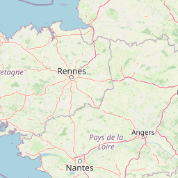
Use this park location map to pinpoint Réserve naturelle régionale des landes de Monteneuf in France, understand its exact geographic position, and read its mapped placement within the surrounding landscape more clearly.

Pigeon | © OpenStreetMap contributors

Location context for Réserve naturelle régionale des landes de Monteneuf

Bretagne

Visualizing Atlantic heathland habitats, schist outcrops, and megalithic terrain

Réserve naturelle régionale des landes de Monteneuf Landscapes and Scenery

Photographic collections reveal the varied terrain, wet moorland patches, and exposed rock formations defining Réserve naturelle régionale des landes de Monteneuf. Examining visual records helps researchers and visitors understand the protected Atlantic heathland mosaic and ancient megalithic alignments.

A row of large vertical megalithic stones standing in a field of grass and flowering heath plants, with trees in the background.

Park atlas

Compare surrounding moorland terrain and regional conservation landscapes across Brittany

Parks Near Réserve Naturelle Régionale des Landes de Monteneuf and Regional Protected Areas

Visitors comparing Réserve naturelle régionale des landes de Monteneuf can examine adjacent protected landscapes, Atlantic heathland habitats, and regional nature reserves. Extending the geographic review reveals broader ecological patterns and related protected areas throughout the surrounding territory.
A watercolor painting showing a soft, panoramic view of a coastal wetland with small islands in the distance and grassy foreground dunes.
Regional parkBretagne
About 29 km away#1 closest

Southwest

Parc naturel régional du Golfe du Morbihan: Coastal Landscape and Marine Park Geography

Protected maritime territory and island geography in Bretagne

Covering over 80,000 hectares of combined land and marine space, Parc naturel régional du Golfe du Morbihan offers a unique view into the intersection of Atlantic coastal heritage and environmental conservation. Learn about the park's structural role in the Bretagne region through its intricate network of inlets, peninsulas, and marshland habitats that define its distinctive maritime character.

Area
642 km²
Established
2014
IUCN
V
Nature reserveLoire-Atlantique
About 50 km away#2 closest

South

Réserve naturelle régionale de l'étang du pont de fer: Protected Wetlands of Loire-Atlantique

Coastal freshwater pond, wooded buffers, and wetland connectivity.

This regional nature reserve encompasses a sizeable freshwater pond and surrounding marshes, serving as a vital link in the chain of wetlands between the Vilaine estuary and the Guérande region. Its distinctive landscape, defined by floating sedge islets and dense alder woodland, supports a high density of avifauna and rare plant species. As a key component of the protected terrain in Loire-Atlantique, the reserve offers insight into coastal wetland ecosystems and their function as biodiversity corridors in western France.

Area
0.626 km²
Established
2008
IUCN
IV
Relief
Lowland
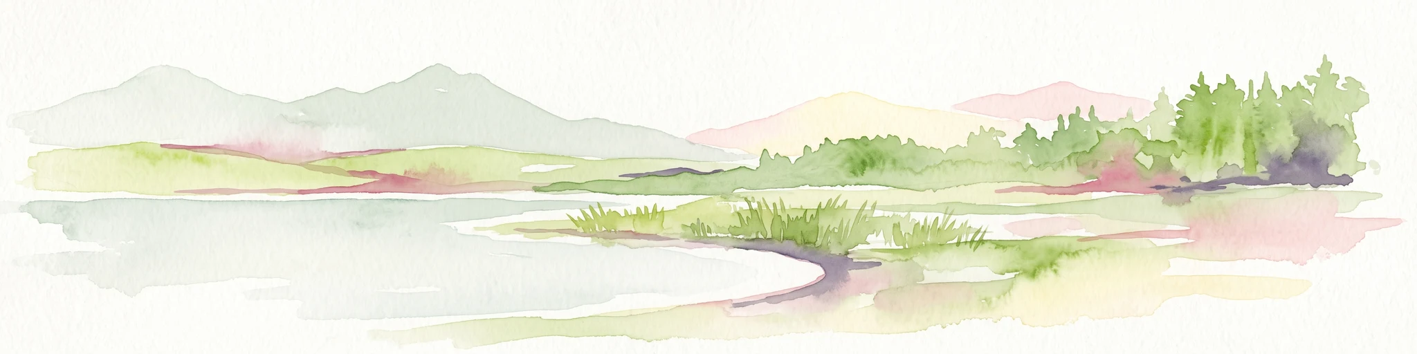
A soft watercolor illustration depicting a serene wetland scene with a calm body of water, grassy marshland, and distant rolling hills under a pale sky.
Nature reservePays de la Loire
About 58 km away#3 closest

South

Réserve naturelle régionale du marais de Brière: Protected Wetland Geography in Western France

A vital conservation mosaic of reedbeds, canals, and flooded meadows.

Located in the Pays de la Loire region, this protected area preserves the distinctive Grande Brière marshland landscape. The reserve manages a complex network of channels, islands, and damp meadows, providing essential habitat for migratory waterbirds and wetland wildlife. It represents a significant effort to maintain the ecological integrity of inland marsh complexes through structured regional conservation.

Area
8.36 km²
Established
2012
IUCN
IV
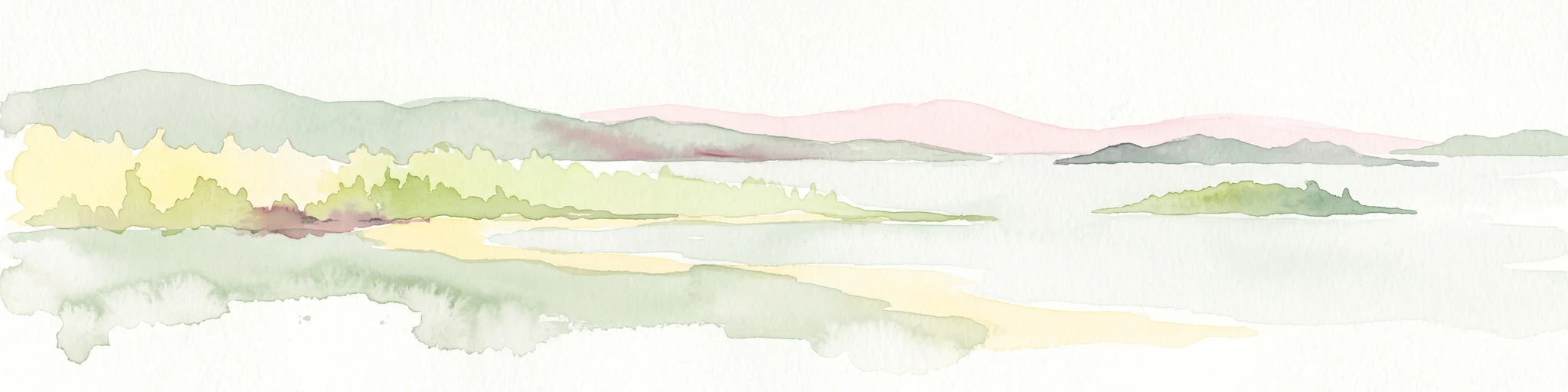
A soft watercolor illustration showing a calm coastal bay with distant low hills, green shorelines, and sandy patches under a pale sky.
Nature reserveCôtes-d'Armor
About 80 km away#4 closest

Northwest

Réserve naturelle nationale de la baie de Saint-Brieuc: Coastal Geography and Protected Terrain

Tidal mudflats and salt marshes on the North-Armorican coast.

Located in the Côtes-d'Armor department, this French nature reserve spans over 1,000 hectares of intertidal terrain. The area features a complex mosaic of sandy flats, brackish marshes, and dune systems, providing a critical study of coastal processes and tidal ecosystems along the Brittany shoreline.

Area
11.4 km²
Established
1998
IUCN
IV
Relief
Lowland
Nature reservePays de la Loire
About 81 km away#5 closest

Southeast

Réserve naturelle régionale de la tourbière de Logné: Protected Wetland Landscape Map

A rare peatland refuge in the Pays de la Loire administrative region

Located on the outskirts of Nantes, the Réserve naturelle régionale de la tourbière de Logné protects a delicate raised bog system. This atlas entry provides a detailed look at the basin terrain, its surrounding hills, and the wetland connectivity that supports its status as a critical botanical and invertebrate sanctuary within the Erdre valley.

Area
0.706 km²
Established
2011
IUCN
IV
A horizontal watercolor painting depicting a soft coastal scene with green grassy shores; distant hills; and a calm expanse of water.
Nature reservePays de la Loire
About 84 km away#6 closest

South

Réserve naturelle régionale de la pointe Saint-Gildas: Coastal Geography and Protected Map

Regional Nature Reserve in Pays de la Loire, France

The Réserve naturelle régionale de la pointe Saint-Gildas represents a significant protected coastal headland. Located in Loire-Atlantique, the site encompasses 11.5 hectares of land where freshwater estuarine influences converge with Atlantic saltwater, providing a unique focus for regional geographic and landscape conservation studies.

Area
0.115 km²
Established
2014
IUCN
IV
Relief
Lowland
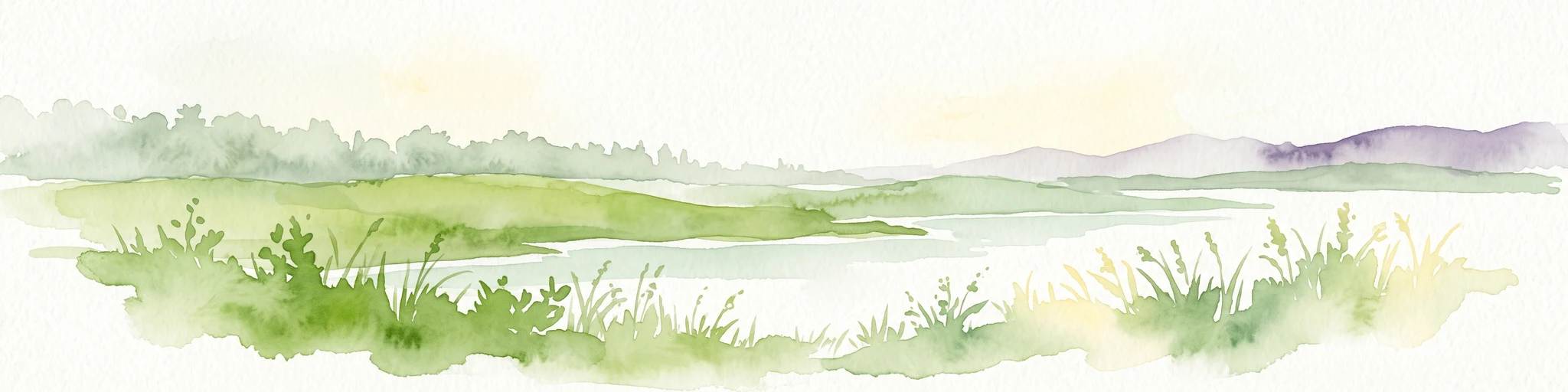
A soft watercolor illustration of a green wetland area with rolling hills and misty silhouettes in the background, set against a white background.
Nature reserveBretagne
About 87 km away#7 closest

Northeast

Réserve naturelle régionale du marais de Sougeal: Regional Wetland and Protected Landscape in Bretagne

A managed floodplain sanctuary near the Bay of Mont-Saint-Michel

Located in the Ille-et-Vilaine department, this regional nature reserve preserves a unique strip of wet grassland and flood-prone meadows. Use our mapping data to understand the park's specific terrain, from its narrow channel systems to its role as a key stopover for migratory waterbirds and a communal grazing area in the heart of Bretagne.

Area
1.74 km²
Established
2006
IUCN
IV
Relief
Lowland
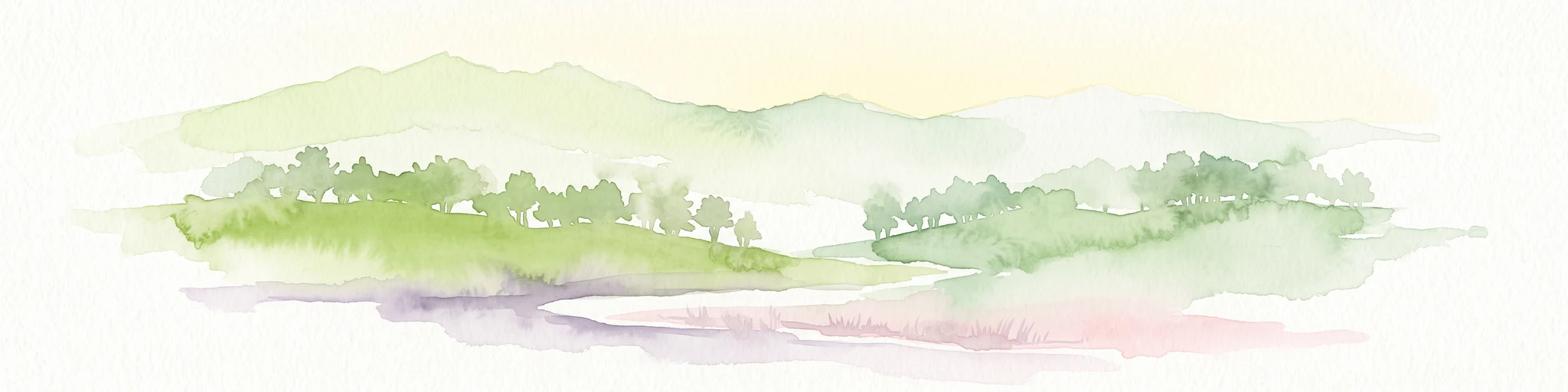
A watercolor painting showing a soft, stylized landscape of green hills, marshy fields, and patches of pink wildflowers or heathland against a white background.
Nature reserveBretagne
About 96 km away#8 closest

West

Réserve naturelle régionale des landes et marais de Glomel: Protected Bog and Heathland Atlas

A rare inland wetland refuge within the Bretagne Montagnes Noires

Explore the geographic mosaic of the Réserve naturelle régionale des landes et marais de Glomel, a protected area in Bretagne comprising dual sites of peat bogs, wet heaths, and marshy meadows. This atlas entry details the internal terrain, including the Grazius stream network and the historic canal environment, essential for understanding the habitat distribution and conservation of this distinct inland landscape.

Area
1.078 km²
Established
2008
IUCN
IV
Relief
Upland

Common questions about visiting, size, designation, and location context for Réserve naturelle régionale des landes de Monteneuf

Réserve naturelle régionale des landes de Monteneuf FAQs for park facts, access, geography, and protected area context

Find quick answers about Réserve naturelle régionale des landes de Monteneuf, including protected-area facts, park geography, trail and visitor context, and how the park fits into its surrounding country and regional landscape.
MoriAtlas Explorer

Continue Your Protected Areas Search Across the Global Atlas

Deepen your exploration by continuing the structured search for national parks and protected areas worldwide. Utilize the comprehensive filtering capabilities to compare different conservation landscapes and refine your understanding of global park geography. Discover more about the distribution and characteristics of protected natural areas.

Global natural geography