
Mori Atlas logo
Nature reserveRéserve naturelle régionale des tourbières du Jolan et de la Gazelle

A high-altitude peatland mosaic within the volcanic landscape of Auvergne-Rhône-Alpes.

Réserve naturelle régionale des tourbières du Jolan et de la Gazelle: Protected Volcanic Wetlands

(Réserve naturelle régionale des tourbières du Jolan et de la Gazelle (RNR320))

The Réserve naturelle régionale des tourbières du Jolan et de la Gazelle represents a critical conservation area of high-altitude peatlands, bogs, and montane grasslands situated between the Cézallier plateau and the Monts du Cantal. This protected landscape preserves rare wetland communities, including sphagnum mires and wet meadows, at elevations exceeding 1,100 metres. By mapping these delicate ecosystems, the site provides essential insights into the hydrology and biodiversity of the Auvergne volcanic uplands.

peatlandsbogswetlandsvolcanic landscapeAuvergneCantal
A flat-style digital illustration depicting a winding river leading toward a waterfall flanked by steep cliffs, with mountains in the background, coniferous trees in the foreground, and a pale sun in the sky.

Réserve naturelle régionale des tourbières du Jolan et de la Gazelle

Nature reserve

Park overview

Structured park overview, official facts, and landscape profile for Réserve naturelle régionale des tourbières du Jolan et de la Gazelle

Réserve naturelle régionale des tourbières du Jolan et de la Gazelle park facts, protected area profile, and essential visitor context

Review the core facts for Réserve naturelle régionale des tourbières du Jolan et de la Gazelle, including designation, size, terrain, visitor scale, habitats, and operating context in one park-focused overview.

About Réserve naturelle régionale des tourbières du Jolan et de la Gazelle

The Réserve naturelle régionale des tourbières du Jolan et de la Gazelle protects an exceptional peatland complex in the heart of the Massif Central, within one of Europe's largest regional natural parks. Created in 2018 as the very first regional nature reserve in Cantal, it preserves a fragile mosaic of wetland habitats on a topographic catchment of nearly 200 hectares, surrounded by summer pastures, hay meadows, and conifer plantations. The site's average elevation of around 1,133 metres places it firmly within the montane zone, where cold, humid conditions have shaped its peat-forming landscapes over thousands of years.

The peatlands belong to a network of habitats that is increasingly rare across France. Sphagnum-dominated raised hummocks, known as ombrotrophic habitats and fed mainly by rainwater, sit alongside minérotrophic mires, which receive additional mineral-rich groundwater and create the characteristic trembling or quaking surfaces. These ecological zones support specialist plants such as Andromeda polifolia, Drosera rotundifolia, Vaccinium oxycoccos, Carex limosa, and Luronium natans, alongside extensive Sphagnum carpets that anchor the hydrology and carbon storage of the site.

Surrounded by the deeply volcanic landscapes of the Cézallier plateau and silhouetted against the Monts du Cantal, the reserve also stands out for its cultural and geographical context. It overlooks the Santoire valley, between the towns of Murat and Riom-es-Montagnes, with the departmental road RD9 serving as the main boundary reference. The Sanctuary's management by the syndicat mixte du Parc naturel régional des Volcans d'Auvergne links peatland conservation to broader regional efforts on habitat connectivity, water resources, and climate adaptation in the volcanic uplands of central France.

Quick facts and research context for Réserve naturelle régionale des tourbières du Jolan et de la Gazelle

The Réserve naturelle régionale des tourbières du Jolan et de la Gazelle is a regional nature reserve classified on 14 June 2018 in the Cantal department, France. It lies within the Parc naturel régional des Volcans d'Auvergne, between the Cézallier highlands and the Monts du Cantal. With about 155 hectares of protected area at an average elevation of around 1,133 metres, it concentrates sphagnum peatlands, quaking mires, and wet meadows on the commune of Ségur-les-Villas.

The reserve is the first regional nature reserve in Cantal and is administered by the syndicat mixte of the Volcans d'Auvergne Park. IUCN category IV habitat and species management applies. The 2023–2027 management plan was adopted by the consultative committee on 29 August 2022.

Protection and recognition

Documented terrestrial protection scope, 2018 designation history, and official database records

Réserve naturelle régionale des tourbières du Jolan et de la Gazelle Protection Status

Terrestrial protection status records for Réserve naturelle régionale des tourbières du Jolan et de la Gazelle establish a formal 2018 establishment baseline within official protected area databases. Structured reference facts compile documented designation timelines and administrative scope for conservation geography research.

Protection details

Protection scope
Terrestrial
Designated year
2018
Transboundary protection
No
WDPA ID
555639931
Park context

Deeper park guide and search-rich context for Réserve naturelle régionale des tourbières du Jolan et de la Gazelle

Réserve naturelle régionale des tourbières du Jolan et de la Gazelle history, landscape, wildlife, and travel context

Explore Réserve naturelle régionale des tourbières du Jolan et de la Gazelle through its history, landscape character, ecosystems, wildlife, conservation priorities, cultural context, and seasonal travel timing in a structured park guide built for atlas discovery and search intent.

Why Réserve naturelle régionale des tourbières du Jolan et de la Gazelle stands out

The reserve is best known for its concentration of peatland habitats in a high-altitude volcanic setting: sphagnum hummocks, trembling mires, oligo-mesotrophic wet meadows, acidic montane nard grasslands, and mesotrophic megaphorbiaia. It is also recognized for the diversity of marshland birds, peatland dragonflies, and relict plant species that thrive above 1,100 metres in the Auvergne uplands.
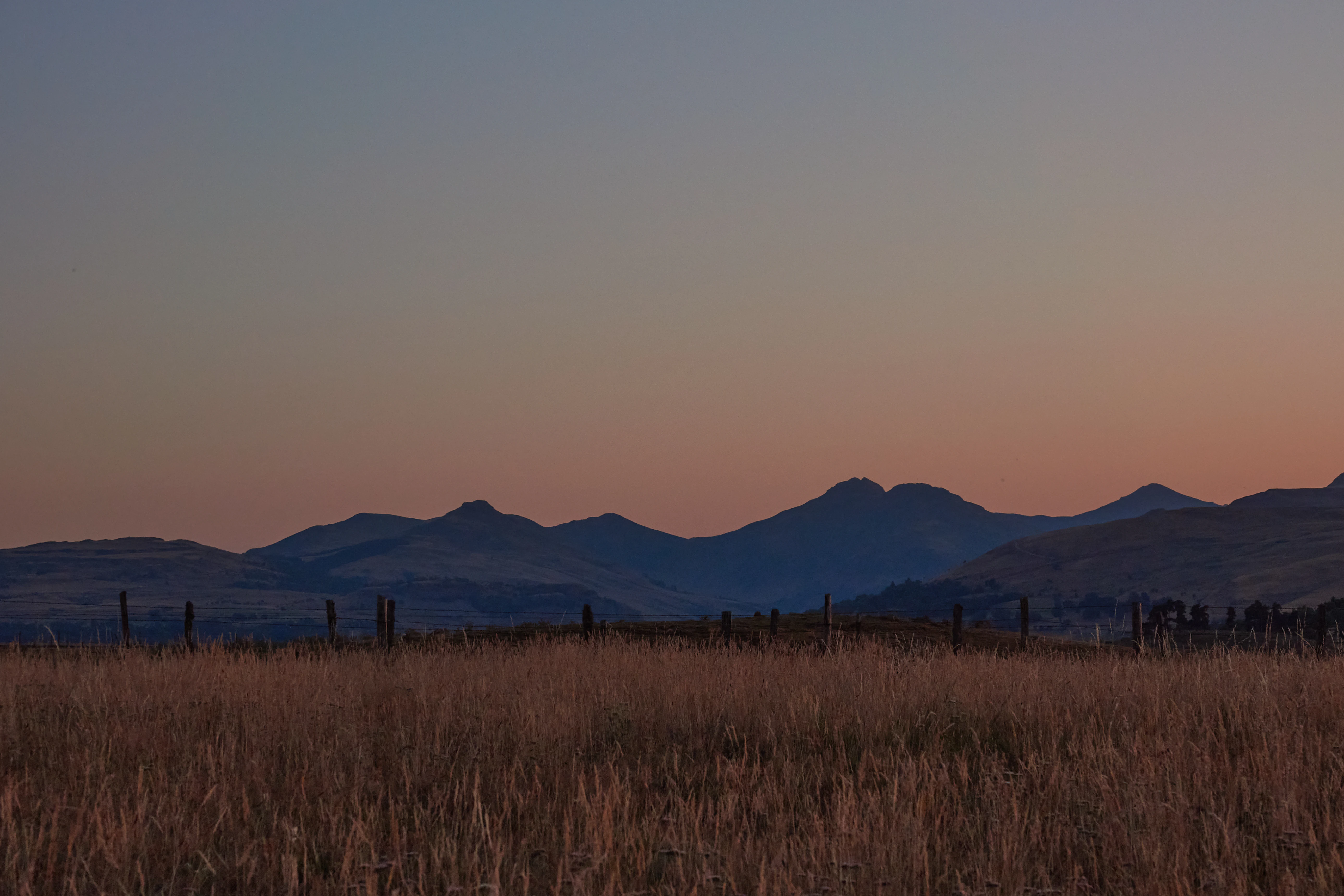
A landscape view of silhouettes of the Cantal Mountains against a soft sunset sky, with a foreground of tall, dry grass in the nature reserve.
Sunset view over the Cantal Mountains from the Montirargues viewpoint, near the Tourbières du Jolan et de la Gazelle nature reserve.

Réserve naturelle régionale des tourbières du Jolan et de la Gazelle history and protected-area timeline

The path to the reserve's establishment was a multi-year process involving public consultation, scientific review, and landowner engagement. A public consultation on the project ran from 9 November 2015 to 9 February 2016, followed by scientific and institutional feedback in March 2016. Between April and June 2016, the public was informed about how their input had been taken into account, and from July to September 2016 the project team gathered formal agreement from the landowners involved.

The reserve was officially classified by the Regional Assembly on 14 June 2018, becoming the first regional nature reserve ever created in the Cantal department. Its management was entrusted to the syndicat mixte du Parc naturel régional des Volcans d'Auvergne, the same body that oversees the broader volcanic park. On 29 August 2022, the consultative committee adopted the reserve's first formal management plan, covering the 2023–2027 period and setting out priorities for habitat monitoring, hydrological protection, and visitor awareness.

Although the formal protection is recent, the underlying peatlands represent ancient ecological archives that have accumulated over millennia under the cool, wet conditions of the Cantal uplands.

Réserve naturelle régionale des tourbières du Jolan et de la Gazelle landscape and geographic character

The reserve occupies a distinctive upland position between the Cézallier volcanic plateau and the more rugged Monts du Cantal. From its heaths, bogs, and wet meadows, visitors can see panoramic views across the Santoire valley and toward the Limon plateau and the iconic silhouette of the Cantal mountains. The reserve's average altitude of 1,133 metres places it in an environment shaped by long winters, misty summers, and a hydrology dominated by peat-forming processes rather than fast-flowing rivers.

The topographic catchment that feeds the peatlands covers nearly 200 hectares and blends summer pastures, traditional hay meadows, and patches of conifer plantation. These surrounding land uses create a transitional landscape where human activity and natural wetlands meet; while the plantations affect drainage patterns, the open pastures and meadows support the broader ecological mosaic. Streams rising in the bogs eventually feed the local watercourse, La Gazelle, which then joins the Santoire river below.

The access road, the RD9 linking Allanche to Ségur-les-Villas, runs along the boundary of the site, offering dramatic perspectives on the peatlands and the surrounding volcanic terrain, where ancient lava flows and rounded summits frame one of the most characteristic highland landscapes of the Auvergne.
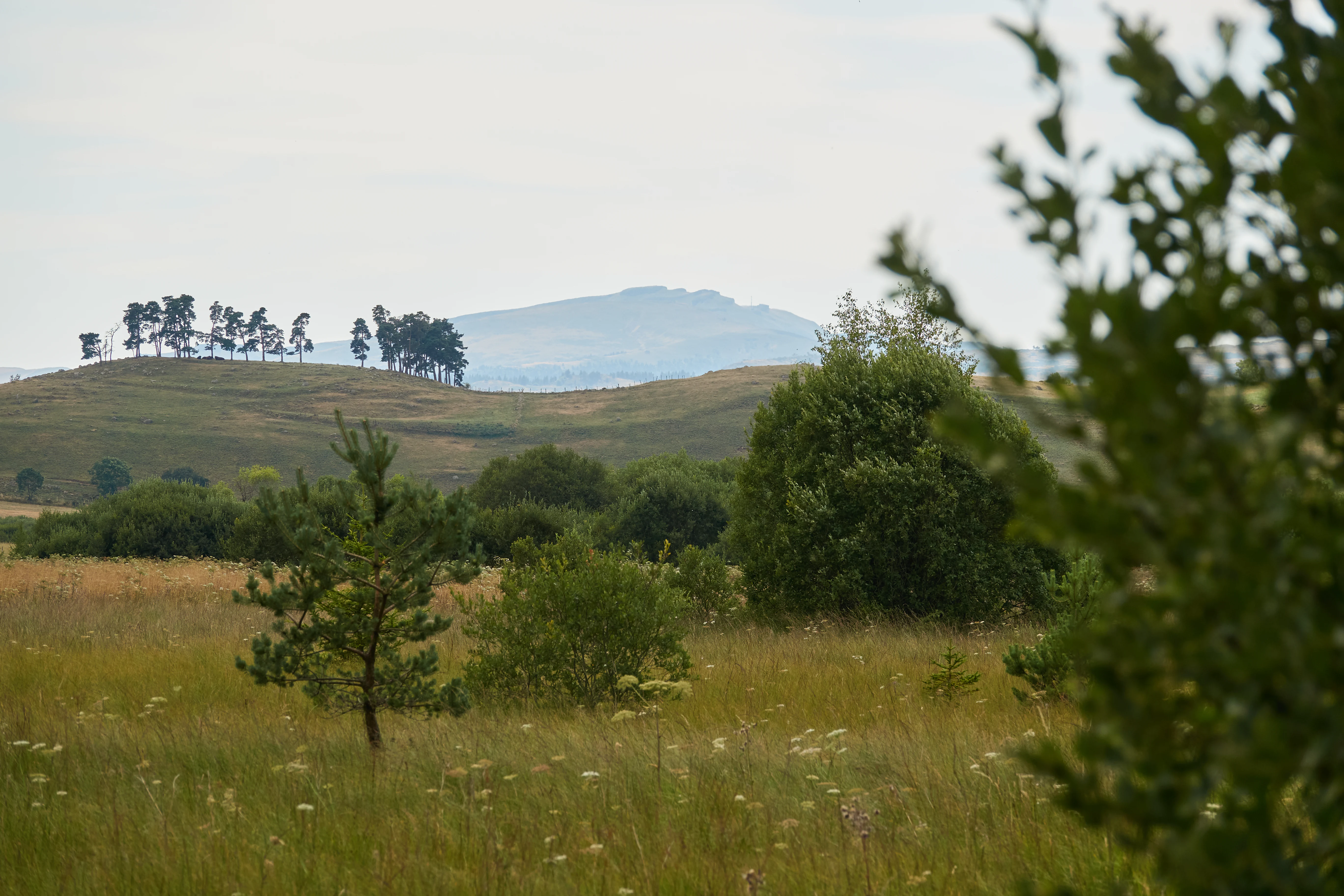
A wide landscape view featuring rolling grassy hills, scattered shrubs, and a line of trees on a small rise under a cloudy sky.
A view of the landscape at the Réserve naturelle régionale des tourbières du Jolan et de la Gazelle.

Réserve naturelle régionale des tourbières du Jolan et de la Gazelle ecosystems, habitats, and plant life

Ecologically, the reserve is defined by a rare concentration of peatland habitats set within a montane environment. Ombrotrophic sphagnum hummocks, fed primarily by rainfall, are accompanied by minérotrophic trembling mires, oligo-mesotrophic flooded meadows, acidic montane nard grasslands, and mesotrophic montane megaphorbiaia. Each of these habitats supports a distinct set of plant communities, with the Sphagnum layer playing a central role in water retention, peat formation, and carbon storage.

The site harbours several rare and relict plant species that reflect its status as a glacial and post-glacial refugium. Notable species include Andromeda polifolia, Drosera rotundifolia, Vaccinium oxycoccos, Vaccinium microcarpum, Carex limosa, Carex dioica, Salix bicolor, and Luronium natans, alongside aquatic species such as Cicuta virosa and Ceratophyllum demersum. The presence of Sphagnum species and Calamagrostis stricta further underlines the acidic, nutrient-poor conditions that define the site.

The surrounding mosaic of pastures, hay meadows, and small conifer plantations contributes to a varied ecological gradient. This combination of open peatland and pastoral landscape is characteristic of the Auvergne highlands and shapes both the local hydrology and the biological diversity of the reserve.
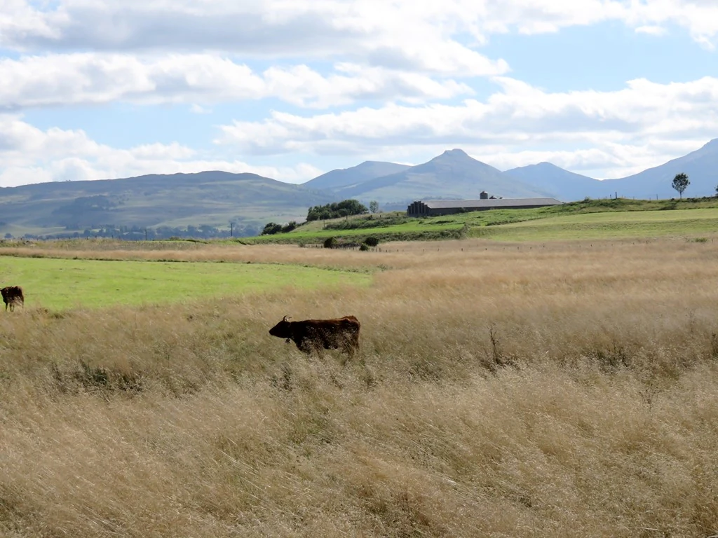
A wide outdoor shot of a grassy, golden-brown meadow with cattle grazing; mountains are visible in the far background under a blue sky with white clouds.
A view of the landscape at the Jolan peatland site in Cantal, France.

Réserve naturelle régionale des tourbières du Jolan et de la Gazelle wildlife and species highlights

Faunal richness complements the botanical value of the reserve. Among mammals, the European otter is a notable presence, reflecting the quality of the wetland habitats and the connected stream network. Common frogs, palmate newts, common toads, midwife toads, natterjack toads, great crested newts, viviparous lizards, grass snakes, and the European adder are recorded among the reptiles and amphibians, many of which depend directly on the peatland pools and surrounding wet meadows.

The reserve is especially important for birds. Nesting species include summer and winter teals, the spotted crake, the common snipe, the water rail, the common moorhen, and the great grey shrike. Migratory waterfowl and waders add seasonal drama, with wigeons, northern shovelers, little egrets, purple herons, great egrets, bitterns, black and white storks, merlins, hobbies, peregrine falcons, marsh harriers, hen harriers, Montagu's harriers, ruffs, Eurasian woodcocks, common and wood sandpipers, whiskered and black terns, black woodpeckers, and sand martins recorded on passage.

Invertebrate diversity is equally strong. Butterfly species such as the bog fritillary, the large blue, and the marsh fritillary share the habitat with dragonflies including the white-faced darter, the northern emerald, the yellow-spotted emerald, the crescent bluet, and the scarce blue-tailed damselfly. Heath bush-crickets, meadow grasshoppers, and bog crickets complete an assemblage shaped by the cool, humid conditions of the upland bogs.

Réserve naturelle régionale des tourbières du Jolan et de la Gazelle conservation status and protection priorities

The reserve's principal conservation significance lies in its protection of high-altitude peatlands, an increasingly rare and vulnerable habitat type in France. Peatlands act as long-term carbon stores, regulate local hydrology, and support specialist biodiversity adapted to nutrient-poor, acidic, and waterlogged conditions. By safeguarding roughly 155 hectares of these habitats within a topographic catchment of about 200 hectares, the reserve contributes both to climate mitigation and to biodiversity conservation.

Its IUCN Category IV classification reflects a focus on habitat and species management through active intervention where needed, including monitoring of peat-forming vegetation, control of invasive or unsuitable land uses such as inappropriate plantation forestry, and hydrological surveillance. The adoption of the 2023–2027 management plan provides a structured framework for these actions.

As the first regional nature reserve in Cantal, the site also serves as a reference point for peatland protection in the Auvergne-Rhône-Alpes region. Its location within the Parc naturel régional des Volcans d'Auvergne allows conservation efforts to be integrated with broader landscape-scale planning, including connectivity between wetland sites, sustainable pastoral practices, and public engagement.

Réserve naturelle régionale des tourbières du Jolan et de la Gazelle cultural meaning and human context

The reserve sits within a long-established pastoral landscape where summer grazing, haymaking, and small-scale forestry have shaped the highland environment for generations. The place names Jolan and La Gazelle refer to nearby hamlets that give the protected area much of its character, while La Gazelle is also the name of the stream that drains the peatlands before flowing into the Santoire.

The site's integration into the Parc naturel régional des Volcans d'Auvergne links peatland protection to a wider regional identity centred on volcanic geology, traditional agriculture, and rural heritage. Local communities have been actively involved in the reserve's creation through the landowner consent process in 2016, embedding the project in the social fabric of Ségur-les-Villas and surrounding communes.

Top sights and standout views in Réserve naturelle régionale des tourbières du Jolan et de la Gazelle

Highlights of the reserve include the panoramic views from the Cézallier toward the Vallée de la Santoire and the Monts du Cantal, the dense network of boardwalk-style sightlines along the peatlands, and the seasonal spectacle of migratory birds over the bogs. The combination of relict bog flora, peatland dragonflies, and nesting marshland birds within a single high-altitude site makes it a compact but unusually rich conservation area.

The reserve's status as the first regional nature reserve in Cantal, together with its placement within the Parc naturel régional des Volcans d'Auvergne, gives it additional significance as a model for future peatland protection efforts in the Auvergne volcanic uplands.

Best time to visit Réserve naturelle régionale des tourbières du Jolan et de la Gazelle

Late spring through early autumn is generally the most rewarding period for visiting upland peatlands in the Cantal. Warmer months bring active dragonfly and butterfly seasons, flowering of montane plants, and the strongest bird activity, with both nesting species and migratory passage at their peaks. Cooler, mistier weather can enhance the atmospheric character of the bogs.

Winter visits reveal a quieter, more austere landscape shaped by frost and snow, when sphagnum surfaces freeze and the surrounding volcanic summits become more visually dominant. Access conditions can be more demanding, so most natural-history interest is concentrated in the snow-free months when the peatlands are most biologically expressive.
Monthly climate preview

Long-term representative point measurements tracking monthly averages, temperature swings, and precipitation distribution.

Climate Normals and Annual Temperature Rhythm for Réserve naturelle régionale des tourbières du Jolan et de la Gazelle

Historical data recorded at a representative elevation of 947.5 meters maps out the measured monthly temperature progression and daily precipitation rates across the landscape. Examining the complete twelve-month record reveals broader climatic shifts and detailed variations in temperature and precipitation over time.
Annual mean8 °C
0 °C17 °C
Jan
Feb
Mar
Apr
May11°
Jun15°
Jul17°
Aug17°
Sep13°
Oct
Nov
Dec
Warmest month
August

17.4 °C

Coolest month
January

-0.1 °C

Wettest month
November

2.9 mm/day

Driest month
March

1.7 mm/day

Park location guide

Geography guide, regional context, and park location map for Réserve naturelle régionale des tourbières du Jolan et de la Gazelle

Réserve naturelle régionale des tourbières du Jolan et de la Gazelle park geography, regions, and map view in France

Understand where Réserve naturelle régionale des tourbières du Jolan et de la Gazelle sits in France through a broader geographic reading of the surrounding landscape, nearby location context, and its mapped position within the national park landscape.

How Réserve naturelle régionale des tourbières du Jolan et de la Gazelle fits into France

France is a unitary semi-presidential republic and one of the world's largest economies. It borders Belgium, Luxembourg, Germany, Switzerland, Italy, Monaco, Andorra, and Spain, with a maritime border to the United Kingdom. The country is known for its cultural influence, art, cuisine, and political history spanning centuries.

Wider geography shaping Réserve naturelle régionale des tourbières du Jolan et de la Gazelle in France

France is located in Western Europe. Metropolitan France extends from the Rhine to the Atlantic Ocean and from the Mediterranean Sea to the English Channel and North Sea. The country borders Belgium, Luxembourg, Germany, Switzerland, Italy, Monaco, Andorra, Spain, and has a maritime border with the United Kingdom.

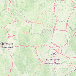
Map view of Réserve naturelle régionale des tourbières du Jolan et de la Gazelle

Use this park location map to pinpoint Réserve naturelle régionale des tourbières du Jolan et de la Gazelle in France, understand its exact geographic position, and read its mapped placement within the surrounding landscape more clearly.

Pigeon | © OpenStreetMap contributors

Location context for Réserve naturelle régionale des tourbières du Jolan et de la Gazelle

Auvergne-Rhône-Alpes
Recorded earthquake history

Review Recorded Seismic Events for Réserve naturelle régionale des tourbières du Jolan et de la Gazelle

Examine the historical catalogue of earthquakes documented near the Réserve naturelle régionale des tourbières du Jolan et de la Gazelle. This MoriAtlas resource identifies past seismic activity through verified records to provide geographic context for the region surrounding these volcanic-landscape peatlands.

Réserve naturelle régionale des tourbières du Jolan et de la Gazelle Earthquake History

Catalogued events

21 events

Strongest magnitude

Magnitude 3.7

Most recent event

Nov 4, 2008

This history includes earthquakes recorded inside the park or within 50 km of its borders

Visualizing high-altitude peatlands, volcanic terrain, and rare wetland habitats in Auvergne

Réserve naturelle régionale des tourbières du Jolan et de la Gazelle Photos and Landscapes

High-resolution photography reveals the complex mosaic of sphagnum hummocks, quaking mires, and wet meadows defining the high-altitude volcanic terrain. Visual documentation provides essential geographic context for understanding the fragile wetland communities and protected catchment boundaries.

A landscape view of silhouettes of the Cantal Mountains against a soft sunset sky, with a foreground of tall, dry grass in the nature reserve.

A wide, panoramic view of a grassy highland plateau with gentle hills and distant mountains under a cloudy sky.

A wide landscape view featuring rolling grassy hills, scattered shrubs, and a line of trees on a small rise under a cloudy sky.

A wide outdoor shot of a grassy, golden-brown meadow with cattle grazing; mountains are visible in the far background under a blue sky with white clouds.

Park atlas

Compare adjacent volcanic uplands, peatlands, and regional protected landscapes

Explore Other Parks Near Réserve naturelle régionale des tourbières du Jolan et de la Gazelle

Browsing other parks near Réserve naturelle régionale des tourbières du Jolan et de la Gazelle reveals related wetland reserves across the Auvergne volcanic highlands. Analyzing these adjacent protected areas provides broader geographic context for high altitude peatland ecosystems.
A soft watercolor painting depicting rolling green hills and distant faint mountains under a light sky.
Nature reservePuy-de-Dôme
About 25 km away#1 closest

Northeast

Réserve naturelle nationale du rocher de la Jaquette Protected Area and Volcanic Landscape

Explore rocky cliffs and rare entomological habitats in the Puy-de-Dôme region.

Situated on the flanks of a volcanic outcrop above the Rentières valley, this nature reserve protects a diverse habitat mosaic within the Massif Central. The site provides essential breeding grounds for protected raptors and represents one of the most significant insect sites in central France, offering a clear view into regional volcanic ecology and mountain-valley geography.

Area
0.362 km²
Established
1976
IUCN
IV
Relief
Mountain
A soft watercolor painting of a wide, rolling landscape with green hills, pale mountain silhouettes in the background, and a faint reddish-brown foreground, presented on a white background.
Natural monumentAuvergne-Rhône-Alpes
49 km away#2 closest

North

Chaîne des Puys - faille de Limagne: Mapping Volcanic and Tectonic Protected Landscapes

Geological exploration of the Auvergne-Rhône-Alpes volcanic chain

Spanning a rhythmic skyline of roughly eighty volcanoes, the Chaîne des Puys - faille de Limagne represents a premier site for studying continental rifting and volcanic landforms. This protected monument offers a clear view into the interplay between the ancient mountain basement, the massive Limagne fault, and the resulting volcanic edifices that define the regional identity of the Auvergne-Rhône-Alpes area.

Area
242.23 km²
Established
2018
Relief
Mountain
Climate
Temperate
Nature reserveAuvergne-Rhône-Alpes
About 57 km away#3 closest

Northeast

Réserve naturelle régionale du Puy de Marmant: Volcanic Geography and Protected Terrain

Regional nature reserve in the Auvergne-Rhône-Alpes landscape.

This protected site preserves a prominent volcanic hill and its surrounding dry grasslands within the Limagne basin. The reserve serves as an ecologically significant island, maintaining specialized thermophilous plants and rare geological formations composed of basalt and peperite. It remains an essential reference for understanding the volcanic heritage and unique botanical diversity of the Puy-de-Dôme department.

Area
0.203 km²
Established
1985
IUCN
IV
Relief
Upland
Watercolor painting depicting a soft green landscape with rolling hills, riverbank vegetation, and a central waterway.
Nature reserveNouvelle-Aquitaine
About 61 km away#4 closest

West

Réserve naturelle régionale des gorges de la Maronne et Tours de Merle: Protected Gorge Geography

Mapping the Maronne river basin and medieval towers in Nouvelle-Aquitaine

This protected area captures the distinct vertical relief of the Maronne river valley. The landscape profile includes steep rocky outcrops, narrow riparian corridors, and the historic site of the Tours de Merle. Exploring this regional reserve offers an understanding of how northern Massif Central ecosystems and medieval stone structures coexist within a protected framework in the heart of the Corrèze region.

Area
2.059 km²
Established
2025
IUCN
IV
Relief
Upland
A soft, light-toned watercolor painting showing rolling green hills and valley slopes under a pale sky.
Nature reserveOccitanie
About 65 km away#5 closest

Southwest

Réserve naturelle régionale des coteaux du Fel, A Protected Landscape in Occitanie, France

Regional nature reserve in the Aveyron department.

Located along the Lot valley, the Réserve naturelle régionale des coteaux du Fel preserves a mosaic of sun-drenched oak and chestnut woodlands, heathlands, and historic meadows. This nature reserve provides a critical study of small-area conservation and dryland habitat management within the rural landscape of Occitanie. Use this resource to understand the park's terrain, mapped boundaries, and its ecological importance in the northern Aveyron region.

Area
123.38 km²
Established
2011
IUCN
IV
Nature reserveAuvergne-Rhône-Alpes
66 km away#6 closest

East

Réserve naturelle régionale du lac de Malaguet: Regional Nature Reserve and Wetland Atlas

Mapped protected landscapes in Haute-Loire, Auvergne-Rhône-Alpes

This protected area centers on a 14th-century artificial lake that now functions as a rich ecological sanctuary. Explore the confluence of medieval water infrastructure, riparian forests, and meadow zones that support diverse upland fauna. The site offers a clear example of long-term landscape transformation from industrial utility to a protected biodiversity refuge within the eastern Massif Central.

Area
0.542 km²
Established
2014
IUCN
IV
Relief
Upland
Nature reservePuy-de-Dôme
74 km away#7 closest

North

Réserve naturelle régionale des cheires et grottes de Volvic: Volcanic Landscapes and Bat Habitats

A regional nature reserve within the Puy-de-Dôme volcanic terrain

This protected area captures the geological signature of the Puy de la Nugère, where trachy-andésite lava flows form a stark surface landscape known as cheires. Beneath these flows, an extensive network of abandoned quarries provides stable cavities for diverse bat species, creating a dual-layered ecological site within the Chaîne des Puys.

Area
0.613 km²
Established
2014
IUCN
IV
Visitors
100K annual
A horizontal watercolor illustration depicting a soft landscape with rolling hills, a body of water in the foreground, and pine trees on the right side.
Nature reserveNouvelle-Aquitaine
About 80 km away#8 closest

Northwest

Réserve naturelle régionale de la haute vallée de la Vézère: Protected Highland Geography

Wetland ecosystems of the Corrèze and Plateau de Millevaches.

Representing a vital network of peatland and bog systems, this nature reserve in the Nouvelle-Aquitaine region preserves essential highland habitats. Its scattered parcels illustrate the complex wetland geography of the Massif Central, offering a focused look at how protected boundaries safeguard specialized ecosystems within the upper Vézère river catchment area.

Area
1.963 km²
Established
2015
IUCN
IV
Relief
Lowland

Common questions about visiting, size, designation, and location context for Réserve naturelle régionale des tourbières du Jolan et de la Gazelle

Réserve naturelle régionale des tourbières du Jolan et de la Gazelle FAQs for park facts, access, geography, and protected area context

Find quick answers about Réserve naturelle régionale des tourbières du Jolan et de la Gazelle, including protected-area facts, park geography, trail and visitor context, and how the park fits into its surrounding country and regional landscape.
MoriAtlas Explorer

Continue Your Protected Areas Search Across the Global Atlas

Deepen your exploration by continuing the structured search for national parks and protected areas worldwide. Utilize the comprehensive filtering capabilities to compare different conservation landscapes and refine your understanding of global park geography. Discover more about the distribution and characteristics of protected natural areas.

Global natural geography