
Mori Atlas logo
Nature reserveRéserve naturelle régionale du marais de Larchant

Explore the geomorphology of this aquifer-fed calcareous marsh near the Gâtinais plateau

Réserve naturelle régionale du marais de Larchant Protected Area and Regional Geography

(Réserve naturelle régionale du marais de Larchant (RNR9))

The Réserve naturelle régionale du marais de Larchant protects a unique calcareous wetland nestled within an amphitheater formed by the Gâtinais plateau escarpment in Île-de-France. Fed by resurgences from the Beauce aquifer, this site displays a mosaic of reedbeds, wet meadows, and marsh woodland. It functions as a critical ornithological refugium, marking a distinct ecological link between the plateau edge and the nearby Loing river valley.

wetlandcalcareous marshregional nature reserveÎle-de-FranceSeine-et-Marnewaterbirds
Vector-style digital illustration showing a waterfall flowing down a steep rock cliff into a river, framed by foreground trees in a forest setting.

Réserve naturelle régionale du marais de Larchant

Nature reserve

Park overview

Structured park overview, official facts, and landscape profile for Réserve naturelle régionale du marais de Larchant

Réserve naturelle régionale du marais de Larchant park facts, protected area profile, and essential visitor context

Review the core facts for Réserve naturelle régionale du marais de Larchant, including designation, size, terrain, visitor scale, habitats, and operating context in one park-focused overview.

About Réserve naturelle régionale du marais de Larchant

The Réserve naturelle régionale du marais de Larchant occupies a defined but specialized patch of the Île-de-France countryside, on the edge of one of France's most celebrated forests. Although small in size when compared with major national parks or sprawling regional reserves, its footprint is highly focused, protecting a calcareous wetland ecosystem with rare ecological continuity for this part of northern France.

The reserve lies in the commune of Larchant, in the Seine-et-Marne department, around sixty kilometers south of Paris. It sits at the contact between two major landscape units: the Gâtinais plateau, whose western escarpment forms a steep natural boundary, and the broader plain of the Loing river to the east. At the base of this escarpment, a natural depression has filled with water through millennia, creating a permanent marshland that continues to function as a hydrological and ecological system today.

What distinguishes the marais de Larchant from many other wetland sites in France is the interaction between its geology and hydrology. The marsh is fed by resurgences from the Beauce aquifer, a vast underground water system under the limestone plateaus to the west. These resurgences create a cyclic variation in water levels on a multi-year scale, periodically flooding and drying the marsh in ways that continually reshape vegetation patterns, invertebrate communities, and birdlife.

Because of these natural dynamics, the reserve functions as something of a long-term ecological observatory. The site hosts an exceptional diversity of plant communities, including wet meadows, tall-herb marsh vegetation, reedbeds, swamp willow thickets, and alder swamp woodland, while its birdlife is widely regarded as one of the richest concentrations of waterbirds in the entire Île-de-France region. The reserve also lies within the broader Fontainebleau and Gâtinais Biosphere Reserve, placing its local conservation role in a wider regional and international framework.

Quick facts and research context for Réserve naturelle régionale du marais de Larchant

The Réserve naturelle régionale du marais de Larchant is a regional nature reserve covering approximately 124 hectares in the Seine-et-Marne department of Île-de-France, France. It lies near the village of Larchant, close to the Loing river and adjacent to the Fontainebleau forest. The reserve protects a calcareous wetland system fed by resurgences of the Beauce aquifer, which produces natural variations in water levels and habitat conditions.

Originally classed as a voluntary nature reserve in 1988, the site was reclassified under regional nature reserve status in November 2008. It is also part of the Fontainebleau and Gâtinais UNESCO Biosphere Reserve. Managed by the Association Réserve Naturelle Marais de Larchant (ARNML), the reserve is classified as IUCN Category IV and is known above all for its exceptionally rich waterbird populations and wetland flora.

Protection and recognition

Documented terrestrial protection scope, management records, and verified designation data

Protection Status and International Recognition for Réserve naturelle régionale du marais de Larchant

Terrestrial protection status, designation history, and management records for Réserve naturelle régionale du marais de Larchant provide clear context on conservation status. Structured protection facts and database identifiers outline the official administrative scope of this protected area.

Protection details

Protection scope
Terrestrial
Transboundary protection
No
WDPA ID
555514369
Park context

Deeper park guide and search-rich context for Réserve naturelle régionale du marais de Larchant

Réserve naturelle régionale du marais de Larchant history, landscape, wildlife, and travel context

Explore Réserve naturelle régionale du marais de Larchant through its history, landscape character, ecosystems, wildlife, conservation priorities, cultural context, and seasonal travel timing in a structured park guide built for atlas discovery and search intent.

Why Réserve naturelle régionale du marais de Larchant stands out

The reserve is best known for its calcareous marsh ecosystem, fed by resurgences from the Beauce aquifer, which produces natural cyclic variations in water levels and creates constantly shifting habitat conditions. These dynamics support an unusually high diversity of wetland plants and waterbirds for a site located so close to the Paris region, making the marsh one of the most important ornithological sites in Île-de-France. It is also recognized for the distinctive geomorphological setting in which it sits: the bottom of a natural amphitheater formed by the scarp of the Gâtinais plateau, with the Loing river marking its eastern edge. This combination of geology, hydrology, and habitat structure gives the reserve its distinctive ecological character.
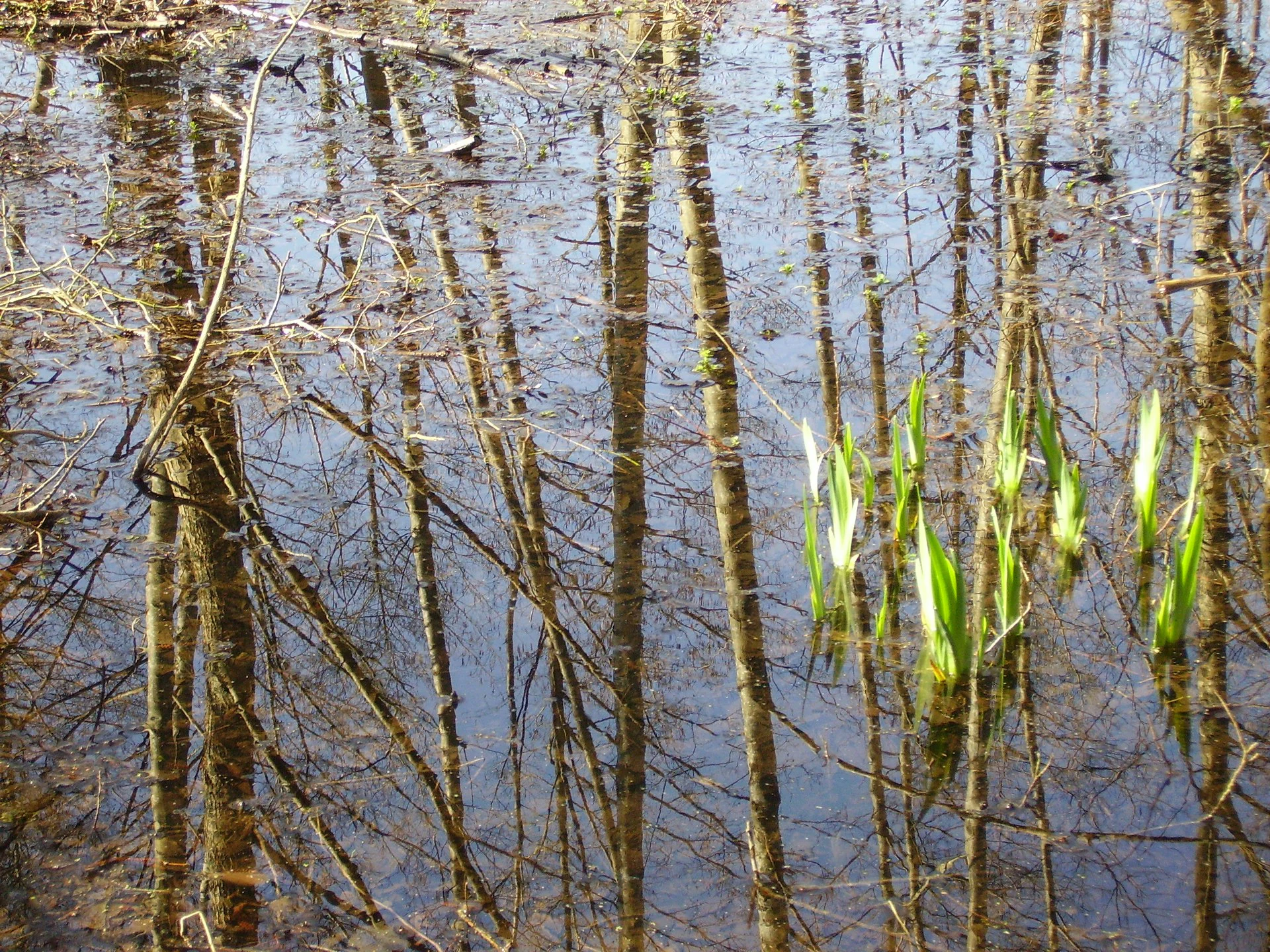
A close up view of calm marsh water reflecting thin tree trunks and bare branches, with small green aquatic plants emerging from the surface.
Emerging vegetation within the Larchant marsh, characterized by still, reflective waters and surrounding trees.

Réserve naturelle régionale du marais de Larchant history and protected-area timeline

The marsh itself is a long-standing natural feature of the landscape, shaped over centuries by the interaction between the Beauce aquifer and the topography of the Gâtinais plateau. Its ecological value gradually drew scientific and conservation attention during the late twentieth century, particularly with the recognition of its importance for breeding waterbirds.

In 1988, following growing concerns about habitat degradation and the desire to protect the site's outstanding biodiversity, the area was formally designated as a voluntary nature reserve. This earlier status existed until the French 'loi démocratie de proximité' of 2002, which restructured France's categories of protected areas. The voluntary reserve status was withdrawn as part of this legal reform, and a process of reclassification was initiated.

The reclassification culminated in November 2008, when the marsh received its current designation as a regional nature reserve (réserve naturelle régionale), established by a regional deliberation. Since then, the reserve has been managed locally by the Association Réserve Naturelle Marais de Larchant, which carries out conservation, monitoring, and educational activities. The site also benefits from broader recognition through its inclusion in the Fontainebleau and Gâtinais Biosphere Reserve, strengthening its role within regional and international conservation networks.

Réserve naturelle régionale du marais de Larchant landscape and geographic character

The landscape of the Réserve naturelle régionale du marais de Larchant is defined by a striking transition between two contrasting physical units. To the west rises the escarpment of the Gâtinais plateau, the eastern edge of the broad Beauce plain, which falls steeply toward the marsh in a series of slopes and rocky edges typical of the region. This escarpment frames the marsh like a natural wall, contributing to the feeling of an enclosed, sheltered landscape.

At the foot of this escarpment lies the marsh itself, occupying the bottom of what is described locally as the 'golfe' of Larchant. The depression collects water from the Beauce aquifer, producing a permanently wet terrain characterized by reedbeds, wet meadows, and patches of marsh woodland. The eastern edge of the reserve opens toward the Loing river, which provides a hydrological and ecological link to the wider river valley.

The result is a compact landscape mosaic of calcareous marsh, scarp-edge habitats, and river-edge features. The visual character varies dramatically with water levels: in some seasons the marsh expands into open water and reflective surfaces, while in drier periods the vegetation closes in and the ground becomes a tangle of reeds, grasses, and scrubby woodland edges.

Réserve naturelle régionale du marais de Larchant ecosystems, habitats, and plant life

The reserve's natural value rests on the unusual combination of calcareous substrate, fluctuating water levels, and varied wetland vegetation. The hydrology is dominated by resurgences from the Beauce aquifer, which brings mineral-rich water to the surface and drives long-term cycles of flooding and drawdown. These cycles continually reshape the conditions in which plants and animals live, producing an ever-changing mosaic of habitats within the same small area.

Flora is dominated by hygrophilous, or moisture-loving, plant communities. Tall-herb formations, calcareous marsh with Cladium mariscus, reedbeds, and various pre-forest and forest communities, including marshy willow thickets, alder swamp with marsh fern, and poplar stands, give the site a layered vegetation structure. Approximately 480 plant species have been recorded within the reserve, reflecting the diversity of microhabitats found along the gradients between open water, saturated marsh, drier scrub, and woodland margins.

The ecological significance of the site extends well beyond vascular plants. The mosaic of habitats and the water-level dynamics make the marsh exceptionally attractive to waterbirds, dragonflies, amphibians, fish, and bats, contributing to an overall biodiversity that is unusually high for a site of this size and so close to a major metropolitan region.

Réserve naturelle régionale du marais de Larchant wildlife and species highlights

Although the reserve protects a wide range of animal groups, its wildlife reputation rests principally on its birds. The marsh is considered one of the richest ornithological sites in the Île-de-France region, particularly for waterbirds associated with reedbeds, shallow water, and marshy edges. In the 1980s, the site hosted breeding populations of species such as the Eurasian bittern, the little bittern, the black-crowned night heron, and the marsh harrier, marking it as a site of major regional importance.

More recent observations have continued to document notable species. The purple heron has been recorded breeding as of 2009, and the osprey and little egret are among the species that may breed or do so in the near future. The dynamic water levels produce shifting conditions that favor both resident and migratory species, giving birdwatchers a varied seasonal pattern of interest.

Beyond birds, the reserve harbors a rich assemblage of dragonflies, including notable species such as the green-eyed hawker, metallic skimmer, and white-tailed orthetrum, as well as grasshoppers and crickets of conservation interest. Beetle diversity is also high, with more than 145 recorded species. Amphibians include the common toad, agile frog, pool frog, marsh frog, great crested newt, and palmate newt, while reptiles such as the slow worm, green lizard, grass snake, asp viper, and wall lizard are present. Fish diversity is documented at around eleven species, and the site supports notable bat species including the greater mouse-eared bat and Geoffroy's bat, reflecting the value of the mosaic of woodland, water, and marsh edge habitats.

Réserve naturelle régionale du marais de Larchant conservation status and protection priorities

The conservation significance of the marais de Larchant lies in the protection of a calcareous wetland ecosystem that remains functional and biodiverse despite intense pressure from urbanization, agriculture, and land-use change across northern France. Its proximity to the Paris metropolitan area makes the preservation of such a complex wetland system particularly meaningful, as opportunities for similar habitats in the region have diminished over time.

The reserve's value is recognized through multiple layers of protection. At the local level, it is managed as a regional nature reserve by a dedicated association, with active habitat management, monitoring, and public engagement. At the broader scale, the site is part of the Fontainebleau and Gâtinais Biosphere Reserve, linking its conservation role to an internationally recognized framework that integrates biodiversity protection, research, and sustainable development.

The dynamic hydrology of the site is itself a conservation subject. Because the marsh is tightly linked to resurgences of the Beauce aquifer, conservation efforts require attention not only to local habitat management but also to the broader management of groundwater resources in the region. Maintaining natural water-level variation, controlling invasive species, and protecting vegetation communities such as calcareous Cladium marsh and alder swamp are core objectives of the reserve's ongoing management.

Réserve naturelle régionale du marais de Larchant cultural meaning and human context

The commune of Larchant, near which the reserve lies, is historically known for its links to the pilgrimage route to Santiago de Compostela and its medieval church, reflecting a long human presence in the area. The marsh itself, however, is not strongly associated with traditional cultural or agricultural practices in the way that some rural landscapes are, instead having been valued primarily for its natural qualities.

In modern times the site has acquired an important cultural role as a local point of access to nature and environmental education. The association managing the reserve prioritizes welcoming school groups, teachers, and members of the public, helping to build regional knowledge of wetland ecology and conservation. In this sense, the marais de Larchant functions as both an ecological refuge and an outdoor classroom within the densely populated Île-de-France region.

Top sights and standout views in Réserve naturelle régionale du marais de Larchant

Among the most distinctive features of the Réserve naturelle régionale du marais de Larchant is the unusual convergence of geology, hydrology, and biodiversity in a single small site. The combination of the Gâtinais escarpment, calcareous marsh plain, and proximity to the Loing river creates a clear sense of landscape identity, while the resurgences from the Beauce aquifer drive a long-term ecological dynamism rarely matched in lowland France.

The reserve also stands out for the density and quality of its waterbird life. Despite its modest size, the marsh hosts one of the richest waterbird communities in Île-de-France and serves as a refugium for several species of regional conservation concern. Added to this is its layered vegetation, exceptional insect diversity, and populations of amphibians, fish, and bats that benefit from the mosaic of habitats.

Finally, the reserve offers a model of coexistence between a protected natural area and a major metropolitan region. Located only an hour from central Paris, it provides immersive wetland nature, environmental education opportunities, and a tangible example of how regional nature reserves can safeguard biodiversity at the doorstep of Europe's largest urban agglomerations.

Best time to visit Réserve naturelle régionale du marais de Larchant

The experience of the marais de Larchant varies considerably through the year, in line with the natural cycles that shape the site. Spring and early summer are generally the most rewarding seasons for wildlife observation, when water levels often support the highest diversity of breeding birds, dragonflies, and flourishing wetland vegetation. Reedbeds and marsh edges are especially active with bird song and insect life during this period.

Late spring and early summer also coincide with the most expressive display of wetland flora, when tall-herb vegetation, reeds, and aquatic plants reach their full seasonal development. For visitors interested primarily in amphibian activity, the wetter periods of spring are typically the most relevant.

Autumn and winter change the atmosphere of the marsh significantly. As water levels shift and vegetation dies back, the landscape opens up and gains in reflective surface area, providing a very different visual experience and opportunities for observing wintering and migratory waterbirds. Visitors should generally expect cooler, wetter conditions and should plan appropriate footwear, as the marsh terrain remains saturated for much of the year.
Monthly climate preview

Long-term monthly temperature averages and precipitation patterns measured at a representative coordinate

Climate Normals and Annual Temperature Range for Réserve naturelle régionale du marais de Larchant

Representative coordinate measurements record annual temperature variation alongside steady monthly precipitation totals at Réserve naturelle régionale du marais de Larchant. Detailed monthly climate normals reveal the complete twelve-month cycle of averages and extremes.
Annual mean11 °C
3 °C20 °C
Jan
Feb
Mar
Apr10°
May14°
Jun17°
Jul20°
Aug19°
Sep16°
Oct11°
Nov
Dec
Warmest month
July

19.6 °C

Coolest month
January

3 °C

Wettest month
December

2.2 mm/day

Driest month
March

1.5 mm/day

Park location guide

Geography guide, regional context, and park location map for Réserve naturelle régionale du marais de Larchant

Réserve naturelle régionale du marais de Larchant park geography, regions, and map view in France

Understand where Réserve naturelle régionale du marais de Larchant sits in France through a broader geographic reading of the surrounding landscape, nearby location context, and its mapped position within the national park landscape.

How Réserve naturelle régionale du marais de Larchant fits into France

France is a unitary semi-presidential republic and one of the world's largest economies. It borders Belgium, Luxembourg, Germany, Switzerland, Italy, Monaco, Andorra, and Spain, with a maritime border to the United Kingdom. The country is known for its cultural influence, art, cuisine, and political history spanning centuries.

Wider geography shaping Réserve naturelle régionale du marais de Larchant in France

France is located in Western Europe. Metropolitan France extends from the Rhine to the Atlantic Ocean and from the Mediterranean Sea to the English Channel and North Sea. The country borders Belgium, Luxembourg, Germany, Switzerland, Italy, Monaco, Andorra, Spain, and has a maritime border with the United Kingdom.

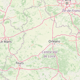
Map view of Réserve naturelle régionale du marais de Larchant

Use this park location map to pinpoint Réserve naturelle régionale du marais de Larchant in France, understand its exact geographic position, and read its mapped placement within the surrounding landscape more clearly.

Pigeon | © OpenStreetMap contributors

Location context for Réserve naturelle régionale du marais de Larchant

Île-de-France

Visualizing the calcareous marsh landscapes and wetland habitats of Larchant

Réserve naturelle régionale du marais de Larchant Photos and Scenery

Visual documentation captures the calcareous marsh terrain, reedbeds, and escarpment geology defining Réserve naturelle régionale du marais de Larchant. Detailed photographic records reveal the shifting water levels and wetland habitats characteristic of this regional nature reserve.

A close up view of calm marsh water reflecting thin tree trunks and bare branches, with small green aquatic plants emerging from the surface.

Park atlas

Compare adjacent wetland reserves, forest edges, and regional protected landscapes.

Parks Near Réserve naturelle régionale du marais de Larchant and Surrounding Protected Areas

Browsing other protected areas near Réserve naturelle régionale du marais de Larchant reveals connected wetland ecosystems and scarp-edge habitats across the surrounding region. Comparing these neighboring reserves provides a clearer understanding of local geomorphological settings and regional biodiversity patterns.
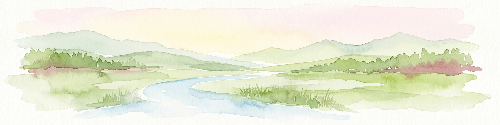
A soft watercolor illustration depicting a serene landscape with rolling green fields, scattered deciduous trees, and a small meandering stream, set against a light, hazy background.
Nature reserveÎle-de-France
About 28 km away#1 closest

North

Réserve naturelle régionale des bruyères de Sainte-Assise: Heathland Conservation Geography

A protected sandy heathland within the Île-de-France region

This reserve protects rare lowland heathland habitat on acidic soils within the Seine-et-Marne department. Spanning approximately 87 hectares near the Seine valley, the landscape is defined by heather and open vegetation. The site provides a vital sanctuary for biodiversity in a peri-urban setting, balancing conservation with its unique integration of historical land use and local geography.

Area
0.872 km²
Established
2009
IUCN
IV
Relief
Lowland
Nature reserveÎle-de-France
About 29 km away#2 closest

Northeast

Réserve naturelle régionale de la colline Saint-Martin et des Rougeaux: Protected Area Atlas

Mapping limestone hill and dry valley habitats in Seine-et-Marne

Spanning roughly 28 hectares near the Seine valley, this nature reserve showcases a complex intersection of former quarry lands and limestone ecosystems. The site provides a critical protected corridor for bat fauna and diverse botanical species, serving as a distinct example of peri-urban conservation in north-central France.

Area
0.277 km²
Established
2024
IUCN
IV
Relief
Upland
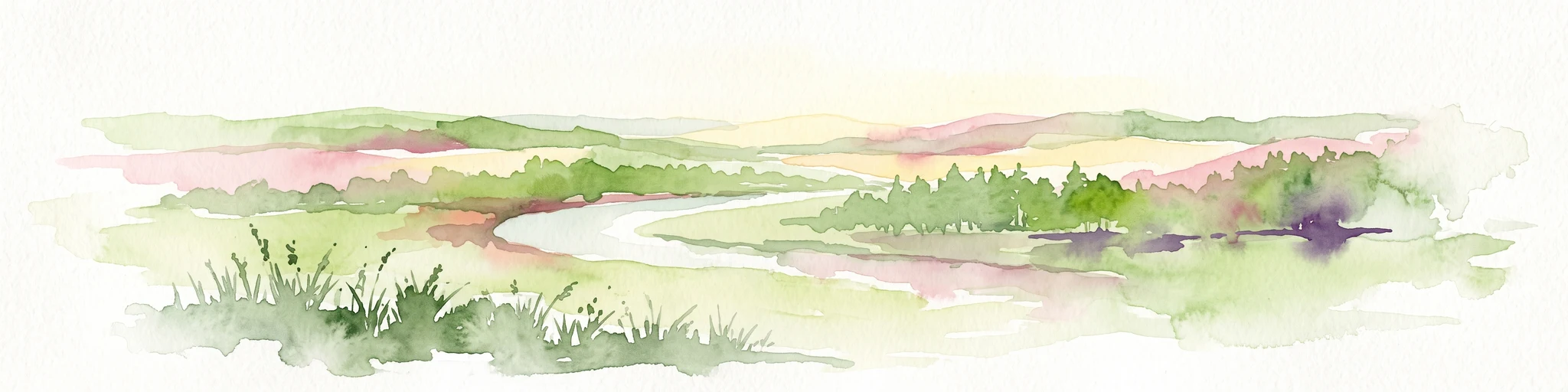
A soft, painterly watercolor illustration depicting a winding river flowing through a green basin with rolling hills, grasses, and scattered trees under a light sky.
Nature reserveÎle-de-France
About 56 km away#3 closest

Northwest

Réserve naturelle régionale du bassin de la Bièvre: Protected Wetland and Basin Geography

A vital urban nature reserve within the Île-de-France region

Located south of Paris, this six-hectare nature reserve demonstrates how an artificial stormwater basin can evolve into a functioning wetland. Its geography is defined by fluctuating water levels and reedbed habitats that provide sanctuary for migratory birds. Examine the protected boundaries and landscape terrain of this significant, compact ecological refuge in the Bièvre valley.

Area
0.06 km²
Established
2009
IUCN
IV
Relief
Lowland
Watercolor painting of a gentle, winding river or pond flowing through a green meadow with soft, rolling hills in the background under a pale sky.
Nature reserveÎle-de-France
About 56 km away#4 closest

Northwest

Réserve naturelle régionale des étangs de Bonnelles: Regional Nature Reserve Geography

Wetland ecosystem analysis in the Yvelines department.

Defined by its two core ponds, this regional nature reserve creates a critical mosaic of wetland, marsh, and woodland habitats. It stands out in the Île-de-France area as a concentrated zone of freshwater biodiversity, supporting a variety of avian and invertebrate life in a region where such undisturbed watery terrain is limited.

Area
0.221 km²
Established
1990
IUCN
IV
Relief
Lowland
Nature reserveÎle-de-France
About 60 km away#5 closest

Northwest

Réserve naturelle régionale du val et coteau de Saint-Rémy: Regional Nature Reserve Geography

A protected river valley and coteau habitat in Île-de-France

Spanning eighty-three hectares across five distinct parcels, this protected area serves as a vital ecological corridor along the Yvette river. Analyze the site's unique habitat distribution, ranging from moist bottomlands to dry, calcareous slopes, and trace its role in preserving regional biological diversity near Saint-Rémy-lès-Chevreuse.

Area
0.83 km²
Established
2008
IUCN
IV
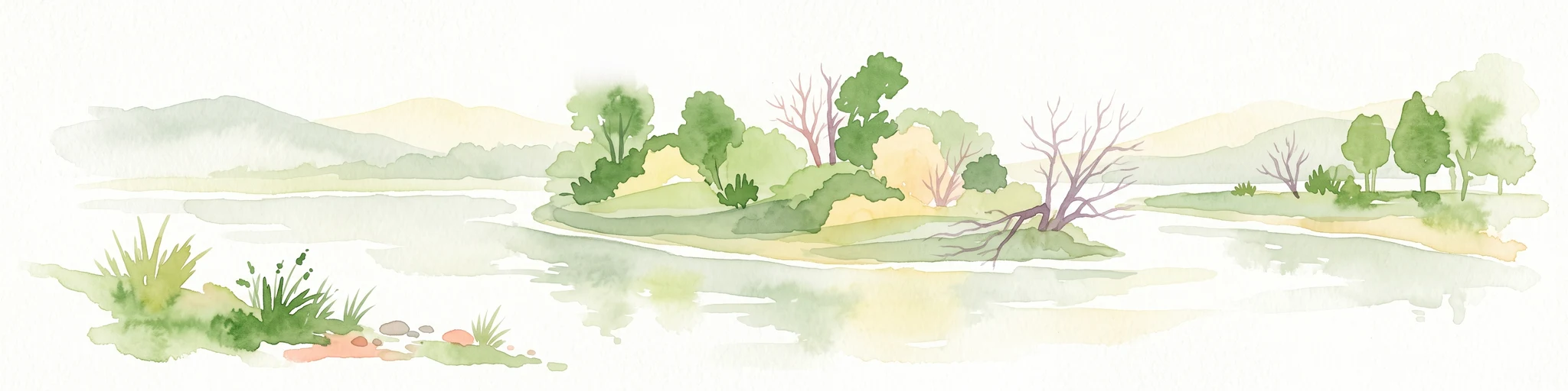
A horizontal watercolor illustration showing a calm river winding around small tree-covered islands with low hills in the distance.
Nature reserveÎle-de-France
About 64 km away#6 closest

North

Réserve naturelle régionale des îles de Chelles: Protected River Islands in Île-de-France

Wetland ecosystems and riparian landscape geography

Located on the Marne River, this protected regional nature reserve encompasses a series of river islands known for their rich wetland biodiversity. The site offers a unique geographic perspective on urban-adjacent conservation, featuring a mosaic of riparian thickets and hygrophilous flora that contrasts with the surrounding Seine-et-Marne landscape.

Area
0.05 km²
Established
2008
IUCN
IV
Relief
Lowland
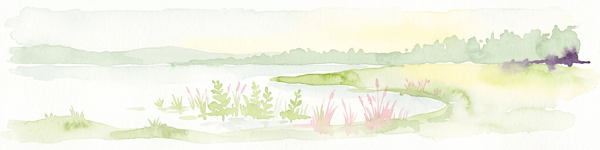
A pale, soft watercolor painting of a calm wetland or marsh, featuring muted green vegetation, light water reflection, and a gentle shoreline under a hazy sky.
Nature reserveÎle-de-France
About 93 km away#7 closest

North

Réserve naturelle régionale du marais de Stors: Atlas and Protected Landscape Overview

A rare wetland enclave in the Vallée de Chauvry

Focusing on the hydrological and ecological character of the Réserve naturelle régionale du marais de Stors, this overview examines its role as a protected nature reserve in the Paris region. Explore the marshland terrain and valley topography that define this unique pocket of conserved habitat in northern France.

Area
0.47 km²
Established
2009
IUCN
IV
Nature reserveÎle-de-France
About 100 km away#8 closest

Northwest

Réserve naturelle régionale du site géologique de Vigny-Longuesse: A Geological Reference Site

Protected limestone landscape in the Vexin region of Île-de-France

Protecting a critical paleontological and stratigraphic record, this reserve showcases a unique Tertiary reef complex. The site combines artificial quarry cliffs with natural geomorphological features, including paleolandslides and fossil-bearing limestone plates, providing a comprehensive outdoor archive of the Paris Basin.

Area
0.219 km²
Established
2009
IUCN
IV
Relief
Upland

Common questions about visiting, size, designation, and location context for Réserve naturelle régionale du marais de Larchant

Réserve naturelle régionale du marais de Larchant FAQs for park facts, access, geography, and protected area context

Find quick answers about Réserve naturelle régionale du marais de Larchant, including protected-area facts, park geography, trail and visitor context, and how the park fits into its surrounding country and regional landscape.
MoriAtlas Explorer

Continue Your Protected Areas Search Across the Global Atlas

Deepen your exploration by continuing the structured search for national parks and protected areas worldwide. Utilize the comprehensive filtering capabilities to compare different conservation landscapes and refine your understanding of global park geography. Discover more about the distribution and characteristics of protected natural areas.

Global natural geography