
Mori Atlas logo
Nature reserveRéserve naturelle régionale du marais de Sougeal

Mapping the seasonal floodplain and protected waterbird sanctuary within the lower Couesnon river landscape

Réserve naturelle régionale du marais de Sougeal: A Regional Protected Wetland in Bretagne, France

The Réserve naturelle régionale du marais de Sougeal is a critical 175 hectare wetland sanctuary situated in the Ille-et-Vilaine department of Bretagne. This elongated lowland basin, defined by its traditional bocage hedgerows and active hydrological management, functions as an essential stopover point for waterbirds and a natural spawning habitat within the Couesnon river corridor. By examining its channel network and seasonal pasture lands, you can gain a clear understanding of how human agricultural heritage and ecological conservation intersect in this distinct French landscape.

wetlandwet meadowwaterbird sanctuarybirdwatchingRamsar siteNatura 2000
A stylized flat-art illustration showing a valley with a waterfall in the background, a winding river in the foreground, and a hilltop castle silhouette reminiscent of Mont Saint-Michel.

Réserve naturelle régionale du marais de Sougeal

Nature reserve

Park overview

Structured park overview, official facts, and landscape profile for Réserve naturelle régionale du marais de Sougeal

Réserve naturelle régionale du marais de Sougeal park facts, protected area profile, and essential visitor context

Review the core facts for Réserve naturelle régionale du marais de Sougeal, including designation, size, terrain, visitor scale, habitats, and operating context in one park-focused overview.

About Réserve naturelle régionale du marais de Sougeal

The Réserve naturelle régionale du marais de Sougeal occupies a long, narrow stretch of seasonally flooded grassland in the Couesnon valley, just inland from one of Europe's most iconic coastal landscapes: the Bay of Mont-Saint-Michel. Although compact in area, the reserve punches well above its size in ecological importance because of its position at the head of a vast intertidal bay that draws tens of thousands of waterbirds.

The reserve's defining character is its openness: a low, flat expanse of wet meadow crossed by numerous drainage rués that allow water levels to be actively managed. In the colder half of the year, when these meadows are deliberately inundated, they become a nocturnal feeding ground, or gagnage, for large numbers of dabbling ducks such as Mallard, Eurasian Wigeon, Northern Pintail, Northern Shoveler, and Common Teal. By spring, the marsh transforms into a key migratory staging area. Tens of thousands of birds, including many waders, pause here, and around sixty waterbird species have been documented using the site in spring alone.

Ecological management is tightly interwoven with traditional land use. During summer the marsh dries down and serves as communal pasture where cattle, horses, and geese graze the rich wet-grass herbage, a practice that has shaped the site for generations. The combination of managed flooding, traditional grazing, restored hydraulic function, and proximity to the Mont-Saint-Michel bay makes the Sougeal marsh a textbook example of a working agricultural wetland that is also a high-value bird reserve.

Quick facts and research context for Réserve naturelle régionale du marais de Sougeal

A regional nature reserve (Réserve naturelle régionale) in Ille-et-Vilaine, Brittany, covering roughly 175 hectares of wet meadows along the Couesnon upstream of the Bay of Mont-Saint-Michel. Created on 22 December 2006 and reaffirmed in 2013, managed by the Communauté de communes de la Baie du Mont Saint-Michel.

The reserve is classified as IUCN Category IV and belongs to a network of overlapping protections including ZNIEFF, an Important Bird Area, a Ramsar site, and Natura 2000 zones. It is recognized internationally for its wintering Northern Pintail populations exceeding Ramsar thresholds.

Protection and recognition

Documented terrestrial protection scope, designation history, and administrative records

Réserve naturelle régionale du marais de Sougeal Protection Status and Designation Records

Terrestrial protection status records for Réserve naturelle régionale du marais de Sougeal outline its official designation history established in 2013. Structured database entries aggregate verified management data and international recognition metrics for conservation research.

Protection details

Protection scope
Terrestrial
Designated year
2013
Transboundary protection
No
WDPA ID
555514350
Park context

Deeper park guide and search-rich context for Réserve naturelle régionale du marais de Sougeal

Réserve naturelle régionale du marais de Sougeal history, landscape, wildlife, and travel context

Explore Réserve naturelle régionale du marais de Sougeal through its history, landscape character, ecosystems, wildlife, conservation priorities, cultural context, and seasonal travel timing in a structured park guide built for atlas discovery and search intent.

Why Réserve naturelle régionale du marais de Sougeal stands out

The reserve is best known as a premier inland waterbird sanctuary connected to the Bay of Mont-Saint-Michel, hosting internationally significant numbers of Northern Pintail and serving as a major spring staging area for ducks and waders. It is equally valued for its role as a key spawning ground for pike (brochet) in the Couesnon system, where restored hydrology supports natural fish reproduction. Its traditional communal grazing use adds a distinctive cultural-landscape layer to its ecological value.
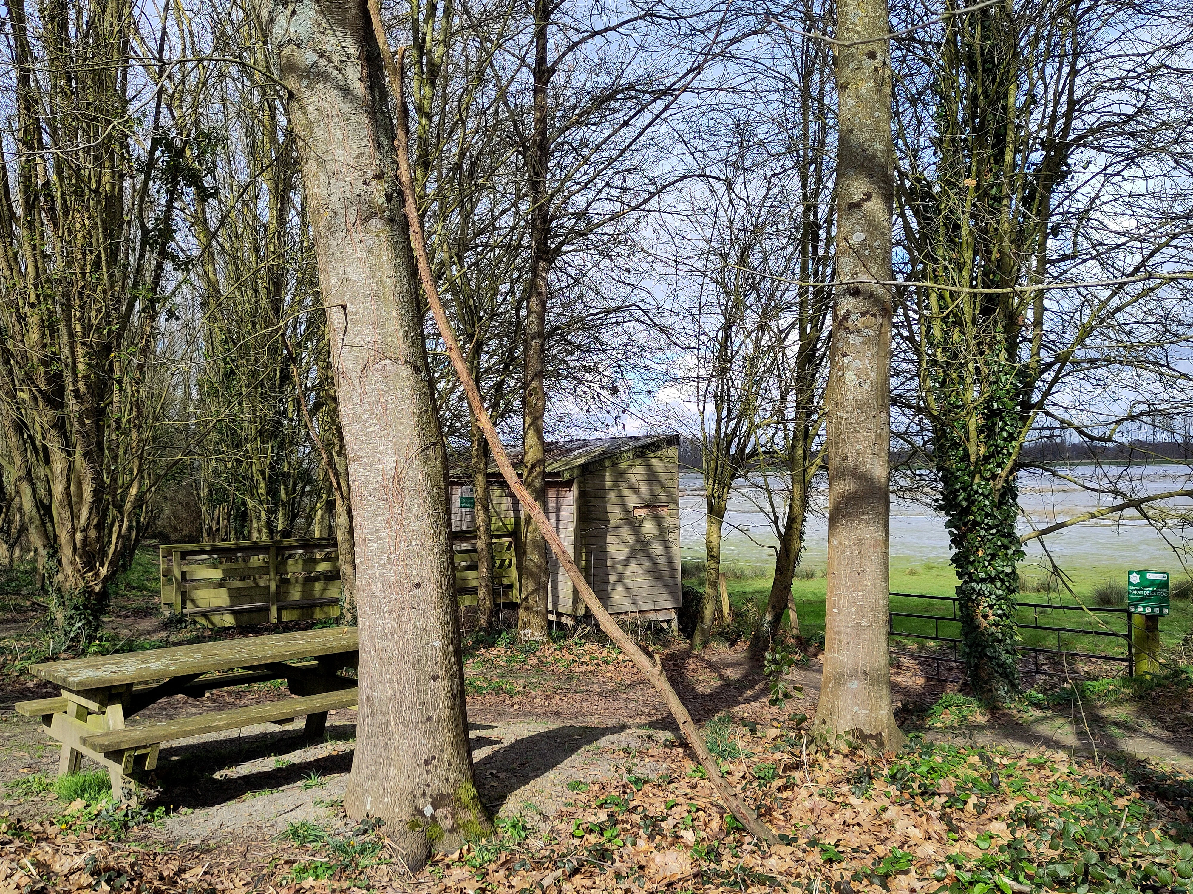
La Musse bird observatory
Bird observatory at the Sougeal marsh in spring 2025

Réserve naturelle régionale du marais de Sougeal history and protected-area timeline

The marshes around Sougeal have been collectively managed land for centuries; the surrounding wetland area has been communal property of Sougeal since the eighteenth century. Long before formal nature protection, the wet meadows were already shaped by traditional communal grazing in summer and seasonal flooding in winter.

The modern reserve was created by a deliberation of the Regional Council on 22 December 2006, classifying the area as a Réserve naturelle régionale under French regional nature reserve law. The classification was renewed through a further deliberation on 28 June 2013, confirming the long-term protection framework. Since its creation, the reserve has been managed by the Communauté de communes de la Baie du Mont Saint-Michel, which has overseen hydraulic restoration work, waterbird monitoring, the establishment of visitor amenities such as the Maison du marais, and the maintenance of the site's pastoral traditions.

Réserve naturelle régionale du marais de Sougeal landscape and geographic character

The landscape is a low-lying, almost level expanse of wet meadow running north-south for roughly three kilometers, with an average width of about 500 meters. This elongated form mirrors the natural floodplain of the Couesnon, whose lower course the reserve closely follows before the river reaches the Bay of Mont-Saint-Michel.

The terrain is shaped primarily by water rather than relief. A network of small channels, or rués, slices through the grassland, allowing managers to flood or drain the meadows deliberately. Low hedgerows in the traditional bocage style and linear belts of poplars mark the edges, framing the open marsh and reinforcing a sense of broad, flat horizons rather than vertical landforms. In winter and spring the visual character is one of sheets of shallow standing water reflecting open sky; in summer the same ground reads as a continuous grassy plain grazed by livestock.
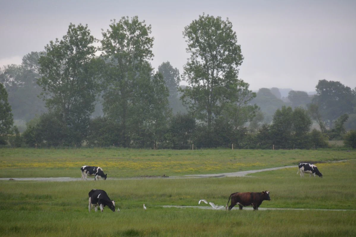
A group of cattle grazing on green pastureland in the Marais de Sougeal, with a line of tall trees in the background under a hazy sky.
Cattle grazing in the wetland prairies of the Marais de Sougeal.

Réserve naturelle régionale du marais de Sougeal ecosystems, habitats, and plant life

Ecologically, the reserve is a managed floodplain meadow, an apparently simple habitat type that supports remarkable biological richness when its hydrology and grazing regime function properly. More than 280 plant species have been recorded, including aquatic and wet-meadow specialists such as floating bur-reed, common fleabane, mare's-tail, and common bladderwort, which thrive in the seasonally inundated rués.

The habitat mosaic combines open wet grassland, shallow flooded channels, ditch networks, hedgerow edges, and poplar shelterbelts. This variety supports a community that includes amphibians such as the European green frog, agile frog, and palmate newt, as well as a rich assemblage of dragonflies, with around fifteen odonate species recorded. The mosaic also provides essential spawning habitat for pike in the Couesnon floodplain, a function that has been strengthened through hydraulic restoration works carried out as part of reserve management.
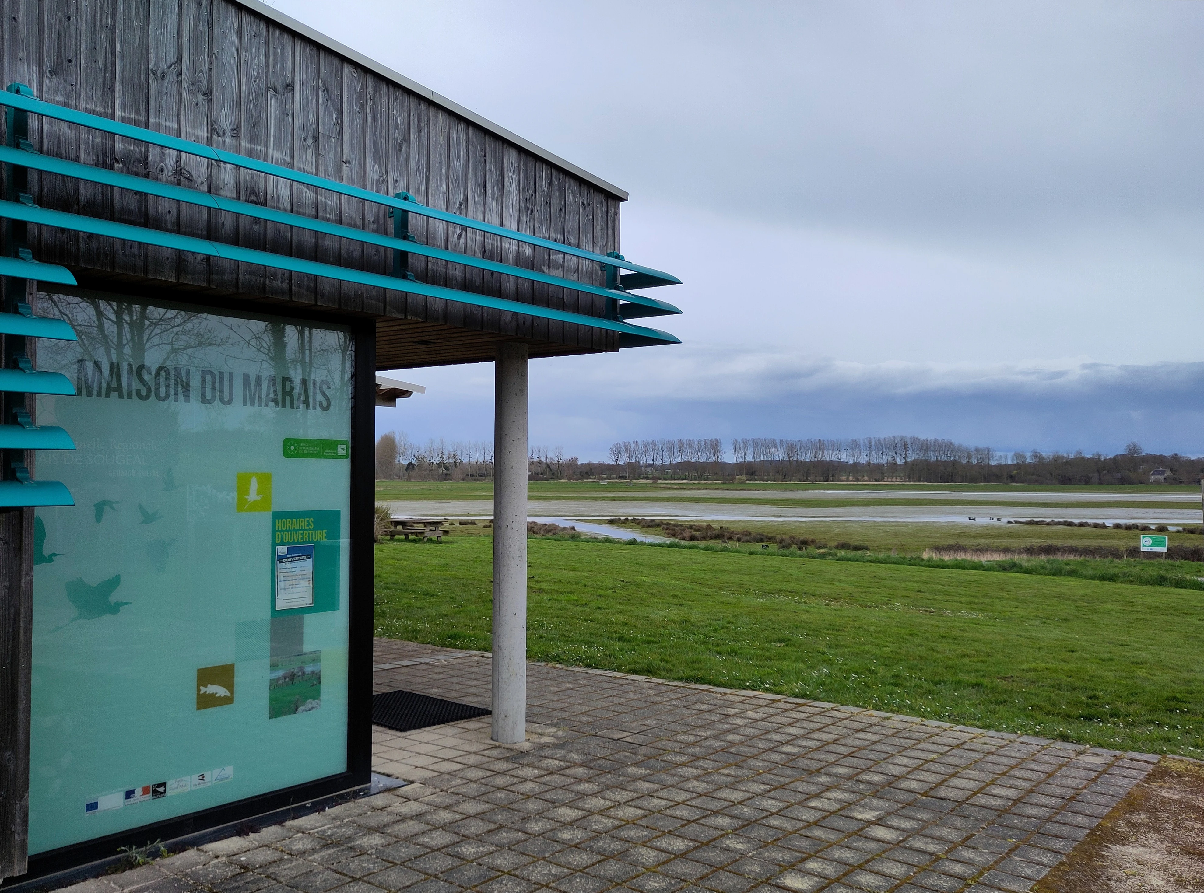
Exterior view of the Maison du marais visitor center building with its turquoise accents, situated at the edge of the open wetland marsh landscape.
The visitor center, Maison du marais, at the Réserve naturelle régionale du marais de Sougeal.

Réserve naturelle régionale du marais de Sougeal wildlife and species highlights

Wildlife is at the heart of the reserve's identity. The proximity of the Bay of Mont-Saint-Michel, an internationally important waterbird site in its own right, gives the marsh an outsized ornithological role. More than sixty waterbird species use the site, especially during spring migration.

Winter brings large flocks of dabbling ducks that use the inundated meadows as nocturnal feeding grounds. Key species include Mallard, Eurasian Wigeon, Northern Pintail, Northern Shoveler, and Common Teal. Northern Pintail in particular occurs in numbers that regularly exceed the population thresholds of the Ramsar Convention, making the reserve an internationally important site for this species. Lapwings and Canada Geese are also conspicuous during the colder months, alongside cormorants.

Spring migration brings a marked shift in the bird community. Thousands of waders use the marsh as a staging area, and species such as Garganey and Northern Pintail can form the largest concentrations within the bay. White Storks nest nearby and exploit the reserve as a feeding area, taking advantage of the seasonal abundance of prey in the wet meadows. Outside of the bird-rich seasons, amphibians and dragonflies add to the site's fauna, while pike reproduction in the Couesnon floodplain links the reserve to the wider freshwater ecosystem of the lower valley.
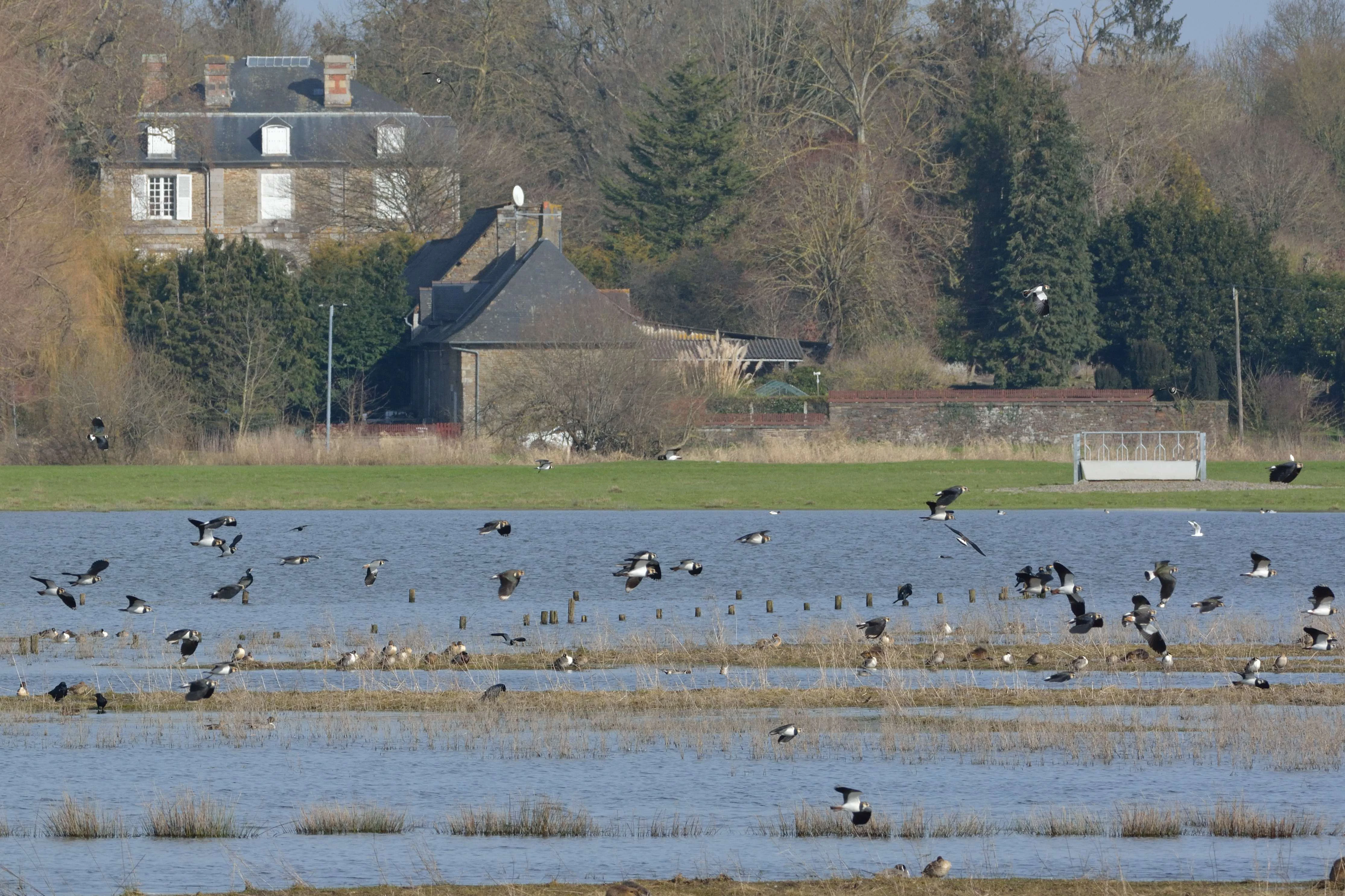
A wide shot of a flooded wetland with numerous birds flying and wading in the water, and a historic stone building visible in the distant background.
Migratory waterbirds flocking over the flooded prairies of the Sougeal Marsh.

Réserve naturelle régionale du marais de Sougeal conservation status and protection priorities

The Sougeal marsh sits within a dense web of overlapping conservation designations, reflecting its ecological as well as cultural value. It is classified as ZNIEFF type I and II, recognized as an Important Bird Area (ZICO), and lies within a Ramsar site because of its international importance for wintering and migratory waterbirds, especially Northern Pintail.

Two Natura 2000 zones cover the area: a Special Area of Conservation across most of the flooded zone, and a Special Protection Area that follows the Couesnon from Antrain to Pontorson and encompasses the SAC. The reserve's own regional designation adds an additional layer of site-specific regulation, including restrictions on motorized vehicle access within the marsh.

Conservation management is closely tied to functional hydrology. Restoration of the marsh's network of rués has been central to restoring the flooding regime that supports both waterbird habitat and pike spawning, demonstrating the site's value as a hub where migratory bird conservation and freshwater ecosystem recovery meet. The continuation of communal grazing is also viewed as an integral conservation tool, helping to maintain open grassland structure that would otherwise be lost to shrub encroachment.

Réserve naturelle régionale du marais de Sougeal cultural meaning and human context

The site carries a strong cultural and agricultural identity rooted in collective land management. Since at least the eighteenth century, the surrounding marshes have belonged to the commune, and a tradition of collective summer grazing by cattle, horses, and geese has shaped both the landscape and local community life.

This pastoral heritage continues today. The seasonal rhythm of grazing, mowing, and water management is part of how the reserve is understood locally, and the Maison du marais serves as a place where visitors can learn about this traditionally managed wetland. The reserve thus embodies a culture of working wet meadows: an agricultural landscape that has been deliberately retained, not sidelined, as part of conservation practice.
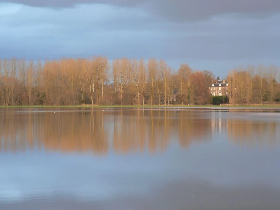
A wide view of a flooded landscape with calm water reflecting a line of leafless trees and a distant building under a cloudy sky.
Flooded wetland meadows at the Marais de Sougeal during winter.

Top sights and standout views in Réserve naturelle régionale du marais de Sougeal

A flooded wet-meadow reserve whose water levels are actively managed through a network of channels, supporting tens of thousands of waterbirds each winter and spring.

Internationally notable for Northern Pintail numbers exceeding Ramsar thresholds, a Ramsar site designation, and a layered network of ZNIEFF, IBA, and Natura 2000 protections. The reserve combines this conservation profile with a striking cultural layer: a working communal grazing landscape, complete with on-site observatories and a visitor center, set against the dramatic backdrop of the Mont-Saint-Michel bay just downstream.
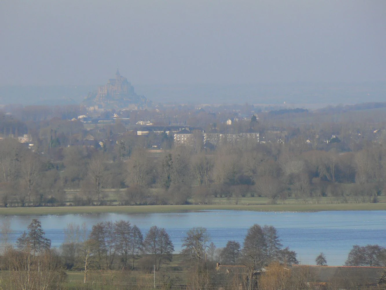
A wide, hazy, high-angle landscape shot showing a body of water in the foreground and mid-ground with trees along the banks, and the faint silhouette of Mont Saint Michel on the horizon.
View of the Marais de Sougéal wetlands with Mont Saint Michel visible in the distant background.

Best time to visit Réserve naturelle régionale du marais de Sougeal

The reserve has two clearly distinct seasonal characters that are worth planning around. Winter and spring are the high seasons for birdwatching, when the meadows are flooded and ducks, waders, and storks concentrate in large numbers; this is when the Maison du marais organizes its waterbird-themed outings.

Summer offers a very different atmosphere, with the ground drying down into open pasture grazed by cattle, horses, and geese. Because the reserve's interest is overwhelmingly ecological and seasonal rather than infrastructural, visiting in either the wet or dry seasons provides a meaningfully different experience of the same site.
Monthly climate preview

Long term monthly temperature averages and precipitation measurements across a representative coordinate

Annual Climate Normals and Temperature Rhythms at Réserve naturelle régionale du marais de Sougeal

Representative point records outline the multi year monthly temperature progression and precipitation rhythm measured across the protected wetland. Examining the complete twelve month dataset provides granular insight into annual climate variations without relying on live forecasts.
Annual mean11 °C
5 °C18 °C
Jan
Feb
Mar
Apr10°
May13°
Jun16°
Jul18°
Aug18°
Sep15°
Oct12°
Nov
Dec
Warmest month
August

17.9 °C

Coolest month
January

4.8 °C

Wettest month
December

2.7 mm/day

Driest month
July

1.6 mm/day

Park location guide

Geography guide, regional context, and park location map for Réserve naturelle régionale du marais de Sougeal

Réserve naturelle régionale du marais de Sougeal park geography, regions, and map view in France

Understand where Réserve naturelle régionale du marais de Sougeal sits in France through a broader geographic reading of the surrounding landscape, nearby location context, and its mapped position within the national park landscape.

How Réserve naturelle régionale du marais de Sougeal fits into France

France is a unitary semi-presidential republic and one of the world's largest economies. It borders Belgium, Luxembourg, Germany, Switzerland, Italy, Monaco, Andorra, and Spain, with a maritime border to the United Kingdom. The country is known for its cultural influence, art, cuisine, and political history spanning centuries.

Wider geography shaping Réserve naturelle régionale du marais de Sougeal in France

France is located in Western Europe. Metropolitan France extends from the Rhine to the Atlantic Ocean and from the Mediterranean Sea to the English Channel and North Sea. The country borders Belgium, Luxembourg, Germany, Switzerland, Italy, Monaco, Andorra, Spain, and has a maritime border with the United Kingdom.

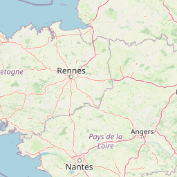
Map view of Réserve naturelle régionale du marais de Sougeal

Use this park location map to pinpoint Réserve naturelle régionale du marais de Sougeal in France, understand its exact geographic position, and read its mapped placement within the surrounding landscape more clearly.

Pigeon | © OpenStreetMap contributors

Location context for Réserve naturelle régionale du marais de Sougeal

Bretagne

Visualizing wet meadow habitats and protected floodplain terrain in Brittany

Réserve naturelle régionale du marais de Sougeal Photos and Landscape Scenery

Visual documentation reveals the seasonal shift from winter floodwaters to summer grazing pastures across the reserve. Examining protected terrain photography provides deeper insight into wetland habitats and regional conservation geography.

La Musse bird observatory

Vilormel ornithological observatory

A group of cattle grazing on green pastureland in the Marais de Sougeal, with a line of tall trees in the background under a hazy sky.

Exterior view of the Maison du marais visitor center building with its turquoise accents, situated at the edge of the open wetland marsh landscape.

A wide shot of a flooded wetland with numerous birds flying and wading in the water, and a historic stone building visible in the distant background.

A modern, single-story building with grey vertical wood cladding sits in a green field, overlooking a wetland area under a cloudy sky.

A wide view of a flooded landscape with calm water reflecting a line of leafless trees and a distant building under a cloudy sky.

A wide, hazy, high-angle landscape shot showing a body of water in the foreground and mid-ground with trees along the banks, and the faint silhouette of Mont Saint Michel on the horizon.

A wide, panoramic landscape view of flat, green wetland plains under a pale, overcast sky.

A wide, low-angle view of a flooded wetland area in winter with a line of wooden posts in the water and a distant building visible behind trees.

A large flock of white geese grazing in a green meadow with a small structure and trees in the background.

A group of dark waterbirds, likely cormorants, perched on small grassy mounds surrounded by shallow water, with a line of bare trees in the distance.

A wide shot of a wetland area with shallow water; numerous waterbirds, including ducks and a cormorant perched on a post, are scattered across small muddy islets and the water surface.

A wide, hazy landscape view of a low-lying wetland area with trees, grass, and a small cluster of buildings in the foreground.

Park atlas

Compare adjacent wetland habitats, river floodplains, and regional reserves across Brittany

Parks near Réserve naturelle régionale du marais de Sougeal and regional protected areas

Browse protected areas and wetland reserves situated close to Réserve naturelle régionale du marais de Sougeal. Comparing nearby valley terrain and lowland habitats provides broader regional context for conservation lands.
Nature reservePays de la Loire
About 49 km away#1 closest

Southeast

Réserve naturelle régionale des prairie et boisement humides des Bizeuls: Regional Nature Reserve Atlas

Wetland habitat preservation in the Mayenne department of western France.

This reserve provides a compact, ecologically dense mosaic of wet meadows and wet woodland in the Pays de la Loire region. It serves as a vital protected area for maintaining wetland biodiversity within a predominantly agricultural landscape, offering a precise look at the terrain and hydrological features characteristic of western France.

Area
0.044 km²
Established
2019
IUCN
IV
A horizontal watercolor painting depicting a soft-toned landscape with a rocky scree slope in the foreground and rolling hills under a pastel sunset sky.
Nature reserveNormandie
About 81 km away#2 closest

East

Réserve naturelle régionale des pierriers de Normandie: Geographic Scree Slope Atlas

Examining rocky protected terrain in Normandy, France

The Réserve naturelle régionale des pierriers de Normandie protects one of the most distinctive natural scree slopes in northwestern Europe. This site preserves fragile rocky debris fields that support specialized vegetation and invertebrate communities. Our atlas data offers a close look at the boundaries and geological character of this significant protected landscape in the Orne department.

Area
0.009 km²
Established
2018
IUCN
IV
Scope
Terrestrial
A watercolor illustration showing a winding river flowing through a green marshland with soft tones and minimalist trees in the background.
Nature reserveManche
About 86 km away#3 closest

North

Réserve naturelle régionale des marais de la Taute: Mapped Landscape and Geography

Wetland geography and protected boundaries in Manche, France

Understand the physical characteristics of Réserve naturelle régionale des marais de la Taute, a mosaic of 147 hectares of protected wet meadows. This area serves as a significant site for marshland conservation, defined by its flat, low-lying river valley geography and fragmented parcel distribution across the Manche landscape.

Area
1.47 km²
Established
2011
Relief
Lowland
Climate
Temperate
Nature reserveBretagne
About 87 km away#4 closest

Southwest

Réserve naturelle régionale des landes de Monteneuf: Geographic Landscape and Protected Area

Atlantic heathland mosaic and Neolithic heritage sites in Bretagne

The Réserve naturelle régionale des landes de Monteneuf serves as a vital refuge for Atlantic heathland habitats within the Bretagne region of France. Situated on thin, acidic schist soils, the area displays a textured mosaic of dry and humid moorland patches, small ponds, and prominent megalithic alignments. This protected territory offers a unique look at how historical land use maintains an open heathland ecosystem amidst a changing rural landscape.

Area
1.255 km²
Established
2013
IUCN
IV
Relief
Lowland
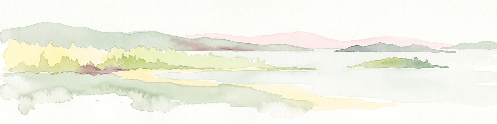
A soft watercolor illustration showing a calm coastal bay with distant low hills, green shorelines, and sandy patches under a pale sky.
Nature reserveCôtes-d'Armor
About 87 km away#5 closest

West

Réserve naturelle nationale de la baie de Saint-Brieuc: Coastal Geography and Protected Terrain

Tidal mudflats and salt marshes on the North-Armorican coast.

Located in the Côtes-d'Armor department, this French nature reserve spans over 1,000 hectares of intertidal terrain. The area features a complex mosaic of sandy flats, brackish marshes, and dune systems, providing a critical study of coastal processes and tidal ecosystems along the Brittany shoreline.

Area
11.4 km²
Established
1998
IUCN
IV
Relief
Lowland
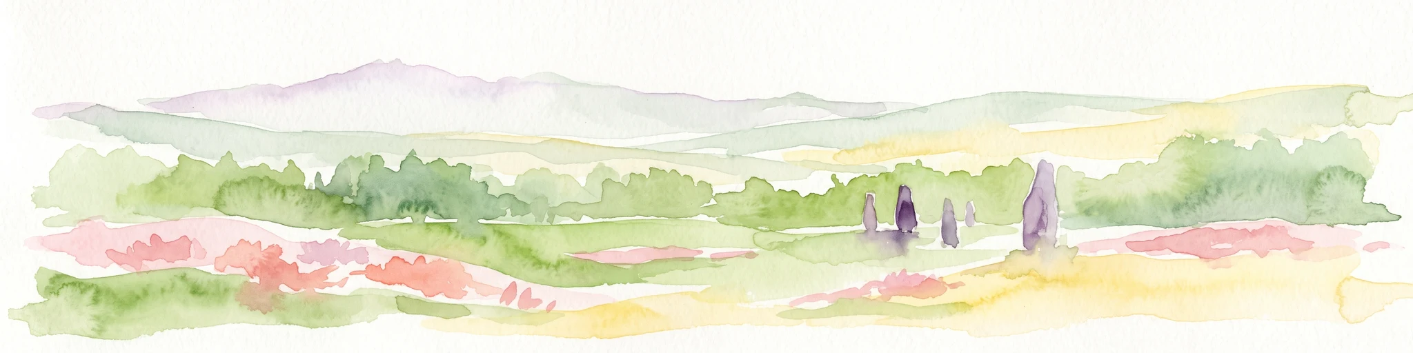
A minimalist watercolor painting of soft green hills and light patches of color against a plain white background.
Nature reserveNormandie
About 87 km away#6 closest

Northeast

Réserve naturelle nationale de la forêt domaniale de Cerisy: A Normandy Protected Area

Ecological landscape and forest geography in France

Situated across the Calvados and Manche departments, this nature reserve protects a substantial beech-dominated state forest. The site provides a unique opportunity to study woodland ecosystems, endemic beetle conservation, and the transition between dense forest interiors and the surrounding Norman bocage landscape.

Area
21.24 km²
Established
1976
IUCN
IV
Relief
Upland
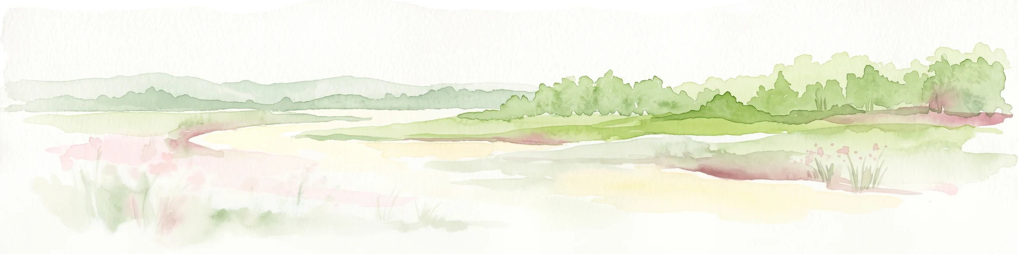
Watercolor painting of a river flowing through a valley with gentle green hills and trees on the banks.
Nature reserveCalvados
About 89 km away#7 closest

Northeast

Rochers des Parcs Nature Reserve: A Detailed Atlas and Protected Landscape Overview

Geographic boundaries and cliff terrain in Calvados, Normandy.

The Rochers des Parcs nature reserve features dramatic Cambrian conglomerate cliffs rising above the Orne river in the Calvados department. This site is defined by its steep wooded slopes, rare plant species, and established network of hiking paths. It represents a vital area of conservation, protected for its geological interest and ecological value, providing a clear window into the rugged terrain of the Suisse normande landscape.

Area
0.36 km²
Established
1977
Relief
Upland
Scope
Terrestrial
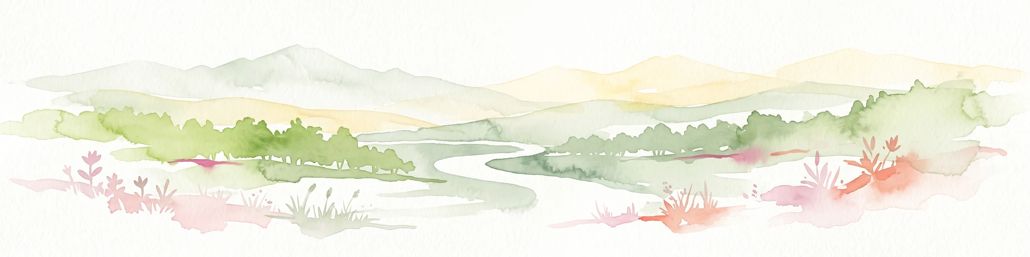
A watercolor illustration of a soft, rolling landscape with green hills, a winding path or stream, and hints of pink flora in the foreground, set against a light background.
Nature reservePays de la Loire
About 93 km away#8 closest

East

Réserve naturelle régionale des landes et tourbière des Égoutelles Geographic Overview

Protected peat bog and wet heathland in Pays de la Loire

Located in Villepail, this nature reserve occupies a sheltered quarry depression in the Mayenne countryside. The site is a study in ecological resilience, featuring approximately one hundred plant species and a diverse fauna of dragonflies and amphibians that thrive in this compact, waterlogged habitat.

Area
0.013 km²
Established
2009
IUCN
IV
Relief
Lowland

Common questions about visiting, size, designation, and location context for Réserve naturelle régionale du marais de Sougeal

Réserve naturelle régionale du marais de Sougeal FAQs for park facts, access, geography, and protected area context

Find quick answers about Réserve naturelle régionale du marais de Sougeal, including protected-area facts, park geography, trail and visitor context, and how the park fits into its surrounding country and regional landscape.
MoriAtlas Explorer

Continue Your Protected Areas Search Across the Global Atlas

Deepen your exploration by continuing the structured search for national parks and protected areas worldwide. Utilize the comprehensive filtering capabilities to compare different conservation landscapes and refine your understanding of global park geography. Discover more about the distribution and characteristics of protected natural areas.

Global natural geography