
Mori Atlas logo
Nature reserveRochers des Parcs

A protected landscape featuring steep wooded escarpments and diverse ecological habitats in the heart of Suisse normande.

Rochers des Parcs Nature Reserve: Mapping the Cambrian Conglomerate Cliffs of the Orne River

Rochers des Parcs stands as a significant protected nature reserve overlooking the Orne river in the Calvados department of Normandy. Defined by its steep Cambrian conglomerate cliffs and mixed deciduous woodlands, this site offers a unique geological and ecological profile within the Suisse normande region. It encompasses a rich natural environment that integrates cliff habitats, rare plant life, and an extensive network of walking trails, serving as a landmark of regional biodiversity and geological heritage.

wooded cliffCambrian conglomerateOrne valleySuisse normandecliff climbingNatura 2000
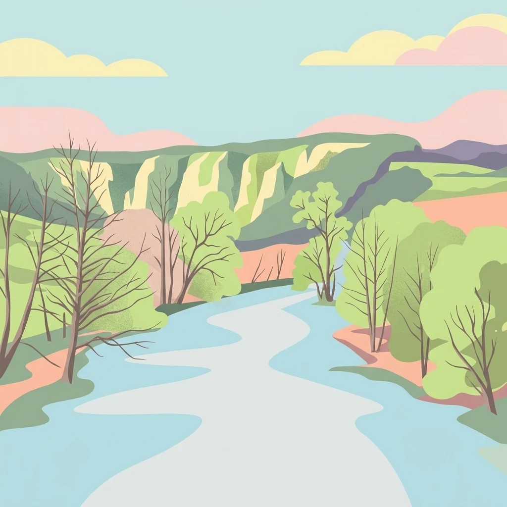
A stylized digital illustration of a river flowing through a forested valley with light colored cliffs in the background under a clear sky.

Rochers des Parcs

Nature reserve

Park overview

Structured park overview, official facts, and landscape profile for Rochers des Parcs

Rochers des Parcs park facts, protected area profile, and essential visitor context

Review the core facts for Rochers des Parcs, including designation, size, terrain, visitor scale, habitats, and operating context in one park-focused overview.

About Rochers des Parcs

Rochers des Parcs is a compact but exceptionally rich natural site in the heart of the Suisse normande, where the Orne river has carved a winding valley through ancient hard rocks. Although small in area, roughly 0.36 square kilometers, the site combines dramatic landforms, ecological value, and outdoor recreation in a way that gives it an outsize regional importance.

The defining feature is a wall of Cambrian conglomerate, a rock type formed from rounded pebbles cemented together in the distant geological past. This hard, durable rock has resisted erosion far better than the surrounding terrain, allowing the river to cut a deep valley while leaving the cliffs standing as steep, wooded escarpments. The result is a landscape that feels almost mountainous in a region otherwise known for bocage farmland and gentle countryside, which is precisely why the area earned the nickname Suisse normande, or Norman Switzerland.

Ecologically, the cliffs and the slopes that fall away from them shelter habitats that are uncommon in lower Normandy. Dry, sun-exposed ledges and gravelly pockets support specialized flora, while the mixed woodland on the upper slopes adds structural diversity. The site forms part of the broader "rochers de Clécy" ZNIEFF, a 244-hectare ecological inventory spread across the communes of Saint-Omer, Saint-Rémy, Le Bô, and Le Vey, and 354 species have been recorded in this inventory. Together these features make the site a focal point for nature conservation in Calvados.

Beyond its natural interest, Rochers des Parcs has a strong cultural and recreational identity. Classified as a site naturel classé in 1977, protected at the European level through Natura 2000, and managed as an espace naturel sensible, it is one of the most layered designations in the area. Visitors know it as a scenic landmark along the Suisse Normande tourist route, a waypoint on the GR 36 long-distance trail, and above all as a premier cliff-climbing destination in western France.

Quick facts and research context for Rochers des Parcs

Located in the Calvados department of Normandy, on the commune of Le Vey facing Clécy, Rochers des Parcs covers approximately 0.36 square kilometers of wooded cliff and slope along the Orne valley. The site sits within the Suisse normande, a region recognized for its hilly terrain and river-cut landscapes that contrast with the flatter Normandy plains.

The protection history combines several overlapping designations: classification as a site naturel classé in 1977 (joined with the Rochers de la Houlle), registration as an espace naturel sensible du Calvados, inclusion in the Natura 2000 network, and inclusion in a ZNIEFF of type 1 covering around 244 hectares. A management plan for the site was produced in 2005 by the local Centre Permanent d'Initiatives pour l'Environnement (CPIE) to guide local public institutions.

Protection and recognition

Terrestrial conservation framework and international recognition data

Rochers des Parcs Protection Status and Official Designation History

Rochers des Parcs maintains a documented terrestrial protection status established in 1977 within the global conservation framework. Detailed designation history and management scope provide clear factual context for analyzing the protected area.

Protection details

Protection scope
Terrestrial
Designated year
1977
Transboundary protection
No
Park context

Deeper park guide and search-rich context for Rochers des Parcs

Rochers des Parcs history, landscape, wildlife, and travel context

Explore Rochers des Parcs through its history, landscape character, ecosystems, wildlife, conservation priorities, cultural context, and seasonal travel timing in a structured park guide built for atlas discovery and search intent.

Why Rochers des Parcs stands out

Rochers des Parcs is best known for its steep wooded cliffs of Cambrian conglomerate rising above the Orne river, a rare geological setting in the region. According to the French Federation of Mountaineering and Climbing, it is the most important cliff-climbing site in western France after the cliffs of Finistère, hosting around one hundred equipped routes. It is also appreciated for its biodiversity. The cliffs and associated habitats harbor 354 inventoried species, including several rare plants such as Micropyrum tenellum, Spergularia morisonii, Sedum rubens, Filago vulgaris, Hypericum linarifolium, Spiranthes spiralis, Rosa micrantha, and Asplenium billotii. This mix of dramatic scenery, geological interest, rare flora, and climbing heritage defines the site's identity.
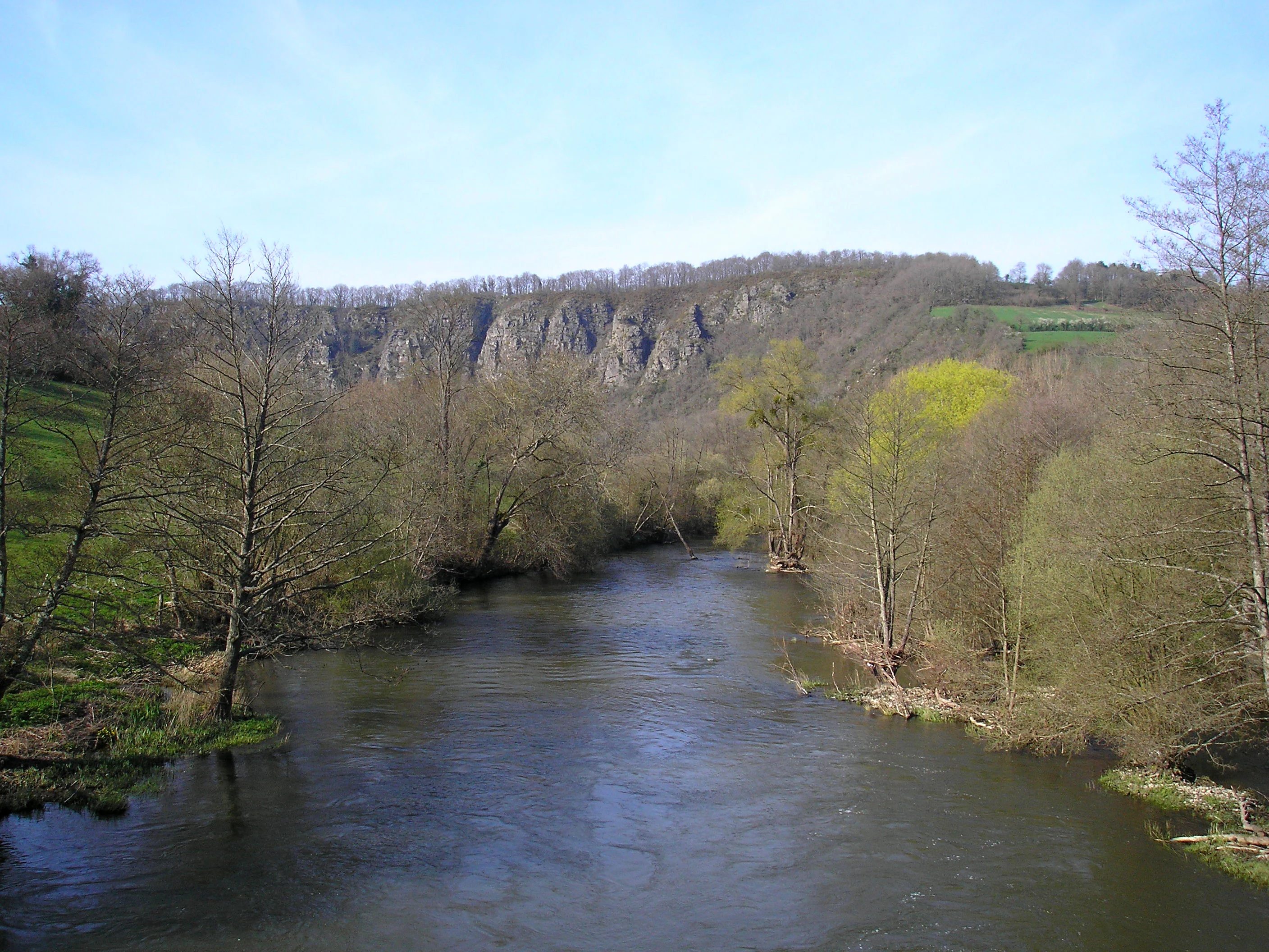
A calm river flowing through a valley, flanked by bare deciduous trees and green banks, with a steep, craggy rock face rising in the distance under a pale blue sky.
The Orne River flowing past the rocky slopes of Rochers des Parcs in Normandy.

Rochers des Parcs history and protected-area timeline

Rochers des Parcs gained formal landscape protection alongside the nearby Rochers de la Houlle through a decree of 27 December 1977, classifying the combined cliffs as a site naturel classé. This French designation protects areas whose conservation or aesthetic value justifies long-term national-level safeguarding.

In the late twentieth and early twenty-first centuries, additional layers of recognition were added. The cliffs were incorporated into the European Natura 2000 ecological network, reflecting their value for protected habitats and species. At the departmental level, the Calvados council designated the site as an espace naturel sensible, a category of French local natural areas used for biodiversity, landscape, and public-awareness purposes.

In 2005, the Centre Permanent d'Initiatives pour l'Environnement (CPIE) of Calvados produced a management plan for the site, providing guidance to local public institutions on how to balance the cliff's ecological sensitivity with its use by walkers and climbers. The site is also inventoried within a ZNIEFF of type 1 covering the "rochers de Clécy," extending across roughly 244 hectares and the communes of Saint-Omer, Saint-Rémy, Le Bô, and Le Vey.

Rochers des Parcs landscape and geographic character

The dominant landscape feature of Rochers des Parcs is a steep cliff of Cambrian conglomerate, a sedimentary rock formed from compacted pebbles and dating back to the early Paleozoic era. This conglomerate has proven far more resistant than the surrounding materials, allowing the Orne river to carve its valley while leaving the cliff standing as a dramatic wall above the water.

The cliff rises abruptly from wooded slopes that tumble down toward the river. Mixed deciduous woodland clings to the upper edges and to the more stable sections of the slope, while exposed rocky outcrops and thin soils create open patches on the steepest faces. The contrast between the dark forested upper rim, the pale rocky middle band, and the soft green river plain below gives the site much of its visual character.

Around Rochers des Parcs, the broader landscape continues the Suisse normande pattern: tight meanders of the Orne, deep side valleys, and a patchwork of woodland interrupted by pastures and small villages. The nearby commune of Clécy lies directly across the river, and the cliff forms one of the most photographed backdrops in the area. Together with the Rochers de la Houlle, the site defines the visual identity of this stretch of the Orne valley.

Rochers des Parcs ecosystems, habitats, and plant life

The ecological interest of Rochers des Parcs lies in the unusual combination of habitats packed into a very small area. The cliffs provide vertical rocky faces with thin, dry soils, the upper slopes support broadleaf woodland, and the transition zone below the cliff includes ruderal and gravelly vegetation. This juxtaposition of dry cliff, shaded forest, and disturbed ground creates a mosaic that is rare in lowland Normandy.

The site is part of the ZNIEFF "rochers de Clécy", a 244-hectare inventory across the communes of Saint-Omer, Saint-Rémy, Le Bô, and Le Vey, where 354 species have been recorded. Within this inventory, several plant species of high conservation interest have been identified, justifying the site's protection status.

These habitats are considered sensitive enough that the site has been placed within the Natura 2000 network and designated as an espace naturel sensible by the Calvados department. The combination of geological history and biological specialization produces an ecological profile that is more reminiscent of upland or edge-of-plateau sites than of the surrounding Normandy farmland.

Rochers des Parcs wildlife and species highlights

The wildlife information available for Rochers des Parcs focuses primarily on the botanical richness recorded within the ZNIEFF. The site is recognized for harboring 354 inventoried species, a notable figure for such a small area, with particular attention given to rare plants that depend on dry, rocky, or disturbed habitats.

Key plant species include the small sand-grass (Micropyrum tenellum), Morison's spurrey (Spergularia morisonii), reddish stonecrop (Sedum rubens), common cudweed (Filago vulgaris), linear-leaved St. John's wort (Hypericum linarifolium), autumn lady's-tresses orchid (Spiranthes spiralis), small-flowered rose (Rosa micrantha), and Billot's spleenwort fern (Asplenium billotii). Several of these are considered rare at the regional or national level and have directly justified the site's protected status.

Beyond vascular plants, the cliff-and-woodland mosaic would be expected to support characteristic fauna of rocky and woodland habitats in Normandy, including breeding birds, bats using cliff crevices, and invertebrates tied to dry grassland outcrops. However, the source material does not provide detailed faunal data, so the wildlife profile is best described primarily through its recognized botanical significance.

Rochers des Parcs conservation status and protection priorities

Rochers des Parcs carries one of the most layered conservation designations in the Calvados countryside, and this stacking of protections reflects genuine ecological and landscape value. In 1977, the cliffs were classified, together with the Rochers de la Houlle, as a site naturel classé by decree of 27 December 1977, giving them long-term national recognition for their scenic and natural character.

At the European level, the site is part of the Natura 2000 network, linking its conservation to broader efforts to protect habitats and species across the European Union. The cliffs are also recognized as an espace naturel sensible of Calvados, a departmental designation that combines biodiversity protection with public outreach and trail management. The site forms part of a ZNIEFF of type 1 covering approximately 244 hectares across the communes of Saint-Omer, Saint-Rémy, Le Bô, and Le Vey, where 354 species have been recorded.

In 2005, the CPIE of Calvados produced a formal management plan for the site, giving public institutions a coordinated framework for handling ecological fragility, public access, and climbing activity. The combination of national, European, departmental, and ecological-inventory designations, all converging on a cliff of less than half a square kilometer, underlines how disproportionately important this small site is for regional conservation.

Rochers des Parcs cultural meaning and human context

Rochers des Parcs is closely tied to the identity of the Suisse normande, a stretch of the Orne valley whose unusually rugged terrain earned it the nickname "Norman Switzerland". The cliffs and the river together form the most iconic and photographed landscape of this area, and Rochers des Parcs is one of the leading visual landmarks that define the regional image of the valley around Clécy.

The site is also an established node on France's tourism geography. It lies along the Suisse Normande tourist route, a 65-kilometer scenic circuit that follows the Orne valley and links the area's principal viewpoints and natural sites. Walking culture is similarly anchored here through the GR 36 long-distance footpath and named local trails such as the sentier du dessus des rochers, which traces the top of the cliff and gives visitors direct contact with the site.

Climbing has added a more recent but distinctive cultural layer. With roughly one hundred equipped cliff routes, Rochers des Parcs is described by the French Federation of Mountaineering and Climbing as the most important cliff-climbing site in western France after the cliffs of Finistère. This has established the site as a regional reference point for the climbing community, blending outdoor sport with the area's broader tradition of landscape appreciation.

Top sights and standout views in Rochers des Parcs

Rochers des Parcs concentrates an unusual amount of natural and recreational value into a small footprint along the Orne valley. Its conglomerate cliffs rise above a wooded river landscape that defines the Suisse normande, and the same rock face that makes the scenery memorable is also recognized nationally as one of the leading cliff-climbing sites in western France.

Equally important is the ecological profile. The site sits within a ZNIEFF that records 354 species including several rare plants, and the cliffs carry overlapping protections as a site naturel classé, a Natura 2000 site, and an espace naturel sensible of Calvados. The combination of geological drama, biodiversity, multi-level protection, and routes for walkers and climbers makes Rochers des Parcs a defining landmark of the Norman countryside around Clécy.

Best time to visit Rochers des Parcs

Because the cliff and woodland combination at Rochers des Parcs changes character with the seasons, timing affects the kind of experience a visitor has more than basic access. Spring and early summer are particularly rewarding for botanical interest, when many of the rare plants associated with the cliffs, such as the autumn lady's-tresses orchid later in the year, are in active growth and the surrounding woodland is fully leafed.

Summer brings long days and warm rock, favorable conditions for both walking the cliff-top trails such as the sentier du dessus des rochers and for climbing the equipped routes. Autumn adds color to the mixed deciduous forest and quieter conditions on the trails, while winter offers more atmospheric views of bare cliffs above the Orne, though weather and shorter days can reduce comfort for outdoor activity.

Because the site is primarily a cliff and woodland landscape without visitor infrastructure details provided in the source material, decisions about timing are best driven by personal interest in flora, scenery, and climbing rather than by any specific operational calendar.
Monthly climate preview

Examine long-term representative weather by month across the protected terrain of Calvados.

Rochers des Parcs Climate Normals, Annual Temperature and Precipitation Profiles

Representative coordinate records show measured monthly averages for temperature and precipitation across the terrain of Rochers des Parcs. Reviewing the complete twelve-month normals provides detailed context on long-term annual climate variations.
Annual mean11 °C
4 °C18 °C
Jan
Feb
Mar
Apr
May13°
Jun16°
Jul18°
Aug18°
Sep15°
Oct12°
Nov
Dec
Warmest month
August

17.7 °C

Coolest month
January

4.3 °C

Wettest month
December

2.8 mm/day

Driest month
March

1.7 mm/day

Park location guide

Geography guide, regional context, and park location map for Rochers des Parcs

Rochers des Parcs park geography, regions, and map view in France

Understand where Rochers des Parcs sits in France through a broader geographic reading of the surrounding landscape, nearby location context, and its mapped position within the national park landscape.

How Rochers des Parcs fits into France

France is a unitary semi-presidential republic and one of the world's largest economies. It borders Belgium, Luxembourg, Germany, Switzerland, Italy, Monaco, Andorra, and Spain, with a maritime border to the United Kingdom. The country is known for its cultural influence, art, cuisine, and political history spanning centuries.

Wider geography shaping Rochers des Parcs in France

France is located in Western Europe. Metropolitan France extends from the Rhine to the Atlantic Ocean and from the Mediterranean Sea to the English Channel and North Sea. The country borders Belgium, Luxembourg, Germany, Switzerland, Italy, Monaco, Andorra, Spain, and has a maritime border with the United Kingdom.

Map view of Rochers des Parcs

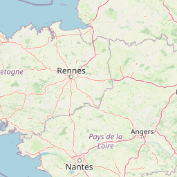
Use this park location map to pinpoint Rochers des Parcs in France, understand its exact geographic position, and read its mapped placement within the surrounding landscape more clearly.

Pigeon | © OpenStreetMap contributors

Location context for Rochers des Parcs

CalvadosNormandie

Examine protected area views, Cambrian conglomerate cliffs, and forest habitats across the region.

Rochers des Parcs Photos and Landscape Scenery: Visualizing the Orne Valley Terrain

Visual records capture the steep wooded escarpments and dramatic rocky outcrops that define the protected landscape along the Orne river. Studying these terrain photographs helps reveal the geological features and diverse habitats characteristic of the wider valley.

A calm river flowing through a valley, flanked by bare deciduous trees and green banks, with a steep, craggy rock face rising in the distance under a pale blue sky.

Park atlas

Compare regional geography, river valleys, and connected conservation sites across Normandy

Explore Parks Near Rochers des Parcs and Surrounding Protected Landscapes

Visitors exploring Rochers des Parcs can continue comparing protected areas throughout the surrounding Orne river valley and nearby regional terrain. Analyzing adjacent natural sites reveals broader geological patterns and connected ecological corridors across northwestern France.
A horizontal watercolor painting depicting a soft-toned landscape with a rocky scree slope in the foreground and rolling hills under a pastel sunset sky.
Nature reserveNormandie
About 40 km away#1 closest

South

Réserve naturelle régionale des pierriers de Normandie: Geographic Scree Slope Atlas

Examining rocky protected terrain in Normandy, France

The Réserve naturelle régionale des pierriers de Normandie protects one of the most distinctive natural scree slopes in northwestern Europe. This site preserves fragile rocky debris fields that support specialized vegetation and invertebrate communities. Our atlas data offers a close look at the boundaries and geological character of this significant protected landscape in the Orne department.

Area
0.009 km²
Established
2018
IUCN
IV
Scope
Terrestrial
A minimalist watercolor painting of soft green hills and light patches of color against a plain white background.
Nature reserveNormandie
About 44 km away#2 closest

Northwest

Réserve naturelle nationale de la forêt domaniale de Cerisy: A Normandy Protected Area

Ecological landscape and forest geography in France

Situated across the Calvados and Manche departments, this nature reserve protects a substantial beech-dominated state forest. The site provides a unique opportunity to study woodland ecosystems, endemic beetle conservation, and the transition between dense forest interiors and the surrounding Norman bocage landscape.

Area
21.24 km²
Established
1976
IUCN
IV
Relief
Upland
A soft watercolor painting of a serene natural landscape featuring foreground grasses, a small body of water, a grassy shoreline, coniferous trees, and hazy hills in the background.
Nature reserveNormandie
About 47 km away#3 closest

North

Réserve naturelle nationale de la falaise du Cap-Romain: Coastal Nature Reserve Map

Explore protected maritime cliffs and Jurassic fossil sites in Calvados, France.

The Réserve naturelle nationale de la falaise du Cap-Romain stands as a compact but rich geological archive on the Côte de Nacre. It protects maritime cliffs, rocky tidal platforms, and significant Bathonian-age sponge fossil reefs. This site offers deep insights into the region's Quaternary history, encompassing glacial deposits, loess layers, and diverse marine fossil assemblages.

Area
0.24 km²
Established
1984
IUCN
III
Nature reserveFrance
About 52 km away#4 closest

Southeast

Réserve naturelle régionale géologique de Normandie-Maine: Geological Nature Reserve

A protected Ordovician limestone site in the Armorican Massif

Located in northwestern France, this reserve focuses on the geological preservation of the Carrière des Vaux. It is an essential site for understanding Paleozoic biostratigraphy, featuring well-exposed limestone sequences and significant microfossil deposits that allow for precise dating of regional strata within the Normandie-Maine landscape.

Area
0.006 km²
Established
2009
Relief
Lowland
Climate
Temperate
A pale watercolor landscape painting showing rolling green hills and distant mountain ridgelines against a white background.
Nature reservePays de la Loire
About 55 km away#5 closest

Southeast

Réserve naturelle régionale Mont des Avaloirs: Protected Landscape and Geographic Overview

Upland heath and summit geography of the Armorican Massif

Investigate the unique physical geography of Réserve naturelle régionale Mont des Avaloirs. This area acts as a biodiversity stronghold in northwestern France, defined by a dramatic interplay of stony blockfields, sheltered valley brooks, and protected peatland basins that create atypical ecological conditions across the Mayenne countryside.

Area
3.211 km²
Established
2020
IUCN
IV
Relief
Mountain
A watercolor illustration of a soft, rolling landscape with green hills, a winding path or stream, and hints of pink flora in the foreground, set against a light background.
Nature reservePays de la Loire
About 60 km away#6 closest

South

Réserve naturelle régionale des landes et tourbière des Égoutelles Geographic Overview

Protected peat bog and wet heathland in Pays de la Loire

Located in Villepail, this nature reserve occupies a sheltered quarry depression in the Mayenne countryside. The site is a study in ecological resilience, featuring approximately one hundred plant species and a diverse fauna of dragonflies and amphibians that thrive in this compact, waterlogged habitat.

Area
0.013 km²
Established
2009
IUCN
IV
Relief
Lowland
A watercolor illustration showing a winding river flowing through a green marshland with soft tones and minimalist trees in the background.
Nature reserveManche
About 67 km away#7 closest

Northwest

Réserve naturelle régionale des marais de la Taute: Mapped Landscape and Geography

Wetland geography and protected boundaries in Manche, France

Understand the physical characteristics of Réserve naturelle régionale des marais de la Taute, a mosaic of 147 hectares of protected wet meadows. This area serves as a significant site for marshland conservation, defined by its flat, low-lying river valley geography and fragmented parcel distribution across the Manche landscape.

Area
1.47 km²
Established
2011
Relief
Lowland
Climate
Temperate
Nature reservePays de la Loire
About 75 km away#8 closest

Southwest

Réserve naturelle régionale des prairie et boisement humides des Bizeuls: Regional Nature Reserve Atlas

Wetland habitat preservation in the Mayenne department of western France.

This reserve provides a compact, ecologically dense mosaic of wet meadows and wet woodland in the Pays de la Loire region. It serves as a vital protected area for maintaining wetland biodiversity within a predominantly agricultural landscape, offering a precise look at the terrain and hydrological features characteristic of western France.

Area
0.044 km²
Established
2019
IUCN
IV

Common questions about visiting, size, designation, and location context for Rochers des Parcs

Rochers des Parcs FAQs for park facts, access, geography, and protected area context

Find quick answers about Rochers des Parcs, including protected-area facts, park geography, trail and visitor context, and how the park fits into its surrounding country and regional landscape.
MoriAtlas Explorer

Continue Your Protected Areas Search Across the Global Atlas

Deepen your exploration by continuing the structured search for national parks and protected areas worldwide. Utilize the comprehensive filtering capabilities to compare different conservation landscapes and refine your understanding of global park geography. Discover more about the distribution and characteristics of protected natural areas.

Global natural geography