
Mori Atlas logo
Nature reserveRéserve naturelle régionale du marais « Les trous de Leu »

Mapped alluvial landscape and alkaline peatland geography in the Grand Est region

Réserve naturelle régionale du marais « Les trous de Leu »: Protected Wetland Atlas

(Réserve naturelle régionale du marais « Les trous de Leu » (RNR275))

Discover the ecological significance and geographic boundaries of Réserve naturelle régionale du marais « Les trous de Leu », a vital nature reserve situated along the Vesle river. This protected area hosts a complex mosaic of alkaline peatlands, reedbeds, and alluvial forests. Learn how this 33-hectare wetland serves as a key biodiversity anchor for the surrounding Champagne-Ardenne landscape within the greater Grand Est territory.

regional nature reservewetlandmarshlandalkaline peatlandalluvial forestVesle valley
A flat-style digital illustration showing a mountain waterfall, a river flowing through a valley, and surrounding forest vegetation.

Réserve naturelle régionale du marais « Les trous de Leu »

Nature reserve

Park overview

Structured park overview, official facts, and landscape profile for Marais Les Trous de Leu Regional Nature Reserve

Marais Les Trous de Leu Regional Nature Reserve park facts, protected area profile, and essential visitor context

Review the core facts for Marais Les Trous de Leu Regional Nature Reserve, including designation, size, terrain, visitor scale, habitats, and operating context in one park-focused overview.

About Marais Les Trous de Leu Regional Nature Reserve

Marais Les Trous de Leu Regional Nature Reserve lies in the Marne department of the Grand Est region in northeastern France, on the outskirts of Reims. The reserve occupies a roughly triangular area of about 33 hectares between the Vesle river to the north and the Coulée verte, a greenway built along the former Canal de l'Aisne à la Marne, to the south. It sits on alluvial soils that have given rise to a finely layered set of wetland communities.

Despite its small size, the reserve is ecologically dense. It shelters a succession of habitats, including low alkaline peatland, base-rich marshes, tall herb fringes (mégaphorbiaie), reedbeds, aquatic vegetation, several types of alluvial woodland (willow, birch, oak, mixed alluvial forest), meso-hygrophilous meadows, and tall nutrient-rich fallow margins. This habitat diversity fits the full ecological gradient between standing water and drier alluvial land, making the site a reference point for understanding the natural heritage of the Vesle valley.

Administratively, the reserve was classified by a regional council deliberation on 20 January 2014, with a renewable ten-year term. It is managed by the Conservatoire d'espaces naturels de Champagne-Ardenne, which acquired the land in December 2012. Beyond its own boundary, it forms the northern portion of the larger Natura 2000 site Marais de la Vesle en amont de Reims and overlaps a ZNIEFF Type I area designated for its alkaline peatland. Together these designations give the reserve a central role in regional wetland protection, while still sitting in close visual and geographic reach of the city of Reims.

Quick facts and research context for Marais Les Trous de Leu Regional Nature Reserve

Marais Les Trous de Leu is a French regional nature reserve covering roughly 33 hectares near Reims, in the Marne department of the Grand Est region. Classified on 20 January 2014 for an initial renewable period of ten years, it is managed by the Conservatoire d'espaces naturels de Champagne-Ardenne. The reserve constitutes the northern portion of the Natura 2000 site Marais de la Vesle en amont de Reims, and overlaps with a ZNIEFF Type I inventory area. Its protected designation is a regional natural reserve under IUCN management category IV.

Protection and recognition

Examine documented protection scope, management records, and administrative designations.

Protection Status and International Recognition for Réserve naturelle régionale du marais « Les trous de Leu »

Protected area designation records and official database entries provide a structured overview of conservation governance for Réserve naturelle régionale du marais « Les trous de Leu ». Verified administrative metrics outline the documented legal framework and international recognition history associated with this regional reserve.

Protection details

WDPA ID
555561964
Park context

Deeper park guide and search-rich context for Marais Les Trous de Leu Regional Nature Reserve

Marais Les Trous de Leu Regional Nature Reserve history, landscape, wildlife, and travel context

Explore Marais Les Trous de Leu Regional Nature Reserve through its history, landscape character, ecosystems, wildlife, conservation priorities, cultural context, and seasonal travel timing in a structured park guide built for atlas discovery and search intent.

Why Marais Les Trous de Leu Regional Nature Reserve stands out

The reserve is best known for its rich mosaic of wetland habitats, especially its low alkaline peatland (tourbière basse alcaline), sedge marshes (bas-marais), reedbeds, and alluvial forests bordering the Vesle river. It is also notable for harboring protected plant species such as the nationally protected Grande douve (Ranunculus lingua) and regionally rare sedges including Carex appropinquata and Carex lasiocarpa. Equally distinctive is its ecological contrast with the surrounding urban and agricultural landscape: a small but high-quality fragment of wet habitat right next to Reims, supporting diverse birdlife, dragonflies, amphibians, and small mammals in an exceptionally compact area.
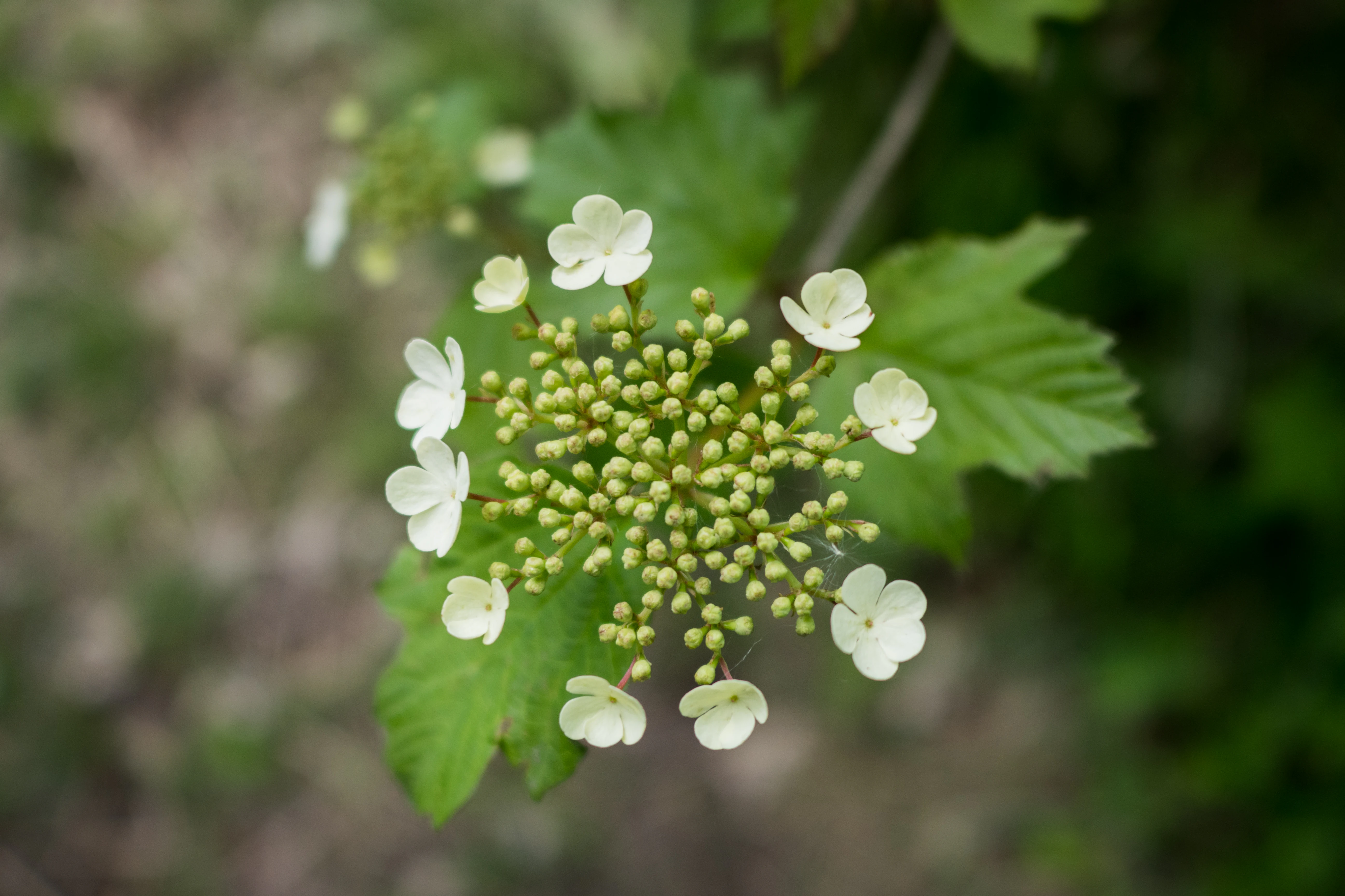
A close-up shot of a white Guelder rose flower cluster, showing a ring of flat, five-petaled sterile flowers surrounding a dense center of small, green, unopened buds against a blurred green leafy background.
A close-up view of the white inflorescence of a Guelder rose, known for its distinct ring of larger sterile flowers surrounding a cluster of fertile buds.

Marais Les Trous de Leu Regional Nature Reserve history and protected-area timeline

The area that now forms the reserve changed hands when the Conservatoire d'espaces naturels de Champagne-Ardenne acquired the property in December 2012, securing the future protection of the site. Within slightly over a year, on 20 January 2014, the Conseil régional officially classified the territory as a regional nature reserve, granting it formal protection for an initial period of ten years, renewable thereafter.

Since the classification, the reserve has been managed under the framework of the French regional nature reserve system, with the Conservatoire d'espaces naturels de Champagne-Ardenne responsible for day-to-day stewardship and the elaboration of a long-term management plan. The reserve also became a component of larger ecological networks, including the Natura 2000 designation Marais de la Vesle en amont de Reims and the ZNIEFF Type I inventory covering its alkaline peatland. Although the site has not yet been developed for public reception, limited organized visits are possible under the manager's supervision.

Marais Les Trous de Leu Regional Nature Reserve landscape and geographic character

The reserve occupies a roughly triangular wedge of land covering about 33 hectares, framed by two parallel waterways: the Vesle river on one side and the Coulée verte, a greenway following the route of the former Canal de l'Aisne à la Marne, on the other. Alluvial soils deposited by the Vesle shape the entire ecosystem of the site and create a gentle, low-relief topography typical of small river-valley wetlands.

The visible landscape alternates between still water surfaces, reed-fringed channels, sedge-dominated marsh, and patches of dense alluvial woodland. Open wet meadows, tall herb communities, and creeping willows line the transitions between aquatic and terrestrial zones. The peatland character, with base-rich (alkaline) conditions, gives rise to particular plant communities, including visible carpets of sedges (Carex species) along the river's edge. The combination of open water, reedbeds, and varied woodland gives the reserve a layered, visually rich appearance despite its modest size.
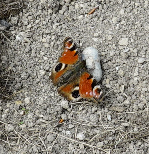
A Peacock butterfly, recognizable by its distinct eye-spots on orange and brown wings, resting on a patch of dry, rocky ground.
A Peacock butterfly resting on a gravel path within the reserve.

Marais Les Trous de Leu Regional Nature Reserve ecosystems, habitats, and plant life

Ecology at Les Trous de Leu is defined by the close interplay between water, alluvial soils, and vegetation succession. The wide range of habitats includes low alkaline peatland, base-rich marshes, tall herb fringes, reedbeds, aquatic plant communities, several alluvial woodland types, meso-hygrophilous meadows, and nutrient-rich tall fallow vegetation. This habitat mosaic is among the most ecologically intact found along the upper Vesle.

Approximately a hundred plant species have been recorded at the site. Among them, the Grande douve (Ranunculus lingua) is protected at the national level, while Laiche paradoxale (Carex appropinquata), Laiche filiforme (Carex lasiocarpa), Laiteron des marais (Sonchus palustris), Rubanier nain (Sparganium natans), and Potamot coloré (Potamogeton coloratus) are rare or regionally protected. Additional patrimonial species include Œnanthe de Lachenal (Oenanthe lachenalii), Orchis incarnat (Dactylorhiza incarnata), Saule rampant (Salix repens), and Utriculaire commune (Utricularia vulgaris), which contribute to the site's botanical significance. The Vesle river itself adds an aquatic dimension, hosting fish species such as ablette, brochet, gardon, and vandoise.
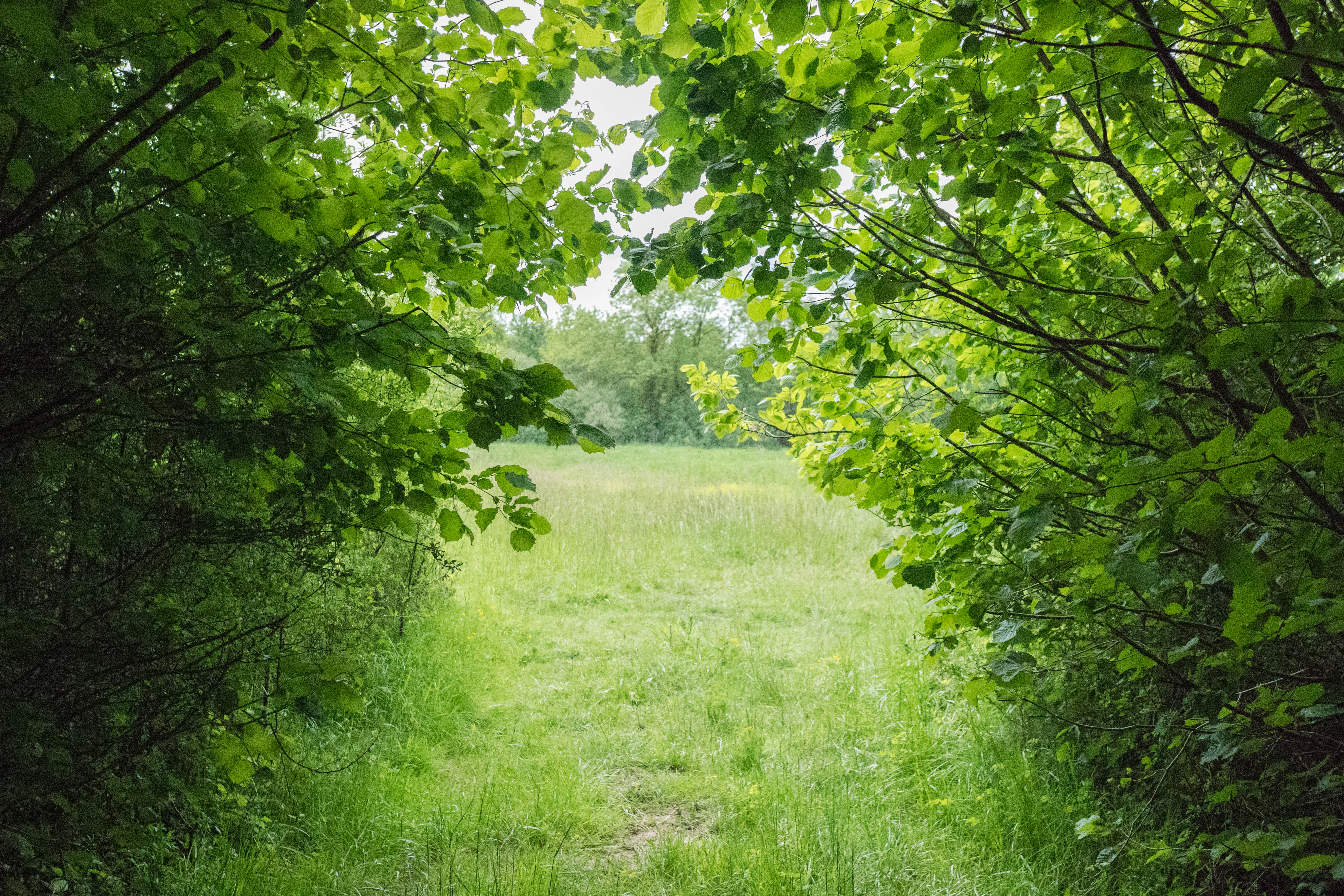
A green, grassy clearing framed by overhanging leafy branches of trees and shrubs on both sides, creating a natural tunnel effect looking out into the field.
A view of an open meadow framed by the foliage of the woodland edge.

Marais Les Trous de Leu Regional Nature Reserve wildlife and species highlights

The reserve supports a strikingly broad fauna for its size. The bird community includes the European kingfisher (Martin-pêcheur d'Europe), the jack snipe (Bécassine sourde), and the red-backed shrike (Pie-grièche écorcheur), species that benefit from the combination of water, reedbeds, and nearby scrub. The dragonfly fauna is equally notable, with species such as the Grande æschne and Cordulie métallique.

Two orthopteran species, the Criquet ensanglanté and the Conocéphale des roseaux, are listed on the regional red list. Among amphibians and reptiles, the agile frog (Grenouille agile) and the viviparous lizard (Lézard vivipare) are present. Small mammals include the European weasel (Belette d'Europe), the water shrew (Crossope aquatique), and several bat species such as the grey long-eared bat (Oreillard gris), common pipistrelle (Pipistrelle commune), Daubenton's bat (Vespertilion de Daubenton), whiskered bat (Vespertilion à moustaches), and Natterer's bat (Vespertilion de Natterer). The mix of aquatic, marsh, and woodland habitats allows these varied faunas to coexist within a small footprint.
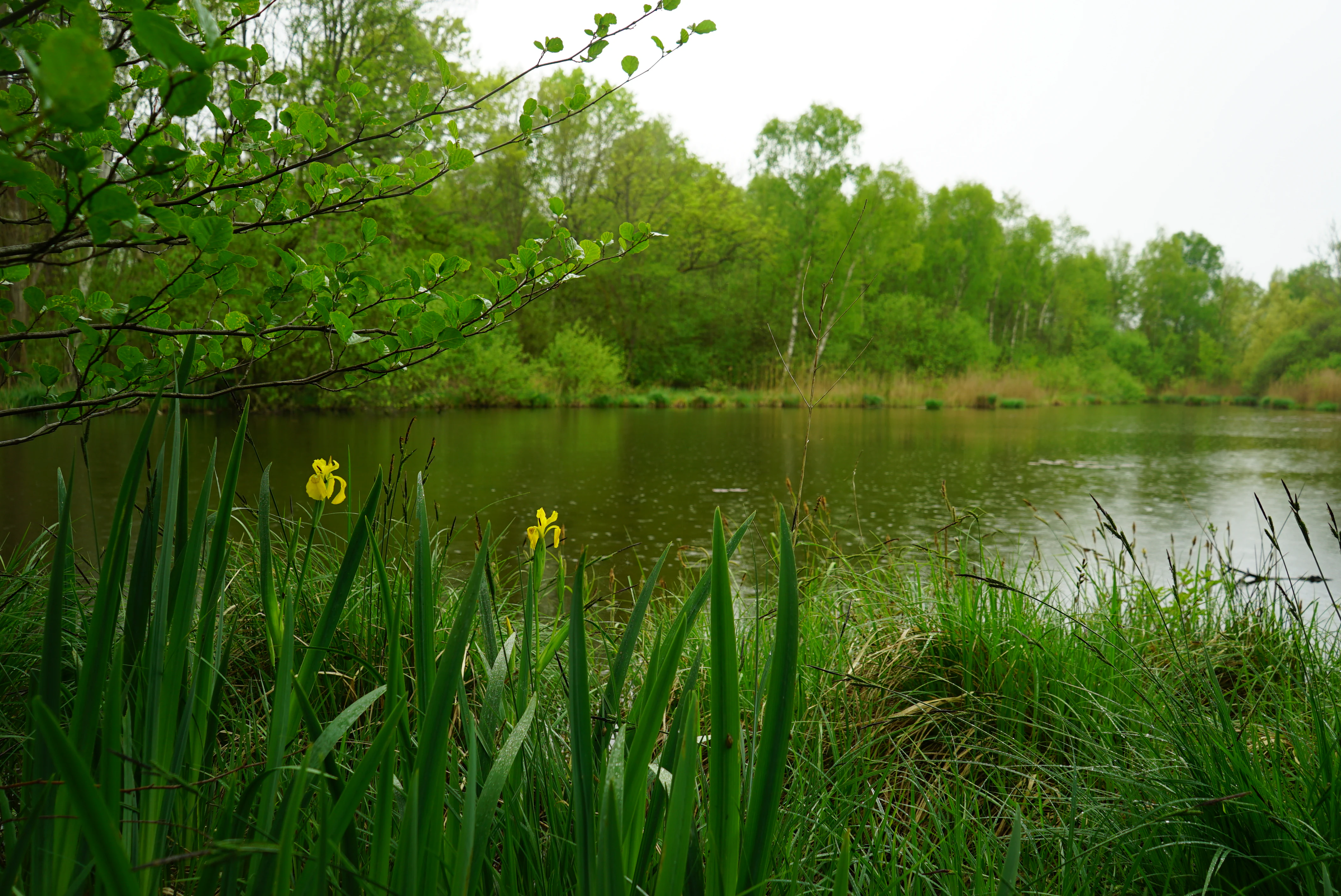
A calm, dark pond surrounded by dense green forest, with yellow flowers blooming in the tall grasses at the water's edge.
A tranquil view of the Trous de Leu marshland featuring yellow irises in the foreground.

Marais Les Trous de Leu Regional Nature Reserve conservation status and protection priorities

Les Trous de Leu carries significance from a conservation standpoint that goes well beyond its modest surface area. Its formal protection as a regional nature reserve since 2014, combined with its integration into the Natura 2000 site Marais de la Vesle en amont de Reims and a ZNIEFF Type I area, places it within multiple overlapping European and national ecological frameworks. This stacking of designations reflects the high biodiversity value attached to the alkaline peatland and alluvial habitats of the upper Vesle.

The reserve's management by the Conservatoire d'espaces naturels de Champagne-Ardenne, an experienced land conservancy, ensures that measures are oriented toward preservation of wet habitats, hydrological functioning, and the conservation of characteristic species. Its role as a refuge for nationally protected plants, regionally rare sedges, sensitive bird and dragonfly species, and several bat species gives the reserve substantial ecological weight, despite being hemmed in by urban and agricultural land near Reims. Conservation planners frequently cite this site as an example of how small but well-preserved wetland fragments can anchor broader ecological networks in heavily used landscapes.

Top sights and standout views in Marais Les Trous de Leu Regional Nature Reserve

A compact but extremely diverse wetland reserve nestled between the Vesle river and a historic canal greenway, Les Trous de Leu stands out for its alkaline peatland, varied alluvial woodland, and unusually rich flora and fauna for a site of just over 33 hectares. It forms the anchor of the Vesle valley's Natura 2000 site, hosts nationally and regionally protected plant species, and offers a rare glimpse of natural marshland heritage within the urban orbit of Reims.
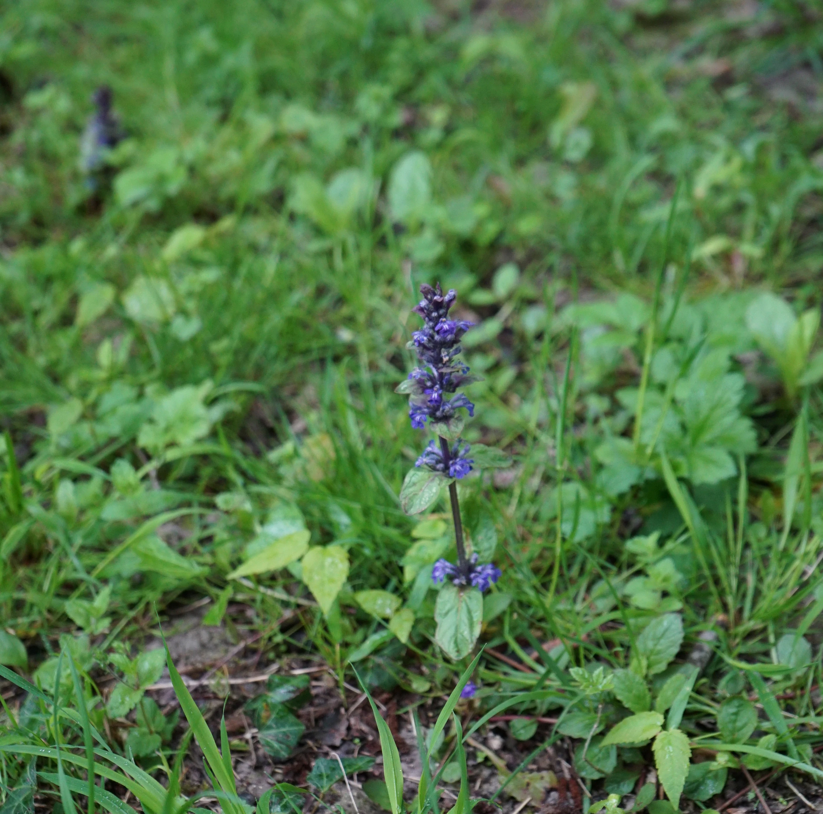
A close-up view of a single purple wildflower stem with small, tubular blue-violet flowers, rising from a grassy meadow background.
A purple wildflower blooming in the meadow habitat of the nature reserve.

Best time to visit Marais Les Trous de Leu Regional Nature Reserve

The reserve is only accessible to the public on foot, along designated paths and observation points, and the regulation allows visits between April and the end of August each year, which corresponds to the period when wetland vegetation, dragonflies, and birdlife are most active. Late spring and early summer tend to be the most rewarding seasons for observing flora and insects, while the surrounding deciduous woodland adds autumn color in the broader landscape. Outside the regulated visit window, the site is not formally open, though the manager may occasionally organize guided visits.

Monthly climate preview

Long-term representative climate patterns and monthly weather averages across the protected area coordinate

Annual Temperature and Precipitation Normals for Réserve naturelle régionale du marais « Les trous de Leu »

Representative coordinates at 148.46 meters elevation record long-term monthly mean temperatures ranging from 1.86 to 19.62 degrees Celsius alongside steady daily precipitation normals. Examining the complete twelve-month climate profile reveals comprehensive variations in temperature ranges and precipitation trends across the protected landscape.
Annual mean10 °C
2 °C20 °C
Jan
Feb
Mar
Apr
May13°
Jun17°
Jul20°
Aug19°
Sep15°
Oct11°
Nov
Dec
Warmest month
July

19.6 °C

Coolest month
January

1.9 °C

Wettest month
December

2.6 mm/day

Driest month
April

1.6 mm/day

Park location guide

Geography guide, regional context, and park location map for Marais Les Trous de Leu Regional Nature Reserve

Marais Les Trous de Leu Regional Nature Reserve park geography, regions, and map view in France

Understand where Marais Les Trous de Leu Regional Nature Reserve sits in France through a broader geographic reading of the surrounding landscape, nearby location context, and its mapped position within the national park landscape.

How Marais Les Trous de Leu Regional Nature Reserve fits into France

France is a unitary semi-presidential republic and one of the world's largest economies. It borders Belgium, Luxembourg, Germany, Switzerland, Italy, Monaco, Andorra, and Spain, with a maritime border to the United Kingdom. The country is known for its cultural influence, art, cuisine, and political history spanning centuries.

Wider geography shaping Marais Les Trous de Leu Regional Nature Reserve in France

France is located in Western Europe. Metropolitan France extends from the Rhine to the Atlantic Ocean and from the Mediterranean Sea to the English Channel and North Sea. The country borders Belgium, Luxembourg, Germany, Switzerland, Italy, Monaco, Andorra, Spain, and has a maritime border with the United Kingdom.

Map view of Marais Les Trous de Leu Regional Nature Reserve

Use this park location map to pinpoint Marais Les Trous de Leu Regional Nature Reserve in France, understand its exact geographic position, and read its mapped placement within the surrounding landscape more clearly.

Pigeon | © OpenStreetMap contributors

Location context for Marais Les Trous de Leu Regional Nature Reserve

Grand Est

Visual exploration of alkaline peatlands, reedbeds, and alluvial woodland habitats

Réserve naturelle régionale du marais « Les trous de Leu » Photos and Landscape Scenery

Visual documentation captures the protected wetland habitats and distinctive river valley terrain across Réserve naturelle régionale du marais « Les trous de Leu ». Photographic records reveal the ecological variety of alkaline peatlands and alluvial woodlands sheltered within the Vesle river corridor.

A close-up shot of a white Guelder rose flower cluster, showing a ring of flat, five-petaled sterile flowers surrounding a dense center of small, green, unopened buds against a blurred green leafy background.

A stone chapel with an arched doorway sits in a clearing surrounded by a dense green forest, fronted by an old wrought-iron gate and fence.

A Peacock butterfly, recognizable by its distinct eye-spots on orange and brown wings, resting on a patch of dry, rocky ground.

A green, grassy clearing framed by overhanging leafy branches of trees and shrubs on both sides, creating a natural tunnel effect looking out into the field.

A calm, dark pond surrounded by dense green forest, with yellow flowers blooming in the tall grasses at the water's edge.

A common comfrey plant with textured green leaves and small clusters of purple, bell-shaped flowers growing in a grassy meadow.

A close-up view of a single purple wildflower stem with small, tubular blue-violet flowers, rising from a grassy meadow background.

A small pool of water sits nestled among tall marsh grasses and dense green trees in a natural wetland setting.

Dense green sedges and tall grasses growing at the water edge of a quiet river, with a forest background.

A close-up view of tall green grasses and meadow vegetation, with a line of out-of-focus trees in the background.

A narrow, partially overgrown earthen trail path leading into a dense, green deciduous forest.

Looking from a wooded edge across a marshy meadow with tall green reeds and wooden fence posts in the foreground.

A bird of prey perched among green marsh vegetation with tall, out-of-focus reeds in the background.

A bird of prey with wings fully spread in mid-flight above green marshy grass, with tall reeds in the background.

Park atlas

Compare surrounding wetland reserves, river valleys, and connected conservation landscapes.

Parks Near Réserve naturelle régionale du marais « Les trous de Leu » and Regional Protected Areas

Browse protected areas and natural reserves located near Réserve naturelle régionale du marais « Les trous de Leu » to evaluate regional biodiversity patterns. Continuing the geographic comparison across neighboring terrain reveals broader patterns in wetland preservation and river valley habitats.
Nature reserveHauts-de-France
About 31 km away#1 closest

Northwest

Réserve naturelle régionale des coteaux du Chemin des Dames Protected Landscape Atlas

Mapped limestone coteaux and grassland mosaic in Aisne

Covering roughly 47 hectares across nine communes, this nature reserve protects the chalky hillslopes characteristic of the Picardy landscape. Its fragmented site structure serves as a key focus for regional biodiversity, maintaining dry calcareous grasslands and scrubland corridors within a wider agricultural matrix.

Area
0.476 km²
Established
2015
IUCN
IV
Scope
Terrestrial
Nature reserveGrand Est
About 37 km away#2 closest

Southeast

Réserve naturelle régionale du Savart de la Folie: Regional Protected Landscape Analysis

Tracing the dry grassland ecosystems of the Grand Est region

Deep dive into the geography of the Réserve naturelle régionale du Savart de la Folie in France. This site highlights the preservation of steppe-like savart habitats within the Champagne region, showcasing the importance of regional nature reserves in protecting specific dry, chalky grasslands.

Area
0.636 km²
Established
2026
IUCN
IV
Scope
Terrestrial
A soft watercolor illustration of a wetland scene with a small pool of water in the foreground, grassy meadows, and distant hills and trees in the background.
Nature reserveGrand Est
About 50 km away#3 closest

Southwest

Réserve naturelle régionale du marais de Reuves: Protected Wetland and Geography

A vital ecological enclave within the Grand Est region of France.

The Réserve naturelle régionale du marais de Reuves provides a detailed look at the hydrology and terrain of the Marais de Saint-Gond. This nature reserve protects varied habitats including open ponds, peatlands, and alluvial forests. Understanding its boundaries reveals how localized conservation efforts preserve essential wetland character against surrounding intensive agricultural development.

Area
0.64 km²
Established
2008
IUCN
IV
Relief
Lowland
A soft, horizontal watercolor painting depicting a calm wetland landscape with grassy banks, distant forested hills, and a pale, misty sky.
Nature reserveFrance
About 72 km away#4 closest

Southeast

Réserve naturelle régionale des étangs de Belval-en-Argonne: Protected Area and Wetland Geography

Mapped pond systems in the Marne department of France.

This protected area features a unique mosaic of five historic pond basins set within a gentle plateau landscape. The site is a cornerstone of the Champagne humide wetland system, defined by its interconnected open water, reedbed margins, and wet woodland habitats that support diverse waterbird and amphibian populations across the Argonne region.

Area
2.037 km²
Established
2012
Relief
Lowland
Climate
Temperate
Nature reserveHauts-de-France
About 74 km away#5 closest

North

Réserve naturelle régionale des prairies humides de la ferme du Moulin Fontaine Protected Area

Wet meadow conservation in the Hauts-de-France region

Spanning 38 hectares in the Aisne department, this nature reserve focuses on the protection of humid grasslands. The site exemplifies regional efforts to maintain semi-natural habitats through a mosaic of hedgerows, moist meadows, and historic farm architecture in the Thiérache landscape.

Area
0.381 km²
Established
2014
IUCN
IV
Nature reserveArdennes
About 76 km away#6 closest

Northeast

Réserve naturelle régionale de la côte de Bois-en-Val: Ardennes Protected Nature Reserve

A study in post-industrial rewilding and mapped biodiversity.

Located in the Ardennes department, this 24-hectare reserve demonstrates how limestone quarry faces, calcicole woodlands, and marshy hollows support a high density of plant and wildlife species. It provides an accessible look at local geology and habitat recovery within a compact, protected geographic frame.

Area
0.24 km²
Established
2008
IUCN
IV
A horizontal watercolor illustration featuring a soft green and yellow landscape of a pond and wetland area with shrubs and meadow grass.
Nature reserveGrand Est
About 81 km away#7 closest

Southeast

Réserve naturelle régionale de l'étang et prairie humide des Paquis: Regional Nature Reserve Geography

Wetland habitat mapping in the Marne department of Grand Est, France

This regional nature reserve encompasses a compact 8.31 hectare wetland complex comprising an étang and a surrounding prairie humide. Its significance lies in its role as a concentrated biodiversity node amidst the open agricultural landscape of the Champagne region, managed primarily for habitat conservation and avian protection.

Area
0.083 km²
Established
2014
IUCN
IV
A horizontal watercolor illustration depicting rolling green hills, scattered evergreen trees, and distant ridgelines in a soft, light-filled style.
Protected landscapeNamur
About 84 km away#8 closest

North

Parc naturel Viroin-Hermeton: Protected Landscape and Geographic Atlas for Namur, Belgium

Karst geology, limestone tienne hills, and river valley terrain

Parc naturel Viroin-Hermeton covers a vast area in Namur province, defined by its geological contrast and biodiversity. The landscape features deep karst fissures known as fondrys, sunny limestone tienne hills, and dramatic river valleys where the Eau Noire and Eau Blanche meet. This atlas entry provides a structured look at the terrain, mapping the transition from agricultural plateau to forest ecosystems within this significant protected area.

Area
480 km²
Established
1998
IUCN
V
Relief
Mixed relief

Common questions about visiting, size, designation, and location context for Marais Les Trous de Leu Regional Nature Reserve

Marais Les Trous de Leu Regional Nature Reserve FAQs for park facts, access, geography, and protected area context

Find quick answers about Marais Les Trous de Leu Regional Nature Reserve, including protected-area facts, park geography, trail and visitor context, and how the park fits into its surrounding country and regional landscape.
MoriAtlas Explorer

Continue Your Protected Areas Search Across the Global Atlas

Deepen your exploration by continuing the structured search for national parks and protected areas worldwide. Utilize the comprehensive filtering capabilities to compare different conservation landscapes and refine your understanding of global park geography. Discover more about the distribution and characteristics of protected natural areas.

Global natural geography