
Mori Atlas logo
Nature reserveRéserve naturelle régionale du massif du Pibeste-Aoulhet

Mapping the ecological diversity and rugged terrain of this Pyrenean nature reserve

Réserve naturelle régionale du massif du Pibeste-Aoulhet: Protected Mountain Landscapes

The Réserve naturelle régionale du massif du Pibeste-Aoulhet represents a vital protected landscape in the French Pyrenees within the Occitanie region. This vast massif spans an extensive altitudinal gradient, where Atlantic, montane, and sub-Mediterranean climatic influences converge to support exceptional plant and animal communities. By tracing these mountain slopes, observers gain insight into a diverse mosaic of forest, summer pastures, and rocky crests.

Pyreneesregional nature reservemountain forestbeech forestrocky cliffssummmer pastures
Vector-style illustration of a valley between steep mountain peaks with a small village, a winding river, and coniferous trees in the foreground.

Réserve naturelle régionale du massif du Pibeste-Aoulhet

Nature reserve

Park overview

Structured park overview, official facts, and landscape profile for Pibeste-Aoulhet Regional Nature Reserve

Pibeste-Aoulhet Regional Nature Reserve park facts, protected area profile, and essential visitor context

Review the core facts for Pibeste-Aoulhet Regional Nature Reserve, including designation, size, terrain, visitor scale, habitats, and operating context in one park-focused overview.

About Pibeste-Aoulhet Regional Nature Reserve

The Pibeste-Aoulhet Regional Nature Reserve, designated RNR241, protects a substantial block of Pyrenean mountainside in the immediate hinterland of Lourdes, in the Hautes-Pyrénées. Its roughly 5,110 hectares extend along the slopes of the Estrèm de Salles, the Batsurguère valley and the approach to Saint-Pé-de-Bigorre, rising from about 400 metres to a peak at roughly 1,680 metres. Because of this elevation range and the complex relief, the reserve acts as a transition zone between the northern foothills of the Pyrenees and the more fully mountain landscapes further south.

The protected area is spread across nine communes: Agos-Vidalos, Omex, Ossen, Ouzous, Saint-Pé-de-Bigorre, Salles, Sère-en-Lavedan, Ségus and Viger. Although it sits close to one of the most-visited pilgrimage towns in France, it preserves a remarkably continuous gradient of semi-natural habitats, from low-elevation broadleaf woodlands to subalpine grasslands and rocky ridges. This combination of accessibility and ecological richness gives the reserve both a strong conservation value and an important role in regional environmental education.

Since its classification in 2012, the Pibeste-Aoulhet reserve has been recognized as the largest Regional Nature Reserve in France by surface area. Its administration is handled by the SIVU du Massif du Pibeste-Aoulhet, and the site also forms part of broader ZNIEFF inventories and of the Special Conservation Area FR7300920 "Granquet, Pibeste et Soum d'Ech", under the European Natura 2000 framework. Beyond its formal designations, the reserve stands out as a working example of how a peri-urban Pyrenean landscape can support endangered species, traditional pastoralism and public outdoor recreation at the same time.

Quick facts and research context for Pibeste-Aoulhet Regional Nature Reserve

The Pibeste-Aoulhet reserve lies in the Hautes-Pyrénées, in the Occitanie region of southwestern France, and covers about 5,110 hectares of mountain slopes. It was classified as a Regional Nature Reserve on 9 February 2012, following its earlier status as a voluntary nature reserve. It is managed by the SIVU du Massif du Pibeste-Aoulhet and is recognized as the largest Regional Nature Reserve in France by surface area. The reserve sits between roughly 400 m and 1,680 m in elevation and is crossed by 13 hiking trails, including the GR 101.

Protection and recognition

Documented terrestrial protection scope, 2012 designation year, and official records.

Protection Status and Designation History for Réserve naturelle régionale du massif du Pibeste-Aoulhet

Terrestrial protection status records for Réserve naturelle régionale du massif du Pibeste-Aoulhet outline official designation history established in 2012. Documented management scope and conservation listings provide verifiable baseline data for this protected area.

Protection details

Protection scope
Terrestrial
Designated year
2012
Transboundary protection
No
WDPA ID
555559630
Park context

Deeper park guide and search-rich context for Pibeste-Aoulhet Regional Nature Reserve

Pibeste-Aoulhet Regional Nature Reserve history, landscape, wildlife, and travel context

Explore Pibeste-Aoulhet Regional Nature Reserve through its history, landscape character, ecosystems, wildlife, conservation priorities, cultural context, and seasonal travel timing in a structured park guide built for atlas discovery and search intent.

Why Pibeste-Aoulhet Regional Nature Reserve stands out

The reserve is best known for its sheer ecological diversity compressed into a relatively compact Pyrenean area. Because the slopes lie at the crossroads of Atlantic, montane and sub-Mediterranean climates, and because contrasting north- and south-facing aspects coexist in the same massif, the territory hosts plant and animal species typical of very different Pyrenean environments. It is especially valued for its exceptionally rich raptor community and for the rare and localized Pyrenean plant species that grow on its rocks, cliffs and peat-influenced habitats.
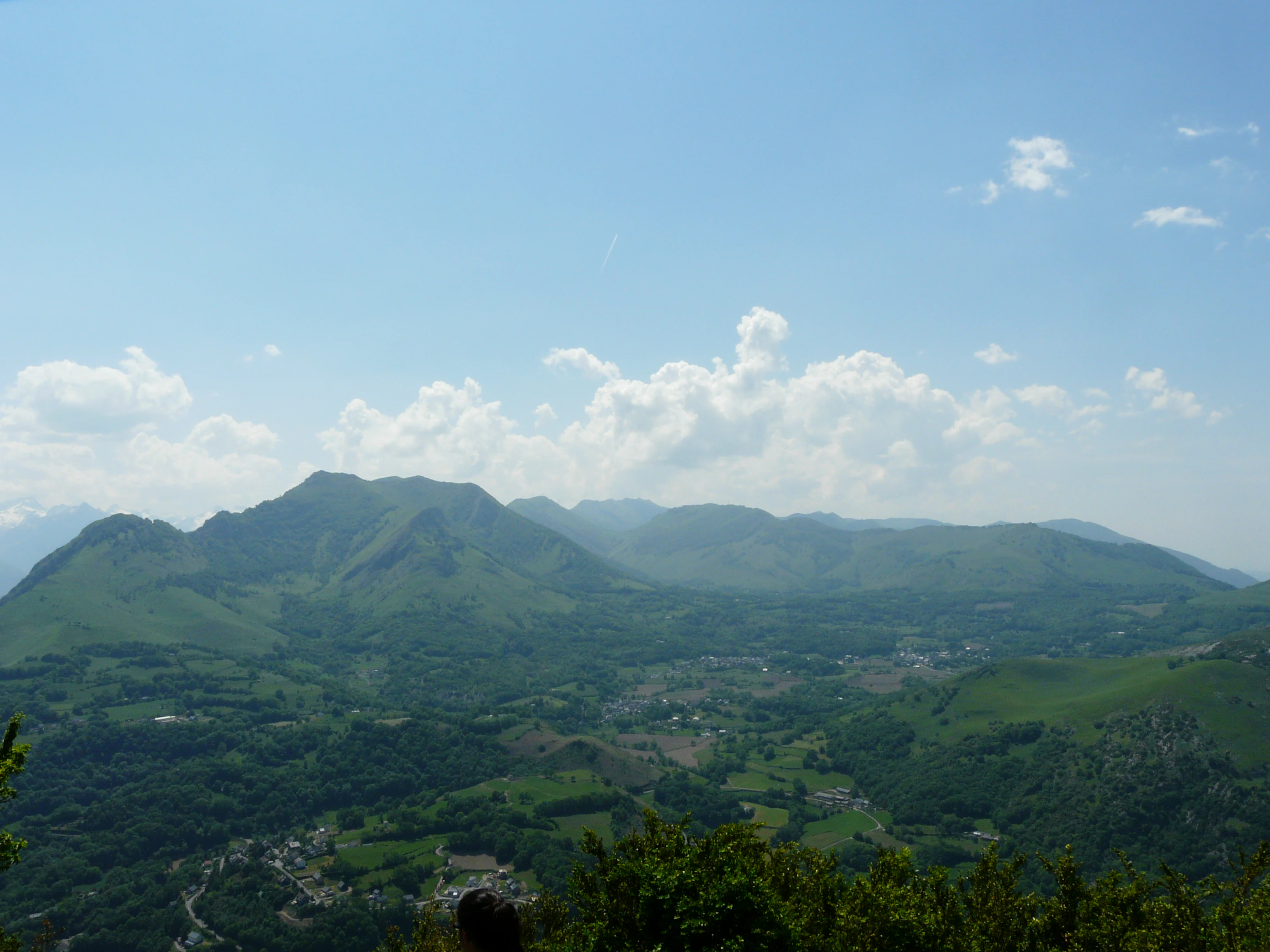
Panoramic landscape view of the green Pibeste mountain range and Batsurguere valley under a blue sky with scattered clouds.
View of the Batsurguere valley and Pibeste peak from Pic du Jer in the Pyrenees.

Pibeste-Aoulhet Regional Nature Reserve history and protected-area timeline

The history of protection on the Pibeste-Aoulhet massif began with the creation of a voluntary nature reserve by prefectoral decree in October 1994. In 1997, a second decree reaffirmed and structured this protection, and in 2002 the area was enlarged to reach about 2,610 hectares, anchoring the early recognition of the site's ecological importance.

In 2009, the procedure to upgrade this protection into a Regional Nature Reserve was launched. The classification was finalized by a deliberation of the Regional Council on 9 February 2012, for an initial period of ten years, and the territory officially became the Pibeste-Aoulhet Regional Nature Reserve. Its surface was expanded to its present extent of roughly 5,110 hectares, placing it at the top of the ranking of French Regional Nature Reserves by area.

Pibeste-Aoulhet Regional Nature Reserve landscape and geographic character

The landscape of the Pibeste-Aoulhet reserve is a Pyrenean hillside mosaic shaped by elevation, aspect and land use. The lower slopes are dominated by broadleaf forest, with beech and oak stands giving way to mixed woodlands and rockier formations as elevation increases. Above the tree line, summer pastures and open grasslands take over, interleaved with rocky outcrops and crests that give the massif its name and identity.

The relief is deeply dissected by small valleys and streams flowing north toward the Lourdes plain. South-facing slopes receive more sunlight and drier conditions, while north-facing slopes keep cooler and damper microclimates; together they create a striking contrast over very short distances. The Pic du Pibeste itself dominates the skyline, offering long views toward the Batsurguère, the Pic du Jer and the chain of Pyrenean summits further south, while the lower valleys retain an intimate, half-rural character strongly connected to nearby villages.

Pibeste-Aoulhet Regional Nature Reserve ecosystems, habitats, and plant life

Ecologically, the Pibeste-Aoulhet massif is one of the most varied pieces of mountainside in the central Pyrenees. The convergence of oceanic, montane and sub-Mediterranean climates, combined with strong contrasts in slope orientation, has produced a layered set of ecosystems in which Atlantic and Mediterranean plant lineages can occur side by side. Forest covers more than half of the territory; the rest is split between high-altitude pastures, rocky cliffs, scree slopes and small rupestrian habitats that are crucial to many of the reserve's rare plants.

Vegetation patterns reflect this triple climatic signature. Beech forests occupy the moister mid-elevation zones, with heat-loving species colonizing the warmer south-facing slopes. Around 850 plant species have been recorded, including several that are very localized in the Pyrenees, such as the Pyrenean endemic Erodium manescavi, the rare Asperula hirta, Androsace cylindrica, the round-leaved sundew, the Western broom and the Atlantic Ophioglossum azoricum. These flora-rich habitats are themselves an essential component of the reserve's biodiversity value.

Pibeste-Aoulhet Regional Nature Reserve wildlife and species highlights

The fauna of the Pibeste-Aoulhet reserve combines typical Pyrenean mountain species with animals characteristic of foothill forests. About 27 mammal species have been documented, including the Pyrenean desman, a small and highly specialized semi-aquatic insectivore found only in clean mountain streams, together with the isard (Pyrenean chamois), mouflon, wildcat, badger, pine marten and genet. Bats are well represented and include the Schreibers' bat, Daubenton's bat, the greater and lesser mouse-eared bats, the Mediterranean horseshoe bat, the greater and lesser horseshoe bats, the Geoffroy's bat and Natterer's bat.

The birdlife is one of the reserve's most distinctive features. A total of 112 bird species have been recorded, of which around 90 are protected. Forest and mountain species such as the capercaillie, rock ptarmigan, grey partridge, red-legged partridge, white-backed woodpecker, middle spotted woodpecker, alpine accentor, yellow-billed chough and wallcreeper share the territory with an exceptionally rich raptor community: 22 species of birds of prey, 18 of which breed locally, including the bearded vulture, short-toed snake eagle, Egyptian vulture, griffon vulture, golden eagle, booted eagle and peregrine falcon.

Amphibians include the Pyrenean newt, midwife toad and fire salamander, while reptiles are represented by the smooth snake, the grass snake and the green-and-yellow whip snake. Among invertebrates, the highly protected Rosalia longicorn (Rosalia alpina) is also a notable presence.

Pibeste-Aoulhet Regional Nature Reserve conservation status and protection priorities

Pibeste-Aoulhet plays an important role in conserving Pyrenean biodiversity at the crossroads of climatic zones. Its size, elevation range and habitat diversity make it a critical refuge for species that would otherwise be split between isolated Atlantic, Mediterranean or fully montane populations. The integration of the reserve into the Special Conservation Area FR7300920 "Granquet, Pibeste et Soum d'Ech" and into the national ZNIEFF inventory underlines its significance for coherent ecological networks across the western Pyrenees.

Specific conservation stakes include the protection of Pyrenean-endemic plants such as Erodium manescavi, the preservation of rupestrian and rocky habitats that host localized flora, and the maintenance of breeding habitat for exceptionally rare raptors such as the bearded vulture, Egyptian vulture and short-toed snake eagle. The reserve also serves as a refuge for vulnerable mammals such as the Pyrenean desman and several protected bat species, and as a long-term monitoring site for the relationships between traditional pastoralism, forest dynamics and cliff-nesting birds.

Pibeste-Aoulhet Regional Nature Reserve cultural meaning and human context

The Pibeste-Aoulhet massif is deeply rooted in the pastoral and rural identity of the Lavedan and Batsurguère valleys. Summer pastures, locally known as estives, are still actively grazed, and this traditional use has shaped both the open landscapes and the mosaic of meadows, hedges and woodlands that the reserve seeks to protect. Villages such as Agos-Vidalos, Ossen, Ouzous and Ségus have long-standing links to these slopes through livestock, haymaking and forest exploitation.

The reserve's proximity to Lourdes gives it an additional cultural dimension. While the town is internationally known for pilgrimage, the surrounding countryside remains a working Pyrenean landscape, and the reserve illustrates how major natural sites can coexist with dense human settlement and strong visitor flows. Local stewardship, carried out through the SIVU du Massif du Pibeste-Aoulhet, also reflects an increasing engagement of Pyrenean communes in managing their natural heritage as a shared regional asset.

Top sights and standout views in Pibeste-Aoulhet Regional Nature Reserve

The reserve's standout features are its sheer ecological diversity within a single massif, the convergence of three distinct climatic influences, and a raptor community that is unusually rich for a peri-urban Pyrenean site. Its capercaillie, rock ptarmigan and wallcreeper populations add rarity value, while the presence of the Pyrenean desman ties protection efforts to clean mountain streams. The combination of more than 850 plant species, 112 bird species and a wide range of protected mammals places the reserve among the most biologically dense Regional Nature Reserves in France.

Best time to visit Pibeste-Aoulhet Regional Nature Reserve

Spring and early summer are particularly rewarding, when alpine meadows and forest understories come into flower and the raptor breeding season becomes visible along the cliffs. Late spring is also a good moment for observing birdsong and for spotting species associated with open rocky habitats. Autumn brings quieter trails and warm-toned beech and oak forests, while visits in deep winter require care because snow conditions on the higher slopes of the massif can be significant. Summer offers long days for hiking the full trail network, though the lower slopes can be warm while the upper pastures remain cool and breezy.
Monthly climate preview

Long-term temperature ranges and monthly precipitation data recorded at a representative elevation

Réserve naturelle régionale du massif du Pibeste-Aoulhet Climate Normals and Annual Weather Patterns

Long-term climate records trace measured annual temperature swings and monthly precipitation averages across representative coordinates in Réserve naturelle régionale du massif du Pibeste-Aoulhet. Detailed twelve-month climatology data provides deeper comparison metrics for analyzing regional weather patterns across the protected landscape.
Annual mean10 °C
2 °C18 °C
Jan
Feb
Mar
Apr
May12°
Jun16°
Jul18°
Aug18°
Sep15°
Oct11°
Nov
Dec
Warmest month
August

18.5 °C

Coolest month
January

2 °C

Wettest month
November

3.2 mm/day

Driest month
August

1.7 mm/day

Park location guide

Geography guide, regional context, and park location map for Pibeste-Aoulhet Regional Nature Reserve

Pibeste-Aoulhet Regional Nature Reserve park geography, regions, and map view in France

Understand where Pibeste-Aoulhet Regional Nature Reserve sits in France through a broader geographic reading of the surrounding landscape, nearby location context, and its mapped position within the national park landscape.

How Pibeste-Aoulhet Regional Nature Reserve fits into France

France is a unitary semi-presidential republic and one of the world's largest economies. It borders Belgium, Luxembourg, Germany, Switzerland, Italy, Monaco, Andorra, and Spain, with a maritime border to the United Kingdom. The country is known for its cultural influence, art, cuisine, and political history spanning centuries.

Wider geography shaping Pibeste-Aoulhet Regional Nature Reserve in France

France is located in Western Europe. Metropolitan France extends from the Rhine to the Atlantic Ocean and from the Mediterranean Sea to the English Channel and North Sea. The country borders Belgium, Luxembourg, Germany, Switzerland, Italy, Monaco, Andorra, Spain, and has a maritime border with the United Kingdom.

Map view of Pibeste-Aoulhet Regional Nature Reserve

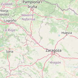
Use this park location map to pinpoint Pibeste-Aoulhet Regional Nature Reserve in France, understand its exact geographic position, and read its mapped placement within the surrounding landscape more clearly.

Pigeon | © OpenStreetMap contributors

Location context for Pibeste-Aoulhet Regional Nature Reserve

Occitanie

Visual reference of Pyrenean mountain terrain, rocky cliffs, and forest habitats

Réserve naturelle régionale du massif du Pibeste-Aoulhet Photos and Landscapes

Visual records illustrate the rugged mountain terrain, beech forests, and high-altitude pastures that define the protected landscape. Examining these field photographs reveals the contrasting slopes, rocky crests, and diverse habitats shaping the Pyrenean massif.

Panoramic landscape view of the green Pibeste mountain range and Batsurguere valley under a blue sky with scattered clouds.

Park atlas

Compare adjacent Pyrenean reserves, mountain forests, and regional conservation areas

Parks Near Réserve naturelle régionale du massif du Pibeste-Aoulhet and Surrounding Protected Landscapes

Browsing other protected areas near Réserve naturelle régionale du massif du Pibeste-Aoulhet reveals wider ecological patterns across the Pyrenean foothills. Expanding the geographic scope helps compare adjacent mountain terrain, forest reserves, and regional conservation landscapes.
National parkHautes-Pyrénées
About 19 km away#1 closest

South

Pyrénées National Park: Protected Landscape & Transboundary Protected Area Atlas

Discover Hautes-Pyrénées' dramatic glacial terrain and alpine environments.

Pyrénées National Park is a significant protected area in France's Hautes-Pyrénées department, renowned for its dramatic glacial cirques, high-altitude lakes, and extensive mountain landscapes. Established as a national park, it offers rich geographic context for atlas exploration, showcasing millions of years of geological formation shaped by tectonic uplift and glacial carving. This park is also notable for its transboundary conservation efforts with Spain, contributing to a broader protected region. Explore its unique terrain, from towering limestone formations to alpine meadows, and understand its place within the Pyrenean mountain range.

Area
458 km²
Established
1967
IUCN
II
Relief
Mountain
Nature reservePyrénées-Atlantiques
About 25 km away#2 closest

Southwest

Vallée du Soussouéou Protected Nature Reserve: Geographic Atlas and Mountain Terrain

A roadless glacial valley in the French Pyrénées-Atlantiques

Vallée du Soussouéou offers a rare glimpse into a roadless Pyrenean landscape. This protected area features a classic glacial U-shaped valley, significant peatland ecosystems, and diverse alpine habitats that support Pyrenean fauna. As a quiet extension of the ecological network in the Western Pyrenees, the valley remains an important site for understanding mountain geography and glacial geomorphology in southwestern France.

Area
45.39 km²
Established
1995
Relief
Mountain
Scope
Terrestrial
Watercolor painting showing a mountain range with a winding river through a valley
National parkSpain
About 41 km away#3 closest

South

Ordesa y Monte Perdido National Park: Glacial Terrain and Pyrenean Protected Landscape

Explore its dramatic valleys, cliffs, and alpine geography.

Ordesa y Monte Perdido National Park is a critical protected area within the Pyrenean geography, defined by its spectacular glacial valleys, towering limestone massifs, and unique karst formations. As a National Park and UNESCO World Heritage Site, it offers a rich environment for exploring mapped terrain and understanding the interplay of geology and high-alpine ecosystems. Delve into the mapped boundaries and distinct landscape features that characterize this significant protected landscape.

Area
156.08 km²
Established
1918
IUCN
II
Relief
Mountain
A soft, watercolor painting depicting distant purple-hued mountain ranges fading into a pale, warm-toned sky, with light green hills and hints of pine forests in the foreground.
Nature reserveOccitanie
About 43 km away#4 closest

Southeast

Réserve naturelle régionale d'Aulon: Mountain Geography and Protected Area Mapping

A diverse protected landscape spanning the central Pyrenees of Occitanie.

This regional nature reserve provides a focused look at central Pyrenean mountain environments. Covering over 1,200 hectares, the area features a steep altitudinal gradient, blending working pastoral meadows with critical habitats such as rocky slopes, conifer forests, and glacial landforms. The site serves as a vital anchor within the broader network of protected mountain terrain found throughout the Occitanie region.

Area
12.37 km²
Established
2001
IUCN
IV
Relief
Mountain
A soft watercolor painting of rolling green hills, distant mountain peaks, and a calm water body against a white background.
National parkOccitanie
About 45 km away#5 closest

South

Pyrénées-Mont Perdu National Park: Alpine Geography and Transboundary Protected Landscapes

Glacial cirques, limestone canyons, and alpine pastoral heritage.

Spanning the high Pyrenees, Pyrénées-Mont Perdu represents a rare union of dramatic geological formations and human cultural heritage. The terrain features vertical limestone walls, deep carved canyons, and expansive cirques that host both diverse alpine ecosystems and active seasonal migration routes. This protected area remains a benchmark for studying the interplay between powerful glacial geography and historic mountain pastoralism in Europe.

Area
306.39 km²
Established
1997
Relief
Mountain
Climate
Alpine
A watercolor painting of a serene mountain landscape featuring gentle rolling hills, small clusters of trees, and soft, muted tones of green, pink, and purple, set against a light background.
Nature reserveOccitanie
About 52 km away#6 closest

Southeast

Réserve naturelle régionale du Massif du Montious: Regional Nature Reserve in Occitanie

Granitic massif geography and Pyrenean protected landscapes

Located in the heart of the Hautes-Pyrénées, this reserve captures the geological and biological essence of the Central Pyrenees. From the summit grasslands at 2,171 metres to the sheltered glacial basins, the terrain provides a comprehensive look at regional mountain ecosystems and Hercynian geological heritage.

Area
7.38 km²
Established
2020
IUCN
IV
Watercolor illustration of a mountainous landscape with a river, green vegetation, and distant peaks under a light sky
National parkProvince of Lleida
About 93 km away#7 closest

Southeast

Aigüestortes i Estany de Sant Maurici National Park: Pyrenean High Mountain National Park Landscape

Explore glacial lakes and winding waterways in Catalonia.

Aigüestortes i Estany de Sant Maurici National Park is a premier national park in the Pyrenees, celebrated for its extensive network of almost 200 glacial lakes and the dramatic natural beauty of the Sant Maurici lake. Its landscape is defined by high mountain terrain, characterized by U-shaped valleys, sharp ridges, and unique hydrological features like the Aigüestortes plain's meandering streams. This protected area in the Province of Lleida offers a rich setting for understanding alpine environments and Pyrenean geography through detailed mapping and atlas exploration.

Area
141 km²
Established
1955
IUCN
II
Visitors
525K annual
A soft watercolor illustration showing rolling green hills, patches of trees, and a distant horizon in shades of light green and pale yellow.
Nature reserveNouvelle-Aquitaine
About 105 km away#8 closest

Northwest

Réserve naturelle régionale du site des carrières de Tercis-les-Bains Protected Landscape

Geological stratotype and Cretaceous fossil reference site in Nouvelle-Aquitaine

This unique nature reserve in southwestern France protects a globally significant Cretaceous geological sequence within former limestone quarries. It serves as a vital scientific landmark for stratigraphy, housing extensive fossil records and structural evidence of salt-driven geology, all set within the scenic terrain of the Adour river basin.

Area
0.448 km²
Established
2015
IUCN
IV
Relief
Lowland

Common questions about visiting, size, designation, and location context for Pibeste-Aoulhet Regional Nature Reserve

Pibeste-Aoulhet Regional Nature Reserve FAQs for park facts, access, geography, and protected area context

Find quick answers about Pibeste-Aoulhet Regional Nature Reserve, including protected-area facts, park geography, trail and visitor context, and how the park fits into its surrounding country and regional landscape.
MoriAtlas Explorer

Continue Your Protected Areas Search Across the Global Atlas

Deepen your exploration by continuing the structured search for national parks and protected areas worldwide. Utilize the comprehensive filtering capabilities to compare different conservation landscapes and refine your understanding of global park geography. Discover more about the distribution and characteristics of protected natural areas.

Global natural geography